3552 entries match your criteria. The first 100 are listed. ⊳
Historical Markers and War Memorials in Wisconsin
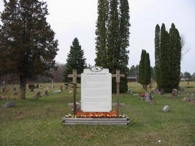
By Keith L, April 19, 2008
East Arkdale Cemetery Marker
1 ► Wisconsin, Adams County, Arkdale — East Arkdale Cemetery —  |
| On State Highway 21 east of 16th Avenue, on the left when traveling east. | |||
| 2 ► Wisconsin, Adams County, Arkdale — Lutheran Church of the Norwegian Synod — |
| On 18th Avenue 0.3 miles north of Cumberland Avenue, on the right when traveling south. | |||
| 3 ► Wisconsin, Adams County, Arkdale — 390 — Site of the First Norwegian Evangelical Lutheran Church of Roche-a-Cri — |
| On Cypress Avenue west of 18th Avenue, on the left when traveling west. | |||
| 4 ► Wisconsin, Adams County, Arkdale — West Church — |
| On 18th Avenue at Cumberland Avenue, on the left when traveling south on 18th Avenue. | |||
| 5 ► Wisconsin, Adams County, Friendship — 260 — Roche-A-Cri State Park — |
| Near State Highway 13 0.3 miles north of Czech Avenue, on the left when traveling north. | |||
| 6 ► Wisconsin, Adams County, Friendship — Veterans Memorial / Cpl. Red Cloud Tribute — |
| On Main Street (State Highway 13) at West Third Street, on the right when traveling north on Main Street. | |||
| 7 ► Wisconsin, Adams County, Monroe Center — Monroe Cemetery — |
| On Bighorn Drive 0.6 miles west of County Highway Z, on the left when traveling west. | |||
| 8 ► Wisconsin, Adams County, Rome — Spring Branch Cemetery Veterans Memorial — |
| Near County Road D near 10th Avenue, on the right when traveling east. | |||
| 9 ► Wisconsin, Ashland County, Ashland — Doctor Edwin Ellis — 1824 - 1903 — Father of Ashland — |
| On Stuntz Avenue at 3rd Street East, on the right when traveling south on Stuntz Avenue. | |||
| 10 ► Wisconsin, Ashland County, Ashland — 304 — Fleet Admiral William D. Leahy — |
| On Lake Shore Drive East (U.S. 2) 0.1 miles west of 20th Avenue East, on the right when traveling west. | |||
| 11 ► Wisconsin, Ashland County, Ashland — 224 — Northland College — |
| On Ellis Avenue (State Highway 13) north of 16th Street east, on the right when traveling north. | |||
| 12 ► Wisconsin, Ashland County, Ashland — 6 — Radisson-Groseilliers Fort — |
| On Lake Shore Drive West (U.S. 2) at Turner Road, on the right when traveling west on Lake Shore Drive West. | |||
| 13 ► Wisconsin, Ashland County, Ashland — Schooner Lucerne — Historic Shipwreck — Wisconsin’s Maritime Trails — |
| Near Lake Shore Drive East (U.S. 2) 0.1 miles east of 15th Avenue East. | |||
| 14 ► Wisconsin, Ashland County, Ashland — Security Savings Bank — |
| On Main Street West east of 3rd Avenue West, on the right when traveling east. | |||
| 15 ► Wisconsin, Ashland County, Ashland — Soo Line Decapod - 950 — |
| On Depot Drive at 3rd Avenue West, on the left when traveling north on Depot Drive. | |||
| 16 ► Wisconsin, Ashland County, Glidden — Glidden State Bank — |
| On East First Street (County Highway N) east of North Grant Street, on the left when traveling east. | |||
| 17 ► Wisconsin, Ashland County, Glidden — 54 — Great Divide — |
| On State Highway 13 2 miles north of State Highway 77, on the left when traveling north. | |||
| 18 ► Wisconsin, Ashland County, Glidden — World's Largest White Pine Log — Biggest & Last Sleigh Hauled Log — |
| On East First Street (County Highway N) at North Grant Street on East First Street. | |||
| 19 ► Wisconsin, Ashland County, La Pointe — Early Vessels — Wisconsin's Maritime Trails — |
| On Fort Road 0.5 miles south of Ferry Dock, on the right when traveling south. | |||
| 20 ► Wisconsin, Ashland County, La Pointe — Gidanamikaagoo omaa Mooningwanekaaning — |
| On Town Park Circle east of Big Bay Road, on the left when traveling east. | |||
| 21 ► Wisconsin, Ashland County, La Pointe — Human History at Big Bay — |
| On Town Park Circle east of Big Bay Road. | |||
| 22 ► Wisconsin, Ashland County, La Pointe — La Pointe Indian Cemetery — |
| On Chief Buffalo Lane west of Old Fort Road, on the left when traveling north. | |||
| 23 ► Wisconsin, Ashland County, La Pointe — 108 — Madeline Island — Known to the Ojibway Indians as Moningwunakauning, "The Home of The Golden Breasted Woodpecker" |
| On Bayfield - La Pointe Avenue at Colonel Woods Avenue (County Route H), on the left when traveling north on Bayfield - La Pointe Avenue. Reported permanently removed. | |||
| 24 ► Wisconsin, Ashland County, La Pointe — Michel Cadotte — |
| On Old Fort Road north of Capser Road, on the right when traveling south. | |||
| 25 ► Wisconsin, Ashland County, La Pointe — 608 — Mooningwaanikaaning — |
| On Colonel Woods Avenue. | |||
| 26 ► Wisconsin, Ashland County, La Pointe — Site of First Catholic Church — |
| On Chief Buffalo Ln. north of 17th St., on the right when traveling north. | |||
| 27 ► Wisconsin, Ashland County, La Pointe, Big Bay State Park — Blow Down Area — |
| On the Lagoon Ridges Trail, on the right when traveling north. | |||
| 28 ► Wisconsin, Ashland County, Mellen — Jeanne D'Arc Willow — |
| On State Highway 77 near Fayette Avenue. | |||
| 29 ► Wisconsin, Ashland County, Mellen — Legend of Mellen — |
| Near POW/MIA Memorial Highway (State Highway 13) at Fayette Avenue, on the right when traveling north. | |||
| 30 ► Wisconsin, Ashland County, Mellen — The Vietnam Memorial Tree — |
| Near POW/MIA Memorial Highway (State Highway 13) at Fayette Avenue, on the right when traveling north. | |||
| 31 ► Wisconsin, Ashland County, Odanah — 70 — The Bad River |
| On U.S. 2 at Old Odanah Road, on the left when traveling west on U.S. 2. Reported permanently removed. | |||
| 32 ► Wisconsin, Barron County, Barron — Erected to the Memory of John Quaderer — 1829 — 1898 — |
| On East La Salle Avenue just east of South 3rd Street, on the right when traveling east. | |||
| 33 ► Wisconsin, Barron County, Chetek — 218 — Pine Was King — |
| Near U.S. 53 at milepost 125, 6.4 miles north of County Highway M, on the right when traveling north. | |||
| 34 ► Wisconsin, Barron County, Chetek — Pre-Columbian Indian Mound — |
| Near 1st Street north of Mill Street, on the left when traveling north. | |||
| 35 ► Wisconsin, Barron County, Dobie — 469 — Our Lady of Lourdes Catholic Church — |
| On 23rd Street 0.1 miles north of 24th Avenue, on the right when traveling north. | |||
| 36 ► Wisconsin, Barron County, Rice Lake — Lentz Steam Engine — |
| Near South Main Street (County Road SS) at Water Street, on the right when traveling north. | |||
| 37 ► Wisconsin, Barron County, Rice Lake — Logging and Lumbering in the Rice Lake Area — A Chronology — |
| Near Stein Street east of South Main Street (County Road SS), on the right when traveling east. | |||
| 38 ► Wisconsin, Barron County, Rice Lake — Rice Lake, a City Built of Lumber — A Chronology — |
| Near Stein Street east of South Main Street (County Road SS), on the right when traveling east. | |||
| 39 ► Wisconsin, Barron County, Rice Lake — The Mystery of the Concrete Pillars — |
| Near Stein Street east of South Main Street (County Highway SS), on the right when traveling east. | |||
| 40 ► Wisconsin, Barron County, Rice Lake — 598 — The Tuscobia Trail — |
| On 25 1/4 Avenue just east of 19 1/4 - 19 3/4 Street, on the left when traveling east. | |||
| 41 ► Wisconsin, Bayfield County, Ashland — Lands Along the Lake — |
| Near U.S. 2 1 mile west of Turner Road. | |||
| 42 ► Wisconsin, Bayfield County, Ashland — Voices in the Mist — |
| Near Major Richard I. Bong/POW-MIA Memorial Highway (U.S. 2) 1 mile west of Turner Road. | |||
| 43 ► Wisconsin, Bayfield County, Bayfield — …the Forest for the Trees — |
| On Little Sand Bay Road. | |||
| 44 ► Wisconsin, Bayfield County, Bayfield — A Family Affair — |
| On Little Sand Bay Road. | |||
| 45 ► Wisconsin, Bayfield County, Bayfield — A Turning Point in Place and Time — |
| On South 1st Street at Wilson Street, on the left when traveling south on South 1st Street. | |||
| 46 ► Wisconsin, Bayfield County, Bayfield — Bayfield Historic Waterfront — Eastern Waterfront / Ferry Dock — Wisconsin's Maritime Trails — |
| On Washington Avenue at North Front Street, on the left when traveling east on Washington Avenue. | |||
| 47 ► Wisconsin, Bayfield County, Bayfield — Boom, Bust, and try to Adjust — |
| On Little Sand Bay Road. | |||
| 48 ► Wisconsin, Bayfield County, Bayfield — Cultural Fire Returns to Stockton Island — |
| Near Washington Avenue. | |||
| 49 ► Wisconsin, Bayfield County, Bayfield — Living on the Edge — |
| On Little Sand Bay Road. | |||
| 50 ► Wisconsin, Bayfield County, Bayfield — Memorial to Commercial Fishermen of Bayfield — Past—Present—Future — |
| On Front Street north of Rittenhouse Avenue, on the right when traveling north. | |||
| 51 ► Wisconsin, Bayfield County, Bayfield — Sailor’s Delight — |
| Near South 1st Street north of Manypenny Avenue, on the right when traveling north. | |||
| 52 ► Wisconsin, Bayfield County, Bayfield — Schooner Pretoria — Historic Shipwreck — Wisconsin’s Maritime Trails — |
| On South 1st Street at Wilson Street, on the right when traveling south on South 1st Street. | |||
| 53 ► Wisconsin, Bayfield County, Bayfield — The Booth Cooperage — |
| On Washington Avenue at Front Street, on the left when traveling east on Washington Avenue. | |||
| 54 ► Wisconsin, Bayfield County, Cornucopia — 28 — Tragedy of The Siskiwit — |
| On State Highway 13 west of Siskiwit Falls Road, on the left when traveling east. | |||
| 55 ► Wisconsin, Bayfield County, Herbster — 522 — "The Gym" — |
| On Lenawee Road 0.1 miles south of Wisconsin Highway 13, on the left when traveling south. | |||
| 56 ► Wisconsin, Bayfield County, Mason — Moquah Natural Area — |
| On Ino Road (Forest Road 236) at 407, on the left when traveling north on Ino Road. | |||
| 57 ► Wisconsin, Bayfield County, Port Wing — Port Wing Brown Stone — |
| On State Highway 13, on the right when traveling west. | |||
| 58 ► Wisconsin, Bayfield County, Port Wing — 145 — School Consolidation — |
| On State Highway 13 at Grand Avenue, on the right when traveling west on State Highway 13. | |||
| 59 ► Wisconsin, Bayfield County, Sand Bay — The Twilight Fishermen — |
| Near Little Sand Bay Road west of Allen Road, on the right when traveling west. | |||
| 60 ► Wisconsin, Bayfield County, Town of Russell — Hokenson Brothers Fishery — |
| On Little Sand Bay Road 0.5 miles west of Allen Road. | |||
| 61 ► Wisconsin, Bayfield County, Town of Russell — Steamer Sevona — Historic Shipwreck — Wisconsin's Maritime Trails — |
| Near Little Sand Bay Road 0.5 miles west of Allen Road. | |||
| 62 ► Wisconsin, Bayfield County, Washburn — Bank of Washburn — 1890 — |
| On East Bayfield Street (State Highway 13) at Central Avenue, on the right when traveling south on East Bayfield Street. | |||
| 63 ► Wisconsin, Bayfield County, Washburn — 49 — Madeline Island — |
| On State Highway 13 north of Burlager/Bodin Road, on the right when traveling north. | |||
| 64 ► Wisconsin, Bayfield County, Washburn — The Sprague Well — Historical Landmark — |
| Near 8th Avenue West at Lakeview Drive. | |||
| 65 ► Wisconsin, Bayfield County, Washburn — Washburn Historic Waterfront — Bigelow / Hines Railroad Trestle — Wisconsin's Maritime Trails — |
| Near 6th Avenue West south of Lakeview Drive, on the left when traveling south. | |||
| 66 ► Wisconsin, Bayfield County, Washburn — Washburn Lumbering Days / The Hines Lumber Company — |
| Near 6th Avenue West south of Lakeview Drive, on the left when traveling south. | |||
| 67 ► Wisconsin, Bayfield County, Washburn — Washburn, The Monolith City — |
| On East Bayfield Street (State Highway 13) at Central Avenue, on the right when traveling south on East Bayfield Street. | |||
| 68 ► Wisconsin, Brown County, Allouez — 22 — Curly Lambeau's Gravesite — Packers Heritage Trail — |
| Near Riverside Drive north of West Allouez Avenue, on the left when traveling north. | |||
| 69 ► Wisconsin, Brown County, Allouez — First Episcopal Mission in Wisconsin — |
| On W. Mission Road west of South Webster Avenue, on the left when traveling west. | |||
| 70 ► Wisconsin, Brown County, Allouez — First Redemptorist Church in America — |
| On Riverside drive (State Highway 57) north of Allouez Avenue, on the left when traveling south. | |||
| 71 ► Wisconsin, Brown County, Allouez — 239 — Heritage Hill State Park |
| Near South Webster Avenue at Greene Avenue, on the right when traveling south. Reported permanently removed. | |||
| 72 ► Wisconsin, Brown County, Allouez — Menomineeville, Seat of Justice — In 1823, James Doty... — Fox River Trail — |
| Near Riverside Drive (State Highway 57) at Lazarre Avenue. | |||
| 73 ► Wisconsin, Brown County, Allouez — Minahan's Tomb — Overlooking Riverside Drive… — Fox River Trail — |
| Near Riverside Drive (State Highway 57) south of Allouez Terrace. | |||
| 74 ► Wisconsin, Brown County, Allouez — 542 — Roi-Porlier-Tank Cottage |
| On Webster Avenue at Greene Avenue, on the right when traveling south on Webster Avenue. Reported permanently removed. | |||
| 75 ► Wisconsin, Brown County, Allouez — Shantytown — In 1820, as a defensive move, — Fox River Trail — |
| Near Riverside Drive (State Highway 57) north of Allouez Avenue. | |||
| 76 ► Wisconsin, Brown County, Allouez — Site of Camp Smith 1820 — |
| On South Webster Avenue north of Green Avenue, on the right when traveling south. | |||
| 77 ► Wisconsin, Brown County, Allouez — The Catholic Bark Chapel — |
| Near Riverside Drive south of Iroquois Avenue, on the right when traveling south. | |||
| 78 ► Wisconsin, Brown County, Allouez — The Port & the Environment — Waterborne transportation... — Fox River Trail — |
| Near Riverside Drive (State Highway 57) 0.3 miles north of West St Joseph Street. | |||
| 79 ► Wisconsin, Brown County, Allouez — Vince Lombardi's Home — |
| Near Sunset Circle. | |||
| 80 ► Wisconsin, Brown County, De Pere — Address by President Lincoln — At The Dedication of The Gettysburg National Cemetery — November 19, 1863 — |
| On College Avenue, on the right when traveling east. | |||
| 81 ► Wisconsin, Brown County, De Pere — Bernard Henry Pennings — Canon Regular of Premontre — |
| Near North Broadway Street (State Highway 57), on the left when traveling south. | |||
| 82 ► Wisconsin, Brown County, De Pere — Brown County Court House 1838 to 1854 — |
| On South Wisconsin Street at George Street (County Route G), on the right when traveling north on South Wisconsin Street. | |||
| 83 ► Wisconsin, Brown County, De Pere — 189 — Marquette–Jolliet — |
| On North Front Street south of James Street, on the right when traveling south. | |||
| 84 ► Wisconsin, Brown County, De Pere — 266 — Rapides des Peres — Voyageur Park — |
| Near William Street west of North Front Street. | |||
| 85 ► Wisconsin, Brown County, De Pere — St. Norbert College & The Packers — Packers Heritage Trail — Lambeau-Lombardi Spur — |
| On 505 3rd Street north of Marsh Street, on the right. | |||
| 86 ► Wisconsin, Brown County, De Pere — Union Hotel — Packers Heritage Trail — |
| On Broadway (State Highway 57) at James Street, on the right when traveling north on Broadway. | |||
| 87 ► Wisconsin, Brown County, De Pere — 262 — White Pillars — |
| On North Broadway (State Highway 57) north of Cass Street, on the left when traveling north. | |||
| 88 ► Wisconsin, Brown County, De Pere — Wisconsin's Maritime Trails — Early Water Routes — |
| Near N Front Street. | |||
| 89 ► Wisconsin, Brown County, Denmark — 373 — Denmark — |
| On Wisconsin Avenue (County Highway KB / T) north of Kellner Street, on the right when traveling north. | |||
| 90 ► Wisconsin, Brown County, Green Bay — 11 — 1634 • 1909 — |
| Near Benderville Road 0.2 miles north of Nicolet Drive (County Highway A), on the left when traveling north. | |||
| 91 ► Wisconsin, Brown County, Green Bay — Alexis De Tocqueville — |
| Near Dousman Street. | |||
| 92 ► Wisconsin, Brown County, Green Bay — Augustin de Langlade — |
| On South Washington Street north of Crooks Street, on the right when traveling south. | |||
| 93 ► Wisconsin, Brown County, Green Bay — Bank Of Wisconsin — |
| On Chicago Street west of South Adams Street. | |||
| 94 ► Wisconsin, Brown County, Green Bay — Bellevue Park — Packers Heritage Trail — Packing Plant Spur — |
| On Main Street (U.S. 141) south of Brook Street, on the right when traveling north. | |||
| 95 ► Wisconsin, Brown County, Green Bay — Bellin Building — Packers Heritage Trail — |
| On East Walnut Street (State Highway 29) at South Washington Street, on the right when traveling east on East Walnut Street. | |||
| 96 ► Wisconsin, Brown County, Green Bay — Birthplace Of The Packers — Packers Heritage Trail — |
| On Cherry Street, on the right when traveling west. | |||
| 97 ► Wisconsin, Brown County, Green Bay — Brown County Civil War Memorial — 61 Heroes 65 — |
| On South Jefferson, on the right when traveling south. | |||
| 98 ► Wisconsin, Brown County, Green Bay — Brown County Courthouse — Packers Heritage Trail — |
| On South Jefferson Street at Doty Street, on the right when traveling south on South Jefferson Street. | |||
| 99 ► Wisconsin, Brown County, Green Bay — Bryan Bartlett Starr — "Bart" No. 15 — |
| On Packer Drive, on the right when traveling west. | |||
| 100 ► Wisconsin, Brown County, Green Bay — Chicago & North Western Depot — Packers Heritage Trail — |
| Near Dousman Street (U.S. 141) east of North Broadway Street (U.S. 141). | |||
3552 entries matched your criteria. The first 100 are listed above. Next 100 ⊳