On this site, February 22, 1873, Jose Lobero, impressario and musician, opened the first legitimate theatre in southern California. The Lobero continues to serve the cultural interests of Santa Barbara one hundred years later. — — Map (db m50920) HM
Jose Lobero opened the region's first legitimate theatre on this site February 22, 1873. For many years the old theatre was the center of social life in Santa Barbara. A new Lobero Theatre, opened in 1924 on the same site, continues to serve the . . . — — Map (db m126018) HM
The original water supply for the Santa Barbara Mission is an outstanding
example of an early water system in Southern California. It was constructed
by the Native Americans under the direction of the Franciscan Padres.
Constructed in . . . — — Map (db m147954) HM
This presidio was established under orders of King Carlos III, April 19-21, 1782, by Governor Felipe De Neve, Padre Junipero Serra and Lieutenant Jose Francisco Ortega, to provide the benefits of government for the inhabitants of the Santa Barbara . . . — — Map (db m50557) HM
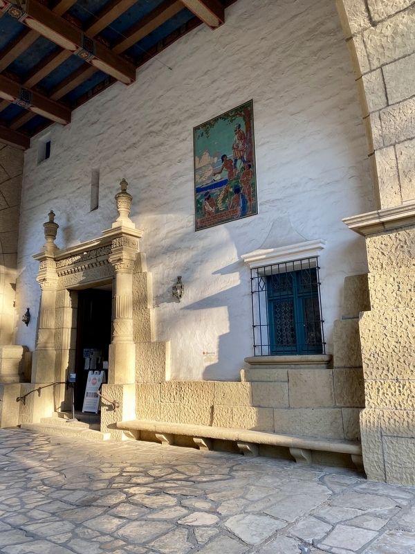
Constructed in 1849 by Don José de la Guerra, this adobe was originally used to house supplies brought in from ships anchored in the harbor.
Don Gaspar Oreña bought the adobe and added the story-and-a-half portion in 1858, shortly after his . . . — — Map (db m106881) HM
Mission Santa Inéz has been designated a National Historic Landmark. This religious complex possesses national significance in commemorating the history of the United States of America.
Mission Santa Ines, founded in 1804, is one of the . . . — — Map (db m143491) HM
This arroyo honoring San Joseph, patron saint of flight and students, was first discovered and traversed by Spanish explorers in 1769. On March 25-26, 1776 Colonel Juan Bautista de Anza made it his encampment No. 99 as mapped by his cartographer . . . — — Map (db m54025) HM
John Cameron Gilroy
circa 1854
John Cameron Gilroy, native of Scotland, arrived in Spanish California in 1814, and became the first permanent English speaking settler. He married Maria Clara de la Ascencion Ortega, daughter of the family that . . . — — Map (db m68909) HM
First contact between the Spanish expeditions and the Ohlone tribes was usually friendly. These encounters, recorded in expedition diaries, indicated that throughout Ohlone territory, the Spanish were treated as "distinguished guests," suggesting . . . — — Map (db m197734) HM
In 1844 Juana de Briones de Miranda, a pioneer Latina property owner, businesswoman and humanitarian, purchased the 4,439 acre Rancho La Purisima Concepcion from Indian grantee Jose Gorgornio. The grant extended two miles south, encompassing . . . — — Map (db m54016) HM
Rancho La Purísima Conceptión was granted to a former Santa Clara Mission Indian, Jose Gorgonio, by Governor Alvarado on June 30, 1840. In 1844, Gorgonio and another Indian, José Ramon, sold the grant to Dona Juana Briones de Miranda, who lived with . . . — — Map (db m90786) HM
Established in December, 1845, Spanishtown developed as Indians, Californios and immigrants from Peru, Argentina and Mexico built their homes on the hill above Deep Gulch. Cinnabar was first mined from a nearby cave known to local Indians. Later in . . . — — Map (db m50750) HM
Located in what was originally known as the East San Jose barrio of “Sal Si Puedes” or “Get Out If You Can,” Cesar and Helen Chavez and their family resided in a home at this site from 1951 to 1953 while Cesar began his work in the Civil Rights . . . — — Map (db m212692) HM
Within a year after the opening of the first overland route from Mexico to Alta California, Governor Filipe de Neve authorized the establishment of the first civil settlement in the state on lands including and surrounding the present Civic Center. . . . — — Map (db m52937) HM
Lt. Juan Bautista de Anza and party crossed this area in March 1776. en route to select sites for the Presido and the Mission of San Francisco
In the center of the marker is a circular motif, designed by Doris Birkland Beezley, of a rider . . . — — Map (db m38342) HM
The Plaza de César E. E. Chávez is part of the original plaza of the 1797 Pueblo de San José and is the oldest continuously used public open space in the city. The plaza was the hub of the old Spanish settlement: the site of Juzgado and the . . . — — Map (db m30207) HM
The Juan Bautista de Anza National HistoricTrail marks a 1,200 mile route that brought settlers to California from Tubac, in present-day Arizona, to what is now San Francisco.
The Spanish planned a system of Presidios, or military . . . — — Map (db m30147) HM
The Palomar Ballroom was constructed on this site in 1946. Operating
under various names, it was an important venue for music and dance
lovers for almost 60 years. As the first racially integrated ballroom in
the city, it attracted big bands, . . . — — Map (db m155027) HM
Farm, orchard, and cannery work in the Santa Clara Valley was seasonal. When a crop was ready to be harvested or processed in one of the Valley's many canneries, employers often supplemented their permanent workforce with workers hired on a . . . — — Map (db m231598) HM
This parcel, known as the Bernal Adobe Site, is part of the Rancho Santa Teresa Historic District of Santa Clara County. Ancestors of Mowekma Ohlone Indians used this area as a large permanent cemetery and village site as long ago as 3,000 years due . . . — — Map (db m52767) HM
This historic adobe was built in 1836 by a native Californian, Roberto Balermino, on Rancho de los Coches. The property was officially granted to him by Governor Micheltorna in 1844. A larger one-story dwelling was built in 1847 by the new owner, . . . — — Map (db m52119) HM
Arts, civic, cultural, historical and indigenous groups benefited from the personal service of this sixth-generation Californian.
The life of this descendent of Santa Clara’s first physician, H.H. Warburton, and the Spanish colonist Alviso, . . . — — Map (db m52935) HM
Two story classic Georgian Colonial Revival rests on solid redwood foundation. Built before 1870 by Luis Arguello, son of first governor of California under Mexican Rule.
1901 residence and office of Dr. George H. Worrall, DDS., long time . . . — — Map (db m52899) HM
This site is what remains of the original Mission Santa Clara corral, which once covered about 6 acres and was enclosed by an adobe wall.
In 1847, marking the transition from Spanish/Mexican mission to American town, William Campbell mapped the . . . — — Map (db m52900) HM
Secundino Robles
c. 1811-1890
María Antonia García
c. 1816-1896
Here lie a Don and Doña.
Proud Californios who shaped this region
under Spanish, Mexican, and United States governance. In 1824, at age thirteen, Secundino discovered an . . . — — Map (db m218886) HM
The Berryessa Adobe was built at a crossroad in California history. When constructed in the 1840s, Spanish colonial building traditions were blending with American influences. The builders constructed adobe walls on stone foundations and used soil . . . — — Map (db m52932) HM
The fifth church facade has changed since 1825.
The Spanish Built the first church in 1825 with no decoration. Ten years later, figures of saints were painted on the church faced. Over the next 90 years the face was remolded twice. . . . — — Map (db m195447) HM
Watsonville, where strawberries are sweeter, apples are crisper and produce plentiful, is a friendly place of diverse people who share a strong sense of community and optimism.
Don Sebastian Rodriquez owned the grant, Bolsa de Pajaro, on which . . . — — Map (db m54880) HM
This tablet dedicated to his memory. He was State Senator 1852-1853; Mayor of Santa Barbara, Captain of California Volunteers serving in Arizona during the Civil War 1861-1865. He was a loyal member of the Ancient and Honorable Order of E. Clampus . . . — — Map (db m58330) HM
This is the site of Rancho Los Putos of 10 square leagues granted in 1845 by Governor Pio Pico granted to Juan Felipe Peña and Manuel Cabeza Vaca. The Peña Adobe, erected here in 1842, is still owned by the descendants of the Pena-Vaca families. The . . . — — Map (db m10821) HM
George Washington Call (1829-1907) and his Chilean wife, Mercedes Leiva (1850-1933), bought 2,500 acres including Fort Ross in 1873. While maintaining a house in San Francisco, the family developed a dairy ranch and expanded the transport of local . . . — — Map (db m16357) HM
Petaluma Adobe served as the center for General Mariano Guadalupe Vallejo’s 66,000-acre working rancho from 1836-1846. It was once the largest privately owned adobe building in northern California; Vallejo sold the building and surrounding acres in . . . — — Map (db m71981) HM
Built 1856
California Heritage Council Award of Merit
Sonoma League for Historic Preservation
Headquarters
Dedicated May 1, 1976 — — Map (db m15249) HM
Born July 4, 1807 in Monterey
Died January 18, 1890 in Sonoma
Founder of the Pueblo of Sonoma on June 24, 1835
Commissioner of the Sonoma Mission
Commandant General of California
Director of Colonization for the Northern Frontier . . . — — Map (db m231569) HM
"A Small Army of Employees"
General Vallejo was one of the most powerful men in California. The Servants' Quarters was once a section of his impressive house, Casa Grande, but the rest burned in 1867. The Vallejo family employed "a small army . . . — — Map (db m231026) HM
Columbia was a boomtown.
The discovery of gold in 1850 attracted thousands of miners here. As more people arrived, the demand for goods, services and entertainment soared.
In the gold rush, Columbia stores and other businesses thrived. . . . — — Map (db m53301) HM
In 1769 the "El Camino Real - The King's Highway” was begun by the
Franciscans and lead by Fr. Junipero Serra. Missions were situated in
areas where large populations of Indians lived and where soil was
fertile enough to sustain a settlement. As . . . — — Map (db m154365) HM
Cesar E. Chavez was born in Yuma,
Arizona, on March 31, 1927. His parents
Librado and Juana Chavez came to
Oxnard to work in the walnut orchards
in 1938, 1939 and 1940. During their 1939 stay
the family lived in a storage building at
this . . . — — Map (db m146945) HM
Welcome to Rancho Camulos, a National Historic Landmark. Ygnacio del
Valle established Rancho Camulos and began building his adobe home
here in 1853 on what was part of a 48,000-acre Mexican land grant
awarded to his father. Originally a . . . — — Map (db m220575) HM
Granted the Rancho San Francisco on January 22, 1839, to Antonio del Valle, including 48,815 square acres. Jacoba Felz filed a claim against this grant, which was dismissed June 8, 1857. The Del Valle family chose Camulos as their home, which later . . . — — Map (db m115807) HM
Rancho Camulos has been designated a National Historic Landmark.
This residential complex possesses national
significance in commemorating the history of the
United States of America.
Ygnacio del Valle established Rancho Camulos in 1853, on . . . — — Map (db m154495) HM
In 1839, Antonio Del Valle received Rancho San Francisco, a 48,000-acre
Mexican land grant. Antonio's son Ygnacio inherited the land
after his father's death in 1841. Ygnacio began construction
on a small, four-room, single story dwelling in . . . — — Map (db m220571) HM
1925 - Canyon School was built.
Built especially for Spanish-speaking
children to meet their language needs.
Parents were offered classes in citizenship,
health, and homemaking.
Originally, there were eight classrooms. . . . — — Map (db m184851) HM
This is the site of the headquarters of the Spanish Rancho San Jose de Nuestra Senora de Altagarcia y Simi. The name derives from "Shimiji," the name of the Chumash village here before the Spanish. At 113,000 acres, Rancho Simi was one of the . . . — — Map (db m167458) HM
The Simi Adobe was headquarters for the Spanish Colonial Land Grant named San Jose de Nuestra Senora de Altagracia y Simi. Santiago Pico was the original grantee in 1795, followed by three of his sons, Francisco Javier, Miguel and Patricio, to whom . . . — — Map (db m143273) HM
The Chumash Indians used this site to celebrate their Hutash Fiesta, held after the harvest each year towards the end of September. The Hutash Fiesta coincided with the Spanish Missionary's San Miguel Day giving the historic Chapel built on the site . . . — — Map (db m124617) HM
Beneath the floor of the rear portion of the Wilson Studio and Peirano Market lies
a major segment of the Mission Lavanderia. Built to serve the Mission converts, it provided washing facilities for clothing and was part of an
extensive aqueduct . . . — — Map (db m129361) HM
The original small adobe on this site was built by Don Raimundo Olivas and his son, Nicolas, in 1837. The present structure was begun in 1847, with roof beams from the Santa Paula Canyon, and tiles made from native soil. Don Raimundo lived in this . . . — — Map (db m51424) HM
This adobe is the only early two-story adobe in the Santa Clara River Valley. A small one-story adobe, built in 1837 was enlarged in 1849 by Don Raimundo Olivas: a prosperous cattle rancher. Continuous use has preserved the adobe for public viewing. — — Map (db m51032) HM
A unique example of an early working-class adobe home.
Spanish and Mexican adobes once lined Ventura's downtown streets but only the Ortega Adobe survives today due to its continuous occupation as a residence or business.
Emigdio Miguel . . . — — Map (db m143708) HM
Rancho Cañada Larga o Verde, as it was originally known, came out of lands of the San Buenaventura Mission. Following Mexican independence from Spain, Joaquina Alvarado de Moraga, whose late husband, Gabriel Moraga, was a distinguished soldier of . . . — — Map (db m124924) HM
A visible section of the mission aqueduct still exists just east of Highway 33 on Cañada Larga Road. It is one of the few remaining parts of a seven-mile-long system that delivered water from San Antonio Creek to El Caballo filtration plant on the . . . — — Map (db m143278) HM
San Buenaventura Mission was an oasis of abundance. Visitors, including British Captain George Vancouver (1793) and the American California resident Alfred Robinson (early 1800s), commented on the good yield of the gardens and orchards.
The nearby . . . — — Map (db m135860) HM
The Chilean Community of Northern California and the Consulate General of Chile in San Francisco present this plaque in honor of
José Manuel Ramírez Rosales
A Chilean 49er, pioneer, artist, visionary and co-founder of the City of . . . — — Map (db m55758) HM
[Map captions, clockwise from top right, read]
• Penitente Canyon [informational]
• Great Sand Dunes National Park [informational]
• Stations of the Cross Shrine [informational]
• The Fort Garland Museum is a restored . . . — — Map (db m160927) HM
Isolated from the rest of Colorado, the San Luis Valley is often a forgotten place. For Native American tribes including the Utes, Apache, Navajos, and others, this Valley is a source of life - a place where humans and spirit enter and leave . . . — — Map (db m71875) HM
¡Bienvenidos! Caminantes!
Come! Take a walk with us. We know an old song, El Caminante, which tells of taking a long walk along the ancient roads. Like the first prehistoric inhabitants, you too are a ‘caminante’, or one who walks upon . . . — — Map (db m71877) HM
In an attempt to settle unknown territory, the Mexican government offered a large gift of land, la merced, for anyone brave enough to attempt to settle the San Luis Valley. Mexican land grants made it possible for even a poor man to . . . — — Map (db m160677) HM
You have entered the land of the Río Bravo del Norte, the northernmost outpost of sixteenth century Spain. To the Spanish people, the San Luis Valley was a wild and unexplored place known only to the Native people. Amidst the beauty and towering . . . — — Map (db m160674) HM
¡Bienvenidos! Caminantes!
Come! Take a walk with us. We know an old song, El Caminante, which tells of taking a long walk along the ancient roads. Like the first prehistoric inhabitants, you too are a ‘caminante’, or one who walks upon . . . — — Map (db m160668) HM
Ready or not, with the Treaty of Guadalupe Hidalgo in 1848, Hispano settlers (pobladores) of the San Luis Valley became Americans overnight. The pobladores of the large land grants were legally granted citizenship of the United . . . — — Map (db m160679) HM
Rodolfo Corky Gonzales born in Denver June 18, 1928, son of a migrant worker, helped organize and lead the Chicano civil and human rights movement of the 1960s and '70s. He advocated equality, justice and self-determination for the Chicano/Mexicano . . . — — Map (db m135326) HM
“We have to organize. The best way to make the system work for us is cooperation.”
-- Bernie Valdez (1912-1997)
Co-founder of Latin American Education Foundation and the Latin American Research and Service Agency, and Head of the Colorado . . . — — Map (db m135515) HM
History often neglects or omits the 1913-1914 Colorado coalfield strike and massacre
Looking onto this prairie, you see one of several places where coal miners lived during the strike.
Miners demanded better wages, an eight-hour work . . . — — Map (db m193668) HM
In the late 1860s, directly across the street stood the Colorado Hotel, a two-
story adobe building fronted by a wooden arcade. It was the station for the Denver Santa Fe Stage Line and, for several days, the refuge of some 60 Anglo town residents . . . — — Map (db m100505) HM
From this spot in the fall of 1776, you might have seen a small expedition crossing the plains below, heading west into Utah. The group was led by Atanasio Dominquez and Silvestre Velez de Escalante, two Franciscan friars attempting to find a . . . — — Map (db m154613) HM
Teresita Sandoval was one of the daring souls that arrived at the Pueblo settlement in
1841. Like other women of that time, she would witness and be partner to changes in her
country. She departed from her traditional life as the wife of Manuel . . . — — Map (db m64751) HM
Colorado's vast plains, rugged mountains, and grand plateaus, so magnificent in their beauty and variety, seem at times to overshadow the state's history and people. But look closely. The story of Colorado is every bit as dramatic as the physical . . . — — Map (db m47324) HM
Discovery of gold in the Rocky Mountains in 1859 lured thousands of prospectors to the area eventually known as the Colorado Territory. This first wave of fortune seekers triggered the development of farms, ranches, businesses, and railroads . . . — — Map (db m222040) HM
The test of mankind's progress is not whether we add more to the abundance of those who have much; it is whether we provide enough for those who have too little. — — Map (db m170069) HM
Between 1863 and 1865, nearly 1,700 men of color enlisted in the 29th Volunteer Infantry Regiment, Connecticut's first non-white military unit. The recruits came from a variety of racial and ethnic origins and professional backgrounds. A . . . — — Map (db m230467) HM
The Effect of Human Actives on Long Island Sound
Humans have inhabited the shores of Long Island Sound for thousands of years. Before European settlement, many Native American tribes lived along the Sound. Now more than 20 million people . . . — — Map (db m107344) HM
In the human experience, nothing has the power to transcend political and cultural boundaries quite like sport. On September 10, 1962, Armando "Tantor" Hidalgo '63, one of the 21 Cuban emigres that attended Salesianum from 1960-64, took the field . . . — — Map (db m217914) HM
Este Templo fue consagrado
a la
Gloria de Dios
por el Excelentísimo
Apóstol de Jesucristo
Samuel Joaquín Flores
Washington, D.C. Julio 7 de 2002
[English translation:]
This Temple . . . — — Map (db m238259) HM
The Washington Metropolitan Area Transit Authority Board of Directors, in recognition of the contribution of Officer Marlon Morales, who through courage and valor gave his life for the mission of Washington Metropolitan Area Transit Authority and . . . — — Map (db m110847) HM
The Jones Haywood School of Ballet was founded here by Doris W. Jones and Claire H. Haywood in 1941. Their Capitol Ballet Company, established in 1961, remained the nation's only predominantly African American, professional ballet troupe through the . . . — — Map (db m65511) HM
Painted in 1977, A People Without Murals Is A Demuralized People is the oldest and only mural remaining in Adams Morgan created by a group of Latino immigrant artists. It was brought back to life in 2005 by Sol & Soul, a D.C. . . . — — Map (db m112851) HM
The first crossing of the Colca Canyon became not only an important achievement in the history of exploration, but also opened up the canyon and its beauty to the world. This, in turn, contributed to the acceleration of the economic and social . . . — — Map (db m190156) HM
Traversing the Colca Canyon did not mark the end of the expedition. A month later, the Canoandes'79 team set off again in search of the destination that gave birth to their original expedition: Argentina. The group reached Argentina and Tierra . . . — — Map (db m190152) HM
The Ontario Theatre played a notable role in the history of the Adams Morgan neighborhood. Built for the K-B theater chain in 1951 in a contemporary Modern style, the Ontario began operations as an upscale first-run movie house, hosting local . . . — — Map (db m189086) HM
Furs by Gartenhaus and truffles by Avignon Freres. Hand-crafted ice cream from Budd's. Beginning in the 1910s, such neighborhood favorites occupied the commercial buildings to your right developed by Sanner and Barr. These fashionable shops . . . — — Map (db m130708) HM
The large building to your left is Adams School (1930), built for white students when the DC Public Schools were segregated. An Americanization School taught immigrant adults and children the English language and American culture here from . . . — — Map (db m184988) HM
This is the heart of Washington’s Latino community. Once centered here and in nearby Mount Pleasant and Columbia Heights, the community now extends throughout the region.
As early as the 1910s, the Mexican, Ecuadoran, Cuban, and Spanish . . . — — Map (db m130709) HM
You are entering Bloomingdale. Its name recalls the estate of Navy Commander George Beale, who served in the War of 1812, and his wife Emily, the daughter of Commodore Thomas Truxton. The estate occupied the land now bounded by Florida . . . — — Map (db m110508) HM
Youth from the Latin American Youth Center - Art + Media House used cameras and microphones to explore the changing faces of Columbia Heights’ people and places. Collaborating with community artists, youth researched neighborhood history, . . . — — Map (db m126148)
Youth from the Latin American Youth Center–Art + Media House used cameras and microphones to explore the changing faces of Columbia Heights' people and places. Collaborating with community artists, youth researched neighborhood history, . . . — — Map (db m111852) HM
Youth from the Latin American Youth Center - Art + Media House used cameras and microphones to explore the changing faces of Columbia Heights’ people and places. Collaborating with community artists, youth researched neighborhood history, . . . — — Map (db m126149)
La Lotería Mexicana 🏳️🌈
La lotería es un juego similar al bingo que se originó en Italia en el siglo XV, pero en donde ha dejado huella en la cultura popular y las costumbres, ha sido en México. . . . — — Map (db m177212) HM
"A Black world in which a wonderful democracy of conditions prevailed — waitresses, doctors, preachers, winos, teachers, numbers runners and funeral directors, prostitutes and housewives, cabdrivers and laborers all lived as neighbors."
. . . — — Map (db m130749) HM
Youth from the Latin American Youth Center—Art + Media House used cameras and microphones to explore the changing faces of Columbia Heights' people and places. Collaborating with community artists, youth researched neighborhood history, . . . — — Map (db m129069) HM
Low cost housing in Mount Pleasant in the decades following World War II made it an ideal place for immigrants to the area. Refugees fleeing World War II and the Cold War in Eastern Europe were the first group to arrive. A small Czech community . . . — — Map (db m130866) HM
Youth from the Latin American Youth Center—Art + Media House used cameras and microphones to explore the changing faces of Columbia Heights' people and places. Collaborating with community artists, youth researched neighborhood history, . . . — — Map (db m129027) HM
• 1957: First integrated Episcopal church in DC
• 1969: Began Loaves & Fishes feeding program; hot meals still served every Saturday and Sunday at Noon
• 1975: Ordained four women to the priesthood, resulting in the ordination of . . . — — Map (db m142192) HM
This block is home to some of the largest Latino organizations in the city, all founded as migration from Central America and the Caribbean increased in the 1970s. Several began with a boost from Cavalry United Methodist Church at 1459 Columbia . . . — — Map (db m130754) HM
1248 entries matched your criteria. Entries 301 through 400 are listed above. ⊲ Previous 100 — Next 100 ⊳