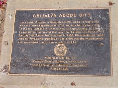
Juan Pablo Grijalva, a Spanish soldier, came to California with the Anza Expedition in 1776. On this hill he built one of the first adobes in what is now Orange County. In 1801 he petitioned for use of the land that became the Rancho Santiago de . . . — — Map (db m50040) HM
Portola camped on bank of Santa Ana River in 1769. Jose Antonio Yorba, member of expedition, later returned to Rancho Santiago de Santa Ana. El Camino Real crossed river in this vicinity. Place was designated Santa Ana by travelers, and known by . . . — — Map (db m50302) HM
On the mesa one-half mile south of here the original Mission of San Juan Capistrano was founded Nov. 1, 1776.
Commemorated El Viaje De Portola April 1968 — — Map (db m188901) HM
San Clemente Island is the southernmost of the eight California Channel islands. The 56 square miles island received its named in November 1602 when Spanish explorer Sebastian Vizcaino sailed passed it while mapping the region. It represents . . . — — Map (db m190450) HM
May date back to 1794. It was part of two buildings known as Hacienda Aguilar. This adobe is associated with Don Blas Aguilar, the last Alcalde (Mayor) of the Mexican period. — — Map (db m51943) HM
The Forster family moved to San Juan Capistrano in 1844 when English man John Forster bought the San Juan Mission and the surrounding area at auction from Pio Pico, the last of the Mexican Governors of California. Forster, then known as Don Juan . . . — — Map (db m188910) HM
This 1830 structure is typical of San Juan Capistrano adobes of this period; thick walls and a wood shingle roof. The house was purchased by Domingo Oyharzabal in 1880 and occupied by his family for over 100 years. — — Map (db m51939) HM
As Governor of Baja California Portola was the military leader of the Spanish expedition into Alta California, which camped near the future site of the Mission on July 23, 1769. — — Map (db m199165) HM
Yorba was one of the 66 Catalonian volunteer soldiers in the Spanish expedition, and later built the Miguel Yorba and Domingo Yorba Adobes. — — Map (db m199166) HM
Avila, "El Rico," was the original grantee of Rancho Niguel, owner of the Avila Adobe, and a first trustee for the San Juan Elementary School District in the 1850's. — — Map (db m199167) HM
Forster bought Mission San Juan Capistrano at public auction in 1844 and later owned 260,000 acres in Orange and San Diego Counties. — — Map (db m199169) HM
While reading this plaque, you are facing the historic El Camino Real, also known as "the King's Highway or "The Royal Road".
Originating in 1769, the trail got its name from the Spanish monarch who directed the establishment of a chain of . . . — — Map (db m188641) HM
A Spanish soldier station at San Juan Capistrano in the late 1700s. He was awarded a land grant in the San Juan Capistrano Area which remained in his family for 10 generations. — — Map (db m199168) HM
Built in the 1840's by Manuel Garcia, it originally had a second story over only half of the ground floor. In 1880 the remaining space was covered by a second floor and a balcony was added. It was a post office in the 1870's, a hotel from 1880 to . . . — — Map (db m149789) HM
Historic Town Center Park
Today the San Juan Capistrano down town and Mission San Juan Capistrano are situated on the site of the Juaneño village of Acjachema. History explains that in 1769 the first Spanish exploratory expedition, led . . . — — Map (db m51947) HM
In 1776, Father Junipero Serra founded Mission San Juan Capistrano. The land upon which Plaza Del Obispo is built was used by the mission to grow fruits and vegetables. In the 1800s, under private ownership, walnut trees were planted here. In the . . . — — Map (db m188547) HM
Jose Dolores Garcia was a prominent citizen of San Juan Capistrano who was
of Juaneno Indian and Spanish descent. In 1862, he married Maria Refugia Yorba
at the Mission. He promised her a new and unique house. After extensive research on horseback . . . — — Map (db m188929) HM
Ortega was the scout who blazed the trails for the 1769 Spanish expedition from San Diego to Sonoma, and discovered San Francisco Bay. — — Map (db m199145) HM
Like much of San Juan Capistrano, the Los Rios Street Historic District and surrounding area was home to Native Americans of the Nation before San Juan Capistrano was established in 1776. The first adobe home for Mission neophytes and soldiers were . . . — — Map (db m188923) HM
The two furnaces at this site, circa 1790's, are the oldest existing metalworking structures in California. They were used for the production of wrought iron, thereby introducing the natives living here to the Metal Age. Previously, only skills in . . . — — Map (db m195045) HM
The cobble foundation is a replica of the original wall foundation which surrounded the gardens and orchard of the Mission San Juan Capistrano. A portion of the foundation has been preserved beneath this replica. The garden and orchard where . . . — — Map (db m188921) HM
"Jewel of the Missions" founded on November 1, 1776 by father Junipero Serra, most renown and most beautiful of the California Missions, Quaint little Serra Chapel is California's oldest building still in use. The magnificent ruins of the Great . . . — — Map (db m149788) HM
Constructed in 1794 as one of forty adobes built to house mission Indians. Named for Polonia Montanez, a nineteenth century resident. Owned by Mr. and Mrs. Forrest Dunivin. Preserved by San Juan Capistrano Historical Society. Restored in 1981 by . . . — — Map (db m148348) HM
This building façade was built in 1938 by Nick and Canuta Arbonies as a home and restaurant which replaced an earlier building that was the first train stationmaster's house and office. The Arbonies were both born in the Basque Navarra region of . . . — — Map (db m188647) HM
Situated below this hill, directly below the hotel, is the Pablo Pryor Adobe-Hide House. Built perhaps as early as 1790, it is possibly the oldest standing adobe in California. During the Rancho period, it was used for storing cattle hide from the . . . — — Map (db m189449) HM
Dick O'Neill 'Uncle Richard' to family and friends contributed significantly to the life of Capistrano Valley. A sixth generation 'Californio', he was an owner
of Rancho Mission Viejo and of the vast Rancho Santa Margarita y Flores, the 'great . . . — — Map (db m188927) HM
Built in 1794 for Feliciano Rios, a
Spanish soldier based at the San Juan
Capistrano Mission, it is the oldest
home continuously occupied by one
family in the state of California. — — Map (db m148345) HM
Sergeant Jose Francisco Ortega was the chief Scout for the Gaspar de Portola exploratory expedition in 1769. While exploring a route for Portola on their way to Monterey Bay, he was the first non-Native American to discover Capistrano Valley. Nearby . . . — — Map (db m188649) HM
Antonio Valenzuela, early pioneer of the town of San Juan Capistrano, built the adobe in the early 1840s, probably on the ruins of a mission Indian adobe dating to the 1790s. Later Valenzuela family members worked as local cowboys or vaqueros. The . . . — — Map (db m149787) HM
In memory of Thomas Anthony 'Tony' Forster, El Presidente of the San Juan Capistrano Historical Society from 1991 to 2007. It was through his vision that these grounds were dedicated to the development of four houses to reflect the various . . . — — Map (db m188925) HM
The first inhabitants of San Juan Capistrano were the Acjachemen. These Native Americans lived in what we know today as Orange County. Some of the tribe's descendants work here at Zoomars.
In 1776, the Historic District was part of the . . . — — Map (db m188924) HM
The California Mission Bell commemorates the route of El Camino Real. This bell sits near the crossroads of the summer and winter route from Mission San Juan Capistrano to Mission San Gabriel Archangel. — — Map (db m188551) HM
In 1857, the Whitney’s arrival in Rocklin signaled the start of the Spring Valley Ranch. In the early 1900’s another important chapter of Rocklin’s agricultural history began with the arrival of Japanese and Spanish immigrants.
Both the . . . — — Map (db m243176) HM
In this valley a conflict between the culture of the Indian and the white man resulted in the death of Juan Diego (Alessandro of the play Romona) by the hands of Sam Temple. — — Map (db m78591) HM
Nearby, an adobe house was built about 1867. It was occupied until 1898 by Leandro Serrano's widow, Josefa. Under Spanish law, she owned the surrounding 20,000-acre Rancho Temescal; but her ownership was denied by the US Supreme Court. — — Map (db m50645) HM
Danish sea captain Cornelius Jensen sailed to San Francisco during the Gold Rush to sell his cargo. In 1854 he settled in Agua Mansa, established a store, and married Mercedes Alvarado, a descendant of a pioneer Californio family. The Jensens . . . — — Map (db m50685) HM
Within the building on this site stand the remaining walls of the Trujillo Adobe. The adobe was the center of La Placita de Los Trujillos, a village founded here in the 1860s. Many generations of the Trujillo family lived in the adobe. La Placita . . . — — Map (db m143382) HM
On September 29, 1976, Cesar Chavez spoke at University Theater at UC Riverside. The Latino American civil rights leader and co-founder of the United Farm Workers (UFW) often visited campuses inviting student support of his causes.
When he . . . — — Map (db m202305) HM
In memory of the American Servicemen of Hispanic descent and all others who sacrificed their lives to protect the freedoms we enjoy. — — Map (db m15474) HM
As a teacher, writer, editor, and activist, Idár preserved Mexican culture in South Texas
and encouraged women to pursue an education and push for equal rights. While
working as a journalist, she became the president of the newly-established . . . — — Map (db m171579) HM
The first female Mexican American author to write in English. Who Would Have Thought
It? was the first novel to be written in English by a Mexican living in the United States.
The book was published in 1872 without the author's name on the . . . — — Map (db m171894) HM
A California suffragist and an educator, she campaigned and translated at rallies in
Southern California where suffragists distributed tens of thousands of pamphlets in
Spanish and worked as a translator for the California suffrage movement. She . . . — — Map (db m171533) HM
News of the 1848 gold discoveries in California traveled around the globe, stirring up thousands of dreams of instant wealth. A slow trickle at first, by 1849 gold seekers rushed in from China, Australia, Mexico, Colombia, Argentina, Chili, Brazil, . . . — — Map (db m229813) HM
A line of strong, diverse, and dedicated teachers from a wide range of social and economic backgrounds have shaped the lives of Sacramento’s children. Ernesto Galarza was such a teacher, with an influence reaching far beyond Sacramento. He was born . . . — — Map (db m229914) HM
First panel:
The Comité Centro Mexicano commemorates the same respect and sense of equality dictated by this historical plaque. With great honor we re-dedicate it in honor of all humanity on this date.
From 1948 to 1975, El Centro . . . — — Map (db m91735) HM
English:
Residents Built and Destroyed on this Corner
The first permanent structures here were the adobe apartments for the Mission military families.
In 1856, a wooden Wells Fargo Express Office replaced the adobe ruins. . . . — — Map (db m82205) HM
Joseph Rodriguez
Private First Class – U.S. Army
Hometown: San Bernardino, California
Recognition: Medal of Honor
Joseph Rodriguez was a twenty-two year old private first class (PFC) assigned to Company F, 2nd Battalion, 17th . . . — — Map (db m242417) HM WM
"Guachama Rancheria, lying along this road, was named San Bernardino May 20, 1810, by Francisco Dumetz. In 1819 it became the San Bernardino Rancho of Mission San Gabriel. The adobe administration building stood about 70 yds. north of this spot, . . . — — Map (db m51015) HM
Established by Tiburcio Tapia, to whom the Cucamonga Rancho was granted March 3, 1839 by Governor Juan Bautista Alvarado of Mexico.
text on the interpretive sign:
The Thomas Winery . . . More than a century of service. . . . — — Map (db m149064) HM
This site sits at the base of the prominent Red Hill Landmark. The early historic importance of the property stems from its proximity to a reliable water source, Cucamonga Creek, and to its location on the major roadway between Los Angeles and San . . . — — Map (db m117911) HM
In 1839 Governor Juan Alvarado granted the 13,000-acre tract called Cucamonga to Tiburcio Tapia, an ex-soldier who was a prominent merchant and alcalde in Los Angeles. A half-mile west of this marker Tapia, employing Indian laborers, immediately . . . — — Map (db m149478) HM
Built in 1945, this park continues to provide a center reminiscent of early Mexican Heritage.
Recognized by Hampton Hotels Save-A-Landmark program as a site worth seeing. — — Map (db m204524) HM
Constructed in 1842 by Diego Sepulveda, nephew of Antonio Maria Lugo, this is believed to be the oldest house in San Bernardino County. The land, formerly controlled by San Gabriel Mission, was part of Rancho San Bernardino, granted to the Lugos in . . . — — Map (db m143658) HM
Here was a palm-studded desert resting place, 1826-1866, for Mexican pioneers, mountain men, the Army of the West, Mormon Battalion, Boundary Commission, Forty-Niners, Railway Survey, Butterfield Overland Mail stages, and California Legion. It was . . . — — Map (db m51578) HM
The Santa Margarita Ranch House Bell. It is not known where the Santa Margarita Ranch House Bell was cast or in what year it was first hung in the arch on the front porch of the ranch house.
It has been suggested that it may have been brought . . . — — Map (db m117060) HM
El Camino Real began in San Diego and followed a coastal route later named Highway 101. In the early 1900s, bells were placed on this route to guide travelers to nearby Spanish Missions. This is an exact replica of the original bell and is . . . — — Map (db m193450) HM
Between 1937 and 1940, these adobe and wood buildings were built by actor Leo Carrillo as a retreat, working ranch, and tribute to old California culture and architecture. The Leo Carrillo Ranch, with its Flying "LC" brand, originally covered 2,538 . . . — — Map (db m51105) HM
While marching to the conquest and occupation of California during the Mexican War, a detachment of 1st U.S. Dragoons, under the command of Brig. Gen. Stephen W. Kearny, was met on this site by native California lancers under, the command of Gen. . . . — — Map (db m51095) HM
On October 29, 1772, Colonel Pedro Fages headed east from San Diego searching for army deserters. It was the first entry by Europeans into Oriflamme Canyon. From there, Fages and his men traveled on through Cajon Pass, around the Mojave and the . . . — — Map (db m219286) HM
Commemorating Cañada de Los Coches Rancho, smallest Mexican Grant in Calif.
Granted in 1843 to Apolinaria Lorenzana by Governor Manuel Micheltorena. Site of Old Gristmill. — — Map (db m88571) HM
Presidio Comandante Francisco Maria Ruiz built this house next to his 1808 pear garden late in 1821 for his close relative and fellow soldier, Joaquin Carrillo, and his large family. From this adobe dwelling, in April 1829, daughter Josefa Carrillo . . . — — Map (db m82465) HM
Built by Juan Francisco Lopez, one of San Diego's early Spanish settlers, the Casa Larga, or Long House, was among the first substantial houses built in the Pueblo of San Diego about 1835. In 1846 it was the home of Juan Matias Moreno, secretary to . . . — — Map (db m11128) HM
Estudillo House
has been designated a
Registered National
Historic Landmark
under the provisions of the
Historic Sites Act of August 21, 1935
This site possesses exceptional value
in commemorating or illustrating
the . . . — — Map (db m11781) HM
After many attempts dated back to 1774 to provide a reliable source of water for crops and livestock for Mission San Diego de Alcala, a dam and flume system was finished between 1813 and 1816 by Indian laborers and Franciscan Missionaries to divert . . . — — Map (db m51074) HM
The stone pilings seen in this archaeological excavation unit are part of the original foundation of the Casa de Aguirre built circa 1853. The original adobe mansion extended ten feet to the east of where the current building ends. The 21st century . . . — — Map (db m71058) HM
Near this point, sea and land parties of the Portola-Serra Expedition met. Two ships, the San Antonio and San Carlos, anchored on May 4-5, 1769. The scurvy-weakened survivors of the voyage established a camp, where on May 14 and July 1 they greeted . . . — — Map (db m51104) HM
Rafael Mamudes was a native of Hermosillo and led an adventurous life. He was once a baker and followed his trade to Monterey. He also mined at Calaveras County and made a sea voyage to Guaymas, Mexico. When he came here to San Diego, he supported . . . — — Map (db m12664) HM
Did You Know?
On a trail close to this one, soldiers and families walked down from the Spanish presidio two centuries ago to tend their gardens and livestock. Around 1820, some families started to build houses beside their gardens and "Old . . . — — Map (db m194306) HM
Formerly attached to Mission San Luís Rey, the 2,219-acre ranch passed through brief ownership by two Mission Indians, then Don Abel Stearns, and into possession of Ysidora Bandini upon marriage to Col. Cave Johnson Couts. The adobe ranch house, . . . — — Map (db m148680) HM
[Panel 1:] Pioneer Monument
Sculptor, Frank Happersberger (1859-1932)
Dedicated to the City of San Francisco on November 29, 1894, the Pioneer Monument was a gift of philanthropist James Lick. Lick, who died in 1876, left . . . — — Map (db m32183) HM
This plaque is placed on the 250th anniversary of the birth of California’s apostle, Padre Junípero Serra, O.F.M. to mark the northern terminus of El Camino Real as Padre Serra knew it and helped to blaze it.
1713 - November 24 - 1963 . . . — — Map (db m32169) HM
On June 29, 1776, Father Francisco Palou, a member of the Anza Expedition, had a brushwood shelter here on the edge of a now vanished lake, Lago de los Dolores (Lake of the Sorrows), and
offered the first mass. The first mission was a log . . . — — Map (db m32067) HM
Juana Briones, born in Hispanic California, was a preeminent woman of her time. In the 1830s and 1840s she transformed an isolated cove in the then Mexican hamlet of Yerba Buena into her rancho. At the site of this park she raised cattle and grew . . . — — Map (db m143437) HM
The area bounded by Montgomery, Pacific, Jackson and Kearny streets was known as “Chilecito” or “Little Chile” & was established during the gold rush period by Chilean settlers. — — Map (db m58384) HM
This marker consists of six plaques arranged in a 2 X 3 pattern. The top left plaque is the title plaque and may contain some text. The top right plaque displayed an arrow which points in the direction of the named street. Other plaques contain . . . — — Map (db m73083) HM
San Francisco Giants: 1958-1963
San Francisco Giants All-Star: 1962
Oldest of the Alou brothers, Felipe preceded Matty
and Jesus in Giants outfield in 1958. A superb
right fielder, his bust-out year was 1962, when he hit
.316, 25 HR, 98 . . . — — Map (db m175008) HM
San Francisco N.L., 1960-1973
Boston A.L., 1974
Los Angeles N.L., 1975
High kicking right-hander from the Dominican Republic won 243 games and lost only 143 over 16 seasons. Won 20 games six times and no-hit Houston in 1963. Led N.L. in . . . — — Map (db m163132) HM
San Francisco Giants: 1960-1973 · Hall Of Fame: 1983
Giants Retired Number: 27
San Francisco Giants All-Star: 1962, 1963, 1964, 1965, 1966, 1967, 1968, 1969, 1971 All-Star Game Most Valuable Player: 1965
"Dominican Dandy" is the . . . — — Map (db m175879) HM
San Francisco Giants: 1958-1966
Hall of Fame: 1999 ·
Giants Retired Number: 30
NL Rookie of the Year: 1958
San Francisco Giants All-Star: 1959, 1960, 1961, 1962, 1963, 1964
The Baby Bull rose from Puerto Rican poverty to Major
League . . . — — Map (db m176641) HM
San Francisco, N.L., 1958-1966, St. Louis, N.L., 1966-1968
Atlanta, N.L., 1969-1972, Oakland, A.L., 1972
Boston, A.L., 1973, Kansas City, A.L., 1974
A powerful first baseman and consistent run
producer for 17 major league . . . — — Map (db m193872) HM
San Francisco Giants: 1965-1967, 1969-1974
Flashy Cuban keystoner was master of the double play, daring opposing runners to touch him during his pivot.
In 1973, he set NL single season record for fielding percentage by a second baseman . . . — — Map (db m175362) HM
Artist who used indigenous
symbols, imagery, colors and
traditions of Mexican culture to
resolutely depict and celebrate
women's form and experience — — Map (db m186740) HM
Army veteran, drag performer, politcal activist, first openly gay candidate for public office in the world, founder of the Imperial Court System
Jose Sarria — — Map (db m120176) HM
Sylvia Rivera
(1951-2002)
Gay liberation and transgender rights
advocate, a founding member of the
Gay Liberation Front, Gay Activist
Alliance and Street Transvestite
Action Revolutionaries — — Map (db m237822) HM
El Camino Real, the Royal Highway, connected the California missions. At the beginning it was a trail, and a cross carved into the bark of trees showed the right path. This was such a tree, and the cross was lost until the day the tree fell (near . . . — — Map (db m154363) HM
The Anza Expedition of 1776, on its way up the Peninsula to locate sites for the Presidio and the Mission of San Francisco, camped here on March 26 at a dry watercourse a short league beyond Arroyo de San Mateo. Location: El Camino Real and Ralston, . . . — — Map (db m154364) HM
After gold was discovered, the thousands who came to California began to build cities and towns. Today's Half Moon Bay grew upon the Mexican land grant awarded to Mexican soldier Candelario Miramontes.
In 1853 Estanislao Zaballa came from Spain . . . — — Map (db m102405) HM
Left Side - English
She donated 59,000 acres of land for the benefit of all people.
Right Side - Spanish
Donadora de 59,000 acres par beneficio de la comunidad — — Map (db m62575) HM
The Chumash Indian Village of "Mishopshnow," discovered by Juan Rodriquez Cabrillo, August 14, 1542, was located one-fourth mile southwest of here. Fray Juan Crespi of the Gaspar de Portola expedition named it "San Roque," August 17, 1769. Portola's . . . — — Map (db m147308) HM
Built by Indian labor in 1817 for Don Domingo Carrillo, whose daughter married Don Jose Maria Covarrubias in 1838. Descendants of these families, many of them leaders in public affairs, occupied this house for over a century. Don Jose Maria was the . . . — — Map (db m50550) HM
Near this site August 26, 1850, two weeks before California Statehood, duly elected common council, City of Santa Barbara, held first official meeting. Here in 1875, first City Hall erected and area still center of city's governmental activities. . . . — — Map (db m50548) HM
Chief Scout for Gaspar de Portolá. Ortega assisted with the founding of Mission San Buenaventura and established the presidio at Santa Barbara where he served as commandant from 1781-1784. Husband of Doña María Carrillo. — — Map (db m131602) HM
Built in 1826 by Daniel Hill of Massachusetts for his bride Rafaela Luisa Ortega y Olivera, granddaughter of José Francisco Ortega, founder and first Comandante of the Royal Presidio of Santa Barbara. Later occupied by the family of Guillermo . . . — — Map (db m50559) HM
An adobe house was built here in 1857 where Don Agustin Janssens, a Belgian, and his wife, Maria Antonia Pico, lived into the 1870s. Janssens, a frequent office holder in the region, had arrived in California in 1834. Don Bruno F. Orella, a native . . . — — Map (db m106411) HM
1248 entries matched your criteria. Entries 201 through 300 are listed above. ⊲ Previous 100 — Next 100 ⊳