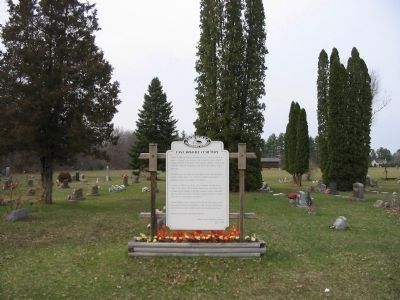
On July 11, 1859, Mr. Halvor Olson offered this 1/2 acre of his land to be used as a cemetery for the members of the Evangelical Lutheran Church (Hauge Synod) here in the Roche a Cree (Arkdale) settlement. People of the community outside the . . . — — Map (db m7368) HM
On this site once stood a Lutheran Church of the Norwegian Synod, from the years 1887 to 1921. This church developed because of a disagreement on some doctrinal points with the United Lutheran Church which stood one half mile south of here.
. . . — — Map (db m4657) HM
In 1850, a group of Norwegian settlers from Koshkonong, the foremost Norwegian settlement colony in the United States at the time, left their southern Wisconsin home and migrated north, settling here in "Roch-a-Cree" or Roche-a-Cri. Imbued with . . . — — Map (db m36123) HM
In 1853, Norwegian immigrants to this area, organized the Norwegian Evangelical Church of Roche-a-Cri, in 1860. A log church was constructed one mile south of this location. It was destroyed by fire in 1866. A frame church was then erected on this . . . — — Map (db m4658) HM
This prominent butte, perhaps the steepest hill in Wisconsin, was called La Roche-a-Cri by 17th and 18th century French voyageurs. Rising 300 feet above the surrounding plain, this landmark undoubtedly guided Indians and early pioneers. Indians of . . . — — Map (db m19822) HM
Korea
Lest We
Forget
In Honor
of all
Veterans,
POWs – MIAs
24th Infantry
"Victory Division"
Designed by Cpl. Donald E. Hahn
34th and 19th Reg.
Tribute to
Cpl. Mitchell Red Cloud Jr. . . . — — Map (db m37091) WM
Ira and Ransom Gleason, father and uncle to Charlotte and Francis Marion Rous set aside the original acre of land for this cemetery, from the land they obtained through the Public Lands Act of 1820. This plaque in memory of Edna Rous Russell and . . . — — Map (db m7534) HM
Duty, Honor, Country
We dedicate this monument to
all our service men and women
in all wars and conflicts.
United States Army
United States Marines
United States Navy
United States Air Force
United States Coast Guard . . . — — Map (db m41686) WM
A man of indomitable faith, he brought culture to a wilderness.
Learning and religion were of first concern. Freely giving to both, he labored unceasingly for a city whose good lay very close to his heart. — — Map (db m94062) HM
William Daniel Leahy was born in Iowa in 1875 and his family soon moved to Wisconsin. He graduated from Ashland High School in 1892 and for the rest of his life considered Ashland his home town.
Leahy graduated from the Naval Academy and served . . . — — Map (db m204096) HM
North Wisconsin Academy, founded in 1892 by the Congregational Churches, provided the first high school education available to young people of the small, isolated lumber camp, sawmill and farm communities in the area known as the Great Lakes Pinery, . . . — — Map (db m209668) HM
A crude structure of boughs of trees “layed acrosse, one upon an other” was erected near here by Pierre Radisson and Medart Groseilliers in 1659. The two French traders came to Chequamegon Bay from Montreal and Radisson's account of . . . — — Map (db m48410) HM
This property has been placed on the
National Register of Historic Places
by the United States Department of the Interior
Security Savings Bank 1889 — — Map (db m125034) HM
When built in July 1900 by the Baldwin Locomotive Works of Philadelphia, engine 950 was the world's largest steam locomotive at a weight of 190,000 pounds with a tractive effort of 47,090 pounds. Originally numbered 600 by the Soo Line, it . . . — — Map (db m272586) HM
Glidden State Bank
Circa 1905
has been placed on the
National Register
of Historic Places
by the United States
Department of the Interior
Nominated by
Jerry Hellenbrand - 2006 — — Map (db m47483) HM
You are now on the great divide which separates the two principal drainage areas of Wisconsin. Water falling to the north of this point finds its way into Lake Superior, then down through the Great Lakes and the St. Lawrence River 2,000 miles into . . . — — Map (db m47222) HM
This white pine log was sleigh hauled to Glidden on Dec. 21, 1984 on the sleigh it sets on. It was cut on State 40 14 miles east of Glidden. Its estimated weight is 7000 lbs. The 20 ft log scaled 1960 [?] board ft. Estimated age 500 to 600 . . . — — Map (db m47534) HM
Native American canoes launched North America’s maritime legacy about 12,000 years ago, making them among the world’s oldest watercraft.
The origins of the birchbark canoe are told in the oral traditions of the Ojibwe people. The spirit . . . — — Map (db m57836) HM
Early Native American Inhabitants
People have been using and occupying sites in the Apostle Islands area for thousands of years. But it was probably not until after 800 A.D. that more extensive use of the islands took place in the form of . . . — — Map (db m165677) HM
Established about 1836 as part of a Roman Catholic mission under the guidance of the dynamic Austrian priest, Frederick Baraga, later made a bishop.
The white man's style of house was adopted as a grave cover by the Christianized Ojibway . . . — — Map (db m144130) HM
The largest of the Apostle Islands was one of the earliest areas of Indian settlement, fur trade, missionary activity and commercial fishing in the interior of North America. It was discovered by French explorers in 1659. Trading posts were built . . . — — Map (db m234580) HM
A French-Canadian trader built a post on this site about 1792. From his wife Madeline daughter of the Chippewa chief White Crane the island takes its present name.
The official French fort La Pointe was built in 1718 about 500 feet west. Its . . . — — Map (db m144128) HM
Aaniin, visitors. Welcome to Mooningwaanikaaning, the homeland of the Ojibwe people. The Ojibwe name for Madeline Island means “home of the yellow-breasted flicker bird.” This island was the last-foretold stopping point on the Ojibwe migration . . . — — Map (db m234361) HM
This blow down area is a result of a wind storm to the island on June 27 1991. Winds were in excess of 100 mph. Damage to the island was spotty ranging from little to very intensive impact. — — Map (db m255116) HM
This willow tree began as a spring from a tree taken from the grounds of the birth place of Jeanne D'Arc of Dormery, Haute Marne, France. In May 1919, sprigs of this willow we're sent a number of Americans Legion Posts by the University of . . . — — Map (db m201014) HM
Mellen, Wisconsin, nestled in a valley in the heart of the Penokee Range, was founded in 1881 by Samuel O'Grady Bennett for which Bennett Street is named.
Iron City, later renamed Mellen for William Mellen of the Wisconsin Central Railroad was . . . — — Map (db m201380) HM
In honor of those who served.
In memory of: James Ledin and Melvin Gunderson, who gave the supreme sacrifice. This tree was planted, by Vietnam Veterans, on November 10, 2007, — — Map (db m201381) HM WM
The Mauvaise (Bad) River was so named by the French due to the difficulties of its navigation. The Indians called it Mushkeezeebi or Marsh River. In 1845 the Rev. L.H. Wheeler, Protestant missionary at La Pointe, planned an agricultural settlement . . . — — Map (db m63661) HM
Vast forests of virgin white pine were the treasure which brought the first wave of white settlers to Northern Wisconsin. The farms came later, but for half a century the forests were local history.
In 1847, the Knapp, Stout & Co. purchased . . . — — Map (db m45069) HM
Indian burial mounds such as this one were once common in the Chetek area. The mounds were built hundreds of years ago before the arrival of Columbus in 1492 by bands of the Ojibwa and Sioux people. This mound may be the last one located in the . . . — — Map (db m263688) HM
The congregation for this church traces its roots back to 1870 when people first held services in their homes in what was originally called Stanfold. This community later became Dobie. Their first Catholic church was built in 1876 but was destroyed . . . — — Map (db m45151) HM
The steam engine was a unique part of the industrial history of America’s heartland. Engines, such as this one, provided the power to generate electricity and run machines in hundreds of factories and municipalities throughout the world.
This . . . — — Map (db m130998) HM
1831 Henry Schoolcraft, Indian agent from Sault St. Marie, MI travels down the Red Cedar River to Rice Lake and held council with the Chippewa Indians at this approximate site. 1847 The Knapp Stout Co. purchased thousands of acres of . . . — — Map (db m161500) HM
1901 The Knapp Stout era was over. The Knapp Stout holdings were sold to the Rice Lake Lumber Company, which later was known as the largest hardwood mill in the country. 1906 The Rice Lake Excelsior Co. arrived on the scene in its present . . . — — Map (db m161666) HM
To quote from the Rice Lake Chronotype, September 30, 1920: ”Extensive improvements are being made at the yards of the Park Falls Lbr. Co. in this city. Monday Cyrille Mercer and a crew of carpenters began working at erecting a monorail . . . — — Map (db m120496) HM
The Tuscobia State Trail represents the history of the railroad in the development of northern Wisconsin. The route was first conceived as a rail line in 1899, but construction did not end until 1914. The Chicago and North Western Railroad ran on . . . — — Map (db m199897) HM
You might know that Lake Superior is the largest body of freshwater in the world, but did you know that it is large enough to generate its own small tide?
This tidal action, called "seiche,” influences Fish Creek. At times, water from Chequamegon . . . — — Map (db m201391) HM
VOICES IN THE MIST
When the mist turns a waltz along the shoreline, and swirls heavenward via convection, lend your ears to the bay. There are forms in the mist, and in the forms there are faces. The faces smile, and the hint of a melody plays . . . — — Map (db m201384) HM
"Bayfield is settling down to its regular winter's business... cord wood, pine logs, oak timber, steamboat wood and fish are the staple products, and the supply is unlimited."
- Bayfield County Press, November 28, 1877 Changing . . . — — Map (db m258915) HM
The Hokensons at Little Sand Bay were just one of many commercial fishing families in the area. This pound net boat came from Rocky Island where a community of fish camps was established in the 1930s. The Olsen, Erickson, Benson, Edwards, Hadland, . . . — — Map (db m258911) HM
You are standing at the “turning Point” for the Bayfield Waterfront Walk and across the water is a place of significance where “turning points” in history occurred. Madeline Island, or “Mooningwanekaaning Minis,” . . . — — Map (db m98243) HM
Bayfield’s history has been powerfully shaped by its location. Situated on the shores of a deep, natural harbor, the city is sheltered from Lake Superior’s notorious storms by the outlying Apostle Islands. Lighthouses, shipwrecks, and a historic . . . — — Map (db m57835) HM
"The planting of millions of fish, with regulations governing the size, limiting the number to be taken each day, and the season that they may be taken from our waters will make it possible to maintain the fish supply for all time to come." . . . — — Map (db m258926) HM
"This is the best combination of cultural heritage and land management that I can think of."
Bob Krumenaker, Superintendent
In October 2017, Apostle Islands National Lakeshore, in collaboration with the Red Cliff Band, Bad River Band . . . — — Map (db m201395) HM
"One could gather biographies of senior citizens around Lake Superior and find that nearly every individual engaged in multiple occupations in order to survive."
- Family Managed Commercial Fishing in the Apostle Islands, NPS Special . . . — — Map (db m258924) HM
Dedicated in 1981 to the hard working commercial fishermen whose indomitable spirits will not be forgotten.
Commissioned by Edwin Erickson,
Mayor of Bayfield, 1970-1976 & 1980-1988
Designed by Harold Kerr (1909-1981)
Constructed by . . . — — Map (db m57811) HM
Pleasure boating grew hand-in-hand with boat clubs of the 1880s and 1890s.
Regattas and other competitions fostered growth in small sailing craft on Lake Superior. The first sailing regatta at Bayfield in 1899 offered a $100 prize.
Serious . . . — — Map (db m260378) HM
Listed on the National Register of Historic Places
In the waters off Outer Island lies the wreck of the Pretoria, one of the largest wooden vessels ever to sail the Great lakes. On September 1, 1905, Captain Charles Smart and nine crew . . . — — Map (db m98244) HM
At one time, a local fishery once encompassed this entire block. Early sailing vessels would bring their harvests here to be salt packed in barrels and shipped to market. Here in “The Cooperage,” one of the remaining buildings of that . . . — — Map (db m57810) HM
Once upon a time, according to an old Indian legend, the sand beach on the east side of this bay was a favorite camping ground. One spring a few lodges of Chippewa from La Pointe encamped here. When their chief, Bi-aus-wah, returned from the hunt, . . . — — Map (db m194929) HM
When the community sought funding for a new gymnasium and town hall, they looked to the Work Progress Administration, a depression-era program, which utilized local materials and labor to create jobs for unemployed workers. Architect Roland C. Buck . . . — — Map (db m36553) HM
In 1935 the Forest Service set aside the one square mile (640 acres) to the North of this point as a “natural area.” This area is administered for ecological research purposes to obtain a better understanding of the natural processes governing the . . . — — Map (db m215839) HM
The familiar sandstone outcroppings along Lake Superior's shoreline provided a popular building material for grand and massive structures all over the Midwest and Eastern United States throughout the last half of the Nineteenth and into the . . . — — Map (db m201591) HM
As the 20th century began, logging operations were in full swing in this area and the small log schoolhouses could not handle the increasing number of students. Some classes were held in churches but additional facilities were needed.
T.N. . . . — — Map (db m30845) HM
Leo, Roy, and Eskel Hokenson began fishing commercially at Little Sand Bay in the 1920s. During the fall herring season, the brothers fished at night when cooler temperatures helped preserve the catch. Noting this habit, friends began saying, . . . — — Map (db m258909) HM
Harvesting the Waters
In 1927, the Hokenson brothers (Leo, Roy, and Eskel) began life as fishermen. For more than 30 years, they met the challenges of fishing the largest lake in the world, relying on their skills, strength, and . . . — — Map (db m46908) HM
Type: Steel, bulk and package freighter
Built: 1890, Frank W. Wheeler, Bay City, Mich.
Sank: September 2, 1905
Length: 372’ Beam: 41’
Cargo: Iron ore
Propulsion: Propeller
Depth of Wreckage: 25’
Lives Lost: 7
Listed on the . . . — — Map (db m46907) HM
The Bank of Washburn is a unique variation of the Romanesque Revival Style designed by architects Conover & Porter of Ashland, Wisconsin. Built in less than one year, the building was fashioned from brownstone quarried at Houghton Point located . . . — — Map (db m48439) HM
To the east is Madeline Island, known to the Ojibway as Moning-wunakauning, “The Home of the Golden Breasted Woodpecker.” The French soldier Pierre le Sueur built his post there in 1693. In 1718 a fort was erected which remained France’s principal . . . — — Map (db m208926) HM
The Sprague Well, believed to be the first drilled artesian well in Bayfield County, was completed at 119 feet 8 inches in April, 1903 by Monroe H. Sprague at the mill office of the Akeley–Sprague Lumber Co. Flow from the 4 inch casing was . . . — — Map (db m57812) HM
In the early days of Washburn, the waterfront was filled with saw mills. The A.A. Bigelow Mill (1887-1902), later to become the Hines Mill, was the largest of three major sawmills in Washburn. It rested on pilings that ran directly out from the . . . — — Map (db m122317) HM
(side 1)
Washburn Lumbering Days
Washburn begins on the shoreline of Chequamegon Bay. The city rises gradually 75 ft. above level of the water. In 1884, the town was created, born of the necessity of the railway (Chicago, St. Paul, . . . — — Map (db m57824) HM
This title was given back in 1892 when Frederick Prentice, president of the Prentice Brownstone Co. of Wisconsin, offered to supply a huge brownstone monolith for the Wisconsin Exhibit at the 1893 World’s Fair in Chicago. He proposed to furnish this . . . — — Map (db m48441) HM
Curly Lambeau is buried in the southeast corner of Allouez Catholic Cemetery, which is located almost directly east of here. He is buried in a family plot along with his father Marcel, mother Mary, and brother Oliver and his wife, the former Dorothy . . . — — Map (db m131521) HM
Near this site stood the first Episcopal Mission in Wisconsin
Founded in 1827 by the Reverend Richard Fish-Cadle
Later first director of Nashotah House — — Map (db m68040) HM
The church of St. John the Evangelist, the first church of the Redemptorists in this hemisphere, stood 215 feet east of this marker. It was begun by Rev. S. Mazzuchelli, O. P. and completed by Redemptorist missionaries sent from Europe by Rev. . . . — — Map (db m66522) HM
This park, built to portray and preserve Wisconsin's beginnings, is located on a site that is itself a part of history. On this 40-acre site stood Camp Smith--a temporary location of Fort Howard--part of the pioneer settlement known as Shantytown, . . . — — Map (db m240687) HM
was appointed by President Monroe as a district judge for the northern and western Michigan Territory, which included what is now the state of Wisconsin. Doty set up the region's new court in an empty log building.
Three years later, . . . — — Map (db m43822) HM
and the Fox River Trail is the tomb of Dr. William Edward Minahan, who died in the sinking of the Titanic. William had four brothers who were also doctors, and his oldest brother, Robert, was also a lawyer who served as mayor of Green Bay from . . . — — Map (db m308811) HM
This house of wattled construction is the oldest standing house, in Wisconsin, built in 1776 by fur-trader Joseph Roi, one of the first seven settlers of La Baye (Green Bay).
It was sold in 1805 to Jacques Porlier, another French-Canadian . . . — — Map (db m240688) HM
Fort Howard commander Colonel Joseph Smith moved the garrison to near this location, about a half-mile back from the shore. The high ridge on which the camp,
dubbed “Camp Smith,” was located provided good visibility and protection . . . — — Map (db m43820) HM
Built by the Indians for Father Claude Allouez in 1671, this is a replica of Wisconsin's first Catholic Church. The original was part of Mission St. Francis Xavior, about one mile south of this site. — — Map (db m68048) HM
is the most cost-effective mode of transportation when compared to truck or rail. Ships quietly move cargo farther (per ton mile) and more efficiently than trucks or trains. Most importantly, ships move cargo more safely than trucks and trains. . . . — — Map (db m43814) HM
Vince Lombardi's home during his nine years as coach of the Green Bay Packers is located directly east of here on Sunset Circle. Other family members included wife Marie, son Vince Jr. and daughter Susan.
Lombardi coached the Packers from 1959 . . . — — Map (db m131520) HM
Four score and seven years ago our fathers brought forth on this continent, a new nation, conceived in Liberty, and dedicated to the proposition that all men are created equal.
Now we are engaged in a great civil war, testing whether that . . . — — Map (db m114242) HM
Here surrounded by his spiritual sons lies all that is mortal of Bernard Henry Pennings Canon Regular of Premontre founder of St. Norbert Abbey Born June 9, 1861 Gemert, Holland Ordained June 19, 1886 Berne Abbey Heeswijk, Holland Blessed . . . — — Map (db m97952) HM
The site of the Brown County Court House from 1838 to 1854
Erected by Jean Nicolet Chapter, Daughters of the American Revolution,
1930. — — Map (db m241936) HM
Here in June, 1673, an expedition headed by Jesuit priest Jacques Marquette and his companion Louis Jolliet departed from St. Francis Xavier Mission to find and explore the upper Mississippi River. In September they returned here to record their . . . — — Map (db m151961) HM
The rapids at De Pere were well known to all early travelers along the Fox and Wisconsin rivers, which provided the best access to the Mississippi. Despite Indian domination, the waterway served explorers, fur traders and voyageurs, missionaries, . . . — — Map (db m11053) HM
St. Norbert College became the training camp of the Packers in 1958 in an agreement that would become the longest such partnership in NFL history. Father Dennis M. Burke, then president of the college, suggested the arrangement to the team that year . . . — — Map (db m56440) HM
The historic Union Hotel opened in 1883 and has been owned by the Boyd family since 1918, the year before the Green Bay Packers were born. Over the years, Packers legends and other prominent pro football personalities have found the Union to be one . . . — — Map (db m190022) HM
This building was erected in 1836 to serve as the office of the Fox River Hydraulic Company, which was chartered by Wisconsin's first Territorial Legislature to construct a dam at Rapides des Peres. Following the 1837 financial crisis, notes issued . . . — — Map (db m10887) HM
The Fox River has served as a highway for the movement of people and goods for thousands of years. Archaeologists working along the Fox River in De Pere uncovered two-thousand-year-old pottery that demonstrates trade with communities in Illinois. . . . — — Map (db m189977) HM
In 1848, immigrants from Langeland, Denmark, seeking economic opportunity and plentiful farmland, settled in this vicinity. The Danes purchased land here and called their early settlement "Copenhagen," later changed to Denmark. In subsequent years, . . . — — Map (db m257604) HM
Commemorating the discovery of Wisconsin in 1634 by Jean Nicolet, emissary of Governor Champlain of New France. In this vicinity Nicolet first met the Winnebago Indians.
Unveiled August 12, 1909, by members of the State Historical Society of . . . — — Map (db m15786) HM
On the river shore
Block 3 Astor directly west of this
marker stood about the year 1745 the
home and trading house of
Augustin de Langlade
and his distinguished son Charles,
the first permanent settlers of Wisconsin.
Charles . . . — — Map (db m39145) HM
Bellevue Park served as the Packers' home field from 1923 to 1924 and was the site of the first Packers-Bears game played in Green Bay.
Bellevue Park was built in less than three weeks in the spring of 1923 with wood salvaged from the stands at . . . — — Map (db m56414) HM
Gerald Clifford and Dr. W. W. Kelly, two members of the "Hungry Five," a group of local men critical to the survival of the Packers over their first three decades, had offices here. Kelly was a physician with an office on the fourth floor. Clifford . . . — — Map (db m145617) HM
The Green Bay Packers were organized on Aug. 11, 1919, in the old Green Bay Press-Gazette building that stood here at 315 Cherry Street. The meeting took place in the editorial department on the second floor.
Two days later, the paper . . . — — Map (db m145614) HM
Dedicated To The Memory of the
brave men of
Brown County
who fought to preserve the union.
Erected by the
Woman's Relief Corps
No.91.
Auxiliary to the
Grand Army of the Republic
1934 — — Map (db m43396) HM
The imposing Brown County Courthouse was where the first stockholders meeting of the newly formed non-profit Green Bay Football Corporation was held on Sept. 17, 1923. It was the first of many important Packer meetings held here over the next four . . . — — Map (db m204751) HM
Quarterback 1956 to 1971
Head Coach 1975 to 1983
6 Conference Championships
5 NFL Championships
Pro Bowl Team 1961,62,63,67
All Pro Selection 1961,62,64,66
MVP Super Bowl 1
MVP Super Bowl 2
NFL MVP 1966
Elected to Pro . . . — — Map (db m39251) HM
The Chicago & North Western Depot was the Packers' usual port of call for road trips over nearly four decades. And often those trips started or ended, or both, with a party thrown by the team's ever-faithful fans.
They threw impromptu . . . — — Map (db m145630) HM
3542 entries matched your criteria. The first 100 are listed above. Next 100 ⊳