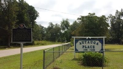
On South Autauga Street at Academy Street, on the right when traveling south on South Autauga Street.
Robert Ripley's world-wide syndicated Believe It Or Not! column for July 31, 1935 read: "C. D. Abbott is the first citizen of the U.S.A. He is first alphabetically in Autaugaville, the first town in Autauga, the first county in Alabama, the . . . — — Map (db m68839) HM
On East 4th Street west of North Court Street, on the right when traveling west.
Created in 1818 by an act of Alabama Territorial Legislature. Autauga Indians lived on creek from which the county takes its name. Autaugas were members of the Alibamo tribe. They sent many warriors to resist Andrew Jackson's invasion in Creek War. . . . — — Map (db m27907) HM
On Maple Street 0.2 miles west of Selma Highway, on the right when traveling north.
Alabama takes its name from this tribe,
whose settlements were located along the
headwaters of the Alabama River. Early French
colonists called them Alibamons, and engaged
the tribe in trade at nearby Fort Toulouse.
When the French . . . — — Map (db m294212) HM
Near West Main Street 0.1 miles west of South Chestnut Street, on the right when traveling east.
Side 1
Water has always played a significant role in the history of Prattville. Daniel Pratt chose the location for his new town because of the proximity to Autauga Creek and the Alabama River. This area was referred to as an . . . — — Map (db m70815) HM
On East Sixth Street 0.4 miles east of North Northington Street, on the right when traveling west.
Known as Fair Road, Sixth Street from Northington Street to the big curve was called “Happy Hollow”. The road went to the Fair home place but also curved right, into Warren Circle. Here stood a small frame church where the congregation’s . . . — — Map (db m70800) HM
On Maple Street at Pletcher Street, on the right when traveling west on Maple Street.
The plank road was constructed of large pine logs, sawed lengthwise and laid round-side down. Daniel Pratt built the road for public benefit and to provide transportation from the Pratt Cotton Gin Factory to Washington on the Alabama River. Over . . . — — Map (db m27983) HM
On West 2nd Street east of McMillan Avenue, on the right when traveling east.
Side 1
In 1860, the center of commerce in Baldwin County ran along the rivers with the remainder of the county mostly wilderness. In 1861, with secession declared, the Alabama Legislature allocated funds to finish the stalled Mobile . . . — — Map (db m100846) HM
On Courthouse Square (U.S. 31) at Hand Avenue, on the left when traveling east on Courthouse Square.
Bottle Creek Site has been designated a National Historic Landmark. This site possesses national significance in commemorating the history of the United States of America. — — Map (db m100849) HM
The Eastern Shore Trail is a 24-mile pedestrian/bike trail from US Hwy 98 at Gator Alley in Daphne to Weeks Bay on Scenic Hwy 98. Teko Wiseman, founder of the Baldwin County Trailblazers-the organization responsible for the trail's . . . — — Map (db m128881)
By the 1750s, French colonists were living on family farms on the shores of Mobile Bay. One group of settlements, known as ‘The Village', was located here along on the bluffs of the eastern shore of the bay. The colonists raised cattle, pigs, and . . . — — Map (db m291606) HM
The first Fairhope pier was built in 1895. In the early years, the wooden pier served as a commercial dock for the bay boats. The first concrete pier was built in 1968 and remained in use until being severely damaged by Hurricane Ivan in 2004 and . . . — — Map (db m128891) HM
The City of Foley was founded in 1905 by John B. Foley of Chicago. Mr. Foley, who was in the pharmaceutical business, heard about this area from a railroad land agent as they traveled to President William McKinley's funeral in 1901. Mr. Foley . . . — — Map (db m188732) HM
Near Fort Morgan Road (Alabama Route 180) 2 miles west of Dune Drive, on the right when traveling west.
American Forces
158 Men
20 Cannons
Casualties
3 Killed; 5 Wounded
British Forces
852 Men
130 Creek Indians
4 Ships; 80 Cannon
23 Killed; 47 Wounded
On September 11, 1814, HMS Hermes, HMS . . . — — Map (db m187342) HM
On Fort Morgan Road (Alabama Route 180) 1.2 miles west of Dune Road, on the right when traveling west.
(preface)
"Damn the Torpedoes!" is a familiar battle cry, but there's more to the story! The Mobile Civil War Trail is your guide to military movements and the way of life on and around Mobile Bay in the closing two years of the Civil . . . — — Map (db m87247) HM
Near Fort Morgan Road (Alabama Route 180) 1.2 miles west of Dune Drive, on the right when traveling west.
Historic 650 miles Water Route along the
Coosa, Alabama and Mobile Rivers
_________
Beginning on the Coosa River at the
Alabama-Georgia State Line
Established 2007 — — Map (db m122443) HM
On Fort Morgan Road (Alabama Route 180) west of Pontoon Lane, on the right when traveling west.
Navy Cove. The Mobile Bay shoreline just inside Mobile Point, close to Fort Morgan, is known as Navy Cove. This was the site of Native American villages for over two thousand years. The name came after the British Navy anchored here when Fort . . . — — Map (db m122441) HM
On Jack Springs Road at Lottie Road (County Road 61), on the right when traveling south on Jack Springs Road.
Front
Lottie has the highest elevation in Baldwin County. A ridge forms a divide where waters to the east flow into Pensacola Bay and waters to the west flow into Mobile Bay. Pine Log Creek begins in Lottie. Pine Log Ditch, used to . . . — — Map (db m122349) HM
On North Hickory Street at Municipal Park Drive, on the right when traveling south on North Hickory Street.
As early as 1889 settlers came to this community, then known as Bennett, to farm. In 1891, John E. Loxley, from Michigan, opened a lumber mill he named 'Bennett Mill'. The settlement was later renamed Loxley, honoring the timber merchant. . . . — — Map (db m234691) HM
On Canal Road at Bay Circle, on the right when traveling west on Canal Road.
Front
This area, located along the southern shore of Wolf Bay, was the original 'Downtown' of Orange Beach. Beginning in the 1870's, the two schooners of James C. Callaway anchored near here in the deep-water Boat Basin. The . . . — — Map (db m130682) HM
On Orange Beach Boulevard (State Highway 161) at Catman Road, on the right when traveling south on Orange Beach Boulevard.
Transportation into Orange Beach was difficult in the early 1900’s. The First ‘real road’ into the area came through Gulf State Park. It was built about 1948, during the administration of Gov. Jim “Big Jim’ Folsom. It was called a ‘Farm to Market . . . — — Map (db m299165) HM
On Perdido Beach Boulevard (Alabama Route 182) east of Parkway Drive, on the right when traveling east.
Before 1906, Perdido Pass was located three miles east of today's Pass.
It was all a part of Point Ornocor with a short river at its end curving to
the west. The pass was narrow and very dangerous. Alabama Point and
Ono Island did not exist. . . . — — Map (db m122442) HM
On Battleship Parkway (U.S. 98) near Interstate 10, on the right when traveling east.
The earliest outline of a recognizable bay on the northern coast of the Gulf of Mexico was shown on a 1507 map by German cartographer Martin Waldeseemuller–the same map to first apply the name "America" to the New World.
Alonso Álvarez de . . . — — Map (db m100841) HM
On Caisson Trace at Spanish Main Street, on the left when traveling west on Caisson Trace.
A trail used in early times by Indians, Spanish Explorers, French Settlers and later by soldiers during the battle of Spanish Fort 1865. At one time a stream driven train paralleled this trace. Its ancient road bed can still be seen south of this . . . — — Map (db m100877) HM
On Confederate Drive, on the right when traveling north.
From this Confederate Fort 15 heavy artillery guns, repelled elements of 2 Union Army Corps, routed 5 ironclad monitors attacking up the Blakely River and for 13 days helped prevent the capture of Mobile until after General Lee's Surrender at . . . — — Map (db m100911) HM
On Cora Slocomb Drive 0.3 miles north of General Canby Drive.
At dusk on April 8, 1865, 300 yards west of this site, the Union Army's 8th lowa Infantry and three Illinois Regiments breached the Confederate main line of resistance. Under the cover of night, troops holding the thin gray line spiked their guns . . . — — Map (db m100855) HM
On Alabama Route 225, on the left when traveling north.
In 1799 the first public school in Alabama was built just north of this site at Boatyard Lake in the Tensaw Community. More than 90 small schools dotted Baldwin County in the early twentieth century. This one room school was built in 1920 by African . . . — — Map (db m122669) HM
On County Road 32 0.2 miles west of Sherman Road, on the right when traveling west.
Sonora Community
The community of Sonora was named in 1901 by the wife of the first postmaster, G.L. Sharretts. Situated near Red Hill Ford on Baker Branch and the intersection of travel routes between Silverhill, Magnolia Springs, Marlow . . . — — Map (db m130878) HM
On Boatyard Road (County Road 80) 0.2 miles west of Fort Mims Road, on the left when traveling west.
Boatyard Landing and Aaron Burr Spring
For over 200 years Boatyard Landing has been used for transportation, commerce, and recreation. This historic landing was named “Boat Yard” during the 1790s when settlers-built boats here with lumber . . . — — Map (db m247480) HM
Near Fort Mims Road 0.4 miles Boatyard Road, on the right when traveling west.
Samuel Mims first
appeared in Spanish
records in 1786. In 1797,
he acquired a land grant
near Boatyard Lake.
Here he established a
plantation and operated
a ferry across the
Alabama River near his home.
The plantation
consisted of . . . — — Map (db m247556) HM
On Holly Creek Landing Road 1.1 miles west of Holly Creek Road, on the right when traveling west.
Montgomery Hill Landing
In the late 1800’s and into the early 20th Century, Montgomery Hill Landing was used by local plantations to send and receive goods from Mobile or points North. Huge paddlewheel boats would dock here for loading and . . . — — Map (db m247493) HM
On Boatyard Road (County Road 80) 0.5 miles west of Burnt Car Road, on the right when traveling west.
The Old Federal Road
The Old Federal Road ran parallel to this present road and on the same course in many areas for centuries this was a walking path used by native Americans. In 1805, the U. S. Government negotiated with the Creek Indians to . . . — — Map (db m247489) HM
On Alabama Route 10 0.3 miles west of County Road 41, on the right when traveling west.
The Pea River Electric Membership Corporation was energized on this site on June 8, 1939. This rural electric cooperative was organized under an executive order signed by President F. D. Roosevelt on May 11, 1935.
Rural members of Barbour, Dale . . . — — Map (db m71804) HM
On Blue Springs Street, on the right when traveling west.
The Central of Georgia Railroad completed a track spur connecting Eufaula, Alabama and Ozark, Alabama in the spring, 1890. The present site of Clio, Alabama was originally a water station known as Adkison Head. Old Clio was a small settlement . . . — — Map (db m200616) HM
On East Broad Street east of North Livingston Avenue, in the median.
The Southwestern Railroad of Georgia was the first rail line to connect with Eufaula when the railroad bridge between Georgetown, Georgia and Eufaula was completed in late 1865. In 1867 the Vicksburg & Brunswick Railroad Company was formed to build . . . — — Map (db m48624) HM
On Springhill Road north of U.S. 82, on the right when traveling north.
This stretch of road between Eufaula and the Bullock County line was reconstructed thro the initiative and assistance of Edward Trippe Comer, of Savannah, GA. Its perpetual upkeep is insured by a fund of $100,000.00 set up in trust by him in 1919. . . . — — Map (db m163247) HM
This road marks the entrance into Eufaula of Federal Troops on April 29, 1865. Lee had surrendered at Appomattox, Virginia on April 9. General Benjamin H. Grierson was advancing with four thousand cavalry from Mobile and was then about at . . . — — Map (db m82872) HM
On East Broad Street east of North Livingston Avenue, on the right when traveling west.
The Second Creek war resulted in the final expulsion of the Creeks from eastern Alabama and paved the way for large-scale American settlement. The town of Irwinton gradually expanded westward from the bluff overlooking the Chattahoochee in the years . . . — — Map (db m101361) HM
Near E. Broad Street at N Forsyth Ave, on the right when traveling west.
The numerous rivers and small streams of the Creeks' homeland played a very important role in their life and culture. Creeks almost invariably lived along waterways. They relied on them for food and a variety of raw materials for utilitarian . . . — — Map (db m284923) HM
On East Broad Street east of North Livingston Avenue, in the median.
William Thomas "Tom" Mann
1932-2005
Family man, entrepreneur and bass angler legend, Tom Mann, achieved fame as a fishing lure designer/manufacturer and helped put Lake Eufaula on the map with his popular television shows. With an . . . — — Map (db m113682) HM
On North Main Street (Alabama Route 51) 0.6 miles south of West Street, on the right when traveling south.
The battles of Hobdy's Bridge and Pea River were the result of the desperate attempt of Creeks to avoid removal to the West by fleeing to Florida along trails bordering the Pea and Conecuh Rivers. The battles marked the last large-scale . . . — — Map (db m111627) HM
Near Blocton Bypass (County Road 24) west of Griffin Town Road, on the right when traveling west.
The railway system was an important part of the iron and steel industry and the operation of the Blocton coke ovens. The ovens were constructed with rails on top for the charging car, often called a larry. There were rails between each row of ovens . . . — — Map (db m215680) HM
On Dallas Loop Road 0.1 miles north of Highway 79, on the left when traveling north.
The Dallas Community in Blount County was settled in the mid-1800s
after the Second Creek War (1836-1837). Settlers built general
merchandise stores, a blacksmith shop, a Methodist Church, and
a cemetery later known as Bethlehem Cemetery. Local . . . — — Map (db m307414) HM
On State Highway 79 at Hornet Drive, on the right when traveling south on State Highway 79.
Member Constitutional Convention 1819
First Senator of Blount County
Brigadier General,
Alabama Militia
County road and court
systems organized
at his house 1820. — — Map (db m32484) HM
On 2nd Street South 0.2 miles south of Highway 75, on the right when traveling south.
Starting in 1889, the Louisville and Nashville Railroad, also known as the Birmingham Mineral Railroad, began railroad freight and passenger
service to Oneonta with the completion of the rail line from Boyles Railroad Yard near Birmingham to the . . . — — Map (db m38894) HM
On Ingram Avenue East at 2nd Street South, on the right when traveling east on Ingram Avenue East.
The origin and development of Oneonta was due to the coming of the Birmingham Mineral Railroad, a part of the Louisville & Nashville Railroad. Because of the presence of iron ore, limestone and coal in the area, there was always a great potential . . . — — Map (db m156406) HM
On U.S. 29 at County Road 19, on the right when traveling south on U.S. 29.
Built by U.S. Army engineers over the summer of 1824, Three Notch Road has served as Bullock County’s major transportation route throughout its history. It was constructed to facilitate military communication between Pensacola in Florida and Ft. . . . — — Map (db m89638) HM
On U.S. 82 at County Road 35, on the right when traveling west on U.S. 82.
Side 1
Built by U.S. Army engineers over the summer of 1824, Three Notch Road has served as Bullock County’s major transportation route throughout its history. It was constructed to facilitate military communication between Pensacola . . . — — Map (db m89637) HM
On Conecuh Avenue at North Prairie Street, on the right when traveling west on Conecuh Avenue.
The Union Springs Train Depot was built in 1899. Although the
building no longer exists, this mural memorializes it as a
significant landmark in the town's early 20th century experience.
The depicted Coal Chute loaded coal into the tender of . . . — — Map (db m252712) HM
On Mobile Road (U.S. 31) 1.4 miles south of Solomon Hill Road (County Road 28), on the right when traveling south.
Early Native Americans in Butler County
Native Americans lived in the land that would become Alabama
for thousands of years before settlers arrived. They included
the Creeks, a multiethnic confederacy of tribes descended from
the . . . — — Map (db m261217) HM
On East Railroad Avenue at Jones Street, on the right when traveling north on East Railroad Avenue.
City of Georgiana Founded in 1855
Early settlers moved from Virginia, the Carolinas, Kentucky, Tennessee and Georgia into the deep forests of southern Butler County. In 1855, the Rev. Pitt S. Milner established a home-stead and post . . . — — Map (db m86265) HM
On Sherling Lake Road (County Road 44) 1 mile west of Braggs Road (State Route 263), on the right when traveling west.
William Bartram, America's first great naturalist, passed through northwest Butler County in July 1775. He described the "limestone rocks" and "banks of various kinds of sea shells" left by oceans that covered this area millions of years ago, and . . . — — Map (db m120937) HM
On Fort Dale Road (Alabama Route 185) 0.3 miles north of Sherling Lake Road, on the right when traveling south.
The Federal Road and the Palings
The Federal Road was built in 1806 as a shorter route from Washington to New Orleans and the new Louisiana Territory. The road entered Alabama at Fort Mitchell, Georgia and passed through Butler County near this . . . — — Map (db m130050) HM
On West Commerce Street (Alabama Route 10) at Bolling Street, on the left when traveling west on West Commerce Street.
Side 1
West Commerce Street Historic District
The completion of the railroad in the late 1850s brought this District into being. The District grew into a major trade center between Montgomery and Mobile. The capital accumulated . . . — — Map (db m70753) HM
On Airport Road 0.1 miles south of Old Stage Road, on the right when traveling south.
Searcy School House was built in 1922, six miles north of Greenville,
Alabama. This historic building is one of the few original wood-frame
school houses remaining in Butler County. Considered state of the art
for its day, it was built by men of . . . — — Map (db m191642) HM
On East 10th Street, on the right when traveling east.
When seven injured "Freedom Riders" arrived at the Hospital on
this date, the mob that had attacked them earlier in the day
followed. The Riders were testing desegregation of public
transportation in the South by riding buses. The bus they . . . — — Map (db m106647) HM
On Albert P. Brewer Highway (State Highway 202) west of Old Birmingham Highway, on the right when traveling east.
On May 14, 1961, a Greyhound bus left Atlanta, GA carrying among its passengers seven members of the Congress of Racial Equality (CORE), a.k.a. the “Freedom Riders,” on a journey to test interstate bus segregation. The bus was met by an angry mob . . . — — Map (db m35737) HM
On East 17th Street at Quintard Avenue, on the right when traveling west on East 17th Street.
Seaman Second Class, United States Navy, George Washington Ingram was killed in action in the defense of Pearl Harbor on December 7, 1941.
For Seaman Ingram's bravery, an American destroyer was built and named in his honor. The U.S.S. George . . . — — Map (db m106617) HM
On East 10th Street west of Kirkwood Avenue, on the left when traveling east.
Outstanding local industrialist as President, Kilby Steel Company; Chairman, Board of Directors, Alabama Pipe Company; President, City National and Anniston National Banks. Served as Mayor of Anniston (1905-09); State Senator (1911-15); Lieutenant . . . — — Map (db m35758) HM
On Gurnee Avenue north of West 10th Street, on the right when traveling north.
Front
This was the site of the Greyhound bus terminal where on May 14, 1961, a bus carrying black and white Civil Rights Activists known as "Freedom Riders" was attacked by a mob of whites who were protesting desegregation of public . . . — — Map (db m106621) HM
Near Gurnee Avenue south of West 11th Street, on the left when traveling south.
The violence reached a crescendo when a flaming bundle of rags was thrown into one of the broken windows. Within seconds, the bundle exploded, sending dark gray smoke throughout the bus.
Three of the Riders found open windows, dropping to the . . . — — Map (db m217417) HM
Near Gurnee Avenue south of West 11th Street, on the left when traveling south.
Prelude: 12 p.m.- 12:54 p.m.
Just before this picture of the Greyhound Bus Depot at 1031 Gurnee (below left) was taken, approximately 75 men had gathered in front of it. They quickly dispersed as free-lance photographer for The Anniston Star, . . . — — Map (db m217412) HM
Near Gurnee Avenue south of West 11th Street, on the left when traveling south.
Pursuit: 1:25 p.m. - 1:35 p.m.
Heading to Birmingham, the battered bus turned south on Gurnee from the station and west on 10th St. while men rushed to their cars to follow. Police escorted the bus to the city limits where they turned back, . . . — — Map (db m217416) HM
Near Gurnee Avenue south of West 11th Street, on the left when traveling south.
Rescue
Once there, all of the injured were treated at the urging of an FBI agent on the scene. In the meantime, the crowd outside the hospital grew larger and more menacing, with some Klansmen threatening to burn the building to the ground. At . . . — — Map (db m217420) HM
On West 4th Street east of Spruce Avenue, on the right when traveling east.
Local "Jim Crow" laws in the first half of the 20th century enforced racial segregation in public transportation facilities throughout the South. The U.S. Supreme Court decision in Boynton v. Virginia (1960) upheld that segregation in these . . . — — Map (db m106602) HM
Near Gurnee Avenue south of West 11th Street, on the left when traveling south.
The Ambush: 12:54 p.m. - 1:10 p.m.
The silence didn't last long. Anniston Klansman William Chappell and a screaming mob of about 50 white men surrounded the bus. An 18-year-old Klansman, Roger Couch, lay on the pavement in front of the bus to . . . — — Map (db m217413) HM
Near Gurnee Avenue south of West 11th Street, on the left when traveling south.
While the Riders awaited rescue, the bus continued to burn. The Anniston Fire Department extinguished the flames and administered oxygen. A state trooper called an ambulance, but it took Cowling to force the driver to carry the injured black Riders . . . — — Map (db m217419) HM
Near Gurnee Avenue south of West 11th Street, on the left when traveling south.
The Rides began in May 1961 when the Congress of Racial Equality (CORE) decided to test a 1960 U. S. Supreme Court ruling that outlawed segregation in depot restaurants and restrooms serving interstate passengers.
Previously, CORE had organized a . . . — — Map (db m217406) HM
Near Gurnee Avenue south of West 11th Street, on the left when traveling south.
The most famous photograph of the Freedom Rides and one of the most iconic of the Civil Rights movement was taken by a freelance photographer for The Anniston Star. Joe Postiglione, called “Little Joe” by his friends, was tipped off by the . . . — — Map (db m217422) HM
Near Gurnee Avenue south of West 11th Street, on the left when traveling south.
The Alabama Knights of the Ku Klux Klan had known about the Freedom Ride since mid-April and had detailed information on the city-by-city itinerary, thanks to FBI memos forwarded to the Birmingham Police Department. In a series of secret meetings in . . . — — Map (db m217411) HM
Near Gurnee Avenue south of West 11th Street, on the left when traveling south.
CORE leadership solicited applicants for the Ride from outside the organization as well as CORE veterans. They tried to achieve a reasonably balanced mixture of black and white, young and old, religious and secular. The only deliberate imbalance was . . . — — Map (db m217410) HM
On Noble Street at East 9th Street, on the right when traveling north on Noble Street.
1st Panel
Two busloads of Freedom Riders arrived in Alabama on Sunday, May 14, 1961, bound for New Orleans. It was an organized effort by the Congress of Racial Equality (CORE) to challenge the South's continued defiance of U. S. . . . — — Map (db m106721) HM
On Noble Street at 9th Street, on the right when traveling north on Noble Street.
Throughout the first half of the 20th century, race relations in the South were dominated by local "Jim Crow" laws. Although in 1960 the Supreme Court ruled that racial segregation violated the Interstate Commerce Act, local laws persisted. . . . — — Map (db m106605) HM
Near Gurnee Avenue south of West 11th Street, on the left when traveling south.
But the Ride didn't end. The national newspaper and television coverage of what had happened galvanized the Nashville Student Movement, which already had experience successfully challenging segregationist practices through lunch counter sit-ins, . . . — — Map (db m217421) HM
Near Gurnee Avenue south of West 11th Street, on the left when traveling south.
In Atlanta, the Riders separated into two integrated groups to board two different buses; the seven who were on the Greyhound bus destined for Anniston included:
• Albert Bigelow, 55 white male from Connecticut (a retired naval officer, . . . — — Map (db m217409) HM
Near Mountain Street Northwest west of Woodward Avenue Northwest.
The Chief Ladiga Trail was named for a Creek Indian leader who signed the Cusseta Treaty in 1832. Under the terms of that agreement, the Creeks gave up claim to their remaining lands in northeast Alabama. Because he had signed the treaty, Ladiga was . . . — — Map (db m36438) HM
Near Mountain Street Northwest west of Woodward Avenue Northwest.
The Depot was constructed in 1860 by the Selma, Rome and Dalton (GA) Railroad. It was used as a transfer and storage point for Confederate troops and materials during the War Between the States. — — Map (db m36443) HM
Boiling Springs Road once provided a vital transportation link
across Choccolocco Creek for residents of the valley. The road
received its name from the Boiling Spring (pictured below and to
the right) located across the creek at this location. . . . — — Map (db m145023) HM
Near Recreation Drive east of Mc Cullars Lane, on the right when traveling east.
Seaman Second Class, United States Navy, George Washington Ingram was killed in action in the defense of Pearl Harbor on December 7, 1941.
For Seaman Ingram's bravery, an American destroyer was built and named in his honor. The U.S.S. George W. . . . — — Map (db m217252) HM WM
On Main Street at East Oak Street, on the right when traveling north on Main Street.
First incorporated as a town, February 7, 1852, in Benton County, Oxford's second incorporation was approved February 21, 1860 in Calhoun County. Long before this territory was “settled”, it was inhabited by Creek Indians. In the time . . . — — Map (db m106589) HM
On Seaboard Blvd at S Center Ave, on the right when traveling east on Seaboard Blvd.
Originally the Dixie Hotel was the Dixie House, operated by Mrs.
Martin Tyler Ledbetter from 1910-1916. Traveling salesmen were
regular guests as well as local residents who boarded the train at
the Hotel. Mrs. Ledbetter set a table with a . . . — — Map (db m285145) HM
On North Center Avenue at Front Street East on North Center Avenue.
The Alabama Tennessee River Railroad was chartered by the Alabama legislature in the session of 1836-1837. Work was begun at Selma in 1851 and the rails reached Blue Mountain in 1861. Work was terminated during the War Between the States.
In . . . — — Map (db m27995) HM
On U.S. 431 0.1 miles south of County Route 222, on the right when traveling south.
In 1885, Five Points was named because of five roads converging at a single point. Before this, the post office was known as Lystra, operated by Postmaster W.C. Smith. The town was incorporated in 1915, making the town Chambers County's oldest . . . — — Map (db m195788) HM
On 20th Avenue (U.S. 29) 0.1 miles north of 61st Street West, on the right when traveling east.
Cornerstones of Chattahoochee Mfg. Co., Langdale, Ala., and Alabama & Georgia Mfg. Co., River View, Ala., were laid on August 1, 1866. Mills used Chattahoochee River water power for operation of spindles and looms. Planters and businessmen of . . . — — Map (db m71637) HM
According to Joseph L. Lanier, "The cotton textile industry came to
East Alabama, in the valley of the Chattahoochee River, in 1866,
soon after Appomattox. Two separate groups of local planters and
merchants took stock of their ruined . . . — — Map (db m297194) HM
On College Street (County Route 20) 0.1 miles south of South River Road, on the right when traveling north.
Cherokee Chief Pathkiller owned a ferry across the Coosa River at this location in the early 1820's. His home was a short distance on the east side of the river. Upon Pathkiller's death in 1827, John Ride, a prominent Cherokee gained a majority . . . — — Map (db m114281) HM
On Riverside Lane at Canyon Drive ( Route 35), on the left when traveling west on Riverside Lane.
The river originates in Lafayette in Walker County, Georgia, flows through Chattooga County, Georgia and then enters Cherokee County before emptying into Weiss Lake. Prior to the construction of the lake, the Chattooga River converged with the Coosa . . . — — Map (db m137513) HM
On Shinbone Valley Road (County Road 127) 0.8 miles north of Jamestown Rd (County Route 15), on the right when traveling south.
In 1902, a coal mine was opened at Lake Lahusage in neighboring DeKalb County. The mined coal was carried by a "dinky line" to the brow of Lookout Mountain at Five Points in Cherokee County. The TAG railroad built a spur line about 2½ miles in . . . — — Map (db m202239) HM
On Canyon Drive (Alabama Route 35) at Main Street ( Route 68), on the right when traveling south on Canyon Drive.
Post Office est. in 1836. During the Civil War, the main body of U.S. General William Tecumseh Sherman's Army camped around the town in October 1864. A private home served as his headquarters. Despite pleas from citizens, his troops burned the mill . . . — — Map (db m114532) HM
On Alabama Route 273 near County Road 81, on the left when traveling north.
Cherokee County established - 1836
Area Cherokee Indians relocated - 1838
Taff Community established - 1842
Community named in honor of Taff family - 1842
Union and Confederate soldiers occupied the area - 1864
Taff post office established . . . — — Map (db m114743) HM
On County Road 15 at State Route 35, on the right when traveling north on County Road 15.
In February 1937, W.P. Brown & Sons Lumber Co. signed a contract with Alabama Power for an estimated 20,000,000 feet of saw timber. The south end of Brown's property is located 1,000 feet back of this marker and extended northward ¾ mile. Brown . . . — — Map (db m114741) HM
On Industrial Boulevard (Alabama Route 68) at Lokey Street on Industrial Boulevard. Reported missing.
The town's name was derived from the name of the Henslee Family which were early settlers in the community. A post office was established in 1837. The Rome & Decatur Railroad (later Southern Railway) began rail service through the town in 1888. . . . — — Map (db m261856) HM
On Blue Pond Road (State Highway 273) at County Road 365, on the right when traveling south on Blue Pond Road.
Completed in 1891 as the Chattanooga Southern Railway, the line ran 91.7 miles from Chattanooga to Gadsden. It was re-organized as the TA&G in 1911. From 1922 until 1951, the "scooter" motor car handled passenger service on the line. The railroad . . . — — Map (db m114744) HM
On County Route 29 at County Route 45, on the right when traveling north on County Route 29.
Put into blast on June 1, 1874, the furnace would change ownership two times prior to being purchased by the Bass Foundry and Machine Co. of Fort Wayne, Indiana in 1880. A rail spur was built from the furnace to Selma, Rome and Dalton Railroad at . . . — — Map (db m114842) HM
On County Road 29 at County Road 27, on the left when traveling east on County Road 29.
Was originally named Ambersonville after one of the early families that settled the community. A post office was established in 1842 as Liberty and changed to Spring Garden in 1844. The Selma, Rome and Dalton Railroad began rail service through the . . . — — Map (db m114959) HM
On 2nd Avenue North west of 5th Avenue South, on the right when traveling west.
Constructed by the Western Pipe and Steel Company of San Francisco. the Bayfield-class attack transport ship was launched on December 29, 1942, as the SS Sea Needle. The vessel was retrofitted at the Brooklyn Naval Shipyard in New York for . . . — — Map (db m224688) HM
On County Road 63 0.6 miles north of State Route 143, on the right when traveling north.
This bell was salvaged from Frisco Railroad steam locomotive No. 734, built in 1905 and scrapped during the early 1950's.
It was donated to Confederate Park by Alf Miller Israel Thompson in memory of Pvt. L. Israel, Co E, 19th Alabama Infantry . . . — — Map (db m129335) HM
Near Mitchell Dam Road 0.5 miles east of County Road 93.
Named by the Board of Directors
of
Alabama Power Company
to honor
James Mitchell
President 1912-1920
Major modifications to this project were completed in 1985. Three new generating units with a total capacity of 150,000 kilowatts . . . — — Map (db m72486) HM
41345 entries matched your criteria. The first 100 are listed above. Next 100 ⊳