After filtering for Utah, 80 entries match your criteria.
Agriculture Topic
By Vincent Cascio, July 7, 2011
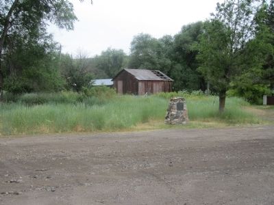
Hansen Cooperative Dairy Marker
| 1 ► Utah, Box Elder County, Beaver Dam — 334 — Hansen Cooperative Dairy — |
| On West Beaver Dam Road, on the left when traveling west. | |||
| 2 ► Utah, Box Elder County, Park Valley — Medea Siding — 1899-1906 — |
| On Transcontinental Railroad Back Country Byway, on the right when traveling west. | |||
| 3 ► Utah, Cache County, Logan — 9 — Cache County Relic Hall — |
| On 100 W 100 S. | |||
| 4 ► Utah, Cache County, Logan — 174 — Pioneer Mills of Cache Valley — |
| On Main St., on the right when traveling north. | |||
| 5 ► Utah, Carbon County, Helper — Matt Warner — April 12, 1864-December 21, 1935 — The Bandit Who Became Judge — |
| On South Main Street. | |||
| 6 ► Utah, Davis County, Bountiful — Bountiful Centennial Monument — |
| On North Main Street, on the right when traveling south. | |||
| 7 ► Utah, Davis County, Bountiful — 44 — Heber C. Kimball — |
| On Orchard Drive at Mill Street, on the right when traveling north on Orchard Drive. | |||
| 8 ► Utah, Davis County, Syracuse — Antelope Island — |
| Near West 1700 South. | |||
| 9 ► Utah, Davis County, Syracuse — Bailers — |
| Near Antelope Island Road. | |||
| 10 ► Utah, Davis County, Syracuse — Combines — |
| Near Antelope Island Road. | |||
| 11 ► Utah, Davis County, Syracuse — Fielding Garr Ranch — A Timeline of History — |
| Near Antelope Island Road. | |||
| 12 ► Utah, Davis County, Syracuse — Horse-Drawn Wagons — |
| Near Antelope Island Road, on the right when traveling north. | |||
| 13 ► Utah, Davis County, Syracuse — Rippers — |
| Near Antelope Island Road. | |||
| 14 ► Utah, Davis County, Syracuse — Sickle Mowers — |
| Near Antelope Island Road. | |||
| 15 ► Utah, Davis County, Syracuse — The Fielding Garr Ranch — |
| Near Antelope Island Road. | |||
| 16 ► Utah, Davis County, Syracuse — Tractors — |
| Near Antelope Island Road. | |||
| 17 ► Utah, Davis County, Syracuse — Transportation — |
| Near Antelope Island Road. | |||
| 18 ► Utah, Davis County, Syracuse — Trucks — |
| Near Antelope Island State Park. | |||
| 19 ► Utah, Davis County, Syracuse — Welcome to the Frary Homestead — Antelope Island State Park — |
| Near Antelope Island Road. | |||
| 20 ► Utah, Emery County, Huntington — 105 — Huntington — |
| On State Highway 31, on the left when traveling south. | |||
| 21 ► Utah, Iron County, Cedar City — Legacies of Iron County — |
| On North Main Street (Utah Route 130) south of Iron Mission Parkway (West 685 North), on the right when traveling south. | |||
| 22 ► Utah, Iron County, Cedar City — The Hay Derrick — |
| On North Main Street (Utah Route 130) south of Iron Mission Parkway (West 685 North), on the right when traveling south. | |||
| 23 ► Utah, Iron County, Enoch — 480 — Enoch Schoolhouse and Tithing Office — |
| On Jones Road, 0.1 miles west of Enoch Road, on the left when traveling west. | |||
| 24 ► Utah, Kane County, Glendale — Millstones — A Precious Commodity — |
| On Main Street, on the left when traveling north. | |||
| 25 ► Utah, Kane County, Mount Carmel — Isaac Behunin — Meribah Morton Behunin and Elmina Tyler Behunin — |
| On State Street (U.S. 89) at the road to Mount Carmel Cemetery, on the left when traveling north on State Street. | |||
| 26 ► Utah, Kane County, Pahreah — 347 — Pahreah — |
| On U.S. 89, on the left when traveling east. | |||
| 27 ► Utah, Salt Lake County, Bluffdale — Wardle Fields Regional Park — A History of the Wardle Family Farm — |
| Near 14000 South west of South 2700 W. | |||
| 28 ► Utah, Salt Lake County, Cottonwood Heights — Agriculture — Big Cottonwood Canyon Trail — |
| Near Big Cottonwood Canyon Road, on the right when traveling south. | |||
| 29 ► Utah, Salt Lake County, Draper — "Milk White" — Draper Historic Rail — |
| On Pioneer Road near South 1130 East, on the right when traveling west. | |||
| 30 ► Utah, Salt Lake County, Draper — Egg Basket of WWII — Draper Historic Rail — |
| Near Pioneer Road west of South 1130 East. | |||
| 31 ► Utah, Salt Lake County, Draper — Eggs Across America — Draper Historic Rail — |
| Near Pioneer Road west of South 1130 East, on the right when traveling west. | |||
| 32 ► Utah, Salt Lake County, Draper — Life on the farm… — Draper Historic Rail — |
| On Pioneer Road near South 1130 East, on the right when traveling west. | |||
| 33 ► Utah, Salt Lake County, Draper — On the Table — Draper Historic Rail — |
| On Pioneer Road west of South 1130 East, on the right when traveling west. | |||
| 34 ► Utah, Salt Lake County, Draper — The Egg Came First — Draper Historic Rail — |
| On Pioneer Road west of South 1130 East, on the right when traveling west. | |||
| 35 ► Utah, Salt Lake County, Riverton — 411 — Riverton Tithing Yard Hill — |
| Near South 1500 West, on the right when traveling north. | |||
| 36 ► Utah, Salt Lake County, Salt Lake City, Canyon Rim — 77 — Sandstone Wall & Aquaduct — |
| 37 ► Utah, Salt Lake County, Salt Lake City, Capitol Hill — Historical Gardens — |
| Near North West Temple Street. | |||
| 38 ► Utah, Salt Lake County, Salt Lake City, Central City — Modern Irrigation — |
| On 300 South, on the right when traveling west. | |||
| 39 ► Utah, Salt Lake County, Salt Lake City, Central City — 102 — Pioneer Camping Grounds — |
| On University Boulevard at State Street, on the right when traveling east on University Boulevard. | |||
| 40 ► Utah, Salt Lake County, Salt Lake City, The Avenues — Eagle Gate 1859 — |
| On State Street at South Temple Street, on the right when traveling north on State Street. | |||
| 41 ► Utah, Salt Lake County, Salt Lake City, Yalecrest — 73 — Pioneer Silk Industry — |
| On Herbert Avenue, on the right when traveling west. | |||
| 42 ► Utah, Salt Lake County, South Jordan — Garside/McMullin House — Utah Historic Site — |
| Near South 1300 West south of South Jordan Parkway (Utah Route 151). | |||
| 43 ► Utah, Salt Lake County, South Jordan — Granary & Hay Barn — |
| Near Holt Farm Lane west of South Temple Drive. | |||
| 44 ► Utah, Salt Lake County, South Jordan — Hitching Post & Watering Trough — |
| On Holt Farm Lane east of South Temple Drive, on the left when traveling east. | |||
| 45 ► Utah, Salt Lake County, South Jordan — Lamb Shed — |
| Near Holt Farm Lane west of South Temple Drive. | |||
| 46 ► Utah, Salt Lake County, South Jordan — Milk House — |
| Near Holt Farm Lane east of South Temple Drive. | |||
| 47 ► Utah, Salt Lake County, South Jordan — Samuel and Geneva Holt Farmstead — Utah Historic Site — |
| Near Holt Farm Lane east of South Temple Drive. | |||
| 48 ► Utah, Salt Lake County, South Jordan — Samuel Elijah & Margaret Geneva Holt — |
| Near Holt Farm Lane east of South Temple Drive. | |||
| 49 ► Utah, Salt Lake County, South Jordan — The Grove — |
| Near Holt Farm Lane east of South Temple Drive. | |||
| 50 ► Utah, Salt Lake County, South Jordan — The Samuel Elijah Holt Farm — |
| On Holt Farm Lane east of South Temple Drive, on the left when traveling east. | |||
| 51 ► Utah, Salt Lake County, South Salt Lake — 98 — Carlisle Family Historical Marker — |
| Near Carlisle Park Lane, on the right when traveling south. | |||
| 52 ► Utah, Salt Lake County, Taylorsville — 117 — Millrace — 1855 — |
| Near W 5400 S near Utah Route 173. | |||
| 53 ► Utah, Salt Lake County, West Jordan — 12 — Utah Idaho Sugar Factory — West Jordan, Utah 1916-1970 — |
| On 1825 West, 0.1 miles south of 7800 South (Utah Highway 48), on the right when traveling south. | |||
| 54 ► Utah, Salt Lake County, West Valley City — 71 — A Struggle For Water — West of the Jordan River — |
| Near West 3500 South. | |||
| 55 ► Utah, San Juan County, Monticello — Cowboy Tack Shed — Workstation of the West — |
| Near South Main Street south of West 100 South, on the right when traveling south. | |||
| 56 ► Utah, Sanpete County, Manti — A Unique Way to Conquer the West — Pioneer Heritage Gardens — |
| Near 100 East. | |||
| 57 ► Utah, Tooele County, Grantsville — Iosepa Historical Memorial — |
| On Utah Route 196 at milepost 23,, 15 miles south of Interstate 80, on the left when traveling south. | |||
| 58 ► Utah, Uintah County, Vernal — Do Religion and Money Mix? — A Tale of Two Banks — |
| On West Main Street (U.S. 40) at South Vernal Avenue (U.S. 191), on the right when traveling east on West Main Street. | |||
| 59 ► Utah, Utah County, Alpine — Relief Society Grainary — |
| Near Grove Circle north of East 770 North. | |||
| 60 ► Utah, Utah County, Lehi — The History of the Lehi Sugar Factory — |
| On Mill Pond Road at Pioneer Crossing, on the right when traveling south on Mill Pond Road. | |||
| 61 ► Utah, Utah County, Orem — World War II P.O.W. Camp — Dedicated December 12, 1943 — |
| On North 800 East at East 950 North, on the left when traveling north on North 800 East. | |||
| 62 ► Utah, Utah County, Orem, Geneva — Former Pleasant Grove Canning Co. — |
| On 650 North at Orem Boulevard, on the right when traveling west on 650 North. | |||
| 63 ► Utah, Utah County, Pleasant Grove — Jeppa and Anna Nelson Granary — |
| On South 100 East, on the right when traveling north. | |||
| 64 ► Utah, Utah County, Pleasant Grove — 341 — Pioneer Flour Mill — |
| On South 100 East, on the right when traveling north. | |||
| 65 ► Utah, Utah County, Springville — In Memory of Edwin Whiting Pioneer — |
| On Left Fork Hobble Creek Road, on the left when traveling north. | |||
| 66 ► Utah, Washington County, Hurricane — Early Day Wood Beam Walking Hand Plow — |
| Near West State Street. | |||
| 67 ► Utah, Washington County, Hurricane — Pioneer Bowery — |
| On East 200 North, 0.1 miles east of North State Street, in the median. | |||
| 68 ► Utah, Washington County, Hurricane — Smith Mesa — |
| Near West State Street. | |||
| 69 ► Utah, Washington County, Hurricane — Survival in Utah’s Dixie — |
| Near West State Street. | |||
| 70 ► Utah, Washington County, La Verkin — 474 — La Verkin Canal — |
| On West 500 North, on the right when traveling east. | |||
| 71 ► Utah, Washington County, Leeds — From Schoolhouse to Town Hall — A Building on the Move — |
| On North Main Street (Utah Route 228), on the right when traveling north. | |||
| 72 ► Utah, Washington County, Leeds — The Leeds Tithing Office — |
| On Center Street at Main Street, on the right when traveling south on Center Street. | |||
| 73 ► Utah, Washington County, Leeds — Water Is Life...The Shovel Is Divine — |
| On North Main Street at West Center Street, on the left when traveling east on North Main Street. | |||
| 74 ► Utah, Washington County, St. George — And the Desert Shall Blossom — |
| Near St. George Boulevard. | |||
| 75 ► Utah, Washington County, St. George — Gardeners’ Club Hall — |
| Near St. George Boulevard. | |||
| 76 ► Utah, Washington County, St. George — Utah-Idaho Sugar Company — Former site of the — c.1934-1979 — |
| On East 200 North, on the right when traveling west. | |||
| 77 ► Utah, Washington County, St. George — Virgin River Pump Station — |
| On South Bloomington Drive. | |||
| 78 ► Utah, Washington County, Zion National Park — Original Inhabitants / Living Traditions — |
| 79 ► Utah, Washington County, Zion National Park — Promised Land — |
| 80 ► Utah, Wayne County, Teasdale — 522 — Nielsen Grist Mill — |
| On Utah Route 24 at milepost 63.8,, 1.6 miles west of North Teasdale Road, on the right when traveling west. | |||