This is the sight of the trading post established and operated by Bernardus and David Laughton, fur traders in 1828. Laughton’s Ford on the Des Plaines lies directly west. — — Map (db m230025) HM
The Hofmann Dam
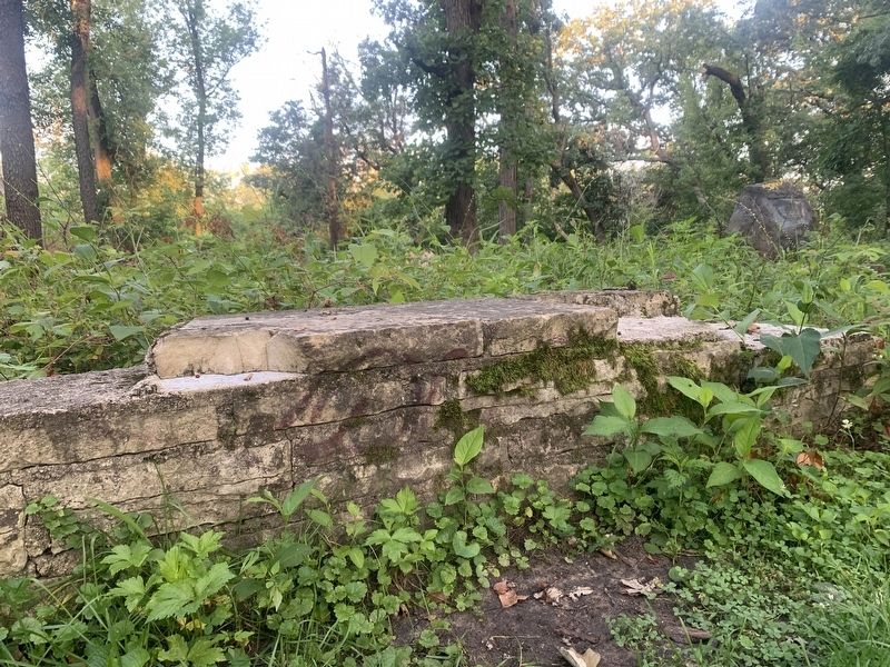
Developed over 150 years ago, the site of the Hofmann dam has contributed to the development of Chicago and its surrounding suburbs. Before Chicago was incorporated, a small village named Lyons developed just 12 miles west. Home . . . — — Map (db m225297) HM
Indians traversed this path for about a thousand years to obtain salt at Vermillion River.
In 1832, General Winfield Scott's army and supply wagons went this way to fight Blackhawk's warriors.
Soon, pioneers came west by this well worn road. . . . — — Map (db m234953) HM
George Gabel opened an Indian trading post on this site in 1847. In 1856 he sold the property to John Dilg who had arrived in the Chicago area in 1850 and settled on Waukegan Road in 1854. Dilg and his wife, Maria Magdalena Gabel Dilg operated . . . — — Map (db m94518) HM
On this site in 1835, Joseph Kettlestrings and his
wife, Betty, first settlers of Oak Park, built their
cabin amid the oaks on "the only dry land between
Chicago and the Aux Plaines.” It later became an inn
called The Oak Ridge House, and was . . . — — Map (db m188769) HM
You are standing on a Continental Divide. Water falling on this line separates and runs to the west and to the east. To the west the water flows to the Des Plaines River in River Forest, on to the Illinois and Mississippi Rivers and to the Gulf of . . . — — Map (db m230260) HM
You are standing on a Continental Divide. Water falling on this line separates and runs to the west and to the east. To the west the water flows to the Des Plaines River in River Forest, on to the Illinois and Mississippi rivers and to the Gulf . . . — — Map (db m237480) HM
You are standing on a Continental Divide. Water falling on this line separates and runs to the west and to the east. To the west the water flows to the Des Plaines River in River Forest, on to the Illinois and Mississippi Rivers and to the Gulf . . . — — Map (db m237481) HM
You are standing on a Continental Divide. Water falling on this line separates and runs to the west and to the east. To the west the water flows to the Des Plaines River in River Forest, on to the Illinois and Mississippi Rivers and to the Gulf . . . — — Map (db m237482) HM
You are standing on a Continental Divide. Water falling on this line separates and runs to the west and to the east. To the west the water flows to the Des Plaines River in River Forest, on to the Illinois and Mississippi Rivers and to the Gulf of . . . — — Map (db m241781) HM
In 1837, Joseph and Betty Kettlestrings paid $215.98 for 173 acres of land west of a nascent
Chicago. It is unlikely they could have envisioned that their settlement would evolve into the
Village of Oak Park; now a thriving community of 52,000 . . . — — Map (db m188624) HM
This tablet marks the spot
where stood the home of
Joseph Kettlestrings
the first White settler in Oak Park,
this ground being a portion of the
quarter section of land which he
purchased from the United States
Government in the year 1833 . . . — — Map (db m189041) HM
The mural you see to the left, was inspired by the work of Longfellow Elementary School art students in 2000.
Artist Mirtes Zwierzynski together with Longfellow School's art teacher Chris Worley, students, and PTO gathered to create an . . . — — Map (db m235458) HM
You are standing at the north entrance to Mills Park. Just ahead is Pleasant Home, a National Historic Landmark that was originally constructed for the John Farson family in 1897. The Farsons regularly gathered family and friends in the mansion . . . — — Map (db m231252) HM
Originally, all of Mills Park was owned by banker and philanthropist John Farson. Second owner Herbert Mills was the inventor of the first coin-operated slot machine. The Mills Family sold the estate, including Pleasant Home, to the Park District . . . — — Map (db m231420) HM
This southwest corner of the park features a Discovery Zone for park visitors of all ages to explore and reconnect with nature. Mills Park's original owner John Farson was known for his fun, eclectic spirit, and this area reflects his sense of . . . — — Map (db m231421) HM
Architecture
The interior of Pleasant Home boasts glorious art glass windows, ornate wood hand carvings, delicate mosaic floors and beautiful brass and glass light fixtures. There are nine fireplaces, five bedrooms, and many original . . . — — Map (db m231424) HM
You are now in the heart of the 4.5 acre Mills Park, where grand gardens, a carriage house and fountain once stood. John Farson welcomed 2,000 guests to his glorious Rose Fete here. This event featured an operetta amid a landscape studded with . . . — — Map (db m231425) HM
This plaque commemorates and honors the strength and courage of Black Oak Park residents who established and built Mount Carmel Baptist Church at this location in 1905, which stood until 1930. Originally, the Church had purchased a property on . . . — — Map (db m241199) HM
Oak Park was incorporated as a village November Fifth, 1901. The first president and board of trustees was elected December Seventeenth, 1901, and the first village board meeting was held on January Second, 1902. To all those officials who have so . . . — — Map (db m233468) HM
Oak Park River Forest Museum opened in this building in 2017 as the new home of The Historical Society of Oak Park and River Forest after the organization raised more than $1 million in private donations to bring new life to this vacant and . . . — — Map (db m232791) HM
Pleasant Home is a National Historic Landmark designed by prominent Prairie School architect George W. Maher in 1897. It is one of the earliest and most distinguished examples of Prairie School architecture. The richly artistic interior features . . . — — Map (db m231423) HM
Founder of the Oak Park Regional Housing Center, Bobbie played a key role in devising and implementing what became a national model for achieving a racially diverse community without subsequent re-segregation. The Housing Center marketed Oak Park . . . — — Map (db m232992) HM
From the earliest days of Oak Park, members of the Austin family were among
the community's most respected leaders. Henry Austin, Sr. came to what is
now Oak Park in 1859, buying a large parcel of land lacated between Lake and
Ontario Streets and . . . — — Map (db m185278) HM
The site of present-day River Forest was once home to prehistoric Native Americans, who constructed large effigy mounds throughout the region. Soon after the American Revolution Chippewa, Menominee, and Potawatomi Indians moved onto the landscape, . . . — — Map (db m94461) HM
The preservation and restoration of this oak savanna remnant is a tribute to the Illinois savanna that existed prior to settlement in this area. Its unique ecological system is characterized by trees and shrubs, rare wild flowers, and diverse . . . — — Map (db m236961) HM
Local lore has it that this boulder known as "Che-Che-Pin-Qua Rock" (The Indian name given to Alexander Robinson), was used by the Potawatomi tribe as a trail marker along our river.
This rock is native to our woods. Reach out to touch a piece . . . — — Map (db m246293) HM
July 1832
General Winfield Scott camped near
this spring on way to Blackhawk War.
June 7, 1834
Election of Jean Babtiste Beaubien as 1st
Colonel of Militia of Cook County, known as 60th Illinois
Militia. In celebration of the . . . — — Map (db m236101) HM
Only 11 Miles from Downtown Chicago
The area that is now Riverside holds a unique place in our country's history. Its proximity to the Chicago Portage, which provided a connection between Lake Michigan and the Mississippi River, made the area . . . — — Map (db m233954) HM
Riverside Town Hall
27 Riverside Road • Designed and built 1895 • Architect: George Ashby
In 1891, the Village of Riverside and Riverside Township reached an agreement whereby the village donated the land for the new town hall and the . . . — — Map (db m234271) HM
This boulder marks the old river-crossing used by the Indians on the trail from North to South, by the fur traders, and by the early settlers in the development of the West.
Dedicated July 4, 1932 — — Map (db m233483) HM
The Riverside Historic District/Riverside Landscape Architecture District is an area recognized for its significance as one of the first planned communities in the United States. The district includes most of the Village of Riverside and is bounded . . . — — Map (db m233695) HM
A Brief History of Riverside, Illinois
1. In 1828, The Lawton brothers, David and Bernardus (Barney), came to the area and established an outpost. They chose the area for its proximity to the Chicago Portage and one of the busiest land trails . . . — — Map (db m233530) HM
Site of first home built in
Cook County west of Chicago
by its first elected sheriff
Stephen Van Rensselaer Forbes
1831
Only voting place of
Cook County for its first
colonel of the state militia
Jean Baptiste Beaubien
June 7, 1834 . . . — — Map (db m233519) HM
Portions of the Lincoln Highway were first established by identifying existing roads to be paved. The Sauk Trail from the eastern Illinois border westbound through Sauk Village was designated as a section of the original route, including the . . . — — Map (db m204975) HM
Wise Road is named for the Wiese Family, who once farmed nearly 80 acres of land at the corner of Wise Road and Spring Cove Drive. The road was named "Wiese Road" for many years. It is unknown whether the "e" was dropped accidentally by the Cook . . . — — Map (db m148601) HM
Considered Skokie's oldest structure, this log cabin was built by Nicholas and Elizabeth Meyer circa 1847 and was located near the northwest corner of Lincoln Avenue and Gross Point Road.
The cabin's logs were cut from oak and walnut trees found . . . — — Map (db m242987) HM
In 1888, the Village of Skokie was incorporated under its original name, Niles Centre. Around 1910, the British word, Centre, was replaced by
the American revision Center.
In 1925, local property owner Al Lies replaced the . . . — — Map (db m243011) HM
Skokie's historic "Engine House" has been part of the Village landscape since construction in 1887. Many trace the origin of the building to growing
concerns about fire especially after the Great Chicago Fire swept through the nearby big city in . . . — — Map (db m242989) HM
The
Village of Niles Center
was incorporated
in the year 1888
Adam Harrer being the
first president
Succeeding presidents were
John W. Brown
Peter Blameuser
George Sintzel
and
George H. Klehm
The first meeting place . . . — — Map (db m243017) HM
First Permanent Settler
Sauk Trail & Vincennes Road
1883
Designated Brown's Corners
Village of South Chicago Heights
May 19, 2003
— — Map (db m172992) HM
Wolf Road Prairie Nature Preserve has been formally dedicated as a sanctuary for native plants and animals. It is maintained in its natural condition so that present and future generations can see the Illinois landscape as it appeared in the past. . . . — — Map (db m246229) HM
One branch of the Green Bay Trail traversed this region. Originally an Indian trail, after 1816 the route connected Fort Dearborn at Chicago with Fort Howard at Green Bay. Couriers faced hunger, cold and Indians to carry dispatches on a round trip . . . — — Map (db m66618) HM
Hutsonville was named after the Isaac Hutson family massacred by Indians in 1813 at a spot sixty four rods due east of this marker. Hutson was killed later in a skirmish with the Indians near Fort Harrison, Indiana. — — Map (db m152463) HM
Here stood the home of Edward N. Cullom who with Joseph Kitchell platted the Village of Palestine in 1818. They donated to the county the land including the Public Square for the County Seat. Early court sessions were held in the Cullom home. — — Map (db m23311) HM
About 1813 the William Eaton family and other restless pioneers considered Fort LaMotte too crowded and therefore constructed a new stockade on a site several hundred yards North of here. A family trait of the Eatons, large feet, led to the name . . . — — Map (db m23319) HM
About 1812 the settlers in this area built Fort LaMotte for protection from hostile indians.
The pioneers farmed the adjoining land but stayed within easy reach of the protective walls.
After the War of 1812 the Indian threat diminished and . . . — — Map (db m23308) HM
On this site stood the home of Augustus C. French (1808-1864) when he was elected the ninth Governor of Illinois.
The early settlers in Illinois came mostly from Southern States so that French, a native of New Hampshire, was the first "Yankee" . . . — — Map (db m23318) HM
Two early residents of Palestine, John Houston and Francis Dickson, purchased this lot as the site for a combination dwelling and store about 1818.
By 1820 their stock of merchandise provided nearby settlers with goods which they previously had . . . — — Map (db m23313) HM
In this area Joseph Kitchell who settled here in 1817 erected a Grist Mill and Distillery which eliminated the trip to Shakertown, Indiana where the farmers had previously taken their grain.
Horses were used for power, grain was taken in pay, . . . — — Map (db m23307) HM
This area reminded Frenchman John LaMotte of the land of milk and honey, Palestine. While a member of the LaSalle exploring party, he became separated from the group, traveled down the Wabash River, and first gazed upon the region in 1678. Other . . . — — Map (db m23328) HM
A United States Land Office was located at this site in 1820 and operated until 1855. Settlers from as far as Chicago came here to file on homesteads.
Young Abraham Lincoln passing through Palestine in 1830 with his family in emigrant wagons . . . — — Map (db m23316) HM
[column 1:]
"History of The National Road"
Settlers had been moving west since the early 1700's. By 1802, so many farms and towns had been settled in the Ohio Valley that people living in the territory were calling for . . . — — Map (db m155631) HM
This, the second Cumberland County Courthouse, erected in 1887, is located on this site in the approximate geographical center of Cumberland County. This site was formerly occupied by the first courthouse, which was built in 1855 and was destroyed . . . — — Map (db m229859) HM
In the early 1800's Shabbona was a principal chief of the Ottowa, Potawatomi, and Chippewa group of tribes which banded together to form "The Three Fires." Shabbona camped briefly in a large grove one-half mile south of here. He fought with the . . . — — Map (db m31672) HM
Moses Stacy, soldier in the War of 1812, arrived here in 1835. This inn, built in 1846 and his second home, was a halfway stop between Chicago and the Fox River Valley and a probable stage stop for Rockford-Galena coaches. For many years the . . . — — Map (db m97573) HM
Home of the first settler of DuPage County. A flowing spring attracted Bailey Hobson to come from Indiana to build a cabin in 1830 and a home in 1835. Hobson was a farmer, miller and soldier in the Black Hawk War.
The mill site, now . . . — — Map (db m234774) HM
Near this site in 1832 a 100-foot square stockade enclosed by wooden pickets, with two blockhouses on diagonal corners, was built. Here Captain Morgan L. Payne and his company of forty-five men protected the settlers from roaming Sauk Indians during . . . — — Map (db m97574) HM
Site of
First Frame House
in DuPage County
Home of
George Martin Family
Built in 1833
Willed to the City
of Naperville
in 1936
Destroyed by Fire
in 1958 — — Map (db m234806) HM
This plow, which helped turn wild prairies into productive farm fields, represents the logo of the Naperville Heritage Society.
As a fledgling grassroots organization in 1969, volunteers began holding an annual Antiques Show and Sale to . . . — — Map (db m246633) HM
In 2004, the Villa Historic District was awarded a Historic Landmark plaque by the Villa Park Historic Preservation Commission to recognize its significance to the Village of Villa Park. These buildings represent such an important part of . . . — — Map (db m244870) HM
Wayne Village was founded as a settlement by Solomon Dunham, after the Galena and Union tracks were completed in 1850. (Later called the Chicago Northwestern R.R.) The founder of the settlement was appointed the first station master, postmaster, and . . . — — Map (db m57842) HM
Warren Lyon Wheaton, one of the founders of the community that bears his
and his brother Jesse's name, built his home on this site in 1848. Though no
longer evident, the original home has been incorporated within this much
larger structure.
. . . — — Map (db m230989) HM
A few miles west of here on July 18, 1765, Pontiac, an Ottawa Chief, and George Croghan, British Representative, met in a formal peace council which ended the most threatening Indian uprising against the British in North America. Following the . . . — — Map (db m10997) HM
Plaque One
These Millstones long in the Service
of our Pioneers dedicated to their memory
by the Edgar County Historical Society
1817 - 1927
Plaque Two
From the Lewis Jones Farm near Nevins
presented to
Edgar . . . — — Map (db m23457) HM
Paris lies in the heart of a rich farming area. Most of the land embraced in Edgar County, including Paris, remained Kickapoo hunting grounds until 1819, but the eastern quarter of the county was part of a tract ceded by the Indians in 1809 and . . . — — Map (db m188363) HM
To Morris Birkbeck
Who in 1817 with George Flower founded the English settlement in Edwards County This memorial is erected by the Department of Illinois Woman's Relief Corps Auxiliary to the Grand Army of the Republic "In respect and gratitude . . . — — Map (db m154631) HM
The former village of Wanborough, Illinois, was established in August 1818 by English settler and entrepreneur Morris Birkbeck. A center of commerce for his fellow countrymen emigrating to the English settlement in Edwards County, Wanborough once . . . — — Map (db m177846) HM
They traveled West by horse and wagon, oxen and Conestoga, and by foot. They represented a staggering assortment of crafts, talents and trades. They emigrated from Germany in search of affordable land, economic opportunity, and political and . . . — — Map (db m152530) HM
Born in Pennsylvania. First store keeper in Vandalia for owner, William Kinney. House of Representatives 1828-29. Registrar of Vandalia Land Office. State Bank Commissioner 1835. — — Map (db m42410) HM
The store of Ebenezer Capps was located just north of this site at the northeast corner of Main and Fourth streets.
The location of Main street is not the same today as when Lincoln was here. Vandalia existed long before the coming of . . . — — Map (db m42486) HM
Born in Kentucky. Father of James W. Berry. Territorial Auditor. State Auditor of Public Accounts 1819-31. Co-Editor of "Illinois Intelligencer", Kaskaskia 1817-20. President of State Bank 1837. Black Hawk War soldier. Father-in-law of Gov. W. L. . . . — — Map (db m42383) HM
Born in Hanover. Leader of Colony from Hanover, Germany. Came to Vandalia in 1819 with Frederick Hollman, who remained to build houses. Bearing all expenses, Ernst returned with colonists December, 1820. Director of State Bank, 1821. Trustee of . . . — — Map (db m42380) HM
On December 1, 1834 Abraham Lincoln entered the State Capitol that stood on this site. This was his first term as a state representative and the first time he held elective office. The Abraham Lincoln that began his political career on that . . . — — Map (db m42510) HM
At the beginning of Lincoln's second term as a state representative, several southern legislatures were concerned that the Federal Government would abolish slavery in the District of Columbia. Most of the members of the Illinois Legislature . . . — — Map (db m42490) HM
Born in Hanover. Member of Ernst Colony. Merchant. Paymaster in Blackhawk War 1832. Division Quarter Master in Illinois Militia - Colonel 1834. House of Representatives 1846-48. — — Map (db m42411) HM
Born in Hanover. Died Feb. 3, 1847. Member of Ernst Colony. Builder and operator of Vandalia Hotel. Merchant. Daughter, Olivia Whiteman, friend of the Abraham Lincoln family, unveiled Madonna of the Trail statue. — — Map (db m42384) HM
Half an acre of this Old State Burial Ground was laid off for state officials in 1835. Although exact location is unknown, it is thought to be in this area. In 1874 the monument and remains were moved to South Hill Cemetery. Four Representatives . . . — — Map (db m42421) HM
John B. E. Canal
A representative from
Madison County in the
General Assembly of Illinois
Born at Baltimore
June 24, 1809
Died at Vandalia
December 31, 1830
Benjamin A. Clark
Representative of the
General Assembly . . . — — Map (db m42627) HM
In Lincoln’s first campaign speech on March 9, 1832, he expressed support for internal improvements.
“Time and experience have verified to a demonstration, the public utility of internal improvements. That the poorest and most . . . — — Map (db m42512) HM
Born in Kentucky. Circuit Clerk of Fayette County 1826-56. Adjutant General 1834-39. First talented artist of Illinois. Portrait painter of state officers and legislators. Commissioned by General Assembly to copy portraits of Washington and . . . — — Map (db m42381) HM
Dr. Morey was born in Erie Co. Penna. but moved to Illinois when a young man. He was nearly 50 yrs. old at his death and had been engaged in the practice of medicine for nearly thirty years.
He graduated from the Physio-Medical College of Ohio . . . — — Map (db m42700) HM
The delegation from Sangamon County for the 1836-1837 Session of the legislature quickly became known as the "Long Nine."
The seven representatives and two senators were all six feet or taller. Five were lawyers, three were farmers, and one . . . — — Map (db m42485) HM
On December 5, 1836 Abraham Lincoln attended the opening session of the Tenth Gereral Assembly in Vandalia. This session was held in a new building just recently completed by the citizens of Vandalia to serve as the State Capitol. It was . . . — — Map (db m42517) HM
On June 12, 1823, the Third General Assembly, meeting in the newly formed city of Vandalia, conveyed one and one-half acres of land to the city of Vandalia, with the proviso that the land be used as a burial ground. This is the location of that . . . — — Map (db m42428) HM
Abraham Lincoln traveled past this spot while he served as a state representative in Vandalia. This location marks the route of a road that ran from Vandalia to Springfield, Illinois. Traces of the roadway are still visible today. The roadway . . . — — Map (db m42527) HM
N·S·D·A·R Memorial
to the
Pioneer Mothers
of the
Covered Wagon Days
The Cumberland Road.
Built by
the Federal Government.
Was authorized by Congress
and approved by
Thomas Jefferson in 1806.
Vandalia marks the . . . — — Map (db m42341) HM
Wife, born in Kentucky, and son of James Hall, first Man of Letters in Illinois. State Treasurer 1827-31. President of first state historical society 1827-33. Author of first book of literary style in Illinois 1828. Trustee of Illinois College . . . — — Map (db m42388) HM
This is the site of a two-story frame building occupied by Robert Blackwell, State Printer 1818-1832, and publisher of the Laws of the United States. In 1823 he became publisher of the Illinois Intelligencer newspaper. The first periodical in . . . — — Map (db m42348) HM
Born in Kentucky. State Printer. Publisher of Laws of United States. Editor of newspaper "Illinois Intelligencer" 1825-32 and Co-Owner with James Hall 1829-32. House of Representatives 1832. Senate 1838-40. Black Hawk War soldier. . . . — — Map (db m42376) HM
Born in Virginia. State Treasurer 1819-23. Trustee of Vandalia appointed by Legislature 1821. House of Representatives 1826-28. Senate 1828-32 and 1836-38. State Bank Commissioner 1835-37. Registrar of U.S. Land Office. Isabella, niece of Shadrach . . . — — Map (db m42423) HM
On this site lived Robert K. McLaughlin, State Treasurer 1820-1823, State Senator 1828-1832, 1836-1837, and Register of the United States Land Office 1837-1845. Here the Governors of Illinois resided when the Legislature was in session. The . . . — — Map (db m42339) HM
The second state capitol owned by the State was a two-story brick building erected here in 1824, using the walls of the first State Bank which burned January 28, 1823. Abraham Lincoln was a member of the House in the 1834-1835 and 1835-1836 . . . — — Map (db m42351) HM
Here stood a two-story log building erected in 1819 for Ferdinand Ernst who brought the German colony to Vandalia. Named Union Hall, it was operated as a hotel. After Ernst's death in 1823 it was managed by E.M. Townsend, and from April 1825 by . . . — — Map (db m42363) HM
Wooten Harris • Henry Ginger
John Morrell • Thomas Mahon
John Diamond • Isaac Martin
Joseph Evans • Benjamin Todd
Michael Tedrick • James Virden
James S. Carson • Rev. Henry Walker
James Cheshier • Thomas Craig Sr.
Harris Reavis • . . . — — Map (db m42536) HM
The third capitol building owned by the state was restored as a memorial in 1933. It was the capitol from December 3, 1836 to July 4, 1839. Abraham Lincoln was a member of the House during the three sessions of the legislature held in this . . . — — Map (db m42346) HM
Come inside and live the story of the Historic National Road, the road that built the nation. Just thirty years after declaring independence from the British, the young nation was feeling the growing pains of westward expansion. President Thomas . . . — — Map (db m144185) HM
As the Illinois State Capital, Vandalia provided many hotels to serve the needs of legislators and visitors. Vandalia had at least eleven hotels that served the needs of travelers. Whenever a session of the legislature was in progress, these . . . — — Map (db m144134) HM
620 entries matched your criteria. Entries 101 through 200 are listed above. ⊲ Previous 100 — Next 100 ⊳