Wooten Harris • Henry Ginger
John Morrell • Thomas Mahon
John Diamond • Isaac Martin
Joseph Evans • Benjamin Todd
Michael Tedrick • James Virden
James S. Carson • Rev. Henry Walker
James Cheshier • Thomas Craig Sr.
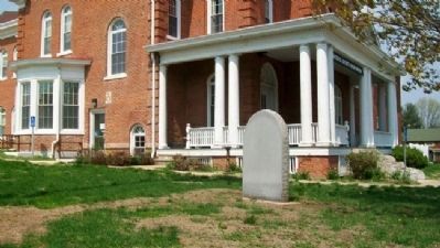
Harris Reavis • . . . — — Map (db m42536) HM
The third capitol building owned by the state was restored as a memorial in 1933. It was the capitol from December 3, 1836 to July 4, 1839. Abraham Lincoln was a member of the House during the three sessions of the legislature held in this . . . — — Map (db m42346) HM
Come inside and live the story of the Historic National Road, the road that built the nation. Just thirty years after declaring independence from the British, the young nation was feeling the growing pains of westward expansion. President Thomas . . . — — Map (db m144185) HM
As the Illinois State Capital, Vandalia provided many hotels to serve the needs of legislators and visitors. Vandalia had at least eleven hotels that served the needs of travelers. Whenever a session of the legislature was in progress, these . . . — — Map (db m144134) HM
Born in Maryland. Clerk of First General Assembly of Illinois Territory, Kaskaskia 1812. Clerk of House of Representatives and of Legislative Council, 1815. Clerk of Constitutional Convention 1818. Secretary of Senate 1818-20. Chief Surveyor of . . . — — Map (db m42374) HM
Lewistown Trail, from Springfield to Galena via Lewistown, was one of the main routes to the Galena Lead Mines from 1827 to 1837. The Trail crossed the Illinois River at Havana, where Ossian M. Ross, the founder of Lewistown, operated a ferry. He . . . — — Map (db m129216) HM
Lewis and Clark made their first entry into the "Illinois Country" as it was known in 1803, near this location. The primary purpose for the stop was to procure a supply of salt for their journey. Here they would have encountered the "squatters" . . . — — Map (db m155031) HM
In commemoration of the families that lived in Tent City after the devastating flood of 1937. One and a half mile east of Junction, a 15-acre strip of the Finney Austin farm was used to erect a " tent colony" to house Gallatin county flood refugees. — — Map (db m208171) HM
Here we honor the spirit of the place called "Shawneetown." This proud spirit was born in the heart of the first stalwart Shawnee brave who saw in this beautiful river site, a homing place. It ignited in the first white settler 17 years before the . . . — — Map (db m154636) HM
The Illinois Territory was formed in 1809. Its Governor, Ninian Edwards, laid out a district on Sept. 14, 1812 and called it the County of Gallatin. After Albert Gallatin, Secretary of the U.S. Treasury. The county changed size and shape often . . . — — Map (db m210685) HM
Thomas Carlin, sixth elected Governor of Illinois (1838-1842), was an early settler of Illinois and a prominent figure in organizing Greene County and establishing Carrollton as its county seat in 1821.
Born in Kentucky in 1789, Carlin came to . . . — — Map (db m142746) HM
[panel 1] "...How sweet the recollection, when my children were about me, then I felt I had protection, and no one dared to flout me." Elsie Armstrong wrote an epic poem that records the tragic deaths of four children. It . . . — — Map (db m233211) HM
This half-faced camp, built by Joe Sukle of logs cut from the Aux Sable timber, is a replica of the one built by Henry Cryder, Nathaniel Tabler, and Zachariah Walley when they arrived at Aux Sable Creek on October 23, 1833. The original camp . . . — — Map (db m239309) HM
Canal commissioners were charged with platting towns to develop commerce along the canal. In 1841, the state's largest county — LaSalle County (to the west) was split with the eastern section becoming Grundy County. The location of the new county . . . — — Map (db m233167) HM
This road was a main route of travel after 1808. It ran in a northwesterly direction from Shawneetown via the U.S. Salines (Salt Works) to near Edwardsville. Most of the early settlements were along the Goshen Road which crosses Illinois Highway 14 . . . — — Map (db m178562) HM
Gilbert Griswold Jr., pioneer teacher, surveyor, and Justice of the Peace, founded Walpole in 1857. He was born 4-16-1788 in Cheshire County, New Hampshire, and died 11-10-1866 and was buried with his family on their farm near Walpole. He was the . . . — — Map (db m146185) HM
The fertile prairies of Illinois attracted the attention of French trader Louis Jolliet and Father Jacques Marquette as they explored the Mississippi and Illinois Rivers in 1673. France claimed this region until 1763 when he surrendered it to Great . . . — — Map (db m55419) HM
In 1673 the areas of the Mississippi and Illinois Rivers were explored by Frenchmen Louis Joliet and Father Jacques Marquette. Their voyages resulted in French claims on the area until 1763 when, by the Treaty of Paris, France ceded the land to . . . — — Map (db m55418) HM
In 1846, about 13,500 Mormon pioneers fled Nauvoo, Illinois, in search of religious freedom. They departed in phases to prepare the way for those who would follow. Their journey started by crossing the Mississippi River. They traveled about 1,300 . . . — — Map (db m244071) HM
Lewis Bidamon, second husband of Emma Smith, built this structure during the 1860s from the foundation stone of the Nauvoo House. Bidamon owned a carriage “manufactory.” He, and his brothers John and Christian had conducted a number of . . . — — Map (db m55436) HM
Near here, the Mormon exodus to the Rocky Mountains began on February 4, 1846 in seven years, members of The Church of Jesus Christ of Latter-day Saints, commonly called the Mormons, had built Nauvoo to a size comparable to Chicago, with . . . — — Map (db m55440) HM
On the anniversary of the 200th year celebration of the Prophet Joseph Smith, and the 175th anniversary of the establishment of the Church of Jesus Christ of Latter Day Saints, this monument of His prophets Joseph Smith and Brigham Young has been . . . — — Map (db m55439) HM
In 1839 the Mormons, or Latter Day Saints, settled at Nauvoo and made it their chief city. During their residence its population reached 15,000. After long friction with non-Mormons the Mormons were expelled in 1846. Three years later French . . . — — Map (db m55444) HM
In 1839 the Mormons, or Latter Day Saints, settled at Nauvoo and made it their chief city. During their residence its population reached 15,000. After long friction with non-Mormons the Mormons were expelled in 1846. Three years later French . . . — — Map (db m244018) HM
Site of Quashquema Indian Village
—
First White Settlement
By Captain James White 1824
—
Venus
First Post Office
In Hancock County established 1830
—
Town of Commerce
1834
—
Nauvoo 1839
City . . . — — Map (db m244017) HM
Completed in 1843, the Mansion House was the second Nauvoo residence of Joseph Smith and his wife Emma. A hotel wing was added and opened in late 1843. The hotel was leased to Ebenezer Robinson in January 1844. As part of the lease agreement, the . . . — — Map (db m55435) HM
Nauvoo has been designated a Registered National Historic Landmark under the provisions of the Historic Sites Act of August 21, 1935. This site possesses national significance in commemorating the history of the United States. — — Map (db m244020) HM
In 1841 church members were commanded to build two “houses,” a house for the Lord (the Nauvoo Temple) and a house for man to be known as the Nauvoo House. It was to be “a delightful habitation for man, and a resting-place for the weary traveler.” . . . — — Map (db m55433) HM
This is the site of the original survey stone for Nauvoo, the "city beautiful," founded by church members in 1839 after they were forced to leave Missouri. All streets of the city were platted from this point. The two widest streets in Nauvoo at the . . . — — Map (db m68890) HM
Nauvoo was once the site of a Sauk and Fox village. After the Indians moved west of the Mississippi, promoters attempted to develop town sites here but the marshy bottom lands attracted few settlers.
In 1839, the Mormon Prophet Joseph Smith . . . — — Map (db m55432) HM
The original Red Brick Store opened for business on January 5, 1842, with Joseph Smith as owner and proprietor. The main floor was a general store. At the back on this floor, Bishop Newell K. Whitney had an office where people could pay their bills . . . — — Map (db m55437) HM
This two-story, two-room log block house was located on the original 135 acres purchased from local farmer Hugh White and may date to 1803. Joseph Smith moved here in the spring of 1839 with his wife Emma; sons Joseph III, Frederick Granger . . . — — Map (db m55434) HM
A communal society of French Icarians was established at Nauvoo in 1849. Led by Etienne Cabet, a French political theorist, the Icarians believed that all property must be held communally. The community was incorporated by the Illinois General . . . — — Map (db m55442) HM
On the morning of June 24, 1844, Joseph Smith and his brother Hyrum left their families, homes, and fellow Saints for the last time. Traveling on horseback, they paused on this bluff. Joseph looked admiringly at the unfinished temple and the city of . . . — — Map (db m55443) HM
Here once stood the thriving community of Green Plains. Established in the early 1830s, the settlement straddled four Hancock County townships and included log homes, a store, a blacksmith shop, a post office, and several cemeteries. Levi Williams, . . . — — Map (db m243818) HM
Much of the nation's history has unfolded along the Mississippi River. During the War of 1812, this location provided a commanding view of the river, and was the site of strategically important forts.
The First Defense
The region's first . . . — — Map (db m243903) HM
William Pell, Jr. settled here in 1832, founded Pell's Landing. In 1874, Pell's Landing was incorporated as Rose Clare and became the City of Rosiclare in 1932. Always an important river town, the discovery of fluorite and other minerals in the . . . — — Map (db m206199) HM
Travel the Byway and discover the importance of the Ohio River to the nation and the world. Experience the magnificent natural landscapes of southern Illinois while coming to know how the historic events and people that shaped the region and the . . . — — Map (db m196762) HM
One of the oldest brick buildings in Bishop Hill, the 1851 Carpentry Shop was originally used as a manufacturing and fabrication center for colony furniture and wagon components. The bottom floor served as the general work area and a set of double . . . — — Map (db m177486) HM
Two miles north of here, religious dissident immigrants from Sweden founded the communal society of Bishop Hill in 1846. The charismatic Erik Jansson lead the society spiritually and temporally until 1850 when he was murdered. By 1854, a total of . . . — — Map (db m177481) HM
Bishop Hill Colony Historic District has been designated a National Historic Landmark This site possesses national significance in commemorating the history of the United States of America 1984 National Park . . . — — Map (db m177484) HM
This bronze sculpture of a pioneer family is lovingly dedicated to the memory of Nell, Elizabeth (Newton) Henningsen (1917 - 2002). She excelled as a daughter, student, dietician, World War II army dietician, wife, mother, homemaker, grandmother . . . — — Map (db m160103) HM
For many years Butterfield Trail was one of the main routes from East Central Illinois to the Chicago area. In 1831 Ben Butterfield marked out the rail from Danville to Lockport where he had settled the previous year. The trail crossed Spring Creek . . . — — Map (db m164819) HM
In 1822, Gurdon S. Hubbard,
on this spot, built an
Indian Trading Post and
operated it until 1834.
Here the Indian Princess
Watchee-Kee lived with
Hubbard, as his wife. — — Map (db m96050) HM
The first memorial service in Illinois, and one of the first in the nation, to honor those who had died in the Civil War, took place at Woodlawn Cemetery on April 29, 1866. On that day, a group of more than 200 veterans gathered at the old "Blue . . . — — Map (db m163493) HM
Captain William Boone, the nephew of the famous Daniel Boone, is thought to have been the first white settler in Jackson county, having arrived shortly after Lewis and Clark discovered Tower Rock. William Boone's son, Benningen, was the first white . . . — — Map (db m180340) HM
Dr. Conrad Will, the "Father of Jackson County," was born in Pennsylvania in 1779 and came to Illinois in 1813. He was a physician but also operated a grist mill, tannery, and salt works. He was one of the founders of Jackson County and in 1816 . . . — — Map (db m160951) HM
Dr. John Logan, born in Ireland in 1788, came to America with his family in 1793. He moved to Jackson County in 1822 where he married Elizabeth Jenkins. Dr. Logan served four terms in the Illinois Legislature and became a friend of Abraham Lincoln. . . . — — Map (db m161005) HM
The Atkinson Cemetery was established March 11, 1875, by James Atkinson, who granted the land as a community burial ground. The first recorded burial (1843) was of Sarah A. Short, daughter of Thomas Jefferson and Martha "Patsy" (Maddux) Short. The . . . — — Map (db m236731) HM
The Goshen Road was one of the main arteries of travel in the early 1800's, when Illinois was frontier country. The road ran in a Northwesterly direction from Shawneetown to Edwardsville - A distance of more than 150 miles. Shawneetown and . . . — — Map (db m88993) HM
Where the rivers meet
The essence of the meeting of the Great Rivers National Scenic Byway is the celebration of the unique river communities found at the convergence of America's great rivers. At the confluence of the Mississippi and . . . — — Map (db m210702) HM
This memorial is dedicated to the three mothers and their five children buried in the Hathaway Cemetery. Located in Section 34 of Jersey Township North, the cemetery was the final resting place of: Lydia and John McCluer; Katherine, Elizabeth, and . . . — — Map (db m142828) HM
Leonard and Clay McAdams built the log cabin on your right in the 1920s in the timbered-covered hills in southwestern Jersey County. The cabin was home to a family of six and looked much as it does today, with one room downstairs and a small loft . . . — — Map (db m142794) HM
You are standing in what once was known as Hickory Grove, a tiny settlement that included three log cabins and the Red House.
The four-room Red House, built in 1827, was the first frame home in this area. In 1830, the Red House was converted . . . — — Map (db m142827) HM
"First Pioneer Settlers
in Jo Daviess County to
Turn the Prairie Sod --
1827 - 1853."
"Their Courage and Endurance
Paved the Way."
We Follow in Their Footsteps! — — Map (db m90175) HM
Prior to 1820, Indians and occasional white traders occupied LaPointe, the name given to the present site of Galena. The settlement grew rapidly in 1823 and 1824 as each boat deposited new arrivals on the banks of the Fever (now Galena) River. . . . — — Map (db m202767) HM
Prior to 1820, Indians and occasional white traders occupied LaPointe, the name given to the present site of Galena. The settlement grew rapidly in 1823 and 1824 as each boat deposited new arrivals on the banks of the Fever (now Galena) River. . . . — — Map (db m202769) HM
This building was originally a residence. An early photograph identifies it as the home of E.D. Huntoon, an early settler who came from Maine in 1837. Remnants of that building were found in the form of rough-hewn timber walls (the axe marks are . . . — — Map (db m170199) HM
Aurora's east/west rivalry dates back to its beginnings. Arriving in 1834 from New York state, town founder Samuel McCarty constructed two mills on the east bank of the river, and the settlement of "McCarty Mills" grew up around them. The settlement . . . — — Map (db m170200) HM
The 1838 Greek Revival Peleg Young Bliss House is an example of post and beam construction, which utilizes large wooden timbers joined together with wooden pegs. While this construction technique was commonly used in homes, churches, barns and . . . — — Map (db m235370) HM
The History
In 1837, a young Scot settler drew a straw that gave him the privilege of naming his new home, and he chose to name it after his home town - Dundee, Scotland.
Thr River
There are over 200 islands in the Fox River between . . . — — Map (db m94540) HM
Bourbonnais Grove’s first families came from Quebec’s Upper St. Lawrence Valley in the 1830s and ’40s to settle what would become the largest 19th century French-Canadian agrarian village in Illinois. Some immigrants moved on to found St. Anne, St. . . . — — Map (db m105623) HM
Dedicated to the memory of Gurdon Saltonstall Hubbard, Noel Le Vasseur, Francois Bourbonnais—early pioneers in the employ of The American Fur Company who had a post near this site. Father de Pontavisse, first priest and religious . . . — — Map (db m105636) HM
Durham-Perry Farmstead is located on the Perry Farm. It is maintained and operated as an historic site by the Bourbonnais Township Park District.
This plan shows the farmstead as it is today. The drawing is not the scale. The farmstead occupies . . . — — Map (db m58104) HM
Father of Bourbonnais Voyageur, Fur Trader and First Permanent Settler of Bourbonnais GroveNoël Le Vasseur and his wife Watch-e-kee arrived here in 1832. He bought large tracts of land from the Potawatomi Indians and encouraged hundreds of . . . — — Map (db m177500) HM
Thomas Durham, a Quaker, was born on October 1, 1784, in Brunswick, Virginia, to “a large and influential family” of English origin. They
had settled in Virginia in the later part of the 17th or early part of the 18th century.
. . . — — Map (db m105800) HM
Before there was farmland, there were untamed wetlands. One of the largest in North America was the Grand Kankakee Marsh, which saturated nearly a million acres east of Momence and into northern Indiana. This vast wetland, larger than the Florida . . . — — Map (db m177895) HM
This trail was blazed by Gurdon S. Hubbard, 1822–1824, connecting the trading posts of the American Fur Company between Vincennes and Chicago. Momence, near the upper crossing of the Kankakee River, is on this trail. Known also as the . . . — — Map (db m105838) HM
In honor of Walter, Andrew and George Hess, pioneers, whose frontier courage, strength and spirit typified the early days in the Kankakee Valley. Settled here 1839. — — Map (db m216216) HM
The northern boundary of Illinois as prescribed in the Ordinance of 1787 was an East and West line from the Southern tip of Lake Michigan at approximately 41° 38', passing through this region to the Mississippi River. When Illinois applied for . . . — — Map (db m193168) HM
Founded in 1837 by George Washington Gale, who led a group from upper New York State here to establish a Christian manual labor college and a community.
Knox College and the City of Galesburg stand as testimony to the efforts of these . . . — — Map (db m150559) HM
[Left panel]
Lincoln and Douglas
debated here on October 7, 1858.
Their joint meeting was one of seven across Illinois as they
contested Stephen A. Douglas's seat in the Senate that summer and fall. Here in . . . — — Map (db m150565) HM
Tompkins Street
named for
Samuel Tompkins
Member of the committee
which purchased the site
of Galesburg in 1835, and
who carried surveyors
chain when the town was
laid out. — — Map (db m150564) HM
In this area stood a Potawatomi village when Michael Fraker arrived from Kentucky about 1830. With kindness and understanding he negotiated a peaceful settlement with the Indians and became the first permanent settler in northeastern Knox County. . . . — — Map (db m150572) HM
On November 19, 1895 a one room frame school house was moved to this location from the northeast corner of Lake Street and Belvidere Road. Soon afterwards the building was extended ten feet to the front, raised ten feet and a brick veneer was added. . . . — — Map (db m55556) HM
Amos Bennett, born in 1797 in Connecticut to freed slaves, was the first African American settler in Lake County. This marker sits on a portion of land Bennett settled and farmed with his wife and children in the mid 1830s. He later farmed 150 . . . — — Map (db m245306) HM
Built in 1847 of hand hewn, virgin white oak timbers, this is Highland Park's oldest standing structure. It was a centennial gift from Exmoor Country Club to the Highland Park Historical Society and the people of Highland Park.
In December, . . . — — Map (db m64707) HM
In 1837 William Dwyer, his wife Mary, and her brother, Dr. Richard Murphy, established a claim to the property on this site and created what was known as the Dwyer Settlement. The Dwyer homestead included a tavern and one of the three stage stops . . . — — Map (db m66619) HM
The Washburn and Moen Manufacturing Company of Worcester, MA. established a wire mill – The Waukegan Works – east of this location along Lake Michigan. The land for its Illinois operation was purchased January 16, 1891, on the . . . — — Map (db m38184) HM
In 1840, Andrew C. Cook and his wife Mary Oakes came to Wauconda Township from Vermont, via the Erie Canal, the Great Lakes to Chicago and then to Wauconda. They purchased 380 acres of land at $1.25 per acre. A log cabin was erected before clearing . . . — — Map (db m54062) HM
The story of the twin cities of LaSalle and Peru is closely interwoven with the history of the Illinois River and the Illinois and Michigan Canal. In 1673, Jacques Marquette and Louis Jolliet passed through this area by way of the Illinois River . . . — — Map (db m51066) HM
William Seeley, who came to LaSalle County in 1828, platted the town of Lowell. A church was built in 1851 serving Anglicans, Baptists, Congregationalists and Methodists. In 1856, in fulfillment of their having built a place of worship, he deeded . . . — — Map (db m197821) HM
Pioneer of the Great Plains, born here May 27, 1837. Assassinated at Deadwood, August 2, 1876. Served his country as a scout and a spy in the western States, to preserve the Union in the Civil War. Equally great were his services on the frontier as . . . — — Map (db m30858) HM
James Butler "Wild Bill" Hickok was born May 27, 1837, in a house that stood on this block. His parents, William A. and Polly Butler Hickok, settled in Troy Grove (then called Homer) in 1836 after living for a time at Tonica (then called Bailey's . . . — — Map (db m199848) HM
In the late winter of 1830 a few weeks after his 21st birthday Abraham Lincoln passed this way with his father's family entering the State of Illinois for the first time. — — Map (db m176265) HM
These millstones were used in the gristmills of John Small in the early 1800s. The mills at Smallsburg were important in the pioneer times of Lawrence County, not only as a place for grinding grain, but as the social center of the area. Small's Mill . . . — — Map (db m178169) HM
In memory of the early French missionaries and settlers who came to this area in the late 18th century and the Catholic faith that they rooted in the lives of the people on the banks of the Wabash River
1818-1819 The establishment and . . . — — Map (db m178126) HM
The western boundary of the Vincennes Tract passed through this point. The line extended south-southwest thirty-nine miles from present-day Crawford through Lawrence, Wabash, and Edwards counties in Illinois. The Vincennes Tract was seventy-two . . . — — Map (db m98964) HM