After filtering for Maine, 201 entries match your criteria. Entries 101 through 200 are listed.⊲ Previous 100 — The final 1 ⊳
Waterways & Vessels Topic
By Steve Stoessel, October 18, 2021
When the ocean was the great highway for travel Marker
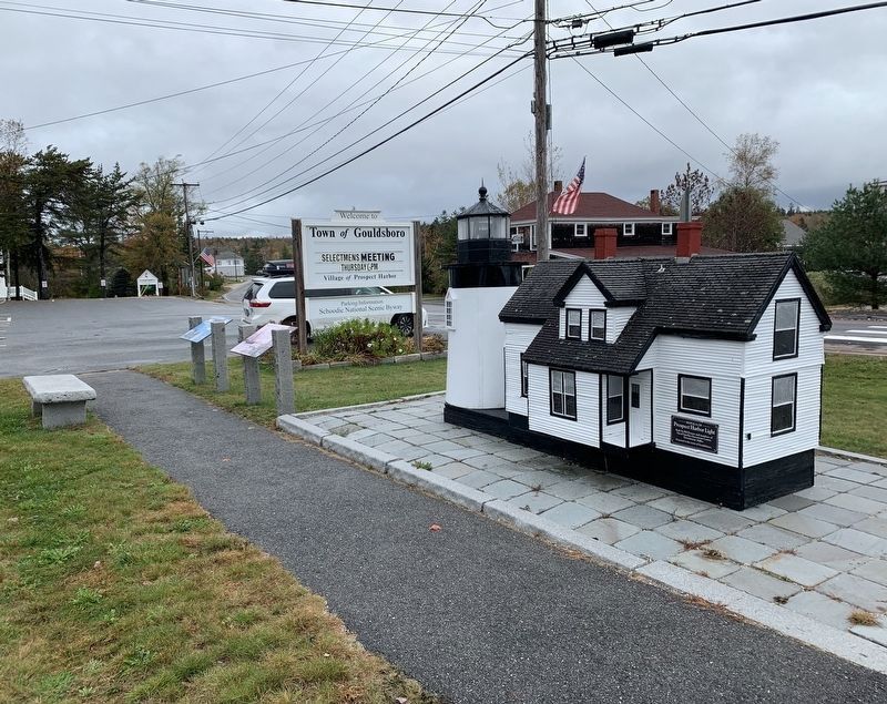
| 101 ► Maine, Hancock County, Prospect Harbor — When the ocean was the great highway for travel — |
| On Main Street (Maine Route 186) at Kelley Lane, on the right when traveling south on Main Street. | |||
| 102 ► Maine, Hancock County, Somesville — Linking oceans, rivers and lakes — |
| On Main Street (Maine Route 102) at Oak Hill Road, on the right when traveling south on Main Street. | |||
| 103 ► Maine, Hancock County, Sullivan — Historic Architecture in Sullivan Harbor — |
| On U.S. 1 near Benvenuto Avenue, on the right when traveling east. | |||
| 104 ► Maine, Hancock County, Sullivan — Summer Rusticators, the Tourist Trade and the Waukeag House Hotel — |
| On U.S. 1 near Benvenuto Avenue, on the right when traveling east. | |||
| 105 ► Maine, Hancock County, Sullivan — The view of Frenchman Bay — |
| On U.S. 1 near Benvenuto Avenue, on the right when traveling east. | |||
| 106 ► Maine, Hancock County, Tremont — A Steadfast Light — |
| On Lighthouse Road. | |||
| 107 ► Maine, Hancock County, Winter Harbor — Connected by Water — |
| On Schoodic Loop Road, 2.4 miles south of Route 186, on the right when traveling south. | |||
| 108 ► Maine, Hancock County, Winter Harbor — Lighthouses Warned Ships of Danger Down East — |
| On Main Street (Maine Route 186) near Newman Street (Maine Route 186), on the right when traveling east. | |||
| 109 ► Maine, Kennebec County, Augusta — 10 — First Kennebec Bridge / Le premier pont du Kennebec — Augusta, Maine — The Museum in the Streets® — |
| On Cony Street at the east side of the Kennebec River Bridge, on the left when traveling west on Cony Street. | |||
| 110 ► Maine, Kennebec County, Augusta — 2 — Gunshots Reverberate on the Kennebec / Des coups de fusil résonnent sur le fleuve Kennebec — Augusta, Maine — The Museum in the Streets® — |
| 111 ► Maine, Kennebec County, Augusta — 2 — Maine Mounted Light Artillery / Artillerie Légère à Cheval du Maine — Augusta, Maine – The Civil War — The Museum in the Streets® — |
| On State Street (U.S. 201) at Union Street, on the right when traveling south on State Street. | |||
| 112 ► Maine, Kennebec County, Augusta — 17 — Shipbuilding Days / L'époque des chantiers navals — Augusta, Maine — The Museum in the Streets® — |
| On Front Street south of Winthrop Street, on the left when traveling south. | |||
| 113 ► Maine, Kennebec County, Augusta — 16 — Steamboat Landing / L'embarquement des bateaux à vapeur — Augusta, Maine — The Museum in the Streets® — |
| On Front Street at Winthrop Street, on the right when traveling north on Front Street. | |||
| 114 ► Maine, Kennebec County, Fairfield — Heritage of the Kennebec River — Le patrimoine de la Rivière Kennebec — |
| On Mill Street at Water Street, on the left when traveling south on Mill Street. | |||
| 115 ► Maine, Kennebec County, Fairfield — Heritage of the Kennebec River — Le patrimoine de la Rivière Kennebec — |
| On Bridge Street at Main Street, on the right when traveling east on Bridge Street. | |||
| 116 ► Maine, Knox County, Camden — The Schooner Grace Bailey / The Schooner Mercantile — Built 1882 and 1916 — |
| 117 ► Maine, Knox County, Owl's Head — Owl's Head Light — |
| 118 ► Maine, Knox County, Owl's Head — Owl's Head Light Station — |
| 119 ► Maine, Knox County, Owl's Head — Welcome to Owls Head Light Station — |
| Near Lighthouse Road, 0.4 miles north of Dodge Point Lane, on the right when traveling north. | |||
| 120 ► Maine, Knox County, Rockland — Portland Head Light Bell (1942) — |
| On Park Drive near Main Street (U.S. 1), on the right when traveling east. | |||
| 121 ► Maine, Knox County, Rockland — Rockland Breakwater Lighthouse — |
| 122 ► Maine, Knox County, Rockland — Rockland Harbor Trail — Snow Marine Park to Rockland Breakwater Light — |
| On Main Street (Maine Route 73) near Myrtle Street, on the right when traveling north. | |||
| 123 ► Maine, Knox County, Rockland — Rockland Harbor Trail — Snow Marine Park to Rockland Breakwater Light — |
| 124 ► Maine, Knox County, Rockland — Rockland Harbor Trail — Snow Marine Park to Rockland Breakwater Light — |
| On Main Street (U.S. 1), on the right when traveling north. | |||
| 125 ► Maine, Knox County, Thomaston — The Builders, the Captains and the Seamen of Thomaston Ships — |
| On Knox Street at Main Street (U.S. 1), in the median on Knox Street. | |||
| 126 ► Maine, Knox County, Thomaston — The Voyage of Captain George Waymouth — |
| On City Avenue / Main Street, on the left when traveling west. | |||
| 127 ► Maine, Knox County, Thomaston — Map — Thomaston, Maine — The Museum in the Streets — |
| On Main Street (U.S. 1) at Knox Street, on the right when traveling east on Main Street. | |||
| 128 ► Maine, Lincoln County, Christmas Cove — In Grateful Memory of Ensign Richard Rundlett Wells — USN 1896-1918 — |
| On Maine Route 129, on the left when traveling south. | |||
| 129 ► Maine, Lincoln County, Damariscotta — Shipbuilding on the Damariscotta River — |
| Near Main Street (U.S. 1) east of Water Street, on the right when traveling west. | |||
| 130 ► Maine, Lincoln County, New Harbor — Bell House — |
| 131 ► Maine, Lincoln County, New Harbor — Oil House — |
| 132 ► Maine, Lincoln County, New Harbor — Pemaquid Point Lighthouse — |
| On Pemaquit Loop Road. | |||
| 133 ► Maine, Lincoln County, Pemaquid — John Cogswell and Family — |
| Near Bristol Road. | |||
| 134 ► Maine, Lincoln County, Pemaquid — Ralph Blaisdell and Family — |
| Near Bristol Road. | |||
| 135 ► Maine, Penobscot County, Bangor — A Place of Meeting — |
| On Hammond Street/State Street (U.S. 2) at Kenduskeag Stream, on the left when traveling east on Hammond Street/State Street. | |||
| 136 ► Maine, Penobscot County, Bangor — Charles A. Thatcher — Capt. U. S. Navy — |
| On Western Avenue north of Lake Avenue, on the right when traveling north. | |||
| 137 ► Maine, Penobscot County, Bangor — Nathaniel Lord — Died July 12, 1852, — |
| On Western Avenue north of Lake Avenue, on the right when traveling west. | |||
| 138 ► Maine, Penobscot County, Bangor — Norumbega Parkway — 1933 — |
| On Franklin Street, 0.1 miles north of Hammond Street (U.S. 2), on the right when traveling north. | |||
| 139 ► Maine, Penobscot County, Bangor — Saltonstall's Naval Fleet Gun — 1779 - 1876 — |
| On Hammond Street/State Street (U.S. 2) at Kenduskeag Stream, on the left on Hammond Street/State Street. | |||
| 140 ► Maine, Penobscot County, Bangor — Samuel de Champlain — |
| On Hammond Street/State Street (U.S. 2) at Kenduskeag Stream, on the left when traveling east on Hammond Street/State Street. | |||
| 141 ► Maine, Penobscot County, Bangor — Spanish-American War Memorial — |
| On Main Street (U.S. 202) at Cedar Street, on the left when traveling north on Main Street. | |||
| 142 ► Maine, Sagadahoc County, Bath — Wyoming Sculpture — Sparred Length (tip of jibboom/bowsprit to stern rail) 426 feet — |
| 143 ► Maine, Sagadahoc County, Bath — Wyoming Sculpture — Sparred Length (tip of jibboom/bowsprit to stern rail) 426 feet — |
| 144 ► Maine, Sagadahoc County, Bath — Bath Iron Works — A General Dynamics Company — |
| 145 ► Maine, Sagadahoc County, Bath — Deckhouse from steamer Winapie ca.1909 — |
| 146 ► Maine, Sagadahoc County, Bath — Kennebec River — |
| 147 ► Maine, Sagadahoc County, Bath — Launch day! — |
| 148 ► Maine, Sagadahoc County, Bath — Mill & Joiner Shop (1899) — |
| 149 ► Maine, Sagadahoc County, Bath — Shipyard Owner's Home — The William T. Donnell House — (1840s, 1892) — |
| 150 ► Maine, Sagadahoc County, Bath — Site of the Blacksmith Shop (1897, 1913) — |
| 151 ► Maine, Sagadahoc County, Bath — Site of the North Ways (1901) — |
| 152 ► Maine, Sagadahoc County, Bath — Site of the South Ways (ca. 1867) — |
| 153 ► Maine, Sagadahoc County, Bath — The Caulkers' Shed (1899) — |
| 154 ► Maine, Sagadahoc County, Bath — The Fitting-Out Pier (1906) — |
| 155 ► Maine, Sagadahoc County, Bath — The Mould Loft (1917) — |
| 156 ► Maine, Sagadahoc County, Bath — The Pitch Oven (1902) — |
| 157 ► Maine, Sagadahoc County, Bath — Transformer House (1909) — |
| 158 ► Maine, Sagadahoc County, Phippsburg — Forts on the Kennebec River — |
| 159 ► Maine, Sagadahoc County, Phippsburg — Sites of Forts in this Area — |
| 160 ► Maine, Somerset County, Bingham — Benedict Arnold 1775 Kennebec River Crossing — |
| Near U.S. 201, 8 miles north of Donigan Road, on the left when traveling north. | |||
| 161 ► Maine, Waldo County, Belfast — 21 — Biggest Little City / Une Grande Petite Ville — Belfast, Maine — The Museum in the Streets — |
| On Footbridge Road, on the left when traveling west. | |||
| 162 ► Maine, Waldo County, Belfast — 29 — Five-Masted Beauty / Une beauté à cinq mâts — Belfast, Maine — The Museum in the Streets — |
| Near Front Street. | |||
| 163 ► Maine, Waldo County, Belfast — 30 — Regal Passenger Steamer / Un paquebot à vapeur majestueux — Belfast, Maine — The Museum in the Streets — |
| Near Commercial Street. | |||
| 164 ► Maine, Waldo County, Belfast — 26 — The Finest and the Fastest / Le plus rapides et les plus racés — Belfast, Maine — The Museum in the Streets — |
| Near Front Street. | |||
| 165 ► Maine, Waldo County, Prospect — Conflict and Prosperity on the River — |
| 166 ► Maine, Waldo County, Searsport — 15 — Home of Clara Pendleton Blanchard 1843-1931 / La maison de Clara Pendleton Blanchard 1843-1931 — Searsport, Maine — The Museum in the Streets — |
| On West Main Street (U.S. 1), on the right when traveling north. | |||
| 167 ► Maine, Waldo County, Searsport — 16 — The Growth of Ship Building: Isaac Carver / Le développement des chantiers navals : Isaac Carver — Searsport, Maine — The Museum in the Streets — |
| On East Main Street (Rt. US-1) at Mortland Road, on the left when traveling east on East Main Street (Rt. US-1). | |||
| 168 ► Maine, Waldo County, Searsport — 17 — The Home of a Hero / La maison d'un héros — Searsport, Maine — The Museum in the Streets — |
| On East Main Street (U.S. 1) at Navy Street, on the right when traveling east on East Main Street. | |||
| 169 ► Maine, Waldo County, Stockton Springs — Fort Point State Park — |
| Near State Park Road, 1 mile east of Cape Jellison Road. | |||
| 170 ► Maine, Washington County, Calais — Exploring the Coast / Exploration de la côte — |
| 171 ► Maine, Washington County, Calais — Lessons Learned / Leçons durement apprises — |
| 172 ► Maine, Washington County, Calais — Settling on Saint Croix Island / Colonisation de l'île Sainte-Croix — |
| 173 ► Maine, Washington County, Calais — Strangers Offshore / Étrangers du grand large — |
| 174 ► Maine, Washington County, Calais — Welcome to Saint Croix Island International Historic Site / An Enduring Legacy — Bienvenue au lieu historique international de l'île-Sainte-Croix / Un précieux héritage — |
| 175 ► Maine, Washington County, Eastport — S.L. Wadsworth & Son — Nation’s Oldest Ship Chandlery — Established 1818 — |
| On Water Street at Furniture Avenue, on the right when traveling south on Water Street. | |||
| 176 ► Maine, Washington County, Machias — First Naval Battle of the American Revolution — |
| On Dublin Street at Obrien Avenue, on the right when traveling north on Dublin Street. | |||
| 177 ► Maine, Washington County, Machias — First Permanent English Settlement in Machias Bay — 1763 - 1904 — |
| On Main Street (Maine Route 192) at Free Street, on the left when traveling west on Main Street. | |||
| 178 ► Maine, Washington County, Machias — The Machias River — Downeast Fisheries Trail — |
| 179 ► Maine, Washington County, Weston — A rich fishing tradition continues year-round — Guides, sport and fishing camps — |
| On U.S. 1 north of Moody Lane, on the right when traveling north. | |||
| 180 ► Maine, Washington County, Weston — Chiputneticook Chain of Lakes — |
| On U.S. 1 north of Moody Lane, on the right when traveling north. | |||
| 181 ► Maine, Washington County, Weston — Rivers & Streams: Ancient Highways of the Wabanaki — |
| On U.S. 1, on the left when traveling north. | |||
| 182 ► Maine, York County, Biddeford — Map — Biddeford, Maine — The Museum in the Streets — |
| On Water Street at Sullivan Street, on the right when traveling east on Water Street. | |||
| 183 ► Maine, York County, Biddeford — Map — Biddeford, Maine — The Museum in the Streets — |
| On Main Street at Adams Street, on the left when traveling west on Main Street. | |||
| 184 ► Maine, York County, Biddeford — 1 — The Biddeford Shipyards / Les Chantiers Navals — Biddeford, Maine — The Museum in the Streets® — |
| On Water Street at Sullivan Street, on the right when traveling west on Water Street. | |||
| 185 ► Maine, York County, Biddeford — 5 — The Laconia Co. / La Compagnie Laconia — Biddeford, Maine — The Museum in the Streets® — |
| On Main Street at Laconia Street, on the right when traveling west on Main Street. | |||
| 186 ► Maine, York County, Kennebunk — 9 — Brick Store Museum Block / Les Bâtiments du Brick Store Museum — Kennebunk, Maine — The Museum in the Streets® — |
| On Main Street (U.S. 1) just south of Elm Street (Maine Route 9A/35), on the right when traveling south. | |||
| 187 ► Maine, York County, Kennebunk — 21 — Hugh McCulloch Home / La demeure Hugh McCulloch — Kennebunk, Maine — The Museum in the Streets® — |
| On Summer Street (Maine Route 9A/35) just west of Durrell's Bridge Road, on the left when traveling west. | |||
| 188 ► Maine, York County, Kennebunk — Map — Kennebunk, Maine — The Museum in the Streets — |
| On Main Street (Route 1) at Water Street, on the left when traveling west on Main Street. | |||
| 189 ► Maine, York County, Kennebunk — Map — Kennebunk, Maine — The Museum in the Streets — |
| On Summer Street (Maine Route 9A/35) at Elm Street, on the right when traveling east on Summer Street. | |||
| 190 ► Maine, York County, Kennebunk — 23 — The Butland Shipyard and Cemetery / Le chantier naval Butland et le Cimetière — Kennebunk, Maine — The Museum in the Streets® — |
| Near Friendly Pines Lane south of Constitution Road, on the right when traveling east. | |||
| 191 ► Maine, York County, Kennebunk — 20 — The Landing / The Landing (le quai) — Kennebunk, Maine — The Museum in the Streets® — |
| On Summer Street (Maine Route 9A/35) at Moulton Farm Road, on the right when traveling east on Summer Street. | |||
| 192 ► Maine, York County, Kennebunk — 2 — The Mousam River / Le Fleuve Mousam — Kennebunk, ME — The Museum in the Streets — |
| On Water Street just south of York Street (U.S. 1), on the right when traveling south. | |||
| 193 ► Maine, York County, Kennebunk — 13 — Zion's Hill / Zion's Hill (La Colline Dorée) — Kennebunk, Maine — The Museum in the Streets® — |
| On Summer Street (Maine Route 9A/35) at Park Street, on the right when traveling east on Summer Street. | |||
| 194 ► Maine, York County, Kittery — Kittery Maine USS Thresher (SSN 593) Memorial — |
| On Rogers Road at Shepards Cove Road, on the right on Rogers Road. | |||
| 195 ► Maine, York County, Kittery — Shipyard Mall — |
| Near Mac Donough Avenue near Charles/Morris Avenue. | |||
| 196 ► Maine, York County, Kittery — Sloop Ranger Memorial — |
| On US 1 South. | |||
| 197 ► Maine, York County, Wells — Ice House — Keeping food cold without electricity — Historic Laudholm Farm — |
| Near Skinner Mill Road north of Laudholm Farm Road, on the right when traveling north. | |||
| 198 ► Maine, York County, Wells — Laudholm Farm: The foundation of the Wells Reserve — |
| Near Skinner Mill Road north of Laudholm Farm Road, on the right when traveling north. | |||
| 199 ► Maine, York County, Wells — Water Tower — How can water flow uphill? — Historic Laudholm Farm — |
| Near Skinner Mill Road north of Laudholm Farm Road, on the right when traveling north. | |||
| 200 ► Maine, York County, York — "Nubble Light House" — Cape Neddick Light Station — U.S. Coast Guard — |
| On Sohier Park Rd, 0.1 miles Nubble Rd, on the right when traveling east. | |||
201 entries matched your criteria. Entries 101 through 200 are listed above. ⊲ Previous 100 — The final 1 ⊳