After filtering for New Jersey, 423 entries match your criteria. Entries 101 through 200 are listed.⊲ Previous 100 — Next 100 ⊳
Waterways & Vessels Topic
By Devry Becker Jones (CC0), April 21, 2023
USS New Jersey Memorial
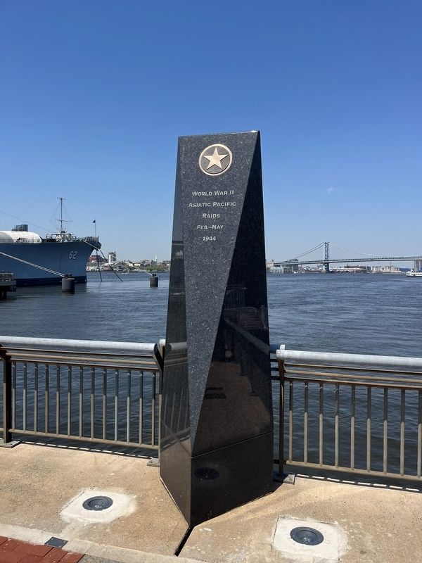
| 101 ► New Jersey, Camden County, Camden, Central Waterfront — USS New Jersey Memorial — |
| Near Clinton Street west of South Delaware Avenue, on the left when traveling north. | |||
| 102 ► New Jersey, Camden County, Camden, Central Waterfront — USS New Jersey Propeller — |
| On Riverside Drive at Dr. Martin Luther King Boulevard, in the median on Riverside Drive. | |||
| 103 ► New Jersey, Camden County, Camden, Cooper Grant — Benjamin Franklin Bridge — |
| On Water Street at Pearl Street, on the right when traveling south on Water Street. | |||
| 104 ► New Jersey, Camden County, Camden, Cooper Grant — Camden Rising — |
| Near Water Street south of Penn Street, on the right when traveling south. | |||
| 105 ► New Jersey, Camden County, Camden, Cooper Grant — Camden's Ferry System — |
| Near Aquarium Loop Drive west of Riverside Drive, on the right when traveling south. | |||
| 106 ► New Jersey, Camden County, Camden, Cooper Grant — Cooper Street: the Gateway of Southern New Jersey — |
| On Cooper Street at North 3rd Street, on the right when traveling west on Cooper Street. | |||
| 107 ► New Jersey, Camden County, Camden, Cooper Grant — Enslaved Africans Once Sold Here — |
| On Federal Street (County Road 537) at Jersey Joe Walcott Boulevard, on the right when traveling west on Federal Street. | |||
| 108 ► New Jersey, Camden County, Camden, Cooper Grant — 1 — PRR Federal Street Ferry Terminal — |
| On Jersey Joe Walcott Boulevard, 0.1 miles south of Market Street (County Road 537), on the right when traveling south. | |||
| 109 ► New Jersey, Camden County, Camden, Cooper Point — Enslaved Africans Once Sold Here — |
| Near Elm Street west of Jersey Joe Walcott Boulevard, on the left when traveling west. | |||
| 110 ► New Jersey, Camden County, Camden, Downtown — Benjamin Franklin Bridge — |
| On North 5th Street at Pearl Street, on the right when traveling north on North 5th Street. | |||
| 111 ► New Jersey, Camden County, Camden, Downtown — Cooper Street Historic District — Camden, New Jersey — |
| On Fourth Street south of Cooper Street, on the right when traveling south. | |||
| 112 ► New Jersey, Camden County, Pennsauken Township — Route 30/130 Cooper River Bridge: A Component of the Cooper River Park — Structure No. 0405-153 — Camden County, New Jersey — |
| On North Park Drive at South Crescent Boulevard (U.S. 130), on the right when traveling east on North Park Drive. | |||
| 113 ► New Jersey, Cape May County, Cape May — Cape May County Fishermans Memorial — |
| On Missouri Avenue at Baltimore Avenue on Missouri Avenue. | |||
| 114 ► New Jersey, Cape May County, Cape May — City of Cape May — Incorporated 1857 — |
| On Ocean Street just north of Washington Street, on the right when traveling north. | |||
| 115 ► New Jersey, Cape May County, Cape May — City of Cape May, New Jersey — |
| On Ocean Street north of Washington Street, on the left when traveling south. | |||
| 116 ► New Jersey, Cape May County, Cape May — S. S. Cape May — |
| On Ocean Street at Washington Street, on the left when traveling west on Ocean Street. | |||
| 117 ► New Jersey, Cape May County, Cape May, Lower Township — All Shapes, Sizes and Materials — Aids to Navigation — Maritime History |
| On Light House Avenue, on the left when traveling south. Reported permanently removed. | |||
| 118 ► New Jersey, Cape May County, Cape May, Lower Township — History of Coastal Defenses — |
| On Sunset Blvd. (County Route 606), on the left when traveling west. | |||
| 119 ► New Jersey, Cape May County, Cape May, Lower Township — Lighthouse Keepers' Homes & Gardens — |
| Near Light House Ave (County Route 629) at Lehigh Avenue. | |||
| 120 ► New Jersey, Cape May County, Cape May, Lower Township — Maritime Sentinels — Aids to Navigation — Maritime History — |
| Near Light House Avenue (County Road 629) at Lehigh Avenue, on the left when traveling south. | |||
| 121 ► New Jersey, Cape May County, Cape May, Lower Township — Monomoy Lifesaving Boat — circa late 1800s - 1930s — Cape May Maritime Museum — |
| On Light House Avenue (County Road 629) at Lehigh Avenue, on the left when traveling south on Light House Avenue. | |||
| 122 ► New Jersey, Cape May County, Cape May, Lower Township — Oil House |
| On Light House Avenue, on the left when traveling south. Reported damaged. | |||
| 123 ► New Jersey, Cape May County, Cape May, Lower Township — Oil House — |
| Near Light House Avenue (County Road 629) at Lehigh Avenue, on the left when traveling south. | |||
| 124 ► New Jersey, Cape May County, Cape May, Lower Township — 10 — Pitch Pine — Bradner's Run Nature Trail, Cape May, NJ — Historic Cold Spring Village — |
| Near Seashore Road (County Road 626) 0.4 miles north of Academy Street (County Road 639), on the right when traveling north. | |||
| 125 ► New Jersey, Cape May County, Cape May, Lower Township — S.S. Atlantus — |
| On Sunset Blvd. (County Route 606) when traveling west. | |||
| 126 ► New Jersey, Cape May County, Cape May, Lower Township — 4 — Southern Red Oak — |
| Near Seashore Road (Route 626) 0.3 miles north of Academy Road (County Road 639), on the right when traveling north. | |||
| 127 ► New Jersey, Cape May County, Cape May, Lower Township — The Cape May Lighthouse — |
| Near Light House Avenue (County Road 629) at Lehigh Avenue, on the left when traveling south. | |||
| 128 ► New Jersey, Cape May County, Cape May, Lower Township — The South Cape May Meadows Restoration — |
| Near Sunset Boulevard (County Road 606) east of West Drive, on the right when traveling east. | |||
| 129 ► New Jersey, Cape May County, Cape May, Lower Township — 1 — Tulip Poplar — Bradner's Run Nature Trail, Cape May, NJ — Historic Cold Spring Village — |
| On Seashore Road (County Road 626) 0.4 miles north of Academy Road (County Road 639), on the right when traveling north. | |||
| 130 ► New Jersey, Cape May County, Cape May, Lower Township — Welcome to the Cape May Lighthouse |
| On Lincoln Avenue. Reported permanently removed. | |||
| 131 ► New Jersey, Cape May County, Cape May, Lower Township — Welcome to the Cape May Lighthouse — |
| Near Light House Avenue (County Road 629) at Lehigh Avenue, on the left when traveling south. | |||
| 132 ► New Jersey, Cape May County, Cape May, Lower Township — Welcome to the Nature Trail at Bradner's Run — Bradner's Run Nature Trail, Cape May, NJ — |
| On Shore Road (U.S. 9) 1.6 miles north of Sandman Boulevard (U.S. 9), on the left. | |||
| 133 ► New Jersey, Cape May County, Cape May, Lower Township — Welcome to the Nature Trail at Bradner's Trail — Bradner's Run Nature Trail, Cape May, NJ — |
| On Seashore Road (County Route 626) 0.4 miles north of Academy Road (County Road 639), on the right when traveling north. | |||
| 134 ► New Jersey, Cape May County, Cape May Point, Lower Township — Flipper and Friends — Whale & Dolphin Migration — Wildlife Migration — |
| Near Lighthouse Avenue, on the left when traveling south. | |||
| 135 ► New Jersey, Cape May County, Cape May Point, Lower Township — Longshore Sediment Movement — Cape May Point State Park — Coastal Habitats — |
| Near Lighthouse Road (County Road 629) south of Lehigh Avenue, on the left when traveling south. | |||
| 136 ► New Jersey, Cape May County, Lower Township, North Cape May — The European Settlement of Cape May County — |
| Near Lincoln Boulevard. | |||
| 137 ► New Jersey, Cape May County, Lower Township, North Cape May — Town Bank — |
| On Bayshore Road at Town Bank Road, on the right when traveling south on Bayshore Road. | |||
| 138 ► New Jersey, Cape May County, North Wildwood — All Shapes, Sizes and Materials — Aids to Navigation — Maritime History |
| On N Central Avenue at E 1st Avenue, on the right when traveling north on N Central Avenue. Reported permanently removed. | |||
| 139 ► New Jersey, Cape May County, North Wildwood — Coast Guard Station Hereford — Aids to Navigation — Maritime History — |
| On North Central Avenue north of East 1st Avenue, on the right when traveling north. | |||
| 140 ► New Jersey, Cape May County, North Wildwood — Hereford Inlet Lighthouse — 1874 — |
| On N Central Avenue at E 1st Avenue, on the right when traveling north on N Central Avenue. | |||
| 141 ► New Jersey, Cape May County, North Wildwood — N9 — Hereford Inlet Lighthouse — Borough of North Wildwood 1906 - 1917 — |
| On North Central Avenue north of East 1st Avenue, on the right when traveling north. | |||
| 142 ► New Jersey, Cape May County, North Wildwood — N3 — Hereford Inlet Lightouse — Borough of Anglesea 1885-1906 — |
| On Central Avenue, on the left when traveling north. | |||
| 143 ► New Jersey, Cape May County, North Wildwood — Herefort Inlet Lighthouse — 1874 — |
| On North Central Avenue north of East 1st Avenue, on the right when traveling north. | |||
| 144 ► New Jersey, Cape May County, Ocean City — Sindia — |
| On East 4th Street just west of Atlantic Avenue, on the right when traveling west. | |||
| 145 ► New Jersey, Cape May County, Ocean City — Sindia — |
| On Boardwalk at East 17th Street on Boardwalk. | |||
| 146 ► New Jersey, Cape May County, Ocean City — The Ocean City Historic District — |
| On Wesley Avenue at East 9th Street, on the right when traveling north on Wesley Avenue. | |||
| 147 ► New Jersey, Cape May County, Ocean City — U.S. Life-Saving Station 30 — |
| On East 4th Street just east of Atlantic Avenue, on the right when traveling west. | |||
| 148 ► New Jersey, Cape May County, Ocean City — U.S.S. Arizona Memorial — |
| On Wesley Avenue just west of 5th Street, on the left when traveling west. | |||
| 149 ► New Jersey, Cape May County, Sea Isle City, Townsends Inlet — Fish Alley Circa: 1890 — |
| On John F Kennedy Boulevard, on the right when traveling east. | |||
| 150 ► New Jersey, Cape May County, Stone Harbor — U.S. Life Saving Station No.35 (Tatham Life Saving Station) — National Register Of Historic Places — |
| On 2nd Avenue, on the right when traveling south. | |||
| 151 ► New Jersey, Cape May County, Stone Harbor, Middle Township — Life-Saving Service Rescue Boats — Two Basic Types — |
| On 117th Street, on the right when traveling west. | |||
| 152 ► New Jersey, Cape May County, Stone Harbor, Middle Township — This Rescue Boat — |
| On 117th Street, on the right when traveling west. | |||
| 153 ► New Jersey, Cape May County, Wildwood Crest — The Battle of Turtle Gut Inlet — |
| On New Jersey Avenue at E Miami Avenue, on the right when traveling south on New Jersey Avenue. | |||
| 154 ► New Jersey, Cape May County, Woodbine — Dennis Creek Landing — |
| On North Delsea Drive (New Jersey Route 47) north of New Jersey Route 83, on the right when traveling north. | |||
| 155 ► New Jersey, Cumberland County, Bivalve — Bivalve Oyster Shipping Sheds — |
| On High Street. | |||
| 156 ► New Jersey, Cumberland County, Bivalve — Ecology in the Watershed — Maurice River Watershed — |
| On High Street. | |||
| 157 ► New Jersey, Cumberland County, Bivalve — Maurice River — |
| On High Street. | |||
| 158 ► New Jersey, Cumberland County, Bivalve — The Schooner AJ Meerwald — |
| On High Street. | |||
| 159 ► New Jersey, Cumberland County, Bridgeton — New Jersey Coastal Heritage Trail Route — Information — |
| On East Broad Street. | |||
| 160 ► New Jersey, Cumberland County, Greenwich — Gibbon House — |
| On Ye Greate Street. | |||
| 161 ► New Jersey, Cumberland County, Heislerville — A Guiding Light — Aids to Navigation — Maritime History — |
| Near Lighthouse Road, 0.1 miles west of E Point Road, on the left when traveling west. | |||
| 162 ► New Jersey, Cumberland County, Heislerville — All Shapes, Sizes and Materials — Aids to Navigation — Maritime History — |
| Near Lighthouse Road, 0.1 miles E Point Road, on the left when traveling west. | |||
| 163 ► New Jersey, Cumberland County, Heislerville — East Point Lighthouse — Under Renovation by Maurice River Historical Society — |
| Near Lighthouse Road, 0.1 miles E Point Road, on the left when traveling west. | |||
| 164 ► New Jersey, Cumberland County, Mauricetown — A River to Enjoy and Protect — Maurice River — |
| On Mauricetown Crossway Road. | |||
| 165 ► New Jersey, Cumberland County, Millville — Captain Joseph Buck — 1753 - 1803 — Founder of Millville — |
| Near Buck Street at Sassafras Street, on the left when traveling north. | |||
| 166 ► New Jersey, Cumberland County, Millville — Gunnery Practice Over The Atlantic — |
| On Reeves Street at Peterson Street, on the left when traveling east on Reeves Street. | |||
| 167 ► New Jersey, Cumberland County, Vineland — Adolph A. Phillips — |
| On North 6th Street at Cambridge Street, in the median on North 6th Street. | |||
| 168 ► New Jersey, Cumberland County, Vineland — Corp. Charles Phillips — |
| On North 6th Street at Cambridge Street, in the median on North 6th Street. | |||
| 169 ► New Jersey, Cumberland County, Vineland — Gunner, Clarence Hartman — |
| On Cambridge Street at North 6th Street, in the median on Cambridge Street. | |||
| 170 ► New Jersey, Cumberland County, Vineland — Lieut. Grady R. Roberts — |
| On North 6th Street at Cambridge Street, in the median on North 6th Street. | |||
| 171 ► New Jersey, Cumberland County, Vineland — Seaman, Perre Galkin — |
| On North 6th Street at Cambridge Street, in the median on North 6th Street. | |||
| 172 ► New Jersey, Cumberland County, Vineland — Vice Admiral Wallace M. Beakley Square — Dedicated 4 May 2001 — |
| On East Landis Avenue at Northeast Boulevard on East Landis Avenue. | |||
| 173 ► New Jersey, Essex County, Belleville — Belleville Copper Rolling Mill — 1813-1938 — Hendricks Bros — |
| On Mill Street west of South Franklin Avenue (New Jersey Route 645), on the right when traveling west. | |||
| 174 ► New Jersey, Essex County, Bloomfield — Morris Canal — 1824 - 1924 — National Register Landmark — |
| On Newark Avenue west of Berkeley Avenue when traveling west. | |||
| 175 ► New Jersey, Gloucester County, Monroe, Monroe Township — Christopher Columbus — 1451 - 1506 — |
| On South Main Street at Blue Bell Road (County Road 633), on the right when traveling south on South Main Street. | |||
| 176 ► New Jersey, Gloucester County, National Park — Marvin C. Creamer — |
| Near Hessian Road, on the right when traveling west. | |||
| 177 ► New Jersey, Gloucester County, Paulsboro — Tinicum Rear Range Lighthouse — |
| Near 2nd Street, on the right when traveling east. | |||
| 178 ► New Jersey, Hudson County, Hoboken — Maxwell House Coffee Plant — From Field to Factory in Hoboken — |
| On 11th Street at Hudson Street, in the median on 11th Street. | |||
| 179 ► New Jersey, Hudson County, Hoboken — New York Yacht Club — Home of the America’s Cup — |
| On Maxwell Place at Frank Sinatra Drive on Maxwell Place. | |||
| 180 ► New Jersey, Hudson County, Hoboken — On the Waterfront: — Holland America, Boat Clubs & The Movie — |
| On Sinatra Drive near Fourth Street, in the median. | |||
| 181 ► New Jersey, Hudson County, Hoboken — Southern Piers: — Pier C, Shipping and Longshoremen — |
| On Sinatra Drive near Third Street, in the median. | |||
| 182 ► New Jersey, Hudson County, Hoboken — Southern Piers: — Stevens’ Battery, Ships & Immigrants — |
| On Sinatra Drive near 2nd Street, in the median. | |||
| 183 ► New Jersey, Hudson County, Hoboken — Southern Piers: — Ocean Liners, World War I & Parks — |
| On Sinatra Drive near 1st Street, in the median. | |||
| 184 ► New Jersey, Hudson County, Hoboken — Southern Piers: — Trains, Ferries & the Tubes — |
| Near Sinatra Drive near Newark Street, in the median. | |||
| 185 ► New Jersey, Hudson County, Jersey City — Explosion at Liberty! |
| On Morris Pesin Drive, on the right when traveling east. Reported missing. | |||
| 186 ► New Jersey, Hudson County, Jersey City — Morris Pesin’s Legendary Canoe Trip Which Launched Liberty State Park |
| Near Morris Pesin Drive, on the right when traveling east. Reported missing. | |||
| 187 ► New Jersey, Hudson County, Jersey City — U.S.S. Maine Memorial — |
| On Bergen Avenue at Montgomery Street, on the left when traveling south on Bergen Avenue. | |||
| 188 ► New Jersey, Hudson County, Jersey City, Colgate Center — The Morris Canal — New Jersey's Mountain-Climbing Waterway — 1824 - 1924 — |
| On Hudson Street at Essex Street, on the right when traveling south on Hudson Street. | |||
| 189 ► New Jersey, Hudson County, Jersey City, Colgate Center — What Is This Small Body of Water? — Historic Walk — Exchange Place Alliance — |
| Near Greene Street, 0.1 miles south of Essex Street, on the left when traveling south. | |||
| 190 ► New Jersey, Hudson County, Jersey City, Downtown Jersey City — The Historic Trilogy — |
| Near Washington Street, 0.1 miles south of Dudley Street, on the right when traveling north. | |||
| 191 ► New Jersey, Hudson County, Jersey City, Downtown Jersey City — The Morris Canal |
| On Van Vorst Street at Essex Street, on the right when traveling south on Van Vorst Street. Reported unreadable. | |||
| 192 ► New Jersey, Hudson County, Jersey City, Downtown Jersey City — The Morris Canal Big Basin — |
| Near Washington Street, 0.1 miles south of Dudley Street, on the left when traveling south. | |||
| 193 ► New Jersey, Hudson County, Jersey City, Downtown Jersey City — The Morris Canal Little Basin |
| Near Washington Street, 0.1 miles south of Dudley Street, on the right when traveling north. Reported unreadable. | |||
| 194 ► New Jersey, Hudson County, North Bergen — Hoboken Docks Fire Memorial — |
| Near 1 north of 54th Street, on the right when traveling north. | |||
| 195 ► New Jersey, Hudson County, Weehawken — Weehawken: Gateway to New York — |
| On Port Imperial Blvd at Baldwin Avenue, on the right when traveling north on Port Imperial Blvd. | |||
| 196 ► New Jersey, Hunterdon County, Finesville — Finesville Dam — |
| On Mount Joy Road, on the right when traveling north. | |||
| 197 ► New Jersey, Hunterdon County, High Bridge — Lake Solitude and Taylor Falls — Tayor Steelworkers Historic Greenway — A 7 Mile Greenway Trail Through the Borough of High Bridge Historic Properties — |
| On River Road, on the right when traveling south. | |||
| 198 ► New Jersey, Hunterdon County, High Bridge — Solitude Falls — |
| Near Mine Road. | |||
| 199 ► New Jersey, Hunterdon County, Lambertville — D & R — Delaware & Raritan Canal State Park — |
| On Bridge Street west of Klines Ct., on the left when traveling west. | |||
| 200 ► New Jersey, Hunterdon County, Lambertville — Lambertville Outlet Lock — |
| Near Delaware and Raritan State Park Trail. | |||
423 entries matched your criteria. Entries 101 through 200 are listed above. ⊲ Previous 100 — Next 100 ⊳