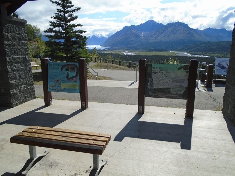
Ice worms really do exist. Not only do
these tiny creatures live in Alaska
legends, they also live on many
Alaska glaciers.
What are they?
Ice worms are segmented annelids, similar to
earthworms. Two species are known to . . . — — Map (db m255280) HM
The resources of the Matanuska Valley, including its people, create a cornucopia of natural wealth.
The Wild Advantage
Throughout history, Athabascans thrived off the bountiful resources of this valley—fishing, hunting, and gathering, . . . — — Map (db m255209) HM
The Matanuska Valley's ecosystem is an intricate
network of diverse, interconnected elements.
You too are a part of this!
Rich and Connected
Carved in part by the Matanuska Glacier and the braided
Matanuska River, this long valley . . . — — Map (db m255256) HM
Did You Know?
Biologist have studied Mt. McKinley wolf packs since the 1930s. Early researchers, such as Adolph Murie, helped to dispel common myths about wolves and argued for their protection. Among many detailed observations, Murie . . . — — Map (db m257649) HM
Dedicated to the indomitable spirit of the
sled dogs of the Iditarod Trail Sled Dog Race.
“The Last Great Race on Earth”
Endurance • Fidelity • Intelligence
Dedicated the first Saturday of March, 2012
Historic replica of . . . — — Map (db m80411) HM
Running down Front Street and passing this monument to the Iditarod National Historic Trail--Authorized By the US Congress 1978, the Trail begins in Seward, Alaska with Tripod Milepost #0. The trail winds its way through the heart of the . . . — — Map (db m290377) HM
Sharing Food, Sharing Life – Then and Now
Ukpiaġvik, which means ‘the place where we hunt snowy owls,’ was one of several ancient villages in the Barrow area. Our ancestors settled here primarily to hunt the great bowhead whales. But . . . — — Map (db m49595) HM
Unlike their salmon cousins, Dolly Varden have the reproductive advantage
of being able to spawn more than once. Cold water, gravel beds, and slow-moving side channels are excellent habitat for these fish.
GROWING IN GRAVEL . . . — — Map (db m257880) HM
"There ain't no choice,' said an oldtimer of choosing between the Chilkoot and the White Pass. 'One's hell. The other's damnation.'"
—Martha Ferguson McKeown
Most stampeders never became rich, but they counted their . . . — — Map (db m257829) HM
"There ain't no choice,' said an oldtimer of choosing between the Chilkoot and the White Pass. 'One's hell. The other's damnation.'"
—Martha Ferguson McKeown
Most stampeders never became rich, but they counted their . . . — — Map (db m257886) HM
A story of a changing shoreline.
During the gold rush, people wanted to build close to the water. When they ran out of suitable land, they began to fill in the mudflats, wetlands, and estuaries You can see the difference between . . . — — Map (db m257903) HM
[Rendering of a loaded pack horse and pack mule] The dead are speaking in memory of us three thousand pack animals that laid our bones on these awful hills during the Gold Rush of 1897-1898. We now thank those listening that heard our groans . . . — — Map (db m69126) HM
During the long cold winters,
this barn provided protection
for Rika's Holstein cows,
oxen, sheep, goats, and
chickens. Rika borrowed the
unusual design from her
homeland of Sweden. — — Map (db m255736) HM
Agricultural Development in Delta began with homesteading in the Delta-Clearwater area in
the early 1950's. Farm sizes varied from 160-320 acres.
In April of 1978 the State of Alaska sold approximately 15,000 acres of agricultural land in the . . . — — Map (db m255720) HM
Delta Junction Bison Range
Bison were released along the Delta River in 1928, and the herd increased from 28 animals to 400 by 1947. Bison hunting began in 1951. The 90,000 acre Delta Junction Bison Range (DJBR) was established in 1979, . . . — — Map (db m255605) HM
What does silence sound like? Where do you go if there are no footsteps to follow? How does it feel to be in a place where day and night are the only times that matter? How does it feel to be totally immersed in nature?
The answers to . . . — — Map (db m255959) HM
Due south rises the 3rd tallest peak in AZ, revered by conservationist, Aldo Leopold Escudilla was home to Ike Clanton of OK Corral fame & Arizona's last grizzly bear. In fall, the north slope is golden with Aspen covering the 23,000 acre fire of . . . — — Map (db m36592) HM
At this location in 1952, a large bone bed was discovered containing the remains of extinct mammoth, tapir, bison and horse. Found with the bones were the weapons and tools of the Indians who had killed and butchered these animals. The bones and . . . — — Map (db m43633) HM
The Carmichael House was built by William and Margaret Ziegan Carmichael on 131.05 acres. On December 11, 1911, Margaret, a single woman at the time, purchased the property from John and Ellen Reilly for $8,000. As the years passed, the Carmichael . . . — — Map (db m27894) HM
At 1:00 p.m. on April 21st, 1907, the "Million Dollar Stope" was created when the Good Enough Stope caved in dropping a horse and wagon 75' into a gaping hole. The driver had climbed down to see why his horse had stumbled only to find himself . . . — — Map (db m131088) HM
In 1857 Congress authorized Navy Lieutenant Edward F. Beale to survey a wagon road along the 35th parallel from Fort Defiance, New Mexico Territory, to the Colorado River. A secondary mission was to test the feasibility of using camels in the . . . — — Map (db m33348) HM
From 1857-60, Lt. Edward F. Beale and a crew of 100 men completed the first federal highway in the southwest from Fort Smith, Ark. to Los Angeles, Calif. at a cost of $200,000. The wagon road was used extensively by immigrants en route to . . . — — Map (db m33346) HM
The rich diversity of plants and animals of the Flagstaff area was first recognized in the summer of 1889 when Dr. C. Hart Merriam led a biological survey to the San Francisco Peaks. Merriam's "Life Zone Theory" detailed that temperature and . . . — — Map (db m201772) HM
The City of Flagstaff purchased this land in 1959 from the United States Forest Service.
In 1964, James Potter, Sr., long-time resident, entrepreneur and Flagstaff Chamber of Commerce President, led the effort to form a non-profit organization, . . . — — Map (db m33347) HM
As the keystone shows, this building was constructed in 1911. Its owner was R.O. Raymond, M.D., one of Flagstaff’s first doctors. Raymond came west for his health. After a short stay in Williams, he moved to Flagstaff in 1906.
He was the . . . — — Map (db m59511) HM
Historic Basque handball court (cancha) built in 1926 by Jesus Garcia, a Spaniard who migrated to Flagstaff in 1912. He owned and operated the adjacent Tourist Home. The Basque would reportedly herd sheep, drink, chase women, or play their beloved . . . — — Map (db m59498) HM
John G. Verkamp came to Flagstaff in the 1890s. He first worked for the Babbitts (three of his sisters were married to Babbitt brothers), then succeeded in a number of businesses on his own, including lumber, livestock and merchandising. He is best . . . — — Map (db m59505) HM
The mule barn and the nearby livery stable were two of the most important buildings in the original Grand Canyon Village. In the early 1900's, when all travel within the village was by horse-drawn carriage, these huge barns were the center of all . . . — — Map (db m39585) HM
Behind you is the Bright Angel mule corral, where each morning mules greet riders and another adventure begins. Mules have carried people into Grand Canyon since sightseeers first visited here in the 1890s. For many people - including those who . . . — — Map (db m205170) HM
California condors are the largest flying birds in North America. Their wingspans of nearly 10 feet (3.5 m) make condors easy to spot gliding above Grand Canyon today. Yet, in the 1920s, these birds disappeared from Grand Canyon skies. Condors were . . . — — Map (db m250417) HM
Kaibab Squirrel Area has been designated a National Natural Landmark.
This site possesses exceptional value as an illustration of the Nation's natural heritage and contributes to a better understanding of the environment. — — Map (db m94912)
Lee Van Deren, cattleman, arrived to put his children in the new Sedona school opened in 1910. Ranching was a major part of Sedona’s early economy. Round ups and cattle drives were a twice a year occurrence for ranchers when moving their herds from . . . — — Map (db m54229) HM
"Old Bill" was born January 3, 1787 in North Carolina. He died March 24, 1849. In that 62 year life span he did a heap of living, most of it in the wilderness. In the late 1700's and early 1800's the mountain men were trappers. In the quest of fine . . . — — Map (db m205150) HM
Thomas Bouse was born in Mendecino County, California and came here about 1889 as a prospector and built the first two rooms of his home. He ran a small store here. He brought his wife, Katherine, and infant daughter here in 1892. Three more . . . — — Map (db m29070) HM
He was our drinking buddy
While on duty
He drank our beer
He was
Full of good cheer
And went to the nurses' quarters around the bend
And came to an untimely end,
Of the Colonel, he was unaware
That it would be the crime of all time . . . — — Map (db m78536) HM
The famous camel herd with which the name of Hi Jolly is linked constitutes an interesting sidelight of Arizona history.
Jefferson Davis (afterward president of the Southern Confederacy), as Secretary of War, approved a plan to experiment . . . — — Map (db m70566) HM
This desert town was made famous by the humor of Dick Wick Hall, healthseeker and operator of the laughing gas station. Hall's publication the Salome Sun was filled with extravagant tales of the desert's adaptation of species. He told of his frog . . . — — Map (db m31824) HM
Marker 1 - (Main Marker):
The original Verde River Sheep Bridge, also known as the Red Point Sheep Bridge, was constructed at this location in 1943 by Flagstaff Sheep Company, which had been grazing sheep in the area under a Forest . . . — — Map (db m53966) HM
The corrals here are the remnants of the sprawling complex of corrals and pastures needed to raise the livestock that was always important to the operations of Sahuaro Ranch.
In early years, horses and mules were the primary source of power for . . . — — Map (db m40686) HM
Although some cows were probably always kept on the ranch to supply fresh milk and butter, it was not until after Richard W. Smith bought Sahuaro Ranch in 1927 that dairy cows were raised here commercially.
At first the Smith family sold only . . . — — Map (db m40662) HM
Little is known about the history of this building, which started out as a horse stable, but it almost certainly was one of the earliest work buildings to be erected at Sahuaro Ranch.
The eastern half, with the vertical wood siding, was built . . . — — Map (db m40685) HM
The barnyard was the center of activity as Sahuaro Ranch. Horses and mules were stabled, trained, and shoed here. Cattle were brought to the corrals for branding, treatment and shipment. Farm implements and wagons were stored and repaired here. . . . — — Map (db m40674) HM
This concrete trough was part of the E.A. Tovrea Memorial Zoo.
In June 1942, the Phoenix Gazette announced the opening of a zoo featuring Arizona wildlife. The small zoo housed bison (like the one pictured here) elk, deer, antelope, coyote, . . . — — Map (db m142633) HM
b. July 12, 1899 Hope, NM
d. October 25, 1971 Wickenburg, AZ
Known as the cowboy's cowboy
Admired and revered by townsfolk
Father and organizer of Turtle Association 1936 which became the Professional Rodeo Cowboy Association
1937 Owned . . . — — Map (db m29473) HM
Whether we have much or little, one-tenth should be paid in… the people are not compelled to pay their tithing… it is urged upon them only as a matter of duty between them and their God.
President Brigham Young, . . . — — Map (db m272727) HM
Pioneer in the path of empire hero of the War with Mexico, lieutenant in United States Navy. Appointed general by the Governor of California. Commanded exploration of wagon route to the Colorado River, with the only camel train in American History . . . — — Map (db m32208) HM
This turn of the century gold mining camp was on the original road through the Black Mountains and eventually became Route 66. Burrows came with the miners and still roam the streets today.
Get you Kicks on Route 66 in Arizona. — — Map (db m188974) HM
World War I was funded partially by the gold out of these mountains in 1912. Oatman boomed from 1910 to the 1920's. Upwards to 8,000 people lived here. Gold mines were closed about 1942. Mines were needed to mine copper for World War II. Blue Ridge . . . — — Map (db m119942) HM
Oatman was founded around 1906 as part of Arizona's richest gold mining area. Oatman was reborn in the late 1960's and early 1970's as a tourist town. The main attraction was the wild burro herd. The burros roaming the Oatman area are descendants of . . . — — Map (db m78570) HM
Oatman was founded about 1908. By 1931, the area's mines had produced over 1.8 million ounces of gold. By the mid 1930's, the boom was over and in 1942 the last remaining mines were closed as nonessential to the war effort.
Burros first came . . . — — Map (db m18964) HM
Oatman was founded about 1908. By 1931, the area's mines had produced over 1.8 million ounces of gold. By the mid 1930's, the boom was over and in 1942 the last remaining mines were closed as nonessential to the war effort.
Burros first came to . . . — — Map (db m114819) HM
The Sonoran Desert can be described as a “desert jungle” because more than 200 species of animals and 600 species of plants live here. Saguaros---with their branching arms and accordion-like pleats—dominate this scene. Intermixed with these cacti . . . — — Map (db m83147) HM
This famous track on the banks of the Rillito River was the birthplace of many racing innovations still in use today. The Southern Arizona Horse Breeders Association, the organization that pioneered Quarter Horse Racing in Tucson, had been hosting . . . — — Map (db m83215) HM
Established June 14, 1887. A small conical red peak gave Red Rock its name. Red Rock was a major cattle shipping point via the S.P. Railroad. This post office celebrated its
Centennial in June 1987. — — Map (db m31190) HM
Long before Facebook, Wally and Marion Paton created a universal following in their Patagonia backyard based upon a shade canopy, a few chairs, and some amazing hummingbirds. People came from all corners to enjoy the beautiful birds frequenting . . . — — Map (db m304543) HM
Seeing whose horse was fastest or who had the best working ranch horse was a natural form of competition for early settlers in Arizona cattle country. So began the race and show tradition at Sonoita. The Sonoita Quarter Horse Show began at the Santa . . . — — Map (db m46881) HM
Ash Fork is located near the 35th Parallel where, in the 1850's the Army Corps of Topographical Engineers began surveying a future railroad route. Camels were imported and used as beasts of burden, adding to the colorful history of the region. A . . . — — Map (db m33442) HM
In 1932, Charles Bell constructed this trail through the rugged canyon of Wet Beater Creek. It was, and still is, used to move cattle up and down the Mogollon Rim. Bell Trail is six miles to the edge of the Rim and climbs a rocky 1200 feet in the . . . — — Map (db m187583) HM
Could This Stone Be The Opening to a Macaw Pen?
Where Did This Stone Come From?
Who Used It?
Why Is This Stone at Montezuma Castle?
Did the Ancient Sinaguans Possibly
Raise Macaws Here?
In the 15th century, near modern-day Casa . . . — — Map (db m40895) HM
The Water Table By March of 1881, fire wells like this one were hand-dug on the four corners of the Courthouse Plaza. At the time, the water table was high enough to allow bucketing of water for fire emergencies. These wells were abandoned . . . — — Map (db m157663) HM
The Ruffner Plaza Stables were built on this lot purchased from Frank Murphy for $3,600. In May 1898, a local newspaper reported that it was "one of the most substantial as well as ornamental improvements which has been put up for several . . . — — Map (db m20297) HM
This free-spirited Son of the West, sensitive to the changing era in which he lived, portrayed the western epic in marble and bronze. Our "Bucky O'Neill" monumental bronze is among his greatest works, and is acclaimed by art critics as one of the . . . — — Map (db m21165) HM
Little Horse Park, now called the Chapel area, was originally a mixture of private and US Forest Service property. Lee Piper homestead there and Otto Hallermund held the Forest Service-issued grazing permit for the area – part of the Sedona . . . — — Map (db m133690) HM
From 1857 to 1860 Lt. Edward F. Beale and a crew of 100 men built the first federal highway in the southwest. The 1857 Beale Expedition used 22 camels and dromedaries for pack animals. This road went from Fort Smith, Arkansas to Los Angeles, . . . — — Map (db m32206) HM
Restoration in Progress The Yuma East Wetlands (YEW) is an innovative restoration project pioneered by the Quechan Indian Tribe and the City of Yuma. The 1,418 acres of the YEW are comprised of native riparian wetland, and aquatic habitats . . . — — Map (db m158390) HM
The Eureka Springs Railroad opened in February, 1883. As the first trains arrived at the original station house, a finely crafted wooden structure, passengers were met by horse drawn carriages and hacks which quickly carried them to the best . . . — — Map (db m80173) HM
About 100 yds. due North lies the bed of "A Lake Called Cayman", which once
ran into the Mississippi at
Mound City. In Spanish, Cayman means "Alligator". The
later named Lake Grandee is
now known as Marion Lake. — — Map (db m299211) HM
In mid-February 1863, Confederate troops at Cypress Bend fired on Union transports on the Mississippi River. On Feb. 19, a force of Union cavalry and mule-mounted infantry set out in pursuit. The Union troops drove off enemy pickets before . . . — — Map (db m107693) HM
Walk or bike this trail
into the heart of the
Arkansas Delta.
Your journey on this
historic rail route
transports you through
time, connects you with
communities, and reveals
rich Delta heritage.
The State of Arkansas acquired this . . . — — Map (db m299927) HM
Spas thrive on pleasant diversions. In contrast to sedate Bathhouse Row, Happy Hollow developed a a free-wheeling carnival atmosphere.
At the turn of the century, Norman Mcleod opened an amusement park in the vicinity of this cold spring and . . . — — Map (db m145652) HM
Horse racing had its origins
in the early history of Hot
Springs. Farm boys brought their
horses into the small settlement
to race them prior to the Civil
War. Formal racing began in the
1890s. The Essex and Oaklawn
tracks began operations in . . . — — Map (db m211177) HM
As Prohibition approached, Hot Springs’ thirty-one saloons prepared to close, and businessmen did not want their beer supply to go to waste. Coincidentally, a small circus was in town at the same time. Saloon owner Jack Goodine treated five . . . — — Map (db m264194) HM
Leading trainer at Oaklawn nine times • President of Arkansas Horsemen’s Benevolent and Protective Association • Top trainer at Hawthorne, Arlington, Detroit, and Louisiana Downs • Trained Proper Reality, winner of 1998 Arkansas Derby, earned $1.7 . . . — — Map (db m264795) HM
In 1897, Hermon Lee Ensign, a wealthy advertising executive with a great love of animals, incorporated the National Humane Alliance. He published a series of illustrated stories focused on educating people to be gentle and considerate of animals . . . — — Map (db m264299) HM
The ostrich farm, located on Whittington Avenue, began operations in 1900 with over 300 ostriches. It was a must on every tourist’s schedule. The ostriches raced, gave rides and pulled small carriages filled with tourists down Central Avenue. — — Map (db m264196) HM
This dog park is named in honor of Batesville native
Sara Elizabeth Low. Throughout her youth, she was
known for her kindness and helpfulness to others. Sara
carried these traits through adulthood and was remembered
for them by fellow crew . . . — — Map (db m242386) HM
Much of what we currently know and enjoy
as Walnut Ridge is built upon the work of an
enterprising, 19th Century businessman by the
name of John Rhea. His life, and even his death,
are the stuff of local legend.
John A. Rhea was born in . . . — — Map (db m170301) HM
The livery barn shown below stood on the site in front of you. Working horses and mules required shoeing, harnessing, and grooming, thus the barn was one of the first buildings built by the Morning Star Mining Company. The animals were essential . . . — — Map (db m161926) HM
Before Lewis and Clark explored the Louisiana Territory in 1804, little was known about the land or the animals of this vast region. President Jefferson, interested in America's natural resources, instructed the expedition to collect specimens and . . . — — Map (db m155194) HM
What an exciting discovery to come across an elk roaming the fields and woodlands of the Buffalo River country. Once again these large members of the deer family can be found grazing or resting in clearings and open spaces.
Native to the hardwood . . . — — Map (db m61755) HM
Settling Along the Buffalo Abraham Villines and his children were among the earliest pioneer families in the Buffalo River valley. Abraham’s grandson William built this log house in 1850 for his new bride, Rebecca. Four years later their son . . . — — Map (db m61752) HM
The Mississippi River defines Helena
The Mississippi River has for centuries been the backbone of life in Helena; fertilizing its soil, supporting its farms and businesses, connecting people and cultures. Despite this rich history, there . . . — — Map (db m231812) HM
Seasons change. As they do, birds and other wild animals migrate from one place to the next to find food. Many birds follow the twists and turns of the Mississippi River as they journey from the northern United States to their winter breeding . . . — — Map (db m229321) HM
The Mississippi River has for centuries been the backbone of life in Helena; fertilizing its soil, supporting its farms and businesses, connecting people and cultures. Helena, built at the base of Crowley’s Ridge, finds itself in a unique location . . . — — Map (db m231559) HM
Found in the floodplains of rivers and streams, these wetland communities depend on water. Unlike a swamp (where water is always present), bottomland hardwood forests experience seasonal flooding.
Disappearing forest
Before the arrival . . . — — Map (db m231810) HM
The impact of stormwater runoff on the Mississippi River is an environmental concern.
The quality and quantity of water in all of our streams, rivers, lakes, aquifers, and oceans is diminishing. We can reverse this negative trend by becoming . . . — — Map (db m231766) HM
Coming of the railroad led to the naming of Jacksonville in 1870 for Nicholas W. "Nick" Jackson (1832 - 1916), a land owner and mule owner who donated the depot site to the Old Cairo & Fulton Railroad with the provision that the new station be named . . . — — Map (db m183518) HM
From Predators to Patrons
This historic Works Progress Administration (WPA) building
constructed in 1934 once housed majestic big cats,
including lions, tigers, and jaguars. Though these animals
have moved to modern habitats better suited . . . — — Map (db m288195) HM
This bronze is one of four replicas of the famous Wild Boar of Florence located at the entrance of the Straw Market in that Historical Italian City. The original was carved in marble by the Greeks before the time of Christ. Later the Romans made a . . . — — Map (db m174255) HM
"This … region [is] annually covered by water and at all seasons by a heavy growth of timber [and] thick can-brakes."
U.S. Rep. A. H. Sevier of Arkansas
Feb. 21. 1838
The Black River flows through . . . — — Map (db m170376) HM
In 1970-71, zoology graduate students Frances C. James and Herman Henry Shugart Jr., working in Professor Douglas A. James' laboratory, published papers that introduced a new way to determine aspects of the environment associated with habitat . . . — — Map (db m224259) HM
Donated to the city of Alameda in 1920 by Park Avenue resident Isabella Derby Clark, this concrete bench was designed by Myrtle Maillot. Mrs. Clark was a proponent of animal welfare. The inscription "In memory of my dumb friends" is a reference to . . . — — Map (db m101553) HM
Before you is on e of the few remnant salt marshes in the San Francisco Bay. As important and delicate ecosystems, salt marshes serve as nurseries for crab and fish species, provide critical habitat for endangered plants and birds, and protect . . . — — Map (db m218655) HM
Berkeley's original shoreline was about where Second Street and the eastern side of Aquatic Park are located today. In 1853 a private wharf was built at the foot of what is now Delaware Street, and a working waterfront with factories and piers . . . — — Map (db m155983) HM
Berkeley's Ohlone Dog Park, situated along a strip of land cleared in the 1960s
for BART undergrounding, is widely considered the world''s first dog park.
Development plans for the area were upended when activists occupied and
dubbed the strip . . . — — Map (db m137042) HM
5225 entries matched your criteria. Entries 101 through 200 are listed above. ⊲ Previous 100 — Next 100 ⊳