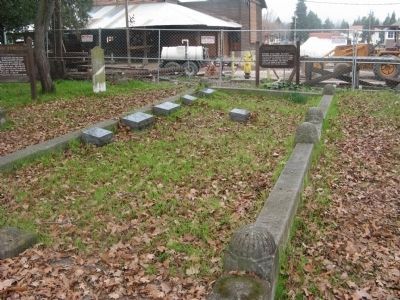
Margaret Tehan Dobbel, the granddaughter of Jeremiah and Ellen Fallon. She was born in Jeremiah Fallon’s home, Dublin, 1874. She married Julius Dobbel and had 13 children. They raised cattle and sheep at Rice, Camel, Dougherty and Donlon Ranches. — — Map (db m201556) HM
An early settler from Tennessee, he bought 10,000 acres from Jose Maria Amador for $2.20 per acre. He was chairman of the first board of Alameda Co. in 1853. He had the Hawthorn trees planted in the cemetery, Carlo, his faithful dog, outlived him by . . . — — Map (db m201564) HM
Son of Jeremiah and Ellen Fallon. Regarded with great respect by people of the area for his honesty and integrity. Renowned for his fine horsemanship and proficiency with the riata (rawhide rope), which sometimes was up to 70 feet in length. He . . . — — Map (db m201554) HM
In 1859, Edward Wiard purchased a 115-acre plot in what
later became Emeryville and built a horse racetrack that
covered most of his property. The Oakland Trotting Park
opened on the Fourth of July 1871. The track was one
mile long and . . . — — Map (db m238949) HM
In 1911, Joseph and Marie Nunes lived in Centerville with their six children. Joseph opened a shoe repair shop and also repaired harnesses and saddles. The family lived in a house that was a former library. In front of the house there was a hitching . . . — — Map (db m213033) HM
Henry Curtner, an enterprising American, arrived at Mission San Jose in 1852. He worked for farmers in the area. In 1856 Curtner returned home to Indiana to marry Lydia Kendall. By 1868 he was able to purchase the portion of Rancho Agua Caliente . . . — — Map (db m211572) HM
The former Salt Evaporation Ponds in front of you have been divided into sections with different levels of saltiness. By studying water conditions, bird use, and prey abundance here, researchers will learn how to create the most opportunities for . . . — — Map (db m206505) HM
As part of the City of Hayward’s commitment to sustainability, we promote healthy, environmentally-sound landscape practices.
Since 2009, the City required that large civic landscape projects be verified as Bay-Friendly Rated Landscapes. This . . . — — Map (db m208210) HM
Try to imagine what Anza’s expedition saw when it first arrived in the East Bay. The creeks teemed with salmon and trout, grizzlies and elk roamed free, shore birds flocked by the millions, and it was home to dozens of communities of Ohlone/Bay . . . — — Map (db m208204) HM
Marker Once:
Once plentiful on California beaches, western snowy plovers now face extinction due to habitat loss from coastal development and beach recreation. Fortunately, dry salt ponds offer these sparrow-sized shorebirds an . . . — — Map (db m207071) HM
Dramatic reductions in tidal wetlands over the past 200 years, due to urban development, agriculture, and salt production, resulted in significant declines in marsh-dependent wildlife. In addition to providing critically important habitat for fish, . . . — — Map (db m207017) HM
Marker One:
Balancing the needs of people and wildlife has long challenged Californians. Gold Rush-era settlers believed the best value of Baylands came from converting them to salt ponds, housing, or other human uses. Today we recognize . . . — — Map (db m207078) HM
There were many outbuildings on the Meek Property. In the early 1890s, the family built the carriage house for carriages and horses. The interior of the carriage house has been restored to replicate how the original building might have looked when . . . — — Map (db m210345) HM
This land has attracted people's interest for millennia. A network of ancient trade routes once linked indigenous people of these different regions: the Ohlone tribe of the San Francisco Bay Area, the Bay Miwoks of the Delta and Mt. Diablo, and . . . — — Map (db m197612) HM
Brushy Peak is a 1,702-foot landmark at the juncture of the San Francisco Bay Area, the California Delta, and the Central Valley. The peak and its environs have been recognized as sacred by generations of native Californians. Due to its . . . — — Map (db m198223) HM
Lake Merrit, once a tidal marsh system and estuary
with an inlet to the Bay, was home to a variety of
wildlife including leopard sharks and bat rays.
Sightings of these creatures likely inspired the
stories of sea monsters in the Lake. Such . . . — — Map (db m163099) HM
First Official Wildlife Refuge in the United States
Established as a State Game Refuge in 1870
Remodeled 1962
Oakland City Council
John C. Houlihan, Mayor • Felix F. Chialvo, Vice Mayor • Harry R. Lange • Fred Maggoria • Dan Marovich • . . . — — Map (db m218623) HM
The naming of the Rainbow Trout species was based on fish taken from the San Leandro Creek drainage. In 1855, Dr. W.P. Gibbons, founder of the California Academy of Sciences, was given three specimens obtained from the creek. He described and . . . — — Map (db m100566) HM
At roughly 45 feet high, the Meadowlark Dairy silo was a distinctive visual landmark. This circular paving marks the silo’s approximate location. The original silo and barn were much larger. Silage, fodder for animals, is created by partially . . . — — Map (db m196197) HM
Since the operation of Chabot reservoir in 1876, four different water companies have managed the lake. Their staff led colorful lives on this hill as they kept an eye on this valuable resource.
In 1904, William Dingee, then head of CCWC, . . . — — Map (db m71707) HM
Named in honor of Antonio Maria Sunol, merchant, naval man and cattlebarron, who acquired a Spanish / Mexican land grant in 1840.
Along with the vast ranching and fertile farmlands, coal and gold were found in the Sunol area in the 1870’s. . . . — — Map (db m24495) HM
A lifelong fourth generation rancher from Ione with summer ranges in the mountains near Kirkwood, Benny Brown made his first appearance in this arena in 1951 at the age of 13. The event was cattle penning. His mother was his partner, and he won . . . — — Map (db m42453) HM
You protected us on the field of battle. You watched over our eternal rest. You will not be forgotten. We are forever grateful.
Dedicated in memory of Specialist 4th Class George D. (Doug) Deitrick and his scout dog, Egor (75IM), . . . — — Map (db m93604) WM
In the early 19th century many canneries operated throughout California. The rich agricultural and fishing areas of east Contra Costa County hosted a number of canneries and packing sheds. The picturesque Antioch waterfront was home to two canneries . . . — — Map (db m18292) HM
HISTORY
Round Valley Regional Preserve was once home to California Indians. It was probably a boundary between several different tribal groups, an area where members of East Bay and San Joaquin Valley groups met periodically to trade and . . . — — Map (db m199528) HM
Within a three-foot thick sandstone bed, seen on both sides of the trail, is a layer of rock containing fossil Turritella aedificata snails. Note the slender tapered shape that has led to calling them “Tower Shells.” They are also . . . — — Map (db m200818) HM
The Orinda Garage and
Miss Graham's Riding
Academy were built
from 1923 - 25 by E.I. de
Laveaga in the Spanish
Mediterranean style.
His uncle ran the
automobile garage on
the corner of Avenida
de Orinda, which still
exists today. . . . — — Map (db m154903) HM
San Pablo Creek, Orinda’s biggest creek, flow from the Glorietta neighborhood, through both side of downtown Orinda, all the way to Wagner Ranch Nature Area, and into the San Pablo Reservoir. The City of Orinda has many other creeks, as you . . . — — Map (db m222683) HM
At Forest Home Farms, much of the food was home grown. The Boones grew vegetables for their own use and raised cattle on a leased ranch in Livermore which they brought to the meat house, in front of you, for processing. This structure was . . . — — Map (db m202114) HM
Man power or animal power – that was the choice for most farmers up until the 1930s to till, sow and reap their crops. Gas engines existed from the early 19th century but were only able to do stationary farm and household chores like grinding grain, . . . — — Map (db m202111) HM
A farm is a complicated endeavor to run. Equipment must be maintained, repaired and stored; crops must be planted, harvested, and kept dry until needed; and farm animals must be fed and sheltered. Specialized buildings are needed, serving many . . . — — Map (db m202106) HM
Animals were an essential part of the ranches and farms of the last century. Horse were especially important to farm life, for they provided transportation, pulled plows, and other farm equipment, hauled cargo, and even powered machines that did . . . — — Map (db m202108) HM
The heroic voyage of this crossbreed steer; floating downriver from Klamath Glen and up the coast into Crescent City Harbor, was an inspiration to the flood victims of Klamath. He embodied their courage, stamina, and indomitable spirit. A living . . . — — Map (db m91941) HM
Livery stables were the service station of the 19th century. They provided hay, grain, stables for the animals and vehicle repair. They also kept horses, mules, carriages and wagons to rent, trade or sell. One of several liveries stood here. The . . . — — Map (db m215364) HM
As miners exhausted the more easily-worked placer gold deposits in Sierra streams and gulches, they began to move into other likely areas. The miners tunnels horizontal drifts into hillsides, or using a method called “coyoting,” dug short vertical . . . — — Map (db m215204) HM
Sequoia Park Zoo has been an integral part of Eureka's community since 1907. Founded on land acquired from the Glatt family to be used as a city park, the zoo has provided a home for many cherished animals and fond family memories. For more than a . . . — — Map (db m219657) HM
"Big Diamond", a circus elephant, expired near here in 1927. His skinned hulk was buried. Years later, his bones were unearthed and speculation arose about a
Humboldt Mastodon until investigators were enlightened
by people who'd seen the . . . — — Map (db m22274) HM
Conservationist, author, anthropologist, a founder of the Save-the-Redwoods League.
This area of 1600 acres, habitat of the last surviving herd in California of Roosevelt Elk is established as a memorial by
· De Forest Grant
· John D. . . . — — Map (db m32569) HM
The Plank Road once provided the only means of crossing the treacherous Imperial Sand Dunes. This historic road spurred settlement of Imperial County and development of San Diego at the start of the automobile age. — — Map (db m50618) HM
A hybrid offspring of a male donkey, commonly known as a jackass, and a female horse. Characterized by long ears, a braying voice and short mane, this patient and sure-footed animal has been used as a beast of burden throughout the world. . . . — — Map (db m92729) HM
For more than a century, the 20 Mule Team has been the symbol of the Borax industry — on product labels, in history books, and on television. The status is well-earned; mule teams help solve the most difficult task that faced death Valley Borax . . . — — Map (db m194275) HM
In 1916, the citizens of Independence
purchased a 40 acre tract of land and
donated it to the State of California
for the building of a fish hatchery.
This structure was the result. The
first trout were produced in 1918, and
since that . . . — — Map (db m218383) HM
Mt. Whitney Pack Trains was established in 1921 by Frank Chrysler
and Ted Cook. In 1946, Norman B. Livermore, Jr. ("Ike") saw the need
for a large pack operation to handle the Sierra Club trips. He
acquired over 130 horses and mules by purchasing . . . — — Map (db m242716) HM
Basque immigrants from the Pyrenees mountains of France and Spain were drawn to California by the Gold Rush. They found providing the miners with lamb and wool more profitable than digging for gold.
Young Basque men would follow their sheep . . . — — Map (db m237371) HM
A true desert icon is the legendary 20-mule team. Longer teams had previously been used, but it is this one that has earned an enduring place in western history. In 1883 William Coleman introduced the teams to haul borax 165 miles from Harmony Borax . . . — — Map (db m286049) HM
Back From the Brink of Extinction
Half a million tule elk once roamed
the marshes and grasslands of
California. The Gold Rush began an
era of commercial hunting and
agricultural practices that decimated
the elk and their . . . — — Map (db m184928) HM
The first and only "Camel Brigade" of the United States Army Commanded by Lt. Edward F. Beale 1857-1864 San Antonio, Texas to Fort Tejon, California — — Map (db m140695) HM
In 1856 the U.S. Army started an experiment using camel for supply transport in the southwest. The camels proved ill suited to the American southwest.
In November 1859 a civilian contractor turned over 28 camels to the Army at Fort Tejon. . . . — — Map (db m32821) HM
Tule elk are one of three subspecies of elk found in California,
and are the smallest of all elk species in North America. They are
related to deer, but are much larger. Tule elk are endemic to
California, meaning they are only found in . . . — — Map (db m280827) HM
Built by Joe Gallinger in 1880, it was purchased in 1926 by Jim and Lucinda (Callie) Wiggins Brite. Upon Lucinda's death in 1944, the Davis family purchased the house. It was customary to drive sheep and cattle along Curry Street to the railroad . . . — — Map (db m52890) HM
The "T-Hacha-P" logo was taken from an early fruit crate label. The steam powered combine shown is followed by a horse drawn water wagon, with Tehachapi Peak in the background. Jake Jacobsen, a former mayor and civic leader, along with his brother . . . — — Map (db m53115) HM
Avelino Martinez was of Mexican, Indian and Chinese descent, four feet-four inches tall and thirteen years of age when he came with a group of drovers to the United States from Sonora, Mexico, searching for his father. He worked as a groom for . . . — — Map (db m52918) HM
Freshwater Marsh
A freshwater marsh once surrounded Bloody Island prior to land reclamation
efforts that began in the late 19th century. Native plants within marshes around
Clear Lake included tules (Scirpus acutus), rushes (Juncus sp.), . . . — — Map (db m143781) HM
A Future President’s Ranch
By 1951, then actor Ronald Reagan purchased several parcels creating the approximately 357-acre ranch that spreads out before you and runs for 1.5 miles along Mulholland Highway. For the next ten
years, . . . — — Map (db m236739) HM
In dedication to the Firefighters who heroically defended Wildlife Waystation throughout the entire December 2017 Creek Fire. Our eternal gratitude for their selfless act of bravery - Cal Fire, Contra Costa County Fire, Los Angeles County Fire Dept, . . . — — Map (db m138093) HM
A Brief History
The barn and two-room bunkhouse/store that were still being utilized at Adams’ Pack Station in 2011 were built 75 years earlier by the original owner of what has become the last remaining pack station in southern California. . . . — — Map (db m122240) HM
Anita May Baldwin
was the only daughter born to Arcadia's founder and owner of
Rancho Santa Anita, Elias J. "Lucky" Baldwin and his third wife,
Jane Virginia (Jennie) Dexter. Known for her generosity and
compassion, Anita Baldwin was a . . . — — Map (db m198153) HM
Oldest operating racetrack in California - opened Christmas Day 1934.
Founded by Dr. Charles H. Strub & Associates.
Designed in Art Deco style by architect Gordon B. Kaufmann.
Introduced Santa Anita Handicap in 1935 - oldest . . . — — Map (db m201111) HM
Set against the backdrop of the San Gabriel Mountains in an area of near year-round ideal weather, Santa Anita Park has been considered one of the most beautiful and finest horse race tracks in the world since its opening on Christmas Day 1934. . . . — — Map (db m198317) HM
Record — 89 starts: 33-15-13.
Won inaugural Hollywood Gold Cup 1938.
Defeated War Admiral in 1938 match race.
Lost Santa Anita Handicap by a nose 1937, 1938.
Won handily in third attempt 1940.
Champion older male 1937, 1938. . . . — — Map (db m201113) HM
Located along Arcadia’s Huntington Drive, just east of Santa Anita Avenue, the Thoroughbred Racing Walk of Champions is a tribute to the horse racing community that has been an integral part of Arcadia history for more than 100 years.
The . . . — — Map (db m145251) HM
Record — 20 starts: 19-1-0.
Owned by Jerry & Ann Moss, trained by John Shirreffs.
Purchased as a yearling for $60,000; Earned $7.3 million in 4-year racing career.
Won 17 graded stakes races, including 13 Grade 1 events.
Won Lady's . . . — — Map (db m201116) HM
The sport of big game fishing originated in Avalon when Charles Frederick Holder caught a 183 pound Blue Fin Tuna with sport fish tackle on June 1, 1898. This angling milestone inspired him to form the Tuna Club of Santa Catalina Island, an . . . — — Map (db m49856) HM
The Tuna Club of Avalon marks the birthplace of modern big game sportfishing. In 1898, led by Dr. Charles Frederick Holder, the club's founding members adopted the rules of conduct stressing conservationist ethics and sporting behavior. Today, their . . . — — Map (db m49678) HM
This mural is dedicated to the annual Avalon Fourth of July parade with iconic
attractions headed to the Casino area to line up in their positions for the parade.
The USC Marching Band always led the parade.
The Budweiser Clydesdale . . . — — Map (db m300823) HM
In celebration of Gay’s Lion Farm. From its start on July 1, 1925, until it closed in December of 1942, the roar of hundreds of lions could be heard throughout the valley, into the hills and beyond. — — Map (db m122058) HM
This block is the site of:
First brick school house in Los Angeles known as School No. 1, built 1854-1855;
Butterfield Overland Mail Company office and corral, 1858-1861;
Office of U.S. Quartermaster, 1861;
Corral for camels from Fort . . . — — Map (db m164547) HM
Sandstone trough used for feeding crushed acorns
to livestock, hewn in 1897 by the Schweikand
family on their San Fernando Valley ranch.
Presented in 1930 by
the Department of Water and Power
of the City of Los Angeles. — — Map (db m174513) HM
The Pony Express was an ultra-fast but short-lived mail service that ran between the East and West from 1860 to 1861. The roughly 1,900-mile route began in Missouri and passed through Wyoming and Utah before crossing the Sierra Nevada mountain . . . — — Map (db m76323) HM
This Griffith Park canyon area served as the City’s Zoo from its founding in 1912 to 1965, when the Los Angeles Zoo moved to its current location about two miles north of where you are currently standing. Many of the walls, grottos, and other . . . — — Map (db m128091) HM
This area served as the City's Zoo from its founding in 1912 until 1965, when the Los Angeles Zoo moved to its current
location about two miles north of where you are currently standing.
Many of the walls, grottos, and enclosures you see . . . — — Map (db m239129) HM
Chester Stock, Ph.D., January 28, 1892 - December 7, 1950. Paleontologist. Chief Curator of Science - Los Angeles County Museum, Chairman of the Division of Geological Sciences - California Institute of Technology who, encouraged by the foresight . . . — — Map (db m51436) HM
This tar trapped lost of meat-eaters, like dire wolves and saber-toothed cats, because they couldn't resist this temptation. Scientists think the sight and smell of other animals stuck in tar attracted carnivores. Carnivores might tear off a trapped . . . — — Map (db m292179) HM
How did these different types of fossils end up in a tar pit together?
For thousands of years, crude oil has been naturally rising up to the surface here forming shallow puddles of sticky goo called asphalt seeps.
Tar pits are . . . — — Map (db m291248) HM
Columbian mammoths lived right here during the last ice age. We call it the Ice Age because thick sheets covered parts of the globe and cooled the planet. Even parts that weren't ice covered like Los Angeles were cooler than now. We study fossils . . . — — Map (db m291256) HM
This historic 8-acre site was once part of Marwyck Ranch, a famous 130-acre
Thoroughbred breeding farm, co-owned by actors Barbara Stanwyck and Zeppo
Marx. The mansion visible atop the hill was built for Stanwyck in 1937.
Comedian Jack Oakie . . . — — Map (db m151044) HM
Los Angeles' "Smithsonian"
To those who believe Los Angeles has no past - welcome to the Natural History Museum.
Here is California in the age of reptiles - not the Hollywood kinds, but the real thing, like the California . . . — — Map (db m216968) HM
Marge Feinberg’s 1974 Master’s Thesis envisioning a wilderness trail encircling the San Fernando, La Crescenta and Simi Valleys and adjacent mountain ranges led to a California law establishing the Rim of the Valley Trail Corridor in the Santa . . . — — Map (db m139166) HM
Coney Island of the
Pacific, as Venice was
called, had wild roller
coasters, beautiful
carousels, giant slides,
fun houses, live camel
rides, miniature trains,
and much, much more. — — Map (db m138626) HM
Established at Wilmington in 1862, Drum Barracks became the United States military headquarters for Southern California, Arizona, and New Mexico. A garrison and base for supplies, it was a terminus for camel pack trains operated by the army until . . . — — Map (db m85152) HM
The hills where you stand are a part of one of the world's geological wonders, The San Andreas Rift - A great fault and earthquake zone.
Because of the movements along this fault zone, the pink and tan colored Punchbowl rocks seen below . . . — — Map (db m115197)
Built originally in 1925 for Will Keith Kellogg
as his winter home for the Kellogg Family
on the site of his Arabian Horse Ranch.
Donated to the State of California by the
W.K. Kellogg Foundation in October 1949
to benefit the . . . — — Map (db m260044) HM
Believing that education offers the greatest
opportunity for really improving one generation
over another, W.K. Kellogg gave his Arabian
Horse ranch to the state of California for this
Cal Poly campus in 1949. The Arabian herd . . . — — Map (db m260045) HM
The Palos Verdes Peninsula supports a plant community called coastal bluff scrub that contains elements of coastal sage scrub. Coastal sage scrub communities are composed of soft, witty sub-shrubs. Coastal sage scrub seen at this site is dominated . . . — — Map (db m81923)
Located approximately 20 miles from the mainland, Santa Catalina Island rises 2000 feet above sea level, approximately 500 feet higher than the Palos Verdes Peninsula. The island is over 20 miles long, making it the longest of the eight California . . . — — Map (db m157646) HM
Mule Skinners kept leather-gear, medicine, tools and supplies in this
building. Mule power was used extensively to haul materials, and power
various types of equipment during the construction of the Los Angeles
Aqueduct and Power Plants 1 and . . . — — Map (db m264097) HM
This herd traces its roots to 1962, when Walt Disney donated a herd of American Bison to
William S. Hart Regional Park. To discourage inbreeding, the County of Los Angeles has exchanged some of its animals with other facilities over the years; . . . — — Map (db m129211) HM
The California Bear Project was developed in August 2004 by the city and bears were
installed from 2005 to 2018 throughout Santa Clarita.
Painted by artist and long-time
Canyon Country resident Frank Rock, the Santa Clarita History . . . — — Map (db m245537) HM
The grunion is a small fish that has swarmed
sandy beaches from Point Conception to Baja
California for centuries, creating a spectacle
unique to the Southern California area. At night
grunions "run" up on shore during annual high
tides in . . . — — Map (db m277004) HM
In 1885, Edwin Cawston chartered a ship for the purpose of transporting from South Africa to America some of the best ostriches obtainable in the world. Of the original 50 fine birds only 18 survived the five week voyage to Galveston and hazardous . . . — — Map (db m130144) HM
5299 entries matched your criteria. Entries 201 through 300 are listed above. ⊲ Previous 100 — Next 100 ⊳