The Independent Order of Odd Fellows, IOOF, is an international fraternal organization that was founded on the North American continent in 1819. The command of the IOOF is to "visit the sick, relieve the distressed, bury the dead and educate . . . — — Map (db m158806) HM
At 2:14 AM on March 24, 1929, the Big Slide on the north side of Gravel Mountain tore loose and buried the Bonanza Empire Chief main office building, a dining hall/bunk house, and a five-room bunkhouse. Two cooks - Mrs. Mayme Watson and Mrs. E.L. . . . — — Map (db m177866) HM
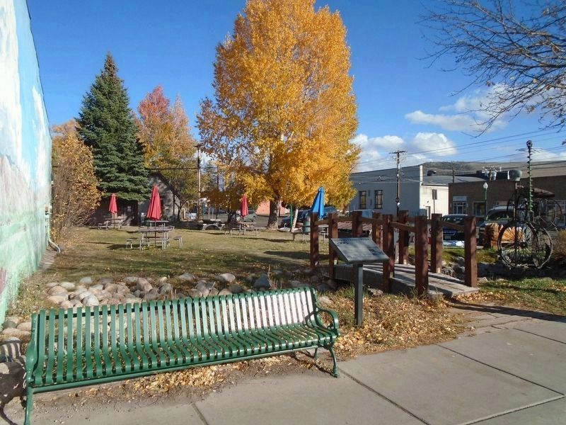
In the late 1800's, the White Ash mine was the largest coal mine in Colorado. Its livelihood dominated Golden and overshadowed even the famous Coors brewery. It produced some of the best and hottest burning coal and was named for the white ash that . . . — — Map (db m152780) HM
First plaque:
Dedicated
to the memory of
Joseph Allen
William Bowden
William Collins
John Collins
Henry Huesman
David Lloyd
Joseph Hutter
John Morgan
John Murphy
Rich Rowe
Who lost their lives here on
Sept. 9th, . . . — — Map (db m152733) HM
Residents of La Plata County came forward time and again to meet the challenges presented by the fires. Each person became a hero in his or her own way.
As days turned into weeks, La Plata County fell victim to the fire. Where you are now . . . — — Map (db m160441) HM
This man-caused forest fire burned 26,000 acres consuming approximately 150,000,000 board-feet of timber. Reforestation by direct seeding and planting of seedling trees was started in 1911 and continues today.
The project was financed by federal . . . — — Map (db m58966) HM
Disturbances like fire, insects, and disease help maintain diversity in a forest by creating a mosaic of vegetation. Without disturbances, forest are less resilient and less healthy.
Fire helps create the scenic variety, particularly the aspen . . . — — Map (db m160444) HM
The large building in the foreground is Durango's first high school. Above it is the new La Plata County Courthouse. The Boulevard, today's Third Avenue, is the street running between the two. The Ladies' Literary Society planted trees in the . . . — — Map (db m160451) HM
On the afternoon of June 9, 2002, a human-caused spark ignited the Missionary Ridge Fire, and a new chapter in the history of our community began.
On June 25, firefighters were further taxed when the Valley Fire started in the Falls Creeks . . . — — Map (db m160439) HM
Hidden Valley Creek, below, once flowed directly
into Horseshoe Park before its course was
diverted by an Ice Age glacial moraine. Today,
beaver continue to alter the creek's course by
building dams that have created the chain of
ponds visible . . . — — Map (db m164184) HM
A day of festivity was followed by one of the darkest in American Labor history.
The state militia was on guard
Because tensions between the strikers and the company had been steadily escalating, the state militia was stationed on . . . — — Map (db m100513) HM
On April 20, 1914, the State Militia unleashed an un-warranted attack on striking coal miners and their families living in a tent colony at this site. Eleven children and two women suffocated in a cellar beneath a tent when flames engulfed the . . . — — Map (db m100509) HM
For centuries, miners have been taking canary birds down into their mines to warn them of potential disaster. If a tunnel or shaft collapses or is blocked, thereby diminishing the oxygen supply, the canary will be the first to react, usually dying, . . . — — Map (db m100501) HM
Panel 1
The Ludlow Massacre
By April 1914, the striking coal miners encamped at Ludlow (ten miles northwest of here) had nothing to lose but their lives. Poor, powerless, largely immigrant, they had held out for . . . — — Map (db m97716) HM
Twenty-three mile Rim Rock Drive was built almost entirely by using picks, shovels, and sheer muscle to remove massive rock and debris. The engineering skill of the workers can be seen today in the tunnels and stonework. With construction came a . . . — — Map (db m159715) HM
On July 16, 1988, a lightning-caused wildfire burned over 15,000 acres of public and private land here as far as the eye can see.
The “I Do” fire, named for a Bureau of Land Management (BLM) firefighter who was married on that day, . . . — — Map (db m114442) HM
Before you, on the east side of Red Mountain Creek, is the headframe of the Yankee Girl Mine.
In 1882, prospector John Robinson discovered a massive "pipe" of silver ore and staked the Yankee Girl claim. He developed an exploratory shaft and . . . — — Map (db m179031) HM
Who were swept to their deaths 1,000 feet north of this marker in the East Riverside Slide Sunday March 3, 1963 while answering the call to Christian duty of his pastorate in Silverton, Colorado
In Honor
Of the many friends & . . . — — Map (db m179139) HM
Panel 1: Mt. Harris 1914-1958
The Colorado-Utah Coal Company's Harris Mine was opened June 12, 1914 under the direction of George Homer and Bryon Harris. The camp was first named Harris, but later changed, due to another established post . . . — — Map (db m116920) HM
The La Plata Miner newspaper began publication on July 10, 1875, after newspaper pioneer John R. Curry managed to haul an old press by pack mule over Stony Pass. The Silverton Standard newspaper began operations in 1889. The two newspapers merged . . . — — Map (db m176710) HM
"One feels," wrote an early Silverton settler, "as if he is shut off from the rest of the world." A fair assessment: In 1874, when its first buildings appeared, the hamlet lay 125 miles from the nearest post office. Though railroad service . . . — — Map (db m177495) HM
Up In Flames
Victor was founded in 1893 at the foot of Battle Mountain – a stone’s throw from where the richest gold mines in the Gold Camp were eventually located. Underground mining was very labor intensive so, like many gold rush . . . — — Map (db m46798) HM
Designed by John J. Huddart and Greeley architect Sidney Frazier, the State Armory served as the training facility for the Greeley unit of the Colorado National Guard and housed sporting events and community activities. It served as a morgue when a . . . — — Map (db m203417) HM
In memory of the construction workers who died at L'Ambiance Plaza April 23, 1987
Michael Addona • Augustus Allman • Glenn Canning • Mario Colello • Francesco D’Adonna • William Daddona • Donald Emanuel • Vincent Figliomeni • Herbert Goeldner, . . . — — Map (db m91977) HM
When the Kohanza Reservoir Dam gave way on the night of February 20, 1869, sixty acres of water, ice, lumber and debris roared down north Main Street. It took shops, homes, bridges and factories with it and several lives were lost. A combination . . . — — Map (db m72857) HM
On the Night of December 8, 1895 a fire broke out in the undertaking and furniture store of Bedient & Mead at the northeast corner of Main St. and Bailey Ave. The fire spread rapidly to the adjoining Western Union telegraph office and Barhite . . . — — Map (db m31586) HM
The East Side of Main Street as it appeared the day after the devastating fire of 1895. (See Panel #17 for a description of the fire.)
Barhite & Valden General Store and the Western Union telegraph office next door were located just . . . — — Map (db m31585) HM
In Memory of Lt. Rodney L. Stokes of Liberty, Mississippi, and Sgt. Julius G. Skyberg of DeSmet, South Dakota Who Lost Their Lives While Fulfilling Their Duties When Their Airplane Crashed on This Spot on Sunday January 23, 1944. Placed Here by . . . — — Map (db m77504) HM WM
On this site stood an African-American neighborhood hidden behind Main Street and Elm Street. Buildings here were given "½" numbers as street addresses. The residents made up the majority of Westport's African-American population, many of whom . . . — — Map (db m226766) HM
Canoe Club, circa 1910- The club house was near the present-day nursery.
Note: The house in back was lost in the flood of 1955
Ice on the river, Circa 1900
View of the river from the tracks, Circa 1910
Station, circa 1911, . . . — — Map (db m92462) HM
Located at the west end of Farmington, the village of Unionville was first recognized as
such by the U.S. Postal Service in 1834. Earlier it was called Langdon’s Quarter and
then Union District. Residents took full advantage of the Farmington . . . — — Map (db m134927) HM
During the week of August 12, 1955, the Farmington Valley was hit by the edge of Hurricane Connie. The area received heavy rainfall that saturated beds of the Farmington River. The following week, Hurricane Diane swept through the Atlantic Coast, . . . — — Map (db m230293) HM
This tree is dedicated to the people and community spirit that helped Cornwall recover from the July 10, 1989 tornado. Town leaders at that time were:
Richard Dakin First Selectman
Patsy Van Doren Selectman
Steve Hedden . . . — — Map (db m41830) HM
"So numerous were the many acts of heroism, rescue of the sick and invalid, neighbors' concern for neighbors, that it would be impossible to chronicle them with slighting someone deserving of great credit." - Torrington Register, August 26, . . . — — Map (db m54559) HM
Camp Hadley was home to "Roosevelt's Tree Army." These young men, 17-25 years old, came from families of unemployed parents during the Great Depression. They joined the Civilian Conservation Corps (CCC) and earned one dollar a day, up to 30 days . . . — — Map (db m243157) HM
Leased to Boston Hartford & Erie R.R. • 1869 Leased to New York & New England R.R. • 1886 Leased to New England R.R. • 1896 Leased to N.Y., N.H., & H. R.R. • 1898 Centennial Exercises sponsored by the New London Railroad Association May 11, 1940 . . . — — Map (db m172115) HM
This fiberglass Japanese fishing boat was swept out to sea during the deadly March 11, 2011 Japanese earthquake and tsunami, then drifted across the Pacific Ocean for a decade. It landed . . . — — Map (db m227088) HM
On August 19 1955, the Quinebaug River, fueled by rain from
Hurricane Diana, overflowed its banks and flooded Putnam. Unlike earlier
floods of the 1880s and 1930s, the flood of 1955 caused extensive
damage. As the river carved a new channel . . . — — Map (db m126037) HM
Bombay Hook Island - Bygone Days
The series of illustrations tell the story of dramatic changes to the landscape just east of where you stand over the past 200 years...from a riverine one in the 1700's and 1800's...to a large . . . — — Map (db m247068) HM
This poster depicts the heyday of the grand resort that existed at nearby Woodland Beach during the late 1800's to early 1900's. Note the passenger train, steamship, grand hotel, dance hall and other resort facilities. As many as a thousand visitors . . . — — Map (db m247066) HM
"Ho! For Collins Beach!"
Back in the 1800's [unreadable] The famous Hygenia House hotel at left [unreadable] dance pavilion and restaurant. A merry-go-round, bath house and other amenities were also on hand to . . . — — Map (db m247122) HM
This bridge is named for local heroine Michelle Newton Smith, an Emergency Medical Technician with the Delaware City Fire Co. Smith, who dedicated her life to helping others, was aiding an injured motorcyclist along U.S. 13 when she was struck by an . . . — — Map (db m213305) HM
You are standing near the site of the last major explosion to occur in the Hagley Yard. On January 2, 1920, more than 50,000 pounds of gunpowder exploded, killing five DuPont workers, destroying two building and damaging many others. Although it . . . — — Map (db m231902) HM
Power of Powder
When gunpowder ignites it becomes an expanding gas that generates a tremendous amount of force. If the gas is contained in an enclosed space it can blow apart its container as it expands. One ounce of gunpowder has enough . . . — — Map (db m231898) HM
In the summer of 2020, two storms—Hurricane Isaias on August 4 and a tornado on August 7—struck the Winterthur landscape, felling over ninety trees in their wake. This 300-year-old white oak tree (Quercus alba), which had been an icon . . . — — Map (db m231940) HM
The Faithful Steward, bound from Londonderry, Ireland to Philadelphia, ran aground on a shoal September 1, 1785 with 249 passengers aboard. Stormy weather drove the vessel toward shore where it became stranded in 4 fathoms (24 feet) of water within . . . — — Map (db m108226) HM
Dedicated to the honor of and in loving memory of the victims of the April 7, 2005 shooting
Jamell Weston (10-3-80 to 4-7-05) •
Davondale "Pete" Peters (8-24-76 to 4-7-05) •
Marcus Cannon •
Carla Green •
Marsha Hankerson •
Anthony . . . — — Map (db m164970) HM
Theodore C. Freeman was born in Haverford, Pennsylvania on February 18, 1930.
When he was fifteen months old, Ted's family moved to Lewes, Delaware.
As Ted grew up, aviation became his passion. On his 16th birthday, Ted earned his pilot's . . . — — Map (db m198890) HM
Theodore C. Freeman was born in Haverford, Pennsylvania on February 18, 1930.
When he was fifteen months old, Ted's family moved to Lewes, Delaware.
As Ted grew up, aviation became his passion. On his 16th birthday, Ted earned his pilot's . . . — — Map (db m114560) HM
On May 25, 1798 at 4:00 pm, H.M. Brig DeBraak capsized and sank off the coast of Cape Henlopen, Delaware during a sudden squall. This memorial honors the thirty-three members of the eighty-five man crew who were lost at sea.
James . . . — — Map (db m38436) HM
Known as the “Great White Hurricane,” the Blizzard of 1888 was one of the most devastating weather events in recorded history. Affecting coastal states from Virginia to Maine, this paralyzing storm resulted in widespread death and destruction. With . . . — — Map (db m19316) HM
Spanish gold doubloon and silver "pieces of eight" can be found from the many Spanish ships that wrecked along our shore entering the Delaware Bay. — — Map (db m232968) HM
Dedicated in memory of the longest serving member of Engine Company 17, Wagon Driver Jackson H. Gerhart.
He was appointed on Feb. 3, 1963 and retired on Sept. 30, 1994. He succumbed to injuries sustained in the line of duty while operating . . . — — Map (db m111800) HM
In memory of
those who
lost their lives
on June 22, 2009
Mary "Mandy" Doolittle
Veronica Dubose
Ana Fernandez
Dennis Hawkins
Lavonda "Nikki" King
Jeanice McMillan
Ann Wherley
David F. Wherley, Jr.
Cameron . . . — — Map (db m110062) HM
The Legacy Memorial Park is dedicated to honor the nine lives lost on June 22, 2009 as a result of an unprecedented train collision. Designed collaboratively by Hunt Laudi Studio with sculptor Barbara Liotta and built through a partnership . . . — — Map (db m115359) HM
In memory of the millions
of innocent victims
of a man-made famine
in Ukraine engineered and
implemented by Stalin's
totalitarian regime
Ukrainian:
У пам'ять . . . — — Map (db m90872) HM
Before there was "Adams Morgan," this crossroads lent the neighborhood its name: "18th and Columbia." Here you could catch a streetcar to just about anywhere and buy nearly anything.
But back in 1922, 18th and Columbia witnessed a tragedy. . . . — — Map (db m130711) HM
On May 17, 1954, the U.S. Supreme Court made its historic decision in Brown vs. Board of Education to end segregation in public schools. One of the lawsuits that made up this decision involved the DC schools, and the following September, . . . — — Map (db m130863) HM
Generations of Americans have given themselves to help others at home and around the world through the American Red Cross, generously donating time, money and blood. They have helped feed, shelter, and clothe those in need—from thousands of . . . — — Map (db m131073) HM
Before there was a DC Fire Department, companies from two then-separate towns — Georgetown and Washington — provided local fire protection. In 1789, Georgetown citizens purchased a hand-pumped engine and fire buckets with funds raised . . . — — Map (db m113420) HM
The August 23, 2011, magnitude 5.8 earthquake left the flying buttresses in bad shape. The shaking cracked buttress flyers, twisted buttresses pinnacles and shook stones apart. To stabilize the stones and prevent major damage in the case of a future . . . — — Map (db m203134) HM
The massive 50-ton, 40+-foot tall grand pinnacles at the top corners of the central tower sustained some of the worst earthquake damage—cracking, twisting and literally popping the top off one of the pinnacles. The eight smaller intermediate . . . — — Map (db m203127) HM
Look up—can you find our decapitated gargoyle? Only the stump of his neck remains after the head was removed for safety reasons.
Only one gargoyle was damaged in the August 23, 2011, magnitude 5.8 earthquake. This gargoyle, known as the . . . — — Map (db m203130) HM
Carvings of 16 Old Testament prophets decorate the grand pinnacles of the south transept. The south transept withstood some of the worst damage in the August 23, 2011, magnitude 5.8 earthquake. Since the earthquake, the western grand pinnacle was . . . — — Map (db m203132) HM
The buttresses that run along the north and south nave generally sustained less damage than the freestanding flying buttresses of the east end, as the lower portions of these buttresses are "engaged" in the lower part of the nave exterior walls. . . . — — Map (db m203141) HM
The north side did not come through unscathed on August 23, 2011. Like the corresponding grand pinnacles on the south transept, the grand pinnacles of the north transept also cracked and twisted. Several of the delicate spires of the secondary . . . — — Map (db m203142) HM
The Earthquake
On August 23, 2011, a magnitude 5.8 earthquake shook the East Coast, causing over $34 million in damage to Washington National Cathedral. While the Cathedral withstood the quake largely intact, buttresses cracked, large . . . — — Map (db m203126) HM
Energy from the 2011 earthquake traveled upward, like the energy traveling to the tip of a cracked whip. Most of the worst damage therefore took place at the tops of towers and buttresses. On the west towers the damage was mostly limited to the . . . — — Map (db m203138) HM
The limestone pinnacles were damaged in the August 23, 2011, earthquake here. The ground shook for less than a minute but caused the 301-foot central tower of Washington National Cathedral to whip back and forth. Some of the 50-ton pinnacles . . . — — Map (db m71202) HM
In the late nineteenth century, a rural retreat called the Woodley Inn rose near what became Massachusetts Avenue and 38th Street. Before the advent of air conditioning, wealthy families summered on the heights overlooking the city to escape the . . . — — Map (db m112151) HM
Lamont Park, across from the number 42 bus stop, was once the turnaround for the numbers 40 and 42 streetcars. Back in the 1940s, "when the conductor called 'end of the line,' passengers stepped onto a yellow wooden platform," recalled former . . . — — Map (db m130881) HM
Commemorating AFT members we have lost during the COVID-19 pandemic and renewing our commitment for safe and welcoming workplaces for all.
#WorkersMemorialDay
#IamAFT
Nagi Abraham •
Federico Acerri •
Arturo Aguilar • . . . — — Map (db m227903) HM
On August 23, 2011, a 5.8 magnitude earthquake occurred 84 miles southwest of Washington, D.C. As the earth shook, the Washington Monument sustained significant damage to many of its marble and granite blocks.
Although the monument remains . . . — — Map (db m70930) HM
Chestnut Blight Strikes!
First identified in 1904 in New York's Bronx Zoological Park, the chestnut blight is caused by an Asiatic fungus (Cryphonectrik parasitica) and is almost always lethal to the American chestnut. Moving through . . . — — Map (db m187482) HM
The corner of 14th and U Streets has been a city crossroads, a neighborhood gathering place, and a stage set for events that have shaken the city and the nation.
For city residents, it was the transfer place for crosstown streetcars and . . . — — Map (db m130793) HM
Dedicated to the Memory of the Victims of the U.S. Arsenal Explosion on June 17, 1864
Ellen Roche •
Julia McEwen •
Bridget Dunn •
W. E. Tippett •
Margaret Horan •
Johanna Connors •
Susan Harris
Lizzie Brahler •
Margaret . . . — — Map (db m80961) HM WM
Limestone of Lost Legacies is a mural project to memorialize five teens who lost their lives to gun violence in the 2017-2018 school year in the District of Columbia. The five lives being commemorated are a snapshot of the widespread epidemic of . . . — — Map (db m152722) HM
In the early evening of November 22, 1963, a clutch of people stood forlornly on this bridge spanning Suitland Parkway. They awaited the procession carrying the body of slain President John F. Kennedy from Andrews Air Force Base to Bethesda . . . — — Map (db m130723) HM
The body of John Wilkes Booth, assassin of President Abraham Lincoln, was brought to the Navy Yard for examination and identification aboard the USS Montauk. With the exception of Mary Surratt, the Lincoln conspirators (including Lewis Payne, . . . — — Map (db m126460) HM
In war and in peace, in commerce and in travel, in rescue and discovery, in fisheries and in research, this nation has forged a bond with and a dependence on the sea. This monument of waves and gulls memorializes our national life at sea. It is . . . — — Map (db m5108) HM
In memory of the lives lost
in the Oklahoma City Bombing
at the
Alfred P. Murrah Federal Building
April 19, 1995
Redbud Trees (Oklahoma State Tree)
Dedicated to the memory
of
Steven Curry and Michael Loudenslager
GSA . . . — — Map (db m115954) HM
In memory of:
Ted Leon Allen, Diane E. Althouse, Peter R. Avillanoza, Andrea Y. Blanton, Paul G. Broxterman, David N. Burkett, Donald E. Burns, Kimberly K. Clark, Kim R. Cousins, Diana L. Day, Castine Deveroux, Susan J. Ferrell, Judy J. . . . — — Map (db m113227) HM
Various vessels have capsized or sunk over the years, including the Lady of the Lake, a steamer that sank in 1895 and had to be broken up with dynamite to be cleared away. — — Map (db m204407) HM
[front (north) face of statue base:]To the brave men
who perished
in the wreck
of the Titanic
April 15, 1912.
They gave their
lives that women
and children
might be saved.
[reverse (south) face of statue . . . — — Map (db m100951) HM
On August 23, 2011, a magnitude 5.8 earthquake centered in Virginia sent tremors throughout eastern North America. This seismic activity affected a number of Washington, D.C. landmarks, including the Washington Monument. National Park Service . . . — — Map (db m49459) HM
On August 23, 2011, a magnitude 5.8 earthquake centered in Virginia sent tremors throughout eastern North America. This seismic activity affected a number of Washington, D.C. landmarks, including the Washington Monument. National Park Service . . . — — Map (db m49521) HM
Gainesville is part of the traditional homelands of the Potano people, a Timucua-speaking society. The Timucua people lived here since time immemorial. Indigenous peoples from other nations long inhabited the area around what is now called . . . — — Map (db m220713) HM
3162 entries matched your criteria. Entries 301 through 400 are listed above. ⊲ Previous 100 — Next 100 ⊳