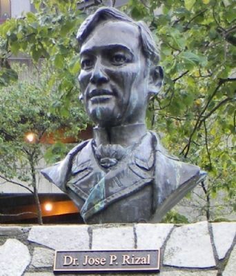
The City and Borough of Juneau Assembly Honors the Contributions of Filipinos in Juneau by naming this downtown location Manila Square.
Juneau Assembly Members: Dale Anderson - Don Etheridge, Jr. - Jeannie Johnson - Ken Koelsch - Frankie . . . — — Map (db m68849) HM
Racism and
Discrimination
From the beginning of the gold mining boom,
pervasive racism disrupted the lives of the Tlingit.. They were forced to adopt new ways and punished for practicing traditional ways.
Restrictions radically altered . . . — — Map (db m282196) HM
Laws restricting Chinese and Japanese immigration in the 1920s resulted in a wave of Filipinos coming to work in Ketchikan's booming canneries. These “Alaskeros,” as they called themselves, began to live here permanently and make long-lasting . . . — — Map (db m182101) HM
Adventurous Japanese-Americans George and Yayoko Shimizu immigrated to Ketchikan in search of opportunity. Around 1903, they opened the New York Café on downtown Front Street.
Ketchikan was divided racially then. Whites lived north of Ketchikan . . . — — Map (db m182073) HM
Around 1900, adventurous Japanese pioneer George Ohashi came to Ketchikan and opened the New York Café on Front Street. This was the beginning of a three-generation Ohashi family career of entrepreneurial activities.
In 1907, Ohashi built this . . . — — Map (db m182044) HM
Across the great divide: Stedman started apart
Ketchikan Creek formed a dividing line in Ketchikan in the early 1900s. To the north, white pioneers' homes, schools and churches stair-stepped up the hill and businesses crowded the waterfront. . . . — — Map (db m182050) HM
Kichirobei (“Jimmy”) Tatsuda and his wife, Sen Seike, started a combination grocery store, pool hall, tobacco shop and boarding house in 1910.
In 1916, the Tatsudas opened their first grocery store in a nearby building. It was truly a family . . . — — Map (db m182093) HM
Stedman Street was a congenial place for Japanese immigrants and their families up to the 1940s. Japanese-born miners, fishermen, laborers and entrepreneurs settled across the creek from downtown and founded families. Japanese-Americans from the . . . — — Map (db m182058) HM
Yasunori Takase built and managed a rooming house here. The
building remained in Japanese ownership until the tragedy of
WW II and internment camps.
1998 Centennial Project/TRT Grant — — Map (db m301502) HM
Yasunori Takase purchased this house and lot from James
Brennan and opened a laundry in 1916. It operated along
with other Japanese proprietorships into the 1940's. — — Map (db m301505) HM
This 1881 double adobe was the site of Garet & Page's Wagon Shop. To your left was the charcoal yard. Charcoal was a primary source of heat for both forges and homes in the early 1880's. This block was part of "Hop Town", the heart of Tombstone's . . . — — Map (db m249782) HM
The Can Can Restaurant was established in 1879 by Quong Kee. It was one of Tombstone's best known restaurants. In 1886 it was purchased by John Henninger who turned it into a first class eating establishment. It had a number of proprietors until . . . — — Map (db m48513) HM
In 1879 there were 11 people in Tombstone of Chinese descent. By 1882 there were 250. The area between 2nd and 3rd and Allen and Toughnut was the area where they lived and had businesses, commonly called "Hoptown". The Chinese ran laundries, . . . — — Map (db m131096) HM
[ The single 30 foot concrete pillar of the monument symbolizes "unity of spirit". The hexagonal base represents a Japanese stone lantern. The 12 small pillars situated around the monument make it a working sundial. Mounted on the 30 foot pillar . . . — — Map (db m32258) HM
Rivers, Arizona
Gila River Indian Community land was selected by the United States Government as one of ten camp sites and construction was started without the permission of the community. The permit for the United States Government to use the . . . — — Map (db m34537) HM
Where you now see cotton fields, 432 barracks once housed about 8,000 Japanese Americans.The Camp was surrounded by a barbed wire fence linking eight guard towers from which armed guards watched the camp and internees. The cam was divided by . . . — — Map (db m170077) HM
Years of discrimination and the Japanese attack on Pearl Harbor led to the forced removal and imprisonment of Japanese Americans. All Japanese Americans on the West Coast were affected by the forced evacuation - including women and . . . — — Map (db m169429) HM
Internees tried to re-create a life they might have lived
outside of confinement.
Earning money in camp was a constant struggle for internees, bills still had
to be paid on property left behind and everyone needed to buy clothes, . . . — — Map (db m169434) HM
Dedicated to the Patriotic Japanese-American men from Rohwer Internment Camp who sacrificed their lives in the service of their country in World War II.
U.S. Fifth Army - 100 Battalion - 442 Regiment
Cassino Anzio . . . — — Map (db m170092) HM WM
The Rohwer internment camp included a 500-acre area for internee living quarters and more than 10,000 acres of surrounding land for farming and timber harvesting. Officially labeled a relocation center, the internment camps for Japanese . . . — — Map (db m167628) HM
The U.S. entry into World War II led to the forced removal of-
nearly 120,000 Japanese Americans from the West Coast
The Japanese Navy attacked Pearl Harbor, Hawaii on December 7,
1941, and America declared war on Japan the next day. . . . — — Map (db m167967) HM
Babies were born, children went to school, adults had jobs, and some people died here during the three years that the Rohwer camp operated. The traditional Japanese family structure was threatened by the camp's communal living conditions: . . . — — Map (db m170078) HM
The relocation center sites were chosen because of their distance from the West
Coast and for their suitability and isolation as secured, closed camps. Inside The Relocation Center The loss of their former lives was profound for the . . . — — Map (db m169430) HM
On February 19, 1942, Pres. Franklin
Roosevelt signed into law Executive
Order No. 9066, interning over 120,000
persons of Japanese ancestry, and
this act irrevocably changed their
lives. The majority of these people
were American citizens. As . . . — — Map (db m170318) HM
Alameda Taiku Kai
(Alameda Athletic Club)
During the years 1916-1938 this was the approximate location
of home plate of the Alameda Japanese American ATK Baseball
Field. Games were played on week-ends against other Japanese
American and top . . . — — Map (db m145337) HM
Traces of Alameda Japantown
Opening up shops on Park Street
Traces of a small close-knit Japanese community remain, yet little is known of the Japantown that once thrived in Alameda. At the turn of the 20th century, Issei, first generation . . . — — Map (db m220123) HM
Life That Connects Us All
We strive to practice gratitude and compassion and to understand the interdependence of life that connects us.
Buddhist Temple of Alameda
In 1916, the Buddhist Temple of Alameda became an independent temple . . . — — Map (db m220508) HM
A Beacon of Light
Our doors open outwards, welcoming those needing support, nurturing faith, and instilling hope.
Buena Vista Church serves as a beacon of light, drawing in those seeking refuge. Offering the warmth of a night school . . . — — Map (db m223217) HM
Becoming a Japantown
A neighborhood planted, a community flourished
With the growth of Japantown, the Tonarigumi, or cohesive neighborhood, began to take shape as Japanese immigrants settled in dwellings, cottages and Victorian flats, . . . — — Map (db m223699) HM
Bobby Seale
class of 1954, while attending Merrit
College, he joined the Afro-American
Association (AAA) and met Huey P.
Newton. Together in 1966, they founded
the Black Panther Party for Self-Defense.
Jean Yonemura Wing
class of . . . — — Map (db m154869) HM
By the late 1960s, a new generation of political activists emerged in Berkeley from protests opposing the
Vietnam War and supporting the Farmworkers, Free Speech, and Civil Rights movements. In May 1968, in an
apartment on this site, Yuji Ichioka . . . — — Map (db m154322) HM
Always go with nature, anywhere, in any circumstance, with gratitude.
The renowned and highly respected Japanese American artist Chiura Obata was a popular member of
the faculty at the University of California, Berkeley from 1932 to . . . — — Map (db m122842) HM
Between 1860 and the 1920s, the Meeks grew grains, green peas, corn, sugar beets, cucumbers, blackberries, and currants. Most of their land was in orchards of almonds, oranges, apricots, peaches, prunes, plums, and cherries. Meek’s land was . . . — — Map (db m210340) HM
Owner of the first Japanese restaurant in Hayward California (Kokeshi)
A caring and giving person, known for her generosity and kindness. She exemplifies the American dream. We will all miss her and never forget her. — — Map (db m207577) HM
WHEN THE PONDS AROUND YOU were first built,
producing salt by solar evaporation required intense labor and
a lot of time. Workers had to move seawater from San Francisco
Bay (only 2.5% salt content) through a series of evaporation
ponds to . . . — — Map (db m174878) HM
Coast Manufacturing and Supply Co. moved to this site in the early 1900s and produced fuse line for explosives. Between 1913 and 1926 Coast hired Chinese immigrants to work in the powder houses located just to the north of this grove of trees. These . . . — — Map (db m198579) HM
The idea for the Chinese junk (boat) came
from the voyage of the real junk "Free
China” from Taiwan to San Francisco in
1955. The idea originally involved the purchase
of an actual junk for the playground, but
eventually developed into a . . . — — Map (db m157313) HM
This marker is made up of two markers and two plaques on the same monument.
One Community, Many Locations
Chinese first settled in Oakland in the 18502 during the California Gold Rush. Unlike San Francisco’s Chinatown, Oakland’s . . . — — Map (db m72762) HM
Dedicated on August 7, 1992, by E Company Veterans of the 442nd Regimental Combat Team, the most decorated United States Army Unit of World War II. The all volunteer 442nd Combat Team was composed of Americans of Japanese ancestry, from the . . . — — Map (db m64182) HM WM
Look carefully. Comparing today’s Japanese Tea House with early pictures, you will notice many differences. The first tea house in Piedmont Park was built by Frank C. Havens and opened on June 30, 1907. It was a replica of the late-fifteenth century . . . — — Map (db m72318) HM
Public outcry led Oakland councilman George Pardee, who later became Governor of California, to campaign Contra Costa Water Company for a clean reliable water system. The Hyatt filters were installed, along with pump houses and filtration basins, . . . — — Map (db m113822) HM
The stone structure before you is a 157 foot vertical control shaft. It joins to Tunnel No. 1 to open and close the flow of water running through the tunnel pipes. Two known accidents took place at this site. Tunnel No. 1 collapsed on two Chinese . . . — — Map (db m71908) HM
In 1979 a renovation of Chabot dam unearthed a century-old Chinese encampment buried in the creek embankment below. California State University Hayward (now called California State University, East Bay) was contracted and students excavated over . . . — — Map (db m71711) HM
In February 1874 a large Chinese work force entered this woodland setting to begin construction of San Leandro Reservoir. Later renamed Lake Chabot after its French-Canadian originator Anthony Chabot, the dam was built using techniques Chabot . . . — — Map (db m71648) HM
Many of the trees surrounding you have foreign roots, each with its own tale. In 1868 the Hayward Journal described Chabot’s plans to encircle the reservoir with “walnut, hickory nuts, butternuts, and other eastern and foreign nut trees.” These . . . — — Map (db m71650) HM
The Alameda County Historical Society dedicates this panel to:
Ah Bing – 41, Kim Yuen – 29, Toy Sing – 31, and Lock Sing – 33, who died outside this tunnel. This panel is also dedicated to the countless unnamed and unsung Chinese laborers . . . — — Map (db m71651) HM
Buena Vista's store and house situated in Jackson Valley, was built by John Fitzsimmons, then sold to Sam Cook, then to James Norris and afterwards to Jacob and Verona Strohm. Once situated in Lancha Plana it was moved by the Chinese who discovered . . . — — Map (db m10189) HM
Looking North from this monument lies 5.22 acres which was originally deeded to Ky Kee, Hop Wah Chung, Quong On Long and Chang Hang Co. in 1883. Known as Chinatown, the community was comprised of stores, homes and a Joss House. At the peak of . . . — — Map (db m42397) HM
Dedicated in the spring of 1863, this building served as a temple of worship for 10,000 Chinese then living here. Funds for its erection and furnishings were provided by the Emperor and Empress of China and local Chinese labor built the structure. . . . — — Map (db m100599) HM
This cemetery was established in 1850 during the Gold Rush days to serve the Chinese communities of Lava Beds, Bagdad, Bidwell Bar and Ophir City (now Oroville). The last burial here was in 1944. — — Map (db m61494) HM
This building, once owned by Sam Choy, is the only building remaining from a large Chinese settlement here in early Gold Rush days. Now owned by the City of Angels Camp. — — Map (db m31889) HM
In the 1850s, Chinese came to California, a land they called Gum Shan, meaning Mountain of Gold, for the same reason as other nationalities: to seek their fortune. As the placer gold played out, Chinese took jobs building railroads, dams, levees, . . . — — Map (db m54986) HM
(front or street side:)
"My parents were given much help
(from the Adachis and Nabetas)
digging a well by hand and building
their house. Much help was given on
how to grow the flowers as well as
how to build the greenhouses. . . . — — Map (db m145945) HM
(front or street side:)
"At four in the morning they would
start preparing the flowers for market.
Grandfather would carefully put the
flowers in a basket and sling it over
his shoulder. Grandmother, carrying
a lantern, would lead him . . . — — Map (db m156299) HM
In front of you is the last remaining structure of El Cerrito's once vibrant Japanese American flower growing industry: the former storefront of Contra Costa Florist which was owned by the Mabuchi Family.
Hikojiro and Tomi Mabuchi, aided . . . — — Map (db m145944) HM
The Japanese military's attack on Pearl Harbor on December 7, 1941 formally brought America into World War II. Newspapers, politicians, and military officials invented or exaggerated the threat of disloyalty by Japanese Americans. Groups including . . . — — Map (db m157883) HM
In the early 1900s, Japanese immigrants planted the seeds of a remarkable nursery community in El Cerrito and Richmond. These nurseries were located mostly west of San Pablo Avenue and north of Portrero Avenue. After interment during World War II, . . . — — Map (db m94249) HM
1885 First Domoto nursery opens in Oakland. The Domotos pioneer California's Japanese American nursery industry and create its wholesale market.
1902 Yataro Nabeta founds the first Japanese American nursery in Contra Costa County, near . . . — — Map (db m146036) HM
After running kitchens in early hotspots such as the "IT" Club and Six Bells, Violet Wong went on to become a culinary pioneer in El Cerrito by introducing Chinese American food. In 1945, Violet and her husband, Albert Wong, opened Violet's . . . — — Map (db m311793) HM
Memorial Tree
This Gingko tree is dedicated in recognition of the contributions of Chinese laborers who toiled in anonymity at the Hercules Powder Works Factory from 1881 until 1912.
(Chinese text not transcribed) — — Map (db m174519) HM
The City of Martinez has been the home of a train station along the waterfront for 125 years. The first station (approximately 200 yards to the east of this site) was erected in 1876 and closed in 2001 when this station was opened.
More than . . . — — Map (db m93542) HM
Following the California Gold Rush of ’49, swarms of Chinese miners came to make their mark on the diggings in the Mother Lode, including this Coloma Valley. They were industrious and self-contained and mostly content to thoroughly comb the old . . . — — Map (db m12225) HM
These two stone buildings known as the Wah Hop and Man Lee Stores were built by Jonas Wilder before 1860and leased to Chinese merchants. Located at the edge of a large Chinese community, they sold traditional foods, clothing and other items. Such . . . — — Map (db m12227) HM
Between 1850 and 1883, Coloma was home to a sizeable Chinese community. These stone buildings, known as the man Lee and Wah Hop stores, are all that remain.
Chinese merchants supplied their countrymen with mining necessities and . . . — — Map (db m215013) HM
A large brick building measuring 50 feet by 65 feet, was built here in 1856. Two older frame structures were demolished and were sorely missed by the “old-timers” of that day. The brick for this store probably came from a brickyard 2 miles south of . . . — — Map (db m12273) HM
Caught up in the frenzied news about the gold discovery, thousand of gold seekers from all corners of the world flooded into Coloma.
Fortune Seekers
California’s gold fields offered boundless opportunity and the hop of a brighter future. . . . — — Map (db m214879) HM
Site of the only tea and silk farm established in California. First agricultural settlement of pioneer Japanese immigrants who arrived at Gold Hill on June 8, 1869. Despite the initial success, it failed to prosper. It marked the beginning of . . . — — Map (db m76181) HM
The last remaining building
of the Gold Rush era Chinese community
in Old Hangtown
Stone House is famous
for its historical significance
as an old Chinese brothel
Restored by
John R. Berry – Attorney at Law
Architectural . . . — — Map (db m36815) HM
Harry Watanabe was 19 years old when he came to Coalinga from Japan in 1915. Watanabe first worked at Ayers Drug Store and the Sullivan Hotel. It was in 1928 that Watanabe found his niche in life and the vocation that left his mark on Coalinga. . . . — — Map (db m64107) HM
In 1874 600 people moved to what is now Fresno. Of those, 200 were Chinese, who made the brick and helped start the building of Fresno. A short time later, they were persuaded to settle west of the train tracks. They built an area of shops, which . . . — — Map (db m52981) HM
Kogetsu-Do
A Fresno landmark. Confectioner Kogetsu - Do has survived in the same location it has occupied for 99 Years. Sugimatsu Ikeda and his wife Sakino started the business in 1915 and were able to purchase this building on "F" Street in . . . — — Map (db m101863) HM
The original site of the first Chinese Consolidated Benevolent Association & Kong Chow Temple
Circa 1880
Dedicated June 1984
Rededicated Dec 2020 by Jim Savage Chapter 1852 E Clampus Vitus — — Map (db m290424) HM
This memorial is dedicated to over 5,000 Americans of Japanese ancestry who were confined at the Fresno Fairgrounds from May to October 1942. This was an early phase of the mass incarceration of over 120,000 Japanese Americans during World War II . . . — — Map (db m165490) HM
Here, on the block of land bounded by E, F, 4th, and 5th streets, over 300 Chinese people once lived in a bustling Chinatown. But high unemployment, economic uncertainty, and a perceived competition for jobs served as excuses for anti-Chinese hate. . . . — — Map (db m233370) HM
From 1942 to 1945, eight US Army guard
towers loomed over the more than 11,000
Japanese Americans held in Manzanar. For
most of that time, US Military Police manned
the towers, a visual reminder that the
unconstitutionally incarcerated . . . — — Map (db m221511) HM
Beginning in the summer of 1942, the War
Relocation Authority (WRA) hired Japanese
American crews to install linoleum floors
and hang sheetrock on walls and ceilings.
But other promised improvements never
appeared. People who could afford . . . — — Map (db m304749) HM
Three times a day, hungry people lined
up outside a mess hall — in blistering
heat and freezing cold, in heavy rain
and during ferocious dust storms.
Once inside, "they plopped food on our
metal plates," Lilly Kitamoto Kodama,
who . . . — — Map (db m304753) HM
One of the adjustments Japanese
Americans had to make while
incarcerated was doing laundry in a
communal building. Each block had a
laundry room with washboards and
concrete tubs.
"There were no dryers and soon wash
lines . . . — — Map (db m304756) HM
War Relocation Authority workers and their
families - more than 400 people - lived within
the same barbed-wire fence that confined
11,000 Japanese Americans. But those
government workers enjoyed higher pay,
better apartments, and freedom.
. . . — — Map (db m300198) HM
This auditorium is one of three original buildings remaining here from Manzanar War Relocation Center. As you walk closer, listen for laughter, tears, music—the sounds of celebration and sadness that once echoed through this building’s cavernous . . . — — Map (db m122704) HM WM
Merritt Park was an oasis of beauty and solitude for a
crowded, confined community. Meandering paths and
waterways, bridges, lawns, and flower gardens filled its
15 acres, delighting the senses and lifting the spirits of
many who came here. . . . — — Map (db m299743) HM
While more than 2,300 children from over 200 schools
came to Manzanar, no plans were initially in place for
their education. With children "running wild,"
parents and internee teachers organized nursery
school and other classes. In June . . . — — Map (db m300242) HM
This is one of 36 blocks at Manzanar where Japanese
Americans lived. Each block had 14 barracks
buildings divided into "apartments." Barracks 1 and
8 (reconstructed) feature exhibits on the challenges
and changes people faced here. Barracks . . . — — Map (db m304761) HM
Life began and ended at
Manzanar. Doctors and nurses
delivered 541 babies. Of the 11,070
people incarcerated here, 150 died.
"Here people are all scared, worried,
and...you can't tell them not to worry
because you're in the same . . . — — Map (db m288412) HM
When not working or attending school,
incarcerated Japanese Americans looked
for ways to occupy their time within the
square-mile camp. When someone "with
initiative or talent" wanted to start a
class or club, they sought an . . . — — Map (db m304755) HM
On March 7, 1942, Lieutenant General
John DeWitt announced that the US Army
would build a "reception center" for
Japanese Americans at Manzanar. Two
weeks later, the first people forced from
their Los Angeles homes arrived here to . . . — — Map (db m304760) HM
Cherry Yamada Uyeda never forgot her first impression
of Manzanar: "It was devastating... the worst thing
[was] what they call the latrine... this separate little
shack, building, the toilets lined up, and you'd wonder,
'What is this? Is . . . — — Map (db m304757) HM
Standing here in 1943, you would have been at the
nerve center of camp life: First Street. Supply
trucks and automobiles rumbled by on this
thoroughfare, where the lines between camp life
and the world outside seemed to intersect. . . . — — Map (db m273403) HM
This tree, presented to Manzanar National Historic Site by Green Legacy
Hiroshima on World Peace Day, September 21, 2025, is a descendant of a
ginkgo tree located at Shukkeien Garden.
About 1,500 yards from the hypocenter, the . . . — — Map (db m299674) HM
It is serene here now, but Block 22 Garden,
built as a gesture of compassion, was to
become a testing ground of resistance at
Manzanar. Deep generational differences and
political divisions among internees met here
and swirled around the . . . — — Map (db m299905) HM
This tree, presented to Manzanar National Historic Site by Green Legacy
Hiroshima on World Peace Day, September 21, 2025, is a descendant of a
persimmon tree located on Peace Boulevard near Shirajinja Shrine.
About 600 yards from the . . . — — Map (db m299741) HM
This tree, presented to Manzanar National Historic Site by Green Legacy
Hiroshima on World Peace Day, September 21, 2025, is a descendant of a
persimmon tree located on Peace Boulevard near Shirajinja Shrine.
About 600 yards from the . . . — — Map (db m299742) HM
Over the years, this monument has become an icon, inspiring a grass-roots movement to preserve Manzanar and remember the sacrifices of 120,313 Japanese Americans confined by their own government.
Buddhist minister Sentoku Mayed and . . . — — Map (db m70549) HM
With 440 acres under cultivation in fields north and
south of the camp, existing orchards with 400 pear
and 600 apple trees, nine warehouses, a root cellar,
a hog farm, and a chicken ranch, people
incarcerated in Manzanar raised, grew, . . . — — Map (db m304752) HM
After President Franklin D. Roosevelt authorized
the US Army to remove Japanese Americans from
their West Coast homes, he created the War
Relocation Authority (WRA) to "provide for their
needs in such manner as may be appropriate, . . . — — Map (db m300241) HM
In the early part of World War II, 110,000 persons of Japanese ancestry were interned in relocation centers by Executive Order No. 9066, issued on February 19, 1942.
Manzanar, the first of ten such concentration camps, was bounded by . . . — — Map (db m122703) HM WM
812 entries matched your criteria. The first 100 are listed above. Next 100 ⊳