After filtering for Nebraska, 141 entries match your criteria. The first 100 are listed. ⊳
Industry & Commerce Topic
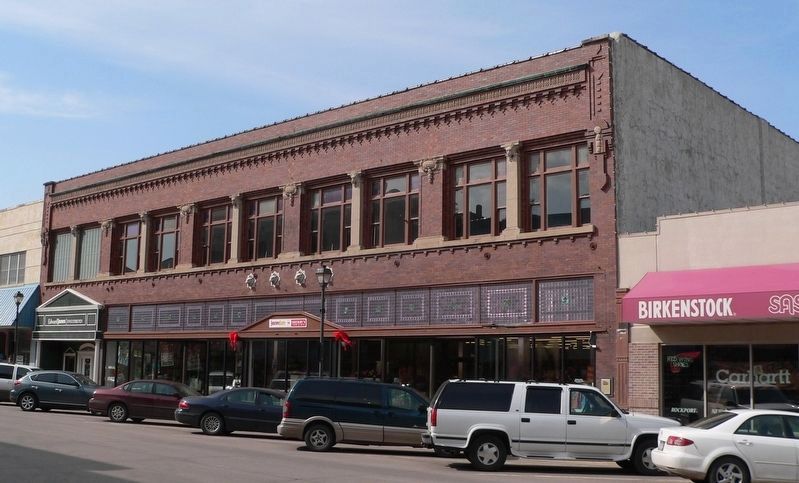
Ammodramus via Wikipedia/Public domain, March 24, 2010
The Stein Building Marker
| 1 ► Nebraska, Adams County, Hastings — The Stein Building — |
| On West 2nd Street (Business U.S. 6) east of North Hastings Avenue, on the left when traveling east. | |||
| 2 ► Nebraska, Antelope County, Neligh — 419 — The Neligh Mill Bridge — |
| On N Street south of East 2nd Street, on the left when traveling south. | |||
| 3 ► Nebraska, Antelope County, Neligh — 120 — The Neligh Mills — |
| On East 2nd Street at N Street, on the left when traveling west on East 2nd Street. | |||
| 4 ► Nebraska, Antelope County, Neligh — Trails, Rails, and Roads: Lifelines of a Mill — |
| On N Street south of East 2nd Street, on the left when traveling south. | |||
| 5 ► Nebraska, Antelope County, Neligh — Water Power at the Neligh Mill — |
| On N Street south of East 2nd Street, on the left when traveling south. | |||
| 6 ► Nebraska, Boone County, St. Edward — 398 — St. Edward — |
| On Beaver Street (State Highway 39) at 4th Street, on the right when traveling west on Beaver Street. | |||
| 7 ► Nebraska, Box Butte County, Alliance — 416 — Alliance Army Air Field — |
| On Perkins Road (State Highway 2) just east of County Road 57, on the left when traveling east. | |||
| 8 ► Nebraska, Box Butte County, Alliance — 268 — Burlington Locomotive 719 — |
| On Box Butte Avenue just south of West 18th Street, on the right when traveling south. | |||
| 9 ► Nebraska, Brown County, Long Pine — 557 — Long Pine — A Railroad Town — |
| On North Main Street, 0.1 miles south of East 3rd Street, on the left when traveling south. | |||
| 10 ► Nebraska, Buffalo County, Kearney — 148 — Kearney Cotton Mill — |
| On U.S. 30, 0.2 miles east of 46th Avenue, on the right when traveling east. | |||
| 11 ► Nebraska, Buffalo County, Kearney — Site of Bauer Drug — November 1, 1946 - December 1958 — Proprietor, George J. Bauer — |
| On Central Avenue near 19th Street, on the left when traveling north. | |||
| 12 ► Nebraska, Buffalo County, Kearney — 178 — The Watson Ranch — |
| On U.S. 30 at 1733 Road, on the right when traveling east on U.S. 30. | |||
| 13 ► Nebraska, Cass County, Plattsmouth — Blake Building — |
| On Main Street, on the right when traveling east. | |||
| 14 ► Nebraska, Cass County, Plattsmouth — Budweiser Building 1888 — |
| On Main Street, on the right when traveling east. | |||
| 15 ► Nebraska, Cass County, Plattsmouth — Drew/Weckbach — |
| On Main Street, on the right when traveling east. | |||
| 16 ► Nebraska, Cass County, Plattsmouth — Excelsior Building — |
| On Main Street, on the right when traveling east. | |||
| 17 ► Nebraska, Cass County, Plattsmouth — Vienna Bakery — |
| On Main Street, on the right when traveling east. | |||
| 18 ► Nebraska, Cass County, Plattsmouth — Wetenkamp Building — |
| On Main Street, on the right when traveling east. | |||
| 19 ► Nebraska, Chase County, Champion — 43 — Champion Water-Powered Mill — |
| On Mill Street near 2nd Street. | |||
| 20 ► Nebraska, Cheyenne County, Gurley — 56 — Discovery Oil Well - Marathon Oil Company — |
| On Gold Rush Byway (U.S. 385) 0.3 miles south of Local Road 38, on the left when traveling north. | |||
| 21 ► Nebraska, Cheyenne County, Potter — 69 — Early Irrigation in Cheyenne County — |
| On Main Street (Lincoln Highway) (U.S. 30) at Road 79, on the right when traveling east on Main Street (Lincoln Highway). | |||
| 22 ► Nebraska, Cheyenne County, Sidney — Sidney-Black Hills Trail — |
| On Lincoln Highway (U.S. 30) 1 mile west of 13th Avenue, on the left when traveling west. | |||
| 23 ► Nebraska, Custer County, Anselmo — 571 — Anselmo — |
| On East Smith Avenue (State Highway 21A Spur) just east of North Dorr Street, on the right when traveling east. | |||
| 24 ► Nebraska, Custer County, Broken Bow — 533 — Broken Bow Town Square — |
| On South E Street (State Highway 2) at South 8th Avenue, on the left when traveling east on South E Street. | |||
| 25 ► Nebraska, Custer County, Gothenburg — 530 — Etna — |
| On Etna Road just east of State Highway 47, on the left when traveling east. | |||
| 26 ► Nebraska, Dawes County, Chadron — 42 — Bordeaux Trading Post — |
| On U.S. 20. | |||
| 27 ► Nebraska, Dawes County, Chadron — 195 — Chadron Creek Trading Post — |
| On Gold Rush Highway (U.S. 385) near Country Club Road, on the right when traveling north. | |||
| 28 ► Nebraska, Dawes County, Crawford — Crossing of the Trails — |
| On 2nd Street just south of Ash Street, on the left when traveling north. | |||
| 29 ► Nebraska, Dawes County, Crawford — 299 — German P.O.W. Camp — |
| Near Bridges to Buttes Byway (U.S. 20) 1.3 miles west of 1st Street, on the left when traveling west. | |||
| 30 ► Nebraska, Deuel County, Big Springs — Keith County Nebraska — |
| On County Highway 36 at County Highway 63.2, on the left when traveling south on County Highway 36. | |||
| 31 ► Nebraska, Dixon County, Ponca — 149 — Ponca — |
| On West 3rd Street (State Highway 26E) just east of North Nebraska Street, on the right when traveling west. | |||
| 32 ► Nebraska, Dodge County, Fremont — Union Depot — 1886 — Union Pacific Blazes Trail to Future — |
| On Main Street near 5th Avenue, on the right when traveling south. | |||
| 33 ► Nebraska, Douglas County, Florence, North Omaha — 50 — The Bank of Florence — |
| On 30th Street at Willit Street, on the left when traveling north on 30th Street. | |||
| 34 ► Nebraska, Douglas County, Florence, North Omaha — The Florence Mill — 1846 — |
| On McKinley Street at 30th Street, on the left when traveling east on McKinley Street. | |||
| 35 ► Nebraska, Douglas County, Florence, North Omaha — 81 — The Florence Mill — |
| On McKinley Street at 30th Street, on the left when traveling east on McKinley Street. | |||
| 36 ► Nebraska, Douglas County, Omaha — Omaha's First Building — Historic Building Site — |
| On Jackson Street at South 12th Street, on the right when traveling east on Jackson Street. | |||
| 37 ► Nebraska, Douglas County, Omaha, Downtown — Anheuser-Busch Beer Depot 1887 — The Old Market Historic Walking Tour — |
| On Jones Street, on the left when traveling west. | |||
| 38 ► Nebraska, Douglas County, Omaha, Downtown — J.P. Cooke Building 1885-1889 — The Old Market Historic Walking Tour — |
| On Howard Street near 13th Street, on the right when traveling east. | |||
| 39 ► Nebraska, Douglas County, Omaha, Downtown — Labor — |
| On Riverfront Drive, on the right when traveling north. | |||
| 40 ► Nebraska, Douglas County, Omaha, Downtown — Site of Union Pacific's Omaha Shops — |
| On 10th Street near Cuming Street, on the right when traveling south. | |||
| 41 ► Nebraska, Douglas County, Omaha, Downtown — Woodmen of the World — |
| On Farnam Street, on the left when traveling west. | |||
| 42 ► Nebraska, Douglas County, Omaha, North Omaha — James G. Megeath — 1824 - 1906 — |
| 43 ► Nebraska, Douglas County, Omaha, North Omaha — James M. Woolworth — 1829 - 1906 — |
| Near Parker Street. | |||
| 44 ► Nebraska, Douglas County, Omaha, North Omaha — Joseph Francis Bauman — 1822 - 1876 — |
| 45 ► Nebraska, Douglas County, Omaha, North Omaha — 7 — Quartermaster's Office and Commissary — Fort Omaha Walking Tour — |
| On East Road, on the right when traveling north. | |||
| 46 ► Nebraska, Douglas County, Omaha, North Omaha — William Davis Brown — 1813 - 1868 — |
| 47 ► Nebraska, Douglas County, Omaha, Southeast Omaha — Omaha Union Station — |
| On 10th Street near Leavenworth Street, on the left when traveling south. | |||
| 48 ► Nebraska, Douglas County, Omaha, The Old Market — Baum Iron Company Building 1880 — The Old Market Historic Walking Tour — |
| On Harney Street at 13th Street, on the right when traveling east on Harney Street. | |||
| 49 ► Nebraska, Douglas County, Omaha, The Old Market — Burlington Building 1879 — The Old Market — Historic Walking Tour — |
| On Farnam Street, on the right when traveling west. | |||
| 50 ► Nebraska, Douglas County, Omaha, The Old Market — Millard Block 1880-1881 — The Old Market Historic Walking Tour — |
| On Harney Street at South 11th Street, on the right when traveling east on Harney Street. | |||
| 51 ► Nebraska, Douglas County, Omaha, The Old Market — Morse Coe Building — The Old Market Historic Walking Tour — |
| On Howard Street at 12th Street, on the right when traveling east on Howard Street. | |||
| 52 ► Nebraska, Douglas County, Omaha, The Old Market — Omaha Firehouse 1903-1904 — The Old Market Historic Walking Tour — |
| On 11th Street near Jackson Street, on the right when traveling south. | |||
| 53 ► Nebraska, Douglas County, Omaha, The Old Market — Windsor Hotel — The Old Market Historic Walking Tour — |
| On Jackson Street at 10th Street, on the left when traveling east on Jackson Street. | |||
| 54 ► Nebraska, Dundy County, Haigler — 126 — Texas Trail Canyon — |
| On U.S. 34, on the right when traveling east. | |||
| 55 ► Nebraska, Fillmore County, Fairmont — 309 — Fairmont Creamery Company — |
| On Fairmont Avenue at F Street, on the left when traveling south on Fairmont Avenue. | |||
| 56 ► Nebraska, Gage County, Beatrice — Homesteading's Legacy is Written on the Land — |
| 57 ► Nebraska, Gage County, Beatrice — Is All Barbed Wire the Same? — |
| 58 ► Nebraska, Gage County, Beatrice — River Town Development — |
| On Court Street (U.S. 136) at 2nd Street, on the right when traveling west on Court Street. | |||
| 59 ► Nebraska, Gage County, Beatrice — War Efforts at Home — We Answered the Call — 1861 - Today — |
| 60 ► Nebraska, Greeley County, Scotia — 144 — Chalk Mine — |
| On State Highway 11 at milepost 58, on the right when traveling south. | |||
| 61 ► Nebraska, Hall County, Grand Island — The Yancey — |
| On Locust Street at 2nd Street (U.S. 30), on the right when traveling north on Locust Street. | |||
| 62 ► Nebraska, Hitchcock County, Trenton — Old Texas Ogallala Trail — 1869 - 1885 — |
| On State Highway 34 near County Route 363, on the left when traveling east. | |||
| 63 ► Nebraska, Holt County, Atkinson — After 3 Tries, Atkinson Started — 1875 — |
| Near Railroad Street just east of North Main Street, on the left when traveling east. | |||
| 64 ► Nebraska, Hooker County, Mullen — 472 — Site of Hecla, Nebraska — |
| On Southwest 1st Street (State Highway 2) 10 miles west of North Washington Avenue (State Highway 97), on the right when traveling west. | |||
| 65 ► Nebraska, Jefferson County, Fairbury — 121 — The Smith Limekiln and Limestone House — |
| On River Road, 4 miles north of U.S. 136, on the right when traveling north. | |||
| 66 ► Nebraska, Kearney County, Minden — Center Pivot Irrigator — Historic Landmark of Agricultural Engineering — |
| Near North Street (U.S. 6) just east of Brown Avenue (State Highway 10), on the left when traveling east. | |||
| 67 ► Nebraska, Kearney County, Newark — 239 — The Burlington & Missouri River Railroad — |
| On Harold Warp Memorial Drive (32nd Road) (State Highway 10) near State Highway 50A, on the right when traveling south. | |||
| 68 ► Nebraska, Keith County, Ogallala — Standard Oil Gas Station — “Hugh” — |
| On North Spruce Street near West 3rd Street, on the right when traveling south. | |||
| 69 ► Nebraska, Keith County, Ogallala — 4 — The Pony Express — |
| On North Spruce Street near West Second Street. | |||
| 70 ► Nebraska, Kimball County, Kimball — 487 — Maginnis Irrigation Flume — |
| On Lincoln Highway (U.S. 30) just west of County Road 29, on the right when traveling east. | |||
| 71 ► Nebraska, Lancaster County, Lincoln — Ronald Reagan — 1911 - 2004 — |
| On Pine Lake Road near South 30th Street. | |||
| 72 ► Nebraska, Lancaster County, Lincoln, Downtown — Beatrice Creamery Building — 1890/1904 — |
| On P Street at North 7th Street, on the right when traveling east on P Street. | |||
| 73 ► Nebraska, Lancaster County, Lincoln, Downtown — H. P. Lau Building — 1904 (corner building); Cox & Schoentgen, architect — 1906 (west annex); architect unknown — |
| On Q Street at North 8th Street, on the right when traveling east on Q Street. | |||
| 74 ► Nebraska, Lancaster County, Lincoln, Downtown — Hardy Building — 1919-20 / 1927 — |
| On North 8th Street just south of R Street, on the right when traveling south. | |||
| 75 ► Nebraska, Lancaster County, Lincoln, Downtown — Harpham Building — 1903/1912 — |
| On P Street near North 8th Street, on the right when traveling west. | |||
| 76 ► Nebraska, Lancaster County, Lincoln, Downtown — Historic Haymarket District — |
| Near North 7th Street at P Street, on the right when traveling south. | |||
| 77 ► Nebraska, Lancaster County, Lincoln, Downtown — Huber Building — 801 Q Street — 1901 — |
| On Q Street at North 8th Street, on the right when traveling east on Q Street. | |||
| 78 ► Nebraska, Lancaster County, Lincoln, Downtown — Lincoln Drug Company Building — 1905;Fiske & Dieman, architec — 1919 (top story); Fiske & Meginnis — |
| On North 8th Street at P Street, on the right when traveling east on North 8th Street. | |||
| 79 ► Nebraska, Lancaster County, Lincoln, Downtown — Lincoln Fixture Building — 1922 — Fiske & Meginnis, architect — |
| On P Street at North 9th Street, on the right when traveling west on P Street. | |||
| 80 ► Nebraska, Lancaster County, Lincoln, Downtown — Lincoln Hide & Fur Building — 1909 — |
| On Q Street at North 7th Street, on the right when traveling west on Q Street. | |||
| 81 ► Nebraska, Lancaster County, Lincoln, Downtown — Old Woods Bros. Companies Building — 1914 — |
| On P Street at North 7th Street, on the right when traveling east on P Street. | |||
| 82 ► Nebraska, Lancaster County, Lincoln, Downtown — Ridnour Building — 1925 — |
| On P Street, 0.1 miles east of North 8th Street, on the right when traveling east. | |||
| 83 ► Nebraska, Lancaster County, Lincoln, Downtown — Salvation Army Building — 749 P Street — 1966 — |
| On North 8th Street near P Street. | |||
| 84 ► Nebraska, Lancaster County, Lincoln, Downtown — Seaton and Lea Ironworks — 301 North 8th Street — 1881 — |
| On Q Street at North 8th Street, on the right when traveling east on Q Street. | |||
| 85 ► Nebraska, Lancaster County, Lincoln, Downtown — Stacy Brothers Building — 1912 — F.C. Fiske, architect — |
| On P Street at North 8th Street on P Street. | |||
| 86 ► Nebraska, Lancaster County, Lincoln, Downtown — Veith Building — 1884 — |
| On P Street near North 8th Street, on the right when traveling west. | |||
| 87 ► Nebraska, Lincoln County, North Platte — Blacksmith Shop — |
| Near North Buffalo Bill Avenue, 0.8 miles north of Lincoln Highway (U.S. 30), on the right when traveling north. | |||
| 88 ► Nebraska, Lincoln County, North Platte — Brady Island Depot — |
| Near North Buffalo Bill Avenue, 0.8 miles north of Lincoln Highway (U.S. 30), on the right when traveling north. | |||
| 89 ► Nebraska, Lincoln County, North Platte — D.A.R. Cabin — |
| Near North Buffalo Bill Avenue, 0.8 miles north of Lincoln Highway (U.S. 30), on the right when traveling north. | |||
| 90 ► Nebraska, Lincoln County, North Platte — Fredricksen House — |
| Near North Buffalo Bill Avenue, 0.8 miles north of Lincoln Highway (U.S. 30), on the right when traveling north. | |||
| 91 ► Nebraska, Lincoln County, North Platte — General Store — |
| Near North Buffalo Bill Avenue, 0.8 miles north of Lincoln Highway (U.S. 30), on the right when traveling north. | |||
| 92 ► Nebraska, Lincoln County, North Platte — Jeffers Family Home — |
| Near North Buffalo Bill Avenue, 0.8 miles north of Lincoln Highway (U.S. 30), on the right when traveling north. | |||
| 93 ► Nebraska, Lincoln County, North Platte — U. P. Caboose #25486 — |
| Near North Buffalo Bill Avenue, 0.8 miles north of Lincoln Highway (U.S. 30), on the right when traveling north. | |||
| 94 ► Nebraska, Madison County, Norfolk — 356 — Verges Park — (Norfolk Brick and Tile Company) — |
| Near Queen City Boulevard just south of Elm Avenue, on the right when traveling south. | |||
| 95 ► Nebraska, Merrick County, Central City — 551 — Heber Hord House — |
| On 16th Street (Lincoln Highway) (U.S. 30) at 15th Avenue, on the left when traveling east on 16th Street (Lincoln Highway). | |||
| 96 ► Nebraska, Nemaha County, Brownville — 64 — Brownville — |
| On Main Street just west of South 2nd Street, on the left when traveling west. | |||
| 97 ► Nebraska, Nemaha County, Brownville — 52 — Muir House — |
| On Atlantic Street at North 2nd Street, on the left when traveling west on Atlantic Street. | |||
| 98 ► Nebraska, Otoe County, Nebraska City — 60 — Nebraska City — |
| On 4th Corso (Nebraska Route 2) 0.2 miles west of South 19th Street, on the right when traveling west. | |||
| 99 ► Nebraska, Otoe County, Nebraska City — The Missouri River — |
| 100 ► Nebraska, Otoe County, Nebraska City — This ELI Windmill — |
| On Central Avenue east of 15th Street, on the left when traveling west. | |||
141 entries matched your criteria. The first 100 are listed above. The final 41 ⊳