2103 entries match your criteria. The first 100 are listed. ⊳
Natural Features Topic
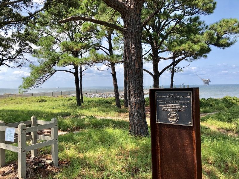
By Mark Hilton, August 22, 2018
Looking west from marker into Mobile Bay.
| 1 ► Alabama, Baldwin County, Gulf Shores — Here ends the Alabama Scenic River Trail — |
| Near Fort Morgan Road (Alabama Route 180) 1.2 miles west of Dune Drive, on the right when traveling west. | |||
| 2 ► Alabama, Blount County, Oneonta — Champion Mines — |
| On 6th Street South (U.S. 231) at Champion Road, on the right on 6th Street South. | |||
| 3 ► Alabama, Clay County, Delta — Alabama's Highest Point — |
| Near Bunker Loop north of Route 281. | |||
| 4 ► Alabama, Colbert County, Tuscumbia — Petrified Conifer Tree / Petrified Lycopod Tree Stump — |
| On S. Main Street. | |||
| 5 ► Alabama, Jackson County, Woodville — Cathedral Caverns — |
| Near Cave Road 0.7 miles east of Cathederal Caverns Road, on the left when traveling east. | |||
| 6 ► Alabama, Jefferson County, Birmingham, Five Points South — Reading Red Mountain — |
| Near Richard Arrington Junior Boulevard South 0.2 miles north of 20th Avenue South, on the right when traveling south. | |||
| 7 ► Alabama, Jefferson County, Clay — The Cahaba Heart River of Alabama — |
| On Old Springville Road / County Road 30, on the left when traveling north. | |||
| 8 ► Alabama, Jefferson County, Pinson — Pinson, Alabama — |
| On Main Street east of Center Point Road (State Highway 75), on the left when traveling east. | |||
| 9 ► Alabama, Lauderdale County, Waterloo — Mud Glorious Mud — |
| On Lauderdale County 1 (County Route 1) 0.8 miles north of Lauderdale County 14 (County Route 14), on the left when traveling north. | |||
| 10 ► Alabama, Lauderdale County, Waterloo — Rock Spring — |
| Near Natchez Trace Parkway (at milepost 330.2), 1.4 miles north of County Road 2, on the right when traveling north. | |||
| 11 ► Alabama, Madison County, Huntsville — Burritt Museum — |
| On Monte Sano Boulevard Southeast at Burrit Drive Southeast, on the left when traveling north on Monte Sano Boulevard Southeast. | |||
| 12 ► Alabama, Madison County, Huntsville — Old Town Historic District — |
| On Holmes Avenue close to Lincoln St., NE. | |||
| 13 ► Alabama, Marengo County, Demopolis — White Bluff — |
| On West Monroe Street. | |||
| 14 ► Alabama, Marshall County, Guntersville — Section of Core — |
| On Paddle Wheel Drive (U.S. 431) at Taylor Street, on the right when traveling south on Paddle Wheel Drive. | |||
| 15 ► Alabama, Talladega County, Childersburg — DeSoto Caverns — |
| Near DeSoto Caverns Pkwy (State Highway 76). | |||
| 16 ► Alabama, Tuscaloosa County, Tuscaloosa — Burns’ Shoals — |
| Near Greensboro Avenue north of 2nd Street (Jack Warner Parkway). | |||
| 17 ► Alabama, Tuscaloosa County, Tuscaloosa — Marr’s Spring — |
| Near Marrs Spring Road south of Campus Drive East, on the left when traveling south. | |||
| 18 ► Alabama, Tuscaloosa County, Tuscaloosa — Why Are We Here? — City of Tuscaloosa — |
| Near 6th Street west of 21st Avenue, on the left when traveling west. | |||
| 19 ► Alaska, Anchorage, Bird Creek — Traveling Tikahtu — Traveling the Cook Inlet — |
| Near Seward Highway (State Highway 1) west of Bushnell Road, on the right when traveling west. | |||
| 20 ► Alaska, Denali Borough, Denali National Park and Preserve — Mountains in Motion / Hot Rocks — |
| On Park Road. | |||
| 21 ► Alaska, Denali Borough, Denali National Park and Preserve — The Time-Honored Trail — Denali National Park and Preserve — National Park Service, U.S. Department of the Interior — |
| On Murie Road north of Bus Concessionaire Road, on the left when traveling north. | |||
| 22 ► Alaska, Fairbanks North Star Borough, College — Boreal forest: living around Thompson Drive — |
| On Thompson Drive 0.1 miles north of Geist Road, on the right when traveling north. | |||
| 23 ► Alaska, Juneau Borough, Juneau, Mendenhall Valley — A View in Time — |
| On The Trail of Time at Glacier Spur Road, on the left when traveling east on The Trail of Time. | |||
| 24 ► Alaska, Juneau Borough, Juneau, Mendenhall Valley — Changing Views — Trail of Time — Tongass National Forest — |
| On East Glacier Trail at Glacier Spur Road, on the left when traveling east on East Glacier Trail. | |||
| 25 ► Alaska, Juneau Borough, Juneau, Mendenhall Valley — Looking Back — Trail of Time — Tongass National Forest — |
| On East Glacier Trail at Glacier Spur Road, on the left when traveling east on East Glacier Trail. | |||
| 26 ► Alaska, Matanuska-Susitna Borough, Sutton-Alpine — A Glacial Pace — |
| Near Glenn Highway. | |||
| 27 ► Alaska, Matanuska-Susitna Borough, Sutton-Alpine — Chugach Mountains — |
| On Glenn Highway (Alaska Route 1 at milepost 61.6) east of Chickaloon Way, on the left when traveling east. | |||
| 28 ► Alaska, Matanuska-Susitna Borough, Sutton-Alpine — Talkeetna Mountains — |
| On Chickaloon Way north of Glenn Highway Milepost 61.6 ( Highway 1), on the right when traveling north. | |||
| 29 ► Alaska, Skagway — Pitch Fork Falls — White Pass & Yukon Route — |
| On Klondike Highway (State Highway 98) south of Liarsville Road, on the right when traveling north. | |||
| 30 ► Alaska, Skagway, Dyea — Asaayíx' Kudziteey Haa Léelk'u Hás Aaní — This Land of our Grandparents Has Tlingit Names — Traditional Place Names of the Skagway Area — |
| On State Street just north of 12th Avenue, on the left when traveling north. | |||
| 31 ► Alaska, Valdez-Cordova Census Area, Tolsona — The Wrangell Mountains — |
| On Glenn Highway (State Highway 1 at milepost 176.5), on the right when traveling east. | |||
| 32 ► Arizona, Apache County, Adamana — Jasper Forest |
| Near Jasper Forest Road, on the left when traveling west. Reported permanently removed. | |||
| 33 ► Arizona, Apache County, Chambers — Badlands — |
| Near Park Road, on the right when traveling north. | |||
| 34 ► Arizona, Apache County, Chambers — Painted Desert / Finding Fossils |
| On Park Road, on the right when traveling west. Reported missing. | |||
| 35 ► Arizona, Apache County, Petrified Forest National Park — A Painted Park — Petrified Forest National Park — |
| On Petrified Forest Road 1 mile north of U.S. Route 66 (Interstate 40), on the right when traveling north. | |||
| 36 ► Arizona, Apache County, Petrified Forest National Park — Over the Edge — Petrified Forest National Park — |
| Near Petrified Forest Road 2 miles north of U.S. Route 66 (Interstate 40), on the right when traveling north. | |||
| 37 ► Arizona, Apache County, Springerville — 1 — Escudilla Mountain — |
| On U.S. 60 at milepost 392, on the right when traveling east. | |||
| 38 ► Arizona, Apache County, Window Rock — In Remembrance of Our Warriors / Navajo Warrior Memorial — |
| Near Parking Lot BIA 100 MP 0 (Route 100 Connector Road) 0.8 miles east of Route 12 N (Arizona Highway 263). | |||
| 39 ► Arizona, Cochise County, Bowie — 086-352 — Old Fort Bowie — Guardian of Apache Pass — |
| On I-10 Extension (Interstate 10), on the left when traveling east. | |||
| 40 ► Arizona, Coconino County, Flagstaff — Geology — |
| On East Aspen Avenue. | |||
| 41 ► Arizona, Coconino County, Flagstaff — The Citadel / Natural Features — |
| On Loop Road, on the left when traveling north. | |||
| 42 ► Arizona, Coconino County, Grand Canyon National Park — Grandview, 1898 — |
| Near Grandview Trail. | |||
| 43 ► Arizona, Coconino County, Peach Springs — Grand Canyon Caverns — |
| On Grand Canyon Caverns Road 1.1 miles south of Arizona Route 66. | |||
| 44 ► Arizona, Coconino County, Sunset Crater Volcano National Monument — As Powerful as a Volcano — |
| Near Lava Flow Trail. | |||
| 45 ► Arizona, Coconino County, Sunset Crater Volcano National Monument — Life and Landscape Transformed — |
| Near Lava Flow Trail. | |||
| 46 ► Arizona, Coconino County, Sunset Crater Volcano National Monument — The Birth of a Mountain — |
| Near Lava Flow Trail. | |||
| 47 ► Arizona, Mohave County, Fredonia — How Can 10 Million Gallons of Water a Year Suddenly Appear in a Stony Desert? — Pipe Spring National Monument — |
| Near North Pipe Spring Road 0.3 miles north of Arizona Route 389, on the left when traveling north. | |||
| 48 ► Arizona, Mohave County, Fredonia — Remnants of a Frozen Sahara — Pipe Spring National Monument — |
| Near North Pipe Spring Road 0.3 miles north of Arizona Route 389, on the left when traveling north. | |||
| 49 ► Arizona, Navajo County, Holbrook — A Gap in the Geologic Record — |
| On Petrified Forest Road, on the left when traveling east. | |||
| 50 ► Arizona, Navajo County, Holbrook — Desert Vistas — |
| Near Petrified Forest Road, on the left when traveling east. | |||
| 51 ► Arizona, Navajo County, Holbrook — From Wood to Stone — |
| On Petrified Forest Road, on the right when traveling north. | |||
| 52 ► Arizona, Navajo County, Holbrook — Painted Desert Community Complex Historic District — |
| Near Interstate 40. | |||
| 53 ► Arizona, Navajo County, Holbrook — The Painted Desert — |
| Near Petrified Forest Road, on the left when traveling north. | |||
| 54 ► Arizona, Navajo County, Holbrook — Triassic Landscape |
| Near Petrified Forest Road, on the right when traveling north. Reported permanently removed. | |||
| 55 ► Arizona, Navajo County, Shonto — A Relict Forest — Navajo National Monument — |
| Near State Highway 564 at County Route 221. | |||
| 56 ► Arizona, Navajo County, Shonto — Upside-down Mountain — Navajo National Monument — |
| On Arizona Route 564. | |||
| 57 ► Arizona, Navajo County, Winslow — Sunset Crossing — |
| On East Second Street/Old Route 66 (Arizona Route 66), on the left when traveling east. | |||
| 58 ► Arizona, Pima County, Tucson, Menlo Park — Sentinel Peak — |
| On South Sentinel Peak Road, on the left when traveling north. | |||
| 59 ► Arizona, Pima County, Vail — Colossal Cave Mountain Park — |
| Near East Old Spanish Trail. | |||
| 60 ► Arizona, Yavapai County, Sedona — Wilson Mtn. Trail — National Recreational Trail — |
| Near Arizona Route 89A, on the left when traveling north. | |||
| 61 ► Arkansas, Arkansas County, Arkansas Post — The Post of Arkansas — |
| On Old Post Road at State Route 169, on the right when traveling south on Old Post Road. | |||
| 62 ► Arkansas, Carroll County, Eureka Springs — Calif Spring — South Main — |
| On Main Street (State Highway 23) at Armstrong, on the right when traveling south on Main Street. | |||
| 63 ► Arkansas, Clay County, St. Francis — Chalk Bluff — |
| Near County Road 347, on the right when traveling north. | |||
| 64 ► Arkansas, Crawford County, Van Buren — Log Town Hill — |
| On Fayetteville Road (State Highway 59) south of Hynes Street, on the right when traveling south. | |||
| 65 ► Arkansas, Garland County, Hot Springs — DeSoto Camp — |
| On Central Avenue (Arkansas Route 7) at Fountain Street, on the right when traveling north on Central Avenue. | |||
| 66 ► Arkansas, Garland County, Hot Springs — Hot Springs — |
| On Central Avenue (State Highway 7) just south of Fountain Street, on the right. | |||
| 67 ► Arkansas, Garland County, Hot Springs, Hot Springs National Park — Geology Rocks! — |
| On Central Avenue. | |||
| 68 ► Arkansas, Garland County, Hot Springs, Hot Springs National Park — Ral City — |
| Near Central Avenue. | |||
| 69 ► Arkansas, Garland County, Hot Springs, Hot Springs National Park — The Zig Zag Mountains — |
| On N Mountain Drive, on the right when traveling north. | |||
| 70 ► Arkansas, Garland County, Hot Springs, Hot Springs National Park — Water Quality through Time — |
| Near Central Avenue. | |||
| 71 ► Arkansas, Garland County, Mountain Pine — Three Sisters Springs History — |
| On State Park Lane, on the right when traveling north. | |||
| 72 ► Arkansas, Jefferson County, Pine Bluff — Bayou Bartholomew — |
| On South Main Street at South Olive Street (Business U.S. 63), on the right when traveling north on South Main Street. | |||
| 73 ► Arkansas, Phillips County, Helena — Battery A — |
| On Adams Street east of Beech Street, on the right when traveling west. | |||
| 74 ► Arkansas, Phillips County, Helena — Battery D — |
| On Military Road 0.1 miles west of Prairie Street, on the left when traveling south. | |||
| 75 ► Arkansas, Pike County, Murfreesboro — A Multifaceted History — |
| Near State Park Road. | |||
| 76 ► Arkansas, Pike County, Murfreesboro — An Attempt at Riches — The Martin Processing Plant — |
| On State Park Road. | |||
| 77 ► Arkansas, Pike County, Murfreesboro — End of a Mystery: What is Below the Surface? — |
| On State Park Road. | |||
| 78 ► Arkansas, Pike County, Murfreesboro — B-26 — Pike County Diamond Mines — |
| On Courthouse Square at North Washington Avenue, on the left when traveling west on Courthouse Square. | |||
| 79 ► Arkansas, Pulaski County, Jacksonville — The Memphis to Little Rock Railroad — Samson Gray Helps Link the State Capital with the Mississippi — |
| Near East Trickey Lane at Military Road. | |||
| 80 ► Arkansas, Pulaski County, Little Rock — One Old Rock — La Petite Roche Historical Walk — |
| Near President Clinton Avenue. | |||
| 81 ► Arkansas, Pulaski County, Little Rock — Smaller Rock, Big Bridge — La Petite Roche Historical Walk — |
| Near President Clinton Avenue. | |||
| 82 ► Arkansas, Pulaski County, Little Rock — The Big Rock and the Little Rock — La Petite Roche Historical Walk — |
| Near President Clinton Avenue. | |||
| 83 ► Arkansas, Pulaski County, Little Rock — Witness to Removal — La Petite Roche Historical Walk — |
| Near President Clinton Avenue. | |||
| 84 ► Arkansas, Searcy County, Marshall — Devils Backbone Road Cut-Geology / Construction — |
| On U.S. 65 north of County Road 415, on the right when traveling south. | |||
| 85 ► California, Alameda County, Berkeley, Berkeley Hills — Indian Rock — Berkeley History — |
| On Indian Rock Avenue. | |||
| 86 ► California, Alameda County, Berkeley, Berkeley Hills — Thousand Oaks Neighborhood and Urns — Circa 1909-1910 — Mark Daniels, Landscape Engineer — |
| On San Fernando Avenue at Yosemite Road on San Fernando Avenue. | |||
| 87 ► California, Alameda County, Berkeley, North Berkeley — Live Oak Park — 1914 — Berkeley History |
| Near Shattuck Avenue near Berryman Street. Reported permanently removed. | |||
| 88 ► California, Alameda County, Fremont, Cameron Hills — Under the Canopy — |
| Near Via Orinda near Castillejo Way. | |||
| 89 ► California, Alameda County, Piedmont — Sulphur Springs Grotto — The Healing Powers of Mineral Springs — |
| Near Wildwood Avenue, on the right when traveling west. | |||
| 90 ► California, Alpine County, Kirkwood — Caples Lake — |
| On Carson Pass Highway (State Highway 88), on the right when traveling east. | |||
| 91 ► California, Alpine County, Kirkwood — Summer Retreat — |
| On California 88, on the right when traveling east. | |||
| 92 ► California, Alpine County, Markleeville — Grover Hot Springs — |
| Near Hot Springs Road. | |||
| 93 ► California, Amador County, Volcano — Volcano Masonic Cave — |
| Near Masonic Cave Road 0.2 miles north of Pine Grove Volcano Road. | |||
| 94 ► California, Butte County, Oroville — Bald Rock Dome — |
| Near Bryant Ravine Road (Forest Road 21N35Y) 1.6 miles north of Lumpkin Road when traveling north. | |||
| 95 ► California, Calaveras County, Angels Camp — Stalactite/Stalagmite — |
| On South Main Street (California Route 49), on the left when traveling south. | |||
| 96 ► California, Calaveras County, Cave City — 956 — California Caverns at Cave City — California Historical Landmark No. 956 — |
| On Cave City Rdoad 2 miles east of Michel Road, on the left when traveling east. | |||
| 97 ► California, Calaveras County, Murphys — Mercer Caverns — |
| Near Sheep Ranch Road. | |||
| 98 ► California, Contra Costa County, Clayton — History of Marsh Creek Springs — |
| Near Marsh Creek Road near Aspara Drive. | |||
| 99 ► California, Contra Costa County, Clayton — Old Marsh Creek Springs — |
| Near Marsh Creek Road near Aspara Drive, on the left when traveling west. | |||
| 100 ► California, Contra Costa County, El Cerrito — Cerrito Creek |
| On San Pablo Avenue at Carlson Boulevard, on the left when traveling north on San Pablo Avenue. Reported unreadable. | |||
2103 entries matched your criteria. The first 100 are listed above. Next 100 ⊳