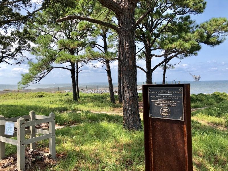
Historic 650 miles Water Route along the
Coosa, Alabama and Mobile Rivers
_________
Beginning on the Coosa River at the
Alabama-Georgia State Line
Established 2007 — — Map (db m122443) HM
John Hanby came in 1817 and found a rich seam of brown iron ore. Named Champion in 1882 when Henry DeBardeleben and James Sloss bought land and brought L&N Railroad causing county seat to be moved from Blountsville to Oneonta in 1889. Most ore was . . . — — Map (db m28362) HM
Everyone needs beauty as well as bread, places to play in and pray
in where nature may heal and give strength to body and soul.
–John Muir
Mount Cheaha is Alabama's highest point at 2,407 feet above
sea level and is part of the . . . — — Map (db m175329) HM
Plaque A 85-90 Million Years Old
Possibly a Bald Cypress
from the Cretaceous Period
or the Age of Dinosaurs Plaque B
325 Million Years Old
A Member of the Giant Club Mosses
from the early Coal Age — — Map (db m29287) HM
Cathedral Caverns has been designated a Registered Natural Landmark under the provisions of the Historic Sites Act of August 21, 1935.
This site possesses exceptional value in illustrating the natural history of the United States. — — Map (db m76233) HM
The Big Seam
The red iron ore labeled "The Big Seam" in the
diagram below appears as an outcrop over this
sign. It extends all the way to Gadsden, 60
miles to the northeast. To the south, it runs as
far as Hoover, where it is a mile . . . — — Map (db m188879) HM
On Cahaba Mountain to the NW, springs form a fragile stream that grows as it carves through the steep, rocky terrain of Birmingham suburbs, flowing south on the Gulf Coastal Plain to the Alabama River, at the site of Alabama's first capital, . . . — — Map (db m25110) HM
Pinson, one of Alabama’s oldest communities, was settled by General Andrew Jackson’s soldiers in the early 1800s, after victory at Horseshoe Bend during the War of 1812. The community was originally known as Hagood’s Crossroads for settler . . . — — Map (db m88406) HM
Birds Come From All Directions to Enjoy the Tasty Treats Hidden Beneath the Mud
In the late summer. fall, and winter, reservoir levels in the Tennessee River Valley drop drastically to expose areas of mudflats. although unsightly to some, theses . . . — — Map (db m105713) HM
Rock Spring Nature Trail offers you an opportunity to explore a small natural spring as it bubbles forth from the ground. Small fish dart about a deep pool created as the stream wandered through rich bottomland soil and limestone rock. Vegetation . . . — — Map (db m84703) HM
Situated on 167 acres of some of the most scenic land in North Alabama, the museum and its grounds contain items of local and national interest.
This property was willed to the City of Huntsville in 1955 by Dr. William Henry Burritt . . . — — Map (db m27876) HM
Designated by the City of Huntsville, Alabama on December 12, 1974 as a Huntsville historic district, it contains houses dating from 1828 onward with the majority dating from 1880 to 1929. Approximate boundaries:
East Clinton Avenue north to . . . — — Map (db m30381) HM
Composed of limestone or “Selma
chalk” which abounds in fossils.
Called “Ecor Blanc” by
eighteenth-century French explorers
and cartographers.
Named “Chickasaw Gallery” because
early Indian inhabitants . . . — — Map (db m38001) HM
Named for the famous Spanish explorer who traveled through this area in 1540. Over its rich history it offered shelter for native Indians for centuries (a 2,000-year-old Woodland Period burial was excavated by archeologists in the mid-1960s), . . . — — Map (db m45034) HM
The remains of Burns' Shoals now lie nearly 40 feet underwater. This rock outcropping was the first of the shoals known as the "Falls of Tuscaloosa" and represents the "Fall Line" or contact point of the Coastal Plain and the Appalachian Plateau, . . . — — Map (db m28904) HM
Part of Marr’s Field, on farmland owned by William Marr, this spring was a major factor in the selection of this site for the University of Alabama campus in 1827. From its opening in 1831 well into the 20th century, the institution relied upon . . . — — Map (db m40388) HM
Since ancient times, people have been attracted to this area because of ease of accessibility and abundant resources. Tuscaloosa lies at an important point where the Black Warrior River crosses the boundary of the Coastal Plain and the Appalachian . . . — — Map (db m217172) HM
Bald Rock
Winston County
Located about 3,000 feet west of the Byler Road
and 3,500 feet southwest of the natural bridge,
stands Bald Rock, an outcropping of exposed rock
about 600 feet in length. Geologically, it is
part of the . . . — — Map (db m309077) HM
Natural Bridge Park is located in the vicinity of early
historic crossings of three Native American paths. The
Mobile Trace served as the primary north-south route.
The Chickasaw Trading Path, the main east-west route,
was in use by the early . . . — — Map (db m309076) HM
“Whenever the [upriver Dena'ina<] needed anything,... they come down to Alexander Creek to trade for beluga grease, seal oil...and they gave [coastal Dena'ina] caribou skins and marten skins. They helped each other, for the were the . . . — — Map (db m283052) HM
Glaciers stretch and contract as they flow over bedrock slopes and around corners. When they stretch past their stress limits, cracks called crevasses appear Open and ShutCrevasses often start with a “crack”, sounding similar to that made by . . . — — Map (db m311379) HM
Where to Find a Glacier You’re more likely to find glaciers at high elevation or close to the poles. Growing at Elevation Glaciers can form wherever winter snowfall exceeds summer melt. At higher elevations, you’re more likely to find . . . — — Map (db m311650) HM
Worthington Glacier has been designated a National Natural Landmark This site possesses exceptional value as an illustration of the nation’s natural heritage and contributes to a better understanding of the environment 1968 National Park Service . . . — — Map (db m310602) HM
On a clear day straight down the road
to the east you can see the Wrangell
Mts. They are [from left to right] Mt.
Sanford 16,237 ft; Mt Drum 12,010 ft.; Mt.
Wrangell 14,163 ft; Mt Blackburn 16,390
ft. Mt Wrangell is the largest . . . — — Map (db m255350) HM
Mountains in Motion
Though the visible glaciers appear remote - gleaming between distant peaks - the valley below is strewn with signs of masses glaciation: stranded boulders, gouged-out ponds, and gravel outwash plains. The last big . . . — — Map (db m71362) HM
Many things have changed since the park was created and the railroad was completed, but the route to the park remains the same. Whether you traveled the historic rail line or modern highway, you took the route taken by the park's first visitors. . . . — — Map (db m283503) HM
Life in the boreal forest
Boreal forest forms a belt that circles the
northern part of the globe, including Canada,
Russia, Scandinavia and Alaska. The location
of boreal forest ecosystems is generally
determined by soil temperature, . . . — — Map (db m256286) HM
Cold air moving down the glacier’s surface pours into the lower Mendenhall Valley influencing the temperature and wind patterns. Temperatures here are generally 10 degrees cooler than 5 miles down the valley. People who live near the glacier . . . — — Map (db m310902) HM
From this vantage point you can spot and identify many features unique to a glacial landscape. Although the glacier has been retreating, it has left many clues of its former movement and present power. BEACH with glacial rock deposits; Blue-gray . . . — — Map (db m310904) HM
Looking out over the landscape to the west, vegetation is thriving on the raised moraine where the Moraine Ecology Trail is located. As you look down the valley, notice how the spruce/hemlock forest is starting to appear and life is returning to a . . . — — Map (db m310910) HM
As you look out from this vista point notice the change in the forest patterns from right to left. Starting from the glacier, across the lake to the lake shore, the rocks and till are rather barren. Continuing your gaze to the left, small shrubs of . . . — — Map (db m310853) HM
Natural and cultural forces reshaped the landscape through plant succession and human development.
Small changes had dramatic effects over time. On a daily basis the movement of the glacier was often unnoticeable As the glacier sets, . . . — — Map (db m282929) HM
The spot on which you stand was underneath the Mendenhall Glacier in 1921. The photo above was taken approximately ¼ mile south of here, near the 1930 parking area. — — Map (db m283005) HM
The pavement may end but your journey through time begins.
Today the cues to the past on the trail ahead are obscured by vegetation. Close examination of this 1939 photograph reveals features along the trail head of you.
Note the . . . — — Map (db m283002) HM
A bight is a bend in the shoreline that forms a shallow bay.
It looks as if a giant creature took a bite out of it. Natives
favored bights for village sites since they are often protected
from fierce weather and have sandy beaches good for . . . — — Map (db m307974) HM
Denali or Mt. McKinley?
Like the clouds that often enshroud it, the question of what to call North America’s tallest peak has loomed over it for more than a century.
Tempestuous Beginnings
An Athabascan story tells of their . . . — — Map (db m311562) HM
Tall Mountain, Taller Tails
Mt. McKinley has been under a cloud of controversy since the first summit attempts in the early 1900s. Many mountaineers saw this wild and uncharted territory with one thought in mind – being the first to . . . — — Map (db m311404) HM
Don't blink or you'll miss it-glaciers are on the move. Research has taught us more about how glaciers move than we've ever known before.
Tracking a Moving Glacier
A glacier's pace varies like a river's speed as . . . — — Map (db m255273) HM
The mountains across the Matanuska River are part of the Chugach
Mountain Range. The Chugach Mountains extend in an arc for roughly
350 miles, bordering Cook Inlet near Anchorage, Prince William Sound and
on toward Icy Bay where they meld with . . . — — Map (db m254977) HM
The mountain dominating the view to the north is Granite Peak.
At 6,729 feet tall, it is one of the highest mountains on the front
range of the Talkeetna Mountains (you are standing at 500 feet). It
can be spotted easily from Anchorage on a . . . — — Map (db m254986) HM
460 Miles south of the Arctic Circle on Meridian Elevation 1014ft. Road built 1898 to 1900. This is one of many scenic spots enroute to Atlin and Dawson — — Map (db m283060) HM
* Lkóot Aaní (Chilkoot)Lkóot Aaní is the name of the area from Haines to Skagway, and the name originates from Lkóot Áa ("The Lake that Puked" [Chilkoot Lake]), where a massive rock . . . — — Map (db m248858) HM
The petrified wood strewn in the valley below was once encased in the bluffs around you. When erosional forces removed the softer rocks, the petrified wood tumbled and accumulated on the valley floor. Once filled with fallen logs, Jasper Forest . . . — — Map (db m269587) HM
Geologists call eroded landscapes such as the Painted Desert "badlands." Summer thunderstorms and winter snowmelt carve the shale and sandstone into mazes of sharp ridges, steep hillsides, and deep V-shaped gullies. Practically waterless, badlands . . . — — Map (db m72923) HM
The colorful mesas, buttes, and badlands before you compose a natural work of art--the Painted Desert.
Wind and running water cut these features from the Chinle Formation deposited over 200 million years ago when this area was a vast inland . . . — — Map (db m72925) HM
As you look out over the Painted Desert, you are only seeing a small portion of it. The Painted Desert extends over 7,500 square miles (19,425 km²) across northeastern Arizona. Because Petrified Forest National Park lies at its heart, the entire . . . — — Map (db m163185) HM
Below you lies a black basalt which forms the rim of the plateau on which you stand. This hard basalt, called the Bidahochi Formation, was deposited by local volcanoes between 16 and five million years ago, and forms a protective cap over the soft, . . . — — Map (db m163270) HM
Due south rises the 3rd tallest peak in AZ, revered by conservationist, Aldo Leopold Escudilla was home to Ike Clanton of OK Corral fame & Arizona's last grizzly bear. In fall, the north slope is golden with Aspen covering the 23,000 acre fire of . . . — — Map (db m36592) HM
In Remembrance of Our Warriors
Who Made the Ultimate Sacrifice and/or
Missing in Action,
They will never be forgotten
and to us they will always be young in our thoughts.
Nelson Lewis • Walter Nelson • Willie A. Notah • Edie . . . — — Map (db m27911) HM
Established 1862 following the Battle of Apache Pass, largest conflict in Arizona Indian Wars. Massed Apaches under Cochise and Mangas Coloradas were routed by howitzers fired by California Volunteers attacked in the pass. Fort Bowie overlooked . . . — — Map (db m6994) HM
In northern Arizona, the history by the earth is revealed on a gigantic scale. Exposures of rock at the bottom of Grand Canyon reveal two episodes of mountain building, each separated by extensive erosion. These rocks, from two billion to 570 . . . — — Map (db m263751) HM
The Citadel
It was a remarkable achievement, to use primitive mortar and local stones to build the walls above you straight up from the edge of the top of the rock. “The Citadel” is the modern name given to this ruin because . . . — — Map (db m60087) HM
"No language can fully describe, no artist paint the beauty, grandeur, immensity and sublimity of this most wonderful production of Nature's great architect. [Grand Canyon] must be seen to be appreciated."
C.O. Hall, Grand . . . — — Map (db m39659) HM
In 1927 Walter Peck, a cowboy and wood cutter, was walking through this area on his way to play poker when he nearly fell into a hole in the ground. The next morning Peck and his friends returned to the hole with lanterns and ropes. Peck was lowered . . . — — Map (db m288664) HM
Cinder cones erode easily and scars are slow to heal. In 1973, Sunset Crater was closed to climbing when 2-foot-wide trails eroded to 60-foot-wide swaths. Tons of cinder were shoveled back up the cone to fill hip-deep trenches. Notice the scars . . . — — Map (db m41676) HM
The landscape before you has existed on Earth for less than 1,000 years, less time than Romanesque architecture or paper money. Consequently, this environment has unique scientific value.
Geologists come here to study weathering processes and . . . — — Map (db m41691) HM
About 1,000 years ago, something spectacular happened in the lives of local Native peoples. Perhaps they first observed a change in animal behavior. Maybe they noticed the ground warming. Then the tremors increased in number and intensity. By the . . . — — Map (db m41689) HM
The answer lies buried in the white and red rocks you can see ahead. Here about 90 percent of any rain and snow is absorbed by plants or quickly evaporates. Only 10 percent of Pipe Spring’s precipitation soaks into the light-colored rock you see at . . . — — Map (db m149469) HM
The pale rock you see here is Navajo sandstone. This rock caps the top of the Vermilion Cliffs for more than 80 miles. Navajo sandstone also forms the high canyon walls at Zion National Park. Imagine an enormous Sahara-like desert, full of . . . — — Map (db m149385) HM
The black basalt that caps the cliffs before you stands in stark contrast to the colorful Chinle Formation visible throughout the Painted Desert.
Below this layer of basalt, a horizontal line cuts across the face of the mesa and separates rocks . . . — — Map (db m68901) HM
From Pintado Point, vistas of remarkable clarity extend far beyond boundaries because the air quality in the surrounding Petrified Forest is among the purest in the continental United States. At times, the San Francisco Peaks, 120 miles (193 km) . . . — — Map (db m68903) HM
Approximately 225 million years ago, during the Triassic Period, a floodplain existed here – littered with fallen trees. Periodic flooding buried the logs beneath layers of silt. Over time, silica-laden waters filtered through these deposits . . . — — Map (db m68870) HM
The Painted Desert stretches before you as an outdoor museum of fossilized plants and animals. Its striking colors emanate from the Chinle Formation of the Late Triassic, which has been eroded by the Little Colorado River drainage system.
An . . . — — Map (db m68896) HM
The dry plateau lands of this region today are far different from the tree-littered floodplains of 225 million years ago during the geologic period called the Triassic. Imagine a forested Triassic land where crocodile-like phytosaurs inhabited . . . — — Map (db m269589) HM
Before you lies a small tributary of the Tsegi Canyon watershed. A quaking aspen grove graces the canyon floor, while the north-facing cliff (right) offers shady habitat for towering Douglas-fir trees.
Thriving here in this desert wilderness is . . . — — Map (db m144450) HM
Hidden away in Tsegi Canyon’s wilderness of bare rock, sand, and sparse vegetation are surprising pockets of luxuriant growth. Betatakin Canyon—home to a village of prehistoric cliff-dwellings farmers—is one of these oases. Fir Canyon, . . . — — Map (db m71514) HM
This crossing, first noted early in the 1850s in journals and maps of explorers along the 35th parallel, is the only convergence of major travel routes on the Little Colorado River. It lies on the trail used by Mormon immigrants journeying from Utah . . . — — Map (db m32722) HM
This Property has
been placed on the
National Register
of Historic Places
By the United States
Department of the Interior
Colossal Cave
Mountain Park
1934 — — Map (db m30613) HM
Richard Wilson was an old bear hunter who lived at Indian Gardens. In 1885 he was killed by a large grizzly bear in what is now known as Wilson Canyon. — — Map (db m99272) HM
Here on the Grand Prairie you tread on
soil laid down over the centuries as the
mighty Mississippi and Arkansas Rivers
brought down their precious cargoes of
silt from the northern uplands.
The footprints of many were pressed into
this . . . — — Map (db m108486) HM
Calif Spring was originally called Table Rock Spring, named for the rock formation above the spring area. This area was set aside as a spring reservation in 1886 by City Ordinance. S. L. Calif established a residence and general store next to the . . . — — Map (db m90703) HM
Named for the white clay which resembles chalk, this magnificent bluff is one of the most important historical landmarks in Arkansas. At this point the St. Francis River cuts through Crowley's Ridge from west to east and forms the boundary between . . . — — Map (db m18136) HM
The residents of Log Town were witness to the retreat of the Rebel army through Van Buren and onward through their settlement. High on Log Town Hill the community watched as masses of Southern soldiers crowded the hill trying desperately to reach . . . — — Map (db m96614) HM
This valley, long known by the Indians as "Tah-Ne-Co," "The Place of the Hot Waters" and according to tradition regarded by the different tribes as neutral ground, was first visited by white men on September 16, 1541, when Hernando De Soto and his . . . — — Map (db m170754) HM
After 1877 when the title to the springs was finally vested in the federal government by the Supreme Court, Congress began to take an active interest in the Hot Springs Reservation. In 1921 the Reservation officially became Hot Springs National Park. — — Map (db m103164) HM
Many years ago, this region of Arkansas was at the bottom of a deep ocean. Mud
slowly built up on the seafloor and eventually became shale, a rock that
results from mud subjected to high pressure and temperatures. Built up sand
became sandstone, . . . — — Map (db m297081) HM
In 1877, General Benjamin F. Kelley arrived at
Hot Springs Reservation as the first
superintendent. He was quickly approached
by bathhouse owners to solve the "problem"
of the poor people living in a tent city known
as "Ral City" on Hot Springs . . . — — Map (db m297084) HM
Formed as the continent Pangaea came together about 300 million years ago, the
Ouachita Mountains are the only
significant mountain range on the
continent that trends east to west, unlike
the Rocky Mountains or the Appalachians,
which trend . . . — — Map (db m297077) HM
In January of 1859, surveyors measured 54 springs, numbering them according to their temperatures. The average recorded temperature of the hot springs was 134 °F (56.7 °C), and their flow was measured at about 450,000 gallons per day. Today, with . . . — — Map (db m297082) HM
During the mid-1800's Hot Springs
rapidly became a nationally known
health resort. At that time it was
an accepted fact that many diseases
could be cured by drinking or
bathing in the area's mineral waters.
So, it was natural that other . . . — — Map (db m297090) HM
Beginning 10 miles northwest of Pine Bluff, this storied bayou flows 300 miles through 6 Arkansas counties and 2 Louisiana parishes before emptying into the Ouachita River in north Louisiana. Indian mounds dotted its banks. Immigrants travelled it . . . — — Map (db m30581) HM
Union forces entrenched on this hill held off repeated assaults by Confederate troops under CSA General Marmaduke on the morning of July 4, 1863, in their attack on Helena. CSA General Marsh Walker's Cavalry Brigade, consisting of the 5th Arkansas . . . — — Map (db m107784) HM
Hindman Hill, southernmost of four positions fortified by Union Forces in June, 1863, was attacked by the 35th, 37th, and Hawthorn's Arkansas Infantry Regiments under General Fagan, CSA at daybreak, July 4, 1863. Thwarted by the strength of the . . . — — Map (db m107791) HM
The history of commercial diamond mining in Arkansas is complex and fascinating.
Through much of the 20th century, the land that makes up today's diamond search
area was divided. It was bought, sold, and leased numerous times. Local farmer . . . — — Map (db m274583) HM
In 1948, Glen L. Martin leased property to build
a diamond processing plant. Martin's plant operation
lasted only eight months after recovering less than
250 carats of diamonds. The original location of
the Martin Plant has been preserved. Its . . . — — Map (db m274185) HM
Ever since John Huddleston discovered the first diamonds here in 1906, people
have wondered what lies under the volcanic soil in Southwest Arkansas. How deep
and how large is this diamond deposit?
From 1990 to 1997, Arkansas State Parks . . . — — Map (db m274572) HM
Two and a half miles southeast of this point is the only locality in North America where diamonds have been found in the rock in which they were formed. They have been found principally in one igneous pipe which, with three small pipes, aggregates . . . — — Map (db m121290) HM
One of the largest public works projects to take place in territorial Arkansas was construction of the Memphis to Little Rock Road, an ambitious effort to allow travelers to cross the dense swamps and Grand Prairie of east Arkansas to reach the . . . — — Map (db m116571) HM
La Petite Roche ("the Little Rock") refers to the
rock outcropping on the Arkansas River used as a
navigation point during the early exploration of what
would become the state of Arkansas. Sometimes called
the Point of Rocks, it is the first . . . — — Map (db m116556) HM
Post-Civil War, railroads became vital to the Arkansas
economy. Point of Rocks was a natural support for
a railroad bridge on the river. In October 1872,
construction began at the Little Rock with several
tons of rock removed from the . . . — — Map (db m116541) HM
Jean-Baptiste Bénard de La Harpe was the first
European explorer to record the existence of a large
rocky bluff on the north bank of the Arkansas River.
According to his journal, La Harpe named it le Rocher
Français ("the French Rock") on . . . — — Map (db m116558) HM
In 1818, the U.S. policy on Indian Removal
restricted the Quapaw to a reservation in Arkansas.
The western boundary, or Quapaw Line, began at
"the Little Rock." This was perhaps the first official
use of the name Little Rock. In 1824, a new . . . — — Map (db m116565) HM
Devils Backbone Road Cut-Geology
This road cut exposes the upper Fayetteville
Shale, and overlying lower Pitkin Limestone
deposited in a shallow sea covering the southern
Ozark region as the Mississippian Geological
Period ended. As . . . — — Map (db m143764) HM
Outcroppings of weathered rock are a prominent feature of the Berkeley Hills, providing evidence of this area’s complex geological past. Composed of Northbrae rhyolite, Indian Rock is an ancient volcanic remnant. Native Ohlone communities gathered . . . — — Map (db m53852) HM
Berkeley History
In the early 1900s, the natural beauty of this undeveloped district, with dramatic rock outcroppings and ancient oaks made it a favorite destination for picnickers and hikers.
After a campaign to make the area a city park . . . — — Map (db m53848) HM
Live Oak Park was created in 1914 when the City of Berkeley purchased four acres from landowners R.S. Penniman and Michael O’Toole. Mr. Penniman’s brown shingle house served as the park clubhouse and also, from 1916-1936, as Berkeley’s North Branch . . . — — Map (db m194669) HM
Amphibians such as the native Pacific Tree Frog rely on shade and habitat created by oaks, buckeyes, willows, and other riparian trees that grow near the creek. Tree frogs eat insects and spiders as large as they are. The toe pads of these . . . — — Map (db m212648) HM
2196 entries matched your criteria. The first 100 are listed above. Next 100 ⊳