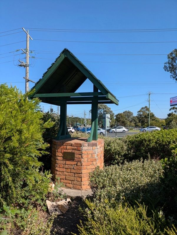
On Wellington Road (Victoria Route 18) at Stud Road and Wellington Road, on the left when traveling east on Wellington Road.
Rowville Carwash
Officially opened by Mobil Oil Australia February 19, 1995
Dedicated to all travellers in memory of Matthew Bergin — — Map (db m296842) HM
Near Stud Road (Victoria Route 9) 0.2 kilometers south of Fulham Road.
Australia Remembers
1945-1995
This Monument is a memorial to the Men and Women of Australia who paid the Supreme Sacrifice in Time of Conflict
Lest We Forget — — Map (db m295948) WM
Near Emmeline Row 0.1 kilometers west of Enterprise Drive.
This large circular brick-lined cistern was initially discovered in November 2008.
It has seven courses of mortar bonded brickwork with cement render, indicating that it was designed to be water-tight.
The exact use of this well is . . . — — Map (db m295946) HM
On Ferntree Gully Road 0.1 kilometers east of Lynton Place, on the left when traveling west.
Scoresby School number 1028 was opened in March 1872. A brick building costing some £450 was build on a two acre property purchased from John and Edmund Ashley. The school opened with 59 children. This was the first school to be built in the Knox . . . — — Map (db m303552) HM
On Ferntree Gully Road 0.1 kilometers Lynton Place, on the left when traveling east.
The first church services in Scoresby were held in William Horner's house in 1866. Horner was instrumental in the development of the Scoresby township, and in particular the building of the Scoresby Wesleyan Church. This church was built in 1874 in . . . — — Map (db m303554) HM
On Blind Creek Trail 0.2 kilometers east of Stud Road ( Route 9), on the right when traveling north.
The Opperman Trails
were officially named by
Chief Commissioner J. L. (Lyn) Davies
and
Lady Mavys Opperman
on 3 November 1996
to commemorate the life and cycling career of
Sir Hubert Opperman, OBE
Terry Maher
Chief . . . — — Map (db m310015) HM
On High Street Road (Victoria Route 24) 0.3 kilometers east of Almray Place, on the left when traveling west.
Shepherds Bush was originally designated as a water reserve, used as a watering place for locals and travelling stock. Having never been privately owned or cut for timber, it offers some of the best original creek vegetation in the Dandenong Valley . . . — — Map (db m312293) HM
On Hutton Street at Mollison Street ( Route C793), on the left when traveling west on Hutton Street.
(Right Plaque)
On February 7th, 2009, devastating bushfires raged through many communities across Victoria. On this day, 173 people lost their lives, over 2000 families lost their home, and many thousands of people had their homes, farms, . . . — — Map (db m312569) HM
On Mollison Street (Route C318) at McKenna Memorial Drive, on the left when traveling north on Mollison Street.
1865-1965
Centenary
of the
Shire of Kyneton
Unveiled by
The Honourable R.J. Hamer E.D. M.L.C.
Minister for Local Government
30th August 1965. — — Map (db m312297) HM
On Hutton Street 0.1 kilometers west of Ebden Street, on the left when traveling east.
The Independent Church met in a carpenter's shop before a wooden church was built in 1853,
replaced in 1859-60 by this Gothic bluestone building with classical details. Great skill is shown in
the carved stonework, belfry, rose window, elaborate . . . — — Map (db m312566) HM
Near Clowes Street west of Ebden Street when traveling west.
Taungurung are the first people of the rivers and mountains. They lived harmoniously according to the natural cycles of the land. Today some Taungurung people still live on Country and are very active in the protection and preservation . . . — — Map (db m313586) HM
On Clowes Street at Ebden Street, on the left when traveling west on Clowes Street.
Gabi mele Taungurung (Dhaagung Wurrung) Biik
(Greetings to Taungurung Country!)
Taungurung are the first people of the rivers and mountains. They lived harmoniously according to the natural cycles of the land. Today some Taungurung people . . . — — Map (db m313585) HM
Near Mollison Street (Victoria Route C318) 0.1 kilometers south of Maxwell Street.
The Gardens were first landscaped in 1866 and demonstrate a strong Von Mueller influence. They occupy nine hectares and are considered to be one of the few surviving Botanical gardens in Victoria. Many of the fine examples of exotic trees were . . . — — Map (db m312551) HM
On Mollison Street (Victoria Route C793) 0.1 kilometers south of Hutton Street, on the left when traveling north.
These columns were created in 2001/02 by local artists, Dianne Barton and Jennie Stewart, with the assistance of more than 2000 students from schools across the shire and members of the Jerang Aboriginal Cooperative.
Each column represents . . . — — Map (db m312594) HM
On Hutton Street 0.1 kilometers west of Mollison Street ( Route C793), on the left when traveling west.
Built in 1857 with simple classically based detailing, the Court House at first had no fireplace, and very little seating. The porch and wings were added in 1861.
Ned Kelly, the bushranger was charged with highway robbery at the Kyneton Court . . . — — Map (db m312568) HM
On Baynton Street at Mollison Street ( Route C318), on the left when traveling west on Baynton Street.
History of Kyneton
Major Thomas Mitchell, on his epic journey to explore the south eastern section of the colony, crossed the Campaspe River at what is now Kyneton on 30 September 1836. In May 1837 Charles Hotson Ebden established the first . . . — — Map (db m312559) HM
On Mitchell Street at Ebden Street, on the left when traveling east on Mitchell Street.
Kyneton was the second township within the Colony of Victoria (Melbourne being the first) to benefit from the formation of a Gasworks. The Kyneton Gasworks were operational prior to the formation of Gasworks in many of the larger towns throughout . . . — — Map (db m313582) HM
On Piper Street (Victoria Route C793) at Powlett Street, on the left when traveling west on Piper Street.
This former bank property was purchased in 1969 by the Shire Council who recognized its particular suitability for use as a folk museum.
The furnishings, ornaments and the numerous exhibits are of local origin drawn from the gracious homes and . . . — — Map (db m313358) HM
On Piper Street (Victoria Route C793) at Powlett Street, on the left when traveling west on Piper Street.
National Trust of Australia
(Victoria)
Kyneton Museum
Formerly the
Bank of New South Wales 1856 - 1904
Architect Andrea Stombuco
Classified — — Map (db m313357) HM
On Mollison Street (Route C793) at Hutton Street, on the left when traveling north on Mollison Street.
(Top Plaque)
Macedon Ranges Shire Council
Kyneton Town Hall
This Hall was extensively restored
and extended during 1994/95.
The new facility was declared open on
Saturday September 23rd, 1995
Miss Maisie Harper
Shire President . . . — — Map (db m312593) HM
On Mollison Street (Victoria Route C318) at Baynton Street, on the left when traveling north on Mollison Street.
In Honour of Those
Who fell in the Great War
1914-1919
(Top Plaque)
Shire of Kyneton
1939 1945
The Shire of Kyneton records
its heartfelt thanks and deep
appreciation of the noble services
rendered by those soldiers who made . . . — — Map (db m312555) WM
On Mollison Street (Victoria Route C318) at McKenna Memorial Drive, on the left when traveling north on Mollison Street.
This Plaque Commemorates the
Service of the
"McKenna Family"
to the Shire of Kyneton.
Martin McKenna 1865-1872 1882-1907
Martin Patrick McKenna 1907-1944
Gerald James McKenna 1936-1949
Gerald George McKenna 1945-1965
Unveiled on . . . — — Map (db m312295) HM
On Piper Street (Victoria Route C793) at Wedge Street, on the left when traveling east on Piper Street.
This bluestone and brick building was built in the 1860s as a flour mill, store and residence. In 1891 it was converted into a butter and cheese factory, which operated for nearly 80 years. Note the typically mid 19th century stucco facade of the . . . — — Map (db m313362) HM
On Ebden Street at Hutton Street, on the left when traveling north on Ebden Street.
Most Rev. James Alypius Goold,
Bishop of Melbourne, Blessed and laid the
Foundation Stone of this Church of Our
Lady of the Rosary on September 20th 1857,
Pius IX being Pope;
Victoria, Queen;
Sir Henry Barkly, Governor;
very Rev. . . . — — Map (db m312563) HM
On Piper Street (Victoria Route C793) at Ebden Street, on the left when traveling east on Piper Street.
Built as the Gold Diggers Arms this hotel was first licensed in 1852 probably in a timber building.
The western bluestone half was erected prior to 1860, and the eastern brick half was completed in 1891. In 1915 the verandah and parapet pedestals . . . — — Map (db m313354) HM
On Saint Agnes Place at Mill Street, on the right when traveling south on Saint Agnes Place.
Swimming Pool Circa 1910
This weir was created as Kyneton's first swimming pool and was a favourite spot for all water activities. Shady trees, bluestone seats and two former Melbourne cable trams helped create a pleasant setting. The first . . . — — Map (db m313584) HM
On Piper Street (Victoria Route C793) 0.1 kilometers east of Ebden Street, on the left when traveling east.
Built for Frederick Castella in 1861-1862, the Mill was acquired by the Willis family in 1898 and operated as a flour mill well into the 20th century. It is a rare example of a flour milling complex in a town setting. The mill was established in . . . — — Map (db m312597) HM
On Piper Street 0.1 kilometers west of Mollison Street ( Route C793), on the left when traveling west.
In 1859 John Jones, a Welsh stonemason, arrived in Victoria. He worked building the railway to Bendigo, including stone bridges, station buildings and the famous viaduct at Malmsbury, where he settled. His son, William Thomas, succeeded him in the . . . — — Map (db m312598) HM
On Main Road (Victoria Route C708) at Station Street, on the left when traveling north on Main Road.
These columns were created in 2001/02 by local artists, Dianne Barton and Jennie Stewart, with the assistance of more than 2000 students from schools across the shire and members of the Jerang Aboriginal Cooperative.
Each column represents . . . — — Map (db m314882) HM
On Main Road (Victoria Route C708) 0.1 kilometers south of Bolithos Road, on the left when traveling south.
The first Anglican Church was located near the railway worker's encampment south of the creek and on the property of John Carre Riddell and Thomas Ferrier Hamilton, known as 'Cairn Hill'. The bible on the lectern dates back to 1856, possibly to the . . . — — Map (db m314853) HM
On Main Road (Victoria Route C708) 0.1 kilometers north of Station Street, on the left when traveling south.
Bluestone or Basalt is Melbourne's and Victoria's signature stone in the same way Sydney is perceived to be a Sandstone city. The Bluestone originates from the ancient basalt lava flows characterised by the volcanic outcrops of Victoria through to . . . — — Map (db m314852) HM
Near High Street 0.1 kilometers east of Forest Street.
A pathway dedicated to Robbie Lodder
Robbie's life was short (11 years) yet he achieved so much in the inspiration he provided for the establishment of a Bone Marrow Registry in Australia, especially in the thoughts that other children like . . . — — Map (db m314849) HM
Near High Street (Route C792) 0.1 kilometers east of Forest Street.
Traditional Owners
Aboriginal People have lived here for more than a thousand generations. The Traditional Custodians of the land on which you are standing are the Djaara People. Dja Dja Wurrung country stretches from Woodend in the . . . — — Map (db m314687) HM
This clock tower was built as a memorial to the local men and women who served in World War I. It was constructed in 1927 and was funded by the community. It was designed by architect Harold Trigg and built by Chadwick Peeler and dedicated in 1928. . . . — — Map (db m314342) HM
On High Street (Route C792) at Anslow Street, on the left when traveling south on High Street.
(Northern Side Plaque 1)
World War I
Gallipoli, France
To Commemorate the Men
of this District who paid
the Supreme Sacrifice
1914 - 1918
(Northern Side Plaque 2)
In Honour for those who served 1914 - 1918 War
from Shire of . . . — — Map (db m313599) WM
On High Street (Victoria Route C792) at Anslow Street, on the left when traveling south on High Street.
Persons enlisting from the Shire of
Newham and Woodend for World War II
Adams, B. ∙ Adams, R. ∙ Agg, J. ∙ Agg, W. ∙ Ainger, H. ∙ Aldridge, C. ∙ Allen, N. ∙ Allen, W. ∙ Allpress, H. ∙ . . . — — Map (db m313781) WM
On Schaw Street at Anslow Street, on the left when traveling south on Schaw Street.
I think I have learned much in this great experience and I know I have learned to appreciate Woodend.
Private Sydney Allan Johnston
Lest We Forget — — Map (db m313590) WM
On Robbs Road 0.1 kilometers east of Exhibition Street, on the right when traveling east.
Anders Park
Anders Mauritz Hansen
Mayor of the City of Footscray (1929-1930)
Councillor (1926-1935)
Local timber merchant and builder who also erected and developed many inexpensive workers homes in the area from 1913-1930's. . . . — — Map (db m306458) HM
On Railway Place 0.1 kilometers west of Maroondah Highway, on the left when traveling west.
Brick Station Building 1889
The brick station building was constructed in 1889 following the extension of the railway line from Ringwood to Upper Ferntree Gully.
It is a rare example of Tudor style and features a red tack-pointed . . . — — Map (db m297046) HM
On Station Street 0.1 kilometers east of James Street.
Conscription and Honours
Ringwood kept above the Victorian quota of providing 10% of eligible men to serve overseas. Dame Nellie Melba often visited Ringwood to support recruitment and fundraising. Two national conscription referenda were . . . — — Map (db m301808) HM WM
On Maroondah Highway (Victoria Route 34) at Stud Road ( Route 9), on the left when traveling west on Maroondah Highway.
This Q.F. 25 Pounder Field Gun was presented to the City of Ringwood by the Ringwood Sub-Branch of the Returned Services League on Armistice Day 1975.
D.F. Snowball, E.D., Sub-Branch President.
R.J. Martin, J.P., Mayor.
Service: World . . . — — Map (db m297770) WM
On Maroondah Highway (Victoria Route 34) at Stud Road ( Route 9), on the left on Maroondah Highway.
In Memory of those who made the Great Sacrifice
The Great War 1914-1919
Johnston C.H. ∙ McCann H.W. ∙ MacKinlay H.W. ∙ Mitchell L. ∙ Morris J. ∙ Palmer E.R. ∙ Parker J.J. ∙ Pollard L.H. ∙ . . . — — Map (db m298339) WM
On Station Street at Greenwood Avenue, on the left when traveling east on Station Street.
Ringwood Methodist Church memorial windows
Alexander Edgar was a dynamic preacher and persuasive evangelist who headed the establishment of the first Central Methodist Mission. He and his wife Katherine came to Ringwood in 1911.
They . . . — — Map (db m297430) WM
Near Greenwood Avenue 0.1 kilometers north of Caroline Street.
Ringwood Primary School - 1921
The first Ringwood State School No. 2997 was built in 1889 on the corner of Ringwood Street and Maroondah Highway. The original foundation stone is now to the right. The school was transferred to this site in . . . — — Map (db m297431) HM
On Station Street at Kendall Street on Station Street.
This memorial plaque is dedicated to the members past and present of Ringwood RSL Women's Auxiliary whose tireless efforts have materially contributed to the work of Ringwood RSL.
Lest We Forget. — — Map (db m301811) WM
On Maroondah Highway (Victoria Route 34) 0.1 kilometers east of Railway Place, on the left when traveling west.
Ringwood Signal Box
Constructed in 1926 to address the increase in trains arriving and departing the junction station after the electrification of the line.
The Ringwood Signal Box was based on early Victorian railway designs . . . — — Map (db m297051) HM
On Railway Place 0.1 kilometers west of Maroondah Highway, on the left when traveling west.
1882
In 1882 the Melbourne to Hawthorn rail network was extended east to the suburb of Lilydale via Ringwood. The extension was a catalyst for the development of Ringwood and resulted in churches, banks and schools being built to service . . . — — Map (db m297047) HM
On Maroondah Highway (Victoria Route 34) at Warrandyte Road, on the left when traveling west on Maroondah Highway.
Ringwood WWI Memorial Clocktower
The Ringwood Memorial Clocktower was constructed as a lasting memorial to those who served during the First World War.
It was erected as a result of public subscription plus a 500 pound grant from the . . . — — Map (db m297294) WM
On Station Street 0.1 kilometers west of James Street, on the left when traveling west.
Ringwood's WWI Casualties
The Rooney family had four orchards on Mullum Mullum Road, Ringwood. There were five boys and one girl in the family, aged thirteen to twenty-two.
Twenty-year-old Norman enlisted in August 1914. Six days . . . — — Map (db m301807) HM WM
On Maroondah Highway (Victoria Route 34) 0.1 kilometers west of Railway Place, on the left when traveling west.
Ringwood's WWI home front
The Australian Red Cross Society was founded on 13 August, 1914, nine days after the outbreak of WWI. The Ringwood ladies quickly responded and five days later they formed one of the first Australian branches, the . . . — — Map (db m297428) WM
On Station Street at Kendall Street, on the left when traveling west on Station Street.
Ringwood's WWI Honour Boards
Many churches and schools in Ringwood raised money to create honour boards to hang in a prominent position in their buildings.
Honour boards were displayed in the Ringwood Mechanics Hall, St Paul's . . . — — Map (db m301809) HM WM
On Maroondah Highway (Victoria Route 34) 0.1 kilometers west of Railway Place, on the left when traveling west.
Sending off the WWI Troops
The Ringwood community was extremely proud of their volunteers, while understanding the danger and potential loss of life. Large crowds would attend send offs, most times in the Ringwood Mechanics Institute Hall . . . — — Map (db m297429) WM
On Maroondah Highway (Victoria Route 34) 0.1 kilometers east of Railway Place, on the left when traveling west.
The Railway was a Catalyst for the development of Ringwood
Rural activity, orchards, brick manufacturing and antimony mining underpinned early history in the area of Ringwood and kept the railway busy.
In 1882, the first year of the . . . — — Map (db m297053) HM
On Maroondah Highway (Victoria Route 34) at Wantirna Road ( Route 9), on the left when traveling west on Maroondah Highway.
WWI Enlistment
After Federation in 1901, the Commonwealth Military Forces provided the framework for militia regiments such as Brighton Rifles (46th Battalion), 10th Australian Light Horse Regiment, 24th Battalion and 48th Battalion, each . . . — — Map (db m297292) WM
On Maroondah Highway (Victoria Route 34) at Wantirna Road ( Route 9) on Maroondah Highway.
WWI Peace and Celebrations
The Armistice between the Allies and Germany was signed in Paris on 11 November, 1918 and marked the end of WWI.
In Ringwood the celebrations could be best summed up via this report from the Box Hill . . . — — Map (db m297204) HM
On Maroondah Highway (Victoria Route 34) 0.1 kilometers east of Railway Place.
WWI Recruitment
Ringwood recruitment levels were generally not an issue as volunteers were numerous. With a population of approximately 1,000 people, everyone knew each other, so there was little chance of eligible men being overlooked. . . . — — Map (db m297202) WM
On Nicholson Street 0.1 kilometers north of Gertrude Street, on the left when traveling north.
Colonial Mutual Life Building
The carved stone blocks assembled here as 'Colonial Square' are a reminder of one of the richest periods in Melbourne's architectural history.
The blocks of granite are from the former Colonial Mutual . . . — — Map (db m304391) HM
Near Nicholson Street 0.1 kilometers west of Gertrude Street.
(Top Plaque)
To Commemorate the laying of the
Foundation Stone of this Building on
February 19th 1879 this plaque was unveiled by
His Excellency
The Honourable Sir Henry Winneke,
K.C.M.G., K.C.V.O, O.B.E., K.St.J., Q.C.
on February . . . — — Map (db m305355) HM
Near Nicholson Street 0.1 kilometers west of Gertrude Street.
(Top Plaque)
Exhibition Building
Great Hall
Built 1878-80
Architect Reed & Barnes
Builder David Mitchell
Classified "A"
(Bottom Plaque)
The National Trust Plaque
was unveiled on May 24th, 1973, by
Sir Harold Gengoult . . . — — Map (db m305345) HM
On Nicholson Street 0.1 kilometers west of Gertrude Street.
(Top Plaque)
1880 - 1980
Her Majesty the Queen
Conferred the Title Royal
on the Exhibition Building
on October 1st 1980
The Centenary of its opening for
The Melbourne International Exhibition 1880-81
The Exhibition . . . — — Map (db m305348) HM
Near Nicholson Street close to Gertrude Street, on the left when traveling north.
This pillar of stone quarried from Stawell was placed here on the insistence of
The Hon. John Woods, M.P.
(born Liverpool England November 5th 1822, died Brighton Victoria April 2nd 1892; engineer, politician and inventor, commissioner . . . — — Map (db m70636) HM
On Victoria Parade at LaTrobe Street, on the left when traveling west on Victoria Parade.
In 1880 the Exhibition Building was completed in time for the Melbourne International Exhibition. The surrounding gardens were re-designed to provide a dignified and attractive setting. The new gardens featured axial pathways, lakes, grand fountains . . . — — Map (db m299549) HM
On Nicholson Street at Gertrude Street, on the left when traveling north on Nicholson Street.
Melbourne architect Joseph Reed designed the magnificent Exhibition Building in 1879. It is built of brick, on a bluestone base, with rich interior decoration. Reed drew on European building styles, including Gothic and Classical forms, for his . . . — — Map (db m304336) HM
Near Nicholson Street 0.2 kilometers west of Gertrude Street.
This building was erected for the Melbourne International Exhibition, 1800-81. As a 'Palace of Industry', it displayed the technologies of the mechanised age. Huge temporary halls housed exhibits of the latest products from more than thirty nations. . . . — — Map (db m305538) HM
Near Nicholson Street 0.1 kilometers west of Gertrude Street.
(Top Marker)
To Commemorate
One Hundred Years Administration
of the Royal Exhibition Building
by
The Exhibition Trustees
This plaque was unveiled by
The Chairman of the Trust
F.R.G. Strickland, O.B.E.
on September 30th, 1981 . . . — — Map (db m304889) HM
Near Nicholson Street 0.1 kilometers west of Gertrude Street.
(Top Plaque)
H.R.H. Princess Alexandra,
The Honourable Mrs. Angus Ogilvy
on 1st October, 1980
unveiled this plaque to commemorate the
centenary of the opening of
the Exhibition Building for the
Melbourne International Exhibition . . . — — Map (db m304895) HM
On Nicholson Street 0.1 kilometers west of Gertrude Street.
The exhibition fountain was commissioned for the Melbourne International Exhibition of 1880. This was the sixth exhibition the city had staged and the grandest by far.
Australia's isolation gave these exhibitions an importance it is difficult . . . — — Map (db m304328) HM
On Nicholson Street 0.2 kilometers west of Palmer Street.
In 2004 the Royal Exhibition Building and Carlton Gardens were inscribed upon the World Heritage List of the UNESCO 'Convention concerning the Protection of the
World Cultural and Natural Heritage'.
Inscription on this list confirms the . . . — — Map (db m305541) HM
Near Wellington Parade (Victoria Route 30) 0.1 kilometers north of Jolimont Road.
The wide, spreading branches of this mature tree provide welcome summer shade. A fast growing native of New South Wales and Queensland, strongly identified with the area of Moreton Bay near Brisbane, it produces round, purplish figs which attract . . . — — Map (db m300206) HM
On Spring Street at Little Collins Street, on the left when traveling south on Spring Street.
Adam Lindsay Gordon was born in 1833 and migrated from England to South Australia in 1853. A keen and daring horseman, he worked as a trooper in the mounted police and as a horse breaker and is commemorated as a jockey at Flemington Racecourse with . . . — — Map (db m299347) HM
On Morrison Place at Bionic Ear Lane, on the left when traveling north on Morrison Place.
Aubrey Bowen Wing,
Royal Victorian Eye and Ear Hospital
is registered by the
Heritage Council of Victoria
Established in 1896 with a bequest from Dr Aubrey Bowen, one
of the pioneers of ophthalmology in Australia, this Victorian . . . — — Map (db m299608) HM
Near Wellington Parade (Victoria Route 30) 0.1 kilometers Jolimont Road.
Silhouetted against the sky are the dark evergreen branches of several Araucaria, trees native to Australia and the islands of the Pacific, including the distinctive profile of the Cook's Pine (or Captain Cook's Pine).
It is just one of the . . . — — Map (db m300207) HM
On Spring Street at Macarthur Street, on the left when traveling south on Spring Street.
Erected by the People of Victoria to honour the memory of
Charles George Gordon
who fell at Khartoum
January 26 1885
"I have tried to do my duty""This is the happy warrior. This is he that every man in arms should wish to . . . — — Map (db m299436) WM
On Macarthur Street 0.1 kilometers south of Saint Andrews Place.
To mark the finish of laying a coaxial cable from Sydney to Melbourne by Post Office lines staff, this stone was unveiled on 10th November 1961 by the Hon. G.W. Davidson, O.B.E., M.P., Postmaster General.
The two cities were first linked by . . . — — Map (db m300885) HM
On Albert Street 0.1 kilometers west of Morrison Place, on the left when traveling west.
Within these walls, on 15th April 1915,
the world-famous soprano,
Dame Nellie Melba,
began to teach aspiring singers the
principles of her celebrated vocal technique.
On 26th February 1931,
Melba's funeral cortege paused near the . . . — — Map (db m299611) HM
On Cathedral Place at Gisbourne Street, on the left when traveling east on Cathedral Place.
Daniel Mannix
Archbishop of Melbourne
Born in Ireland in 1864, Third Archbishop of Melbourne (1914-63)
Dr Daniel Mannix was the most influential churchman in
twentieth-century Australia, an Australian patriot and Ireland's loyal
son. . . . — — Map (db m299619) HM
On Gisborne Street at Albert Street, on the left when traveling south on Gisborne Street.
Daniel O'Connell
The Liberator
1775 - 1847
The leading Irish Statesman and Catholic Parliamentarian of his day,
O'Connell was the founder of the Catholic Association,
a mass movement which promoted universal human rights and . . . — — Map (db m299618) HM
On Victoria Parade (Victoria Route 32) at Gisborne Street, on the left when traveling west on Victoria Parade.
In 1891 the newly formed Metropolitan Fire Brigade held a competition for the design of their headquarters. The building, built in 1892 by T. Cockram & Co., was designed by the third placed firm of Smith & Johnson in association with architects . . . — — Map (db m299607) HM
Near Wellington Parade (Route 30) 0.2 kilometers north of Jolimont Road.
The mid-1800s were formative years for Fitzroy Gardens, with the path network established, many trees planted and fountains installed.
The English Elms lining this pathway are some of the many planted during this era. Tree avenues were designed . . . — — Map (db m300865) HM
On Landsdowne Street 0.1 kilometers north of Wellington Parade (Route 30), on the left when traveling south.
Fitzroy Gardens is a haven on the edge of the city, with many points of interest for visitors to enjoy.
Set aside as a public reserve in 1848, the 26 hectare site officially became Fitzroy Gardens in 1862. It is the City of Melbourne's premier . . . — — Map (db m299956) HM
On Macarthur Street 0.1 kilometers north of Saint Andrews Place, on the left.
When suffragists campaigned for the vote in the late nineteenth century, critics said that women had no interest in political rights. Leading activists including Marie Kirk, Vida Goldstein and Annette Bear-Crawford, working with organisations such . . . — — Map (db m300881) HM
On Parliament Place at Parliament Square, on the left when traveling north on Parliament Place.
Referencing the Monster Petition of 1891, this artwork celebrates the individual collective efforts of Victorian women and their fortitude in claiming the right to vote. It is a permanent acknowledgement of those who united to bring about change. . . . — — Map (db m300878) HM
Near Treasury Place 0.1 kilometers south of Premiers Lane.
This Memorial signifies the grateful recognition by the citizens of this City for the service given by
John F. Kennedy
as President of the United States of America
1960 - 1963 — — Map (db m300875) HM
On Lonsdale Street at Nicholson Street, on the left on Lonsdale Street.
Melbourne High School
successively known as
The Melbourne Model School (1854-1904)
The Melbourne Continuation School (1905-1911)
Melbourne High School (1912-1933)
and
Melbourne Girls' High School (1927-1933)
was located on this . . . — — Map (db m302704) HM
Near Wellington Parade (Victoria Route 30) 0.2 kilometers west of Hotham Street and Clarendon Street.
This Model Tudor Village was presented to the City of Melbourne by the citizens of Lambeth England in appreciation of gifts of food dispatched from Victoria to England during food shortages following World War 2
1939-45 — — Map (db m300758) HM
On Morrison Place at Albert Street, on the left when traveling south on Morrison Place.
New Temple Church
is registered by
Heritage Council Victoria
Built 1872-73, this was the first of two Swedenborgian
churches established in Victoria. Designed by architect
Lloyd Tayler, the main facade has a Gothic-style . . . — — Map (db m299610) HM
On Albert Street at Eades Street on Albert Street.
The Renaissance style figure of a river god was created by Victoria's most important sculptor of the period. The fountain concept was by Clement Hodgkinson, Assistant Commissioner of Crown Lands and Survey and designer of the Fitzroy Gardens. . . . — — Map (db m300209) HM
Near Spring Street 0.1 kilometers north of Lonsdale Street.
Architects Leighton, Irwin & Stevenson successfully designed the building for the isolated site which has four visible facades. Built in 1934/35, the design, incorporating coloured brickwork and central massing, won the Royal Victorian Institute of . . . — — Map (db m302707) HM
On Lansdowne Street at St Andrews Place, on the left when traveling north on Lansdowne Street.
Saint Patrick's College
Occupied this site
1854 - 1968
Victoria's first Catholic Secondary School
The original seminary in the Colony
The second public school in Victoria
Conducted by the Jesuit Fathers 1865 - 1968 . . . — — Map (db m299953) HM
On Wellington Parade (Victoria Route 30) 0.1 kilometers Jolimont Road.
The scar on this tree was created when Aboriginal people removed bark to make canoes, shields, food and water containers, string, baby carriers and other items.
Please respect this site.
It is important to the Wurundjeri people as traditional . . . — — Map (db m300208) HM
517 entries matched your criteria. Entries 101 through 200 are listed above. ⊲ Previous 100 — Next 100 ⊳