On North Park Street at Hannibal Street, on the right when traveling north on North Park Street.
Oct. 6, Day 33 of the forced march from their Indiana homeland, 850 Potawatomi Indians camped nearby after traveling 18 miles that day. As the barren land only allowed one choice for encampment, it was named "Hobson's Choice". Water on route was . . . — — Map (db m181376) HM
Civil War Dead
An estimated 700,000 Union and Confederate soldiers died in the Civil War between April 1861 and April 1865. As the death toll rose, the U.S. government struggled with the urgent but unplanned need to bury fallen Union troops. . . . — — Map (db m181389) HM
On Maine Street at 5th Street, on the right when traveling east on Maine Street.
Singleton had succumbed "Hook and Line" to the Democrats, stated Lincoln in 1854. He and Quincyan James W. Singleton had been fellow Whigs and disciples of Henry Clay. They had campaigned together in 1848 during Whig Zachary Taylor's . . . — — Map (db m150599) HM
Woodland Cemetery—The necropolis that in life (Cornelius Volk) did so much to beaut(ify) and make attractive" (Quincy Daily-Herald, 1898). Among significant historical Woodland memorials are the gravestones of Orville and . . . — — Map (db m150258) HM
On Indian Mounds Park west of South 5th Street, on the left when traveling north.
Warmer climate ends the Ice Age and encourages the growth of different plants. Deciduous trees replace open spruce woodlands. Many Ice Age animals become extinct, and woodland animals such as white-tailed deer are more common. About 7,000 years ago . . . — — Map (db m150277) HM
Father Tolton, the first negro priest in the United States, was born of slave parents in Brush Creek, Missouri, in 1854. Educated at Quincy schools, he returned to this city after his ordination in Rome, Italy, in 1886. He celebrated his first . . . — — Map (db m58799) HM
On 5th Street north of Maine Street, on the left when traveling north.
Lincoln: ". . . I have no purpose directly or indirectly to interfere with the institution of slavery in the states where it exists. I believe I have no lawful right to do so. And I have no inclination to do so."
Douglas: ". . . Mr. . . . — — Map (db m156831) HM
On Maine Street just west of 16th Street, on the left when traveling east.
Style: Italianate
Date: 1856-1857
Builder: George Baughman
Nominated by the Quincy Preservation Commission.
Approved by the Quincy City County, December 27, 1989.
Verne W. Hagstrom, Mayor — — Map (db m156867) HM
On 24th Street (Illinois Route 96) at Jersey Street, on the left when traveling south on 24th Street.
On an August night in 1842, Dr. Richard Eells, an active Quincy Abolitionist in the 1830-40's, was transporting a runaway slave named Charley to a safer location when his carriage was stopped near this spot by a posse searching for Charley. . . . — — Map (db m156857) HM
On 4th Street (Illinois Route 57) at Maine Street (U.S. 24), on the left when traveling north on 4th Street.
First United Presbyterian Church, 1879
8th & Broadway
Gothic Revival Style
Robert Bunce, Architect
Churches usually have an elaborate entrance or portico
to mark the transition into a religious dwelling.
The three portals symbolize the . . . — — Map (db m156776) HM
"I regard (Richardson) as one of the truest men that ever lived; he 'sticks to judge Douglas through thick and thin" (A. Lincoln, 1860). Douglas composed the 1854 Kansas-Nebraska Act. William A. Richardson, another Quincyan and Douglas' . . . — — Map (db m58760) HM
On Hampshire Street west of North 5th Street, on the right when traveling east.
Sixteen days of rain had laid a coat of mud over the macadam streets that wrapped the city's square. Called the "Model City" because of its beautiful setting on the bluffs, Quincy in 1858 occupied about five square miles within . . . — — Map (db m58759) HM
On 24th Street (Illinois Route 96) south of Maine Street, on the left when traveling south.
Distinguished naturalist and educator, friend of birds and young people, a lifelong resident of Quincy, "T. E." was loved by all those who shared his knowledge, enthusiasm and concern for wildlife.
He founded the "Bluebird Trails" to erect and . . . — — Map (db m156860) HM
On 5th Street north of Maine Street, on the left when traveling north.
Lincoln: We oppose the Dred Scott Decision, . . . because we think that it lays the foundation not merely of enlarging and spreading that evil [slavery] but that it lays the foundation of spreading that evil into the states themselves . . . . . . — — Map (db m156830) HM
On 8th Street south of Hampshire Street, on the left when traveling south.
Style: Prairie
Date: 1911-1912
Architect: Ernest M. Wood
Nominated by the Quincy Preservation Commission.
Approved by the Quincy City Council, December 27, 1989
Verne W. Hagstrom, Mayor — — Map (db m156841) HM
"Here, too, the father of the town, with other men of large renown, are gathered by that reaper stern, who cuts down each and all in turn" (Henry Asbury, Reminiscences of Quincy, Illinois". Referring to the leaders from an earlier . . . — — Map (db m150257) HM
On South 12th Street north of State Street, on the right when traveling north.
This Greek Revival style mansion was built in 1835 by John Wood, Quincy's first settler, who erected a log cabin in 1822 at Front and Delaware Streets. The Society was formed in 1896, acquired the mansion in 1907, and maintains museum displays, loan . . . — — Map (db m187255) HM
Near South 5th Street south of Madison Street, on the right.
Inscription - North Side of Monument
How sleep the brave, who sink to rest
By all their country's wishes blest!
When Spring, with dewy fingers cold,
Returns to deck their hallow'd mold,
She there shall dress a sweeter sod
Than . . . — — Map (db m150044) HM
In honor of those who gave the Ultimate Sacrifice in service to the United States of America and the families they left behind. The sacrifice will not be forgotten. — — Map (db m181390) WM
On Maine Street west of 7th Street, on the right when traveling west.
From October 8-10, 1838, more than 800 Potawatomi Indians were encamped here in Quincy, Illinois and directly across the Mississippi River in Missouri. They were being forced to march from Southern Michigan and Northern Indiana to Eastern Kansas . . . — — Map (db m150021) HM
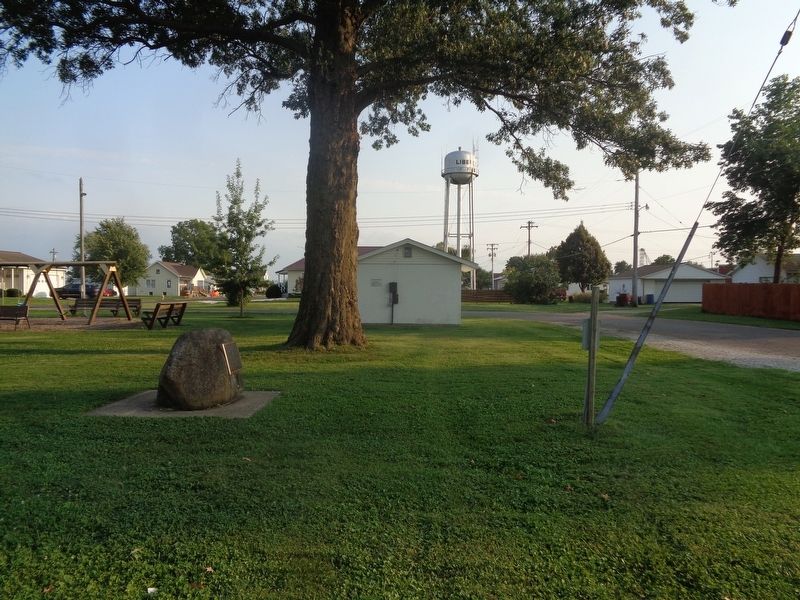
On Indian Mounds Park, 0.1 miles west of South 5th Street, on the right when traveling east.
In 1888, the Quincy Boulevard & Park Association was created to determine the location of parks and to develop beautiful boulevards. As early as 1894, E.J. Parker, the Association's president, began discussions with the city to acquire land where . . . — — Map (db m150072) HM
On Quinsippi Island Road, on the right when traveling east.
From 1818 through 1851 groups of American Indians were forcibly removed from states on the east side of the Mississippi River to territories on the west side. One of these removals was the Potawatomi Trail of Death, conducted by William Polke, . . . — — Map (db m181375) HM
Near South 5th Street, 0.1 miles south of Madison Street, on the right when traveling south.
In 1846, a majestic white oak stood on a Mississippi River Bluff on property owned by Quincy founder John Wood. It towered over the trees that surrounded it. When Wood began to plat Woodland, he chose this oak as the point around which the . . . — — Map (db m150048) HM
Near Maine Street (U.S. 24) just west of 4th Street (Illinois Route 57), on the left when traveling west.
First United Presbyterian Church, 1879
8th & Broadway
Gothic Revival Style
Robert Bunce, Architect
The majority of churches built in Quincy in the 19th century revived a European Gothic style with pointed arches over the entrance and . . . — — Map (db m150586) HM
On North 5th Street at Hampshire Street on North 5th Street.
"The points you propose to press upon Douglas, he will be very hard to get up to" ):Lincoln letter to Henry Asbury, 1858). Originally a Kentucky Whig, Henry Asbury was one of the founders of the Republican Party in Illinois along with . . . — — Map (db m58753) HM
On North 5th Street at Hampshire Street on North 5th Street.
"You are one of my most valued friends" (Lincoln letter to Abraham Jonas, 1860). Their friendship began in 1843 in Springfield when Lincoln and Jonas served together in the Illinois House of Representatives. Jonas became an early and . . . — — Map (db m58764) HM
On Hampshire Street at 9th Street, on the left when traveling east on Hampshire Street.
Lincoln Was Exhausted
after the debate with Douglas.
"I tell you, I'm mighty nigh petered out; I reckon I'll have to quit and give up the race."
That was Lincoln's comment on October 13, 1858; he was in a "state of . . . — — Map (db m156849) HM
On North 5th Street, on the right when traveling east.
On October 13 1858, two candidates for U.S. Senate met in this public square for a sixth debate. Quincy, in the west-central portion of the state, was a true battleground area where both candidates saw reasonable prospects of victory. . . . — — Map (db m58781) HM
On November 1, 1854 an incensed Lincoln attacked the immorality of slavery in a speech at Kendall Hall. Lincoln was awakened from a five-bear political slumber by Douglas's Kansas-Nebraska Act, attacking it in a series of speeches in . . . — — Map (db m149831) HM
On North 8th Street at Hampshire Street, on the right when traveling south on North 8th Street.
Quincy's Eliza Caldwell Browning and Abraham Lincoln first met in 1836. She was a new bride, and he had just received his law license. When Eliza discovered Lincoln's "great merits," the two established an easy rapport. Their . . . — — Map (db m58739) HM
Quincy lawyer and newspaper editor Andrew Johnston became acquainted with Abraham Lincoln in the Illinois Legislature when Lincoln served as representative and Johnson as assistant clerk. Like Lincoln, a Whig, Johnston was a law partner . . . — — Map (db m58795) HM
On Maine Street, on the right when traveling east.
"Archie Williams was one of the strongest-minded and clearest-minded men in Illinois" (A. Lincoln). Lincoln and his friend Archibald Williams had much in common. Both were born in Kentucky and moved to Illinois. Williams coming to Quincy . . . — — Map (db m58790) HM
On Hampshire Street at North 5th Street, on the right when traveling east on Hampshire Street.
With a population of nearly 13,000 in 1858, Quincy was the Adams County seat and the third largest city in Illinois. Quincy boasted a strong, growing economy based on its transportation, milling, pork packing, and light industry. In 1853 . . . — — Map (db m58755) HM
Best remembered for his spectacular fountains, Lorado Taft was the creator of some of our nation's outstanding monuments. Some of his most significant include Blackhawk (Oregon, IL, 1911), The Columbus Memorial (Washington, D.C., . . . — — Map (db m58782) HM
On Maine Street east of 24th Street (Illinois Route 96), on the right when traveling east.
This property was purchased by the city of Quincy in 1837 for use as a cemetery known as Madison Square. Among those who were buried here are the Mormons who died in 1838-1839 while in Quincy seeking asylum from persecution in Missouri. In 1857 . . . — — Map (db m156862) HM
On Indian Mounds Park just west of South 5th Street, on the right when traveling east.
In AD 1673, Pere Jacques Marquette, a Jesuit missionary, Louis Jolliet, a mapmaker, and a small party of Frenchmen explore the Mississippi River by canoe. In eastern Missouri they find a village of the Peoria, one of the tribes that speaks the . . . — — Map (db m150074) HM
On Indian Mounds Park, 0.1 miles west of South 5th Street, on the right when traveling west.
Farming changes almost every part of life and leads to the development of Mississippian culture. Mississippian farmers grow corn, squash, beans, and some native plants. They also hunt, gather, and fish, producing enough food to feed towns and . . . — — Map (db m150286) HM
On 5th Street south of Hampshire Street, on the right when traveling south.
Lincoln: ". . . reduced to its lowest element, slavery is no other than that between the man that thinks slavery is wrong and those who do not think it wrong. . . . We think it is a moral, a social, and a political wrong. . . . [Douglas] has, . . . — — Map (db m156822) HM
Near All American Park just north of Hampshire Street.
On this site stood the U.S. Naval Reserve Training Center of Quincy. Built in the late 1940's, it had 3 Quonset huts, office building, and surface division 9-29(m) with up to 120 personnel. Many were veterans of W.W. II, Korea and Vietnam. Others . . . — — Map (db m150027) HM
On North 3rd Street (Illinois Route 57) north of Maine Street (U.S. 24), on the right when traveling south.
On this exact spot, the corner stone placed in 1910 for the construction of one of the finest; best commercial buildings in this entire area.
Through the years, many very successful businesses were housed here. In later years several very . . . — — Map (db m150028) HM
On Maine Street just east of 8th Street, on the right when traveling east.
On this corner, in 1859, the Franciscan Fathers founded St. Francis Solanus College. In September of 1860, the College was relocated on Allstynes Prairie (the present site) at 19th and College Avenue. The charter was granted by the State of Illinois . . . — — Map (db m150020) HM
On Maine Street at 8th Street, on the right when traveling east on Maine Street.
Founded in 1839 to serve the Irish Catholics of Quincy. Here runaway slave Augustine Tolton attended school, was confirmed and worked until he entered the seminary and became the first negro priest in the United States. — — Map (db m150019) HM
On Indian Mounds Park, 0.1 miles west of South 5th Street, on the left when traveling north.
People arrive in North America from Asia more than 14,000 years ago at the end of the last Ice Age. The formation of glaciers lowers sea level and exposes a wide land bridge connecting Asia and North America where the Bering Sea is today.
In . . . — — Map (db m150287) HM
On 5th Street south of Hampshire Street, on the right when traveling south.
Douglas: "Let each state mind its own business, and let its neighbors alone - then there will be no trouble on this question. . . . If we will stand by that great principle, then Mr. Lincoln will find that this Republic can exist forever . . . — — Map (db m156824) HM
Near South 12th Street just north of State Street.
Abraham Lincoln and John Wood shared similar political views, Both were members of the Whig Party and were strongly allied against slavery. Lincoln and Wood worked to establish the Republican Party, and each campaigned for the other's . . . — — Map (db m58737) HM
On 5th Street just south of Hampshire Street, on the right when traveling east.
Quincy was in a festive mood for the all-day event with bands, banners, and thousands of people in attendance. Historian E.B. Long said, "It was a carnival time in Illinois. Mobs of thousands journeyed by wagon, horseback, boat and . . . — — Map (db m150023) HM
On Rock Quarry Road south of Illinois Route 104, on the left when traveling north.
On October 7, 1838 nearly 850 Potawatomi Indians camped near here on Mill Creek on the forced removal from Indiana to Kansas. The diary records that they traveled 12 miles that day A child died. — — Map (db m181377) HM
On Indian Mounds Park, 0.1 miles west of South 5th Street, on the left when traveling east.
In 1804, the Sac and Fox cede their land between the Illinois and Mississippi Rivers to the United States. Nine years later, General Howard and 1,400 mounted rangers burn a Sac village near the future site of Quincy. Legend has it that the . . . — — Map (db m150073) HM
Civil War Quincy
Confederate forces fired on Fort Sumter in South Carolina on April 12, 1861. Three days later, President Abraham Lincoln called for volunteers to suppress the rebellion. Men in Quincy, Illinois, rushed to volunteer for . . . — — Map (db m181384) HM
On 4th Street (Illinois Route 57) at Maine Street (U.S. 24) on 4th Street.
12th & Maine
Romanesque Revival Style
Harvey Chatten, Arthitect
———————————
Pilasters
Students entered the school through
a monumental arched entrance facing
on Maine . . . — — Map (db m156773) HM
On Maine Street at 16th Street, on the left when traveling east on Maine Street.
Timbered hills, tall
prairie grasses, ravines, creeks,
and springs were prominent features of Quincy in Lincoln's
time. Originally called "Bluffs," the town grew along the Mississippi's east bank and on the heights . . . — — Map (db m156922) HM
On South 9th Street at State Street, on the right when traveling south on South 9th Street.
Began in 1829 with Michael Mast, from Forchheim, Baden. In the early 1830s many immigrants from that area settled here, followed closely by the Hessians. In the 1840s and '50s our ancestors were pouring in mainly from Westphalia and Hanover. Soon . . . — — Map (db m181391) HM
"His name fills the nation; and is not unknown, even in foreign lands" (A. Lincoln, 1856). Stephen A. Douglas, a Jacksonian Democrat, arrived in Quincy in 1841, at twenty-seven the youngest Supreme Court Judge in Illinois history. In . . . — — Map (db m150024) HM
On 5th Street south of Hampshire Street, on the right when traveling north.
Lincoln: ". . . there is no reason in the world why the Negro is not entitled to all the natural rights enumerated in the Declaration of Independence . . . . I hold that . . . in the right to eat the bread . . . which his own hand earns he is . . . — — Map (db m156821) HM
"Who shall say, I am the superior, and you are the inferior?" asked Lincoln in July 1858. The Lincoln-Douglas Debates focused on slavery. During the October 13th Quincy debate Lincoln affirmed: "...in the right to eat the bread . . . — — Map (db m58798) HM
On South 4th Street (Route 57) just south of Maine Street (U.S. 24), on the left when traveling north.
First United Presbyterian Church, 1879
8th & Broadway
Gothic Revival Style
Robert Bunce, Architect
Construction began in May, 1875, but stalled when a violent storm collapsed the walls of the new church. Calamity struck again when fire . . . — — Map (db m150591) HM
On 5th Street north of Maine Street, on the left when traveling north.
Lincoln: "We also oppose [slavery] as an evil so far as it seeks to spread itself. We insist upon a policy that shall restrict it to its present limits. We do not suppose on doing this that we infringe upon the Constitution. . . . . . — — Map (db m156828) HM
On 7th Street at Hampshire Street, on the right when traveling north on 7th Street.
Type: Early Gothic Revival
Date: 1853
Architect: Charles Howland
Nominated by the Quincy Preservation Commission.
Approved by the Quincy City Council, March 1, 1999.
Charles W. Scholz, Mayor — — Map (db m156836) HM
On Bonansinga Drive at All American Park on Bonansinga Drive.
Lincoln traveled to Quincy by stagecoach in 1854 after crossing the Illinois River at Naples. Lincoln's first documented visit was to support the Congressional candidacy of Archibald Williams and to attack the Kansas- Nebraska Act and . . . — — Map (db m57881) HM
On Maine Street, on the right when traveling east. Reported missing.
Statesman and politician Stephen A. Douglas began his distinguished national career in Quincy. A resident of the city from 1841-1847, he served as Associate Justice of the Illinois Supreme Court from 1841-1843, then in the U.S. House until he was . . . — — Map (db m149962) HM
Near Quinsippi Island Road west of Bonansinga Drive.
This smokehouse was originally built on the Luke and Lucinda Kimmons homestead located approximately two miles south of "Five Points" in Liberty Township. In 1972 it was donated to the Quincy Park District and rebuilt on the Adams Landing log cabin . . . — — Map (db m187254) HM
On Hampshire Street at 7th Street, on the right when traveling east on Hampshire Street.
On this site stood the house of Orville Hickman Browning (1806-1881)
Illinois State Senator and Representative
Senator, Secretary of the Interior, and Attorney General of the United States
Friend and adviser of Presidents Abraham . . . — — Map (db m150022) HM
On RJ Peters Drive west of 12th Street, on the right when traveling east.
In the early 1890's Quincy saw a need for a park on the South side. This property was then owned by Judge B.F. Berrian jointly with his brothers. On April 16, 1895 at a meeting of the City Council park committee a recommendation was made and . . . — — Map (db m150206) HM
On All American Park north of Hampshire Street, on the left when traveling north.
In 1839, the Latter-Day Saints crossed the Mississippi River at this approximate site and were befriended by the citizens of Quincy.
(Reverse:)
"The citizens of Quincy (will) be held in everlasting remembrance for their unparalleled . . . — — Map (db m150451) HM
On South 4th Street (Illinois Route 57) just south of Maine Street (U.S. 24), on the left when traveling north.
Here on December 4, 1830 the first organized congregation in Quincy was established by the Reverend Asa Turner, one of seven Yale theological students, known as the "Yale Band," who pledge to save the "west" for Christ by founding churches and . . . — — Map (db m150025) HM
Near Quinsippi Island Road west of Bonansinga Drive.
The Lord's Cabin is dedicated to the glory of God, the use for all God's people and in memory of Sir Knight Norbert H. (Bert) Wensing. (1928-1977)
It was dedicated November 5, 1977, by the most Reverend Joseph A. McNicholas, D.D., Bishop of . . . — — Map (db m187250) HM
Near South 5th Street south of Madison Street, on the right when traveling south.
Inscription - South Side of Monument
"Consecrated A.D. 1867 by Sisters of the Good Samaritan in duty, affection, and reverence to the memory of the faithful soldiers of Adams county, who gave their lives that the nation might live." . . . — — Map (db m150045) HM
On Maine Street east of North 4th Street (U.S. 24), on the right when traveling west.
Mormons in Missouri were forced to flee their homes or face death because of an "extermination order" issued in 1838 by Governor Lillburn Boggs. Many of them crossed into Illinois at Quincy and were made welcome by the people here. In April 1839 . . . — — Map (db m149828) HM
On South 30th Street just south of Maine Street, on the right when traveling north.
The home of Major Thomas Scott Baldwin, aviation pioneer, once stood at this location. Baldwin invented the first folding parachute here in 1887, and by the 1890's had become one of the highest paid parachute exhibitionists in the nation. He built . . . — — Map (db m150016) HM
On Bonansinga Drive at All American Park on Bonansinga Drive.
Quincy's brewers and brick makers, contractors and coopers, foundry and factory workers, and diverse other tradesmen made this Mississippi River community an important center of commerce in Lincoln's day. Quincy's businessmen, whose . . . — — Map (db m57883) HM
On All American Park north of Hampshire Street, on the right when traveling south.
Colonel Ulysses S. Grant and the 21st Illinois infantry arrived in Quincy, Illinois, around noon on 11 July 1861 having completed the last leg of their journey across Illinois.
From Quincy, the troops were ferried across the Mississippi River . . . — — Map (db m150026) HM
On Hampshire Street at North 8th Street, on the right when traveling east on Hampshire Street.
Quincy's Orville Hickman Browning was Lincoln's friend, advisor, and confidant. According to historian David Donald, Lincoln considered Browning an old friend "whom he could absolutely trust. He knew the Illinois senator would never . . . — — Map (db m58742) HM
On Hampshire Street east of 4th Street (Illinois Route 57), on the left when traveling east.
Type: Mediterranean Revival
Date: 1924
Architect: E. P. Rupert
Nominated by the Quincy Preservation Commission.
Approved by the Quincy City Council, January 3, 2000.
Charles W. Scholz, Mayor. — — Map (db m156777) HM
On U.S. 24 at State Route 96, on the right when traveling west on U.S. 24.
In 1673 the areas of the Mississippi and Illinois Rivers were explored by Frenchmen Louis Joliet and Father Jacques Marquette. Their voyages resulted in French claims on the area until 1763 when, by the Treaty of Paris, France ceded the land to . . . — — Map (db m150015) HM
On Indian Mounds Park west of South 5th Street, on the right when traveling west.
Woodland people invent pottery for food storage and cooking and the bow and arrow for hunting and protection. They live in small villages, and they require raw materials and finished objects through long-distance trade.
They bury their dead . . . — — Map (db m150278) HM
On Maine Street east of 7th Street, on the right when traveling east.
This artifact is a section of the antenna tower located on the rooftop of WTC Building #1 which was destroyed during the tragic events of September 11, 2001.
A television broadcasting antenna manufactured in Quincy, Illinois by Harris . . . — — Map (db m150018) HM WM
On Fort Defiance Road, on the right when traveling south.
In November, 1803, Meriwether Lewis and William Clark and their growing contingent of "Corps of Discovery" men, spent five days here teaching each other celestial navigation and surveying skills. Using a sextant, octant, artificial horizon, and . . . — — Map (db m19393) HM
On Sycamore Street at U.S. 51, on the right when traveling east on Sycamore Street.
On May 22, 1863, the United States War Department issued General Order No. 143 to establish the proclamation which developed the Bureau of Colored Troops. African American regiments as United States Colored Troops or USCT.
This division of . . . — — Map (db m216318) HM WM
On Washington Avenue (U.S. 60/62) west of U.S. 51, on the right when traveling east.
Early removal plans called for transporting Cherokee by boat to Indian Territory. The first three detachments passed by here on steamships in the summer of 1838 as they descended the Ohio River. With low water levels and impassable shoals preventing . . . — — Map (db m161480) HM
On Washington Avenue (U.S. 60/62) at Fort Defiance Road, on the right when traveling north on Washington Avenue.
Pierre Francois Xavier de Charlevoix, a French Jesuit, reported as early as 1721 that the land at the confluence of the Mississippi and Ohio Rivers would be a strategic location for settlement and fortification. Nearly a century later, in 1818, the . . . — — Map (db m144870) HM
On Washington Avenue (U.S. 60/62) south of U.S. 51, on the right when traveling east.
Home to thousands of men, women, and children, the Cherokee Nation at the time of removal spread across parts of today's Georgia, North Carolina, Tennessee and Alabama. The 1830 Indian Removal Act required that the Cherokee and other southeastern . . . — — Map (db m161483) HM
On Washington Avenue (U.S. 51) at 14th Street, on the right when traveling north on Washington Avenue.
William B. Duncan, Chairman of the Mobile & Ohio Railroad, presented this Rodman smooth bore cannon to the city of Cairo as a gift, May 27, 1905. The gun saw action for both sides of the Civil War at Fort Morgan, Mobile, Alabama, in 1861, to protect . . . — — Map (db m19423) HM
On Ohio River Scenic Byway (U.S. 60/62) at Fort Defiance Road, on the right when traveling north on Ohio River Scenic Byway. Reported unreadable.
Great River Road
The Great River Road in Illinois follows the Mississippi River through the heart of the nation. Discover exciting history, thriving river cultures, beautiful natural areas, abundant wildlife, and bountiful agriculture as you . . . — — Map (db m174555) HM
On Washington Avenue (U.S. 60/62) south of U.S. 51, on the right when traveling north.
The beginning of the Third Principal Meridian is located in the Ohio River 1,735 feet directly north of this point. In November, 1803, this was the mouth of the Ohio River. At this location, the Lewis and Clark Corps of Discovery encamped for six . . . — — Map (db m19415) HM
On Washington Avenue (U.S. 60/62) south of U.S. 51, on the right when traveling north.
Charting the Confluence On November 14, 1803, at the confluence of the Ohio and Mississippi Rivers, the Corps of Discovery stayed for six days, one of the longest stops made by the expedition. Here, they saw the Mississippi for the first time, . . . — — Map (db m19413) HM
On Washington Avenue (U.S. 60/62) south of U.S. 51, on the right when traveling north.
On November 14, 1803, Meriwether Lewis, William Clark and their party landed at the confluence of the Ohio and Mississippi Rivers, the site of the present day Cairo. They spent nearly a week here, learning how to determine longitude and latitude, a . . . — — Map (db m19419) HM
On Washington Avenue (U.S. 51) south of 17th Street, on the right when traveling south.
First woman in the West to organize camp and hospital relief. Under Gen. Grant's personal command Mary Safford tended the wounded at the battles from Belmont to Shiloh 1861-1862, returning with the casualties by boat to Cairo. Being injured in . . . — — Map (db m161200) HM
On Washington Avenue (U.S. 51) south of 17th Street, on the right when traveling south.
President William Jefferson Clinton, 42nd President of The United States accompanied by his wife, Hillary and Vice President and Mrs. Albert Gore, Jr. spoke to a crowd of over 6000 in Cairo, Illinois at The Cairo Public Library on Friday, August 30, . . . — — Map (db m161195) HM
On Washington Avenue north of 28th Street, on the right when traveling south.
This 1865 mansion, originally built by William Halliday, was purchased by the City of Cairo Nov. 23, 1999, to be preserved and open to the public; it has been placed on the National Register of Historic Places. — — Map (db m188714) HM
On Washington Avenue (U.S. 51) north of 14th Street, on the right when traveling north.
The Newfoundland dog who accompanied the Corps of Discovery to the Pacific and back bought by Meriwether Lewis for $20 in Pittsburgh in 1803. He was "praised much for his docility and qualifications generally for my journey". A quote by Lewis, "He . . . — — Map (db m161201) HM
On Sycamore Street (U.S. 51) 0.2 miles north of Union Street, on the right when traveling north.
The "Big Subway Gate" was constructed in 1914 by Stupp Brothers of St. Louis, MO. The gate was built on the plan of the Gatum Dam at the Panama Canal and weighs 80 tons, is 60 ft. wide, 24 ft. high and 5 ft. thick. The counter weights used to raise . . . — — Map (db m195776) HM
On Washington Avenue (U.S. 60/62), on the right when traveling south.
The beginning of the Third Principal Meridian is located in the Ohio River 1,810 feet directly north of this point. In November, 1803, this was the mouth of the Ohio River. At this location, the Lewis & Clark Corps of Discovery encamped for six . . . — — Map (db m19420) HM
4170 entries matched your criteria. The first 100 are listed above. Next 100 ⊳