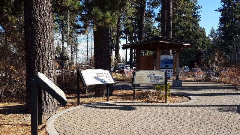
Native people first lived along Lake Tahoe's shoreline over 9,000 years ago when retreating glaciers blocked most corridors to the lake.
Lake Tahoe came to be the center of traditional Washoe life. Their legends describe every aspect of the . . . — — Map (db m112969) HM
Near Emerald Bay Road (State Highway 89), on the right when traveling west.
A Sacred Gathering Place
Many generations of Washoe people spent summers here, living near the shores of Lake Tahoe. Known as da ow a ga by the Washoe, the lake provided a sacred meeting place, where summer gatherings were a focus of . . . — — Map (db m275491) HM
A Plan to Sell Trees
In the latter part of September 1861, Samuel L.
Clemens (Mark Twain) and a friend camped for
three nights on this sandy beach. After hiking
more than 11 miles from Carson City, the two
rowed about three miles across . . . — — Map (db m257004) HM
Near West Lake Boulevard (State Highway 89) west of Highway 28, on the right when traveling east.
The first outlet works were constructed in 1870 by Colonel A.W. Von Schmidt. The stone and timber crib structure soon passed to the Donner Lumber & Boom Co. who continued to regulate, for a fee, the water flow for floatation of logs and, later, . . . — — Map (db m143497) HM
On Truckee River Bike Trail south of Alpine Meadows Road, on the right when traveling south.
The 16 mile railroad from Lake Tahoe to Truckee was a venture by the Bliss family of the Glenbrook Lumber fame. During the summer of 1898, William Seth Bliss was hired to survey the river canyon between Tahoe and the Central Pacific RR at Truckee. . . . — — Map (db m169783) HM
Before roads were built in the Tahoe area in the 1920s, sailing on a steamer was the only way for visitors to reach the resorts lining the south shore. The Tod Goodwin outdid all the other steamers in size and speed. It could carry 150 . . . — — Map (db m275578) HM
Near North Lake Boulevard (State Highway 26), on the right when traveling east.
Think about the people who made Tahoe City what it is today. They were frontiersman and adventurers, hunters and fishermen, lumberjacks and miners, school teachers, newspapermen, and ladies of the night. They ranged from Washoe Indians, who called . . . — — Map (db m34899) HM
Near West Lake Boulevard (State Highway 89) west of State Highway 26.
Business and tourists
Outlet point is the location where the waters of Lake Tahoe find their only release from the lake basin along the Lower Truckee River at Tahoe City
The sheltered inlet of the Truckee River mouth provided safe harbor . . . — — Map (db m34932) HM
On Rufus Allen Blvd at U.S. 50, on the left when traveling north on Rufus Allen Blvd.
To all Veterans of All Wars
this monument is dedicated this
day 31 May 1999, to honor all the
courageous young men and women,
both living and deceased
who served in all wars and conflicts
and did their duty no matter where they
served . . . — — Map (db m113201) WM
Near North Lake Boulevard (State Highway 28) west of Grove Street.
The turn of the last century brought sweeping change to Tahoe City. Previously, only wealthy families could afford to travel to Lake Tahoe for an extended summer vacation. By the 1920s middle class families could afford to travel in their . . . — — Map (db m34522) HM
Near West Lake Boulevard (State Highway 89) near State Highway 26.
Lake Tahoe is sacred to the Wa-she-shu or Washoe people.
Each spring family groups gathered at Da-ow-‘ah-ga or Lake Tahoe’s shore and offered blessings. Countless generations of children were taught by each family’s leader that their . . . — — Map (db m35432) HM
On West Lake Boulevard (State Highway 89) west of North Lake Boulevard (State Highway 28), on the right when traveling north.
This park was named for and dedicated to the memory of William B. Layton by the North Lake Tahoe Historical Society.
North Lake Tahoe will miss the unselfish way the Bill worked for the community. Past General Manager of the Tahoe City Public . . . — — Map (db m143487) HM
On Tunnel Creek Road, on the right when traveling east.
The First Glimpse
In September of 1861, 25-year old Samuel L. Clemens and a
fellow adventurer, John Kinney, walked from Carson City to Lake Tahoe, then known as Lake Bigler, seeking to stake a timber claim on the north shore of the lake. . . . — — Map (db m257210) HM
Near Emerald Bay Road (California Route 89) west of Cascade Road, on the right when traveling west.
From the vista, you can observe Emerald Bay and learn about its rich and colorful past
Residents & Visitors
For thousands of years, Lake Tahoe's Emerald Bay has drawn people to its shores. The Washoe Indians made their . . . — — Map (db m275495) HM
On this site, between 1880 and 1909, Elias J. "Lucky" Baldwin created the elaborate Tallac Resort. The luxury complex featured a hotel, a casino, several cottages, a clubhouse, a boathouse, and three piers.
Wealthy society families from San . . . — — Map (db m112975) HM
Near Lake Tahoe Blvd (U.S. 50) north of Lyons Avenue.
Oldest Standing Structure at Lake Tahoe
In 1859, silver was discovered in Nevada and the road past Lake Tahoe became a busy highway for treasure seekers and for the goods they needed to survive. To keep roads in repair, stations were set up . . . — — Map (db m113203) HM
Guests at the Pope estate had the option of staying in one of three unique cabins, each with its own charm.
Many liked the "Log Cabin" best because it was closest to the lake. The cabin across and up the lawn called the "Pachero," was reserved . . . — — Map (db m112980) HM
Near Heritage Way east of Emerald Bay Road ( Highway 89).
In 1920, at age 19, Dextra Balwin ordered construction of her summer house. The architect created a picturesque summer residence that reflected the simple, natural style favored by the wealthy in the 1920s. The house was completed in 1924 and is . . . — — Map (db m275577) HM
Near Heritage Way east of Emerald Bay Road ( Highway 89).
This site has been a haven for many people over the centuries. The local indigenous group, the Washoe, came here from the valleys of the Eastern Sierras to escape the desert heat, gather food, and enjoy the mountain atmosphere.
In the . . . — — Map (db m275574) HM
Near Heritage Way east of Emerald Bay Road ( Highway 89).
The Pope Estate is the largest of the three estates at the Tallac Historic Site. In 1894, George P. Tallant built a 2,000 square foot rustic-style summer cabin on this site. Five years later, San Francisco businessman William Tevis and his wife . . . — — Map (db m275575) HM
On Foothill Road (Nevada Route 206) at Old Kingsbury Grade Road, on the right when traveling south on Foothill Road.
Dagget Pass Trail, named for C.D. Dagget, who acquired land at its foot in 1854, was earlier called Georgetown Trail. Replaced in 1860 by the wagon road built by Kingsbury and McDonald, for which they received a Territorial Franchise in 1861, it . . . — — Map (db m21892) HM
Near West Lake Boulevard (State Highway 89) west of State Highway 28.
[First Marker – Located on the left:]
The North Lake Tahoe Historical Society (NLTHS) operates and maintains the Gatekeeper’s Museum, The Marion Steinback Indian Basket Museum, the Watson Cabin Living Museum (located above Commons . . . — — Map (db m34922) HM
Near North Lake Boulevard (State Highway 89) west of State Highway 28.
Timber baron and transportation mogul, D.L. Bliss – a one time Nevada banker – was best known for the railroads and steamships that he introduced to the Lake Tahoe Basin. He organized the Carson & Tahoe Lumber & Fluming Co. in 1871 and . . . — — Map (db m34505) HM
On W Lake Blvd, on the right when traveling north.
Trails become roads around Lake Tahoe
Early travel in the Lake Tahoe basin was along Washoe Indian trails and later along American immigrant trails blazed in the 1840s over the rugged Sierra Nevada Mountain passes. The first roads in the . . . — — Map (db m112967) HM
Controlling the flow of water through Lake Tahoe's Truckee River outlet
The Donner Lumber and Boom Company built the first dam across the Truckee River outlet in Tahoe City in 1872. Water released through the dam controlled the flow of . . . — — Map (db m112966) HM
Just as you may have come to fish these waters today, so have native people for thousands of years. Natives of the Tahoe Sierra fished the waters from Lake Tahoe and the Truckee River and Pyramid Lake for food. Depending on the season, they pulled . . . — — Map (db m112970) HM
Near Lake Tahoe Blvd (U.S. 50) north of Lyons Avenue.
A Tahoe Original
In the 1930s a man named Pomeroy built this little cabin following authentic log cabin styles brought to this country from Sweden. It sat on Star Lake Avenue behind the fire station, only a few blocks from here.
The . . . — — Map (db m113204) HM
On River Road (California Route 89) south of Alpine Meadows Road, on the right when traveling south.
A Russian emigrant, surveyor and visionary, Von Schmidt established the present California-Nevada state line between Lake Tahoe and Oregon. He formed the San Fransico and Lake Tahoe Waterworks Company which proposed, during the 1870s, to build a . . . — — Map (db m169743) HM
On The Rubicon Trail, on the right when traveling east.
Historically speaking, to cross the Rubicon River meant that you had passed the point of no return. This trail was originally used by Native Americans as a trade route. In the 1800s it became the main byway from Georgetown to Lake Tahoe. The route . . . — — Map (db m105984) HM
On Wildwood Avenue, on the right when traveling west.
This statue represents and honors the Washoe Tribe of Nevada and California. As the original inhabitants of Lake Tahoe, the Washoe people's life cycles revolved around Lake Tahoe. For thousands of years the Washoe People have been the caretakers . . . — — Map (db m258674) HM
Near West Lake Boulevard north of Tahoe Tavern Road.
Basketmaking is a tradition of the Washoe people of the Great Basin that dates back thousands of years. Different types of baskets were made for holding water and cooking, winnowing seeds and nuts, collecting and storing food, catching fish and . . . — — Map (db m233388) HM
On Lincoln Highway (U.S. 50 at milepost 13) west of Kings Canyon Road, on the right when traveling west.
Can You Imagine Tahoe Without Trees?
In 1883, Edward's Tourist Guide and Directory of the Truckee Basin boasted of a bountiful virgin forest at Lake Tahoe, "The [timber] supply may be said to be never ending....It is beyond the power of man . . . — — Map (db m228460) HM
On Lakeshore Boulevard south of Stateline AVenue, on the left when traveling north.
Lakeside Park was once the Washoe Indians' favorite location for their "love feasts' or fandangos.
In 1860 a Fish Market and Landing was located where Lakeside Marina is today. The fish were used at Lapham's Stateline Hotel, and most likely sold . . . — — Map (db m227672) HM
On Hirschdale Road at Juniper Way, on the left when traveling south on Hirschdale Road.
First steam railroad logging operation in the Truckee River Basin. Commenced operation in the late 1870's under the supervision of Fred Burckhalter, head of the Pacific Lumber and Wood Co. Line extended 10 miles along Juniper Creek with hopes of . . . — — Map (db m105205) HM
Near Lincoln Highway (U.S. 50 at milepost 13) west of Kings Canyon Road, on the right when traveling east.
Panel One: the lifestyle was rustic here at the summit
In 1860, French-Canadian entrepreneur Michele E. Spooner acquired about 640 acres of land with the idea of starting up a sawmill, a shingle mill and a hotel. He named the area . . . — — Map (db m227674) HM
Lake Tahoe first lured hardy souls who came here to build a life in its wilderness.
Pine Lodge, rises -grandly above the translucent blue waters of Lake Tahoe's west shore.
San Francisco's elite built seasonal retreats like Pine Lodge, . . . — — Map (db m55506) HM
Near North Lake Boulevard (State Highway 26), on the right when traveling east.
News that the 1960 Winter Olympics were coming to tiny Squaw Valley and to Lake Tahoe’s West Shore marked a milestone in Tahoe City development. All at once Lake Tahoe became known world-wide. Many new facilities were built for the Olympics, with . . . — — Map (db m37441) HM
On Dog Valley Road (Henness Pass Road), on the left when traveling west.
This cast iron obelisk was one of only four such monuments set by Allexey Von Schmidt during his survey of the California Nevada boundary in 1872-73. It was intended to mark a point on the 120th meridian, the border line between the two states north . . . — — Map (db m94295) HM
On Washington Street at R Street on Washington Street.
[Panel 1]:
Comstock Trail
You will find the trail head sign a hundred yards ahead, next to the recycling/dump site. Beyond the dump site is a ridge extending to your left. The trail winds along this ridge for two miles through . . . — — Map (db m46131) HM
When Elias J. "Lucky" Baldwin died in 1909, he left his real estate holdings in the Tahoe Basin to his daughter, Anita Baldwin. A few years later, Anita gave her daughter Dextra McGonagle this six-acre lot on the shore of Lake Tahoe.
Dextra had . . . — — Map (db m112981) HM
In 1968, Echo Summit served as a high-altitude training center and site of the U.S. Olympic Men's Track and Field Trials. Four world records were shattered here on the track carved out of the El Dorado National Forest. The U.S. team selected for the . . . — — Map (db m89152) HM
In the years before automobiles and paved highways, local businessman D. L. Bliss needed a way to bring people to his new Tahoe Tavern hotel. He formed the Lake Tahoe Railway and Transportation Company to build and operate a railroad connection . . . — — Map (db m112972) HM
On Lincoln Highway (U.S. 50 at milepost 13) west of Kings Canyon Road, on the right when traveling west.
Over the years, this canyon was used for lumbering, cattle and sheep grazing, as well as for its water resources. Today, it is part of Lake Tahoe Nevada State Parks’ Marlette-Hobart Backcountry Management Area.
With over a million visitors each . . . — — Map (db m229311) HM
On Lincoln Highway (U.S. 50) west of Kings Canyon Road, on the right when traveling west.
Glen Hampton, a Forest Service employee and avid backcountry hiker had a dream – an environmentally sensitive trail encircling Lake Tahoe on the ridgetops, offering a challenging hike with breathtaking views of endless mountaintops, lakes, and . . . — — Map (db m229314) HM
On South Upper Truckee Road 1 mile west of Route 89, on the left when traveling west.
"After passing over this summit [Luther Pass] we enter Lake Valley [Lake Tahoe Basin]. Here we are camped, grass scarce. We had the roughest road down the mountain I ever saw." - John W. Powell, Sep 3, 1859 — — Map (db m212026) HM
On Hobart Mills Road at Highway 89, on the right when traveling east on Hobart Mills Road.
Walter Scott Hobart's Sierra Nevada Wood & Lumber Company moved machinery, buildings and railroad equipment here from Lake Tahoe in 1896. The town and business flourished for 40 years. Ceasing operations in 1936. Fiberboard Corporation operated a . . . — — Map (db m129936) HM
The Placer County Emigrant Road, known today as the Western States Trail, extended from Yankee Jim's on the Foresthill Divide to the Washoe Valley in Nevada. Built in 1852, the road served emigrants before providing a link to the Comstock boom towns . . . — — Map (db m143761) HM
On August 2, 1885, fire broke out in the Town of Markleeville destroying several buildings, including Harvey and Rask’s Bucher Shop and Smokehouse. Later on in the Fall, the building was rebuilt and reopened as Rask’s Butcher Shop.
The building . . . — — Map (db m11963) HM
On The Lincoln Highway (U.S. 50 at milepost 3.1), on the left when traveling west.
Toll Roads
Johnson's Cutoff, also called the Carson Ridge Emigrant Road, passed over Spooner Summit and down Clear Creek from 1852 through 1854, but was rugged and little used. With discovery of the Comstock Lode in 1859, Spooner Summit . . . — — Map (db m69714) HM
Near Lincoln Highway (U.S. 50 at milepost 13) west of Kings Canyon Road, on the right when traveling east.
Panel One:
The forest immediately around Virginia City and the Comstock Lode were quickly depleted of their timber. Eyes soon turned to the nearby Sierra Nevada Mountains east of Lake Tahoe for more wood.
Bust!
In the 1890s, the boom . . . — — Map (db m229047) HM
Near North Lake Boulevard (State Highway 26), on the right when traveling east.
Most folks traveling to Tahoe City in the 1800s arrived by stagecoach from Truckee. By 1868, 25 people called Tahoe City home.
Some harvested hay on what is now Tahoe City’s Golf Course, some worked as fishermen on Lake Tahoe. Others found . . . — — Map (db m34864) HM
On Lincoln Highway (U.S. 50 at milepost 13) west of Kings Canyon Road, on the right when traveling west.
This beautiful trail, with spectacular views of Lake Tahoe's high country, follows the route of an old flume and tunnel system that carried water from Marlette Lake to Virginia City. Originally built in 1877, the tunnel eventually collapsed and the . . . — — Map (db m229309) HM
Near Lincoln Highway (U.S. 50 at milepost 13) west of Kings Canyon Road.
Panel One:
in 1851, a free-for-all was happening in this forest
The Territorial government, in an effort to settle the area, was encouraging its residents to build lumber mills and harvest as much lumber as possible.
Then, only four . . . — — Map (db m227767) HM
The big, beautiful Valhalla main building was built for entertaining. Its grand hall and huge lawn could hold scores of friends and family. The porch along the outside of the building could even be transformed into sleeping porches for extra guests. . . . — — Map (db m275580) HM
Near North Lake Boulevard (State Highway 26), on the right when traveling east.
Positioned on a bluff over looking Tahoe City’s Common Beach is the historic Watson’s Log Cabin. The cabin is listed on the National Register of Historic Places as the oldest log structure remaining in the North Lake Tahoe area.
The two-story . . . — — Map (db m34836) HM
On South Virginia Street (Alternate U.S. 395), on the right when traveling south.
Before the arrival, 1858, of Granville W. Huffaker driving 500 head of cattle into the Truckee Meadows, the principal settlers were Mormon. The Comstock Lode and its mining needs focused attention on the valley. Huffaker established his ranch in . . . — — Map (db m94304) HM
On Atlantic Avenue at South Missouri Avenue, on the right when traveling east on Atlantic Avenue.
Known as "Mr. Atlantic City," Paul "Skinny" D'Amato owned and operated the renowned 500 Club in Atlantic City from the 1930's until the club burned down in 1973. D'Amato's 500 Clu was a venue for big name entertainers like Frank Sinatra with whom he . . . — — Map (db m153546) HM
On Carson Pass Highway (California Route 88 at milepost 6.4) east of Red Vista Road, on the right when traveling east.
[The first paragraph of the marker is unreadable]
One of the most popular passes through the Sierras along the Emigrant Trail was Carson Pass. This Pass was discovered by Kit Carson, a guide to the Fremont Party.
The Fremont Party, led by John . . . — — Map (db m223952) HM
On Diamond Valley Road 3 miles east of Highway 89, on the right when traveling west.
John A. “Snowshoe” Thompson (1827-1876) Native of Norway who carried mail across the Sierra Nevada on skis, assisting the needful for twenty years, dwelt and died on this site.
Dedicated on June 30, 1990
Native Sons of the Golden . . . — — Map (db m21301) HM
On U.S. 50 near Ice House Road, on the right when traveling west.
These stone obelisks are all that’s left of the original four that once stood on the corners of the stone arch bridge spanning the American River from 1900 to 1930.
This monument erected by Caltrans District 3 History Committee and the . . . — — Map (db m23183) HM
On US Highway 50 (U.S. 50) west of Pioneer Trail, on the left when traveling west.
This was the site of the most eastern remount station of the Central Overland Pony Express in California. Established as a trading post in 1851 by Martin Smith, it became a popular hostelry and stage-stop operated by Ephraim “Yank” Clement on the . . . — — Map (db m433) HM
On Hobart Mills Road at Highway 89, on the right when traveling east on Hobart Mills Road.
This Monument Marks the Townsite of
Hobart Mills
California
A logging and lumber enterprise
of sixty-six years life in
the Sierra Nevada Mountains
It Commemorates and Honors its Founder
Walter Scott Hobart
1839 - 1892 . . . — — Map (db m129935) HM
Approximately one-half mile south of this point and west of the present highway lay the immense lumberyard of the Carson-Tahoe Lumber and Fluming Company, the greatest of the Comstock lumbering combines operating in the Lake Tahoe Basin during . . . — — Map (db m20804) HM
As a Tribute
To a great compatriot from Telemark
This plaque was presented
by the Norwegian Olympic Ski Team
competing at Sqaw Valley
in February 1960
Dedicated to
John A. “Snow-Shoe” . . . — — Map (db m20748) HM
We Salute John “Snowshoe” Thompson
On his homemade snowshoes John carried the mail and supplies over the snowy Sierras for 20 winters. As he traveled, he saved the lives of seven people who were snowbound in mountain cabins. In . . . — — Map (db m20729) HM
During the late 1940s, this land was used by Sky Harbor Airport and Casino, which flew its wealthy patrons in from San Francisco to spend money in the local casinos. The airport consisted of a dirt landing strip, but with the snow-crested Crystal . . . — — Map (db m91859) HM
On South F Street, on the left when traveling south.
The first religious service in Nevada, officiated by a visiting Protestant Episcopal Reverend, was held in Virginia City's U.S. Courthouse on Sept. 11, 1861. A Parish was organized as St. Paul's Protestant Episcopal. In the following year the Rev. . . . — — Map (db m77709) HM
In the 1890s, the decline in silver mining on the Comstock in Nevada reduced the demand for lumber from the Lake Tahoe basin. Local businessman Duane L. Bliss, owner of Carson and Tahoe Lumber and Fluming Company, recognized a new business . . . — — Map (db m112973) HM
Near North Lake Boulevard (State Highway 28) west of Grove Street.
Tahoe City of the 1860s was a very different place than today. The first businesses include hay production, logging and fishing for native Lahontan cutthroat trout. Comstock Lode silver mining created short-lived boomtowns like Knoxville, . . . — — Map (db m34521) HM
On Kings Canyon Road 0.1 miles south of Cooper Springs Court, on the right when traveling south.
Originally a Washoe Indian trail, Kings Canyon served as a gateway to Lake Tahoe following the gold rush to California. Eagle Station was established in 1851 near the mouth of the canyon, Dr. Benjamin King built his ranch the next year, and others . . . — — Map (db m163164) HM
On South B Street north of Taylor Street, on the right when traveling south.
Following the discovery of silver and gold, the miners obtained their water from the small streams or from the springs located in the canyons such as Ophir Ravine, in Virginis City, and Bullion and Crown Point ravines above Gold Hill. Originally . . . — — Map (db m263686) HM
History records Sand Harbor as playing an important role in the operations of the Sierra Nevada Wood and Lumber company, one of three large combines supplying lumber and cord wood to the Comstock mines during the late 19th century. Walter Scott . . . — — Map (db m208666) HM
On Lake Tahoe Blvd (U.S. 50) east of Wildwood Avenue, on the right when traveling east.
This memorial is dedicated to all from our community who gave their lives and have served our country from all branches of service. We thank you for your sacrifice and you can rest assured that we will support your families and friends. You have . . . — — Map (db m113200) WM
Near Emerald Bay Road (State Highway 89), on the right when traveling north.
Captain Richard “Dick” Barter found his way to Lake Tahoe in the 1860s. Barter spent the long winters in Emerald Bay as the sole caretaker of a summer villa owned by Ben Holladay, Jr.
Originally an English sailor, Barter was known to row all . . . — — Map (db m275493) HM
On Franklin Spings Street (U.S. 29) 0 miles east of Cook Street, on the left when traveling east.
Tyrus Raymond Cobb (1886-1961) moved to Royston as a youth when his father got a teaching position here. He was playing “Town Ball” for the Royston Reds at age 14 and was in the minors at 17. He first played with the Augusta Tourists . . . — — Map (db m10636) HM
On South Carson Street (U.S. 395/50), on the right when traveling south.
On this site in the period from 1870 until 1918 stood the ornate two-story home of Mathew Culbertson Gardner, rancher and lumberman. The residence was headquarters for Gardner’s 300 acre ranch in Meadows to the Southward.
Here was located, 1870 . . . — — Map (db m20926) HM
On U.S. 395 Alterate (Alternate U.S. 395) at Hobart Road, on the right when traveling south on U.S. 395 Alterate.
As early as 1863, two hotels with appurtenant stables were located here. In 1872, one hotel became a station on the newly-completed Virginia and Truckee Railroad between Carson City and Reno.
Crossing under the highway are three inverted . . . — — Map (db m244508) HM
On North Curry Street near West King Street, on the right when traveling south.
Completed in 1876, this palatial residence represents one of the finest and best preserved examples of High Victorian Italianate architecture remaining in the American West.
Charles H. Jones, a French-schooled designer, constructed the residence . . . — — Map (db m21246) HM
On U.S. 395 at Gilman Avenue, on the left on U.S. 395.
This building has been used for many commercial purposes dating back to the late 1800's and early 1900's. The single story rear portion of the building is thought to be the original home of John and Mary Gardner, the Town's namesake. Ollie . . . — — Map (db m21617) HM
On Main Street at Genoa Lane ( Route 206), on the right when traveling north on Main Street.
Panel One:
Utah Territory
The area now making up the state of Nevada was acquired by the United States after the Mexican-American War. This newly acquired land was generally labeled as unorganized territory until 1850. The State of . . . — — Map (db m227650) HM
Lumbering operations in the Glenbrook area of Lake Tahoe began in 1861. Consolidation of V-Flume systems in and near Clear Creek Canyon by 1872 made it possible to float lumber, cordwood, and sawed material from Spooner’s Summit to Carson City and . . . — — Map (db m21014) HM
The “Big Bonanza” was the greatest mining strike in the history of the American West. In 1872, John Mackay, James Fair, James Flood & William O’Brien formed an alliance and took control of the “Consolidate Virginia” and . . . — — Map (db m50103) HM
Near Interstate 80 at milepost 27, on the right when traveling east.
The Truckee River, seen below, runs from Lake Tahoe to Pyramid Lake. The river's first recorded discovery was by Captain John C. Fremont in January, 1844. He camped by its terminus at Pyramid, then followed it to the big bend at Wadsworth. Captain . . . — — Map (db m67268) HM
On Interstate 80, on the right when traveling east. Reported missing.
In prehistoric and early historic times, the Truckee Valley in the vicinity of Verdi, was occupied by the Washoe Indians. Their camps were on these flats near the river. Many fish blinds were located nearby for their use in this important . . . — — Map (db m238337) HM
First Source of Electricity for Reno and the Comstock, Built 1899
The Truckee River is an excellent source of hydroelectric power generation. There are four plants on the river, owned by the Truckee Meadows Water Authority. In the early 1900s, . . . — — Map (db m218895) HM
Near Feather River Highway (Route 70), on the left when traveling west.
Long before settlers and ranchers came to Sierra Valley, native people of the Washoe and Maidu tribes hunted deer and collected plants here, perhaps on the very spot you are standing. The Washoe traveled fro the east, over Beckwourth Pass, from . . . — — Map (db m66175) HM
Near Mills Station Road west of Mather Field Road, on the right when traveling west.
The Lincoln Highway was conceived in 1912 and promoted by American industrialists determined to create one transcontinental highway from existing paths, trails and city streets. Spear-headed by the Lincoln Highway Association, the route was . . . — — Map (db m214505) HM
On South Bond Street (Georgia Route 45) north of Botsford Road, on the left when traveling south.
Over the decades, Peter Hazel has produced magnificent sculptures of all size, installed all around the country. Peter fell in love with the wonders of the sea and nature growing up in
the picturesque community of Half Moon Bay, California. As . . . — — Map (db m302696)
On Donner Pass Road, on the right when traveling east.
History
The bridge “eliminated for all time the terrors of the Donner grade from the state highway system of California.”
Automobile travel could be a harrying affair in the old days and Donner Summit was a difficult route. . . . — — Map (db m81898) HM
On Donner Pass Road near Edie Court, on the right when traveling east.
Welcome to Donner Summit Canyon
You are about to enjoy a wonderful experience with exquisite views, forests and trails. It is also the gateway to the most important square mile in California’s history! Donner Pass, located above the property, . . . — — Map (db m81978) HM
Unveiled June 10, 1989
Artist: Buckeye Blake
It was the winter of 1843-44 when Kit Carson along with the John C. Fremont expedition worked his way south from Pyramid Lake looking for an easy route across the Sierra Nevada. Carson, depicted . . . — — Map (db m20897) HM
On Highway 395, on the right when traveling south.
In 1917 State Senator Wm. F. Dressler gave this 40 acre tract to Washo Indians, then living on ranches in Carson Valley. After a school was opened in 1924, it became a nucleus of settlement.
Before the intrusion of Caucasians in 1848, Washos . . . — — Map (db m3190) HM
On U.S. 395 north of Church Street, on the left when traveling north.
The members of the Minden Town Board selected this site, on the Minden-Gardnerville boundary and adjacent to the telephone company offices, as a particularly appropriate location for what they have named "Sunset Park".
In the early 1900's, . . . — — Map (db m55510) HM
On Riverside Drive, on the left when traveling west.
The Truckee River is home to many kinds of fish.
Prior to the arrival of white settlers, there were only two kinds of fish found in the river that today are considered game fish - Lahontan Cutthroat Trout and Mountain Whitefish.
An . . . — — Map (db m308256) HM
On Lincoln Highway (U.S. 50) west of Apache Avenue, on the left when traveling west.
(back) The Hawley Grade from April 3, 1860 to November 17, 1860 was used by the Pony Express. On November 18, 1860 the new toll road down Johnson Pass (Echo Summit), today’s Old Meyers Grade, was opened to horse traffic and was now used by . . . — — Map (db m435) HM
Near Baldwin Avenue south of Interstate 210, on the right when traveling south.
Today’s Los Angeles County Arboretum & Botanic Garden blends history and horticulture in a landscape ripe with cultural nuance, allowing history to be sampled in its native setting and savored as an integral link between humans and the land they . . . — — Map (db m143271) HM
Near Donner Pass Road, on the right when traveling east.
The rocks here are carved with ancient symbols called petroglyphs.
They were created by pecking the surface of the rock with a tool called a hammerstone. These petroglyphs are thought to be several thousand years old. — — Map (db m81931) HM
On North C Street (Nevada Route 341), on the right when traveling north.
Virginia City, circa. 1880’s, was a bustling industrial community of about 25,000 people which included Gold Hill and the Silver City communities. Gold and silver mining was a corporate environment that was owned by either the bank of California or . . . — — Map (db m81819) HM
On Huntington Drive at Santa Clara Street, on the left when traveling west on Huntington Drive.
Anita May Baldwin
was the only daughter born to Arcadia's founder and owner of
Rancho Santa Anita, Elias J. "Lucky" Baldwin and his third wife,
Jane Virginia (Jennie) Dexter. Known for her generosity and
compassion, Anita Baldwin was a . . . — — Map (db m198153) HM
A hero of the Sierra Nevada Mountains!
Probably the first skier of the West. This Viking son of Norway, exemplified the
spirit of a true pioneer. Strong, daring, faithful and courageous he was the answer to California’s motto
“Bring Me . . . — — Map (db m60514) HM
107 entries matched your criteria. The first 100 are listed above. The final 7 ⊳
Thin black lines indicate changes in relevance. Between each pair of lines entries are ordered geographically but all have the same relevance.
* Inflectional forms of words are their plurals, singulars, and possessives as well as gramatical tenses and similar variations.