After filtering for United States of America, 148 entries match your criteria. The first 100 are listed. ⊳
Historical Markers and War Memorials in Providence RI 02903
By Bryan Simmons, June 8, 2012
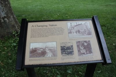
A Changing Nation Marker
| 1 ► Rhode Island, Providence County, Providence, College Hill — A Changing Nation |
| On North Main Street, on the left when traveling north. Reported permanently removed. | |||
| 2 ► Rhode Island, Providence County, Providence, College Hill — A Place for Your Ideas — |
| Near North Main Street (U.S. 1) south of Smith Street, on the left when traveling north. | |||
| 3 ► Rhode Island, Providence County, Providence, College Hill — A Thoroughfare Town |
| On North Main Street, on the left when traveling north. Reported permanently removed. | |||
| 4 ► Rhode Island, Providence County, Providence, College Hill — Around the Corner from Market Square — taken from “The Civic and Architectural Development of Providence” by John Hutchins Cady — |
| On Canal Walk. | |||
| 5 ► Rhode Island, Providence County, Providence, College Hill — Burning of British Taxed Tea — |
| On South Main Street (U.S. 44) at College Street, on the left when traveling north on South Main Street. | |||
| 6 ► Rhode Island, Providence County, Providence, College Hill — Crawford Street Bridge Without Crawford Street — |
| On South Water Street (U.S. 44) at Packet Street, on the right when traveling south on South Water Street. | |||
| 7 ► Rhode Island, Providence County, Providence, College Hill — First Baptist Church — |
| Near Thomas Street. | |||
| 8 ► Rhode Island, Providence County, Providence, College Hill — First Baptist Church in America 375th Anniversary — |
| On Main Street at Washington Street, on the right when traveling north on Main Street. | |||
| 9 ► Rhode Island, Providence County, Providence, College Hill — First Town House of Providence — |
| On South Main Street (U.S. 44), on the right when traveling north. | |||
| 10 ► Rhode Island, Providence County, Providence, College Hill — Gabriel Bernon — |
| On Canal Street, in the median. | |||
| 11 ► Rhode Island, Providence County, Providence, College Hill — Great Gale of September 23, 1815 — |
| On College Street west of N Main Street, on the right when traveling west. | |||
| 12 ► Rhode Island, Providence County, Providence, College Hill — HMS Gaspee — “Sons of Liberty” — |
| On South Main Street at Planet Street, on the right when traveling north on South Main Street. | |||
| 13 ► Rhode Island, Providence County, Providence, College Hill — Luigi Scala — |
| Near College Street just west of South Main Street (U.S. 44), on the left when traveling west. | |||
| 14 ► Rhode Island, Providence County, Providence, College Hill — PFC Alfred Silver USA — |
| Near College Street west of South Main Street (U.S. 44), on the left when traveling west. | |||
| 15 ► Rhode Island, Providence County, Providence, College Hill — Providence Marine Corps of Artillery — Chartered 1801. — Mother of the Rhode Island Batteries — |
| On Benefit Street at Meeting Street, on the left when traveling north on Benefit Street. | |||
| 16 ► Rhode Island, Providence County, Providence, College Hill — Providence Preservation Organizations |
| Near Washington Place at Canal Walk, on the right when traveling east. Reported damaged. | |||
| 17 ► Rhode Island, Providence County, Providence, College Hill — Realizing Providence — |
| Near North Main Street (U.S. 1) at Bowen Street, on the left when traveling north. | |||
| 18 ► Rhode Island, Providence County, Providence, College Hill — Revolutions: American and Industrial — |
| On South Water Street at Packett Street, on the right when traveling south on South Water Street. | |||
| 19 ► Rhode Island, Providence County, Providence, College Hill — Rhode Island Holocaust Memorial — |
| On South Main Street (U.S. 44) at Hopkins Street, on the left when traveling north on South Main Street. | |||
| 20 ► Rhode Island, Providence County, Providence, College Hill — Rhode Island Korean Veterans Memorial — |
| On South Main Street (U.S. 44), on the left when traveling north. | |||
| 21 ► Rhode Island, Providence County, Providence, College Hill — Rhode Island World War II Memorial — |
| On South Main Street just south of Hopkins Street, on the left when traveling north. | |||
| 22 ► Rhode Island, Providence County, Providence, College Hill — Rochambeau's Army in Rhode Island — |
| On Main Street (U.S. 44) at Hopkins Street, on the right when traveling south on Main Street. | |||
| 23 ► Rhode Island, Providence County, Providence, College Hill — Roger Williams National Memorial — National Park Service, U.S. Department of the Interior — |
| Near North Main Street (U.S. 1) at North Court Street, on the left when traveling north. | |||
| 24 ► Rhode Island, Providence County, Providence, College Hill — Shakespeare's Head — |
| On Meeting Street, on the right when traveling east. | |||
| 25 ► Rhode Island, Providence County, Providence, College Hill — Site of Roger Williams House — |
| On Main Street (U.S. 44) at Howland Street, on the right when traveling north on Main Street. | |||
| 26 ► Rhode Island, Providence County, Providence, College Hill — Snowtown Riot 1831 — |
| On Smith Street (Rhode Island Route 44) just east of Canal Street (U.S. 44), on the right when traveling east. | |||
| 27 ► Rhode Island, Providence County, Providence, College Hill — Sons of Liberty — |
| On South Main Street (U.S. 44) at Planet Street, on the right when traveling north on South Main Street. | |||
| 28 ► Rhode Island, Providence County, Providence, College Hill — State Arsenal 20th Century Wars Memorial — |
| On Benefit Street at Meeting Street, on the left when traveling north on Benefit Street. | |||
| 29 ► Rhode Island, Providence County, Providence, College Hill — The Boys of Adams' Battery "G" — Medal of Honor Recipients — "Adams' Intrepid Band of Cannoneers" — |
| On Benefit Street at Meeting Street, on the left when traveling north on Benefit Street. | |||
| 30 ► Rhode Island, Providence County, Providence, College Hill — The Cathedral of St. John — Episcopal — |
| On North Main Street (U.S. 44) at Church Street, on the right when traveling north on North Main Street. | |||
| 31 ► Rhode Island, Providence County, Providence, College Hill — The Century to Statehood |
| Near North Main Street. Reported permanently removed. | |||
| 32 ► Rhode Island, Providence County, Providence, College Hill — The Crawford Street Bridge — taken from "The Civic and Architectural Development of Providence" by John Hutchin Cady — |
| On Crawford Street (U.S. 44) at South Water Street (Route 44), on the right when traveling east on Crawford Street. | |||
| 33 ► Rhode Island, Providence County, Providence, College Hill — The First Baptist Church — |
| On North Main Street, on the right when traveling north. | |||
| 34 ► Rhode Island, Providence County, Providence, College Hill — The First Baptist Church in America — |
| On North Main Street (U.S. 44) at Waterman Street on North Main Street. | |||
| 35 ► Rhode Island, Providence County, Providence, College Hill — The First Baptist Meetinghouse |
| On Canal Walk at Canal Walk, on the left when traveling west on Canal Walk. Reported damaged. | |||
| 36 ► Rhode Island, Providence County, Providence, College Hill — The Grand Lodge of Rhode Island — 1797 1853 — |
| On N. Main Street. | |||
| 37 ► Rhode Island, Providence County, Providence, College Hill — The History of The Weybosset Bridge — |
| On College Street, on the right when traveling west. | |||
| 38 ► Rhode Island, Providence County, Providence, College Hill — The Hurricane of September 21, 1938 — |
| On College Street west of N Main Street, on the right when traveling west. | |||
| 39 ► Rhode Island, Providence County, Providence, College Hill — The Hurricane of September 21st 1938 — |
| On College Street at Providence River Greenway, on the right when traveling east on College Street. | |||
| 40 ► Rhode Island, Providence County, Providence, College Hill — The Market House — Rhode Island School of Design — |
| On Market Square at North Main Street (U.S. 44) on Market Square. | |||
| 41 ► Rhode Island, Providence County, Providence, College Hill — The Meeting Street School — |
| On Meeting Street, on the left when traveling east. | |||
| 42 ► Rhode Island, Providence County, Providence, College Hill — The Meeting Street School — Rhode Island Afro-American Heritage Trail — |
| On Meeting Street just east of North Main Street (U.S. 44), on the right when traveling west. | |||
| 43 ► Rhode Island, Providence County, Providence, College Hill — The Prophet of Religious Freedom — |
| On Main Street (U.S. 44) at Court Street, on the left when traveling north on Main Street. | |||
| 44 ► Rhode Island, Providence County, Providence, College Hill — United States Merchant Marine Memorial — |
| Near College Street west of South Main Street (U.S. 44), on the left when traveling west. | |||
| 45 ► Rhode Island, Providence County, Providence, College Hill — Witness to History — Roger Williams National Memorial — National Park Service, U.S. Department of the Interior — |
| On North Main Street (U.S. 44) at North Main Street, on the right when traveling east on North Main Street. | |||
| 46 ► Rhode Island, Providence County, Providence, College Hill — World War I Memorial — |
| On South Main Street close to College Street, on the left when traveling north. | |||
| 47 ► Rhode Island, Providence County, Providence, Downtown Providence — 1650 — |
| Near Memorial Boulevard west of Exchange Street. | |||
| 48 ► Rhode Island, Providence County, Providence, Downtown Providence — 1700 — |
| Near Memorial Boulevard west of Exchange Street. | |||
| 49 ► Rhode Island, Providence County, Providence, Downtown Providence — 1775 — |
| Near Memorial Boulevard west of Exchange Street. | |||
| 50 ► Rhode Island, Providence County, Providence, Downtown Providence — 1803 — |
| Near Memorial Boulevard west of Exchange Street. | |||
| 51 ► Rhode Island, Providence County, Providence, Downtown Providence — 1832 — |
| On Memorial Boulevard. | |||
| 52 ► Rhode Island, Providence County, Providence, Downtown Providence — 1856 — |
| Near Memorial Boulevard west of Exchange Street. | |||
| 53 ► Rhode Island, Providence County, Providence, Downtown Providence — 1873 - 1909 — |
| Near Memorial Boulevard west of Exchange Street. | |||
| 54 ► Rhode Island, Providence County, Providence, Downtown Providence — 1982 / 1989 — |
| Near Memorial Boulevard west of Exchange Street. | |||
| 55 ► Rhode Island, Providence County, Providence, Downtown Providence — A History of Kennedy Plaza — Kennedy Plaza — Providence — |
| Near Washington Street east of Dorrance Street, on the left when traveling east. | |||
| 56 ► Rhode Island, Providence County, Providence, Downtown Providence — A History of Kennedy Plaza — Kennedy Plaza — Providence — |
| Near Washington Street east of Dorrance Street, on the left when traveling east. | |||
| 57 ► Rhode Island, Providence County, Providence, Downtown Providence — A History of Kennedy Plaza — Kennedy Plaza — Providence — |
| On Washington Street east of Dorrance Street, on the left when traveling east. | |||
| 58 ► Rhode Island, Providence County, Providence, Downtown Providence — A Howling Wilderness |
| On North Main Street (U.S. 1), on the left when traveling north. Reported permanently removed. | |||
| 59 ► Rhode Island, Providence County, Providence, Downtown Providence — A Livelie Experiment — |
| Near North Main Street (U.S. 1) at Howland Street, on the left when traveling north. | |||
| 60 ► Rhode Island, Providence County, Providence, Downtown Providence — A Shelter for Persons Distressed — |
| On North Main Street, in the median. | |||
| 61 ► Rhode Island, Providence County, Providence, Downtown Providence — Abraham Lincoln — |
| On Exchange Street at Fulton Street, on the right when traveling north on Exchange Street. | |||
| 62 ► Rhode Island, Providence County, Providence, Downtown Providence — Across the River from Market Square — taken from "The Civic and Architectural Development of Providence" by John Hutchins Cady |
| On Westminster Street at Memorial Boulevard (U.S. 44), on the right when traveling west on Westminster Street. Reported damaged. | |||
| 63 ► Rhode Island, Providence County, Providence, Downtown Providence — Ambrose Burnside Memorial — |
| On Exchange Street at Exchange Terrace, on the left when traveling north on Exchange Street. | |||
| 64 ► Rhode Island, Providence County, Providence, Downtown Providence — Annye — |
| On Washington Street just east of Snow Street, on the right when traveling east. | |||
| 65 ► Rhode Island, Providence County, Providence, Downtown Providence — Aquene. Eniskeetompowaug. — Peace be with you. All Tribes are Welcome. — Roger Williams National Memorial |
| On Canal Street (U.S. 44) at Park Row West, on the right when traveling south on Canal Street. Reported damaged. | |||
| 66 ► Rhode Island, Providence County, Providence, Downtown Providence — Art at NicoBella's — |
| On Westminster Street at Dorrance Street, on the right when traveling west on Westminster Street. | |||
| 67 ► Rhode Island, Providence County, Providence, Downtown Providence — Arthur Cayo — The Avenue Concept — |
| On Dorrance Street at Westminster Street, on the right when traveling north on Dorrance Street. | |||
| 68 ► Rhode Island, Providence County, Providence, Downtown Providence — Beneficent Congregational Church — |
| On Weybosset Street, on the left when traveling south. | |||
| 69 ► Rhode Island, Providence County, Providence, Downtown Providence — Born to Serve — |
| On Dorrance Street at Westminster Street, on the right when traveling west on Dorrance Street. | |||
| 70 ► Rhode Island, Providence County, Providence, Downtown Providence — Central Wharf Shipping, Whaling, and Other Industries — |
| Near Dyer Street at Ship Street, on the right when traveling north. | |||
| 71 ► Rhode Island, Providence County, Providence, Downtown Providence — Channeling Progress — |
| On Canal Street (U.S. 44) north of Park Row, on the left when traveling south. | |||
| 72 ► Rhode Island, Providence County, Providence, Downtown Providence — Chinatown on Empire — Westminster Street — |
| On Empire Street at Westminster Street, on the right when traveling south on Empire Street. | |||
| 73 ► Rhode Island, Providence County, Providence, Downtown Providence — Civil War Monument — Rhode Island Afro-American Heritage Trail — |
| On Kennedy Plaza at Dorrance Street on Kennedy Plaza. | |||
| 74 ► Rhode Island, Providence County, Providence, Downtown Providence — Commodore Oliver Hazard Perry Monument — |
| On Francis Street at Gaspee Street (U.S. 1), on the right when traveling west on Francis Street. | |||
| 75 ► Rhode Island, Providence County, Providence, Downtown Providence — Early History and Archaeology of Central Wharf — |
| On Eddy Street at Ship Street, on the right when traveling north on Eddy Street. | |||
| 76 ► Rhode Island, Providence County, Providence, Downtown Providence — Easter Rising — |
| On Dyer Street, 0.1 miles north of Friendship Street, on the right when traveling north. | |||
| 77 ► Rhode Island, Providence County, Providence, Downtown Providence — Enhancing Our Urban Rivers — |
| Near Memorial Boulevard west of Exchange Street, on the right when traveling west. | |||
| 78 ► Rhode Island, Providence County, Providence, Downtown Providence — Federal Building / U.S. Courthouse — |
| On Fulton Street at Exchange Street, on the right when traveling south on Fulton Street. | |||
| 79 ► Rhode Island, Providence County, Providence, Downtown Providence — First Professional Theater — |
| On Mathewson Street, on the left when traveling north. | |||
| 80 ► Rhode Island, Providence County, Providence, Downtown Providence — First Universalist Church — |
| On Washington Street just south of Greene Street, on the right when traveling north. | |||
| 81 ► Rhode Island, Providence County, Providence, Downtown Providence — Gaia — Still Here — C2 Paint — |
| On Custom House Street east of Dyer Street, on the left when traveling east. | |||
| 82 ► Rhode Island, Providence County, Providence, Downtown Providence — Garden of Heroes — |
| On Francis Street at Avenue of the Arts, on the right when traveling north on Francis Street. | |||
| 83 ► Rhode Island, Providence County, Providence, Downtown Providence — Gone From Hence |
| On Canal Street (U.S. 44), on the left when traveling south. Reported permanently removed. | |||
| 84 ► Rhode Island, Providence County, Providence, Downtown Providence — Hurricane and Flood of August 31, 1954 — |
| On Weybosset Street north of Post Office Court, on the right when traveling north. | |||
| 85 ► Rhode Island, Providence County, Providence, Downtown Providence — Hurricane and Flood of September 21, 1938 — |
| On Weybosset Street north of Post Office Court, on the right when traveling north. | |||
| 86 ► Rhode Island, Providence County, Providence, Downtown Providence — Irons & Russell Building — 125 Clifford Street — |
| On Chestnut Street west of Clifford Street, on the right when traveling east. | |||
| 87 ► Rhode Island, Providence County, Providence, Downtown Providence — John E. Fogarty Federal Building — |
| On Weybosset Street south of Post Office Court, on the left when traveling north. | |||
| 88 ► Rhode Island, Providence County, Providence, Downtown Providence — Lady Carrington and The Blackstone Canal — |
| On Canal Street, on the right when traveling south. | |||
| 89 ► Rhode Island, Providence County, Providence, Downtown Providence — Lionel Smit — Morphous — 2014, Bronze — |
| On Kennedy Plaza at Exchange Street on Kennedy Plaza. | |||
| 90 ► Rhode Island, Providence County, Providence, Downtown Providence — Major Gales and Hurricanes around Market Square — Sources: "The Civic and Architectural Development of Providence" by John Hutchins Cady — and Providence Journal Bulletin Rhode Island Almanac |
| On Westminster Street at Memorial Boulevard (U.S. 44), on the right when traveling west on Westminster Street. Reported damaged. | |||
| 91 ► Rhode Island, Providence County, Providence, Downtown Providence — Major Henry Harrison Young — |
| On Exchange Terrace, 0.1 miles east of Fountain Street (U.S. 1), on the right when traveling east. | |||
| 92 ► Rhode Island, Providence County, Providence, Downtown Providence — Providence — (Water Street) — |
| On South Water Street, on the right when traveling south. | |||
| 93 ► Rhode Island, Providence County, Providence, Downtown Providence — Providence Harbor History — Brandon's Beach at Burnside Park — |
| On Washington Street, 0.2 miles east of Dorrance Street, on the left when traveling east. | |||
| 94 ► Rhode Island, Providence County, Providence, Downtown Providence — Providence River Park — ⚓ — |
| On Dyer Street at Providence River Greenway, on the left when traveling south on Dyer Street. | |||
| 95 ► Rhode Island, Providence County, Providence, Downtown Providence — Providence River Park — ⚓ — |
| On Memorial Boulevard at Exchange Street, on the right when traveling west on Memorial Boulevard. | |||
| 96 ► Rhode Island, Providence County, Providence, Downtown Providence — Repentance for Slavery — |
| On Weybosset Street at Abbott Park place, on the right when traveling north on Weybosset Street. | |||
| 97 ► Rhode Island, Providence County, Providence, Downtown Providence — Rhode Island Soldiers and Sailors Memorial — |
| On Dorrance Street, in the median. | |||
| 98 ► Rhode Island, Providence County, Providence, Downtown Providence — Rise of the Gangways (1704-1844) / Fall of the Gangways (1844-1983) — |
| On South Water Street (U.S. 44) 0.1 miles south of Power Street, on the right when traveling south. | |||
| 99 ► Rhode Island, Providence County, Providence, Downtown Providence — River Relocation Project and Providence River Park — Dedicated to the Citizens of Providence and the State of Rhode Island |
| On South Water Street (U.S. 44) at Memorial Boulevard (U.S. 44), on the right when traveling east on South Water Street. Reported damaged. | |||
| 100 ► Rhode Island, Providence County, Providence, Downtown Providence — River Relocation Project and Providence River Park — |
| On Dyer Street at Providence River Greenway, on the right when traveling north on Dyer Street. | |||
148 entries matched your criteria. The first 100 are listed above. The final 48 ⊳