364 entries match your criteria. The first 100 are listed. ⊳
South Dakota State Historical Society Markers
Markers included on the official South Dakota State Historical Markers numeric list identified by the South Dakota State Historical Society (SDSHS).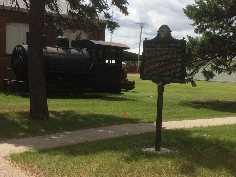
By Ruth VanSteenwyk, May 21, 2017
Civilian Conservation Corps Camp Marker
1 ► South Dakota, Beadle County, Huron — 517 — Civilian Conservation Corps Camp —  |
| On 3rd Street Southwest west of Livestock Avenue, on the right when traveling east. | |||
| 2 ► South Dakota, Beadle County, Huron — 349 — W. Glenn Sloan — Engineer Man of Vision — |
| On 4th Street NE (U.S. 14) at Jersey Avenue NE, on the right when traveling east on 4th Street NE. | |||
| 3 ► South Dakota, Beadle County, Huron — 200 — Where Does the West Begin?/ Here the West Begins — |
| On 3rd Street Southwest west of Livestock Avenue, on the left when traveling east. | |||
| 4 ► South Dakota, Beadle County, Wolsey — 694 — Wolsey: A Crossroad of the Heartland / Wolsey Notables — |
| On Commercial Avenue (U.S. 14) south of Cardinal Street, on the left when traveling south. | |||
| 5 ► South Dakota, Bennett County, Tuthill — 540 — Civilian Conservation Corps Camp — |
| On U.S. 18 at 230th Avenue (State Highway 73), on the right when traveling west on U.S. 18. | |||
| 6 ► South Dakota, Bon Homme County, Springfield — 575 — First School in Dakota Territory Monument — 1860 — |
| On 311th Street at Bon Homme Road, on the right when traveling west on 311th Street. | |||
| 7 ► South Dakota, Bon Homme County, Springfield — 621 — Replica First Schoolhouse — |
| On 311th Street at Bon Homme Road, on the right when traveling west on 311th Street. | |||
| 8 ► South Dakota, Brookings County, Badger, Laketon Township — 737 — Laketon Post Office / Oakwood Post Office — |
| On 457th Avenue 0.5 miles north of 199th Street (County Highway 4), on the right when traveling north. | |||
| 9 ► South Dakota, Brookings County, Brookings — 358 — Brookings / Hillcrest Park — |
| Near 6th Street (U.S. 14) at 17th Avenue, on the right when traveling east. | |||
| 10 ► South Dakota, Brookings County, Brookings — 553 — Brookings County — You are about to enter — |
| On 471st Avenue at 220th Street, on the right when traveling north on 471st Avenue. | |||
| 11 ► South Dakota, Brookings County, Brookings — 285 — First Convention in Brookings County — |
| On 471st Avenue at 219th Street, on the right when traveling south on 471st Avenue. | |||
| 12 ► South Dakota, Brookings County, Brookings — 601 — Medary — |
| On 471st Avenue at 219th Street, on the right when traveling south on 471st Avenue. | |||
| 13 ► South Dakota, Brookings County, Brookings — 189 — Medary Townsite — 1857-58 1871-79 — |
| On 471st Avenue at 219th Street, on the right when traveling south on 471st Avenue. | |||
| 14 ► South Dakota, Brookings County, Bruce — SD-665 — Hessel and Charlotte Houtman Family Farm — |
| On Oakwood Shoreline Drive 1 mile north of 204th Street (County Road 6), on the right when traveling north. | |||
| 15 ► South Dakota, Brookings County, Bruce — 279 — Oakwood — 1877-1894 — |
| On County Road 6 0.5 miles west of 163rd Avenue, on the right when traveling west. | |||
| 16 ► South Dakota, Brookings County, Bruce — 478 — Oakwood Lakes Burial Mounds — |
| Near 202nd Street. | |||
| 17 ► South Dakota, Brookings County, Bruce — 8 — Oakwood Lakes State Park — Breastworks / Te-Tonka-Ha / Nicollet and Fremont — |
| Near South Oakwood Shoreline Drive. | |||
| 18 ► South Dakota, Brookings County, Bruce — 685 — 'Ol Spot Mortimer's Cabin — |
| On 202nd Street 1.2 miles west of 462nd Avenue, on the right when traveling west. | |||
| 19 ► South Dakota, Brookings County, Bruce — 738 — Praise in the Park — |
| On 202nd Street 1.1 miles west of 462nd Avenue, on the right when traveling west. | |||
| 20 ► South Dakota, Brookings County, Bruce — 735 — Significant Site — |
| Near 202nd Street 0.5 miles west of 202nd Street. | |||
| 21 ► South Dakota, Brookings County, Elkton — 196 — Brookings County / Moody County — You are about to enter — |
| On 220th Street east of 481st Avenue (State Route 13), on the left when traveling east. | |||
| 22 ► South Dakota, Brookings County, Elkton — 123 — Hole-In-The-Mountain — |
| On Highway 14 0.5 miles east of 487th Ave, on the right when traveling west. | |||
| 23 ► South Dakota, Brookings County, Elkton — 651 — You are now Entering South Dakota — |
| On 215th Street (U.S. 14) 0.5 miles east of 487th Avenue, on the right when traveling west. | |||
| 24 ► South Dakota, Brookings County, Lake Norden, Laketon Township — 736 — Historic Area — |
| On South Lake Drive east of 456th Avenue (County Highway 2), on the right when traveling east. | |||
| 25 ► South Dakota, Brookings County, Volga — 595 — Lake Campbell Lutheran Church — |
| On 219th Street 1.1 miles east of Caspian Avenue, on the right when traveling west. | |||
| 26 ► South Dakota, Brookings County, Volga — 122 — Oakwood Lakes Big Sioux River - Volga — |
| On 211th Street (U.S. 81) 1.1 miles west of Caspian Avenue, on the right when traveling west. | |||
| 27 ► South Dakota, Brookings County, White — 253 — Lake Hendricks Norwegian Colony of 1873 / Brookings County — |
| On 197th Street 15 miles east of U.S. 29, on the right when traveling west. | |||
| 28 ► South Dakota, Brookings County, White — 330 — Lake Hendricks State Park / Brookings County — |
| On Unnamed Road 0.7 miles north of 201st Street, on the right when traveling north. | |||
| 29 ► South Dakota, Brown County, Aberdeen — 554 — Aberdeen, South Dakota Vietnam Veterans Memorial — |
| On 6th Avenue Southeast (U.S. 12) east of South Harrison Street, on the left when traveling west. | |||
| 30 ► South Dakota, Brown County, Aberdeen — 508 — F.W. Sallet and the Dakota Freie Presse — |
| On East Melgaard Road 0.1 miles west of South Lloyd Street, on the right when traveling west. | |||
| 31 ► South Dakota, Brown County, Columbia — 318 — Columbia — 1879 — |
| Near 396th Avenue. | |||
| 32 ► South Dakota, Brown County, Columbia — 686 — Daly Corners — |
| On 401st Avenue (County Road 18) at 120th Street (County Road 9), on the right when traveling north on 401st Avenue. | |||
| 33 ► South Dakota, Brown County, Columbia — 570 — Father Alexandra Ravoux — |
| Near 396th Avenue 0.6 miles south of 115th Street, on the left when traveling south. | |||
| 34 ► South Dakota, Brown County, Columbia — 580 — Hamlin Garland — |
| On Hamlin Garland Highway (123rd Street) (County Road 11) 0.5 miles west of 391st Avenue (County Road 14), on the right when traveling west. | |||
| 35 ► South Dakota, Brown County, Frederick — 548 — Aurland — |
| On 391st Avenue (County Road 14) 0.5 miles north of 112th Street (State Highway 10), on the left when traveling north. | |||
| 36 ► South Dakota, Brown County, Frederick — 616 — Colin Campbell Fur Post — |
| Near 382nd Avenue 0.1 miles north of 111st Street, on the right when traveling north. | |||
| 37 ► South Dakota, Brown County, Frederick — 319 — Savo Monument — |
| On 391st Avenue (County Road 14) at 104th Street (County Road 3), on the right when traveling north on 391st Avenue. | |||
| 38 ► South Dakota, Brown County, Frederick — 92-B — You Are Entering South Dakota / You Are Now Leaving South Dakota and About to Enter North Dakota — |
| On U.S. 281 0.2 miles south of 102nd St Southeast, on the right when traveling south. | |||
| 39 ► South Dakota, Brown County, Houghton — 515 — Civilian Conservation Corps Camp — |
| On 112th Street (State Highway 10) 1.3 miles west of 400th Ave., on the right when traveling east. | |||
| 40 ► South Dakota, Brown County, Houghton — 424 — Ralph Herseth — Twenty-First Governor — |
| On 112th Street (State Highway 10) at 3rd Street, on the right when traveling east on 112th Street. | |||
| 41 ► South Dakota, Brule County, Chamberlain — 169 — Chamberlain — 1880 — |
| On North Main Street (State Highway 50) at Rodeo Avenue, on the left when traveling north on North Main Street. | |||
| 42 ► South Dakota, Brule County, Chamberlain — 582 — Historic Highway — |
| On 344th Avenue 0.2 miles north of 251st Street, on the left when traveling north. | |||
| 43 ► South Dakota, Brule County, Chamberlain — 456 — Lewis & Clark Memorial Bridge at Chamberlain — |
| Near Interstate 90 at milepost 264. | |||
| 44 ► South Dakota, Campbell County, Herreid — 652 — You are about to enter South Dakota / You are now leaving South Dakota — |
| On U.S. 83 at 102nd St. SE, on the right when traveling south on U.S. 83. | |||
| 45 ► South Dakota, Campbell County, Pollock — 654 — Flint Store and Post Office — |
| On 296th Ave at State Highway 10, on the right when traveling north on 296th Ave. | |||
| 46 ► South Dakota, Campbell County, Pollock — 662 — Old Pollock / Lot Distribution in New Pollock / Lake Pocasse — |
| On State Highway 1804 at 294th Ave, on the right when traveling west on State Highway 1804. | |||
| 47 ► South Dakota, Charles Mix County, Marty — 119 — Martin Marty / Rev. Sylvester Eisenman — |
| On 303rd Street east of 388th Avenue, on the right when traveling east. | |||
| 48 ► South Dakota, Charles Mix County, Marty, Wahehe Township — 647 — Yankton Sioux Treaty of 1858 Monument — |
| On 390th Avenue 0.2 miles north of County Road 2, on the right when traveling north. | |||
| 49 ► South Dakota, Clark County, Clark — 631 — Clark County Veterans Memorial — |
| On 1st Ave. W at Commercial St., on the right when traveling east on 1st Ave. W. | |||
| 50 ► South Dakota, Clark County, Clark — 348 — Samuel Harrison Elrod, — Fifth Governor of South Dakota — |
| On 1st Avenue East at South Commercial Street, on the left when traveling west on 1st Avenue East. | |||
| 51 ► South Dakota, Clark County, Elrod — 472 — Birthplace of South Dakota Amateur Baseball — Garden City - - - - - Six Miles North — |
| On U.S. 212 0.2 miles west of 433rd Avenue, on the right when traveling east. | |||
| 52 ► South Dakota, Clay County, Beresford — 328 — Southeast South Dakota Experiment Farm — In Memory of Gustavus Norgren — Dedicated to the Early Pioneers of South Dakota — |
| On University Road 3 miles east of State Highway 19, on the right when traveling north. | |||
| 53 ► South Dakota, Clay County, Burbank, Fairview Township — 495 — First Rural Electric Cooperative — |
| On State Highway 50 east of 469th Avenue, on the right when traveling west. | |||
| 54 ► South Dakota, Clay County, Meckling — 414 — Meckling & Lincoln — |
| On Main Street south of State Route 50, on the left when traveling east. | |||
| 55 ► South Dakota, Clay County, Vermillion — 425 — Bruyer Church — |
| On South Dakota Route 50 3 miles west of Interstate 29, on the right when traveling west. | |||
| 56 ► South Dakota, Clay County, Vermillion — 495 — First Rural Electric Cooperative — |
| On State Highway 50 west of 469th Avenue, on the right when traveling east. | |||
| 57 ► South Dakota, Clay County, Vermillion — 706 — Governor Andrew E. Lee — |
| On West Main Street west of South Market Street, on the right when traveling east. | |||
| 58 ► South Dakota, Clay County, Vermillion — 579 — Grand Lodge Constitution Site — First Baptist Church Site — |
| On South Dakota Street at West Chestnut Street, on the right when traveling south on South Dakota Street. | |||
| 59 ► South Dakota, Clay County, Vermillion — 574 — Site of the First Permanent School House in Dakota Territory — |
| On South Dakota Street at East Chestnut Street, on the right when traveling north on South Dakota Street. | |||
| 60 ► South Dakota, Clay County, Vermillion — 413 — Vermillion / Historic Highway — |
| On West Cherry Street 0.5 miles south of State Route 50, on the left when traveling west. | |||
| 61 ► South Dakota, Codington County, South Shore — 452 — Legend of Punished Woman's Lake — |
| On South Dakota Route 20 1 mile east of 462nd Avenue, on the right when traveling east. | |||
| 62 ► South Dakota, Codington County, Watertown — 591 — Codington County Veterans Memorial — |
| On 1st Avenue Southeast west of Maple Street Southeast, on the right when traveling east. | |||
| 63 ► South Dakota, Codington County, Watertown — 561 — Codington County Vietnam Veterans Memorial — |
| On 1st Avenue Southeast east of Broadway Street South, on the right when traveling east. | |||
| 64 ► South Dakota, Codington County, Watertown — 566 — Dedicated to Freeman Thayer Post Number 59 — Grand Army of the Republic — Department of South Dakota — |
| On 1st Avenue Southeast west of Maple Street Southeast, on the right when traveling east. | |||
| 65 ► South Dakota, Codington County, Watertown — 499 — Mellette House — |
| On 5th Avenue Northwest at Skyline Drive, on the right when traveling west on 5th Avenue Northwest. | |||
| 66 ► South Dakota, Codington County, Watertown — 498 — Old M. & St. L. Depot Museum — |
| On North Broadway Street 0.1 miles north of 1st Avenue North, on the right when traveling north. | |||
| 67 ► South Dakota, Codington County, Watertown — 635 — Town Clock History — 1887 – 1987 — |
| On 9th Avenue Southeast (U.S. 212) 0.2 miles west of 5th Street Southeast (U.S. 81), on the right when traveling east. | |||
| 68 ► South Dakota, Codington County, Watertown — 191 — Watertown — and Vicinity — |
| On 9th Ave. SW at 3rd St. SW, on the right when traveling west on 9th Ave. SW. | |||
| 69 ► South Dakota, Corson County, Mobridge — 622 — Sakakawea — |
| Near State Highway 1806 4 miles south of U.S. 12. | |||
| 70 ► South Dakota, Corson County, Morristown — 699 — Bismarck-Deadwood Stage Trail — |
| On Highway 12 0.2 miles west of 222nd Ave, on the right when traveling west. | |||
| 71 ► South Dakota, Custer County, Buffalo Gap — 469 — Jedediah Strong Smith’s Route - - 1823 — |
| On U.S. 79 near County Route 101, on the right when traveling north. | |||
| 72 ► South Dakota, Custer County, Custer — 236 — “The Badger Hole” — ¼ mile — |
| On Badger Clark Road at Badger Hole, on the right when traveling south on Badger Clark Road. | |||
| 73 ► South Dakota, Custer County, Custer — 588 — Anna Donna Tallent — |
| On Lower French Creek Road 0.2 miles south of Stockade Lake Drive (U.S. 16A), on the left when traveling south. | |||
| 74 ► South Dakota, Custer County, Custer — 448 — Campsite of General Custer's Expedition — August 1 - 6, 1874 — |
| On Stockade Lake Road (U.S. 16) close to County Route 346. | |||
| 75 ► South Dakota, Custer County, Custer — 516 — Civilian Conservation Corps Camp — Camp SP-3 / Camp Narrows — French Creek — |
| On State Highway 87 0.5 miles north of Lame Johnny Road, on the left when traveling north. | |||
| 76 ► South Dakota, Custer County, Custer — 527 — Civilian Conservation Corps Camp — |
| Near South Playhouse Road east of Needles Highway (State Highway 87). | |||
| 77 ► South Dakota, Custer County, Custer — 531 — Civilian Conservation Corps Camp — |
| On Mt. Rushmore Road (U.S. 16) at Lightning Creek Road (Forest Road 288), on the right when traveling west on Mt. Rushmore Road. | |||
| 78 ► South Dakota, Custer County, Custer — 604 — Horace N. Ross — |
| On Mount Rushmore Road (U.S. 16A) east of South 4th Street, on the right when traveling east. | |||
| 79 ► South Dakota, Custer County, Custer — 444 — The Hearst Highway — Dedicated to the memory of — |
| On Hearst Memorial Highway (U.S. 385) at Avenue of the Chiefs, on the right when traveling north on Hearst Memorial Highway. | |||
| 80 ► South Dakota, Custer County, Hot Springs — 520 — Civilian Conservation Corps Camp — |
| On U.S. 385 1.9 miles north of 7-11 Road (County Road 101), on the right when traveling north. | |||
| 81 ► South Dakota, Custer County, Keystone — 536 — The Pigtail Bridges — |
| On Iron Mountain Road (U.S. 16A) near Highway 244. | |||
| 82 ► South Dakota, Davison County, Mitchell — 722 — Carl Gunderson: — 11th Governor of South Dakota — |
| On North Main Street at East 7th Avenue on North Main Street. | |||
| 83 ► South Dakota, Davison County, Mitchell — 360 — Indian Medicine Tree — |
| Near West University Avenue 0.1 miles south of McCabe Street, on the right when traveling north. | |||
| 84 ► South Dakota, Davison County, Mitchell — 573 — Junction of Jimtown & Fort Thompson Trails — |
| On East 1st Avenue at Bartscher Road, on the right when traveling east on East 1st Avenue. | |||
| 85 ► South Dakota, Davison County, Mitchell — 615 — Old Mill Stone — |
| On South Gamble Street at East Hanson Avenue, on the right when traveling north on South Gamble Street. | |||
| 86 ► South Dakota, Davison County, Mitchell — 451 — Original Site of New Home Lutheran Church — |
| Near 480th Avenue 6.6 miles south of U.S. 90. | |||
| 87 ► South Dakota, Day County, Andover — 283 — Brown County / Day County — |
| On 134th Street at 412th Avenue (County Highway 43), on the right when traveling west on 134th Street. | |||
| 88 ► South Dakota, Day County, Bristol — 276 — Bristol — 1881 — |
| On Railroad Avenue East just east of Main Street, on the left when traveling east. | |||
| 89 ► South Dakota, Day County, Pierpont — 388 — Charles H. Sheldon — Second Governor of South Dakota — 1893 - 1897 — |
| On South Dakota Route 27 at 130th Street, on the right when traveling south on South Dakota Route 27. | |||
| 90 ► South Dakota, Day County, Roslyn — 431 — Pioneering in Dakota — Prairie Fires — |
| On South Dakota Route 25 at 133rd Street, on the right when traveling south on South Dakota Route 25. | |||
| 91 ► South Dakota, Day County, Webster — 568 — Edgar S. McFadden — |
| On U.S. 12 0.2 miles west of West 7th Street, on the right when traveling west. | |||
| 92 ► South Dakota, Day County, Webster — 316 — Sigurd Anderson — 19th Governor of South Dakota, 1951-1955 — Resident of Webster and Day County Since 1932 — |
| On Federal Route 12 0.2 miles W. 7th Street, on the right when traveling west. | |||
| 93 ► South Dakota, Day County, Webster — 376 — The Fight at Webster — |
| On U.S. 12 0.2 miles W. 7th Street, on the right when traveling west. | |||
| 94 ► South Dakota, Day County, Webster — 326 — Webster — County Seat of Day County — |
| On U.S. 12 0.2 miles W. 7th Street, on the right when traveling west. | |||
| 95 ► South Dakota, Day County, Webster — 659 — WWII Plane Crash Holds Memories — |
| On U.S. 12 0.2 miles west of West 7th Street, on the right when traveling west. | |||
| 96 ► South Dakota, Deuel County, Clear Lake — 357 — Tabor Evangelical Church — |
| On County Road 22 at 496th Avenue, on the left when traveling east on County Road 22. | |||
| 97 ► South Dakota, Deuel County, Gary — 450 — Byron J. Cochrane — |
| On Edgewater Drive 0.1 miles east of Wilderness Lane, on the right when traveling east. | |||
| 98 ► South Dakota, Dewey County, Firesteel — 539 — Firesteel — |
| On South Dakota Route 20 0.3 miles south of County Road 3, on the right when traveling south. | |||
| 99 ► South Dakota, Dewey County, Ridgeview — 462 — St. Basil's Church — Mossman, South Dakota |
| On County Road 15 north of U.S. 212, on the right when traveling north. Reported permanently removed. | |||
| 100 ► South Dakota, Douglas County, Corsica — 333 — Grand View — 1882-1894 — |
| On 276th Street (U.S. 281) 0.4 miles west of 392nd Avenue, on the right when traveling west. | |||
364 entries matched your criteria. The first 100 are listed above. Next 100 ⊳