By Michael Kindig, March 22, 2008
Site of Camp Pilot Knob Marker
GEOGRAPHIC SORT Title Sort Marker Number Sort Marker Number Sort N Marker Number Sort T Publication Order Sort Publication Order Sort A Erected Year Sort Most Viewed Sort Most Recent-Interest Sort Most Recently Changed Sort SEE FAQ #33 FOR DESCRIPTIONS
On Sidewinder Road North at Tucker Road, on the right when traveling south on Sidewinder Road North.
On West 5th Street at Pine Avenue, on the right when traveling west on West 5th Street.
On Vanderlinden Road at Interstate 8, on the right when traveling south on Vanderlinden Road.
On East Worthington Road (County Highway S28) at Bypass Federal Highway 116, on the right when traveling east on East Worthington Road.
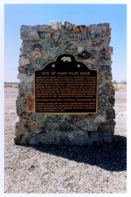
On Country Club Drive, 0.3 miles south of California Route 115 when traveling south.
On West Worthington Road (County Highway S28), on the right when traveling east. Reported missing.
Near In-Ko-Pah Park Road west of Interstate 8.
Near In-Ko-Pah Park Road near Interstate 8.
On Main Street at Route 111, on the right when traveling east on Main Street.
On Beal Road near Telephone Road, on the right when traveling north.
Near Frontage Road, 0.3 miles west of Imperial Highway.
On Ben Hulse Highway (California Route 78) at 1st Street, on the right when traveling south on Ben Hulse Highway.
On Ben Hulse Highway (California Route 78) at 1st Street on Ben Hulse Highway.
On Quechan Drive, on the right when traveling south.
On Interstate 186, 0.2 miles south of Interstate 8, on the left when traveling south.
Paid Advertisement
On Picacho Road, on the right when traveling north.
On Grays Well Road, on the right when traveling east.
On Quechan Drive, 0.1 miles north of Quechan Road, on the left when traveling north.
On West Mehring Road, 0.1 miles west of Imperial Road, on the right when traveling west.
On Gold Rock Ranch Road at Walker Way on Gold Rock Ranch Road.
On California Route 168 north of Reservoir Road and Cataract Road, on the right when traveling east.
On Three Flags Highway (State Highway 395) at County Route 168, on the right when traveling north on Three Flags Highway.
On California Route 168, 1.9 miles east of U.S. 395, on the right when traveling east.
On North Main Street, on the left when traveling north.
On Buttermilk Road near California Route 168, on the right when traveling west.
On U.S. 395, on the right when traveling north.
On Highway 6 (U.S. 6) at Silver Canyon Road, on the right when traveling east on Highway 6.
On Highway 395, on the right when traveling south.
On Airport Road, 0.7 miles north of East Line Street.
On West Line Road (California Route 168) west of Muny Road, on the right when traveling west.
Paid Advertisement
On Main Street (U.S. 395) at East Pine Street, on the right when traveling north on Main Street.
Near North Main Street (U.S. 395).
On South Main Street (U.S. 395) at Lagoon Street, on the right when traveling south on South Main Street.
On U.S. 395 at and an un-named dirt road, on the left when traveling south on U.S. 395.
On Death Valley Road (State Highway 127) at Ash Meadows Road, on the right when traveling south on Death Valley Road.
On State Highway 127, 0.2 miles south of State Highway 190, on the right when traveling south.
Near California Route 190 near Greenland Boulevard, on the left when traveling north.
On Shabbell Lane, 0.3 miles north of U.S. 395, on the right when traveling north.
On West Market Street west of Three Flags Highway (U.S. 395), on the left when traveling west.
On Grant Street at Onion Valley Road on Grant Street.
On Citrus Road, on the right when traveling east.
On Fish Hatchery Road, 1 mile west of U.S. 395, on the right when traveling west.
On Cerro Gordo Road just north of California Route 136, on the right when traveling north.
On California Route 136 at Dolomite Loop (east end) on State Route 136.
On Malone Street just south of Railroad Avenue, on the left when traveling south.
On California Route 136, 1 mile north of Keeler, on the left when traveling north.
Paid Advertisement
Near U.S. 395 at Los Angles Aqueduct Road, on the left when traveling north.
On U.S. 395, 2.7 miles north of California Route 190, on the right when traveling north.
On Sub Station Road at Esha Street, on the right when traveling east on Sub Station Road.
On Whitney Portal Road at Movie Road, on the left when traveling east on Whitney Portal Road.
On Whitney Portal Road, 0.4 miles west of U.S. 395, on the right when traveling west.
On Main Sreet (U.S. 395) south of Busch Street, on the right when traveling south.
On California Route 178, on the right when traveling north.
On Trona Wildrose Road at Ballarat Road, on the right when traveling north on Trona Wildrose Road.
On Trona Wildrose Road at Ballarat Road, on the right when traveling north on Trona Wildrose Road.
On 17th Street at H Street, on the left when traveling west on 17th Street.
Near Lerdo Highway, 1 mile west of California Route 65, on the right when traveling west.
Near 4310 Old Alfred Harrell Highway, on the right when traveling west.
On Truxton Street, on the right when traveling east.
Near 14th Street at G Street.
Near Lake Isabella Boulevard (County Route 155) south of Kilbreth Drive, on the right when traveling south.
Paid Advertisement
On 20 Mule Team Parkway east of Rudnick Boulevard, on the right when traveling west.
On Randsburg Mojave Road at 20 Mule Team Parkway on Randsburg Mojave Road.
On Aerospace Highway (California Route 14), on the right when traveling south.
Near South Lancaster Boulevard, 0.4 miles west of 120th Street East, on the right when traveling west.
On Caliente-Bodfish Road north of School Street.
On Caliente-Bodfish Road (County Route 483), on the right when traveling north.
On State Highway 178, on the left when traveling east.
Near Lebec Road (Interstate 5), on the left when traveling north.
Near Fort Tejon Road west of Interstate 5, on the right when traveling south.
Near Fort Tejon Road near Interstate 5, on the right when traveling south.
On California Route 33 at D Street, on the left when traveling north on State Route 33.
On Jawbone Canyon Road at Aerospace Highway (California Highway 14), on the right when traveling north on Jawbone Canyon Road.
On Isabella Walker Pass Road (State Highway 178) west of Doyle Ranch Road, on the left when traveling west.
On Isabella Walker Pass Road (State Highway 178 at milepost 79.8), on the right when traveling east.
Paid Advertisement
On Red Rock Randsberg Road at Butte Avenue, on the left when traveling north on Red Rock Randsberg Road.
On U.S. 395 just north of Red Moutain Road, on the left when traveling north. Reported missing.
On U.S. 395, 0.2 miles south of Red Mountain Road, on the right when traveling south.
Near Burro Schmidt Tunnel Road.
On North 10th Street south of West Ash Street, on the right when traveling south.
Near Wood Street, on the right when traveling east.
On Bear Valley Road, 3.8 miles north of Cummings Valley Road, on the left when traveling north.
On Iris Way at Violette Court, on the right when traveling north on Iris Way.
Near Woodford-Tehachapi Road south of Country Club Drive, on the left when traveling south.
On Tehachapi Boulevard, on the right when traveling west.
On Woodford-Tehachapi Road, on the left when traveling east.
On Caliente-Bodfish Road (County Road 483) at Walker Basin Road, on the left when traveling south on Caliente-Bodfish Road.
On Glennville-Bakersfield/Granite Road, on the right when traveling south.
Paid Advertisement
On Woody Road, 0.2 miles south of California Highway 155, on the left when traveling south.
On Woody Road at State Highway 155, on the left when traveling east on Woody Road.
On High Valley Road (Business County Road 220).
On Main Street, 0.1 miles east of California Route 29, on the left when traveling east.
On Milford Grade Road at Hamlin Drive, on the right when traveling south on Milford Grade Road.
1757 entries matched your criteria. Entries 301 through 400 are listed above.
⊲ Previous 100 —
Next 100 ⊳