1235 entries match your criteria. The first 100 are listed. ⊳
Historical Markers and War Memorials on the Eastern Shore Region
By J. J. Prats, September 7, 2015
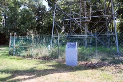
North-South Boundary Between the State of Maryland and the State of Delaware Monument
1 ► Maryland, Caroline County, Andersontown — North-South Boundary Between the State of Maryland and the State of Delaware —  |
| On Shore Highway (Maryland Route 404) near the State Line, on the right when traveling east. | |||
| 2 ► Maryland, Caroline County, Choptank — 25 — Choptank Landing — Escape from Poplar Neck — Harriet Tubman Underground Railroad Byway — |
| On Water Street. | |||
| 3 ► Maryland, Caroline County, Denton — "29, Let's Go!" — |
| On South 4th Street north of Randolph Street, on the right when traveling north. | |||
| 4 ► Maryland, Caroline County, Denton — 6 PDR. Nordenfeldt 57 M.M., Rapid Fire Gun. — |
| On Legion Road, on the right when traveling south. | |||
| 5 ► Maryland, Caroline County, Denton — American Legion — Post 29 — |
| On Legion Road, on the right when traveling south. | |||
| 6 ► Maryland, Caroline County, Denton — Bell from First Methodist Church — |
| On 5th Street south of Franklin Street ( Route 404), on the right when traveling south. | |||
| 7 ► Maryland, Caroline County, Denton — 33 — Caroline County Visitor Center — Abolitionists Abound — Harriet Tubman Underground Railroad Byway — |
| On Crouse Park Lane west of Gay Street ( Route 404), on the right when traveling west. | |||
| 8 ► Maryland, Caroline County, Denton — Caroline Court House — |
| On Market Street near Between 1st and 2nd Streets, on the right when traveling west. | |||
| 9 ► Maryland, Caroline County, Denton — 31 — Caroline Courthouse — In the Shadow of Justice — Harriet Tubman Underground Railroad Byway — |
| On Market Street at North 2nd Street on Market Street. | |||
| 10 ► Maryland, Caroline County, Denton — 35 — Choptank River Heritage Center — Steal Away by River — Harriet Tubman Underground Railroad Byway |
| On River Landing Road. Reported permanently removed. | |||
| 11 ► Maryland, Caroline County, Denton — Denton — |
| On 5th Street at South 6th Street, on the right when traveling north on 5th Street. | |||
| 12 ► Maryland, Caroline County, Denton — Denton Schoolhouse — 104 South 2nd Street — |
| On South 2nd Street south of Franklin Street ( Route 404), on the left when traveling north. | |||
| 13 ► Maryland, Caroline County, Denton — Early Commercial Agriculture — |
| Near Detour Road east of Harmony Road ( Route 16), on the right when traveling east. | |||
| 14 ► Maryland, Caroline County, Denton — Edmondson's Reserve — |
| Near Detour Road 0.4 miles east of Harmony Road ( Route 16), on the right when traveling east. | |||
| 15 ► Maryland, Caroline County, Denton — Emancipation's Close Call — Did Union Troops Suppress the Vote? — |
| On Market Street at North 2nd Street, on the right when traveling west on Market Street. | |||
| 16 ► Maryland, Caroline County, Denton — Great Wars of World Conflict — |
| On Market Street at 1st Street, on the left when traveling east on Market Street. | |||
| 17 ► Maryland, Caroline County, Denton — Hubs of Activity — Terminals, Wharves and Landings on the Choptank |
| On River Landing Road 0.4 miles north of New Bridge Road ( Route 328), on the right when traveling north. Reported unreadable. | |||
| 18 ► Maryland, Caroline County, Denton — John Wilkes Booth — Escape of an Assassin — War on the Chesapeake Bay |
| On 2nd Street at Gay Street, on the right when traveling north on 2nd Street. Reported permanently removed. | |||
| 19 ► Maryland, Caroline County, Denton — Maryland Steamboat Company's Joppa Wharf at Denton — The Wharves at Choptank Crossing — |
| On River Landing Road. | |||
| 20 ► Maryland, Caroline County, Denton — Maryland's Eastern Shore — Hundreds of Enslaved and Free Black Men Enlisted |
| On North 2nd Street at Gay Street, on the right when traveling north on North 2nd Street. Reported permanently removed. | |||
| 21 ► Maryland, Caroline County, Denton — Moses and the Hounds — Harriet Tubman Underground Railroad Byway — |
| On Foot of Gay Street. | |||
| 22 ► Maryland, Caroline County, Denton — Mystery Ship |
| Near Martinak State Park Road 0.4 miles south of Deep Shore Road, on the left when traveling south. Reported damaged. | |||
| 23 ► Maryland, Caroline County, Denton — Neck Meeting House — |
| On Maryland Route 404 at Route 328, on the right when traveling west on Maryland Route 404. | |||
| 24 ► Maryland, Caroline County, Denton — Neck Meeting House Native Garden |
| On Meeting House Road. Reported damaged. | |||
| 25 ► Maryland, Caroline County, Denton — Nest of Traitors — The Denton Arrests |
| On River Landing Road 0.4 miles north of New Bridge Road ( Route 328), on the right when traveling north. Reported permanently removed. | |||
| 26 ► Maryland, Caroline County, Denton — On this spot Sept. 5, 1938 stood Franklin Delano Roosevelt — |
| On Market Street, on the left when traveling west. | |||
| 27 ► Maryland, Caroline County, Denton — Peter Still: The Kidnapped and the Ransomed — |
| Near Detour Road east of Harmony Road ( Route 16), on the right when traveling east. | |||
| 28 ► Maryland, Caroline County, Denton — President Roosevelt's Speech — 1938 — "The Biggest Day That Denton Had Ever Seen" — |
| On Market Street west of North 2nd Street, on the left when traveling west. | |||
| 29 ► Maryland, Caroline County, Denton — Revolution or Fraud? — Emancipation in Caroline Co. |
| On Market Street at 2nd Street, on the right when traveling west on Market Street. Reported permanently removed. | |||
| 30 ► Maryland, Caroline County, Denton — Ruth Ann Crouse — |
| On South 5th Avenue south of Legion Road, on the right when traveling south. | |||
| 31 ► Maryland, Caroline County, Denton — Semiquincentennial Monument — 🇺🇸 — |
| On Market Street west of North 2nd Street, on the right when traveling west. | |||
| 32 ► Maryland, Caroline County, Denton — Steamboats on the Choptank River — Connecting Denton to the World |
| On River Landing Road 0.4 miles north of New Bridge Road ( Route 328), on the right when traveling north. Reported damaged. | |||
| 33 ► Maryland, Caroline County, Denton — Sydney Still: "Sydney's Choice" — |
| Near Detour Road east of Harmony Road ( Route 16), on the right when traveling east. | |||
| 34 ► Maryland, Caroline County, Denton — The County Alms House, then Plaindealing — Stark Realities… Stately Home, c. 1792 - 2017 — |
| On South 5th Avenue south of Legion Drive, on the right when traveling south. | |||
| 35 ► Maryland, Caroline County, Denton — The Denton Arrests — "Arresting … treasonable characters" — |
| On Crouse Park Lane west of Gay Street ( Route 404), on the right when traveling west. | |||
| 36 ► Maryland, Caroline County, Denton — The Doncaster Dwelling: A Perfect Substitute — |
| Near Detour Road east of Harmony Road ( Route 16), on the right when traveling east. | |||
| 37 ► Maryland, Caroline County, Denton — The Food Sources of Enslaved Afro-Marylanders — |
| Near Detour Road east of Harmony Road ( Route 16), on the right when traveling east. | |||
| 38 ► Maryland, Caroline County, Denton — The Martinak Boat — 50th Anniversary — |
| Near Martinak State Park Road 0.4 miles south of Deep Shore Road, on the left when traveling south. | |||
| 39 ► Maryland, Caroline County, Denton — RM-1239 — Thomas Carney — ca. 1760-1828 — |
| On Market Street. | |||
| 40 ► Maryland, Caroline County, Denton — 34 — Tuckahoe Neck Meeting House — Living Their Beliefs — Harriet Tubman Underground Railroad Byway — |
| On Meeting House Road. | |||
| 41 ► Maryland, Caroline County, Denton — Two Neighbors * Two Governors * Two States — The Citizens of Denton and Caroline County Honor Two Native Sons — Sherman W. Tribbitt, Governor of Delaware, 1973; Harry Roe Hughes, Governor of Maryland, 1979-1987 — |
| On Franklin Street (Maryland Route 404) at South 2nd Street, on the right when traveling east on Franklin Street. | |||
| 42 ► Maryland, Caroline County, Denton — War Along the Chesapeake — A Divided Region — |
| On North 2nd Street just south of Gay Street ( Route 404), on the right when traveling north. | |||
| 43 ► Maryland, Caroline County, Denton — White Tenant Farmers — |
| Near Detour Road east of Harmony Road ( Route 16), on the right when traveling east. | |||
| 44 ► Maryland, Caroline County, Denton — 30 — William Still Center — Families Divided & United — Harriet Tubman Underground Railroad Byway — |
| On Detour Road. | |||
| 45 ► Maryland, Caroline County, Denton — William Still: "Father of the Underground Railroad" — |
| Near Detour Road east of Harmony Road ( Route 16), on the right when traveling east. | |||
| 46 ► Maryland, Caroline County, Federalsburg — A Paradise For Smugglers — Nanticoke River, 1861-1863 — |
| On South Main Street (Maryland Route 308) north of Smith Street, on the right when traveling north. | |||
| 47 ► Maryland, Caroline County, Federalsburg — Civil War Memorial — |
| Near Bloomingdale Avenue (Maryland Route 315) west of Old Denton Road, on the right when traveling west. | |||
| 48 ► Maryland, Caroline County, Federalsburg — Exeter / Idlewild Mill — |
| On Denton Road 0.2 miles north of Laurel Grove Road, on the left when traveling north. | |||
| 49 ► Maryland, Caroline County, Federalsburg — Federalsburg Hometown Veterans Memorial — |
| On Rosser Road south of Federalsburg Highway ( Route 313), on the left when traveling south. | |||
| 50 ► Maryland, Caroline County, Federalsburg — Former Clubhouse at Federal Field — Home of the Federalsburg Athletics — The Eastern Shore League — |
| On University Avenue North at Greenridge Road, on the right when traveling north on University Avenue North. | |||
| 51 ► Maryland, Caroline County, Federalsburg — Marshyhope Creek Bridge — |
| On East Central Avenue (Maryland Route 306), on the left when traveling west. | |||
| 52 ► Maryland, Caroline County, Federalsburg — The Historic Nanticoke Lodge Masonic Temple — |
| On North Main Street (Maryland Route 315) just north of West Central Avenue, on the left when traveling north. | |||
| 53 ► Maryland, Caroline County, Federalsburg — These Dead Shall Not Have Died in Vain — |
| Near Veterans Drive, on the right when traveling south. | |||
| 54 ► Maryland, Caroline County, Federalsburg — Veterans Memorial — |
| Near Bloomingdale Avenue (Route 315) west of Old Denton Road, on the right when traveling west. | |||
| 55 ► Maryland, Caroline County, Greensboro — Choptank River Park — |
| On East Sunset Avenue (Maryland Route 314) west of Greensboro Road ( Route 313), on the left when traveling west. | |||
| 56 ► Maryland, Caroline County, Greensboro — Goldsborough House — |
| On West Sunset Avenue just east of Church Street, on the left when traveling east. | |||
| 57 ► Maryland, Caroline County, Greensboro — Greensboro — |
| On East Sunset Avenue (Maryland Route 314) at Greensboro Road ( Route 313), on the right when traveling west on East Sunset Avenue. | |||
| 58 ► Maryland, Caroline County, Greensboro — 33 — Greensboro — Threatened by Ideas — Harriet Tubman Underground Railroad Byway |
| On North Main Street (Route 480) just south of Cedar Lane, on the right when traveling south. Reported missing. | |||
| 59 ► Maryland, Caroline County, Greensboro — Greensboro Veterans Memorial Park — 1989 — |
| On South Main Street (Route 480) at Park Avenue, on the right when traveling north on South Main Street. | |||
| 60 ► Maryland, Caroline County, Greensboro — Letter to Lincoln — Chaos on the Eastern Shore — |
| On Main Street (Maryland Route 480) at Bernard Avenue, on the left when traveling south on Main Street. | |||
| 61 ► Maryland, Caroline County, Greensboro — Peter Harrington — Revolutionary Officer, founder of Greensboro — |
| On Md 480 Main Street at Cedar Lane, on the right when traveling south on Md 480 Main Street. | |||
| 62 ► Maryland, Caroline County, Harmony — “Sailing Away to Freedom” — Gilpin Point — Harriet Tubman Underground Railroad Byway — |
| On Holly Park Drive. | |||
| 63 ► Maryland, Caroline County, Harmony — William Richardson — |
| On Holly Park Drive. | |||
| 64 ► Maryland, Caroline County, Hillsboro — Frederick Douglass — "Tales of Horror" |
| On Main Street (Alternate Maryland Route 404) 0.4 miles west of Ridgely Road ( Route 480), on the left when traveling west. Reported permanently removed. | |||
| 65 ► Maryland, Caroline County, Hillsboro — Frederick Douglass — "Tales of Horror" — |
| On Main Street (Maryland Route 404) just west of Cemetary Road, on the right when traveling east. | |||
| 66 ► Maryland, Caroline County, Hillsboro — St. Paul’s Episcopal Church — (St. John’s Parish) — |
| On Church Street at Maple Avenue, on the right on Church Street. | |||
| 67 ► Maryland, Caroline County, Jumptown — 35 — Adkins Arboretum — Slavery's Arboretum — Harriet Tubman Underground Railroad Byway — |
| On Eveland Road. | |||
| 68 ► Maryland, Caroline County, Marydel — Sapling from 400 Year Old Oak Tree — |
| Near Crown Stone Road (Maryland Route 454) at Fire House Lane. | |||
| 69 ► Maryland, Caroline County, Preston — Charles Dickenson — |
| On Auction Road (Maryland Route 621) at Harmony Road ( Route 16), on the right when traveling east on Auction Road. | |||
| 70 ► Maryland, Caroline County, Preston — Choptank — |
| On Choptank Road at Maryland Ave., on the left when traveling south on Choptank Road. | |||
| 71 ► Maryland, Caroline County, Preston — Colonel William Richardson — Born 1735, died 1825 — |
| On Harmony Road (Maryland Route 16) at Wilkins Branch Road, on the left when traveling north on Harmony Road. | |||
| 72 ► Maryland, Caroline County, Preston — Dover Crossing Timeline — |
| On Dover Bridge Road (Maryland Route 331) 0.8 miles west of Carr's Creek Lane, on the right when traveling west. | |||
| 73 ► Maryland, Caroline County, Preston — Escape from Poplar Neck — Harriet Tubman Underground Railroad Byway — |
| On Water Street. | |||
| 74 ► Maryland, Caroline County, Preston — 23 — Leverton House — Finding Safe Haven — Harriet Tubman Underground Railroad Byway — |
| On Seaman Road. | |||
| 75 ► Maryland, Caroline County, Preston — Linchester — Circa 1681 — |
| On Maryland Route 331 at Linchester Road, on the right when traveling south on Maryland Route 331. | |||
| 76 ► Maryland, Caroline County, Preston — Linchester Mill — |
| On Linchester Road at Route 331 on Linchester Road. | |||
| 77 ► Maryland, Caroline County, Preston — 24 — Linchester Mill — Living Dangerously — Harriet Tubman Underground Railroad Byway — |
| On Linchester Road (Route 817) at Main Street ( Route 331), on the left when traveling west on Linchester Road. | |||
| 78 ► Maryland, Caroline County, Preston — Mt. Pleasant Cemetery — Dangerous Rendezvous — Harriet Tubman Underground Railroad Byway — |
| On Marsh Creek Road. | |||
| 79 ► Maryland, Caroline County, Preston — Mt. Pleasant M. E. Church — 1864 - 1962 — |
| On Marsh Creek Road. | |||
| 80 ► Maryland, Caroline County, Preston — Preston |
| On Main Street (Maryland Route 331) at Maple Street, on the right when traveling south on Main Street. Reported missing. | |||
| 81 ► Maryland, Caroline County, Preston — Site of Frazier’s Chapel — Preston, Maryland, 1785 — |
| On Main Street (Maryland Route 331) at Harmony Road ( Route 16), on the left when traveling south on Main Street. | |||
| 82 ► Maryland, Caroline County, Preston — The Dover Bridge — |
| On Dover Bridge Road (Maryland Route 331) 0.8 miles west of Carr's Creek Lane, on the right when traveling west. | |||
| 83 ► Maryland, Caroline County, Preston — The Maryland Lot — |
| On Water Street. | |||
| 84 ► Maryland, Caroline County, Preston — The Underground Railroad — Seed of War — |
| On Linchester Road 0.1 miles north of Route 331, on the right when traveling south. | |||
| 85 ► Maryland, Caroline County, Preston — 28 — Webb Cabin — Living Free — Harriet Tubman Underground Railroad Byway — |
| On Grove Road. | |||
| 86 ► Maryland, Caroline County, Ridgely — Ridgely Memorial Park — Early History — 1919 - 1938 — |
| On West Belle Street west of Central Avenue ( Route 312), on the right when traveling west. | |||
| 87 ► Maryland, Caroline County, Ridgely — Ridgely Railroad Station — |
| On West Belle Street at North Maryland Avenue, on the right when traveling west on West Belle Street. | |||
| 88 ► Maryland, Caroline County, Ridgely — Ridgely, MD 1888 - 1917 — A Period of Broad Growth — |
| On West Belle Road at Cow Barn Road, on the left when traveling west on West Belle Road. | |||
| 89 ► Maryland, Caroline County, Ridgely — Saulsbury House - Fifer Hospital - Ridgely House — 1934 - 1943 — "The only such institution Caroline County has ever possessed" — |
| On Central Avenue (Maryland Route 312) at East Belle Street, on the right when traveling south on Central Avenue. | |||
| 90 ► Maryland, Caroline County, Ridgely — The Drinking Fountain — Erected by the Forget-Me-Not Band of Mercy, 1915 — |
| On West Belle Street west of Central Avenue ( Route 312), on the right when traveling west. | |||
| 91 ► Maryland, Caroline County, Ridgely — Town of Ridgely Flag — |
| On Central Avenue (Maryland Route 312) just south of East Railroad Street, on the left when traveling south. | |||
| 92 ► Maryland, Caroline County, Ridgely — Wood Ducks — |
| Near Eveland Road 0.2 miles north of Sawmill Road, on the right when traveling south. | |||
| 93 ► Maryland, Cecil County, Calvert — Brick Meeting House — |
| On Brick Meeting House Road 0.2 miles west of Route 272, on the right when traveling west. | |||
| 94 ► Maryland, Cecil County, Calvert — Calvert Village — |
| On Telegraph Road (Maryland Route 273) at Rosebank Road, on the right when traveling east on Telegraph Road. | |||
| 95 ► Maryland, Cecil County, Cecilton — Cpl Brandon Michael Craig — |
| On West Main Street (Maryland Route 282) at North Bohemia Avenue ( Route 213), on the right when traveling west on West Main Street. | |||
| 96 ► Maryland, Cecil County, Cecilton — Founded on Friendship — Chesapeake Country National Scenic Byway |
| On W. Main Street (Maryland Route 282) west of Bohemia Avenue ( Route 213), on the right when traveling west. Reported permanently removed. | |||
| 97 ► Maryland, Cecil County, Cecilton — Greenfield — |
| On Augustine Herman Highway (Maryland Route 213) 1 mile north of Main Street, on the left when traveling south. | |||
| 98 ► Maryland, Cecil County, Cecilton — Union Bethel African Methodist Episcopal Church — A Sanctuary of Faith & Freedom — |
| On Church Street, on the right when traveling west. | |||
| 99 ► Maryland, Cecil County, Charlestown — Capt. Michael Rudulph — |
| On Conestoga Street at Water Street, on the right on Conestoga Street. | |||
| 100 ► Maryland, Cecil County, Charlestown — Charlestown — |
| On Market Street at Bladen Street, on the right when traveling east on Market Street. | |||
1235 entries matched your criteria. The first 100 are listed above. Next 100 ⊳