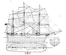
SS Savannah Diagram
| Near Church Street at Front Street. |
| On U.S. 52 at Howard Lane, on the right when traveling south on U.S. 52. |
| Near Church Street at Front Street. |
| On 2nd Street (U.S. 1) 0.1 miles south of Powe Street (U.S. 1), on the right when traveling north. |
| On Huger Street 0.1 miles north of McDonald Street, on the left when traveling north. |
| On Church Street at Front Street, on the left when traveling west on Church Street. |
| On Church Street near Front Street, on the left when traveling east. Reported permanently removed. |
| On 3rd Street at Kershaw Street, on the right when traveling south on 3rd Street. |
| On West Greene Street west of Jersey Street, on the right when traveling west. |
| On Church Street at Front Street, on the right when traveling east on Church Street. |
| On Chestnut St. at Washington Street, on the right when traveling north on Chestnut St.. |
| On Front Street north of Kershaw Street, on the right when traveling north. |
| On Church Street at Front Street, on the left when traveling west on Church Street. |
| On West Main, on the right when traveling east. |
| On West Main Street (Business State Highway 9) at Academy Street, on the left when traveling west on West Main Street. |
| On East Main Street at Green Street, on the right when traveling west on East Main Street. |
| On West Main Street (Business State Highway 9) at Crescent Drive, on the right when traveling west on West Main Street. |
| On East Main Street (State Highway 9) at Scotch Road, on the right when traveling east on East Main Street. |
| On East Main Street at Park Drive, on the right when traveling west on East Main Street. |
| On East Main Street at Green Street, on the right when traveling west on East Main Street. |
| On East Main Street at Page Street, on the right when traveling west on East Main Street. |
| On West Pine Avenue at South Sixth Street, on the right when traveling west on West Pine Avenue. |
| On Sumter Highway (U.S. 521) at Brogdon Road, on the right when traveling north on Sumter Highway. |
| On North Brewington Road (State Highway 14-50) 1.7 miles north of U.S. 301, on the right when traveling north. |
| On Kenwood Road near Henry Road, on the left when traveling west. |
| On Patriots Road (State Highway 14-410) near Lesesne Drive (State Highway 14-480), on the right when traveling west. |
| Near Sunset Drive (U.S. 301) at South Boundary Street, on the right when traveling east. |
| On North Brooks Street (US 301 / 521) near West Rigby Street, on the left when traveling north. |
| On Bozard Street east of South Mill Street (South Carolina Highway 260), on the right when traveling east. |
| On South Mill Street near Sunset Drive (U.S. 301), on the right when traveling south. |
| On West Boyce Street (State Highway 261) at South Mill Street (State Highway 260), on the left when traveling west on West Boyce Street. |
| On West Boyce Street (State Highway 261), on the left when traveling west. |
| On West Boyce Street (State Highway 261), on the left when traveling west. |
| On Dinkins Street near Grace Street, on the right when traveling west. |
| On North Mill Street at Rigby Street, on the left when traveling south on North Mill Street. |
| On East Rigby Street at North Brooks Street, on the left when traveling west on East Rigby Street. |
| On North Brooks Street (U.S. 301/521) near Oak Street, on the left when traveling north. |
| On South Mill Street (State Highway SC260) at W. Hospital Street, on the left when traveling north on South Mill Street. |
| On Greeleyville Highway (U.S. 521) at Mallett Road (State Highway 14-384), on the right when traveling east on Greeleyville Highway. |
| Near Old Georgetown Road west of North Brooks Street (U.S. 301), on the left when traveling west. |
| On Weinberg Street north of West Boyce Street, on the left when traveling north. |
| On North Brooks Street (U.S. 301) north of West Boyce Street (South Carolina Highway 261), on the left when traveling north. |
| On US 301 & US 521, on the left when traveling north. |
| On L and H Pearson Road 0.1 miles south of Costello Road, on the right when traveling south. |
| On US 301 at Joe Marie Road, on the right when traveling south on US 301. |
| On South Boundary Street at West Boyce Street (South Carolina Highway 261), on the right when traveling north on South Boundary Street. |
| On North Brooks Street (U.S. 301/521) near Rigby Street, on the right when traveling south. |
| On West Rigby Street near North Mill Street, on the right when traveling west. |
| On Patriot Road (State Highway 14-410) at Wyboo Road on Patriot Road. |
| On Black River Road (South Carolina Route 527) 0.1 miles south of June Burn Road, on the right when traveling south. |
| On Paxville Highway (State Highway 261) at U.S. 15, on the right when traveling east on Paxville Highway. |
| On Old River Road (State Highway 14-76) 1 mile south of Governor Richardson Road, on the right when traveling south. Reported permanently removed. |
| On Old River Road (State Highway 14-76) 1 mile south of Governor Richardson Road, on the right when traveling south. |
| On Old River Road at Elliots Landing Road, on the right when traveling south on Old River Road. |
| On Old River Road (State Highway 14-76), on the right when traveling south. |
| On State Highway 527, on the left when traveling north. |
| On Liberty Hill Road (State Highway 14-373) near Old River Road, on the left when traveling north. |
| On Larry King Jr. Drive near 4th Street, on the left when traveling east. |
| On Fort Watson Road (State Highway 14-803). |
| On H.T. Everetts Road (State Highway 14-306) near Pulitzer Road , Richbourg Lane (State Highway 14-258), on the right when traveling east. |
| On Church Street (U.S. 301) near Burgess Street, on the right when traveling north. |
| On Delaiane Street at Hill Street, on the left when traveling west on Delaiane Street. |
| On Liberty Hill Road (State Road 140373) 0.8 miles north of Bynum Road, on the left when traveling north. |
| On South Church Street (U.S. 15) near Main Street (U.S. 301), on the right when traveling north. |
| On Fort Watson Road (State Highway 14-803) 1 mile west of St Paul Road (U.S. 15/301), on the left when traveling west. |
| On Fort Watson Road (State Highway 14-803), on the left when traveling west. |
| On St. Paul Road (U.S. 301/15), on the right when traveling north. |
| On 4th Street at Larry King Highway, on the left when traveling north on 4th Street. |
| On 4th Street at Larry King Highway, on the left when traveling north on 4th Street. |
| On M W Rickenbaker Road, on the left. |
| On Cantey Street, on the right when traveling east. |
| On 4th Street at Larry King Highway, on the left when traveling north on 4th Street. |
| On Fort Watson Road (State Highway 14-803), in the median. |
| On 4th Street at Larry King Highway, on the left when traveling north on 4th Street. |
| On North Cantey Street, on the right when traveling south. |
| On West Main Street (U.S. 301) at South Dukes Street, on the right when traveling south on West Main Street. Reported permanently removed. |
| On South Dukes Street at Main Street, on the right when traveling south on South Dukes Street. |
| On 1st Street at Larry King Highway, on the right when traveling north on 1st Street. |
| On North Cantey Street south of Carson Street, on the right when traveling north. |
| On South Cantey Street, on the right when traveling south. |
| Near Fort Watson Road (State Road 14-803). |
| On Granby Lane east of Alex Harvin Highway (U.S. 301). |
| On Main Street (U.S. 301). |
| On Carson Street at North Church Street (U.S. 15), on the left when traveling east on Carson Street. |
| On West Main Street (U.S. 301) near South Dukes Street, on the right when traveling south. |
| On Calvert Street (State Highway 14-119) west of Main Street (U.S. 301), on the right when traveling west. |
| On Main Street near Green Street, on the right when traveling south. |
| On Miller H.Mellette Highway (U.S. 378) near Seloc Road (State Highway 14-34), on the right when traveling east. |
| On Main Street (U.S. 301/378) near Dials Bay Road (State Highway 14-206), on the left when traveling north. |
| On Gamble Street at Main Street (U.S. 301/378), on the right when traveling east on Gamble Street. |
| On Calvert Street (State Highway 14-119) at Main Street (U.S. 301), on the left when traveling west on Calvert Street. |
| On U.S. 378, on the right when traveling west. |
| On Main Street (U.S. 301/378) at State Highway 14-115, on the right when traveling north on Main Street. |
| On Evangeline Drive at North Main Street (State Highway 52), on the right when traveling north on Evangeline Drive. |
| On E. McIver Rd. at Pisgah Road, on the left when traveling north on E. McIver Rd.. |
| On Ebernezer Road, on the right when traveling north. |
| On Main St. (U.S. 52), on the left when traveling south. |
| On Main Street at Pearl Street, on the right when traveling north on Main Street. |
1022 entries matched your criteria. The first 100 are listed above.
Next 100 ⊳
