263 entries match your criteria. The first 100 are listed. ⊳
Historical Markers and War Memorials on the Snake River Plain Region
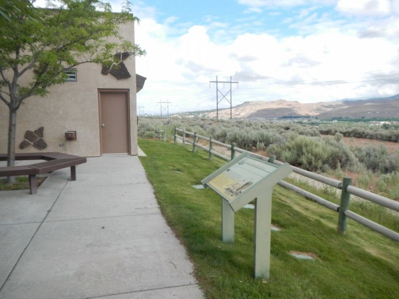
By Barry Swackhamer, May 18, 2018
"Our Road Was Very Steep..." Marker
1 ► Idaho, Ada County, Boise — "Our Road Was Very Steep…" —  |
| Near East Lake Forest Drive near South Kelton Place, on the right when traveling west. | |||
| 2 ► Idaho, Ada County, Boise — Abraham Lincoln — |
| On Julia Davis Drive 0.2 miles east of Capital Boulevard, on the left when traveling east. | |||
| 3 ► Idaho, Ada County, Boise — Abraham Lincoln and Idaho — 1809 - 2009 — |
| On N Capitol Boulevard north of W Bannock Street, in the median. | |||
| 4 ► Idaho, Ada County, Boise — 72 — Airmail Service |
| On Campus Lane 0.1 miles west of Broadway Avenue (U.S. 20/26), on the left when traveling west. Reported permanently removed. | |||
| 5 ► Idaho, Ada County, Boise — Anduiza Hotel and Fronton — 619 Grove Street — |
| On Grove Street near South Capitol Boulevard, on the right when traveling east. | |||
| 6 ► Idaho, Ada County, Boise — Anduiza Hotel and Fronton — |
| On Grove Street near South Capitol Boulevard, on the right when traveling east. | |||
| 7 ► Idaho, Ada County, Boise — 376 — Arrowrock Dam — |
| On State Highway 21 at milepost 17, 0.2 miles south of Arrowrock Road, on the right when traveling north. | |||
| 8 ► Idaho, Ada County, Boise — Bar Gernika — Basque Pub & Eatery — 202 S. Capitol Blvd. — |
| On South Capitol Boulevard at Grove Street, on the right when traveling north on South Capitol Boulevard. | |||
| 9 ► Idaho, Ada County, Boise — 379 — Basque Country — |
| On Interstate 84 at milepost 62, 1 mile west of Black's Creek Road, on the right when traveling west. | |||
| 10 ► Idaho, Ada County, Boise — Basque Museum and Cultural Center — 611 Grove Street — |
| On Grove Street near South 6th Street, on the right when traveling east. | |||
| 11 ► Idaho, Ada County, Boise — 359 — Beaver Dick's Ferry — |
| On Warm Springs Avenue (at milepost 7), 0.1 miles Highland Valley Road, on the left when traveling north. | |||
| 12 ► Idaho, Ada County, Boise — Boise High School — 1010 W. Washington Street — |
| On West Washington Street at North 10th Street, on the right when traveling west on West Washington Street. | |||
| 13 ► Idaho, Ada County, Boise — 402 — Boise State University |
| On Campus Lane 0.1 miles west of Broadway Avenue (U.S. 20/26), on the left when traveling west. Reported permanently removed. | |||
| 14 ► Idaho, Ada County, Boise — Boise: A City Along the Trail — |
| On West Fort Street, on the left when traveling south. | |||
| 15 ► Idaho, Ada County, Boise — Bonneville Point — |
| Near S. Upper Blacks Creek Road 1.3 miles north of E. Blacks Creek Road. | |||
| 16 ► Idaho, Ada County, Boise — Bonneville Point — The Oregon Trail — |
| On State Highway 21 at East Lake Forest Drive, on the right when traveling east on State Highway 21. | |||
| 17 ► Idaho, Ada County, Boise — Bronco Gymnasium — Treasuring the Past... Shaping the Future — Boise State University — |
| On West Broncos Drive, on the right when traveling west. | |||
| 18 ► Idaho, Ada County, Boise — Bronco Stadium — Treasuring the Past... Shaping the Future — Boise State University — |
| On West Broncos Drive, on the right when traveling north. | |||
| 19 ► Idaho, Ada County, Boise — Captain Bonneville — |
| Near S. Upper Blacks Creek Road 1.3 miles north of E. Blacks Creek Road. | |||
| 20 ► Idaho, Ada County, Boise — Crossing the River — The First Broadway Bridge — |
| On S Broadway Ave (U.S. 26), on the right when traveling south. | |||
| 21 ► Idaho, Ada County, Boise — Crossing the River — South Boise Streetcar Line — |
| On S Broadway Ave (U.S. 26), on the right when traveling north. | |||
| 22 ► Idaho, Ada County, Boise — Cyrus Jacobs/Uberuaga House — 607 Grove Street — |
| On Grove Street near South 6th Street, on the right when traveling east. | |||
| 23 ► Idaho, Ada County, Boise — Davis Orchard — |
| On Julia Davis Road, on the right when traveling south. | |||
| 24 ► Idaho, Ada County, Boise — Diversion Dam — |
| On State Highway 21 at East Warm Springs Avenue, on the right when traveling east on State Highway 21. | |||
| 25 ► Idaho, Ada County, Boise — 343 — Diversion Dam — |
| On State Highway 21 at milepost 8, 0.3 miles east of Warm Springs Avenue, on the right when traveling south. | |||
| 26 ► Idaho, Ada County, Boise — Ezra Meeker — The Oregon Trail — |
| On State Highway 21 at East Lake Forest Drive, on the right when traveling east on State Highway 21. | |||
| 27 ► Idaho, Ada County, Boise — First Computer in Boise City — |
| On Main St at N 6th St, on the right when traveling east on Main St. | |||
| 28 ► Idaho, Ada County, Boise — Fort Boise — The Oregon Trail — |
| On State Highway 21 at East Lake Forest Drive, on the right when traveling east on State Highway 21. | |||
| 29 ► Idaho, Ada County, Boise — Fort Boise — |
| On N 5th Street, on the left when traveling north. | |||
| 30 ► Idaho, Ada County, Boise — Frank Steunenberg — Governor of Idaho — 1897-1900 — |
| On West Jefferson Street at North Capitol Boulevard, on the left when traveling west on West Jefferson Street. | |||
| 31 ► Idaho, Ada County, Boise — Grove Street Warehouse — 608/610/612 Grove Street — |
| On Grove Street near South 6th Street, on the left when traveling east. | |||
| 32 ► Idaho, Ada County, Boise — Heath Building — 176 S. Capitol Blvd. — |
| On South Capitol Boulevard at Grove Street, on the right when traveling north on South Capitol Boulevard. | |||
| 33 ► Idaho, Ada County, Boise — Idaho State Penitentiary — Founded 1868 — |
| Near Old Penitentiary Road. | |||
| 34 ► Idaho, Ada County, Boise — Idaho's Emigrant Trails — The Oregon Trail — |
| On State Highway 21 at East Lake Forest Drive, on the right when traveling east on State Highway 21. | |||
| 35 ► Idaho, Ada County, Boise — Idaho's Liberty Bell Replica — |
| On West Jefferson Street at North Capitol Boulevard, on the right when traveling west on West Jefferson Street. | |||
| 36 ► Idaho, Ada County, Boise — In Memory — |
| Near W University Drive. | |||
| 37 ► Idaho, Ada County, Boise — Jesus Urquides Packs a Mule, 1925 — |
| On West Main Street 0.1 miles east of South 2nd Street, on the right when traveling east. | |||
| 38 ► Idaho, Ada County, Boise — Jesus Urquides, Circa 1870 — |
| On West Main Street 0.1 miles east of South 2nd Street, on the right when traveling east. | |||
| 39 ► Idaho, Ada County, Boise — Kelton Road — The Oregon Trail — |
| On U.S. 21 at East Lake Forest Drive, on the right when traveling north on U.S. 21. | |||
| 40 ► Idaho, Ada County, Boise — 156 — L.D.S. Pioneers of Boise — |
| Near South Cole Road near Brentwood Drive, on the left when traveling north. | |||
| 41 ► Idaho, Ada County, Boise — Laiak — (LIE-yak) A traditional Basque tool used for turning the soil — |
| On South Capitol Boulevard at Grove Street, on the right when traveling north on South Capitol Boulevard. | |||
| 42 ► Idaho, Ada County, Boise — Maria Dolores (Lola) Binnard, circa 1910 — |
| On West Main Street 0.1 miles east of South 2nd Street, on the right when traveling east. | |||
| 43 ► Idaho, Ada County, Boise — McClelland Ferry — |
| On South Capitol Boulevard near Julia Davis Drive, on the right when traveling north. | |||
| 44 ► Idaho, Ada County, Boise — 318 — More's Creek — |
| On State Highway 21 at milepost 17, 0.2 miles south of Arrowrock Road, on the right when traveling north. | |||
| 45 ► Idaho, Ada County, Boise — Old Oregon Trail — |
| Near East Lake Forest Drive near Orchid Way, on the right when traveling west. | |||
| 46 ► Idaho, Ada County, Boise — Old Oregon Trail - West Boise — |
| Near North Eagle Road (State Highway 55) at U.S. 26, on the left when traveling north. | |||
| 47 ► Idaho, Ada County, Boise — Operation Desert Storm Memorial — |
| On N Capitol Boulevard, on the right when traveling north. | |||
| 48 ► Idaho, Ada County, Boise — 375 — Oregon Trail — |
| On Interstate 84 1 mile north of Black's Creek Road, on the right when traveling south. | |||
| 49 ► Idaho, Ada County, Boise — Oregon Trail Monument — |
| On West Jefferson Street at North 6th Street, on the right when traveling west on West Jefferson Street. | |||
| 50 ► Idaho, Ada County, Boise — Original Student Union — Treasuring the Past... Shaping the Future — Boise State University — |
| On Theater Lane, on the right when traveling north. | |||
| 51 ► Idaho, Ada County, Boise — Reinhold Chrystman — An Evangelical Christian "Chose" — |
| Near South 8th Street. | |||
| 52 ► Idaho, Ada County, Boise — Sacajawea and Pomp — |
| On Julia Davis Drive, on the right when traveling west. | |||
| 53 ► Idaho, Ada County, Boise — 10 — Site 10 ★ Blacks Creek Road Crossing — |
| On Black Creek Road near Songbird Lane, on the left when traveling west. | |||
| 54 ► Idaho, Ada County, Boise — Student Union — Treasuring the Past... Shaping the Future — Boise State University — |
| Near Theater Lane. | |||
| 55 ► Idaho, Ada County, Boise — The Basque Center — 601 Grove Street — |
| On Grove Street at South 6th Street, on the right when traveling east on Grove Street. | |||
| 56 ► Idaho, Ada County, Boise — 1 — The Boise Gallery of Art — Boise Art Museum 1937 — Did You Know? — |
| Near South Capitol Boulevard near West Fulton Street, on the right when traveling north. | |||
| 57 ► Idaho, Ada County, Boise — The Chico Club — |
| On South 6th Street at Grove Street, on the right when traveling south on South 6th Street. | |||
| 58 ► Idaho, Ada County, Boise — The Foote Legacy in Idaho — |
| Near State Highway 21 near East Sandy Point Road, on the right when traveling east. | |||
| 59 ► Idaho, Ada County, Boise — The Fur Trade and the Tide of Emigration — |
| Near S. Upper Blacks Creek Road 1.3 miles north of E. Blacks Creek Road. | |||
| 60 ► Idaho, Ada County, Boise — The Hunt Expedition — |
| Near S. Upper Blacks Creek Road 1.3 miles north of E. Blacks Creek Road. | |||
| 61 ► Idaho, Ada County, Boise — 3 — The Log Cabin — 1940 — Did You Know? — |
| Near South Capitol Boulevard near West River Street, on the right when traveling north. | |||
| 62 ► Idaho, Ada County, Boise — The O’Farrell Cabin — |
| On West Fort Street, on the left when traveling south. | |||
| 63 ► Idaho, Ada County, Boise — The O’Farrells — |
| On West Fort Street, on the left when traveling south. | |||
| 64 ► Idaho, Ada County, Boise — The O'Farrell Cabin — |
| On West Fort Street south of North 5th Street, on the right when traveling west. | |||
| 65 ► Idaho, Ada County, Boise — 151 — The Oregon Trail — |
| On Warm Springs Avenue (at milepost 7), 0.1 miles south of Highland Valley Road, on the left when traveling north. | |||
| 66 ► Idaho, Ada County, Boise — The Shoshone and Northern Paiute — Echoes of an Ancient Homeland — |
| Near S. Upper Blacks Creek Road 1.3 miles north of E. Blacks Creek Road. | |||
| 67 ► Idaho, Ada County, Boise — The Story of Julia & Tom Davis — |
| Near Julia Davis Road. | |||
| 68 ► Idaho, Ada County, Boise — 2 — The WPA (Works Project Administration) — 1935-1943 — Did You Know? — |
| Near South Capitol Boulevard near Julia Davis Drive, on the right when traveling north. | |||
| 69 ► Idaho, Ada County, Boise — 16 — Tom and Julia Davis Homesite — 1889 — Did You Know? — |
| On South Capitol Boulevard at West Myrtle Street, on the right when traveling south on South Capitol Boulevard. | |||
| 70 ► Idaho, Ada County, Boise — Urquides Village, Southern Edge, circa 1958 — |
| On West Main Street 0.1 miles east of South 2nd Street, on the right when traveling east. | |||
| 71 ► Idaho, Ada County, Boise — Warm Springs Avenue — |
| On East Warm Springs Avenue at North Straughan Avenue, on the right when traveling west on East Warm Springs Avenue. | |||
| 72 ► Idaho, Ada County, Boise — Wheels of Change — |
| Near East Lake Forest Drive near Orchid Way, on the left when traveling west. | |||
| 73 ► Idaho, Ada County, Boise — Whitman Overlook — |
| Near East Lake Forest Drive near Orchid Way, on the right when traveling east. | |||
| 74 ► Idaho, Ada County, Boise — Wilson Price Hunt Expedition — |
| On South Capitol Boulevard near Julia Davis Drive, on the right when traveling north. | |||
| 75 ► Idaho, Ada County, Boise, Basque Block — Adelia Garro Simplot — In Commemoration — Basque Museum and Cultural Center — |
| On West Grove Street, on the left when traveling west. | |||
| 76 ► Idaho, Ada County, Boise, Basque Block — Basque Arborglyphs — |
| On West Grove Street west of S 6th Street, on the left when traveling west. | |||
| 77 ► Idaho, Ada County, Boise, Boise State University District — Administration Building — Treasuring the Past... Shaping the Future — Boise State University — |
| Near West University Drive. | |||
| 78 ► Idaho, Ada County, Boise, Boise State University District — Assembly Hall — Treasuring the Past... Shaping the Future — Boise State University — |
| Near West Cesar Chavez Lane. | |||
| 79 ► Idaho, Ada County, Boise, Boise State University District — Christ Chapel — Old St. Michael’s Church — Oregon Trail Memorial — |
| On West Cesar Chavez Lane, on the right when traveling west. | |||
| 80 ► Idaho, Ada County, Boise, Boise State University District — Engineering Complex — Treasuring the Past... Shaping the Future — Boise State University — |
| On West University Drive, on the right when traveling east. | |||
| 81 ► Idaho, Ada County, Boise, Boise State University District — Father of Bronco Football — |
| On W Broncos Drive, on the right when traveling north. | |||
| 82 ► Idaho, Ada County, Boise, Boise State University District — First Protestant Episcopal Church — In Montana · Idaho · Utah — Erected 1866 — |
| On West Cesar Chavez Lane, on the right when traveling north. | |||
| 83 ► Idaho, Ada County, Boise, Boise State University District — Friendship Bridge — Treasuring the Past… Shaping the Future — Boise State University — |
| On West Cesar Chavez Lane, on the right when traveling west. | |||
| 84 ► Idaho, Ada County, Boise, Boise State University District — St. Margaret’s Hall — Treasuring the Past... Shaping the Future — Boise State University — |
| Near West Cesar Chavez Lane. | |||
| 85 ► Idaho, Ada County, Boise, Boise State University District — St. Margaret's Hall — |
| Near West Cesar Chavez Lane. | |||
| 86 ► Idaho, Ada County, Boise, Downtown — “Lovely Lawns Carefully Kept” — |
| On N 2nd Street, on the right when traveling south. | |||
| 87 ► Idaho, Ada County, Boise, Downtown — “Silver & Gold in the Sunlight Blaze” — |
| On N 3rd Street, on the left when traveling south. | |||
| 88 ► Idaho, Ada County, Boise, Downtown — “The Finest in the Territory” — |
| On N 3rd Street, on the left when traveling south. | |||
| 89 ► Idaho, Ada County, Boise, Downtown — A Capital Investment — |
| On N 3rd Street, on the left when traveling south. | |||
| 90 ► Idaho, Ada County, Boise, Downtown — A Close Call — |
| On North 2nd Street, on the right when traveling south. | |||
| 91 ► Idaho, Ada County, Boise, Downtown — A Lasting Legacy — |
| On W Main Street at N 2nd Street, on the right when traveling west on W Main Street. | |||
| 92 ► Idaho, Ada County, Boise, Downtown — Assay Office — |
| On West Main Street. | |||
| 93 ► Idaho, Ada County, Boise, Downtown — Boise Turnverein Building (Crescent Building) — Historic American Buildings Survey — Boise Historic District — |
| On Main Street at South 6th Street, on the right when traveling east on Main Street. | |||
| 94 ► Idaho, Ada County, Boise, Downtown — C.W. Moore Park — |
| On South 5th Street, on the right when traveling west. | |||
| 95 ► Idaho, Ada County, Boise, Downtown — Central Idaho Wilderness Act — Cecil D. Andrus: A Legacy of Conservation — |
| On W Bannock Street, on the left when traveling south. | |||
| 96 ► Idaho, Ada County, Boise, Downtown — Federal Building — Boise Capitol Area District — |
| On West Bannock Street, on the right when traveling west. | |||
| 97 ► Idaho, Ada County, Boise, Downtown — Hells Canyon — Cecil D. Andrus: A Legacy of Conservation — |
| On W Bannock Street, on the left when traveling south. | |||
| 98 ► Idaho, Ada County, Boise, Downtown — Lumberjack to Statesman — Cecil D. Andrus: A Legacy of Conservation — |
| On W Bannock Street, on the right when traveling north. | |||
| 99 ► Idaho, Ada County, Boise, Downtown — Perrault–Fritchman Building (1879) — |
| On S Capitol Boulevard at Main Street, on the right when traveling north on S Capitol Boulevard. | |||
| 100 ► Idaho, Ada County, Boise, Downtown — Sawtooth National Recreation Area — Cecil D. Andrus: A Legacy of Conservation — |
| On West Bannock Street, on the right when traveling north. | |||
263 entries matched your criteria. The first 100 are listed above. Next 100 ⊳