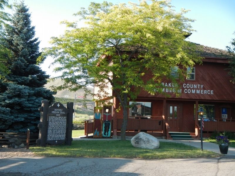
By Barry Swackhamer, June 29, 2017
Baker Marker
GEOGRAPHIC SORT Title Sort Marker Number Sort Marker Number Sort for Trails Publication Order Sort Publication Order Sort A Erected Year Sort Most Viewed Sort Most Recent-Interest Sort Most Recently Changed Sort SEE FAQ #33 FOR DESCRIPTIONS
Near Campbell Street near Sunridge Lane, on the right when traveling west.
On State Road 86 (Oregon Route 86).
On Oregon Route 86 near Oregon Trail, on the right when traveling west.
On Old U.S. 30 at Oxman Ranch Road, on the left when traveling west on Old U.S. 30.
On Front Street (La Grande-Baker Highway) near 4, on the left when traveling south.
Near Camp Adair Road near Pacific Highway West ( Route 99W), on the left when traveling east.
On Corvallis-Newport Highway (aka Main Street) (U.S. 20) at South 11th Street, on the right when traveling west on Corvallis-Newport Highway (aka Main Street).
On McLoughlin Boulevard (Oregon Route 99) near S. 2nd Street, on the right when traveling south.
On Mt. Hood Highway (U.S. 26), on the left when traveling west.
On Northbound Rest Area (Interstate 205), on the right when traveling north.
Near SW Boones Ferry Road at SW Tauchmann Street.
On Oregon Coast Highway (U.S. 101) north of Carnahan Road N, on the right when traveling north.
On Oregon Coast Highway (U.S. 101) north of Carnahan Road North, on the right when traveling north.
On Warrenton-Astoria Highway (Business U.S. 101) at Fort Clatsop Road, on the left when traveling west on Warrenton-Astoria Highway.
On Oregon Coast Highway (U.S. 101) near Radar Road, on the right when traveling east.
Paid Advertisement
Near Sunset Highway (Route 26 at milepost 28) near Olson Road, on the right when traveling west.
On Sunset Highway (Route 26 at milepost 28) near Olson Road.
Near South Promenade at Avenue A.
Near Columbia River Highway (U.S. 30) near Clifton/Shingle Mill Road, on the right when traveling west.
On Columbia River Highway (U.S. 30) at SW Old Portland Road, on the left when traveling north on Columbia River Highway.
On Oregon Coast Highway (U.S. 101) south of Central Avenue, on the right when traveling south.
On Coquille-Bandon Hwy (Oregon Route 425) south of Coos Bay-Roseburg Highway ( Route 42) when traveling south.
On North Bank Chetco River Road at Oregon Coast Hwy (U.S. 101), on the right when traveling south on North Bank Chetco River Road.
On Oregon Coast Hwy (U.S. 101), on the left when traveling north.
On Oregon Coast Highway, on the left when traveling east.
On Oregon Coast Hwy (U.S. 101), on the right when traveling south. Reported missing.
On Central Oregon Highway (U.S. 20), on the right when traveling west.
On Interstate 5, on the right when traveling south.
On Oregon Coast Highway (U.S. 101) 0.1 miles south of Lower Smith River Road, on the right when traveling south.
On Vineyard Lane at Elgarose Road, on the left when traveling south on Vineyard Lane.
Paid Advertisement
On Southeast Spruce Street at SE Washington Ave (U.S. 138) on Southeast Spruce Street.
On Umpqua Highway (Oregon Route 38) at Main Street, on the left when traveling west on Umpqua Highway.
On U.S. 20 at South Harney Road, on the right when traveling east on U.S. 20.
On Dead Indian Memorial Rd at Green Springs Highway (U.S. 66) on Dead Indian Memorial Rd. Reported permanently removed.
Near U.S. 97 0.4 miles south of SW Culver Highway, on the left when traveling north.
On I-5 Frontage Road at Ritchie Road, on the right when traveling north on I-5 Frontage Road.
On Klamath Falls-Lakeview Hwy (Oregon Route 140).
Near U.S. 97 at Glendale Street, on the left when traveling south.
On Green Springs Highway (Oregon Route 66 at milepost 44) at Toby Grade Road, on the right when traveling west on Green Springs Highway.
On Lakeshore Drive, on the right when traveling west.
On Oregon Route 31 south of Old Fort Rock Road, on the left when traveling south.
On Fremont Hwy (U.S. 395), on the right when traveling south.
On Oregon Route 58 south of Edenvale Road, on the left when traveling north.
On Oregon Coast Highway (U.S. 101) south of Southeast 54th Drive, on the right when traveling south.
On Yaquina Bay State Park Road west of Oregon Coast Highway (U.S. 101), on the left when traveling north.
Paid Advertisement
On Halsey-Sweet Home Highway (West Bishop Way) (Oregon Route 228 at milepost 6) near Loucks Way, on the right when traveling east.
On Santiam Highway (U.S. 20) close to Gorton Road (Santiam Wagon Road) (Forest Road 2032), on the right when traveling east.
On Roswell Road (Oregon Route 452) at Succor Creek Highway ( Route 201), on the left when traveling west on Roswell Road.
On Danner Loop Road near Old Ion Highway, on the right when traveling north.
On Central Oregon Highway (U.S. 20), on the right when traveling north.
On A Street East (U.S. 26) at Washington Street East (U.S. 26), on the left when traveling east on A Street East.
On Main Street North East near Pacific Highway East ( Route 99E), on the left when traveling south.
Near Interstate 5 at milepost 281, 1 mile south of Miley Road, on the right when traveling north.
Near Champoeg Road NorthEast near French Prairie Road NorthEast.
On Hillsboro-Silverton Highway NorthEast (Oregon Route 219) near Champoeg Road NorthEast, on the left when traveling south. Reported missing.
Near Hatchery Road 0.3 miles south of Tanner Creek Road.
On Columbia River Highway (Interstate 84 at milepost 23), 8.6 miles west of Rooster Rock Park West-bound on ramp, on the right when traveling west.
On North Broadacre Road 0.1 miles west of North Expo Road.
On Northwest Skyline Boulevard 0.4 miles west of West Burnside Road, on the left when traveling west.
On Historic Columbia River Highway at Crown Point Highway on Historic Columbia River Highway.
On Oregon Route 18 near Grand Ronde Road, on the right when traveling west.
Paid Advertisement
On Pacific Highway West (Oregon Route 99W) at Burch Grove Lane, on the right when traveling north on Pacific Highway West.
On Biggs-Rufus Highway (Oregon Route 206) 0.2 miles east of Moody Road (County Road 143), on the right when traveling west.
On U.S. 101 near Bayview Forest Road, on the left when traveling north.
Near Old Oregon Trail near Interstate 84, on the left when traveling north.
On Old Highway 30 near Main Street, on the right when traveling north.
On Pendleton Highway (Southeast Court Avenue) (U.S. 30) near Goad Road when traveling west.
On Westgate (Northwest Pendleton Highway) (U.S. 30) near County Route 1302, on the left when traveling west.
On Pendleton - John Day Highway (U.S. 395), on the left when traveling north.
On La Grande - Baker Highway (Adams Avenue) (U.S. 30) near Otten Drive, on the right when traveling north.
On La Grande - Baker Highway (Oregon Route 237) near Government Gulch Road, on the left when traveling north.
On Wallowa Lake Highway (Oregon Route 82) 0.1 miles east of Highland Avenue, on the right when traveling east.
On Wallowa Lake Highway (Powerhouse Road) (Oregon Route 351), on the right when traveling north.
On Interstate 84 at milepost 72, on the right when traveling west.
Near Celilo Park Road 0.1 miles south of Celilo-Wasco Highway ( Road 206), on the right when traveling west.
On Sherar's Bridge Highway (Oregon Route 216) near U.S. 197, on the right when traveling east.
On NorthWest Victory Lane near NorthWest School Road, on the right when traveling north.
Paid Advertisement
On SouthEast Dayton-Salem Highway (aka 3rd Street) (Oregon Route 221) near Main Street, on the right when traveling south.
On SouthEast Dayton-Salem Highway (aka 3rd Street) (Oregon Route 211) at Main Street, on the right when traveling south on SouthEast Dayton-Salem Highway (aka 3rd Street).
Near SW Oldsville Road 0.2 miles east of SW Dusty Drive, on the right when traveling west.
︽