459 entries match your criteria. The first 100 are listed. ⊳
Former U.S. Presidents: #03 Thomas Jefferson Historical Markers
By Mark Hilton, January 14, 2017
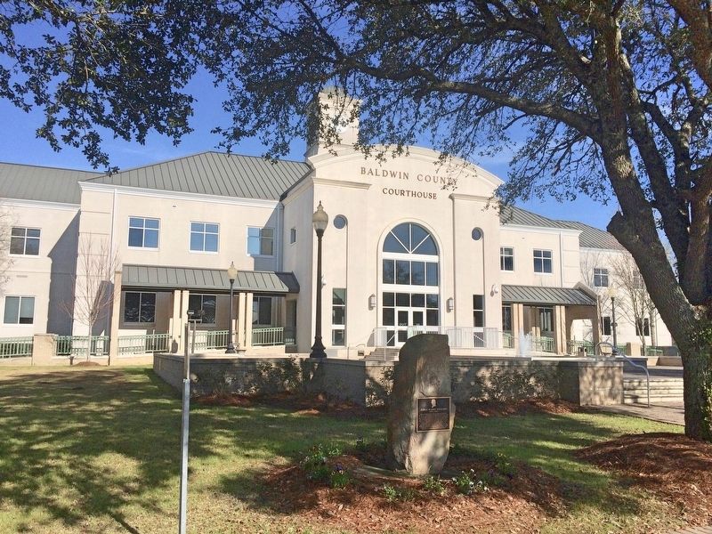
Plaque and stone in front of the Baldwin County Courthouse.
| 1 ► Alabama, Baldwin County, Bay Minette — Judge Harry Toulmin — (1766 – 1823) — |
| On Courthouse Square (U.S. 31) at Hand Avenue, on the left when traveling west on Courthouse Square. | |||
| 2 ► Alabama, Lawrence County, Oakville — Cherokee Indian Removal — |
| 3 ► Alabama, Mobile County, Mt. Vernon — 5 — Ephraim Kirby's Grave — Mount Vernon History Trail — |
| On Old Military Road East (Alabama Route 96) 0.1 miles north of Old Military Road South, on the right when traveling north. | |||
| 4 ► Arkansas, Benton County, Bella Vista — United States Commanders in Chief — |
| 5 ► California, San Luis Obispo County, Atascadero — Your American Heritage Monument — |
| Near El Camino Real near Mercedes Avenue (California Route 41), on the right when traveling north. | |||
| 6 ► Colorado, Garfield County, Glenwood Springs — When the Railroads Arrived in Glenwood Springs — |
| On 8th Street east of Grand Avenue, on the right when traveling east. | |||
| 7 ► Connecticut, Fairfield County, Stamford, Downtown — Freedom Shrine — |
| On Atlantic Street at Main Street, on the right when traveling north on Atlantic Street. | |||
| 8 ► Connecticut, New Haven County, Milford — Jefferson Bridge — |
| On River Street, 0.1 miles north of West River Street, on the left when traveling north. | |||
| 9 ► Connecticut, New Haven County, Milford — Peter Pond — 1740 - 1807 — |
| On Gulf Street at Cherry Street, on the right when traveling south on Gulf Street. | |||
| 10 ► Delaware, New Castle County, Middletown — NCC-237 — Witherspoon Tavern — |
| On West Main Street (Delaware Route 299) west of S. Broad Street (Delaware Route 71), on the right when traveling east. | |||
| 11 ► Delaware, New Castle County, Wilmington, Cool Spring — A City Park Is Born — Cool Spring Reservoir Plaza — established 2009 — |
| Near North Van Buren Street north of West 10th Street, on the left when traveling north. | |||
| 12 ► Delaware, New Castle County, Wilmington, Cool Spring — NC-121 — Cool Spring Park — |
| On 10th Street at Van Buren St., on the right when traveling west on 10th Street. | |||
| 13 ► District of Columbia, Washington, Northeast Washington, Arboretum — Galium mollugo — White Bedstraw — |
| Near Meadow Road Northeast, 0.1 miles east of Eagle Nest Road Northeast, on the left when traveling west. | |||
| 14 ► District of Columbia, Washington, Northeast Washington, Eckington — The Plantation / The City — |
| On Harry Thomas Way Northeast at Q Street Northeast, on the right when traveling north on Harry Thomas Way Northeast. | |||
| 15 ► District of Columbia, Washington, Northwest Washington, Columbia Heights — An American Meridian — Meridian Hill Park, National Historic Landmark — National Park Service, U.S. Department of the Interior — |
| On 15th Street Northwest north of Chapin Street Northwest, on the left when traveling north. | |||
| 16 ► District of Columbia, Washington, Northwest Washington, Downtown — The Inaugural Parade Tradition — |
| Near 15th Street Northwest south of G Street Northwest, on the right when traveling south. | |||
| 17 ► District of Columbia, Washington, Northwest Washington, Downtown — White House Kitchen Garden — National Park Service, U.S. Department of the Interior — |
| On E Street Northwest west of 15th Street Northwest, on the right when traveling west. | |||
| 18 ► District of Columbia, Washington, Northwest Washington, Georgetown — Eastern Redbud — |
| Near Q Street Northwest just west of 27th Street Northwest, on the right when traveling west. | |||
| 19 ► District of Columbia, Washington, Northwest Washington, Georgetown — Georgetown's Watering Holes — |
| On Wisconsin Avenue Northwest at N Street Northwest, on the right when traveling south on Wisconsin Avenue Northwest. | |||
| 20 ► District of Columbia, Washington, Northwest Washington, Georgetown — St. John's Episcopal Church, Georgetown Parish — |
| On Potomac Street Northwest at O Street Northwest, on the right when traveling east on Potomac Street Northwest. | |||
| 21 ► District of Columbia, Washington, Northwest Washington, Georgetown — St. John's: 200 Years of History — |
| On O Street Northwest at Prospect Street Northwest, on the right when traveling west on O Street Northwest. | |||
| 22 ► District of Columbia, Washington, Northwest Washington, Georgetown — Washington Before Washington — |
| On P Street Northwest west of 23rd Street Northwest. | |||
| 23 ► District of Columbia, Washington, Northwest Washington, Kalorama Triangle — 12 — Kalorama Triangle — Roads to Diversity — Adams Morgan Heritage Trail — |
| On Columbia Road Northwest north of Mintwood Place Northwest, on the right when traveling south. | |||
| 24 ► District of Columbia, Washington, Northwest Washington, Penn Quarter — .2 — Ceremony at the Crossroads — Civil War to Civil Rights — Downtown Heritage Trail |
| On 7th Street Northwest at Indiana Avenue Northwest, on the right when traveling north on 7th Street Northwest. Reported permanently removed. | |||
| 25 ► District of Columbia, Washington, Northwest Washington, Penn Quarter — .2 — Ceremony at the Crossroads — Civil War to Civil Rights — Downtown Heritage Trail — |
| On 7th Street Northwest at Indiana Avenue Northwest, on the right when traveling north on 7th Street Northwest. | |||
| 26 ► District of Columbia, Washington, Northwest Washington, Penn Quarter — .8 — Pennsylvania Avenue — Civil War to Civil Rights — Downtown Heritage Trail |
| On Pennsylvania Avenue Northwest at 10th Street Northwest, on the right when traveling west on Pennsylvania Avenue Northwest. Reported permanently removed. | |||
| 27 ► District of Columbia, Washington, Northwest Washington, Penn Quarter — Site of Rhodes Tavern — 1799 - 1984 — |
| On F Street Northwest at 15th Street Northwest, on the right when traveling west on F Street Northwest. | |||
| 28 ► District of Columbia, Washington, Northwest Washington, Shaw — The Almanac of 1792 / The Naming of a Neighborhood — |
| On Rhode Island Avenue Northwest (U.S. 29) at 10th Street Northwest, on the right when traveling west on Rhode Island Avenue Northwest. | |||
| 29 ► District of Columbia, Washington, Northwest Washington, Shaw — The City & The Stars — |
| On Rhode Island Avenue Northwest (U.S. 29) at 10th Street Northwest, on the right when traveling west on Rhode Island Avenue Northwest. | |||
| 30 ► District of Columbia, Washington, Northwest Washington, Sheridan-Kalorama — 1 & 2 — History of Sheridan-Kalorama — Sheridan Kalorama — Call Box Restoration Project — |
| On Decatur Place Northwest at 22nd Street Northwest, on the right when traveling east on Decatur Place Northwest. | |||
| 31 ► District of Columbia, Washington, Northwest Washington, Sheridan-Kalorama — 7 — Joel Barlow — Sheridan Kalorama — Call Box Restoration Project — |
| On Bancroft Place Northwest at 23rd Street Northwest on Bancroft Place Northwest. | |||
| 32 ► District of Columbia, Washington, Northwest Washington, Sheridan-Kalorama — 6 — Kalorama — Sheridan Kalorama — Call Box Restoration Project — |
| On 24th Street Northwest at Massachusetts Ave Northwest on 24th Street Northwest. | |||
| 33 ► District of Columbia, Washington, Northwest Washington, The National Mall — A Memorial to the 56 Signers of the Declaration of Independence — A Gift From The American Revolution Bicentennial Administration — 1976 — |
| Near Constitution Avenue Northwest (U.S. 50) east of 19th Street Northwest, on the right when traveling east. | |||
| 34 ► District of Columbia, Washington, Northwest Washington, The National Mall — Washington: The Man — National Mall and Memorial Parks — National Park Service, U.S. Department of the Interior — |
| Near 15th Street Southwest north of Jefferson Drive Southwest, on the right when traveling south. | |||
| 35 ► District of Columbia, Washington, Northwest Washington, The Palisades — Joseph Moor, Grocer — Georgetown African American Historic Landmark — 2020 — |
| On Reservoir Road Northwest east of V Street Northwest, on the right when traveling east. | |||
| 36 ► District of Columbia, Washington, Southeast Washington, Barney Circle — Uriah Tracy — Congressional Cemetery — |
| Near E Street Southeast, 0.1 miles east of Potomac Avenue Southeast, on the right when traveling east. | |||
| 37 ► District of Columbia, Washington, Southeast Washington, Capitol Hill — 12 — Christ Church and Its Parishioners — Tour of Duty — Barracks Row Heritage Trail — |
| On G Street Southeast at F Street Terrace Southeast, on the right when traveling east on G Street Southeast. | |||
| 38 ► District of Columbia, Washington, Southeast Washington, Capitol Hill — Destroying the Library — Star-Spangled Banner National Historic Trail — National Park Service, U.S. Department of the Interior — |
| On Pennsylvania Avenue Southeast at 3rd Street Southeast, on the right when traveling west on Pennsylvania Avenue Southeast. | |||
| 39 ► District of Columbia, Washington, Southeast Washington, Capitol Hill — Eastern Market — A Lively Market for a Lively Neighborhood — |
| On 7th Street Southeast north of C Street Southeast, on the right when traveling south. | |||
| 40 ► District of Columbia, Washington, Southeast Washington, Capitol Hill — 1 — Edge of the Row — Tour of Duty — Barracks Row Heritage Trail — |
| On Pennsylvania Avenue Southeast east of 7th Street Southeast, on the right when traveling east. | |||
| 41 ► District of Columbia, Washington, Southeast Washington, Capitol Hill — Marine Barracks — Washington, D.C. — "Oldest Post of the Corps" — |
| On 8th Street Southeast north of I Street Southeast, on the right when traveling north. | |||
| 42 ► District of Columbia, Washington, Southeast Washington, Capitol Hill — Marine Barracks Washington, D.C. — Established 1801 — Semper Fidelis 1801 — |
| On 7th Street Southeast just south of Virginia Avenue Southeast, on the right when traveling south. | |||
| 43 ► District of Columbia, Washington, Southeast Washington, Capitol Hill — 5 — Oldest Post of the Corps — Tour of Duty — Barracks Row Heritage Trail — |
| On G Street Southeast at 9th Street Southeast, on the right when traveling west on G Street Southeast. | |||
| 44 ► District of Columbia, Washington, Southeast Washington, Capitol Hill — 7 — Strike Up the Band — Tour of Duty — Barracks Row Heritage Trail — |
| On 8th Street Southeast at I Street Southeast, on the right when traveling south on 8th Street Southeast. | |||
| 45 ► District of Columbia, Washington, Southeast Washington, Navy Yard — 1806 — Thomas Jefferson — |
| Near 4th Street Southeast north of Tingey Street Southeast, on the left when traveling north. | |||
| 46 ► District of Columbia, Washington, Southwest Washington, East Potomac Park — Defender of Liberty — George Mason Memorial, National Mall and Memorial Parks — National Park Service, U.S. Department of the Interior |
| Near East Basin Drive Southwest at Ohio Drive Southwest, on the left when traveling west. Reported permanently removed. | |||
| 47 ► District of Columbia, Washington, Southwest Washington, The Tidal Basin — Thomas Jefferson Memorial — National Historic Landmark — |
| Near 14th Street Southwest west of Ohio Drive Southwest, on the right when traveling west. | |||
| 48 ► Florida, Jefferson County, Monticello — F-279 — Jefferson County Sesquicentennial — 1827-1977 — |
| On Jefferson Street (Courthouse Circle) (U.S. 19) at Washington Street (U.S. 90), on the left when traveling north on Jefferson Street (Courthouse Circle). | |||
| 49 ► Florida, Jefferson County, Monticello — F-278 — The Town of Monticello — |
| On North Jefferson Street (U.S. 19) south of West Pearl Street, on the right when traveling south. | |||
| 50 ► Florida, Santa Rosa County, Milton — America – A Defender Of Liberty — Santa Rosa Veterans Memorial Plaza — |
| Near Willing Street, 0.1 miles west of Caroline Street. | |||
| 51 ► Florida, Santa Rosa County, Milton — Freedom Of The Press — Santa Rosa Veterans Memorial Plaza — |
| On Willing Street, 0.1 miles west of Caroline Street. | |||
| 52 ► Florida, Seminole County, Sanford — Hellen Keller Grove — Featured Tree — Hellen Keller Southern Magnolia — |
| On South Elm Avenue just south of West 6th Street, on the left when traveling south. | |||
| 53 ► Georgia, Bibb County, Macon — 011-7 — Colonial Trading Path |
| On College Station Drive, 0 miles south of Columbus Road, on the right when traveling south. Reported missing. | |||
| 54 ► Georgia, Camden County, St. Marys — Weathering — The War of 1812 — St. Marys History Walk — |
| Near Bartlett Street at St Marys Street West, on the left when traveling north. | |||
| 55 ► Georgia, Chatham County, Savannah — Construction of Fort Jackson — |
| Near Fort Jackson Road. | |||
| 56 ► Georgia, Chatham County, Savannah, Historic District - North — William Stephens — First Grand Master, Grand Lodge Of Georgia, F &AM — |
| Near East Oglethorpe Avenue. | |||
| 57 ► Georgia, DeKalb County, Stone Mountain — Stone Mountain - Confederate Memorial — |
| Near Robert E Lee Boulevard at Memorial Hall Circle, on the right when traveling east. | |||
| 58 ► Georgia, DeKalb County, Stone Mountain — The Country Comes Before Me — |
| Near Robert E Lee Boulevard at Memorial Hall Circle, on the right when traveling east. | |||
| 59 ► Georgia, Habersham County, Clarkesville — 068-7 — Summer Home of Joseph Habersham — ← — |
| On Hollywood Highway (Old U.S. 441) 0.1 miles north of New Liberty Road, on the left when traveling north. | |||
| 60 ► Georgia, Richmond County, Augusta — Samuel Hammond — |
| On Greene Street, in the median. | |||
| 61 ► Idaho, Idaho County, Kooskia — "...Observe the face of the country..." — Lewis and Clark as Naturalists — |
| On U.S. 12 at milepost 158 near Forest Road 1684, on the left when traveling west. | |||
| 62 ► Idaho, Idaho County, Kooskia — Songs Of Sadness On This Sacred Path — Nez Perce Flight of 1877 — |
| On U.S. 12 at milepost 158 near Forest Road 1684, on the left when traveling west. | |||
| 63 ► Idaho, Lemhi County, North Fork — In Commemoration of Old Toby the Shoshone Indian — Members of the Lewis & Clark Expedition - August and September 1805 — |
| On Lewis and Clark Highway (U.S. 93 at milepost 326.5) at Salmon River Road (Route NF 030), on the right when traveling south on Lewis and Clark Highway. | |||
| 64 ► Idaho, Lemhi County, Tendoy — Plants New to Science — |
| On Agency Creek Road near Cow Creek, on the left when traveling west. | |||
| 65 ► Illinois, Alexander County, Cairo — Lewis & Clark — Corps of Discovery — |
| On Washington Avenue (U.S. 60/62) south of U.S. 51, on the right when traveling north. | |||
| 66 ► Illinois, Fayette County, Vandalia — Madonna of the Trail — The National Old Trails Road — |
| On Gallatin Street at 4th Street, on the left when traveling east on Gallatin Street. | |||
| 67 ► Illinois, Fayette County, Vandalia — Vandalia — End of The Road — |
| On Gallatin Street just west of South 4th Street, on the right when traveling west. | |||
| 68 ► Illinois, Fayette County, Vandalia — Welcome to the National Road Interpretive Center — Vandalia, Illinois — |
| On South 5th Street just north of West Gallatin Street, on the right when traveling north. | |||
| 69 ► Illinois, Madison County, Alton — Freedom Shrine — |
| On Tavernier Way, 0.2 miles south of West MacArthur Drive (Illinois Route 111/140), on the left when traveling south. | |||
| 70 ► Illinois, Sangamon County, Springfield — Surveyor Presidents — Looking for Lincoln — |
| On Washington Street just west of 6th Street. | |||
| 71 ► Illinois, St. Clair County, Collinsville — Cahokia Mounds — The Road to America's Oldest City — |
| On Ramey Drive, 0.3 miles south of Collinsville Road, on the right when traveling south. | |||
| 72 ► Indiana, Allen County, Fort Wayne — Little Turtle — |
| 73 ► Indiana, Allen County, Fort Wayne, Spy Run — Meshekinnoquah — (Chief Little Turtle) — |
| On Lawton Place, 0.1 miles east of Spy Run Avenue, on the right when traveling east. | |||
| 74 ► Indiana, Clark County, Clarksville — History’s Great Explorers — |
| On W. Winbourne Avenue at W Riverside Drive, on the right when traveling south on W. Winbourne Avenue. | |||
| 75 ► Indiana, Clark County, Jeffersonville — Thomas Jefferson — |
| On East Court Avenue at Spring Street, on the left when traveling east on East Court Avenue. | |||
| 76 ► Indiana, Clark County, Jeffersonville — Thomas Jefferson — April 13, 1743 — July 04, 1826 — |
| On East Court Avenue at Spring Street, on the right when traveling west on East Court Avenue. | |||
| 77 ► Indiana, Elkhart County, New Paris — Five Medals Village — |
| On County Road 142, 0 miles east of County Road 29, on the left when traveling east. | |||
| 78 ► Indiana, Kosciusko County, Warsaw — General Tadeusz "Thaddeus" Kosciuszko — Polish Patriot — 1746 - 1817 — |
| On Main Street, on the right when traveling east. | |||
| 79 ► Iowa, Pottawattamie County, Council Bluffs — Seeking Buyers and Sellers — |
| On 34th Ave/. | |||
| 80 ► Iowa, Pottawattamie County, Crescent — Anticipating An Indian Council — |
| On Monument Road. | |||
| 81 ► Iowa, Pottawattamie County, Crescent — Like a Bald Man’s Head — |
| On Monument Road. | |||
| 82 ► Iowa, Pottawattamie County, Crescent — The Lewis and Clark Expedition — |
| On Monument Road. | |||
| 83 ► Iowa, Woodbury County, Sioux City — Floyd Monument — |
| On S. Lewis Blvd., 0.3 miles north of Lincoln Way, on the right when traveling south. | |||
| 84 ► Iowa, Woodbury County, Sioux City — The Death of Sergeant Floyd — Lewis & Clark Expedition — |
| Near S. Lewis Blvd., 0.3 miles north of Lincoln Way. | |||
| 85 ► Iowa, Woodbury County, Sioux City — The Lewis & Clark Expedition — |
| On Larsen Park Road. | |||
| 86 ► Iowa, Woodbury County, Sioux City — The Lewis and Clark Expedition — Lewis and Clark National Historic Trail |
| Near South Lewis Boulevard, 0.3 miles Lincoln Way. Reported missing. | |||
| 87 ► Kansas, Atchison County, Atchison — The Lewis and Clark Expedition — |
| On River Road at Commercial Street, on the right when traveling north on River Road. | |||
| 88 ► Kansas, Dickinson County, Herington — Vietnam Memorial — Freedom Is Not Free — |
| On North Broadway near Vine Street, on the left when traveling north. | |||
| 89 ► Kansas, Doniphan County, White Cloud — The Lewis and Clark Expedition — |
| On State Highway 7 near Main Street, on the right when traveling north. | |||
| 90 ► Kansas, Ford County, Dodge City — The 100th Meridian, Where East Meets West — |
| On Central Avenue at Front Street, on the right when traveling north on Central Avenue. | |||
| 91 ► Kansas, Leavenworth County, Fort Leavenworth — Captain Meriwether Lewis — 1774 - 1809 — |
| On Stimson Avenue, on the right when traveling west. | |||
| 92 ► Kansas, Leavenworth County, Fort Leavenworth — Captain William Clark — 1770 - 1838 — |
| On Stimson Avenue, on the right when traveling west. | |||
| 93 ► Kansas, Shawnee County, Topeka — Corridor of Flags — |
| Near NW Railroad Street near NW Curtis Street, on the left when traveling west. | |||
| 94 ► Kansas, Wyandotte County, Kansas City, Fairfax — The Lewis and Clark Expedition — |
| 95 ► Kentucky, Ballard County, Wickliffe — 1309 — Fort Jefferson Site / Indian Massacre — |
| On Westvaco Road (U.S. 51/62), on the right when traveling south. | |||
| 96 ► Kentucky, Bell County, Middlesboro — 2217 — Lewis and Clark in Kentucky Cumberland Gap — Cumberland Gap — |
| On U.S. 25E, on the right when traveling east. | |||
| 97 ► Kentucky, Boyle County, Danville — 2216 — Lewis and Clark in Kentucky - Danville — |
| On Main Street, on the right when traveling east. | |||
| 98 ► Kentucky, Fayette County, Lexington — Andrew Jackson — 1767 - 1845 — |
| Near East Main Street (U.S. 60) at Midland Avenue (U.S. 60), on the right when traveling west. | |||
| 99 ► Kentucky, Fayette County, Lexington — George Washington — 1732 - 1799 — |
| Near East Main Street (U.S. 60) at Midland Avenue (U.S. 60), on the right when traveling west. | |||
| 100 ► Kentucky, Fayette County, Lexington — 1687 — Mt. Horeb Presbyterian Church — |
| On Iron Works Pike (County Route 1973) at Mount Horeb Pike, on the left when traveling east on Iron Works Pike. | |||
459 entries matched your criteria. The first 100 are listed above. Next 100 ⊳