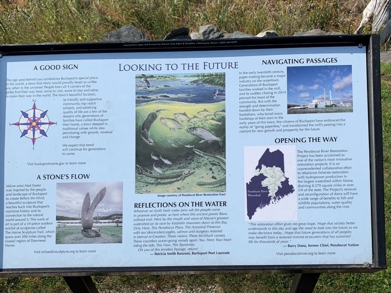
A Good Sign
The sign post behind you symbolizes Bucksport's special place in the world, a town that many would proudly boast as unlike any other in the universe! People from all 4 corners of the
globe find their way here, some to visit, . . . — — Map (db m183890) HM
To the Top of the World
The beginnings of an historic journey to the
North Pole took place across the bay at the
McKay and Dix Shipyard on Verona Island
when the keel for a 185-foot, 650 ton wooden
sail-steamer named the . . . — — Map (db m183886) HM
Just upriver from here, a point of land pushes out into the river. Today it is called Salmon Point, once the site of the Seaboard paper mill and now home to a land-based salmon farm. To the Penobscot people, this place is elanapayi-kwasaweyik . . . — — Map (db m258696) HM
The Penobscot River is a vital resource. In the 1700's it spawned numerous riverside communities, while the 1800's saw Bangor become the "lumber capital of the world", and Bucksport an international port renowned for shipbuilding. Crafted along . . . — — Map (db m55115) HM
Small businesses have been anchors in Bucksport for generations, and are equally important in shaping the future of the town.
This Federal-style house, built circa 1824, belonged to Phineas Heywood, a harness maker whose store was located across . . . — — Map (db m258687) HM
This marker commemorates the
men and women who achieved
American independence.
These Patriots, believing in the
noble cause of liberty, fought
valiantly to found a new nation.
1775-1783
Presented by
The Town of Bucksport, Maine
and . . . — — Map (db m285114) WM
A Past of Ports
The Penobscot River has played an important role in the history and development of the Town of Bucksport. This site where you are standing was once occupied by a commercial wharf, one of many along Bucksport's waterfront in . . . — — Map (db m183844) HM
"Panawap'skewtekw,” meaning "River of rocks spreading out” is the original, indigenous name for the Penobscot River. According to an ancient Penobscot legend, the river was created when Guards-Water, a giant frog monster . . . — — Map (db m183889) HM
At this site and adjacent to Mill Stream is the location of the first sawmill built in 1764 by Jonathan Buck. The mill provided boards, staves, shingles and clapboards needed by the settlers as well as for sale in Boston and more distant ports. The . . . — — Map (db m148399) HM
This monument was erected
in memory of Colonel Jonathan Buck,
founder of Bucksport, who died on March 13, 1798
The memorial, built of Blue Hill granite, was erected
by his descendents nearly sixty years after his death.
Sometime after its . . . — — Map (db m145041) HM
Built in 1929-1930, the Maine Seaboard Paper Company mill shifted Bucksport from a largely maritime economy to a mill town. Built on the site of the former Blodgett tannery, the mill took advantage of electricity from the newly built Wyman Dam on . . . — — Map (db m258693) HM
The military history of our nation came to Bucksport quite dramatically over the centuries. The young settlement was occupied by the British during the War of 1812 and gained its most prominent view, Fort Knox, in the 1840s, built to protect . . . — — Map (db m233480) HM
Once the largest hotel in eastern Maine, the Robinson House was built as a private home in 1783, and converted to a tavern and lodging in 1820. The hotel hosted a number of famous Americans in the 19th century, including five presidents: . . . — — Map (db m257812) HM
In 1763 Jonathan Buck settled the area, which was subesequently burned during the Revolutionary War. First incorporated as "Buckstown", the name was changed to "Bucksport" in 1817. In the 1800's Bucksport thrived as an international port. Later . . . — — Map (db m55112) HM
Battle on the River
In 1779, the early settlers of Bucksport witnessed a devastating military defeat for the Americans during the Revolutionary War. A fleet of 44 warships and support vessels from the Continental Navy Fleet set out on a . . . — — Map (db m183880) HM
This unique suspension bridge opened in 1931. The total span 2040 feet (about 7 football fields) at a height of 135 feet. Each 206 foot tower rests on a concrete pier, that required six days of continuously pouring concrete to build. Final cost for . . . — — Map (db m148396) HM
This Fortress, originally known by its garrison as FORT PENOBSCOT and named by Admiral Sir George Collier in his reports FORT CASTINE received its present designation from its builder, British general Francis McLean upon its completion in December . . . — — Map (db m77148) HM
This fort, originally known by its garrison as “Fort Penobscot” and named by Admiral Sir George Collier in his reports “Fort Castine” received its present designation from its builder, British general Francis McLean upon its . . . — — Map (db m77147) HM
Built in 1780 by Colonel Campbell, named in honor of his regiment, H.B.M. 74th - “The Argyle Highlanders,” following a southerly direction to the shore.
Upon the explosion of the Tory refugees - September-October, 1784, a . . . — — Map (db m77152) HM
Ellsworth's City Hall was built in 1934-35, after the devastating 1933 fire destroyed the earlier seat of government and much of the downtown. Architect and area summer resident Edmund Gilchrist Jr. of Philadelphia designed both the City Hall . . . — — Map (db m260031) HM
In honor of the men of Ellsworth who served, and to the memory of those who fell on land and sea in the war for the Union, their grateful townsmen have raised this memorial.
1861 - 1887 — — Map (db m54537) WM
Portland architect Francis Fassett designed the "new" courthouse and jail constructed in 1885. The courthouse featured fireproof rooms and eventually held records from three counties. The law library was declared the finest east of Portland. In . . . — — Map (db m260016) HM
The First School for Ellsworth Falls children was built in 1847. In 1874, the City of Ellsworth purchased the State Street property from John Lymburner and built a new school. This second school served local children until around 1960. It was later . . . — — Map (db m259754) HM
The Tisdale House was constructed in the Federalist style in 1817 by Colonel Melatiah Jordan for his son Benjamin. Judge Joshua Hathaway first purchased the property, then Seth Tisdale for whom the property is named. In 1897, George Nixon Black . . . — — Map (db m260017) HM
The Union River's sawmills were a short distance to the harbor and the ocean. This made Ellsworth an ideal port for shipping lumber, barrel staves, and shingles. In the mid-1800's Ellsworth was considered the second largest lumber exporting port in . . . — — Map (db m260011) HM
It was determined to be an act of arson in the Bijou Theater behind stores on Main Street that started the City burning on May 7, 1933. The alarm sounded in the evening, and firemen soon realized that a disaster was unfolding. Fire units arrived . . . — — Map (db m260021) HM
Knowlton Park was named after Dr. Charles C. Knowlton, M.D. He was among the leading practicing physicians of Ellsworth and Hancock County in the early 1900s. This plot of land was once the location of the Cole Shoe Factory built in 1889. The . . . — — Map (db m259953) HM
Before the great fire of 1933, tourist homes were a predominant feature in Ellsworth serving as hotels for travelers to the region. The American House was one such home, built in 1836 by Benjamin Tinker and located on Main Street. Downtown . . . — — Map (db m260027) HM
Evidence from Archaeology and oral/tribal histories tells us that the Union River watershed has been a homeland for Maine's Indigenous peoples since the end of the last ice age about 12,000 years ago. This is due to a wealth of natural resources, . . . — — Map (db m259952) HM
Samuel Kidder Ehiting (1817-1882) was an investor in sailing vessels and a member of a large mercantile family with branches in Castine and Ellsworth. In 1822, Jarvis Whiting (Samuel's father) built a tavern on the site of the current S.K. Whiting . . . — — Map (db m260025) HM
Ellsworth Falls Village served as the industrial heart of Ellsworth. Whitcomb, Haynes and Co. in 1913 was Ellsworth's largest business. They owned mill properties, wharves, timberlands, and interests in 13 vessels. Logs were sawn at Ellsworth Falls . . . — — Map (db m259755) HM
Transporting Ellsworth's lumber around the world required a successful combination of resources and ships to carry the cargo. Shipbuilding along the Ellsworth waterfront was bustling in the 1800's with numerous shipyards, wharves, sail lofts and a . . . — — Map (db m260014) HM
The "Freshet" of April 1923 caused serious and costly damage to downtown Ellsworth. Water levels rose dramatically in the lakes created by the 1907 dam, due to snow melt and torrential rain.
Upriver Brimmer's Bridge dam broke through, as did a . . . — — Map (db m260018) HM
A rail line to Ellsworth was completed in 1884 for the Shore Line Railroad passenger trains. Soon, the line was extended to McNeil Point in Hancock, where train passengers boarded a ferry for the short trip to Bar Harbor. The rail line was later . . . — — Map (db m260024) HM
Ellsworth is the proud shire town of Hancock County, We're a small waterfront City that is a vibrant, year-round community where people live and work Here you'll discover the real Maine close to coastal attractions, away from the crowds. Our City . . . — — Map (db m260032) HM
Ann Jarvis Greely (1831-1914, photo inset below) at twenty, purchased a dry goods store and grew it to carry high quality apparel. In 1895 she was authorized by the state legislature to practice medicine. Ann strongly supported temperance and a . . . — — Map (db m260023) HM
For 100 years, three generations of the Colonel John Black family owned and lived at the estate they called Woodlawn. The Black family wealth came from lumber, land sales and shipping. Woodlawn, built between 1824 and 1827, is from an . . . — — Map (db m260015) HM
In honor of the citizens of
the Town of Franklin
who served their country in the Civil War
Enoch W. Blaisdell ·
Robert A. Blaisdell ·
Charles M. Blaisdell ·
William Blaisdell ·
Gardiner Blake ·
Augustus N. Bragdon ·
Edward . . . — — Map (db m55094) WM
In Hancock County, the granite industry was
most significant between the years 1870 to
1910. Franklin and Sullivan became the main
source of paving and curbing stones for the
major US cities: Boston Philadelphia,
Providence, Washington, DC . . . — — Map (db m233950) HM
The Granite Industry of Franklin and Sullivan
Quarrying granite in eastern Hancock County was centered in the towns of Franklin and Sullivan. The quality of granite found around Tranton and Hog Bay was high. The Bays provided an easy way to . . . — — Map (db m234536) HM
In memory of
Militiamen - Rangers of Plts. 8 8-9. Now
Franklin
who served in
1775 - Revolutionary War - 1781
Defense of Machias - Frenchman's Bay - Siege of Bacaduce
Jeremiah Bragdon ·
John Bragdon ·
Moses Butler Sr. ·
Moses . . . — — Map (db m233874) HM WM
World War II Veterans
Kenneth Young ·
Dana Collar ·
Allison G. Catheron, II ·
Edward Williamson ·
Alvin Stillwell ·
Thomas Hooper ·
Eugene C. Butler ·
Marion Ryder ·
Reginald Dyer ·
Oliver McNeil, Sr. ·
Harry Emerton · . . . — — Map (db m55107) WM
This
historic galamander (granite lifter) was
used in the local quarries for nearly a hundred
years. As far as we know, it is the only
surviving complete machine and stands as a
memorial to the granite industry that flourished
from 1820-1940. . . . — — Map (db m234315) HM
In honor of the citizens of
the Town of Franklin
who served their country in the World War
Allen Butler ·
Chauncey Butler ·
Leo E. Butler ·
Julian Butler ·
Harris Bunker ·
James Bunker ·
Neil Bunker ·
Edward Bragdon · . . . — — Map (db m55095) WM
September 25, 1918
“Dismissal of Incompetent Persons
Any incompetent person or persons who may be employed on the work shall be removed on the requisition of the owner or engineer; and no person so removed shall . . . — — Map (db m102501) HM
Honor Roll
W.W. I
Lester J. Lurvey • Ralph W. Reynolds
W.W. II
Leslie D. Wright • Julian G. Smith • Donald F. Graves
Joseph P. Chase Jr. • Francis G. Kelley
Kenneth F. Grindle • George M. Chilles
Korean War
Robert . . . — — Map (db m54456) WM
You are standing by Somes Sound, one of only a few US fjards – glacially carved valleys drowned by the sea. This five-mile-long bay has attracted people for thousands of years. English homesteaders Abraham and Hannah Somes and James and . . . — — Map (db m106549) HM
You are standing beside the only fjord on the east coast of the United States. A fjord is a long, deep, and narrow valley carved by glaciers and flooded by the sea.
At this narrow place between Acadia and Norumbega Mountains, a concentrated ice . . . — — Map (db m54484) HM
Prospect Harbor and beyond: Beacons of
safety built to endure storm, tide and wave
Lighthouses are monuments to 19th century engineering and design with their hewn rock foundations, spiral staircases, sloping conical towers, and Fresnel lens. . . . — — Map (db m184521) HM
Established in 2017 for the citizens of Gouldsboro through the generosity of one of its own.
Gouldsboro peninsula is thirty thousand acres of granite, heath and shallow soil, two mountains and two ponds. On a point in West Gouldsboro, . . . — — Map (db m184603) HM
Dorcas Library
In 1932 the Dorcas Society,
a Christian women’s group in Prospect Harbor that did good works for the community with
money raised from sewing projects, erected a small building here with two rooms. One room was for sewing and the . . . — — Map (db m183938) HM
Prospect Harbor "is the home of sea
Captains…who sail the high seas…eleven in number. Many own ships built in the area."
"Roads of that time were few and bad" In contrast, the sea offered an open road to travel and trade. Winds blowing . . . — — Map (db m184556) HM
“The construction of these two lodges marks a step well considered in the development of the (carriage road) system and… marks a step in development of the whole island and for the Park, since such beautiful structures just . . . — — Map (db m102504) HM
Ancient ice and powerful waves worked for eons to round the cobbles that grace Acadia’s beaches. Glaciers carried many of them great distances to this spot. Now the sea endlessly tumbles them with local rock creating an ever-changing mosaic of . . . — — Map (db m106551) HM
A Part of History
Both Native Americans and early settlers enjoyed abundant harvests along this coastal shore. Each spring, thousands of adult alewives made an upstream pilgrimage, moving from salt water into the Mill Pond and up Somes Brook . . . — — Map (db m54520) HM
The Carroll Homestead represents a coastal Maine farm of the 1800s and the island's hard-working, self-sufficient, year-round residents. Four generations of the Carroll family lived on the 100-acre homestead and harvested food and firewood for . . . — — Map (db m279046) HM
Many of Maine’s beaches are covered with cobblestones, but here powerful ocean storms have assembled them into a massive seawall. As the waves break, they scour rocks from the base of the beach and carry them up on the shore. As the tide rises, the . . . — — Map (db m105668) HM
This stone cutter proudly stands as a tribute to the many workers whose labor and dedication have made this region known internationally as the home of Deer Isle Granite.
The sculpture by William Muir was given to the Town of Stonington by . . . — — Map (db m145043) HM
Dedicated in honor of the service men and women of Stonington who served their country in time of war and peace and in cherished memory of those who sacrificed their lives in the cause of American liberty — — Map (db m86970) WM
In the 1800s when ship building, quarrying and mining thrived, enterprising businessmen built boarding houses and hotels to house the many laborers. Blacksmith shops, livery stables, grocery and feed stores, and a meat shop flourished as well. . . . — — Map (db m54711) HM
With the help of steamship & train travel in the late 1800s, summer tourism peaked. But within a few short decades, the age of the auto and better roads to Bar Harbor - plus closing mines and quarries - led to decades of gradual economic . . . — — Map (db m54709) HM
All the mountains that you see are part of Acadia National Park
The Age of Sail lingered into the 1900s as sailing ships proved more economical than steamships for carrying heavy cargos such as granite.
Generations of watercraft ply . . . — — Map (db m54707) HM
Bass Harbor Head Light stands at the southern most tip of Mount Desert Island and marks the entrance to Blue Hill Bay and Bass Harbor. Since 1858 it has warned mariners of navigation hazards along this rocky shore.
In the nineteenth century, the . . . — — Map (db m102500) HM
With deep gratitude and
In memory of those who
Freely gave their live and
Services in the Great War
For Freedom and Democracy
This tablet is placed here.
A.D. 1919 — — Map (db m184637) WM
Directly across Frenchman Bay... the beautiful group of islands, which, like stepping stones, form a connecting line to Mount Desert... Pennsylvania Railroad Company's Summer Excursion Book, 1891 Water was the primary . . . — — Map (db m184514) HM
The beauty of this region inspired naturalists, artists, philanthropists, and environmental leaders to resist development and conserve the land. Despite their varied backgrounds, these individuals shared the goals of acquiring property and . . . — — Map (db m285170) HM
Wander Winter Harbor and find traces of our past. Our architecture tells a story of seafaring fishermen and traders, 19th century summer rusticators, grand public buildings, and
ongoing adaptation to new opportunities.
1.Channing Chapel . . . — — Map (db m184163) HM
Fires were all too common in the days of open flames, wood stoves, candles, and oil lamps. Bucket brigades and hand-pump fire engines were often not enough. Fires reshaped Winter Harbor in 1887, 1891, 1902, 1915, 1922, and 1931. Yet determined . . . — — Map (db m184158) HM
Schoodic Peninsula Acadia National Park
Dedicated to the memory of
John Godfrey Moore
1848 - 1899
A Maine man who loved his native state, wherein he spent with his family, some of the happiest days of his life. He owned Schoodic . . . — — Map (db m184691) HM
On November 11, 1938,
U.S. Park Ranger
Karl A. Jacobson
was fatally shot while patrolling
the Schoodic District
of Acadia National Park.
His service and sacrifice to the
National Park Service and to
the people of this country
will . . . — — Map (db m184133) HM
Winter Harbor Light (active 1856-1930)
For years the staunch little sentinel beacon on Mark Island guarded the entrance to Winter Harbor Sound, lighting the way for ships and small craft to the safety of snug Winter Harbor. The Coast Guard . . . — — Map (db m184638) HM
As part of a deal brokered by John D. Rockefeller Jr., the National Park Service built this structure in 1935 to house Navy personnel and top-secret radio operations.
In exchange, the Navy moved its base from Mount
Desert Island to make way for . . . — — Map (db m184690) HM
The Early Settlers
The town of Addison was given permission to incorporate by the General Court of Massachusetts on February 14, 1797. The settlers chose the name in honor of the British writer Joseph Addison. The earliest town records were . . . — — Map (db m183744) HM
"...all set to clear the island, to fetch wood, to cut timber, to carry earth & other things necessary for the construction of the buildings."
Samuel Champlain Journal, 1604 (translation)
Pierre Dugua's settlement plans . . . — — Map (db m125214) HM
In grateful remembrance of
The Men of Calais
who upon land or sea hazarded their
lives that the nation might be preserved
and that government of the people, by
the people and for the people should
not perish from the earth. . . . — — Map (db m125062) WM
A Synagogue near this site in 1924-1987 was the home of the Congregation of Chaim Josef named in honor of Henry Joseph Unobskey This was the only Jewish Congregation to exist in Washington County. Its members included residents of Charlotte . . . — — Map (db m136995) HM
"…I set out from Ste. Croix on September 2...with twelve sailors and two Indians to serve us as guides to the places with which they were acquainted."
Samuel Champlain Journal, 1604 (translation)
This model shows the Saint Croix Island colony as depicted by Samuel Champlain. His depiction was idealized. Archeological research has revealed discrepancies in building size and location.
[Sketch caption reads]
Plan for 1604 Saint . . . — — Map (db m125257) HM
"The Sieur de Mons decided to remove elsewhere...to escape the cold and dreadful winter..."
Samuel Champlain Journal, 1605 (translation)
After the terrible winter, Pierre Dugua, Sieur de Mons, ordered his men to take down . . . — — Map (db m125245) HM
St. Croix Island has been presented to the United States of America as a monument to Sieur de Monts and Samuel de Champlain on the North American continent. The creation of this monument has been accomplished as a result of the public spirit and . . . — — Map (db m125115) HM
"...His Majesty commanded the Sieur de Mons to prepare a fresh expedition..."
Samuel Champlain Journal, 1604 (translation)
The newcomers who landed on the island offshore came from France. Their leader was Pierre Dugua, . . . — — Map (db m125161) HM
In 1604, this was the land of the Passamaquoddy. In June, several families would have been camped here harvesting fish and shellfish. Nobody knows what the residents thought when a large ship landed at a nearby island. We do know they helped the . . . — — Map (db m125159) HM
"During the winter a certain malady attacked many of our people...
We could find no remedy..."
Samuel Champlain Journal, 1604 (translation)
When winter came, treacherous ice made crossing to the mainland impossible. . . . — — Map (db m125238) HM
This memorial is dedicated to the men and women of Calais, Maine who served their country to preserve the traditional principles of freedom, justice and way of life in our area — — Map (db m125045) WM
City of Calais
Veterans Park
Dedicated
July 31 2009
———————————
Designed by Mayor
Vinton E Cassidy
in honor of area Vets
July 31, 2009 . . . — — Map (db m125103) WM
Share the dramatic story of Saint Croix Island. In 1604, over a hundred artisans, soldiers, and gentlemen sailed here from France in a bold attempt to establish a European colony north of Florida. They built a settlement on an island offshore and . . . — — Map (db m125121) HM
Capt. Bucknam House
has been placed on the
National Register
of Historic Places
by the United States
Department of the Interior
1789 — — Map (db m183743) HM
The Union Church was built in 1840 by the Union Meetinghouse Association to be used for non-denominational worship.
In 1898 the bell was donated to the church by the Columbia Falls Women's Society.
In 1903 the Church was deeded to the Town . . . — — Map (db m55073) HM
Early Settlers of the Pleasant River Known to Have Been in Action Against the British During the Revolution of 1775 to 1783
[Honor Roll of Veterans] — — Map (db m55088) HM WM
The Ruggles House, built for Thomas Ruggles, a prominent citizen of Columbia. Architect and builder was Aaron Simmons Sherman. Restored 1950-1951 by the Ruggles House Society. A notable example of nineteenth century Adam style architecture and hand . . . — — Map (db m55090) HM
This monument erected by
Greenwood Cemetery Society
July 4, 1958
to honor the brave youth of
Columbia Falls, who so
unselfishly entered our
Armed Force to help
Keep America Free
They left their families and their friends
to . . . — — Map (db m55089) WM