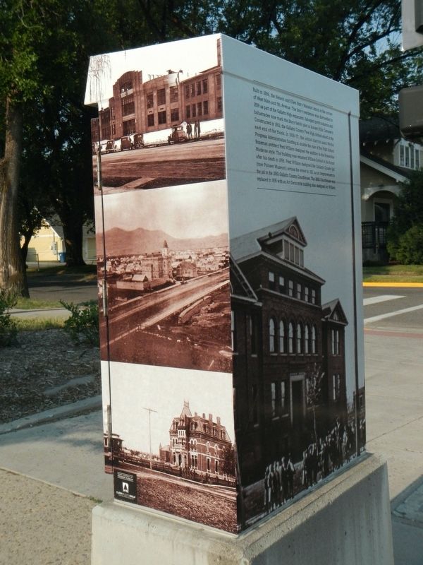
Built in 1886, the Nelson and Ellen Story Mansion stood at the corner of West Main and 5rh Avenue. The Story residence was dismantled in 1838 as part of the Gallatin High expansion. Salvaged porch columns and balustrades now mark the Story family . . . — — Map (db m192059) HM
When Montana achieved statehood in 1889, Bozeman was more cowtown than cosmopolitan as it vied with other towns to become the state capital. Architect George Hancock of Fargo, North Dakota, put form to Bozeman’s aspirations by designing several . . . — — Map (db m191975) HM
Sacajawea, the Shoshone woman who guided portions of the Lewis and Clark Expedition led Captain Wm. Clark and his party of ten men over an old buffalo road through this pass on July 15, 1806. They were eastward bound and planned to explore the . . . — — Map (db m162423) HM
The Young Men’s Christian Association (YMCA), founded in England in 1844, made its way to the United States in the 1850s. By the turn of the century, many American cities boasted YMCA facilities providing reasonable accommodations and physical . . . — — Map (db m192069) HM
Seventeen-year-old Julius Lehrkind fled compulsory service in the German militia by stowing away on a ship bound for America in 1860. Already having served as a brewmaster’s apprentice, Lehrkind easily found employment. Eight years later, a sizable . . . — — Map (db m192443) HM
The 1915 Panama-California Exposition in San Diego raised the profile of the Mission style, and the style became popular among cosmopolitan Montanans through the 1930s. Built in 1909, this two-story Mission Style home, patterned on Southern . . . — — Map (db m192237) HM
Built in 1910, the Thomas Byron Story Mansion and Carriage House were designed by renowned architect C. S. Haire, known for his work on the Montana state capitol addition. Haire’s plan for T. Byron Story, his wife Katherine Ferris, and their five . . . — — Map (db m192236) HM
Attorney Charles S. Hartman deserves a prominent place among Bozeman’s early residents. He opened a law practice in 1884 and with his wife Mollie built this home in 1886. Hartman carved a stellar career that included serving as a delegate to the . . . — — Map (db m192239) HM
The Dokken-Nelson Funeral Home business commissioned this building from Bozeman’s prolific early twentieth century architect, Fred F. Willson, and it is indicative of Willson’s diversity of styles. Upon the building’s completion in 1936, Hermann . . . — — Map (db m192066) HM
Development was sparse in this neighborhood in the early 1900s, but by the mid-1910s, construction boomed around Cooper Park. This classic Colonial Revival style home was built on a choice lot diagonally across from Cooper Park circa 1919. The park, . . . — — Map (db m192184) HM
Bozeman's enthusiastic bid to become Montana's capital began upon statehood in 1889 with the construction of impressive buildings here at Rouse Avenue and Main Street. An obstacle facing building contractors was Sour Dough Creek. A fieldstone barrel . . . — — Map (db m191979) HM
Bozeman’s extensive streetcar system offered reliable transportation from 1892 until 1922. In 1901, the Gallatin Light, Power, and Railway Company built this facility as an office and barn for its trolleys. After 1904 when the second story was . . . — — Map (db m191993) HM
Deeply admired in the 1890s, the Queen Anne style began to lose its allure after 1900, when its artistic jumble of angles and textures began to seem cluttered. The rejection of complexity was gradual, however, and many homebuilders opted for more . . . — — Map (db m192064) HM
"from the three forks of the Easterly fork of the Galletines River to the river Rochejhone is 18 miles on an excellent high dry firm road the very incoiderable hills." William Clark, July 15, 1806
Cattle baron, banker, and entrepreneur Nelson Story purchased this site in 1870 for $154. In June 1911 the United States Secretary of the Treasury took the land from Nelson Story Jr. and his family citing that public use required taking and holding . . . — — Map (db m192070) HM
For centuries distant and diverse tribes visited the Gallatin Valley to hunt. They stampeded buffalo over cliffs during the "dog days" before the acquisition of horses and guns. They hunted animals for food, clothing and shelter. They also mined . . . — — Map (db m29075) HM
Conflicts along the Bozeman Trail between Lakota, Northern Cheyenne, and Arapaho Indians and settlers escalated with the establishment of forts along the route in 1866. After Indians killed John Bozeman, in the Yellowstone Valley in 1867, the . . . — — Map (db m29079) HM
Established as a military post August 27, 1867 by order of
President Andrew Johnson and General U.S. Grant
the post was abandoned in December 1886
Captain Wm. Clark
of the Lewis and Clark Expedition
encamped here July 14, 1806 with his . . . — — Map (db m98279) HM
At the dawn of the twentieth century Bozeman emerged the undisputed economic and cultural center of the Gallatin Valley. A growing number of businessmen and professionals settled in the residential area south of Main Street, where a few prominent . . . — — Map (db m192176) HM
An abundance of beaver encouraged Corps of Discovery members John Colter and John Potts to return to the headwaters. In 1808, Blackfeet Indians killed Potts in a confrontation and stripped Colter bare, giving him a chance to run for his life. In one . . . — — Map (db m29077) HM
A livery and feed stable stood here in the 1880s and 1890s, but in 1901, William Nevitt, hardware store owner and “capitalist,” decided that downtown Bozeman could use more commercial space. The Avant Courier reported on the progress of his new . . . — — Map (db m192026) HM
Calls for a better Gallatin County jail came in 1886, only five years after the county's second jail was established in the original courthouse's basement. A grand jury found that the facility lacked proper ventilation, sewer, and security, as well . . . — — Map (db m292625) HM
The museum, located next to the Gallatin County Courthouse at 317 West Main, was the former county jail. Along with many museum exhibits showcasing the history of Gallatin County is an historical research library, the photo archives, and one of the . . . — — Map (db m193258) HM
Chartered in 1866, Gallatin Masonic Lodge No. 6 built this brick corner block in 1883 for an estimated $20,000, then a princely sum. The grandest of several buildings erected during the early 1880s following the arrival of the railroad, this Masonic . . . — — Map (db m192021) HM
Bozeman real estate and insurance broker Edward M. Gardner and city treasurer George Willson commissioned this extended family home in 1907. George was married to Edward’s stepdaughter Florence and the two families—including five Willson boys—shared . . . — — Map (db m192238) HM
Before the 1880s, Catholic missionary priests visited Bozeman about four times a year, holding Mass in private homes and rented halls. The community built its first Catholic church for the Holy Rosary Parish in 1885 at present day Seventh Street and . . . — — Map (db m192025) HM
Recognizing the need for a luxury hotel, Bozeman businessmen joined together in a collaboration that spanned nearly a century. Culminating in the opening of the Hotel Baxter on March 2, 1929, the effort involved several generations of dedicated . . . — — Map (db m192024) HM
Lewis and Clark's Corps of Discovery reached the headwaters of the Missouri River and named the three tributaries in July, 1805. With great difficulty the Corps of Discovery fought rapids and troublesome mosquitoes as they pulled their boats . . . — — Map (db m29072) HM
This diminutive neighborly district of thirty-four rather modest, early homes was surveyed and platted as Lindley and Guy’s Addition in anticipation of the arrival of the Northern Pacific Railroad. A lumber planing operation occupied the northwest . . . — — Map (db m192152) HM
A Northern Pacific spur line ran in front of this warehouse, originally railroad owned and built in the 1880s for the cold storage of produce. The brick walls are four layers thick with a central air space to maximize insulation; a chute conveyed . . . — — Map (db m192448) HM
Built in 1905, Malmborg School is one of the most architecturally interesting one-room schoolhouses in Gallatin County. The one-story octagonal school originally sported an open front porch with wooden Doric columns resting on high plinths. An open . . . — — Map (db m191973) HM
The design for this two-and-one-half-story home came from architect D. S. Hopkins, of Grand Rapids, Michigan, who published numerous “pattern books” of architectural plans. The Queen Anne style defines the residence, which features an asymmetrical . . . — — Map (db m192373) HM
Gallatin County boasted twenty-seven grain elevators in 1915, a testament to farming’s important economic role. Despite drought and low commodity prices, Montana Mercantile added this towering elevator to the Bozeman skyline in 1933. It added the . . . — — Map (db m192445) HM
Born in Ohio 1838. Died 1926. Freighter, merchant, gold miner, banker, cattle baron, vigilante, miller, builder, real estate developer in Los Angeles, U.S. Government contractor. Trailed first 1,000 Texas cows to Montana in 1866, and 500 mustang . . . — — Map (db m284073) HM
The twenty-eight homes along this stretch of North Tracy Avenue illustrate the extensive residential development that occurred north of Main Street. Impressive homes at 322 and 316 North Tracy, built in 1890 and 1900, and two bungalows at 519 and . . . — — Map (db m192451) HM
The gold strikes at Alder Gulch in 1863 yielded Nelson Story a fortune and laid the foundation of an economic empire spanning three generations. In 1866, a desperate need for beef in Montana's gold camps prompted the young entrepreneur to bring the . . . — — Map (db m253583) HM
As Bozeman made its bid for state capital, the construction of fashionable homes and buildings contributed to the town’s promotional efforts. Economic depression in 1893 and designation of Helena as state capital in 1894 tempered the boomtown . . . — — Map (db m192376) HM
The Pioneer Museum, located next to the Gallatin County Courthouse at 317 West Main, was the former County jail. Along with many museum exhibits showcasing the history of Gallatin County is an Historical Research Library. The photo archives, and . . . — — Map (db m29085) HM
A full-length front porch welcomed visitors to the clapboard home constructed on this lot in 1904. Robert and Edith Cooley purchased the residence from Golden Rule bookkeeper R. A. Black the following year. The couple had moved to Bozeman in 1899 . . . — — Map (db m192235) HM
Sacajawea, a Shoshone Indian woman, was captured by Hidatsa Indians at the three forks of the Missouri River in the Gallatin Valley and taken to the Mandan villages in North Dakota. There she joined the Lewis and Clark expedition in 1805-6 with her . . . — — Map (db m284366) HM
The first services were held in this lovely Gothic style Episcopal church in October 1890. Built at a time when Bozeman hoped to become the capital of Montana, the church reflects the optimism and prosperity that came on the heels of the gold rush . . . — — Map (db m192067) HM
Perceiving the economic advantages of the approaching railroad, Nelson Story Sr. began construction of "the largest flour mill in Montana" in 1882. Manufacturing "Saskatchewan" and "Montana Belle" flour, the Story Mill soon became the largest . . . — — Map (db m253557) HM
Optimistic Bozeman entrepreneurs John Dickerson, Walter Cooper, and Nelson Story (of cattle drive fame) platted the Park Addition in 1883. Despite the arrival of the Northern Pacific that year, the addition remained undeveloped until the late 1890s, . . . — — Map (db m192180) HM
On July 14, 1806 Captain William Clark accompanied by 11 members of the expedition party camped about a mile east of here on the flat at the mouth of Kelly Canyon. The next day, Sacajawea guided the party up the canyon on an old buffalo trail to a . . . — — Map (db m98296) HM
President Abraham Lincoln signed the Homestead Act into law on May 20, 1862. The Homestead Act declared the, "any citizen or intended citizen could claim 160 acres - one quarter square mile - of surveyed government land. Claimants must 'improve' the . . . — — Map (db m205925) HM
Missourian, William Tinsley traveled to Montana in 1864 to stake his own homestead claim in Willow Creek, MT. William and his soon to be wife, Lucy Ann Nave met in Virginia City, MT where William worked for the Wells Fargo Stage Company and Lucy . . . — — Map (db m205924) HM
The Museum of the Rockies acquired the Tinsley house in 1986, which helped complete the plans for a working Living History Farm exhibit. The house was moved from Willow Creek, MT in one piece and restored to its original 1890s condition. After . . . — — Map (db m205926) HM
Thomas and Anna Noble came to Bozeman in 1890 from Salesville. Thomas, an experienced logger, secured employment with the Prey Lumber Company. After S. C. Kenyon purchased the firm, Kenyon and Noble became partners in the business, furnishing early . . . — — Map (db m192177) HM
Railroad anticipation sparked a frenzied building boom prompting a shortage of brick that postponed completion of this popular watering hole for nearly two years. Begun in 1880, Phil Skeehan’s Tivoli Beer Hall finally opened in 1882. William Beall . . . — — Map (db m192023) HM
First Peoples utilized the valley for over 11,000 years before the arrival of Lewis & Clark, and the others that would follow. Trails brought cattle and homesteaders to an agricultural paradise. The military followed, defending settlers, consuming . . . — — Map (db m29084) HM
Settlers came to the Gallatin Valley on the heels of the first Montana gold strike at Grasshopper Creek near Bannack, Montana, in 1862. As Meriwether Lewis had predicted, farmers found the valley well suited for agriculture. They planted crops and . . . — — Map (db m29078) HM
Something is Terribly Wrong
Fourteen-year-old Darwin Steffler was in bed in his family’s lakeside lodge about 5.5 miles east of here, when he felt the earthquake strike. After checking on his little brothers, he race through the darkened . . . — — Map (db m271542) HM
Imagine what it was like…
A lake that tipped…a woman who leaped from her home just in time...a performer who didn't let an earthquake stop her…cabins swallowed by waves that came out of nowhere...a highway that vanished…
Here at the . . . — — Map (db m271541) HM
A Trail Through History
The road from Three Forks to Helena is a old one. Long before the establishment of those cities, it originated as a trail used by Montana's first citizens as they followed the bison herds and other game animals. . . . — — Map (db m282749) HM
John Quincy Adams of the Milwaukee Land Company, a subsidiary of the Chicago, Milwaukee and St. Paul Railway, platted the present town of Three Forks in 1908. Unlike most railroad officials, Adams and his son, B. S. Adams, took an unusual personal . . . — — Map (db m192664) HM
Aviation captivated America during the 1920s, particularly when Charles Lindbergh flew solo across the Atlantic in 1927. The United States made rapid strides and airfields opened all over the country. The town of Belgrade constructed Gallatin . . . — — Map (db m206125) HM
One of Montana’s most amazing historical events occurred near here in 1809. In
September of that year, John Colter and John Potts, former Lewis and Clark Expedition
members, were trapping beaver on the Jefferson River near the headwaters when a . . . — — Map (db m98317) HM
The Headwaters Region was the setting for the legend of
Colter’s Run
1808
In the fall of 1808 John Colter and John Potts,
both former members of the Lewis and Clark
Expedition, were trapping on the Jefferson
River. Angered by previous . . . — — Map (db m98438) HM
The Headwater's Region was the setting for the legend of ... Colter's Run 1808
In the fall of 1808 John Colter and John Potts, both former members of the Lewis and Clark Expedition, were trapping up the Jefferson River. Angered . . . — — Map (db m192790) HM
Throughout the 16th and 17th centuries, England, France and Spain competed in the search for a water route across North America. Explorers such as DeSoto, La Salle and de la Verendrye believed that the Mississippi-Missouri was the fabled Northwest . . . — — Map (db m192728) HM
The Headwaters drew many trappers because of its large beaver population.
Lewis and Clark had barely returned to the East when, spurred by their reports of vast numbers of beaver, Manuel Lisa formed the Missouri Fur Company. . . . — — Map (db m192729) HM
The original townsite of Gallatin City, north of here on the
west side of the combined Madison and Jefferson Rivers,
was selected in 1862. In Feb., 1863 sixty cabins were being
constructed. The river was forded when it was low and a
ferry was . . . — — Map (db m127042) HM
Built by Jarvis Akin, the Hotel was originally a one-room building of hand-hewn logs. It was the center of Gallatin City's social life; travelers sometimes complained of not being able to sleep because of the ruckus. As the town died, the Hotel was . . . — — Map (db m127043) HM
George Drouillard, the son of a Shawnee mother and French-Canadian father, was one of the most valued members of the Lewis and Clark Expedition. Meriwether Lewis noted in a letter to Secretary of War Henry Dearborn that Drouillard was "a man of much . . . — — Map (db m206126) HM
(Three panels are located at the Three Forks Chamber of Commerce kiosk:)
Lewis and Clark Corps of Discovery Sites Along this Portion of the Missouri River Valley
Crimson Blufffs
July 24, 1895 (Lewis Journal) . . . — — Map (db m192877) HM
In Patriotic Memory of
Sacajawea
an Indian woman whose heroic courage
steadfast devotion and splendid loyalty
in acting as guide across the Rocky Mountains
made it possible for the
Lewis and Clark Expedition
1804 - . . . — — Map (db m98495) HM
“The object of your mission is to explore the Missouri river, & such
principle stream of it, as, by its course & communication with the
waters of the Pacific ocean… may offer the most direct & practicable
water communication across . . . — — Map (db m99217) HM
Lewis and Clark explored the Missouri River in search of the "Northwest Passage."
"The object of your mission" wrote President Thomas Jefferson to Meriwether Lewis and William Clark "is to explore the Missouri River and such principal . . . — — Map (db m192786) HM
You are standing at the headwaters of the great Missouri River. The Jefferson and Madison Rivers converge with the Gallatin joining one mile downstream to become the Missouri River. Here, the famed explorers accomplished a major goal of their . . . — — Map (db m73542) HM
The Missouri and Mississippi drainage determined the boundaries of the ... Louisiana Purchase.
The acquisition, as well as the expiration, of the Mississippi-Missouri by the white man was carried out against a background of European . . . — — Map (db m192732) HM
The Milwaukee Land Company, a subsidiary of the Milwaukee Road, established the town of Three Forks in 1908. Company land agent John Q. Adams chose this townsite and held a lot sale in 1908. Buyers came by the trainload, purchasing 250 lots. . . . — — Map (db m192666) HM
Approx.. 2 miles north on the Trident Road (#286) is the
confluence of the Jefferson and Madison Rivers. A mile
further downstream you can view the Gallatin River
merging to form the headwaters of the Missouri River, the
longest U.S. river. . . . — — Map (db m99206) HM
The Headwaters has been populated for over 11,000 years
The Headwaters region was occupied for more than 11,000 years by bands of hunter and gatherers. Ample big game such as bison, elk and deer, and the abundant natural rock for tool . . . — — Map (db m192724) HM
A native of Three Forks, Montana, born March 16, 1922, Dean Porgerba loved to fly airplanes, especially single engine jets. Dean was a veteran of W.W. II and the Korean War. In his country's third conflict, his plane was shot down over the North . . . — — Map (db m206124) HM WM
The town of Three Forks, born to serve as a division point for the Chicago, St. Paul, and Milwaukee Railway, took root in 1908. As the town grew to a sizable settlement of 2,300, the Empire Theatre opened to serve local audiences. Manager David R. . . . — — Map (db m192662) HM
This statue was erected to commemorate Sacajawea and the Bicentennial of the Lewis and
Clark Expedition of 1803- 1806. She was a member of the Corps of Discovery and was invaluable as an interpreter in obtaining horses from her Shoshone people, . . . — — Map (db m98496) HM
Familiar with the Headwaters area, Sacajawea was invaluable as an interpreter for Lewis and Clark.
In 1800, Sacajawea was camped on the Jefferson River with her Shoshone tribe. Attacked by a band of Minnetarees, she was captured and . . . — — Map (db m192793) HM
Arrival of the Milwaukee Railroad caused Three Forks to move (1908-1910) one mile up the Missouri River from its 1863 townsite, as happened with many sister towns in the developing West. Milwaukee Railroad purchasing agent John Q. Adams saw need for . . . — — Map (db m141722) HM
In front of you is the site of Gallatin City, 1865-1880's. After it became obvious that steamboats could not operate economically from Fort Benton to the Headwaters, the town was relocated from the north side of the river to this location. Sitting . . . — — Map (db m126990) HM
"The Nisei bought an awful big hunk of America with their blood." - General Joseph "Vinegar Joe" Stillwell
''You fought the enemy abroad and prejudice at home and you won." - President Harry Truman, July 1946
This memorial is to recognize . . . — — Map (db m192723) HM WM
Clad in buckskin, the trapper carried with him his knives, gunpowder and lead. a Hawken rifle, perhaps a pipe and a book. Except for flour and salt, he lived entirely off the land. He did his trapping in the spring and fall. During the summer, . . . — — Map (db m192788) HM
The Gallatin Valley
While known to Montana First Citizens for Millennia, it was not until William Clark explored the valley in July 1806 that we have the first written description of the Gallatin Valley. Clark described the valley as an . . . — — Map (db m282810) HM
Log cabins were introduced to North America by the Swedes and Germans.
Because they were easy to build and made use of readily available materials, log cabins became the most common building on the frontier.
This cabin has dovetail notches and . . . — — Map (db m127044) HM
Many nations traveled and lived along these banks, giving their own names to
the river. “Missouri” is the official name given by the U.S. Geological Survey. It
dates back to French explorer Jacques Marquette’s journal and 1673 map of . . . — — Map (db m99215) HM
This region was alive with beaver, otter and game before the white man came. It was disputed hunting territory with the Indian tribes. Sacajawea, the Shoshone squaw who guided portions of the Lewis and Clark Expedition, was captured near here when a . . . — — Map (db m126978) HM
On their upstream journey in 1805, Lewis and Clark traveled through this area in two groups. On his return journey in 1806, Clark's group passed through the Headwaters area on their way to the Yellowstone River.
Sites depicted on this map . . . — — Map (db m206117) HM
The Thomas-Frederick Mill was one of two built in the Gallatin Valley during the 1860’s to process locally-grown grains and to guarantee a reliable supply of flour and meal.
Flour from here was freighted regularly to the gold camps of Helena, . . . — — Map (db m127045) HM
Easy river access and large numbers of beaver made the Headwaters a logical place for the ... Three Forks Post - 1810
In 1810, Manuel Lisa of the Missouri Fur Co. sent a large party of 32 trappers under command of Pierre Menard . . . — — Map (db m192792) HM
Three Forks Post
The Headwaters of the Missouri River were potentially a fur trapper's paradise. Following the return of the Corps of Discovery in 1806, the expeditions's co-leader, William Clark told stories about the abundant beaver . . . — — Map (db m282631) HM
Solid bank buildings were designed to assure customers that their money was safe from both theft and bank failure—a tenuous premise in the days before Federal Deposit Insurance. Here Romanesque arches, rusticated sandstone, thick masonry walls, and . . . — — Map (db m192663) HM
From 38 to 30 million years ago, great herds of rhinoceros-like herbivores, called Megacerops, roamed this part of Montana. Megacerops, also known as Brontotheres, were massive animals. Classified as Perissodactyla, Megacerops had three . . . — — Map (db m213356) HM
From 38 to 30 million years ago, great herds of rhinoceros-like herbivores, called Megacerops, roamed this part of Montana. Megacerops, also known as Brontotheres, were massive animals. Classified as Perissodactyla, Megacerops had three . . . — — Map (db m282647) HM
In 1908 construction began on Montana’s first cement manufacturing facility. In May 1910, the first cement was shipped to a hardware store in Missoula, Montana. The company-owned village of Trident was built before the plant was completed and at . . . — — Map (db m126996) HM
Dedicated to all the men and women
of the Headwaters Area, who gave of themselves
while serving in our armed forces
in times of war and peace — — Map (db m98451) WM
The Montana soil is swallowing hundreds of old homestead buildings like this one. Each takes with it untold stories of men and women whose lives brought them drought and blizzards, loneliness and companionship, fear and simple joys, much like we . . . — — Map (db m127000) HM
I've been a pretty tough old bird, but I wouldn’t want to go through that again! Grace Miller August 1959
Survival Tactics
Seventy-something-year-old Grace Miller was a self-professed “tough old bird.” When she found . . . — — Map (db m114166) HM
On August 17, 1959, this area was hit with the most devastating modern geologic disaster in the Rocky Mountains. An earthquake of a magnitude 7.5 on the Richter scale violently shook the earth, triggering a massive landslide, large surface cracks . . . — — Map (db m113832) HM
504 entries matched your criteria. Entries 101 through 200 are listed above. ⊲ Previous 100 — Next 100 ⊳