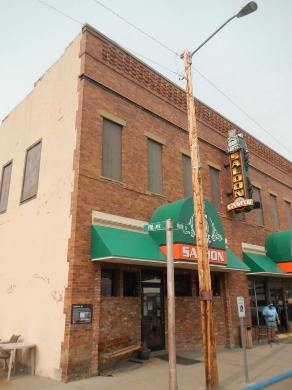
In 1918, the city of Forsyth was threatened by rising flood waters of the Yellowstone River.
Only a two block section of Main Street between 8th and 10th avenues remained relatively dry because temporary berms were quickly constructed to hold . . . — — Map (db m164763) HM
In 1918, the city of Forsyth was threatened by rising flood waters of the Yellowstone River. Only two blocks of Main Street between 8th and 10th Avenues remained dry. Temporary berms had been constructed to hold the flood waters at bay to protect . . . — — Map (db m164773) HM
In 1918, a rising Yellowstone River threatened the City of Forsyth. According to the Forsyth Times Journal, "Over 500 men worked for 36 hours to keep the flood water out of the city as much as possible." On this day in the early morning hours, the . . . — — Map (db m164785) HM
In 1918 the city of Forsyth was flooded for 2 1/2 weeks by the rising waters of the Yellowstone River.
The waters rushed into the west end of Forsyth, flooding the entire town north of the Northern Pacific Railroad tracks. As the flood . . . — — Map (db m165144) HM
In 1918, water from the Yellowstone River rushed into the west end of Forsyth and flooded the entire town north of the Northern Pacific Railroad tracks. Every basement was flooded to the floor joists. Homes in the residential district had 2 to 3 . . . — — Map (db m165234) HM
Decorative half-timbering and an intricate roofline distinguish this elegant one-and-one-half-story home. Mary Philbrick had the residence built as a wedding present for her daughter Mary Frances and son-in-law Harry Cornwell, a hardware merchant. . . . — — Map (db m165146) HM
Hiram Marcyes was born September 11, 1844 in Newberg, Maine. He served in the Civil War as a bugler in the Fourth Minnesota Volunteer Infantry Company with the the Union army. His service took him in battles from Vicksburg to Sherman's March to the . . . — — Map (db m188746) HM
One the morning of May 23, 1876, two cavalrymen and a citizen teamster, attached to Colonel John Gibbon's Montana Column, were ambushed by a war party of Lakota in the bluffs on the north side of the Yellowstone a few miles downriver from this . . . — — Map (db m164801) HM
A pressed metal cornice, door surrounds made of cast iron, and an exposed steel I-beam distinguish the façade of the 1907 Kennedy-Fletcher block. Geo. L. Mesker and Co. of Bedford, Indiana, the largest architectural ironworks in the country, . . . — — Map (db m164766) HM
Cattleman Lafayette H. Parker and his wife, Lida, purchased a small home on this lot in 1910. Lafayette died two years later of tuberculosis, but Lida continued to live here, and in 1917, she obtained a mortgage to replace her home with a two-story . . . — — Map (db m164921) HM
Terra-cotta medallions sporting the Masonic emblem of square and compass and the words “Masonic Temple” centered beneath the cornice proudly announce this building’s primary purpose. Chartered in 1898, the Forsyth Masonic Lodge met in borrowed . . . — — Map (db m164686) HM
When the Milwaukee road arrived in 1907, Forsyth boomed, and carpenter Maurice S. Lord decided to open his own business. “It won’t cost you anything to talk to me,” he advertised, “and if I can’t suit you as to price and quality, . . . — — Map (db m165145) HM
The deep eaves and flared rooflines of this two-story home were meant to evoke the Far East, while its octagonal tower, ornamental brackets, decorative beveled glass, and corbelled chimneys reveal the attention to detail that accompanied the home’s . . . — — Map (db m165230) HM
Pioneer businessman Thomas Alexander founded Forsyth’s first bank in 1892. In 1898, he built this ashlar stone bank building with material quarried within a mile of Forsyth. Three small panels on the cornice commemorate the year of construction and . . . — — Map (db m164760) HM
Carpenter Gustav Hoff purchased this lot in 1900, and sometime before 1920 he built this one-story, hipped roof house, likely as an investment. Robert “Shorty” Meredith and his wife Mary bought the residence in 1920 for $2,500. The . . . — — Map (db m164855) HM
Emmett and Anna Meyerhoff arrived in Forsyth in 1902 and quickly became prominent in Forsyth society. The assistant cashier of the newly organized Forsyth State Bank (later First National Bank), Meyerhoff was bank president by 1913. Anna was active . . . — — Map (db m165149) HM
A truncated hipped roof reflects this circa 1895 home’s modest beginnings. Carpenters used shorter, less expensive pieces of lumber for hipped roofs than for triangular-shaped gable roofs. Owners added a full-length front porch (since removed) and a . . . — — Map (db m164924) HM
The Northern Pacific Railroad surveyed along the north side of the Yellowstone River during the summers of 1871 and 1873, a time when the still-powerful Lakota controlled the unceded land south of the river. A a result, the survey crews required . . . — — Map (db m188744) HM
Scandal and intrigue surrounded the construction of Rosebud County Courthouse in 1914. Rosebud County citizens recognized the need for a new courthouse when they passed a $125,000 bond issue in 1911 to fund the building. To design a suitable . . . — — Map (db m164668) HM
“Remember the Flu epidemic” declared a notice advocating support for Rosebud County Hospital. In 1918 and 1919 influenza killed over 5,000 Montanans. Flu victims in Forsyth received care at the Masonic Hall, temporarily converted into an . . . — — Map (db m164791) HM
“May You Prosper Well in Your New Theatre with Your Steadfast Faith in Forsyth,” read one of the many ads that filled the August 28, 1930, Forsyth Times. Car and clothing merchants joined building contractors and suppliers in congratulating Anthony . . . — — Map (db m164689) HM
Northern Pacific Railroad engineer Thomas Sorenson and his wife Hannah built this one-and-one-half-story residence circa 1910. That year the Norwegian immigrant couple lived here with their five children and two boarders, both of whom also worked . . . — — Map (db m164835) HM
Civil engineer Charles Taber helped survey the original Northern Pacific line through Forsyth in 1881. He must have liked what he saw because he soon returned to Forsyth, becoming the town’s first mayor after it incorporated in 1904. Taber purchased . . . — — Map (db m165047) HM
When General Terry, Custer and Gibbon met on the steamer Far West to coordinate the final plan of action against the hostiles, it was decided that the Indians were probably camped along the Little Bighorn. Custer was to lead the Seventh Cavalry to . . . — — Map (db m165235) HM
The history of Forsyth depends heavily on two men - Thomas Alexander and Hiram Marcyes - very different individuals yet both dedicated to creative and aggressive growth. Thomas Alexander began as a pioneer sheep, cattle and horse rancher and . . . — — Map (db m165231) HM
Small touches add elegance to this one-and-one-half-story Colonial Revival residence and matching garage. Particularly noteworthy are its overall symmetry, prominent eave returns, shingled gabled ends, and classical pillars supporting the hipped . . . — — Map (db m165143) HM
Symmetrical facades, conservative design, and the use of durable material, particularly stone and brick, typified small-town Montana bank buildings like this one, originally constructed in Vananda, seventeen miles northwest of Forsyth. In the days . . . — — Map (db m164685) HM
Dr. Arthur C. Wilson moved to Forsyth after graduating medical school in 1891. He worked as a surgeon for the Northern Pacific Railroad, as a medical examiner for insurance companies, and as the county health officer. Forsyth’s first resident . . . — — Map (db m165042) HM
Many a dogie * (not doggie - dudes please note) has been decorated with one of these famous Montana irons.
(Click on the photograph to enlarge it and have a closer look at the brands.)
* A dogie is a little calf who has lost . . . — — Map (db m164408) HM
In the years following the Korean War, tensions heightened between the United States and Soviet Union. To prevent a surprise communist attack, the U.S. Air Force established a network of radar stations to protect American air space. Using the most . . . — — Map (db m164493) HM
Founded in 1908, Ingomar became a hub of commerce when the Milwaukee Road Railroad completed its line across Montana. The community had no source of water and relied on the railroad to provide 22,000 gallon water tank cars each week for the town . . . — — Map (db m189089) HM
Founded in 1908, Ingomar became a hub of commerce when the Milwaukee Road Railroad completed its line across Montana. The community had no source of water and relied on the railroad to provide 22,000 gallon water tank cars each week for the town . . . — — Map (db m189095) HM
As hundreds of farmers and ranchers homesteaded the arid, treeless plains of northwestern Rosebud County, the townsite of Ingomar was platted along the tracks of the Chicago, Milwaukee & St. Paul Railway in 1912. That year, one teacher and a . . . — — Map (db m189103) HM
J. Abraham “Abe” Bookman came from Ireland with his wife, Anna, and brother-in-law, Simon Sigman. By 1912, they had settled in Ingomar, where Bookman operated the town mercantile and Sigman served as postmaster. The business was so prosperous that . . . — — Map (db m189091) HM
Completion of the “Milwaukee Road” brought hundreds of homesteaders to Ingomar during the 1910s. By 1914, wood-frame homes and a small commercial district proclaimed the town a permanent settlement. On July 2, 1914, the Ingomar Index announced that . . . — — Map (db m189093) HM
In the aftermath of the Rosebud and Little Bighorn battles, both Generals Terry and Crook withdrew to their respective base camps waiting for additional troops and supplies. Even though the commands were only about 100 miles apart, communication . . . — — Map (db m189247) HM
At noon on June 22, 1876, the Seventh Cavalry under the command of Lieutenant Colonel George Armstrong Custer began its ill-fated march to the Little Bighorn near this location.
General Alfred Terry, having ordered a parade review send-off for . . . — — Map (db m189167) HM
At noon, on June 22, 1876, Lt. Colonel George Armstrong Custer's command broke camp along the Yellowstone River, passed in review of General Terry and Colonel Gibbon, and marched to the mouth of Rosebud Creek. The Seventh Cavalry then proceeded . . . — — Map (db m189172) WM
In 1886, ranchers buried near here what many believe to be the remains of Private Nathan Short, Co. C, 7th U.S. Cavalry. Short was believed to be carrying a message from General Custer at the Battle of the Little Bighorn, 70 miles S.W, of this . . . — — Map (db m313337) HM WM
Wherever you are in Montana, you stand in the pathway of Lewis and Clark. Their 1804-1806 expedition was a grand adventure to investigate the people and resources of the newly acquired Louisiana Purchase and to seek a navigable passage across the . . . — — Map (db m164417) HM
A few days after the Custer disaster on June 25, 1876, General Alfred Terry moved the decimated Seventh Cavalry to Fort Pease on the Yellowstone waiting nearly a month for additional troops and supplies.
By late July, the steamboats contracted . . . — — Map (db m164626) HM
From July 28, 1806, when William Clark passed Rosebud Creek on his way down the Yellowstone, this river valley has served as one of the major avenues for development and trade in eastern Montana. Innumerable trappers and traders followed Clark's . . . — — Map (db m164409) HM
In June 1876, the column of General John Gibbon and Lieutenant Colonel George Armstrong Custer, both under the command of General Alfred Terry, met near here at the mouth of Rosebud Creek aboard the steamer Far West. They were under orders to . . . — — Map (db m164624) HM
Beginning in early May, 1876 when the Lakota ran off about thirty horsed belonging to the Crow scouts, patrols from the Montana Column reported Indian sightings almost every day from the Big Horn River on down to Rosebud Creek. All signs indicated a . . . — — Map (db m164542) HM
From its origins as a railroad siding established by the Northern Pacific in 1882, Rosebud grew into a bustling homesteading community. The town boasted 300 residents when Fred and Mary Mefford arrived from the Midwest in 1896, bringing with them a . . . — — Map (db m164619) HM
About 65 million years ago, the inland sea receded as the Rocky Mountains rose, pushing the shoreline further east. Great rivers meandered through the coastal plain in a warm and humid climate, depositing sediment which would later become known as . . . — — Map (db m164492) HM
When the Dakota Column arrived at the confluence of the Powder River and the Yellowstone, General Alfred Terry wanted to be certain that the Lakota had not moved south and east even though Gibbon's scouts had already located the big village on the . . . — — Map (db m189245) HM
Children first attended school in a log cabin at this site in 1882, the year the Northern Pacific Railroad completed its line through the Yellowstone Valley. The railroad brought growing numbers of homesteaders, and in 1904 the community replaced . . . — — Map (db m165242) HM
Behind every name on these bricks is the story of a man or woman who believed in duty and sacrifice to this great nation. Their stories crisscross the globe and speak of glory, honor and sacrifice of individuals who became part of a greater whole, . . . — — Map (db m306297) HM
The ditch was prone to flooding during heavy rains. One of the worst floods was in August 1912 when two inches of rain fell in two hours. Gillette Avenue flooded as well as the many businesses and homes in the area. The sidewalks which were made of . . . — — Map (db m306495) HM
When the Burlington & Missouri Railroad laid tracks to this area in August of 1891, the town of Gillette came into existence. The railroad provided local ranchers with the means to transport large herds of livestock to markets in the East. After . . . — — Map (db m306293) HM
The early 20th century explosion of the automobile into American life highlighted a deplorable lack of surfaced roads. Newly minted drivers discovered the unsuitability of wagon trails for the automobile, and local good roads associations formed to . . . — — Map (db m288650) HM
The Chicago, Burlington and Quincy Railroad proposed a canal system that diverted water from Donkey Creek to Stone Pile Creek and from Stone Pile Creek into Burlington Lake. Construction began in 1907 and was completed in 1908. During construction, . . . — — Map (db m306405) HM
Commemorating 100 years having been created from portions of Crook and Weston County by authority granted from the Eleventh Legislature of the State of Wyoming on February 13, 1911 and named after John Allen Campbell, the first Governor of the . . . — — Map (db m242840) HM
Model Twenty-two Horsepower 26 Year built 1937 Weight 6210 This caterpillar track-type tractor was equipped with a small blade and used extensively in the oilfields surrounding Gillette, WY. It was used for light construction, road building, and . . . — — Map (db m306589) HM
At the center of McManamen Park is a 10-acre lake, dredged in 1987 deep enough to hold water all year long. An additional 40-acres is dedicated to overflow that fills with water in wet years. Turning Burlington Lake into the McManamen Park “prairie . . . — — Map (db m306440) HM
By October 1943, negotiations were completed where the City of Gillette took over the CB&Q water ditch, according to Mayor Roy Montgomery. Under the terms of the agreement, the city received title to all the land through which the ditch ran, . . . — — Map (db m306292) HM
Height 7 ft. Width 10 ft. 6 in. Depth 10 ft. Capacity 14 yds. This bucket is off a Marion 190 Shovel, built in Marion, Ohio. It came to Campbell County in 1975 after working in Wales. The Marion Shovel was used to move overburden and coal. . . . — — Map (db m306596) HM
Commemorating the brave young men and women of Campbell County, who responding to duty and honor, paid the ultimate price by sacrificing their lives so their loved ones and neighbors could live free. — — Map (db m306299) WM
In September 1943, officials of the Chicago, Burlington and Quincy Railroad were negotiating with the City of Gillette for disposal of the Burlington Ditch. There was an original offer to the city that was turned down; details of the original offer . . . — — Map (db m306497) HM
In 2000, the Gillette City Council considered banning dogs from McManamen Park from March 1 to October 1 during the nesting season. The shallow water, which provides a source of food and the nesting habitat consisting of areas of relatively . . . — — Map (db m306468) HM
Wyoming's eastern Powder River Basin is a region of limited rainfall and high rolling grasslands, an area ideally suited for livestock grazing, but not large-scale crop production. Settlers emigrating to the region could obtain lands under several . . . — — Map (db m306295) HM
Built by General Electric Horsepower 3,000 Year built 1972 Weight 411,580 lbs. Length 67 ft. Height 15 ft. Miles traveled 2,400,000 Fuel 150 gal./hr. Engine 5802 was used to haul 11,680,000 tons of coal from Campbel County mines. It holds 4,000 . . . — — Map (db m306500) HM
Flood waters from the overflowing Burlington Ditch caused thousands of dollars in damage after rapidly melting snow overflowed between Kendrick and Carey Streets in January 1943. The ditch at this point was eight feet deep. Some of the heaviest . . . — — Map (db m306496) HM
Fred Grant Hicks, born in Ohio, emigrated to Wyoming in 1908 to work for the Burlington Railroad. The Hicks homestead was north of Burlington Lake. He was the roundhouse foreman for twelve years. In 1932 he and his wife Florence purchased the . . . — — Map (db m306470) HM
George Amos moved to Wyoming in the late 1800s to work as the foreman on the 4-J Ranch. A bachelor, he was a cowpuncher by day, and a voracious reader at night. In addition to a love for books, Amos subscribed to as many as 20 magazines and many . . . — — Map (db m203256) HM
Bede McCann was hired quite often in the summer time to use a team and scraper to clear the weeds and grass out of the Burlington Ditch. He also mowed the right-of-way along Highway 14-16 and planted the evergreen trees along the highway and train . . . — — Map (db m306494) HM
This building, constructed in 1936, was completely paid for by the City of Gillette, without bonds or increased taxation, a source of pride for this community. The mayor's office, clerk's office, and courtroom were on the first floor with fire . . . — — Map (db m203279) HM
Built in 1935 with funds from the Public Works Administration (PWA), this was the first federal building constructed in Gillette. It utilized a standard floor plan developed for post offices nationwide. This building was Gillette's Post Office . . . — — Map (db m203281) HM
In September 1945, with the conclusion of the war and the impending return of hundreds of men and women, the City administration made plans to improve Gillette and provide employment for all who wished to return and live here. The city was prepared . . . — — Map (db m306279) HM
Located in a corner of the Schneider Ranch and adjacent to the Highlight Road in central Campbell County, sat the Cowboy Bar which served as a watering hole for thirsty roughnecks and miners for 26 years. The bar began as an old outbuilding moved . . . — — Map (db m306300) HM
who served in the Persian Gulf during Desert Storm Sculptured by Patrick Love base donated by Gillette Energy Rotary Club constructed by Barton Construction — — Map (db m306298) HM WM
Built by Bridgestone Weight 8,400 lbs. Size 40:00-57 1991 cost $13,000 Height 12 ft. Width 4 ft. This tire was used on Unit Rig trucks to haul soil and coal in local coal mines. Each tire can carry a 137,500 lb. load. The tire is a 60 bias . . . — — Map (db m306543) HM
A concrete walkway was finished in 2013 around Burlington Lake at McManamen Park. The walkway was made of concrete to allow easier access for wheelchairs and to make the path easier to walk in poor weather. The walkway is10 feet wide and 7,400 . . . — — Map (db m306498) HM
Built by Allis Chambers Engine ED-40 Front tires 9x18” – 10 ply Height 50 ft. Rear tires 44x10” – 16” ply Year built 1935 Pulling units are now called workover rigs. Instead of having a permanent derrick left over a well, a pulling unit . . . — — Map (db m306574) HM
Year built 1975 Height 45 feet Model RR11 Serial # 1100-70-5E Built by Joy Manufacturing Co. (Robbins Division) This drill was used to drill large holes in conjunction with mining coal. The holes were drilled into the overburden (the dirt . . . — — Map (db m306598) HM
Weight 2,100 lbs. Material Granite Time Capsules 20 yr., 50 yr., 100 yr. Sundials were invented 3,500 years ago by the Babylonians. The base is marked with divisions of time and must be level. The gnomon, an upright indicator, casts the shadow. . . . — — Map (db m306599) HM
In 1908, the Chicago, Burlington & Quincy Railroad completed construction of an extensive canal system. It was designed to supply water for the railroad steam engines and to water the livestock waiting to be shipped out. The Burlington Ditch . . . — — Map (db m306294) HM
Model BD30HD Truck weight 235,000 lbs. Height 18 ft. Horsepower 1600 Width 23 ft. Year built 1978 Length 65 ft. Load capacity 170 tons This truck was assembled at the Jacobs Ranch Mine to haul coal. It has logged 20,000 operating hours to haul 10 . . . — — Map (db m306499) HM
In 1891 when Gillette was founded, day-to-day living revolved around the railroad and surrounding ranches. The northern boundary of the City at that time was Burlington Lake where cattle were led to drink when livestock was moved by railroads. From . . . — — Map (db m306371) HM
Model HBGG-6 Year built 1945 Horsepower 168 Cubic inch 4006 Kilowatt 113 These generators provided electrical power for a natural gas processing plant in the Ute oilfield north of Gillette, WY. They were taken out of service in approximately . . . — — Map (db m306582) HM
The fur industry ruled the northwest at the beginning of the 19th century; however, much of the interior of the western United States remained a mystery. The Lewis and Clark expedition constituted the only organized exploration, a fact which . . . — — Map (db m97954) HM
Gross weight empty 223,276 lbs. Gross weight loaded 563,276 lbs. Engine 16V149 Detroit 1600 hp Life to date: 30,000 hrs. Fuel consumption 20-gal. hr. Tires avg. cost $9,000 Engine rebuild avg. cost $35,000 143 was moved from Butte to the Black . . . — — Map (db m242992) HM
Trivia Question! Where did cattle originate that were trailed to Wyoming? Long-horned cattle were driven up from Texas on the Chisholm, Western and Goodnight Loving Trails. Herefords were shipped from the British Isles and cattle . . . — — Map (db m242990) HM
Soon after the retreat of the great Western Interior Seaway of. the Cretaceous Period, great coal swamps covered Eastern Wyoming. This fossilized tree stump was recovered from the Eagle Butte Coal Mine located about 48 miles to the North of here. . . . — — Map (db m203255) HM
"The lack of rail service in large areas of Wyoming did not prevent small coal mines from being opened. Throughout much of rural Wyoming wood was not readily available, and it was too valuable to be used as fuel on the plains and basins. Coal . . . — — Map (db m242967) HM
"By mid-century most corporations wished to place themselves at arms length from the "company town" concept, in some cases it was neither possible nor desirable. A need existed. Many employees opposed being on the road for hours; they wanted to be . . . — — Map (db m242991) HM
As with other emigrant trails in the west, the Bozeman Trail followed a route previously used by traders, trappers, and Native Americans. John Bozeman, along with John Jacobs, officially opened the Bozeman Trail to emigrants in 1863. This 500-mile . . . — — Map (db m210594) HM
"In the beginning when Wright was first taking shape and becoming its own place it was the spring of 1949 when the Wyoming Highway Department began constructing the Reno Junction Maintenance Camp. It was located about two and a half miles south of . . . — — Map (db m242956) HM
"In 1886 an explosion killed 2 boys, the territorial legislature took steps to ban children from working in coal mines. The coal mine safety law prohibited boys under the age of 14 and "women and girls of any age" from being employed "in or about . . . — — Map (db m242986) HM
To all that serve we salute you thanks for your sacrifice United States Navy ☆ United States Army United States Air Force ☆ United States Marine Corps United States Merchant Marine ☆ United States Coast Guard Wright, . . . — — Map (db m242962) WM
Ages ago Wyoming was covered by seas. Through a period of millions of years the land gradually rose, leaving the present landscape of plains, mountains and rolling hills. As the land emerged, erosion began and through eons of time, formed Ayres . . . — — Map (db m92098) HM
Came to rest near hear at 2140 Hrs. Feb. 25 1943 while returning to the Casper Army Air Field. The entire Machala Crew gave the last full measure.
2nd LT. Louis E. Machala (Pilot) •
2nd LT. Ned J. Devries (Copilot) •
2nd LT. Harry N. Cannon . . . — — Map (db m208630) HM WM
From this point, the Bozeman Trail wound a long, twisting northwesterly route to the Montana goldfields. This view points out a portion of that difficult and dangerous road. The map shows the locations of forts, rivers and mountains along the trail. . . . — — Map (db m80089) HM
During World War II, Douglas was home to the primary prisoner of war (POW) camp for Wyoming. There were 17 satellite camps throughout the state. Construction of the camp began early in 1942; the first prisoners to arrive at the camp were 412 . . . — — Map (db m305843) HM
Car #1886 was built at St. Louis Car Company in 1884 as a part of an order for ten short sixty foot coaches for service on the so called "Cowboy Line" of the C&NW being built at the time through Douglas to Lander, Wyoming.
The car was rebuilt in . . . — — Map (db m92181) HM
The oldest piece in the display, the car was built by the Burlington and Missouri River Railroad in the company shops at Plattsmouth, Nebraska in 1884 at a cost of $1023 as a mainline freight caboose. It was rebuilt and modernized with new brake . . . — — Map (db m92182) HM
This massive steam locomotive was donated to the people of the State of Wyoming by the Chicago, Burlington and Quincy Railroad Company. It was moved dead-in-train from Galesburg, Ill to Orin then via C&NW Railroad to Douglas in April of 1962. . . . — — Map (db m92162) HM
This car was built by the Budd Company at Philadelphia, PA as a 48 seat Diner in March 1947. It was part of an order for new stainless steel passenger cars for system-wide service. It was named "Silver Salver" and was numbered #196, later Burlington . . . — — Map (db m92166) HM
448 entries matched your criteria. Entries 101 through 200 are listed above. ⊲ Previous 100 — Next 100 ⊳