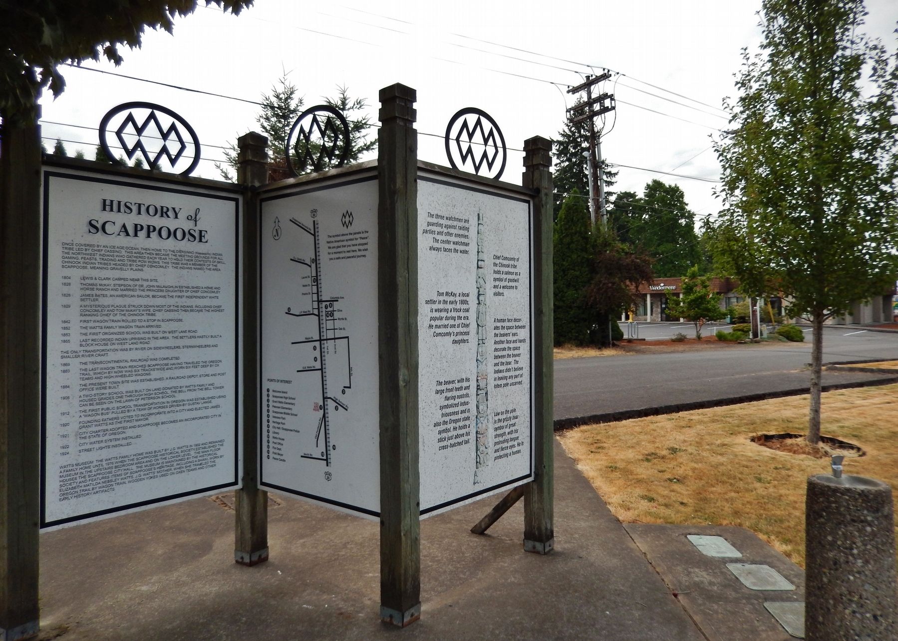
Panel 1
Once covered by an Ice Age ocean, then home to the Diersinno (Keeassino) Indian Tribe led by Chief Cassino, this area then became the meeting grounds for all the Northwest Indians who gathered each year to hold their . . . — — Map (db m113156) HM
Lewis & Clark on the Columbia River
The Lewis and Clark Expedition made the first documented descent of the Columbia from the mouth of the Snake River to the Pacific.
This voyage strengthened the claim of the young United States to . . . — — Map (db m113157) HM
Lewis & Clark and the Corps of Discovery
In 1803, the United States purchased the Louisiana Territory from France, expanding this country from the Mississippi River west to the Rocky Mountains and from the Gulf of Mexico north to . . . — — Map (db m113159) HM
One of the Oregon Country’s most picturesque fur-traders, Thomas McKay is buried near Scappoose.
He was a daring leader, famous storyteller and could drive a nail with a rifle ball.
A Canadian, he arrived with the Astorians as a teen-age boy; . . . — — Map (db m114416) HM
The path before you represents the Corps of Discovery's journey on the Columbia River – from its confluence with the Snake to the Pacific Ocean.
Entering the Columbia in mid-October 1805, they travelled along the river from shore to shore . . . — — Map (db m113154) HM
In 1804-06, Captains Meriwether Lewis and William Clark led 31 men and one dog on an epic journey.
President Thomas Jefferson commissioned this "Corps of Discovery" to find a route to the Pacific Ocean through the newly acquired Louisiana . . . — — Map (db m113155) HM
In October 1856, the U.S. Lighthouse Board entered this fog bell and Cape Disappointment Lighthouse into service, thus establishing the first light station on the Oregon and Washington coast.
Positioned on the north side of the entrance to . . . — — Map (db m113153) HM
Migrating fish are attracted to large flows of water coming from the Bonneville Dam. To take advantage of this natural reaction, fish-collection facilities are placed along the face of the powerhouse and at each end of the spillway dam. These . . . — — Map (db m92686) HM
Thousands of Oregon Trail emigrant passed this way toward new lives in a place Abigail Scot, emigrant of 1852, called the "Garden of the World" The Willamette Valley was nearly 2,000 miles from Missouri, and by the time emigrants reached this . . . — — Map (db m158539) HM
Construction of the Columbia River Highway begun here in 1912
Funds were contributed by Simon Benson Labor was performed by honor men detailed by Governor Oswald West — — Map (db m292156) HM
Sturgeon range throughout the Columbia River system, however the construction of Bonneville Dam and the other dams upstream blocked sturgeon migration. Sturgeon, unlike salmon, do not use fish ladders. Sturgeon below Bonneville Dam travel up and . . . — — Map (db m92687) HM
Although steel has been made for centuries, it wasn’t until the Bessemer process was introduced in the 1870s that it could be produced in quantity.
The Bridge of the Gods mural is the creation of Larry Kangas, of Beaverton, . . . — — Map (db m112267) HM
"The first locomotive ever run over the first railroad ever built in the state of Oregon"
Early travel on the Oregon Trail was extremely dangerous. The last 100 miles of the journey westward from The Dalles to the Willamette . . . — — Map (db m158538) HM
High in the tower, the school bell rang, resonating across the grounds.
Sixteen school kids grabbed their lunch pails and headed with their teacher, Miss Graham, into the 1893 Crapper School.
As the community grew, the students outnumbered . . . — — Map (db m113941) HM
Leslie and Truman Butler commissioned well-known Portland architect A.E. Doyle to design a bank of the Butler Banking Company, the business they founded in 1900. The Egyptian style building was completed in September 1924, and the grand opening . . . — — Map (db m112295) HM
Harry DeWitt built this new automobile garage in 1920 when the demand for new cars and service was high in Hood River. During the Great Depression of the 1930s, the garage was divided and used as the Greyhound Bus Station, a service garage, and a . . . — — Map (db m112235) HM
Designed to house several businesses, the E.L. Smith Building was constructed in 1904 for $10,000. The First National Bank, organized by entrepreneur and regional politician Ezra L. Smith in 1900, occupied the main storefront from 1904 to 1910 until . . . — — Map (db m112294) HM
Designed by Hood River architect R.R. Barely, the "new" First National Bank building was constructed in 1910 by contractors J.M. Wright and L.M. Bentley for a cost of $40,000. The building housed the bank on the first floor and the Commercial Club . . . — — Map (db m112264) HM
Gale-force winds bedeviled explorers and emigrants alike in the Columbia River Gorge.
Journals from the 1800s depict travel as treacherous through this singular passage in the Cascade Range where 60 mile-per-hour gusts are common.
By . . . — — Map (db m113939) HM
Constructed in 1907 under the management of J.M. Culbertson, the Hood River Banking and Trust Company represents one of the older brick buildings in downtown Hood River. Decorative features include the sheet metal cornice, arched windows with leaded . . . — — Map (db m116955) HM
Constructed in 1920 by local contractor L.C. Baldwin, the new City Hall was formally dedicated in February 1921 by Mayor E.L. Scobee. The building housed the city offices and council chambers on the main floor, and the fire and police statins on the . . . — — Map (db m112240) HM
The development of a public library was promoted by the Hood River Woman's Club, the local library board and other community supporters. With a $17,500 grant from the Carnegie Corporation, the Woman's Club succeeded in their efforts to erect a . . . — — Map (db m197089) HM
In 1917, a modern Franklin touring car was delivered from Portland for the grand opening of the Hood River Garage. Similar one-story, concrete service garages proliferated throughout the Gorge after the Columbia River Highway was completed in 1916 . . . — — Map (db m112300) HM
From 1901 until 1935, the Hood River United States Post Office occupied the ground floor of the Masonic Hall at 210 Second Street. This post office building was completed in September 1935 after the United States government allocated $90,000 for its . . . — — Map (db m197088) HM
Designed by The Dalles architect C.J. Crandall in 1904, the Hotel Waucoma was one of the earliest brick buildings constructed in downtown Hood River. Built for $14,000, the new hotel boasted of 27 guest rooms equipped with steam heat, porcelain . . . — — Map (db m112297) HM
A.S. Keir and C.A. Class erected the building in 1905 for use as a drug store, pharmacy, and soda fountain. Originally a one-story structure, a second floor was added when the building was remodeled in 1927 in the Art Deco style. The colorful tile . . . — — Map (db m112262) HM
Built in 1914, the original tenant of the building was the Garrabrant and Parker's Confectionary Store. Candy and cigars were sold in the store, and people often sat for hours at the popular soda foundation (sic). A game of billiards could be played . . . — — Map (db m112296) HM
The Hood River Masonic Lodge No. 105 A.F. & A. M. was chartered in 1892 and incorporated in 1896. Five years after the Lodge incorporated, the Masons erected a new lodge hall. Named after benefactor Andrew H. Tieman, the hall was dedicated on . . . — — Map (db m112236) HM
Dedicated to the Men and Women Who Served to Keep America Free
Listed on This Stone Are Those of Hood River County Who Made the Ultimate Sacrifice
World War I
W. Lucian Carson • Guy Eastman • Floyd Gramp • Arthur L. Granstrom • . . . — — Map (db m112258) WM
Constructed in 1911, the OWR & N Co. Railroad Depot served Hood River's thriving fruit, timber, and tourist industries. The Craftsman style building which was larger than most other stations replaced the original 1882 Queen Anne style depot on the . . . — — Map (db m112302) HM
Prominent business person and leader of the fruit industry, Charles H. Sproat financed the construction of the Sproat Building in 1911 to house the E.A. Franz Furniture Company. Upon completion, the owners boasted of a buff colored brick exterior , . . . — — Map (db m112305) HM
William M. Stewart advertised his home furnishings and hardware business as Hood River's "Complete Homefurnisher." The one-story brick building on the east was erected in 1902 and the other two sections to the west were constructed in 1905. The . . . — — Map (db m112239) HM
Constructed in 1909 by Samuel and Laurence Blowers, the building originally housed a hardware store and "modern playhouse" on the first floor and offices on the second floor. Laurence Blowers was one of Hood River's first mayors and was appointed . . . — — Map (db m112234) HM
Dr. Frampton Brosius was one of the town's early mayors and a community activist. Brosius constructed the building for use as a centralized location for doctor's offices; one of the first buildings in Hood River designed for this use. Constructed in . . . — — Map (db m112260) HM
The Eliot Building was financed by Portland minister T.L. Eliot in 1908 for use by the E.A. Franz Hardware Store. In 1906, the prominent Portland architect, A.E. Doyle, completed the architectural plans for the commercial building while studying . . . — — Map (db m112259) HM
Charles Hall, president of the Home Telephone Company, financed the construction of the building for $45,000 in 1909. Erected of "Newberg" pressed brick, the building housed a variety of businesses including the Butler Bank, Bragg Mercantile, and . . . — — Map (db m112261) HM
Sternwheeler traffic on the Columbia River reached a fevered-pitch with the completion of Cascade Locks in 1896.
Steam-powered paddlewheelers provided a vital link between The Dalles and Portland.
The trip averaged six hours on a good day, and . . . — — Map (db m113947) HM
The Mt. Hood Hotel Annex, constructed in 1912-13, was built as an annex to the original wooden hotel which stood to the north. The first floor housed commercial businesses and the second story had apartments and additional hotel rooms. In 1926, the . . . — — Map (db m112232) HM
The building at this location served as a schoolhouse for pioneer settlers who came to Hood River Valley in the early 1900's. Originally built as a one room log schoolhouse the building was located at a popular Indian camping site on the trail over . . . — — Map (db m112335) HM
For nearly 60 years this turbine helped make power at Bonneville Dam. Throughout these years it has meant different things to different people at different times. During installation, it meant jobs to help people recover from the Great Depression. A . . . — — Map (db m92685) HM
The prominent monolith across the river was named Beacon Rock by Lewis and Clark, November 2, 1805. It marked the beginning of tidewater for early river explorers who used it for a landmark in their journeys. The Indians say that when the Chinook . . . — — Map (db m34643) HM
Using the sun’s energy, the chlorophyll in a plant’s leaves produce sugars and starches that nourish the plant.
Shafts of light dance briefly through this deep canyon, illuminating shade-tolerant ferns, mosses, and lichens . . . — — Map (db m112252) HM
The US Department of Agriculture describes cedar as possessing a natural resistance to rot…
It is well recognized for its longevity and strength above other wood products.
Oneonta Bluff presented an obstacle to engineer Samuel C. . . . — — Map (db m112251) HM
Captain George Vancouver in a voyage of exploration to the Northwest coast of America ordered by the British Admiralty Office assigned Lieutenant William Robert Broughton, Commander of H.M.S. Chatham, to explore the navigable waters of the Columbia . . . — — Map (db m34495) HM
In early November 1805, the Corps of Discovery entered the upper Columbia River estuary. The western Columbia Gorge was a setting of awe-inspiring beauty. Towering cliffs rose above the river. Dense forests of cottonwood, alder, maple, and . . . — — Map (db m158626) HM
Demands for a good road paralleling the Columbia River began with emigration along the rugged Oregon Trail in 1843. But it took Samuel Hill and this view to help make the dream a reality.
Sam Hill, an eccentric and wealthy railroad . . . — — Map (db m114071) HM
There is much of legend and tradition associated with the Columbia River and its gorge.
The geologic story is neither fable, myth nor tradition, but one of fact, facts that independently stand out in every rock and waterfall, as if begging . . . — — Map (db m114529) HM
Stacks of cordwood and bushels of potatoes lined the docks of Corbett Landing in the 1880s.
This riverside steamboat landing and railroad whistle stop served early settlers as a shipping and receiving station for surplus produce and the . . . — — Map (db m113253) HM
Stretching from rainforest to desert, and from sea level to mountains, the Columbia Gorge provides a wide range of habitat for plants and animals. The Wahkeena Creek watershed is only one example of a unique gorge ecosystem.
Wahkeena Falls. . . . — — Map (db m91210) HM
Meriwether Lewis and William Clark, the two great American explores who made secure claim of the United States for the Oregon Country, passed along this stretch of the Columbia River with their Corp of Discovery on their way to the Pacific Ocean on . . . — — Map (db m158543) HM
A tireless leader in Columbia River development, park enhancement, preservation of scenic beauty, establishment of Vista House, re-creation of the Lewis and Clark Trail, and countless other good works, he left his mark on the Oregon Country, and we . . . — — Map (db m91293) HM
Native peoples have resided along this river since time immemorial. These lands have provided a bountiful life and a highway for extensive trade and travel. In the 1700s, European and American seafarers began plying the Pacific coast, seeking . . . — — Map (db m288859) HM
The glistening tide of salmon returning annually to spawn in the Columbia River and its tributaries was of legendary proportions. For thousands of years, American Indians used spears and dip nets to harvest this seasonal bounty. But fishwheels . . . — — Map (db m158545) HM
Chief Engineer, Scenic Columbia River Highway, 1913–1915.
Pioneer Builder of hard-surface roads. His genius overcame tremendous obstacles, extending and replacing the early trail through the Columbia River gorge with a highway of poetry . . . — — Map (db m86445) HM
Not until this highway was built
was it possible to go up or down
the Columbia River Gorge -
Earliest period rafts and
dug-outs (native boats) –
Later period steamboats
and railroad –
Erected by loving . . . — — Map (db m114072) HM
Originator of ocean going log rafts. Sponsor of the Columbia River Highway. Benefactor of Benson Polytechnic School. Donor of the Benson Tract containing Multnomah Falls, Wahkeena Falls and Benson State Park.
Patern and casting by Benson High . . . — — Map (db m91212) HM
This restaurant has been serving motorists on the historic Columbia River Highway since the late 1920s.
Once a hot dog stand and beer joint, it was originally located at the east end of the Sandy River Bridge.
During the 1930s it became the . . . — — Map (db m113257) HM
Classic symbol of the Columbia River Gorge, Vista House beckons travelers to Crown Point to revel in an extravaganza of water, cliff, and sky. Samuel C. Lancaster, design engineer of the Historic Columbia River Highway, envisioned this outcropping . . . — — Map (db m86662) HM
Visited by over two million people a year, Multnomah Falls is the second-highest year-round waterfall in the United States and one of 77 on the Oregon side of the Columbia River Gorge. Multnomah Creek, created by underground springs from Larch . . . — — Map (db m91119) HM
Nathaniel J. Wyeth of Boston, Massachusetts began permanent American settlement of Oregon by building a fur trading and salmon packing post one-half mile east to rival the Hudson's Bay Company at Fort Vancouver. He guided the missionaries Jason . . . — — Map (db m113950) HM
600 yards southwest on the east bank of the Multnomah Channel was the site of Fort William. Nathaniel J. Wyeh, Massachusetts trader and founder of Ft. Hall, established Ft. William near Warrior Point in 1834. In the spring of 1835 he moved the . . . — — Map (db m245463) HM
Since 1912 the Royal Rosarians have served as the Official Greeters and Ambassadors of Goodwill for the City of Portland.
This statue marks 100 years of service to the City of Portland.
Wearing their white suits that have not changed in a . . . — — Map (db m270023) HM
Beginning in 1945 and for 30 years thereafter, the U.S. sought to
prevent Communist rule in the then French colony of Vietnam. At first
the effort took the form of aid to the French forces. With the
defeat in 1954 and the division of the . . . — — Map (db m309462) WM
On land, at sea, and in the air the U.S. greatly increased its offensive
against North Vietnam. U.S. troops numbered nearly half a million,
using two thousand tactical aircraft and dropping two million tons of
bombs. This massive offensive . . . — — Map (db m309466) WM
On the Vietnamese New Year of 1968, North Vietnam attacked 100 towns and cities in South Vietnam and for a time occupied portions of the U.S.
Embassy. Though eventually repulsed, this show of North Vietnamese
force, together with more than . . . — — Map (db m309470) WM
Though by now the U.S. Air Force and the air wings of the Army, Navy,
and Marine Corps assumed the main burden of the war, some remaining
ground forces invaded Cambodia. Also, with U.S. air support, the South
Vietnamese invaded Laos. However, . . . — — Map (db m309560) WM
When North Vietnam launched a massive attack threatening the South Vietnamese capital, the U.S. retaliated with more bombing and by mining North Vietnamese harbors. With this severe blow to North Vietnam, the Soviet Union and the Peoples Republic . . . — — Map (db m309567) WM
Dedicated to the 57,000 men and women of Oregon who served in Vietnam
So long as we are not forgotten we do not die. And thus this garden is a place of life. — — Map (db m309458) WM
“We Oregonians are best when we anticipate the future. Westside Max is an investment in a viable community, by our generation for future generations.” The Honorable Les AuCoin United States Congress, First District of Oregon, 1975–1992 . . . — — Map (db m309588) HM
And these remain, the missing in action, in Vietnam: November 11, 1987. Tyrrell G. Lowry • Robert F. Barber • ★ Arden K. Hassenger • Bennie L. Dexter • Theodore J. Shorack Jr. • Charles W. Marik • Robert G. Nopp • Robert E. Hoskinson • . . . — — Map (db m309572) WM
Welcome to this grove. As all that leafs and blossoms here came from seed, so too did the idea for this living memorial. The seeds of its creation were planted by five veterans and the parents of a Marine killed in Vietnam. They began the Oregon . . . — — Map (db m309449) WM
Found in North Dakota, this is a petrified stump of the Giant Sequoia tree (Sequoiadendron giganteum). It is estimated to be five million years old. Petrified wood occurs when a tree is buried by a landslide or other occurrence. With no oxygen . . . — — Map (db m309360) HM
The volcanic rock beneath the city that makes up most of the ground beneath your feet is basalt. In Portland’s West Hills it erupted as lava flows, but also formed in deep basalts as far away as where Pendleton is today, that flowed all the way to . . . — — Map (db m309628) HM
Two hundred and sixty feet below here, MAX light rail trains run in parallel twin tunnels three miles through Portland’s West Hills. A joint venture of Frontier-Kemper Constructors and Traylor Bros. built the 21-foot-diameter tunnels between July . . . — — Map (db m309589) HM
On the night of December 28, 1978, United
flight 173 with 189 aboard crash landed
here, killing ten. We dedicate our thoughts
to all who were aboard and remember
those who perished.
Gabor Andor ·
Rosina Andor ·
Baby Rosina Andor . . . — — Map (db m243781) HM
Constructed in 1905, year of the Lewis and Clark Exposition, the Bronaugh Apartments are one of the oldest remaining apartment houses in Portland. James Issac Marshall, a neighbor and personal friend of the Bronaugh family, built the apartments for . . . — — Map (db m309740) HM
(Facing west) Long before this place was Portland, it was a quiet patch of woods tucked in between the Tualatin Mountains and the Willamette River, in sight of the freshly crafted foothills of the Cascades. The first humans to arrive in . . . — — Map (db m309745) HM
Within a year of the US entering World War II, more than 160,000 people moved to Portland — a city of only 360,000 — to work in Home Front industries. Industrialist Henry Kaiser's three shipyards employed the most workers. To house his employees . . . — — Map (db m38410) HM
Danish immigrant Neils J. Blagen constructed this cast-iron fronted building. Blagen had been the contractor for the Wasco County Court House in the 1870’s and Temple Beth Israel in 1888. He later used his construction abilities to bring one of the . . . — — Map (db m309005) HM
What makes Forest Park so special?
Forest Park is one of the largest natural forested urban parks in America, featuring over 80 miles of trails throughout 5,000-plus acres. While stands of large trees may be the first thing you notice, the . . . — — Map (db m269866) HM
Golden West Hotel Portland’s only hotel operated by and serving African Americans from 1906 to 1930 has been placed on the National Register of Historic Places by the United States Department of the Interior for its significance in the . . . — — Map (db m308957) HM
Minnesota Hotel has been placed on the National Register of Historic Places by the United States Department of the Interior 1909 — — Map (db m308965) HM
In this comedy about Portland life, Fred Armisen and Carrie Brownstein walk the winding paths and courtyards of the Lan Su Chinese Garden during a double date, showing the garden as a living part of the city’s cultural landscape.
(Season 5, . . . — — Map (db m309001) HM
Shang Dynasty Replica 2002 bronze The young elephant standing peacefully on his father’s back symbolizes safe and prosperous offspring. A replica of a wine pitcher from the late Shang Dynasty (circa 1200–1100 BC) this sculpture is about . . . — — Map (db m310097) HM
“People associate Jim Crow laws with the Deep South, the area where slavery had been legal and most widely practiced. But in the early 20th century, Portland joined the Jim Crow tradition [when] the Oregon Supreme Court ruled that . . . — — Map (db m308920) HM
This short trail leads to the Willamette Stone, the surveyor's monument that is the point of origin for all public land surveys in Oregon and Washington. The landmark was established on June 4, 1851 by John B. Preston, Oregon's first Surveyor . . . — — Map (db m38400) HM
Beginning here, the Willamette Meridian was established running north to Puget Sound and south to the California border, and the Base Line was established running east to the Idaho border and west to the Pacific Ocean.
From the surveyed lines, . . . — — Map (db m113946) HM
“I always worked two jobs. You ran on the road, you waited tables at the Portland Hotel, then in later years the race track opened and you worked at the racetrack…All of us did that. We had to do it to make ends meet.” Otto . . . — — Map (db m308936) HM
Dedicated to the memory of these men and women from Oregon so their sacrifice will never be forgotten.
Oh, could our fallen brothers know the honor they helped bring to God, and to our country, to their memory now we sing.
You gave your . . . — — Map (db m11979) HM
The Chinese believe that large, uniquely shaped rocks represent the potent power and wildness of nature, a tradition refined over 2,000 years. Objects like this 16-foot, 17-ton limestone, which have been naturally shaped by the waters of Lake Tai, . . . — — Map (db m309315) HM
The Lewis and Clark Expedition of 1804–1806 has been described by biohistorian Prof. Paul R. Cutright, as “the transcendent achievement of its kind in this hemisphere, if not the entire world…[their] journeys are among the glories of American . . . — — Map (db m309040) HM
Here, in one of the city's first brick buildings, Abner Hunt Francis and
his brother Isaac operated a thriving clothing business. Educated free
Blacks, they settled in Oregon despite the territory's 1849 Black
exclusion laws. When in 1851 the . . . — — Map (db m286167) HM
This granite from the Alfred P. Murrah Federal Building is placed here to help us reflect, to heal, and to live.
This memorial is dedicated to the victims, survivors, and rescuers of the bombing in Oklahoma City on April 19, 1995. — — Map (db m309313) HM
Dedicated to the memory of Captain Alexander P. Ankeny (1813-1891), promoter of civic amenities and a driving force behind Portland’s early development. Development with profits from wheat and timber during the Gold Rush Era, the City of Portland . . . — — Map (db m256874) HM
The Date: August 15, 1945. Portland’s Population: 415,675. News of the year: President Franklin Delano Roosevelt dies April 12. Germany surrenders May 7. The atomic bomb is dropped on Hiroshima, Japan, August 6. Japan surrenders August 15, ending . . . — — Map (db m309791) HM
This is the main mast of the immortal U.S.S. Oregon, all that remains of one of the worlds most gallant ships after serving America in three major wars. Launched in 1893 she made the famous run through the Straits of Magellan. In 1898 she joined the . . . — — Map (db m256681) HM
Pioneer Portland merchant and U.S. Senator, Benjamin Stark came to Portland in 1845 on the bark TOULON and established a merchandising business. That same year, he purchased Asa Lawrence Lovejoy’s interest in a land claim, which, together with . . . — — Map (db m256868) HM