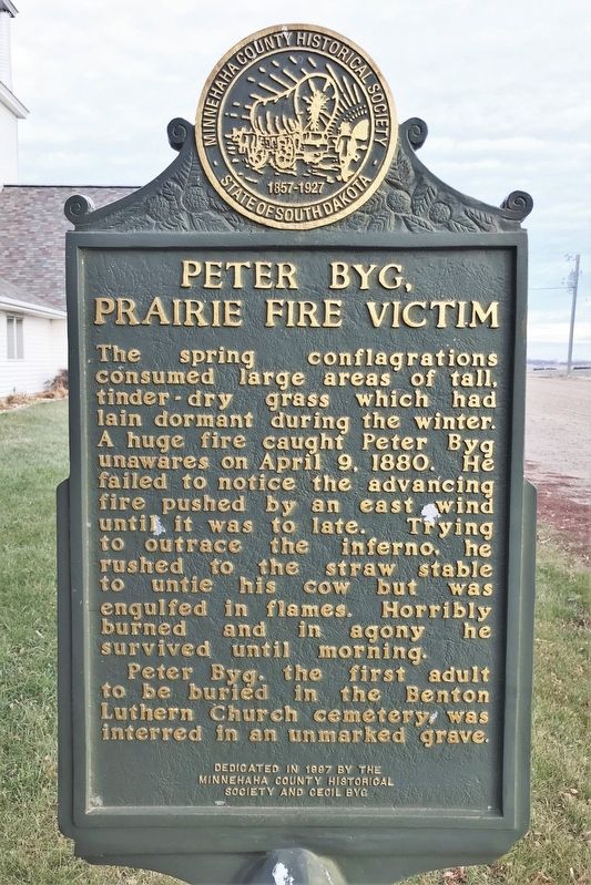
On 257th Street 0.2 miles west of 468th Avenue (County Road 141), on the right when traveling west.
Peter Byg was born near the tiny village of Halk, South Jutland, Denmark. After emigrating to America, in time he settled on a claim located 2½ miles southwest of this spot. He built a sod dugout house where he lived with his wife, Anna Raven, and . . . — — Map (db m187016) HM
On 471st Avenue at 254th Street (County Road 122), on the right when traveling south on 471st Avenue.
The Nidaros Norwegian Lutheran Congregation, the first church in Minnehaha County, was organized by fifty pioneers on August 12, 1868, at the sod home of John and Kirsti Thompson on the west bank of the Big Sioux River about three miles southeast of . . . — — Map (db m187017) HM
On 244th Street 0.3 miles west of 476th Avenue, on the left when traveling west.
On a windy, cold, and damp 3rd of November 1938, the eyes and ears of the nation focused on Dell Rapids, host to the greatest annual competition of American agriculture: the National Corn Husking Contest. An estimated 125,000 people from all over . . . — — Map (db m222273) HM
On East 3rd Street at Washington Avenue, on the right when traveling east on East 3rd Street.
Minnehaha Co. - Population 2145 in 1965
Named after the dells and rapids of the Big Sioux River, which flows through the town and reminded settlers of the dells of the Wisconsin River. First surveyed in 1859 and sub-divided in 1864. . . . — — Map (db m208403) HM
On East 3rd Street west of Washington Avenue, on the right when traveling east.
This caboose was donated to the city of Dell Rapids by L.G. Everist Inc. in appreciation to the Milwaukee Railroad for 100 years of service to the Dell Rapids Community.
The Milwaukee Railroad first arrived in Dell Rapids on September 17th, . . . — — Map (db m208398) HM
On Beach Avenue 0.2 miles south of East 3rd Street, on the left when traveling south.
whose vision and industry led to the establishment of the Dell Rapids Bathing Beach in 1917, this building is respectfully dedicated this 4th day of July, 1934
Built by the Dell Rapids Park Board and the city council in co-operation with the . . . — — Map (db m208405) HM
On 255th Street 0.2 miles west of 255th Street, on the right when traveling west.
In 1908 the Western Bridge and Construction Co. of Omaha, Nebraska, built this Pratt-Through Truss Bridge. Workers fastened beams together with diagonal bracing to create a strong rigid framework. Each beam of a truss bridge shares a portion of the . . . — — Map (db m184708) HM
Near 252nd Street east of 481st Avenue, on the right when traveling west.
Within short distance of this hill of peace eleven original pioneer families came in 1873 to claim the land and to give us birth
Johannes E. Berdahl ·
Mrs. Lars Brandvold ·
C. O. Henjum ·
Synneve Henjum ·
Thor Hermanson ·
Olaus . . . — — Map (db m208421) HM
Side 1 The Reconstruction Finance Corporation (RFC) granted a $410,000 relief loan to South Dakota in 1932, the third year of the Great Depression, Garretson became one of five towns in the county allotted funds.
Its City Council then . . . — — Map (db m188833) HM
On 5th Street (Local Route 5th) 0.2 miles west of Main Street, on the right when traveling west.
Two events in the 1870s in eastern Minnehaha County, Dakota Territory, provided the stimulus leading to the beginning of the town of Garretson. The first was the founding of the now-vanished village of Palisade, often referred to as Garretson’s . . . — — Map (db m69089) HM
Near 252nd Street east of 481st Avenue, on the right when traveling east.
Norway Lutheran Church was established by Norwegian-American pioneers on March 23, 1874 in Minnehaha County, Dakota Territory. They met in sod houses, schools and a lean-to until the building was completed. Land, where the church could be seen and . . . — — Map (db m208420) HM
Near 252nd Street east of 481st Avenue, on the right when traveling east.
This bell that called the people to worship is placed here to the memory of the men and women who endured the dangers and hardships of pioneer life, and still found time and money to build churches for themselves and for those who should follow . . . — — Map (db m208422) HM
Palisades State Park
Palisades State Park began with an initial gift of 20 acres from Mrs. Winona Axtell Lyon in 1947. During the next twenty years, smaller tracts were added to the park as money to purchase them became available. In 1969, . . . — — Map (db m208240) HM
On 252nd Street east of 479th Avenue, on the right when traveling east.
One of the deepest desires of Norwegian immigrants who settled in this area of the Slip-Up Creek was to have a church where they and their children might hear the saving gospel. On December 17, 1873, O. O. Sando, a circuit-riding preacher who served . . . — — Map (db m208419) HM
On Devil's Gulch Park Road 0.5 miles north of 5th Street, on the left when traveling north.
Imagine a fall day in 1876. A man approaches, galloping on his horse as fast as they can go. They are trying to escape a posse after robbing a bank in Northfield, Minnesota. The man has already divided ways with his brother to help evade the lawmen, . . . — — Map (db m187036) HM
Settlers homesteaded in this area beginning in 1865. A feed and flour mill was built in the early 1870's, with power from a large wooden dam across Split Rock Creek east of this marker. A town, complete with three stores, livery barn, blacksmith . . . — — Map (db m208239) HM
On North Main Avenue at West 2nd Street on North Main Avenue.
Dedicated to the men and women of our community who come from every walk of life to serve our country in all wars so that we can enjoy the freedoms of democracy. — — Map (db m182276) WM
On North Main Avenue at West 2nd Street, on the right when traveling south on North Main Avenue.
In 1878 when Hartford was first settled, it was called Oaksville after pioneer I.E. Oaks. The next year, the Worthington & Sioux Falls Railroad extended its line to Salem, South Dakota, and established a station at Oaksville. By 1881, the town, . . . — — Map (db m224417) HM
On 462nd Avenue south of 263rd Street, on the right when traveling south.
Relying on their faith in God, on June 6, 1881, a group of 33 German immigrant families met to establish a church under the leadership of Pastor G. Schmidt. These visionary pioneers bought five acres of land from a farmer named Carl Boy for $10 and . . . — — Map (db m212170) HM
On 457th Avenue (South Dakota Route 19) 0.2 miles south of 249th Street, on the right when traveling south.
Townsite of Hartman was homesteaded in 1878 by John Hartmann, Sr. Town started in January 1899. Hans J. Johnson, Postmaster & General Store; Charles F. Bartling, Creamery; Jarvis W. Phelps, Blacksmith; John and Carl Johnson, Farm Implements; John . . . — — Map (db m183490) HM
On 265th Street (South Dakota Route 42) at 456th Avenue ( Route 19), on the right when traveling west on 265th Street.
On plains where Native Americans once hunted vast herds of buffalo, a country general store called Wellington Corner sprang up at this location in 1921. The first building, which became the ice house, was constructed by Luther and Anna Gage. The . . . — — Map (db m183487) HM
On 1st Avenue north of 4th Street, on the right when traveling south.
The first school in Lyons was built in 1879-80 as a one room building with an entrance. The school was furnished with homemade desks and a blackboard painted on a wall. Construction of a new masonry building started around 1920-21. Because the old . . . — — Map (db m237376) HM
On 249th Street 1.4 miles east of 453rd Avenue, on the right when traveling east.
Doug Horsted died of cancer on January 18, 2000 at the age of 36. An avid sportsman, hunter, and fisherman, he took every opportunity to enjoy the outdoors with family and friends. He especially enjoyed pheasant, waterfowl, and deer hunting on the . . . — — Map (db m205267) HM
On 258th Street (County Road 130) 0.4 miles west of 475th Avenue (State Route 115), on the right when traveling west.
During a round barn building boom in South Dakota, Alfred and Marit Christensen, together with relatives and neighbors, built a round dairy barn one-third mile northeast of this marker. Forty round barns were built in the state between 1903 and . . . — — Map (db m181305) HM
On 258th Street (County Road 130) 0.8 miles west of 475th Avenue (State Route 115), on the right when traveling west.
Lindbergh Landing
Col. Charles A. Lindbergh was the first to fly non-stop from New York to Paris. The 33½-hour solo flight on May 20-21, 1927, in a single engine monoplane, was a phenomenal aeronautical achievement which fascinated the . . . — — Map (db m181301) HM
On 258th Street (County Road 130) at Church Avenue, on the right when traveling west on 258th Street.
Rebuilt 1878 from timbers of wind-wrecked church south from Baltic.
Moved to Baltic 1912.
Moved to Renner 1939.
Oldest church in use in South Dakota. — — Map (db m181290) HM
On 258th Street (County Highway 130) 0.8 miles west of 475th Avenue (State Highway 115), on the right when traveling west.
We fight for our freedom and we fight for peace, one day we might not have to fight at all! You look up to the American flag and you see a flag, I look up to the American flag and I see all the people who gave their lives for freedom.
Becky H. . . . — — Map (db m181304) WM
On 258th Street (County Road 130) 0.8 miles west of 475th Avenue (State Route 115), on the right when traveling west.
Leonard Renner, a German immigrant and a Union Army Civil War veteran, came to Dakota Territory in 1878. He acquired farm land in Mapleton Township. Years later, the Chicago, Milwaukee, St. Paul and Pacific Railroad built a track . . . — — Map (db m181296) HM
On 481st Avenue (South Dakota Route 11) 0.5 miles north of Route 42, on the right when traveling south.
Ole B. Iverson, his father Iver, brother Peter and brother-in-law Andy had no established roads to follow when they came to Dakota Territory in 1868. They had to wade or ford rivers and streams as best they could. These men, from near Decorah, Iowa, . . . — — Map (db m181919) HM
On South Dakota Route 42 west of Douglas Avenue, on the right when traveling east.
In 1874 the first Sunday school was held in the crude dugout home of Madison and Elizabeth Webster. The pupils studied directly from the Bible for several years until additional materials were purchased from a traveling missionary. A Methodist . . . — — Map (db m181619) HM
On South Dakota Route 42 0.6 miles west of 483rd Avenue, on the right when traveling west.
On July 27, 1888, Thomas Ryan of Dubuque, Iowa, purchased land for the Rowena townsite in the SE¼, Section 26, Split Rock Township from Nelson Webster. On October 10, 1888, Ryan platted the town into 43 city blocks and named the streets after . . . — — Map (db m181618) HM
Near North Walts Avenue south of West Bailey Street, on the right when traveling south.
Sponsors:
Disabled American Veterans,
Sioux Falls
Patron: DAV Member Dale Weir
Dedicated to the honor of all who have been called to the service of our country, often at great personal sacrifice. May this sentry always remind us to . . . — — Map (db m207935) HM WM
On Park Access Road 0.6 miles west of South Minnesota Avenue, on the left when traveling south.
Manfred Georg Sigismund Szameit was born in Madüsee, Pomerania, Germany, on September 10, 1936. Three years later, Fuehrer Adolph Hitler ordered Nazi Germany armies to invade Poland. This action greatly worried Manfred's father Heinrich. Concerned . . . — — Map (db m187263) HM
Near South Cliff Avenue 0.2 miles south of East 41st Street, on the right when traveling south.
After a strong coalition of civic organizations urged the city to build Falls Park and to set up a City Specification Committee within the Chamber of Commerce, such a study was conducted in 1967-68. The subsequent transformation of the appearance . . . — — Map (db m197452) HM
On West 22nd Street 0.1 miles west of South Western Avenue, on the right when traveling east.
Beginning in 1873, for four consecutive summers great swarms of grasshoppers riding prevailing winds reached the Midwestern states and territories where they landed and destroyed farmers' field crops. Although several huge clouds of grasshoppers . . . — — Map (db m208637) HM
On Iverson Crossing Road 0.4 miles west of 481st Avenue (State Highway 11), on the left when traveling west.
Long before bridges spanned the Big Sioux River, travelers and settlers forded the river at this location. Pioneer Ole B. Iverson, a Norwegian immigrant, homesteaded here in 1868 and "Iverson Crossing" became a common point of reference and a local . . . — — Map (db m199014) HM
On South Highline Place north of East 18th Street, on the right when traveling south.
On a cold 1936 New Year's Eve about 160 yards west of this spot, there occurred a dramatic and unlikely attempt to commit murder. At 9:35 p.m. a large powder storehouse exploded. Inside were 310 25-pound kegs of powder, over 3000 pounds of . . . — — Map (db m186532) HM
Side A
Since 1872 only one earthquake centered in Minnehaha county has been recorded. A mild quake with an intensity of IV on the Mercalli scale and a magnitude of 4.1 on the Richter scale affected 5000 square miles in this region and 3:37 . . . — — Map (db m133545) HM
USS South Dakota: 17 - 40mm Quad Mounts
Total - 68 Guns
Guns can be operated single fire or
Fully automatic - 120 rounds per minute
Basic gun crew for quad mount:
Mount Capt, Pointer, Trainer,
4-Loaders, 4-Ammunition Passers . . . — — Map (db m146020) HM WM
On West Indian Mound Place, on the right when traveling west.
For several thousand years ancient peoples quarried veins of pure copper in the Lake Superior area. First, they built fires next to exposed raw copper to loosen it from bedrock. Next, they used handheld stone mauls to dislodge chunks of copper that . . . — — Map (db m197252) HM
Near South 4th Avenue west of East Park Drive, on the right when traveling south.
A Park Born in Controversy
Helen McKennan's will, gifting 20 acres of land for a new park, became the center of intense public debate after her death in 1906. She also gave her home, the former residence of Col. Melvin Grigsby, to be sold to . . . — — Map (db m186530) HM
On West 22nd Street, on the left when traveling west.
Side A
During most of the 19th century, few women completed high school
and only daughters of the privileged or well educated had an
opportunity for a higher education. In 1881 seventeen women met
in Boston, Massachusetts, to discuss . . . — — Map (db m97577) HM
The son of a Kentucky frontiersman, Lincoln had to struggle for a living and for learning. Five months before receiving his party's nomination for President, he sketched his life.
"I was born February 12, 1809, in Hardin County, Kentucky. . . . — — Map (db m112639) HM
On East Amidon Street 0.1 miles west of North Cliff Avenue, on the right when traveling east.
About 200 yards southwest of this marker is the location long supposed by historians to be the burial site of Judge Joseph Amidon and his son William, ambushed and killed by Santee Sioux warriors on August 25, 1862. The Sioux war party was under . . . — — Map (db m194668) HM
Near West 18th Street west of South Grange Avenue, on the right when traveling east.
In June of 1894, inspired by tales of marvelous progress in medicine at the 1893 Chicago Columbian Exposition, a small group of Lutheran clergy and laymen banded together to form a hospital association. They organized Sioux Falls Hospital . . . — — Map (db m238362) HM
Near North Walts Avenue south of West Bailey Street, on the right when traveling south.
Captain, U.S. Army, 15th Infantry, 3d Division
Crossing of the Volturno River, Italy, 13 October 1943
G.O. No.: 71, 31 August 1944 Born 20 April 1915, Greenville, Iowa;
Entered service at Toronto, South Dakota
For conspicuous gallantry . . . — — Map (db m208040) HM
(side one)
Settlers arrived in this area in the 1860s. Later they began quarrying its vast deposits of quartzite. East Sioux Falls, a rough-and-tumble quarrymen's town, began in 1887 and flourished for several years. The financial . . . — — Map (db m131971) HM
On West 12th Street (State Highway 42) just west of South Kiwanis Avenue, on the right when traveling east.
On June 7, 1941, Vera Bushfield, wife of the governor of South Dakota, smashed a bottle of champagne against the towering bow of a new battleship and proudly proclaimed, “I christen thee South Dakota!” While an 80 piece band from Sioux Falls’ . . . — — Map (db m40516) HM
Near North Weber Avenue 0.2 miles south of East Falls Park Drive, on the right when traveling south.
In the city's early days, the falls attracted both industry and pleasure seekers. During their leisure time, settlers and visitors enjoyed both the falls and Seney Island
The Island, as it was called by early residents, was an oasis for . . . — — Map (db m124198) HM
On West Algonquin Street 0.1 miles east of North Industrial Avenue, on the right when traveling west.
Following victory in Europe during World War II, the Sioux Falls Army Air Base became a reception center for airmen returning to be redeployed to the war in the Pacific. A twin-engine B-25 bomber, Army 0577, was added to the base fleet. Christened . . . — — Map (db m194613) HM
Mfr - Cramp Shipbuilding Co
Diameter - 17' - 6" Wt - 18.2 Ton
Bu. Eng. Serial No. 6304
USS South Dakota had two - 4 blade
inboard propellers and two - 5 blade
outboard propellers. Thrust from
the four propellers - 130,00 HP . . . — — Map (db m146035) HM
Near South Perry Place 0.1 miles north of State Highway 42, on the right when traveling north.
to start to develop new leaves, branches, or flowers
header:
Phillips Ave and 9th Street, looking North, 1886.
Photo Courtesy of Siouxland Heritage Museums in Sioux Falls, South Dakota.
Decorative
The . . . — — Map (db m199075) HM
On East 24th Street 0.1 miles east of South Bruce Road, on the right when traveling east.
At age 11, William F. Cody was forced to find work after his father died. During his colorful life (1846--1917) Cody was a messenger, Pony Express rider, Civil War soldier, army scout, guide, and Indian fighter. He earned his nickname, "Buffalo . . . — — Map (db m206792) HM
Near East Rice Street 1.5 miles east of North Bahnson Avenue, on the right when traveling east.
Early geologic research into glacial deposits indicated that during the Ice Age there were only four periods of glaciation in North America. Today fourteen episodes of glaciation are recognized. Deposits from five of these episodes are found in . . . — — Map (db m205272) HM
Side 1
Dr. W.H. Over, South Dakota's first archeologist, sketched maps of two 1600s' Omaha earth-hut villages in present-day lower Sherman Park. He also outlined a 51-feet in diameter Omaha dance bowl or circle in the upper park.
. . . — — Map (db m139437) HM
Near North Walts Avenue south of West Bailey Street, on the right when traveling south.
Second Lieutenant, U.S. Army, 17th U.S. Infantry
El Caney, Cuba, 1 July 1898. Date of issue: 21 June 1899
Born Cheyenne Agency, South Dakota
Entered service at Fort D.A. Russell, Wyoming
Gallantly assisted in the rescue of the wounded from . . . — — Map (db m208048) HM
On East River Boulevard 0.3 miles west of South Southeastern Avenue, on the right when traveling west.
A Sioux quartzite ledge, located near this site on the west bank of the north-flowing Big Sioux River, was known to early residents as Cherry Rock. On scorching hot, sultry summer afternoons the more daring used the outcropping as a platform to leap . . . — — Map (db m199867) HM
Side 1
In the first half of the 20th century, periodic epidemics of polio rattled the nation with waves of critically ill patients, terrified parents, and overwhelmed hospitals. The polio virus attacked the nervous system, causing . . . — — Map (db m101278) HM
On East 10th Street (State Highway 42) at South Van Eps Avenue, on the right when traveling east on East 10th Street.
Here stood the landmark Children's Home Society of South Dakota (CHS) "house of stone" orphanage, erected in 1901. Designed by Wallace Dow.
CHS began in 1893, operating out of a rented house in central Sioux Falls, as co-founders William and . . . — — Map (db m208676) HM
On South 2nd Avenue 0.2 miles north of East 26th Street, on the right when traveling north.
Melvin Grigsby enlisted in the Union Army at the age of 16. Captured by the Confederates, he was confined in four different prisons, including the infamous Andersonville prison. After escaping in 1865, he joined Gen. W. T. Sherman's army. Later he . . . — — Map (db m186531) HM
On W. 22nd Street 0.1 miles west of S. Holly Street, on the right when traveling east.
Front Columbus College began in 1909 in Chamberlain. S. Dak., and operated there for 12 years. With the inspiration of Bishop Thomas O'Gorman, the all-male prep school, high school, and college were moved to Sioux Falls and reopened in . . . — — Map (db m92174) HM
On South Perry Place 0.1 miles north of State Highway 42, on the left when traveling north.
to break up soil or prepare the land with a tool for planting; to grow a plant or crop
header:
Photo Courtesy of Siouxland Heritage Museum in Sioux Falls, South Dakota [SHM 92.8.3]
Stone Cutting Tools . . . — — Map (db m199155) HM
Near North Walts Avenue south of West Bailey Street, on the right when traveling south.
The National Society of the Daughters of the American Revolution (DAR) is a nonprofit, nonpolitical, volunteer women's service organization. It is dedicated to promoting patriotism, preserving American history, and securing America's future . . . — — Map (db m241915) HM
On W. 22nd Street at S. Holly Street, on the right when traveling east on W. 22nd Street.
Front Near the beginning of the 19th century two wars were fought in two widely separated Spanish possessions. Men from South Dakota were federal combatants in both conflicts. The 1898 Spanish-American War was fought in Cuba, only 90 miles . . . — — Map (db m92196) HM
On South Perry Place 0.1 miles north of State Highway 42, on the right when traveling north.
to scatter, the natural distribution of seeds, to become widespread
header:Quartzite Quarry
Dell Rapids, 2007.
Quarrying Today
Even though quarry operations have come to an end in East . . . — — Map (db m199076) HM
On W 18th St 0.5 miles west of S. Grange, on the right when traveling west.
The Van Demark name is synonymous with orthopedic surgery in South Dakota. Dr. Guy Van Demark (1879-1963) was the first orthopedic surgeon in South Dakota. 'Dr. Guy' and Irene Fisher Coon, R.N., founded the original specialized crippled . . . — — Map (db m123104) HM
E.A. Sherman is recognized as the father of the Sioux Falls park system. To commemorate his work, J.K. Daniels & the Roman Bronze Works of New York was commissioned to create this bronze portrait in 1917. It was rededicated in Honor of the Park . . . — — Map (db m131976) HM
On West Indian Mound Place 0.1 miles west of South Kiwanis Avenue, on the right when traveling west.
Pioneer archeologist Dr. William H. Over mapped two 1600s' Omaha earth-hut villages located along the nearby banks of the Big Sioux River. He noted that the south village was "a very old site" and that the larger village "lying 500 yds. to the north . . . — — Map (db m197249) HM
On South Perry Place 0.1 miles north of State Highway 42, on the left when traveling north.
to change, to develop gradually to become more advanced and complex
Plant Communities
A plant community is a group of living plant species that all naturally grow together in one location. All the plants in a community share the . . . — — Map (db m199154) HM
Near Sands Street east of 469th Avenue, on the right when traveling east.
This park was made possible by a generous donation of 91 acres of property from the Soukup family to the City of Sioux Falls Parks & Recreation Department in 2009. This site was formerly a gravel mining operation used to supply Soukup Construction . . . — — Map (db m288770) HM
Fashioned of maple logs harvested from the banks of the Big Sioux River near Renner, this rustic home was built by Lars Kvernmo with the help of neighbors John Nelson (one of the first Norwegian immigrants in Minnehaha county) and Ole Gilseth. It . . . — — Map (db m244823) HM
On South Perry Place 0.1 miles north of State Highway 42, on the right when traveling north.
to grow well, to be strong and healthy, especially because conditions are right
header:East Sioux Falls
East Sioux Falls, 1890. Photo Courtesy of Siouxland Heritage Museums [SHM 78.35.32]
Pink . . . — — Map (db m199106) HM
On South Perry Place 0.1 miles north of State Highway 42, on the left when traveling north.
to develop leaves, known as foliage
header:
Photo Courtesy of Siouxland Heritage Museums in Sioux Falls, South Dakota [SHM 92.8.16]
Saloons
East Sioux Falls was filled with quarrymen that needed an . . . — — Map (db m199153) HM
On West Algonquin Street 0.1 miles east of F Avenue North, on the right when traveling west.
Side one:
Two "flying classroom" Lockheed twin engine AT-18 medium bombers collided in midair above the Sioux Falls Army Air Force Base December 8, 1944. Three crewmen, four students on board, and three students in a barracks below were . . . — — Map (db m194621) HM
On East 12th Street west of South Omaha Avenue, on the right when traveling east.
Fort Dakota was established in 1865 at the abandoned Sioux Falls City town site. Regulars of the 22nd U.S. Infantry Regiment were stationed there in 1866. Four men from this regiment died before the fort was closed in 1869. They were buried in the . . . — — Map (db m206795) HM
Near North Walts Avenue south of West Bailey Street, on the right when traveling south.
The President of the United States
in the name of The Congress
takes pleasure in presenting the
Congressional Medal of Honor to
Foss, Joseph Jacob
Captain, U.S. Marine Corps Reserve, Marine Fighting Squadron 121, 1st Marine . . . — — Map (db m208044) HM
On Benson Road at LaMesa Drive, on the right when traveling east on Benson Road.
After emigrating from County Donegal, Ireland, Robert and Lillie Foster settled in a sod house about three miles northwest of this marker in late 1872. Six of their nine children shared the small, primitive home. Within months, two of the children . . . — — Map (db m187458) HM
Near North Weber Avenue 0.2 miles south of East Falls Park Drive, on the right when traveling south.
Quartzite is the stone you see revealed throughout Falls Park. Sioux Quartzite is the local name for his stone. It was also called Jasper. Sioux Quartzite provided both the physical and financial base for the city of Sioux Falls.
Quartzite is . . . — — Map (db m124199) HM
Near South Perry Place 0.1 miles north of State Highway 42, on the right when traveling north.
to produce fruit; the ripened ovaries containing seeds
header:
Federal Building, originally Post Office and Federal Courthouse.
Architectural
Quartzite stone is used today, as it was in the past, for . . . — — Map (db m199074) HM
Near Western Avenue South north of 45th Street West, on the left when traveling north.
On April 30, 1789, George Washington, standing on the balcony of Federal Hall on Wall Street in New York, took his oath of office as the first President of the United States.
Born in 1732, into a Virginia planter family, he learned the morals, . . . — — Map (db m251572) HM
On South Perry Place 0.1 miles north of State Highway 42, on the left when traveling north.
to grow from a seed or spore into a new individual
header:
Photo Courtesy of Siouxland Heritage Museums, Sioux Falls, South Dakota [SHM 41.15.20]
Illinois Central Railroad
In 1887, the quarries at East . . . — — Map (db m199157) HM
Near North Walts Avenue south of West Bailey Street, on the right when traveling south.
"He shall swallow up death in victory.....
And this mortal shall put on immortality."
Isaiah 25:8, 1 Corinthians 15:53
Dedicated to all the men and women who have
sacrificed their lives in defense of the United
States of . . . — — Map (db m208153) WM
Near North Walts Avenue south of West Bailey Street, on the right when traveling south.
This monument honors, recognizes and serves Gold Star Families and the legacy of their Loved Ones who have paid the ultimate sacrifice while serving in the armed forces of the United States of America.
The Homeland panel depicts images . . . — — Map (db m208037) WM
As many as 62 children at a time were taught in this typical one-room schoolhouse. It was the largest and best-equipped school in Minnehaha County when it was built. Winter sessions began after harvest, November or December, with a spring session . . . — — Map (db m244821) HM
Near East Falls Park Drive, on the right when traveling south.
During the City's early years, a number of industries located at the Falls of the Big Sioux River and used the energy produced by the river's flow to run their machinery.
The Queen Bee Mill and the Sioux Falls Light & Power Company . . . — — Map (db m124191) HM
On North Valley View Road north of West Grove Place, on the right when traveling north.
For more than a century, the educational needs of children in this area have been served by six successive schools. On April 17, 1872, the Wayne Township District No. 10 School Board voted to "build a sod school house." Teacher Elsie Barnes held . . . — — Map (db m222306) HM
An early pioneer and land
speculator in Sioux Falls,
Helen McKennan
recognized a need for
city parks. She donated
her home and 20 acres of
adjacent land in 1906 to
become what is now
known as McKennan Park.
Martin . . . — — Map (db m113432) HM
Near North Walts Avenue south of West Bailey Street, on the right when traveling south.
Private First Class, U.S. Marine Corps Reserve
Company C, 1st Battalion, 7th Marines, 1st Marine Division
Chungehon, Korea, 22 April 1951
Born 1 July 1930, Mena, Arkansas
Entered service at Blackhawk, South Dakota
For conspicuous . . . — — Map (db m208046) HM
Near East Falls Park Drive 0.2 miles south of East Falls Park Drive, on the right when traveling south.
The Falls were at the heart of the young city of Sioux Falls — nicknamed the Queen City. The Queen Bee Mill stood at the most powerful point of the Falls and was a center of activity in the 1880s.
The Queen Bee Mill was sited to take full . . . — — Map (db m124190) HM
On West Madison Street 0.1 miles east of North Covell Avenue, on the right when traveling east.
Enraged over the broken promises of the white man, the Santee Sioux, led by Chief Little Crow, launched the "War of the Outbreak" - or "Dakota War" - in August, 1862, along the Minnesota River. Little Crow ordered White . . . — — Map (db m184699) HM
Near North Weber Avenue 0.2 miles south of East Falls Park Drive.
(side 1)
The changing of global sea levels over millions of years was a major factor in determining the ancient geography of Minnehaha County. Through much of geologic time, salty warm-water seas covered the interior of the United . . . — — Map (db m124175) HM
Near North Walts Avenue south of West Bailey Street, on the right when traveling south.
Orderly Sergeant, U.S. Marine Corps,
U.S.S. Ticonderoga
Second battle of Fort Fisher - 13 to 15 January 1865
G.O. No. 59 - 22 June 1865
Born 21 February 1839 - Ephrata, Pennsylvania
Entered service in Pennsylvania
Died 3 November 1900 . . . — — Map (db m208050) HM
On West 39th Street west of South Jefferson Avenue, on the left when traveling west.
After their September 7, 1876, failed attempt to rob a bank at Northfield, Minnesota, Jesse and Frank James separated from the Younger Brothers gang, rode southwest, and entered Minnehaha County, Dakota Territory.
Little direct evidence exists . . . — — Map (db m197202) HM
On South Kiwanis Avenue 0.1 miles south of West 16th Street, on the right when traveling south.
So named by the City of Sioux Falls on June 13, 1932
On May 4, 1932 Kiwanis Club members planted 70 trees along Harvard Ave., one for each club member, from 18th St. north.
In response to this and at the suggestion of Ed Smith, the City . . . — — Map (db m244810) HM
Lady Liberty first graced McKennan Park in 1942 although the statue was not formally dedicated until August 1, 1943. As several thousand watched, twins Thelma and Elma Iverson unveiled a wood carving of the Statue of Liberty. The statue had been . . . — — Map (db m113437) HM
Near South Summit Avenue 0.1 miles south of University Place (West 28th Street), on the right when traveling south.
This stone marks the SW corner of a
Land Grant
by Richard F. Pettigrew and Samuel L. Tate
which assured the building of the
Lutheran Normal School
Dakota Territory • 1889
Augustana College moved to
Sioux Falls and merged with . . . — — Map (db m207103) HM
464 entries matched your criteria. Entries 101 through 200 are listed above. ⊲ Previous 100 — Next 100 ⊳