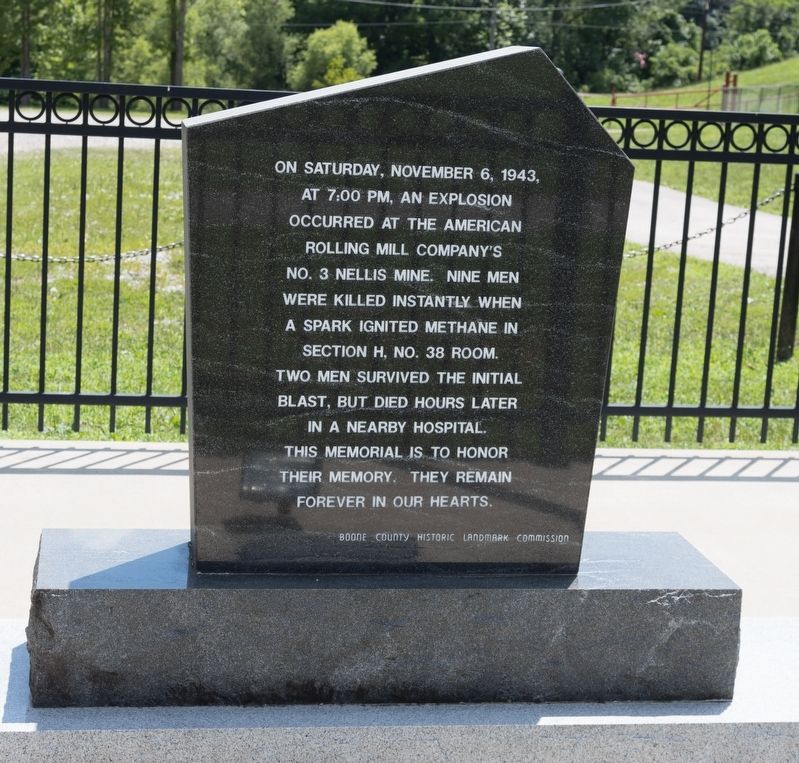
On Memorial Drive near Ridgeview-Nellis Road (County Route 1), on the right when traveling west.
William C. Barker • Julias Domokos • Lester Gunnoe • William H. Gunnoe • O’Dell Linville • Onal O. Miller • John Setliff • Steve Turkovitch • Lawrence J. Vincent • John Williams • William O. Workman
— • —
On Saturday, November 6, . . . — — Map (db m137442) HM
On Daniel Boone Parkway (West Virginia Route 3) 0.1 miles west of Roundbottom Road (Local Route 119/21), on the right when traveling west.
John Peter Salley (Salling) and companions discovered
coal near here in 1742 on their exploring trip from the Greenbrier River. They followed the Coal River to its junction with The Great Kanawha River at St. Albans. — — Map (db m137510) HM
On Daniel Boone Parkway (West Virginia Route 3) 0.5 miles west of the Peytona Post Office on Roundbottom Road (Local Route 119/21), on the left when traveling west. Reported missing.
Under rock overhang across highway was an Indian camp site. Here were found several burials. One occupation, Fort Ancient, dates from A.D. 1400; another, Buck Garden, from A.D. 1000. Pottery and other artifacts were found. — — Map (db m252534) HM
On Daniel Boone Parkway (West Virginia Route 3) 0.5 miles west of the Peytona Post Office on Roundbottom Road (Local Route 119/21).
To the north, birthplace and home
of John Edward Kenna, U. S. Senator
and prominent figure in the early
life of this State. His statue
stands among the notables of other
States in the Hall of Columns in
the national capitol in Washington. — — Map (db m137454) HM
On Daniel Boone Parkway (West Virginia Route 3) at Roundbottom Road (Local Route 119/21) when traveling west on Daniel Boone Parkway.
Named for William Madison Peyton,
father of navigation on Coal River,
who promoted and actively engaged in
coal mining. As chief engineer for the
Coal River Navigation Company, he
locked and dammed Coal River in the
1840’s and made it . . . — — Map (db m137511) HM
On Pond Fork Road (West Virginia Route 85) north of Pondco Hollow Road, on the right when traveling north.
(At base of flagpole on the right)
In memory of
West Virginia Armed Services
who have given the ultimate
sacrifice during the
War on Terror
In remembrance of
the victims
September 11, . . . — — Map (db m272217) WM
On Coal River Road (West Virginia Route 3) at Red Martin Lane, on the right when traveling west on Coal River Road.
War comes to the Big Coal River - Emboldened by a resounding victory against Confederates at Boone Court House (Madison), Union General Cox ordered Federal troops back into the Coal River Valley. This time the target was the Big Coal River. . . . — — Map (db m285300) HM
On Coal River Road (West Virginia Route 3) at Bridge Avenue, on the left when traveling east on Coal River Road.
The Coal River is a tributary of the Kanawha River in southern West Virginia. It is formed near the community of Alum Creek by the confluence of the Big and Little Coal Rivers. The Coal River flows generally northward through western Kanawha County, . . . — — Map (db m137542) HM
On Coal River Road (West Virginia Route 3), on the right when traveling west.
Completed as Sherman District Jr.
High in 1931. Whitesville School
replaced a building that burned
down in 1929. Wysong and Bengston
designed the rare example of high-style Art Deco architecture in the
southern West Virginia coalfields.
Since . . . — — Map (db m137755) HM
On Coal River Road (West Virginia Route 3) just west of Bridge Avenue, on the right when traveling east.
Following the footprint.
Every mine explosion leaves behind a footprint that offers clues to investigators
as to where the blast originated and how the force traveled from the ignition
point. The footprint left behind in the Upper Big Branch . . . — — Map (db m137546) HM
On Coal River Road (West Virginia Route 3) just west of Bridge Avenue, on the right when traveling west.
Monday, April 5
3:01 p.m. Explosion erupts
through the mine, blasting
debris out of the portals and
lasting for several minutes.
The carbon monoxide
monitoring system alarms
and mine fan records show
a major disruption to . . . — — Map (db m137549) HM
On Cial River Road (West Virginia Route 3) west of Bridge Avenue, on the right when traveling west.
This memorial is dedicated to twenty-nine miners who lost their lives in an explosion at the Upper Big Branch Coal Mine on April 5th, 2010 and to all miners who have suffered injury, illness or death as a result of working in the coal industry. This . . . — — Map (db m137751) HM
On Coal River Road (West Virginia Route 3) just north of Bridge Avenue, on the right when traveling north.
1907 Fairmont Coal Company
Monongah No. 6 and No. 8 Mines
Monongah, West Virginia
At 10:20 a.m., December 6, 1907, explosions occurred at the No. 6 and No. 8 mines at Monongah, West Virginia. The explosions ripped through the mines, . . . — — Map (db m285301) HM
On Gauley Turnpike (U.S. 19) at Millstone Run Road, on the right when traveling east on Gauley Turnpike.
Following the Battle of Bulltown, a record of the engagement is this letter transmitted by the Union soldier Captain William H. Mattingly to Colonel Wilkinson at Clarksburg.
Battle of Bulltown
Bulltown, October 13, . . . — — Map (db m309026) HM
Bulltown. Important point in plan of Washington to establish water transportation to West. Salt was made here as early as 1792. Attack of whites in 1772 upon Captain Bull's Indian village here was among the causes of Dunmore's War. . . . — — Map (db m37050) HM
On Gauley Turnpike (U.S. 19) at Millstone Run Road, on the right when traveling east on Gauley Turnpike.
On October 13, 1863, 700 Confederate soldiers assembled on this hillside in preparation for an attack against the Union hilltop stronghold on your left. The Confederate objective was to gain control of a vital link in the strategically important . . . — — Map (db m309022) HM
On Gauley Turnpike at Millstone Run Road, on the right when traveling east on Gauley Turnpike.
On the evening of October 12, 1863, Confederate troops under the command of Colonel William L. Jackson arrived at Falls Mill on the Little Kanawha River a few miles from Bulltown. Union estimates of their number ranged from 700 to 1,000. . . . — — Map (db m309025) HM
On Bulltown Campground Road at Millstone Run Road, on the right when traveling west on Bulltown Campground Road.
[The marker features several images with captions interpreting throughout.]
This stone culvert under construction in the Falls Mill area of old Route 19 allowed Falls Creek to pass under the road — a link in transporting goods produced . . . — — Map (db m309006) HM
On Bulltown Campground Road at Millstone Run Road, on the right when traveling west on Bulltown Campground Road.
Thousands of Union troops poured into western Virginia from Ohio, Indiana, and Pennsylvania in the spring and summer of 1861—the first months of the Civil War. From towns along the Baltimore and Ohio Railroad, some of these troops marched south . . . — — Map (db m309013) HM
On Bulltown Campground Road at Millstone Run Road, on the right when traveling west on Bulltown Campground Road.
Because farming was the major economic activity in the region, social life tended to be organized around the physical site and the requirements and activities of the farm—especially before paved roads were introduced—and to involve those . . . — — Map (db m309004) HM
On Bulltown Campground Road at Millstone Run Road, on the right when traveling west on Bulltown Campground Road.
Built before 1900 in the "saddlebag" style common to central West Virginia, this one-and-a-half-story log house consists of two "pens" or "cribs."
Most of the logs of the left, and presumably older, pen are joined by means of half-dovetailed . . . — — Map (db m309019) HM
On Bulltown Campground Road at Millstone Run Road, on the right when traveling west on Bulltown Campground Road.
This granary is the oldest outbuilding on the farm. Corn was stored here at harvest time, after it had been cut, dried, and shucked, and was used during the winter months to provide food for both people and livestock. Cornmeal was a staple food. . . . — — Map (db m309017) HM
On Bulltown Campground Road at Millstone Run Road, on the right when traveling west on Bulltown Campground Road.
Marker History
The West Virginia state historic marker in-front of you, originally was installed in 1937 beside U.S. 19 at a wayside park. The second location was directly across from Millstone Run Road. The most recent move to this . . . — — Map (db m309002) HM
On Bulltown Campground Road at Millstone Run Road, on the right when traveling west on Bulltown Campground Road.
Built around 1883, this two-story log structure was owned by the Johnson family until it was purchased by the U. S. Army Corps of Engineers in 1972.
Its most unusual architectural feature is the cat-and-clay chimney made of wooden slats . . . — — Map (db m309020) HM
On Bulltown Campground Road at Millstone Run Road, on the right when traveling west on Bulltown Campground Road.
Typically, a “breastworks” is an improvised and more or less temporary form of fortification. The Union breastworks at this site are now marked by a shallow ditch just below and circling the crest of the hill.
Archeological excavations in . . . — — Map (db m309015) HM
On Bulltown Campground Road at Millstone Run Road, on the right when traveling west on Bulltown Campground Road.
After visiting this site in 1914, a former resident of the Bulltown area described childhood memories of the abandoned Union encampment, long after the Civil War had ended (Reported in the Braxton Central, May 1, 1914):
On Bulltown Campground Road at Millstone Run Road, on the right when traveling west on Bulltown Campground Road.
On the evening of October 12, 1863, Confederate troops under the command of Colonel William L. Jackson arrived at Falls Mill on the Little Kanawha River a few miles from Bulltown. Union estimates of their number ranged from 700 to 1,000. . . . — — Map (db m309010) HM
On Bulltown Campground Road at Millstone Run Road, on the right when traveling west on Bulltown Campground Road.
Constructed of yellow poplar logs in 1878-1879, St. Michael’s was one of three small Catholic churches that together formed the “Weston Missions,” administered by the pastor of St. Patrick’s Church in Weston.
In 1884, administrative . . . — — Map (db m309008) HM
On Bulltown Campground Road at Millstone Run Road, on the right when traveling west on Bulltown Campground Road.
The control of Bulltown meant the control of part of the Weston and Gauley Bridge Turnpike, including the nearby covered bridge that carried the turnpike across the Little Kanawha River. In a mountainous region where communication and . . . — — Map (db m309016) HM
On Bulltown Campground Road at Millstone Run Road, on the right when traveling west on Bulltown Campground Road.
Occupied by Union pickets, or sentries, these outlying rifle pits are located 800 feet north of the main entrenchments. Designed to provide Union forces with a means of early warning in the event of attack from the north, the northeast, or from . . . — — Map (db m309011) HM
On Gauley Turnpike (U.S. 19) at Millstone Run Road, on the right when traveling east on Gauley Turnpike.
During the Battle of Bulltown, on October 13, 1863, seven soldiers under the command of Colonel William Jackson were killed and soon after buried on the battlefield. In 1889, one Milton Butcher, whose farmland included a portion of the . . . — — Map (db m309024) HM
On Bulltown Campground Road at Millstone Run Road on Bulltown Campground Road.
The well at this site is the only feature inside the Union fortifications that can be clearly identified. Located just north of the main fortifications, it was—and until recently continued to be—a source of drinking water.
The well helped . . . — — Map (db m309012) HM
On Bulltown Campground Road at Millstone Run Road, on the right when traveling west on Bulltown Campground Road.
Although this specie[s] of combatant, Union or Confederate, was in most cases only a determined local partisan obsessed with opinions of patriotic self-sufficiency, he was sometimes the social scum of the community… [The bushwacker] made no . . . — — Map (db m309007) HM
On Bulltown Campground Rd at Millstone Run Road, on the right when traveling west on Bulltown Campground Rd.
West Virginia Railroads, Roads, Rivers And Towns In 1861
This map shows the locations of all the major mid-nineteenth-century transportation routes in what is now West Virginia. The major transportation routes were the James River and . . . — — Map (db m309003) HM
On Bulltown Campground Road at Millstone Run Road, on the right when traveling west on Bulltown Campground Road.
The original Weston and Gauley Bridge Turnpike ran along the ridges and hills of western Virginia and was the only important north-south road in this region. It stimulated commerce and population growth in many of the towns through which it . . . — — Map (db m309021) HM
On Bulltown Campground Road at Millstone Run Road, on the right when traveling west on Bulltown Campground Road.
Distance: 10.5 miles
History
The Weston and Gauley Bridge Turnpike served as an early transportation route for developing commerce in Braxton and surrounding counties. Both Union and Confederate forces transported equipment and . . . — — Map (db m309018) HM
Braxton County Formed in 1836 from Lewis, Kanawha, and Nicholas. Named for Carter Braxton, signer of the Declaration of Independence. Washington planned to establish important point in project for western communication in this county. Gilmer . . . — — Map (db m73419) HM
On 5th Street (West Virginia Route 5) at Wabash Avenue ( Route 5), on the left when traveling west on 5th Street.
Remembering those whom have paid the ultimate sacrifice protecting our country and the freedoms we love
KIA
***SSgt Ray L. Ball-Army, WWII, ΚΙΑ •
*Pvt Solomon H. Brown-Army, WWI, KIA •
*SSgt Ward Byrne-Army, . . . — — Map (db m291225) WM
On Bridge Street (West Virginia Route 5) at S. Wabash Avenue, on the left when traveling west on Bridge Street.
Area first settled in 1798; Payton Byrnes came in 1830. First known as Lumberport in 1866, when Capt. John Burns established first saw mill in area. Incorporated by county in 1902 and named for Burns. — — Map (db m50025) HM
Dedicated to the memory of all Paratroopers and Gliderman who spearheaded all major invasions by dropping behind enemy lines to secure military objectives. "Lest We Forget" whose courage, dedication and traditions make them America's finest. — — Map (db m70903) WM
On Elk Street (West Virginia Route 4) south of 5th Street, on the right when traveling south.
Proud tribute is here paid to Gassaway community members who answered the call to the colors in
World War II
1941 -1945
☆ ☆ ☆
Korea 1950 - 1955
Vietnam 1961 - 1973 — — Map (db m281021) WM
On Elk Street (West Virginia Route 5) at 5th Street, on the right when traveling south on Elk Street.
Proud tribute is here paid to Gassaway community members who answered the call to the colors in World War II 1941 - 1945.
Joe Alderman • Harry Adkins • Don Ankrum • Jack Alderman • Leo Ankrum • Robert Ankrum • Vernice Joe Ankrum • Jim . . . — — Map (db m309043) WM
On Elk Street at 5th Street, on the right when traveling south on Elk Street.
Honoring all who serveed.
Flag Etiquette
1. Never lower the flag to anything or person.
2. Only fly it upside down if in distress.
3. Do not use the flag as a covering, drapery, or decoration of any kind. Red, white, . . . — — Map (db m309047) WM
On Elk Street at 5th Street, on the right when traveling south on Elk Street.
Korea 1950-1955 / Vietnam 1961-1973
Ables, Wesley H. • Ables, Rondle L. • Ables, William E. • Adams, Norman E. • Ankrom, Donzell L. • Ankrom, Leo R. • Argabrite, Ernest C. • Allbright, Jimmie D. • Bailey, Jack L. • Belknap, Freddie K. • . . . — — Map (db m309501) WM
On Elk Street at 5th Street, on the right when traveling south on Elk Street.
Donated to town of Gassaway in early 1900's by daughter of Henry Gassaway Davis.
Originally located on Elk St. across from Gassaway Midland Co. (formerly Stanard Co.)
Later moved to Hank Lough property on Chapel Road. Presented to the town in . . . — — Map (db m309045) HM
On Gauley Turnpike (U.S. 19) at Corley Caress Road, on the right when traveling north on Gauley Turnpike.
On October 13, 1863, Confederate troops under Col. W. L. "Mudwall" Jackson attacked Union forces at Bulltown, where they were repulsed by elements of the 6th and 11th WV infantries. Compelled to withdraw, Jackson’s men retreated to Salt Lick Bridge . . . — — Map (db m161248) HM
On Airport Road (West Virginia Route 15) at Braxton County Cemetery Road, on the right when traveling north on Airport Road.
James H. Payne • Donald D. Workman • Billie Jack Miller • Howard M. Simmons • Edward Lane • Paul Dale Karickhoff • Ronald V. Wood • Lilburn Helmick • Billie B. Helmick • James William Thompson • Ernest L. Davis • Floyd Earl Rhodes • James Hugh . . . — — Map (db m308997) WM
On the hill in front of you are two fortifications that Union Gen. George B. McClellan ordered constructed late in1861. They guarded the wooden covered bridge located here on the Weston and Gauley Bridge Turnpike. In October 1863, Capt. William H. . . . — — Map (db m58727) HM
The coal-and-wood house, a rectangular building constructed of rough saw-mill lumber, stood here. After the introduction of gas heating, the building was used for general storage.
Bulltown families traditionally gathered wood for their stoves in . . . — — Map (db m229228) HM
In time the Cunninghams built a granary, barns, coal-and-wood house, outhouse, and chicken house, in addition to the main house, to form a traditional central West Virginia subsistence farm. It was on the Cunningham farmstead, in 1861, that Union . . . — — Map (db m229231) HM
Named for Henry Cunningham, the Cunningham House was owned by the Cunningham family from the time it was built in the early nineteenth century until 1976, when it was purchased by the U. S. Army Corps of Engineers.
The original building was a . . . — — Map (db m229232) HM
The food cellar served as a combination refrigerator and extended pantry. Because most families grew most of their own food, they needed a large storage area.
Meats and fruits, vegetables and other harvested foods were canned, pickled, or dried . . . — — Map (db m229233) HM
The McCauley Barn was built in the nineteeth century. The original structure was rectangular and had, as it has now, a loft and a gable roof.
D. W. "Joe" McCauley purchased the barn in 1928 and, in 1933, added a three-stall horse shed along the . . . — — Map (db m229234) HM
The main purpose of the spring house, which was built over a natural spring, was to provide a family with fresh, sanitary drinking water. The water was either pumped or dipped by hand, as needed.
The spring house was also a source of . . . — — Map (db m229229) HM
On Main Street east of 3rd Street, on the right when traveling east.
In Memorium
Brigadier General
James Kemp McLaughlin
1918-2019
Braxton County Native
WWII Veteran 1941-1945
Piloted 39 Combat Missions
8th Air Force
Founder & Commander
W.Va. Air National Guard
1947-1977 . . . — — Map (db m281226) WM
On Main Street 0.1 miles east of Camden Avenue ( Route 4), on the right when traveling east.
On December 29, 1861, Confederate partisans attacked a company of the 1st West Virginia Cavalry at Sutton. After ammunition ran low, the Federals left with part of the Confederate force in pursuit. When the Confederates returned, they found the town . . . — — Map (db m173334) HM
On Main Street (County Highway 19/40), on the right when traveling east.
The scenic Elk River now flows peacefully before you, but in 1861, the conflict raged here. That year, Col. Erastus B. Tyler's 7th Ohio constructed earthworks near this location to protect an important suspension bridge. About 100 men of Capt. . . . — — Map (db m208238) HM
Panel 1
How Did Braxton County Get Its Name?
Ten years after Sutton was incorporated, Braxton County was formed in 1836. The new county was named after Carter Braxton, a signer of the Declaration of Independence. The Town of Sutton . . . — — Map (db m173346) HM
On Main Street west of 3rd Street, on the right when traveling west.
Honoring Revolutionary War Soldiers and Patriots buried in Braxton County.
Andrew Skidmore, 1750-1827 • Charles Francis Boggs Jr., 1754-1837 • Jacob Fisher 1763-1846 • Peter Shields, 1755-1832 • John Dobbins 1747-1833 • Patrick Murphy, . . . — — Map (db m179591) WM
On Main Street east of 3rd Street, on the right when traveling east.
(Preface):
On April 20, 1863, Confederate Gens. William E. "Grumble" Jones and John D. Imboden began a raid from Virginia through present-day West Virginia against the Baltimore and Ohio Railroad. Taking separate routes, they . . . — — Map (db m281228) HM
On Main Street at Camden Avenue ( Highway 4), on the right when traveling east on Main Street. Reported permanently removed.
In 1861, Col. Erastus B. Tyler’s 7th Ohio Infantry constructed earthworks near Suttonville to protect the suspension bridge across the Elk River. Later in the year, Capt. Weston Rowand’s Co. K, 1st Virginia Cavalry (US), about a hundred men, . . . — — Map (db m58728) HM
On Main Street at 3rd Street, on the right when traveling east on Main Street. Reported permanently removed.
(Preface) On April 20, 1863, Confederate Gens. William E. “Grumble” Jones and John D. Imboden began a raid from Virginia through present-day West Virginia against the Baltimore and Ohio Railroad. Taking separate routes, they later . . . — — Map (db m252259) HM
On Main Street west of 3rd Street, on the right when traveling west.
Boggs, Clarence H. • Brown, Solomon • Buckner, Thomas • Carr, Benjamin H. • Clayton, Harry • Clowser, David • Conley, John P. • Craft, John E. • Criss, Guy Harley • Cutlip, William I, • Dobbins, Thomas • Dulin, Edwin L. • Exline, Oscar • Fisher, . . . — — Map (db m179590) WM
On Old Turnpike Road (Local Route 19/40) at Centralia Road (Local Route 17), on the right when traveling north on Old Turnpike Road.
The geographic center of the irregular-shaped state of West Virginia is near this point, according to accepted methods of locating centers of geographic areas. It was also West Virginia's center of population in 1860. — — Map (db m173331) HM
On West Virginia Route 2 at Park Avenue, on the right when traveling south on West Virginia Route 2.
Near here stood Beech Bottom Fort, which was with Fort Pitt and Fort Henry in the group of posts guarding the western borders during the Revolution and its attendant Indian wars. Troops from Fort Pitt helped garrison this important fort. — — Map (db m54915) HM
On River Road (West Virginia Route 2) 0.2 miles north of Caroline Avenue, on the left when traveling north.
On land near here was state's first military airfield, home to the West Virginia Flying Corps. Founded in April 1917 by Louis Bennett Jr. and backed by state and private funds, the corps was modeled after the French Lafayette Escadrille with the . . . — — Map (db m176858) HM
On Main Street (West Virginia Route 67), on the right when traveling west. Reported missing.
Here lived the leading influence in America's largest indigenous religious movement, Christian Church (Disciples of Christ), and founder of Bethany College. Built in four periods: the John Brown Mansion, completed in 1793; Buffalo Seminary, in 1819; . . . — — Map (db m20826) HM
Born in Prince Edward Island, Canada, September 4, 1849
Died December 15, 1920
Fourth President of Bethany College
For thirty-nine years Chief Executive of the
Foreign Christian Missionary Society
Every missionary sent to . . . — — Map (db m20836) HM
On Main Street (West Virginia Route 67) 0.2 miles east of Route 88, on the right when traveling east.
Bethany
Here Scots-Irish Alexander Campbell founded a religious movement which he called the Disciples of Christ. In this place Amos Dolbear perfected parts of the telephone, and longtime Speaker of the House "Champ" Clark, Supreme Court . . . — — Map (db m79899) HM
On Main Street (Route 67) at Fairway Street, on the right when traveling east on Main Street.
Bethany
Bethany College, established here in 1840, oldest school of college rank in State. The home and the study of Alexander Campbell, founder, are here. Prof. A. E. Dolbear here perfected parts of the telephone, which Bell used.
. . . — — Map (db m79900) HM
On Main Street at Church Street, on the right when traveling east on Main Street.
Bethany Church of Christ, the oldest church building in Bethany, was built in 1852 according to plans drawn by Alexander Campbell, founder of Bethany College and leader in the Disciples Movement. Its foundation is built of stone from the original . . . — — Map (db m20830) HM
On Main Street (West Virginia Route 67), on the right when traveling east. Reported missing.
Here are buried the Campbell family; the first missionaries, other prominent leaders in the Disciples Movement, presidents and distinguished teachers of Bethany College. The seven foot hand hewed stonewall is a unique feature of Cemetery. — — Map (db m20963) HM
On Main Street (West Virginia Route 67), on the right when traveling east.
In this house, 8 Bethany College Students - William Cunningham, John Johnson, Alexander Earle, Richard Alfred, Eugene Tarr, Henry Bell, John Hunt and Jacob Lowe - Met in 1858 and founded Delta Tau Delta. This social fraternity soon spread across the . . . — — Map (db m20849) HM
A major grant from the Renner Foundation, which was matched by alumni gifts, made possible, in 1970, the complete remodeling of Bethany House built in 1948. Henry Clay and James A. Garfield were among the notable guest at the first Bethany House . . . — — Map (db m79901) HM
Born in County Down, Ireland, Feb. 1, 1763, and died at the residence of his son Alexander, Jan. 4, 1851, aged 91 years, 11 mthns, five days. Many years a minister of the Secession Presbyterian Church in Ireland and Scotland. In the United States . . . — — Map (db m20835) HM
Near Harmon Creek Road 0.7 miles east of Mechling Hill Road ( Route 12), on the left when traveling east.
Brooke County, West Virginia
World Championship Boxing Match
Joe Goss - Champion
(England, 180 lb., 52 years old)
vs
Patty Ryan - Challenger
(American, 180 lb., 28 years old)
Winner after 87 rounds, Patty Ryan
(Ryan . . . — — Map (db m298963) HM
On Pennsylvania Avenue just east of Boyd Road ( Route 5), on the right when traveling east.
In honor of each member of all faiths of this community who so heroically served in the Armed Forces and dedicated to the sacred memory of those who sacrificed their lives for democracy, peace and justice — — Map (db m298866) WM
Near Eldersville Road (West Virginia Route 27) at St. John's Road, on the right when traveling west.
Founded in 1793 by Joseph Doddridge. It is the first Episcopal Church west of the Alleghenies and the oldest continuous worshipping congregation within this religious body in West Virginia. The first church, made of logs, was burned by Indians. . . . — — Map (db m79897) HM
On Main Street (West Virginia Route 2) at Raymond Street, on the right when traveling north on Main Street.
This monument was dedicated by American Legion Post 45 on Memorial Day May 25, 1998 to honor our heroes who served
in World War I - World War II - Korea - Vietnam
Granada - Lebanon - Panama and the Persian Gulf — — Map (db m223836) WM
On Main Street (West Virginia Route 2), on the right when traveling north.
John Decker built a fort of logs and stone on a site just north of State St. near Ohio River, 1774. Leaden bullets and arrowheads found here on the river bank signify Native American attack on the fort from Mingo Island. — — Map (db m21605) HM
On Main Street (West Virginia Route 2) at Raymond Street, on the right when traveling north on Main Street.
This flag pole is dedicated to the memory of
Joseph "Joey" Perito
who died for our freedom during the Vietnam War in the U.S. Army — — Map (db m223725) WM
On Main Street (West Virginia Route 2) at Raymond Street, on the right when traveling north on Main Street.
Dedicated to the honor and sacrifice of our men and women of Cross Creek District who honorably served our country in all wars
☆ ☆ ☆ ☆ ☆
This memorial is erected in grateful remembrance to those the living . . . — — Map (db m225649) WM
On Main Street (West Virginia Route 2) at Raymond Street, on the right when traveling north on Main Street.
WACs Army •
WAVES Navy •
WAF Air Corps •
AWRS Marines •
SPARS Coast Guard •
WASP Air Service Pilots •
Nurses Corps •
Red Cross Salvation Army •
Gold Star Mothers •
U S O •
Women Defense Workers •
Women Air Raid Wardens — — Map (db m223708) WM
On Archer Hill Road near Route 2, on the right when traveling west.
Village of Power. Built to house employees of the Windsor Power Plant, the village of Power consisted of 100 homes along tree-lined streets, a post office, and a company-owned store. There also was a fulltime doctor. Residents gathered at the . . . — — Map (db m285130) HM
On Military Drive 0.1 miles south of Marshaling Yard Drive, on the right when traveling south.
In memory of
Joseph Robinson
who made the Supreme Sacrifice
and
the following members of the
Weirton Heights Volunteer Fire Dept.
who served their country in World War II
Ray Poland • John Ritchie • Obie Phebus • Robert De . . . — — Map (db m155999) WM
On Military Drive just south of Marshaling Yard Drive, on the right when traveling south.
In memory of those who perished September 11, 2001 during the Attack on America
Steel Beams from the World Trade Center New York City
Weirton Steel Corporation presented these World Trade Center steel beams to . . . — — Map (db m160900) WM
Near Military Drive 0.1 miles south of Marshaling Yard Drive, on the right when traveling south.
In memory of
William "Bill" Courtney (1950 - 2010)
Husband ~ Father ~ Brother ~ Friend
Patriot
27 years military service
Forever in our hearts
U.S. Navy
U.S. Air Force — — Map (db m155996) WM
On Charles Street at 6th Street, on the left when traveling north on Charles Street.
Constructed by Alexander Wells at
65 Washington St., Buffaloe, Virginia
(present day Third St.,
Wellsburg, West Virginia)
The Wells Log House was, and is, in the
“National Register of Historic Places”
District of . . . — — Map (db m21634) HM
4266 entries matched your criteria. Entries 201 through 300 are listed above. ⊲ Previous 100 — Next 100 ⊳