The Bellevue Transformation
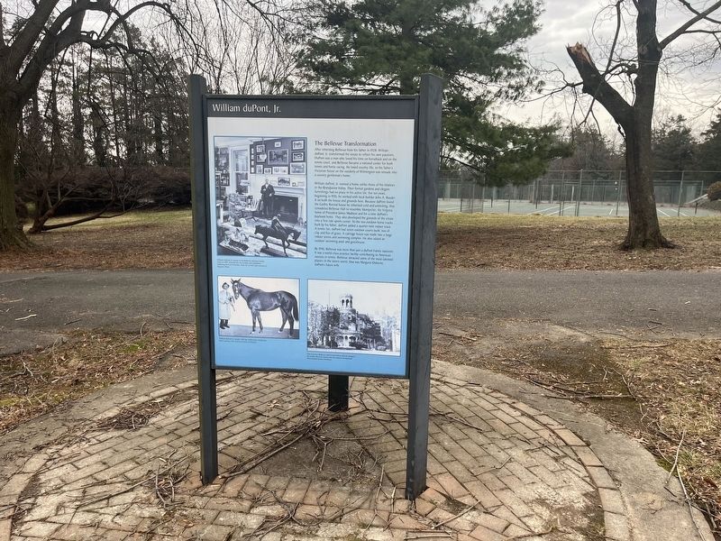
After inheriting Bellevue from his father in 1928, William duPont, Jr. transformed the estate to reflect his own passions. DuPont was a man who loved his time on horseback and on the tennis court, and Bellevue . . . — — Map (db m240848) HM
Known in its early days as the "Presbyterian Church at Christiana Bridge," this congregation was organized in the 1730s. A church structure was built on this site soon after and a graveyard was established by the mid-18th century. Rev. Charles . . . — — Map (db m145161) HM
Formal education for African American children in Christiana began in the 1880s with the construction of a one-room schoolhouse. Many African American schools in existence at this time were marked by dilapidated facilities, a lack of running water, . . . — — Map (db m145173) HM
The origin of this congregation may be traced to the earliest days of Methodism in America. In March, 1771, Joseph Pilmore, one of the first Methodist missionaries from England, preached outdoors at Christiana. Upon returning in 1773, Pilmore noted . . . — — Map (db m145164) HM
General Lafayette enroute to Virginia, to command expedition against Benedict Arnold, landed 1500 troops here, with cannon, stores, and ammunition, March 2, 1781. Council of Maryland issued warrant to impress carriages, teams and drivers for his use . . . — — Map (db m145051) HM
An Act of the Second Continental Congress established the Delaware Regiment on December 9, 1775. Delawareans were eager to fight for independence from Great Britain, and the regiment quickly grew to over 700 men in 1776. The regiment was initially . . . — — Map (db m145050) HM
In 1813 a group of African-American Methodists led by Peter Spencer formed an independent denomination that came to be known as the African Union Church. It was the first incorporated religious body in the United States controlled entirely by . . . — — Map (db m145162) HM
Operated flour mill one-fourth mile south. Was captain in French and Indian War. In American Revolution was member of Boston Relief Committee, colonel of Delaware battalion of famous "Flying Camp," Brigadier General of Delaware militia and first . . . — — Map (db m67210) HM
Colonel George Talbot , cousin of Lord Baltimore, in defiance of William Penn's claim to Delaware, erected a fort nearby, 1684, on land of the Widow Ogle. Talbot dispossessed settlers between here and Iron Hill who refused to acknowledge Baltimore . . . — — Map (db m145052) HM
Colonial River Port and Crossroads
A National Historic District
1684
[reverse side]
Named for Queen Christina of Sweden
Home of Col. John Read
Landing of Marquis de Lafayette and 1500 Troops. March 1781
Major colonial . . . — — Map (db m145361)
This was once the home of John Jakob Raskob (1879-1950), financier, DuPont and General Motors executive, Chairman of the Democratic National Committee, and developer of the Empire State Building. Known as "The Patio," his palatial home was . . . — — Map (db m14697) HM
The roots of this congregation can be traced to 1843 and the missionary efforts of Rev. Greenbury W. Ridgely and the Rt. Rev. Alfred Lee, who conducted services every other Sunday in the Claymont Stone School. The church was accepted into the . . . — — Map (db m154091) HM
Also known as Naaman's Creek School No. 1, THE CLAYMONT STONE SCHOOL was built on land donated by John Dickinson, the "Penman of the American Revolution," in 1805. The building was expanded and renovated in 1905. Evidence suggests that it may have . . . — — Map (db m146379) HM
John Grubb, one of the original English settlers in Delaware, acquired a one-third interest in a 600 acre tract of land at this location in 1680. Several generations passed and the Grubb family greatly increased their land holdings in the area and . . . — — Map (db m146375) HM
The industrial expansion of Brandywine Hundred in the late 19th and early 20th centuries was largely reflective of national trends in the growth and development of heavy industry. As large corporations moved to locations outside of major cities, . . . — — Map (db m154138) HM
To those who have
served in peace, we are
thankful for their
steady watch and
perseverance. To those
who have seen battle,
we know there are no
unwounded comrades
Those who gave their
lives that others may
live . . . — — Map (db m154166) WM
Constructed 1924-25. Also known as the Green Street School. Prominent in United States history as the first public high school in the 17 segregated states to be legally integrated.
In January 1951, eight black students applied for admission. Due . . . — — Map (db m14705) HM
The oldest portion of this structure is believed to have been built circa 1730. In the 1740s the house and surrounding property were sold to Philadelphia merchant Thomas Robinson. Other holdings included a milling operation and landing on nearby . . . — — Map (db m14704) HM
The home of world-renowned illustrator Felix O.C. Darley (1822-1888). Built in the late 18th century and enlarged several times during the first half of the 19th century, the house was purchased by Darley in 1863 and renamed "The Wren's Nest." . . . — — Map (db m14137) HM
In honor of the men and women of Worthland community who served in the Armed Forces in the World War II
Anderson, Clarence M. •
Baker, Ira •
Banke, William R. •
Barnes, John W. •
Bevando, John J. •
Bierley, Levi •
Bryson, . . . — — Map (db m240920) WM
In 1835 five trustees of the African Union Church purchased this half acre of land for $80, thereby establishing a church, now razed, and cemetery. Throughout its active years the church and cemetery served the residents of Polktown, one of the . . . — — Map (db m244708) HM
By the turn of the century, Fort Delaware had become part of a coastal defense system, linking Fort Mott in New Jersey and Fort Dupont in Delaware. Batteries* Hentig and Dodd, which each housed two rapid-fire guns, were intended to furnish . . . — — Map (db m21662) HM
Although the idea of a waterway crossing the upper Delmarva peninsula was suggested in the 1600s, the canal did not become a reality until 1829. Over 2,600 workers, including many Irish immigrant and African-American laborers, dug the canal with . . . — — Map (db m174514) HM
Fort DuPont’s chapel was constructed in 1941 to meet the spiritual needs of soldiers preparing to go abroad. The spire on this chapel indicates its non-denominational status.
The Army considered wooden structures “temporary.” Most of the wooden . . . — — Map (db m156151) HM
In 1847, the Reverend Andrew F. Freeman and the Reverend Thomas F. Billop were appointed as a committee to organize and solicit subscriptions for a Protestant Episcopal church in Delaware City. The parish was formally organized on May 28, 1848, . . . — — Map (db m10208) HM
The British attack on Lewes, Delaware, during the War of 1812 demonstrated the need for forts to protect the Delaware River and the ports of Wilmington and Philadelphia. The War Department recognized Pea Patch Island's strategic location and . . . — — Map (db m174520) HM
This building, formerly known as Delaware City School #118C, served as a school for the African American students of Delaware City between the years of 1922 and 1961. During these years 13 teachers taught over 300 students. — — Map (db m174522) HM
Constructed in 1910 at the head of Officers Row, the Commanding Officer Quarters sits on what was once Delaware City farmland.
The building is prominently located on the north corner of the Parade Ground, a highly visible and dominating . . . — — Map (db m189100) HM
These brick were brought from England in the 17th Century and used in the construction of Lord Fairfax Mansion at Belvoir, Virginia, 1736. — — Map (db m174452) HM
March 17, 1887 First Organized;
January 23, 1889 Delaware City Hose Co.;
July 9, 1924 Reorganized Delaware City Fire Co. No. 1;
January 29, 1926 Incorporated;
November 7, 2004 815 Fifth St. — — Map (db m140485) HM
In the years prior to WW II, many of the local citizens were watermen and made their living from the river. If a boat crew was in distress and needed assistance, other boat owners from town would navigate their craft to make the needed rescue. . . . — — Map (db m189888) HM
In 1919 Delaware radically altered its state school system, opening a new era in the education of African-American youth. Progress was stimulated by the efforts of the Delaware School Auxiliary Association and its primary supporter, P.S. duPont, who . . . — — Map (db m10445) HM
In 1914, the Equal Suffrage Study Club, founded by and for African American women, encouraged the public to campaign for women's voting rights and inclusion of African American women. This club was one of Delaware's most active suffrage . . . — — Map (db m205501) HM
The river marshes around Delaware City provided the ideal habitat for fishes, waterfowl and muskrats. In the 1800s, local residents thought this wildlife would always be available and abundant.
The harvesting of fish and birds in excessive . . . — — Map (db m174497) HM
As operations at Fort Dupont continued to expand, so did the need for additional housing.
The solution? Utilize surplus housing from nearby Fort Mott, New Jersey, which was in caretaker status. In December 1931, the 1st Engineers rolled . . . — — Map (db m174451) HM
This fort was originally established in 1863 as the Ten Gun Battery opposite Fort Delaware. In 1897 construction began on concrete gun batteries armed with long-range rifles, rapid-fire rifles and mortars. The fort was renamed in honor of Rear . . . — — Map (db m140397) HM
The U.S Army’s World War II XIII Corps (Dec ’42-Sept ’45) stationed its headquarters at Ft. DuPont (May ’43-June’44) prior to transferring to Eto. XIII Corps troops reached the Elbe River, near Tangermunde, Germany, in April 1945, the closest that . . . — — Map (db m140451) WM
Ten separate granite block formed each gun embrasure. Granite could absorb the shock of enemy fire, and thus protect the troops within the fort's walls. The iron shutters on the outside of the embrasure were designed to shield the gun crews from . . . — — Map (db m174814) HM
Just a half-mile off Delaware City's Battery Park, Pea Patch Island is home to a large colony of herons in America. While Fort Delaware occupies the southern end of the island, nine species of wading birds have settled on the marshy, forested . . . — — Map (db m189915) HM
Delaware City’s story begins in 1801 when the Newbold brothers, Barzilla, Clayton, and John, of New Jersey, acquired 1600 acres of land on the Delaware River, John Newbold built a wharf that became a center for trading and shipping grain, giving . . . — — Map (db m189478) HM
Through his leadership Pea Patch Island was returned to the State of Delaware by the Federal Government in 1948. He was the founder and first president of the Fort Delaware Society, January 1950 and was elected chairman of the board in 1956. — — Map (db m10207) HM
Fort DuPont State Park
Tucked beneath the northern foot of Reedy Point Bridge, Fort DuPont is one of the last open riverfront areas left in northern New Castle County. Once farmland, the site has been dedicated to defending the Delaware . . . — — Map (db m174456) HM
This bridge is named for local heroine Michelle Newton Smith, an Emergency Medical Technician with the Delaware City Fire Co. Smith, who dedicated her life to helping others, was aiding an injured motorcyclist along U.S. 13 when she was struck by an . . . — — Map (db m213305) HM
Officers Row was a home to commissioned officers and their families. The road was the originally the Henry farmhouse driveway leading from the canal (bottom left). The fountain replaced the “triangle” between Officers Row, Elm and Maple. The . . . — — Map (db m140434) WM
Delaware City was founded in 1826, in anticipation of the opening of the Chesapeake and Delaware Canal. The town was incorporated in 1851. The benefits of proximity to the canal resulted in a sustained period by prosperity and expansion of the . . . — — Map (db m94190) HM
This 18 acres of open space has been the focal point for most of the fort’s existence and has served many purposes over the years.
Geographically, the Parade Ground separated officers’ quarters from enlisted barracks and utilitarian . . . — — Map (db m140448) HM
Fort Delaware is located on Pea Patch Island in the Delaware River. The island is sometimes said to have gotten its name from a boat loaded with peas that ran aground on a mud shoal in the 1770s. The spilled peas sprouted, mud caught in the . . . — — Map (db m21589) HM
The African American community known today as Polktown is one of the earliest remaining free black settlements in Delaware and has been continuously occupied for nearly two centuries. It extended on both sides of the historic branch canal and . . . — — Map (db m244709) HM
The African Union Church once stood on this site adjacent to the cemetery. The church was a branch of the original "Spencer Churches," founded by Wilmington's Peter Spencer in 1813. In 1835, five trustees of the church - Perry Reynolds, Noah . . . — — Map (db m244731) HM
The Post Exchange (PX) was constructed in 1906. Later known as Burton Hall, the PX was a multi-purpose facility that over the years included a gymnasium, bowling alley, barber shop, pool tables, soda fountain, exchange and library. — — Map (db m188564) HM
This is the fort’s headquarters, also known as the administration building, constructed in 1901. The first floor of the building contained offices, the second floor was used for courts martial and records storage. The fort’s first official . . . — — Map (db m140447) WM
In the late 1890s, when the fort was being modernized, these generators were installed to provide back-up power for the lights, elevators, and the firing of the twelve-inch guns. An electrical service ran under the Delaware River to supply the . . . — — Map (db m174813) HM
The Chesapeake and Delaware Canal offered easy passage between Philadelphia and Baltimore for both freight and passengers. By reducing the miles traveled between the two cities, the canal improved access to Pennsylvania's Susquehanna Valley and . . . — — Map (db m174515) HM
In its original state, heavy iron-studded oak doors (like the one before you) stood at both ends of the sally port. Large granite blocks, quarried in Quincy, Massachusetts, line its walls. A sample of the fort’s fine brickwork can be seen on the . . . — — Map (db m21665) HM
They seem scary to many people, but a world without bats is scarier. Bats eat millions of flying pests each night, helping to control mosquitos and moths and saving farmers billions of dollars in pesticides.
White-Nose Syndrome [WNS] . . . — — Map (db m190540) HM
Made in Philadelphia 1839 for the Chesapeake and Delaware Canal Company, it was used as an air chamber for workmen to make underwater repairs on the lock gates. The canal was opened in 1829 and was operated until the sea level canal was opened at . . . — — Map (db m189476) HM
This earthbound rectangle of water before you was once the eastern gateway to the Chesapeake and Delaware Canal, one of four locks that regulated water depth along the canal to allow vessels to make the 14-mile journey between the Delaware River . . . — — Map (db m174502) HM
The Theatre was constructed by the U.S. Army's 1st Regiment and the Works Progress Administration in 1933 to provide entertainment for soldiers, their families, employees and civilians. Adult tickets were 20 cents and children's tickets were 10 . . . — — Map (db m174453) HM
This cemetery is the final resting place for five Civil War veterans. The United States War Department established the Bureau of Colored Troops on May 22, 1863 under General Order 143. These were free African American men who served in a segregated . . . — — Map (db m244717) HM
This monument is dedicated to those residents of Delaware City and Fort Dupont, past and present, who served in the United States Military and to honor those who gave the ultimate sacrifice. — — Map (db m215308) HM
This quiet waterfront promenade was once part of a busy, noisy commercial district that included coal wharves, a steamboat dock, sheds and stores, and broad staging areas for local produce destined for markets in Philadelphia and Baltimore. Piers . . . — — Map (db m174518) HM
Typical of a 19th century working class community, this burial ground likely contained a large number of wooden and fieldstone markers. Open unmarked areas indicate that was probably the case. Many of these handmade markers have disappeared over . . . — — Map (db m244729) HM
Shellfish call the muddy bottom their home
Among the many species of bottom-dwelling invertebrates
the most commercially important are oysters and blue
crabs. The estuary has been famous for high-quality
oysters for over a century. After . . . — — Map (db m191859) HM
1640
Native people welcomed the early explorers
Before the arrival of the first Europeans, this area was occupied by Lenape Indians, who depended on the forests, river valleys and waterways for their survival. When the early Dutch . . . — — Map (db m191668) HM
Completed in 1901, the New Castle County Workhouse at Greenbank was named the first penal institution in the United States to employ armed female guards. Nicknamed "Annie Oakleys" for their excellent shooting ability with the machine guns and rifles . . . — — Map (db m195007) HM
On December 9, 1775, the Continental Congress resolved that a body of troops be raised in Delaware "for the defense of American liberty." Commanded by Colonel John Haslet, the Delaware Regiment consisted of more than 500 battle-ready troops when . . . — — Map (db m128084) HM
In the years prior to the Revolutionary War, John Aiken commenced the operation of a tavern and storehouse at this location near the intersection of two of the major roadways of the Delmarva Peninsula. Aided by their proximity to this important . . . — — Map (db m153860) HM
The federal government recognized the need for a militia. It is mentioned in the Constitution and the Bill of Rights. The 2nd Amendment states “A well-regulated Militia, being necessary to the security of a free State, the right of the people to . . . — — Map (db m140181) WM
Welsh Tract Church
William Penn granted a 30,000 acre tract of land to three Welshmen, (David Evans, William Davis, and William Willis) in 1701. They and their followers had left southern Wales in search of religious freedom. In encouraging . . . — — Map (db m140189) HM
Welsh Tract Church
William Penn granted a 30,000 acre tract of land to three Welshmen, (David Evans, William Davis, and William Willis) in 1701. They and their followers had left southern Wales in search of religious freedom. In encouraging . . . — — Map (db m238425) HM
What is iron ore?
Iron is a silvery-white, solid metal, though when found in Pencader Hundred, it commonly appears as a brown and sometimes nearly black oxide of iron. Its chemical symbol Fe, is derived from ferrum, the Latin word for iron. . . . — — Map (db m140211) HM
From Pencader Hundred shipping was possible by either the Delaware River of the Chesapeake Bay.
One third of the population of the United States now lives within a day's drive of Pencader Hundred.
The shortest distance overland between . . . — — Map (db m238426) HM
Native Americans of the Northeastern Woodlands
It is widely believed that the first inhabitants of the Americas date back 15,000 years ago. That migration spread across North America and one group became known as the Lenni Lenape. As they . . . — — Map (db m238424) HM
The great debt we owe the French people was repaid 136 years later during the First World War when the American Expeditionary Force arrived in France. On July 4, 1917, American troops marched through Paris, ending at the grave of Lafayette. At . . . — — Map (db m168721) HM
Delaware boundaries are made up of three distinct lines.
* The 12-mile radius, surveyed 1701.
** The Transpeninsular Line, surveyed 1751.
*** The Mason-Dixon Line, surveyed 1763.
All the lines were completed even before Delaware became a . . . — — Map (db m153857) HM
The majority of the United States population in the early 1800s resided in the Mid-Atlantic area north and south of Delaware. Travelers along the east coast from higher populated areas such as New York and Philadelphia had to pass through . . . — — Map (db m238429) HM
On October 15, 1701, William Penn granted 30,000 acres of land to William Davies, David Evans, and William Willis "in behalf of themselves and Company of new Welsh Purchasers." Known as the Welsh Tract, this expansive holding attracted large . . . — — Map (db m153859) HM
James Boulden the Elder and his family moved to Delaware from Maryland in the mid-18th century, amassing wealth and expanding their land ownership in Pencader Hundred as the century progressed. The two-story brick mansion house was built during this . . . — — Map (db m147803) HM
On 3 September 1777, approximately 800 Americans forming the “Special Corps” of Brigadier General William Maxwell engaged several thousand Hessian and Anspach “Jägers” (light infantry) and British light infantry in the vicinity of Cooch’s Bridge. . . . — — Map (db m238428) HM
What is a Hundred?
A hundred is an old English subdivision of a county. Although the origin is somewhat shrouded in mystery, basically it was a tract of land large enough to provide a hundred men to serve the king’s wars. In American . . . — — Map (db m156915) HM
Philadelphia Campaign
Troop Maneuvers
in Delaware and Maryland
August 25-September 10, 1777 (as shown on the map)
(Inscription in the lower right) The Philadelphia Campaign was so-named since the city was the British . . . — — Map (db m153862) HM
The Philadelphia Campaign was so-named since the city was the British destination when they sailed from New York, landing 17,000 troops near Elkton, Maryland. Colonial sharpshooters engaged the British in a delaying action at the Battle of . . . — — Map (db m238427) HM
In the Civil War the first camp of this name was at Wilmington Fair Grounds for the First and Second Delaware Regiments. The same name was given this site in September 1862 for a camp of Pennsylvania troops sent to guard powder mills. They were . . . — — Map (db m45573) HM
As early as 1813, Mass was celebrated in private
homes throughout the area. St. Joseph Church
was built in 1841 by a diverse community of
Roman Catholic immigrants to meet the needs of
the growing Catholic population. The nearby
DuPont powder . . . — — Map (db m128683) HM
Original Town Lattice Truss Covered Bridge – ca. 1850
Bridge Deck Rehabilitated – 1964
Listed on National Register of Historic Places – 1973
Complete Rehabilitation & Steel Beams Added – 1982
Rehabilitated Stone Foundation and
Replaced . . . — — Map (db m62043) HM
For those who answered the call of duty and have yet to return to family and home, Who are listed among the Prisoners of War (POW) and those Missing in Action (MIA), This chair is reserved as a seat of honor. — — Map (db m174917) WM
In 1813 a group of African-American Methodists formed an independent denomination known as the African Union Church. It was the first incorporated religious body in the United States controlled entirely by African-Americans. In 1866 the African . . . — — Map (db m92146) HM
In 1726, William and Catherine Cox built a Flemish bond brick house named "Ocasson" on 350 acres of land acquired from Letitia Penn. William Phillips and his heirs owned the farm from 1766-1830 and added a bank barn by 1770. From 1830-1856 Quaker . . . — — Map (db m157190) HM
Local tradition states that a school was present at this location as early as 1829. However, in 1878 the first documented school for African-Americans in Hockessin was established in this vicinity. The school was funded and built primarily by the . . . — — Map (db m94251) HM
The Hockessin Friends Meeting has operated with an active membership and regular services, known as Meetings for Worship, since its founding. The Meeting is part of the larger Philadelphia Yearly Meeting faith community.
The expansion of the . . . — — Map (db m92144) HM
Also known as the Hockessin Colored School, this building was constructed in 1920 to serve the needs of the communities African-American students. Funding for construction was provided by the Delaware School Auxiliary Association and its primary . . . — — Map (db m92145) HM
Born in 1899 in Washington DC. James Henry Winters was a pitcher in the Negro leagues from 1919-1933. Winters, who was also known as "Jesse" and "Nip," was one of the top left-handed pitchers of his day. Known for his wild style and pitching speed, . . . — — Map (db m143839) HM
Built in 1882, St. John the Evangelist Church was the third Catholic church to be built in the Hockessin area. Soon after it opened, St. John's established a parochial school in its hall. By 1934 the school was closed due to dwindling financial . . . — — Map (db m94252) HM
Site of the first Catholic church in Delaware, Usually called "Coffee Run" Church. Land purchased 1772 by Rev. Matthias Manners. First church erected shortly thereafter. Last church erected by Rev. Patrick Kenny. Remained standing until 1908. . . . — — Map (db m43694) HM
1621 entries matched your criteria. Entries 301 through 400 are listed above. ⊲ Previous 100 — Next 100 ⊳