899 entries match your criteria. Entries 401 through 500 are listed.⊲ Previous 100 — Next 100 ⊳
Texas 1936 Centennial Markers and Monuments Historical Markers
In 1935/1936 the State of Texas Legislature created a commission to celebrate the 100th anniversary of Texas independence from Mexico. Part of this consisted of placing about 1,100 statues, and granite and bronze markers and monuments around Texas. See more at the Texas Historical Commission website 1936 Texas Centennial Markers.
By James Hulse, April 21, 2023
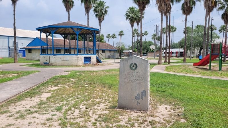
Approximate Site of Mission San Joaquin del Monte a Visita Marker
County seat of Hidalgo County 1852 - 1908 • Known as Edinburgh in 1852 • • Name changed in 1861 to Hidalgo in honor of Miguel Hidalgo y Costilla, 1753 - 1811, Parish Priest who led the movement in 1810 for Mexican Independence • • Almost completely . . . — — Map (db m223843) HM
Once the lands of the Mission of the Oblate Fathers, this property (160 acres) was owned by Bryan from 1910 to 1916. While residing here he wrote many articles and engaged in a magazine debate with Senator Albert J. Beveridge. — — Map (db m292466) HM
Created February 7, 1855
Organized May 14, 1853
Named in honor of
Dr. George W. Hill
1814-1860
Member of the Texas Congress
and Legislature
Secretary of War of the
Republic of Texas, 1843-1845
Lexington, first village . . . — — Map (db m62522) HM
A Soldier in the Texas Army in 1836 • Born in Louisiana, February 20, 1811 • Died May 28, 1900
His Wife
Margaret Ann Addison
Born in Missouri, February
24, 1815 • Died July 26, 1878 — — Map (db m212064) HM
A frontier military post established
on the site a Waco Indian village
by Brevet Major R. A. Arnold, second
United States Dragoons, on March 27,
1849. Named in honor of Lt. Col.
William M. Graham who fell at Molina
del Rey, September 8, 1847. . . . — — Map (db m269256) HM
Formed from Young and Bexar
Territories
Created August 21, 1876
Organized February 19, 1921
Named in honor of
George W. Hockley
Commander of the artillery
at San Jacinto. Secretary
of War of the Republic of
Texas. Died in 1851. . . . — — Map (db m155396) HM
Chartered in 1873 under the name Add-Ran Christian College • Removed to Waco on December 25, 1895 • Reestablished at Fort Worth in 1909 as Texas Christian University — — Map (db m268790) HM
Home County of Texas Confederate General W. H. King 1839 - 1910
Georgian. Moved to Texas 1861. Rose to rank of colonel, 18th Texas Infantry. Led regiment in Red River Campaign of 1863 to prevent split of South along Mississippi. . . . — — Map (db m316857) HM
Formed from Lamar and Nacogdoches Counties Created March 25, 1846
Organized July 13, 1846
Named in Honor of the Pioneer Hopkins Family Which Came to Texas From Kentucky and Indiana
County Seat, Tarrant 1846-1858 Sulphur Springs, . . . — — Map (db m186645) HM
Established before 1836 Used by Elisha Clapp and neighboring settlers as a place of defense against the Indians Abandoned about 1844 — — Map (db m219447) HM
Commanded a company at the capture of Bexar, 1835 - Veteran of the Mexican War, 1846 - Born in Tennesse, 1808 - Died in 1876 — — Map (db m286847) HM WM
Created from Nacgodoches County
June 12, 1837
Organized the same year
named in honor of
Sam Houston
1793-1863
Commander-in-Chief of the Texan
Army at San Jacinto
President of the Republic and
Governor of the State of Texas . . . — — Map (db m63530) HM
A soldier in the Army of Texas, 1836 Chief Justice of Houston County, 1841 Born in Tennessee Feb. 1, 1788 Died Nov. 24, 1848 His wife Elizabeth (Stone) Gossett Born in Tennessee Sept. 1, 1789 Died July 6, 1849 — — Map (db m219482) HM
Veteran of San Jacinto • Commander of the "Horse Marines" in June, 1836 • A Senator in the Congress of the Republic 1836-1839 • Born in Georgia in 1805 • Died in January, 1843 — — Map (db m219480) HM
Built as a home by Joseph D. Rice, Sr., who came to Texas in 1828.
In 1838 it was designated as a stopping place for the stage coach from Nacogdoches to Crockett. — — Map (db m121249) HM
Formed from Young and Bexar
Territories
Created August 21, 1876
Organized June 15, 1882
Named in honor of
Volney Erskine Howard
1809 – 1889
Came to Texas in 1844
Delegate to the First State
Constitutional . . . — — Map (db m120477) HM
Resentment over private control of
the salt lakes in this region,
often called Guadalupe Lakes,
led to the El Paso Salt War
1877
which entailed the loss of many
lives and much property — — Map (db m61508) HM
Formed from El Paso County
Created February 16, 1917
Organized August 25, 1917
Named in honor of
Claude Benton Hudspeth
Born in 1877
A native Texan
Holder of larger ranching interests
Member of the Texas Legislature
and the . . . — — Map (db m118227) HM
Created April 11, 1846
Organized July 19, 1846
Named in honor of
General Memucan Hunt
1807-1856
Secretary of the Navy and
Inspector General of the Army
of the Republic of Texas
Minister to the United
States
Adjutant . . . — — Map (db m119856) HM
Fifteen miles to the site of the
Battle of Adobe Walls
Fought on November 25, 1864
between Kiowa and Comanche Indians
and United States troops
commanded by
Colonel Christopher Carson
1809 – 1868
This was "Kit" Carson's . . . — — Map (db m93256) HM
Created March 7, 1889
Organized April 16, 1889
Named in honor of
Robert Anderson Irion
1806-1860
Came to Texas in 1833 and
located at Nacogdoches
Member of the first Texas
Congress
Secretary of State in the
Cabinet of . . . — — Map (db m126172) HM
Here ran the Southern Overland
Mail Line connecting St. Louis and
San Francisco with semi-weekly
stage and mail service, 1858-1861
The length of the route, 2,795
miles, and the superior service
maintained made this a pioneer
enterprise . . . — — Map (db m119273) HM
As partially reconstructed in 1936
Established by the United States War Department
on November 26, 1867
as a protection of the frontier
against hostile Indians
Named in honor of
General Israel B. Richardson, U.S.A.,
killed at Antietam, . . . — — Map (db m119221) HM
Established November 26, 1867 by the United States Army to defend the frontier against the Indians. A mail station on the Butterfield Overland Stage Line 1858-1861. Abandoned as a military post May 23, 1878 — — Map (db m138158) HM
Home of the Karankawa Indians granted in part to Stephen F. Austin and to Martin de Leon. Settled 1824-1835 by colonists largely from Alabama, Louisiana, Kentucky, Tennessee and, west of the Lavaca, Mexico. Organized as a municipality December 5, . . . — — Map (db m120609) HM
Situated in the present county of Jackson was the mission of Nuestra Señora del Espiritu Santo de Zuñiga. Established by Joseph de Azlor, Marquis of Aguayo, and Father Fray Agustin Patron, O.F.M. in 1722 for the civilizing and Christianizing of the . . . — — Map (db m120608) HM
A part of the first army of the Texas Republic, under the command of General Felix Huston, and later of General Albert Sidney Johnston, was stationed here from December, 1836, until furloughed by order of President Sam Houston on May 18, 1837. . . . — — Map (db m134420) HM
Founded in 1834 by Dr. F. F. Wells personal friend of Stephen F. Austin · County seat of Jackson County from 1835-1883 · Old home of Capt. Clark L. Owen of Civil War fame · Here the following were first organized in Jackson County: Methodist Church . . . — — Map (db m167911) HM
Jasper County
Included in the Empresario grant to Lorenzo de Zavala in 1829.
Created the municipality of Bevil in 1834, in honor of John Bevil, early settler.
Name changed by the provisional government of Texas, December 3, 1835 . . . — — Map (db m128583) HM
Important river navigation point, 1830-1860. Established by John Bevil in whose honor the municipality was first named in 1834 with Bevilport as seat of justice. A mail station in 1835. County seat of Jasper County, 1836-1837. Incorporated . . . — — Map (db m136970) HM
Born in North Carolina 1764 Fought at Camden, Brier Creek and Eutaw Springs in the Revolutionary War and the capture of San Antonio, 1835 in the Texas Revolution. — — Map (db m136728) HM
Established by Lieut. Col. Washington Seawell with six companies of the Eighth U.S. Infantry in October 1854 for protecting travelers on the San Antonio-El Paso Road.
Named in honor of the then Secretary of War, Jefferson Davis, it was . . . — — Map (db m26357) HM
Formed from Presidio County. Created March 15, 1887. Organized May 16, 1887. Named in honor of Jefferson Davis. 1806-1868. President of the Confederate States. Fort Davis, County Seat, Presidio County, 1875. County Seat, Jeff Davis County, . . . — — Map (db m51483) HM
Ruins of
the ranch home of Manuel Musquiz,
a pioneer who settled here
in 1854
Abandoned due to Indian raids
the deserted buildings served as
a Ranger Station intermittently,
1880 - 1882
while the country was being
cleared of . . . — — Map (db m145336) HM
In early days the Indian trail through these mountains followed the gorge below known as Limpia Canyon. To avoid the floods travelers over the San Antonio - El Paso Road, emigrants, U.S. troops and supply trains, and the mail chose this higher pass . . . — — Map (db m239563) HM
Named in honor of
Mary Dewleigh Borlace
Warren Beaumont
by her husband Henry Millard
who laid out the town in 1835
on a site known as Tevis's Bluff
Incorporated in 1838 — — Map (db m129555) HM
Site of the home of Noah Tevis who came to Texas in 1826 and built his cabin on land not granted until 1835. On a portion of this known as Tevis Bluff, the town of Beaumont was laid out before his death December 6, 1835. Erected by the State of . . . — — Map (db m172382) HM
Here from 1862 to 1864, camped Colonel A. W. Spaight's Battalion, 2nd Texas Infantry, Confederate States Army, composed of soldiers from Jefferson, Liberty, and Chambers counties. Their presence here served to prevent invasion of this part of . . . — — Map (db m239913) HM
Discovery well of the Spindletop Oil Field and the first important well on the Gulf Coast. It blew in on Jan. 10, 1901, flowing 100,000 barrels of oil a day from a depth of 1020 feet. The oil production which resulted made Beaumont a city and the . . . — — Map (db m64411) HM
Center Front Panel
In memory of Lt. Richard W. Dowling and his men. Texas remembers the faithfulness and valor of her sons and commends their heroic example to future generations.
The Men Who Fought with Lt. Dowling Were:
Left Front Panel . . . — — Map (db m118792) HM WM
Formed from Brooks and Duval
counties
Created March 31, 1913
Organized August 11, 1913
Named in honor of
James Stephen Hogg
1851-1906
First native Texan to serve
as governor
Father of the Railroad Commission
Hebbronville, . . . — — Map (db m152037) HM
Formed from Nueces County,
Created March 11, 1911,
Organized May 6, 1911,
Named for Judge James B. Wells,
an able lawyer,
Born near Aransas Pass, Texas,
July 12, 1854,
Died at Brownsville
December 21, 1923
Alice, the . . . — — Map (db m193562) HM
Named for Middleton T. Johnson (1810-1866), native of South Carolina, for 7 terms an Alabama Legislator, a leading Texan after 1840. Served in 9th Texas Legislature, in Texas Rangers, Mexican War, Civil War.
County created and organized 1854 . . . — — Map (db m221227) HM
Established November 14, 1851
Abandoned April 6, 1854
Repaired and Used by Southern Overland Mail, 1858-1861
Sub-Post of Fort Griffin in 1871 and 1872
A thriving village which grew up in its vicinity after the Civil War served as . . . — — Map (db m74737) HM
Born in Massachusetts January Twentieth 1798 was licensed to practice medicine in 1820. Came to Texas in 1833. Doctor Jones participated in the Battle of San Jacinto 1836 while a surgeon in the army of Texas. He was a member of the Congress of the . . . — — Map (db m78967) HM
Site of Emigrant Trail, the Frontier Military Road, and Fort Phantom Hill, founded in 1851 to guard the military road.
County created 1858 from Bexar and Bosque counties. Named for Anson Jones (1798–1858), a veteran of San Jacinto, . . . — — Map (db m78965) HM
Established November 14, 1851 by the United States Army as a protection of the settlers against the Indians. Abandoned and burned April 6, 1854. Repaired and used by Southern Overland Mail, 1858-1861, sub-post of Fort Griffin, 1871-1872, temporary . . . — — Map (db m78401) HM
Formed from Bexar County
Created February 4, 1854
Organized February 27, 1854
Named in honor of
Henry Wax Karnes
1812-1840
Conspicuous for gallantry at
storming of Bexar
Commanded a company at
San Jacinto
Texas Ranger . . . — — Map (db m121656) HM
Oldest Polish settlement in Texas -
Established December 24, 1854 by
the Reverend Leopold Moczygemba
O.F.M., who was instrumental in
bringing from Poland about 100
Polish peasant families - Within a
few months the majority sought . . . — — Map (db m131917) HM
In 1844
A.J. Beck, Henry Beck
Wilson Fogleman, A.H. Henry
W.T. Patton, Ed. King
settled in this vicinity
A Methodist church
was organized in 1845
with Rev. J.W. Fields as pastor
A.H. Henry, Ed. King, stewards,
A.H. Henry . . . — — Map (db m97065) HM
Created February 26, 1848
Organized August 7, 1848
Named in honor of
David Spangler Kaufman
1812-1851
Came to Texas in 1837 and
located at Nacogdoches
Member of the Texas Congress
1839-1845
Member of the United States
Congress . . . — — Map (db m96206) HM
Created January 10, 1862
Organized February 18, 1862
Named in honor of
George Wilkins Kendall 1809-1867
Poet, journalist, author
and farmer
One of the founders of
the New Orleans Picayune
Member of the
Santa Fe Expedition . . . — — Map (db m111220) HM
Created April 2, 1921
out of Cameron, Willacy
and Hildago Counties
Named for Capt. Mifflin Kenedy
1818 — 1895
Sent to Texas 1846 on
United States Army supply boats
Commercial Navigator of the
Rio Grande 1848-1860
Sarita is the . . . — — Map (db m118070) HM
Commanding the Expeditionary Army of the United States sent to Texas in 1845 encamped on March 15, 1846, while en route with his troops from Corpus Christi to the Rio Grande ReverseThe Texas Highway Department Proudly Dedicates this . . . — — Map (db m239565) HM
Established as a frontier post by the United States Army, July 8, 1855. Headquarters in 1856 for 40 camels, sent by Secretary of War Jefferson Davis, to be used in a system of overland communication with the West, which proved impracticable. . . . — — Map (db m155392) HM
Formed from Bexar County
Created January 26, 1856
Organized March 22, 1856
Named in honor of
James Kerr, 1790-1850
the first American settler on
the Guadalupe River. General
manager of DeWitt's Colony
signer of the Texas . . . — — Map (db m111222) HM
Established as a frontier post by the United States Army, July 8, 1855. Headquarters in 1856 for 40 camels sent by Secretary of War Jefferson Davis to be used in a system of overland communication with the West, which proved impracticable. . . . — — Map (db m239568) HM
Jumano and Apache Indians inhabited region when Spanish explorers traveled across it in the 17th and 18th centuries, and were displaced by the Comanche tribe by the mid-19th century. Area was under military jurisdiction of Forts Terrett . . . — — Map (db m239569) HM
Created Aug. 21, 1876, from Bexar County, whose diamond-shaped boundaries extended from the Rio Grande to the Panhandle to El Paso. Named for William King, who died at the Alamo. Chief industry, ranching, is reflected in its famous cattle brands: . . . — — Map (db m105091) HM
Formed from Young and
Bexar Territories
Created February 1, 1858
Recreated August 21, 1876
Organized March 20, 1886
Named in honor of
General Henry Knox
1759–1806
Major General of the
Continental Army, 1781
Secretary of . . . — — Map (db m81302) HM
Established by Samuel M. Fulton
(1810-1851)
At this point, which became known as Fulton's Crossing after about 1833
Earlier known as the site of United States Factory Erected by the State of Texas
1936 — — Map (db m192672) HM
Created December 17, 1840
from Red River County
Organized in 1841
Named in honor of
Mirabeau B. Lamar, 1798 – 1859
Father of Texas education
President of the Republic of Texas
1838 – 1841
Lafayette, 1841
Mount . . . — — Map (db m96841) HM
Here on 100 acres donated by Mathias Glick was the second county seat of Lamar County – Mount Vernon – where court was held June, 1843, to April, 1844 when Paris was made the county seat • John A. Rutherford, chief justice • John R. Craddock, county . . . — — Map (db m300984) HM
First county seat of Lamar County •
A clapboard courthouse was built by John Lovejoy on 40 acres donated by John Watson •
Here court was held June, 1841 to June, 1843 •
John A. Rutherford, Chief Justice; John R. Craddock County . . . — — Map (db m110614) HM
Indian camp and watering place. Took its name from first sod house built in 1876 by George and John Causey and Frank Lloyd, buffalo hunters. First permanent settlement in this region. In 1882 a cow camp was established at this point by Estes . . . — — Map (db m151360) HM
Indian camp and watering place extensively used in hunting buffalo. Became cattle territory in 1882 when Tom Lynch drove his herds from New Mexico.
After acquisition by the Capitol Syndicate this became headquarters of largest division of the . . . — — Map (db m104434) HM
In Memory of George W. Littlefield, a pioneer plainsman, soldier and state benefactor. Founder and developer of Yellow House Ranch and the city of Littlefield. Born June 20, 1842. Died November 10, 1920. — — Map (db m151358) HM
One of the Lampasas sulphur springs named in honor of first settler in this vicinity in 1853, Moses Hughes, whose wife regained health through its waters. — — Map (db m71609) HM
Founded 1838
County Seat, Lavaca County
since 1852
Named for Mrs. Margaret Hallett, widow of John Hallett, a member of Austin's colony and a veteran of San Jacinto, who donated the town site. — — Map (db m95361) HM
March 15, 1836 under the command of General Sam Houston while retreating from Gonzales to the Brazos River Erected by the State of Texas 1936 — — Map (db m164249) HM
In this grave rests James Goucher and five members of his family murdered by Indians November 26, 1836. With the true pioneering spirit he had opened the first road from San Felipe to the settlements on the Colorado, known for many years as . . . — — Map (db m84810) HM
Located on Old San Antonio Road, on land surveyed in 1821 as part of the original colony of Moses and Stephen F. Austin.
In 1854 became site of major settlement by Wend from northern Europe, led by Pastor Johann Kilian.
Had only school . . . — — Map (db m111932) HM
Here in 1854 under the leadership of Rev. John Kilian Ev. Lutheran pastor about 600 Wends seeking religious liberty established the first Wendish settlement in Texas — — Map (db m84606) HM
Here a blockhouse was constructed in 1840 as headquarters for the Boggy and Trinity Rangers commanded by Captain Thomas N. B. Greer. A community retained the name Fort Boggy for a number of years. — — Map (db m221212) HM
Here a log building was erected in 1846.
County officials installed Nov. 12, 1846
Geo. V. Lusk, Chief Justice
Wm. Childress, Probate Judge
Israel P. Reinhardt, County Clerk
Wm. B. Middleton, Sheriff
David Foster, Coroner
Baxter King, . . . — — Map (db m119575) HM
A Spanish settlement on the Atascosito road was established here in 1757 to prevent French trade with the Indians. Four and one-half miles west of here the road crossed the Trinity. There Alonso de Leon, Spanish explorer, crossed in 1690. The road . . . — — Map (db m116714) HM
Born in Franklin County, Georgia
January 25, 1803 Died at Liberty, Texas, April 20 1878 An officer at the Siege of Bexar and at San Jacinto 1837 appointed by Congress Surveyor of Liberty County 1841, Colonel of the 2nd Regiment of the 2nd . . . — — Map (db m195844) HM
To
Generals Charles Lallemand,
Antoine Rigaud, the veterans
of the Napoleonic Wars and
other French settlers,
who, after many trials and adventures, came to Texas in the spring of 1818 to found on the banks of the Trinity River the . . . — — Map (db m128335) HM
A trail across this region traveled and described by Alonso de Leon in 1690 became the "La Bahía" or "Lower Road" in the 18th century. First settlement, Atascocita, established in 1757. The town established May 5, 1831 as the "Villa de la Santísima . . . — — Map (db m121260) HM
The home of the Orcoquisac Indians. An East – West trail across the region traveled by Alonso De Leon in 1690 became the “La Bahia” or “Lower Road” of the 18th century and the Opelousas Road of the 19th. At the point . . . — — Map (db m117041) HM
A Soldier in the Army of Texas, 1835 A Participant in the Battle of San Jacinto Born in Louisiana October 7, 1807 Died October 7, 1869 — — Map (db m195837) HM
An Officer in the Army of Texas 1835 - 1836 Born in Louisiana March 11, 1810 Died April 19, 1873 His Wife Mary A. Merriman Bryan Born August 6, 1817 Died January 13, 1861 — — Map (db m206773) HM
Here General Sam Houston built a home in 1843 and in it resided until 1845. A post office was established May 22, 1846 with Vernon B. Lea as postmaster. It was discontinued October 24, 1868 and reestablished April 26, 1869. The name of the town was . . . — — Map (db m255325) HM
Delegate to the Second Convention of Texas, 1833 Alcalde of Liberty Municipality, 1835 First Judge of the Municipality Born in Franklin County, Georgia March 25, 1801 Died in Galveston June 28, 1839 — — Map (db m195713) HM
Organized May 24, 1845 with the following members: Nancy Lea, Margaret Houston, Antoinette L. Bledsoe, Joseph L. Ellis, Benjamin F. Ellis, Archer B. Worsham and B. F. Brown, pastor - - It sent delegates to the Baptist State Convention organized . . . — — Map (db m255327) HM
Established by the Brazos Synod of the Cumberland Presbyterian Church. Opened its doors as a co-educational institution September 23, 1869. Chartered August 13, 1870. Included Schools of Law and Theology. Removed in 1902 to Waxahachie. — — Map (db m292071) HM
899 entries matched your criteria. Entries 401 through 500 are listed above. ⊲ Previous 100 — Next 100 ⊳