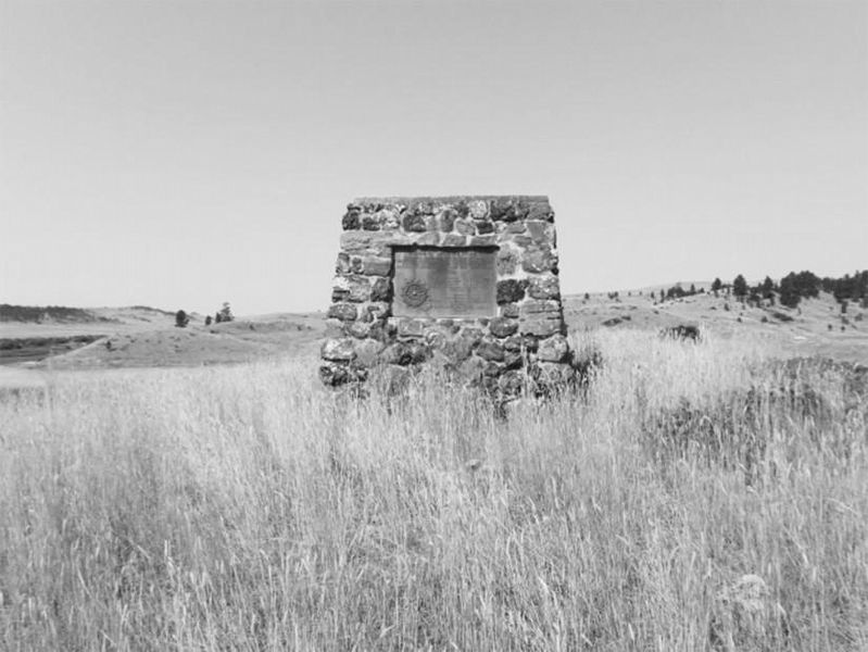
"In grateful recognition of the valor and sacrifice of the soldiers killed in action fought on these grounds, between the United States Forces under General George Crook and Sioux and Cheyenne Indians under Chief Crazy Horse. June 17, 1876. 3rd U.S. . . . — — Map (db m221578) HM WM
On August 10, 1983 a prairie fire swept over the battlefield, burning nearly 600 acres of dense, thick vegetation. In May and June of 1984 the National Park Service began an unprecedented systematic archeological survey of the Custer Battlefield. . . . — — Map (db m86810) HM
In memory of enlisted men 2nd and 7th U. S. Cavalry and 5th U. S, Infantry killed in action near Bear Paw, Montana September 30, 1877 < Left Side of Monument : > 7th U. S. Cavalry Troop A 1st Serg’t Geo. McDermott Serg’t Otto Derglew . . . — — Map (db m86873) HM
This monument was originally erected at Ft. Keogh in 1881 to honor U.S. Army casualties from the 1877 Nez Perce War. PLEASE NOTE: “Hostile Indians” is in historical context with a term used for Native American enemies of the United . . . — — Map (db m86865) HM
This position was held by Co. L commanded by Lt. James Calhoun. It may have been used to hold off Chief Gall and his Sioux warriors and thus protect Custer's advance. From here these soldiers could have attracted Capt. Benteen's column and the pack . . . — — Map (db m21643) HM
After separate skirmishing, Custer’s command reunites here. Company L, under Lt. James Calhoun, skirmishes with Gall, Crow King, Two Moons, and other warriors. From here these soldiers could have attracted Capt. Benteen’s column and the pack . . . — — Map (db m86838) HM
After the battle, Sioux and Cheyenne removed their dead and buried them in tipis, scaffolds, and adjacent hillsides in the Little Bighorn valley. Southern Cheyenne Chief “Ve’ho’enohnenehe” (Lame White Man) and Northern Cheyenne . . . — — Map (db m86860) HM
Plagued with the loss of the great buffalo herds, the confinement to reservations, disease, famine, and poverty, Chief Plenty Coups led the Crow people through a painful transition.
Gifted with vision, the power of impressive speech, honor . . . — — Map (db m85999) HM
The white markers on the knolls and in the ravines to the west and southwest show were the troopers of Co, C under Capt. Tom Custer and Co. E under Lt. Smith were found. The Indian encampment lay beyond on the flat across the river. — — Map (db m21645) HM
From this promontory 13 miles away in the Wolf Mountains, Custer's scouts observe the Lakota, and Cheyenne pony herd and evidence of a large village in the valley behind you. Convinced the Indians had spotted his regiment and would soon scatter, . . . — — Map (db m45580) HM
From the Crow’s Nest, a vantage point 14 miles away in the Wolf Mountains, Custer’s Crow and Arikara scouts saw evidence of the massive Lakota, Cheyenne, and Arapaho encampment. Convinced that he was discovered, Custer abandoned plans for a . . . — — Map (db m86817) HM
After the brief encounter near the river, Custer’s two companies retreat up the ravine to your right known as Deep Coulee. The remainder of Custer’s command skirmishes with warriors on the high ridge ½ mile to your right. Seizing the . . . — — Map (db m86831) HM
Deep Ravine (Crazy Horse Gully & Grey Horse Ravine) was the scene of fierce fighting during the battle. Crazy Horse, and other Sioux and Cheyenne warriors crossed the Little Bighorn River (in front of you) and rode up the ravine during the attack . . . — — Map (db m86800) HM
Custer’s command deploys in the current national cemetery area and advances into the basin across the road to your left before withdrawing to Last Stand Hill. Toward the conclusion of the battle, soldiers from Company E moved toward the Deep . . . — — Map (db m86839) HM
Warriors ascend the large ravine behind you pursuing Custer’s troops. Soldiers retreat through the area to your front and right. Indians position themselves along the ridge to your left knows as Greasy Grass Ridge. Archeologists discovered numerous . . . — — Map (db m86834) HM
Custer National Cemetery, like Arlington National Cemetery, provides a final resting place for many generations of those who faithfully served in the United States armed forces. Here, Americans of many races and beliefs rest side by side. Relive . . . — — Map (db m86846) HM
On June 25, 1876, approximately 7,000 Lakota, Cheyenne, and Arapaho, including 1,500 – 2,000 warriors, encamped below on the Greasy Grass River (Little Bighorn). Under the political and spiritual leadership of Tatanka-Iyotanka (Sitting Bull), . . . — — Map (db m86814) HM
An Indian memorial to honor Native American participation in the Battle of the Little Bighorn, June 25-26, 1876, and change the name of Custer Battlefield National Monument to Little Bighorn National Monument, was authorized by Congress in 1991 . . . — — Map (db m86804) HM
The Indian charge shatters the Calhoun defense and crashes through the soldier position at right, held by Capt. Myles Keogh’s Company I, Crazy Horse and White Bull cut down the retreating soldiers who flee northwest along this ridge in an effort to . . . — — Map (db m86811) HM
This knoll was contested by Indians and soldiers. Some evidence indicates soldiers of Company C occupied this position since bodies of Sergeants Finckle and Finley were found here. Indian testimony suggests that Southern Cheyenne war leader Lame . . . — — Map (db m86836) HM
Lakota, Cheyenne, and Arapaho warriors surrounded this position near the climax of the battle. Lt. Col. George Armstrong Custer and approximately 41 men, shoot their horses for breastworks and fight to the death. Custer and several soldiers were . . . — — Map (db m86801) HM
This area was occupied by troops A, B, D, G, H, K, and M, 7th. U.S. Cavalry, and the pack train when they were besieged by the Sioux Indians June 25th and 26th 1876. — — Map (db m21636) HM
In memory of
Officers and soldiers who fell near this place
fighting with the 7th United States Cavalry
against the Sioux Indians
on the 25th and 26th of June,
A.D. 1876
— — Map (db m7022) HM WM
Arikara “I shall not see you (sun) go down behind the mountains tonight …I am going home today, not the way we came, but in spirit, home to my people.”- Bloody Knife, Arikara (June 25, 1876) “These Old Scouts, today we remember them, . . . — — Map (db m87723) HM
Advancing down Reno Creek, Custer pauses at a tipi located behind this ridge. The tipi contains the remains of a Sans Arc warrior killed a week before at the Battle of the Rosebud. Indians flee toward the village, prompting Custer to order Reno's . . . — — Map (db m45581) HM
After leaving Cedar Coulee, Custer descends toward the Little Bighorn River in the ravine ahead known as Medicine Tail Coulee. Custer probably again divides his command: three companies likely ascend to the higher ridges beyond. Two companies . . . — — Map (db m86824) HM
As soldiers descend Medicine Tail Coulee, the Minniconjou and Cheyenne camps were on the western bank. Archeological evidence supports Indian testimony, that initial fighting took place on the flats near the river to your left and cutbank directly . . . — — Map (db m86827) HM
Following the battle, the Lakota and Cheyenne removed their dead and buried them in lodges, scaffolds, and the hillsides. Surviving members of the 7th Cavalry hastily buried the soldiers, Indian Scouts, and civilians on June 28, 1876. In 1877, . . . — — Map (db m86844) HM
This National Cemetery, established in 1886, is for interment of those who served honorably in the Armed Forces of the United States. their immediate families also have burial privileges.Many from indian battles of the northwest are buried here. . . . — — Map (db m45551) HM
Indian descendants of participants in the Battle of the Little Bighorn helped form the vision of the Indian Memorial. The “Peace Through Unity” theme was conceived by the late Enos Poor Bear, Sr. and Austin Two Moons. Together, they . . . — — Map (db m86806) HM
Under mounting pressure, Reno abandons the timber. His retreat disintegrates into a rout as pursuing warriors ride in amongst the troopers killing more than 30 soldiers. Indian casualties are few. Lakota and Cheyennes drive the cavalry across the . . . — — Map (db m86821) HM
After fording the Little Bighorn River one mile to your left, Reno’s battalion gallops down the valley below. Convinced he is vastly outnumbered, Reno dismounts, and forms a skirmish line across the valley floor, firing into the lodges. Warriors . . . — — Map (db m86819) HM
Reno's battalion of 175 soldiers, civilian personnel, and Arikara and Crow Scouts halt in the valley and form a thin skirmish line. Warriors race out from the village to oppose him. After 10 minutes of fighting Lakota and Cheyenne warriors outflank . . . — — Map (db m45583) HM
During Reno's retreat from the timber, Crazy Horse, Wooden Leg, Black Elk, and perhaps as many as 600 warriors chase the soldiers across the Little Bighorn River. Reno's casualties are 40 men killed and 13 wounded. The remnants of Reno's command . . . — — Map (db m45584) HM
After the battle, 39 cavalry horses that had been shot for breastworks during Custer’s Last Stand, were found among the dead on Last Stand Hill. In 1879, a temporary cordwood monument was erected by the Army on the crest of the hill. The area, . . . — — Map (db m45604) HM
June 25-26, 1876 - From the ridge to your right, Custer first views the village. Needing more information about the extent of the encampment, he moves further north. After witnessing the beginning of Reno's charge, Custer's five companies descend . . . — — Map (db m45587) HM
After an unsuccessful attack on the Indian camp in the valley, Major Reno and his battalion retreated to this vicinity where they were soon reinforced by Captain Benteen's battalion and the pack train. In an attempt to find and rejoin Custer they . . . — — Map (db m45554) HM
Reno occupies a defensive position in the timber. Determined to defend their village, warriors soon penetrate the woods, convincing Reno that the position is untenable. After fighting for 30 minutes, Reno retreats across the Little Bighorn River. — — Map (db m45585) HM
In an attempt to locate Custer, Company D under Captain Thomas Weir advances to this hilltop position without orders late on June 25. Weir may have witnessed the conclusion of the battle three miles ahead. He is later joined by Captain Benteen and . . . — — Map (db m86823) HM
This is the farthest point reached by Capt. Weir in his attempt to assist Custer. Minutes after arriving, his company was joined by Capt. Benteen's company and others. They remained about 45 minutes until mounting warrior pressure forced them back . . . — — Map (db m21640) HM
The hill in front of you was occupied by Lakota, and Cheyenne during the fight on Last Stand Hill. An unknown Sioux warrior wearing a warbonnet was killed here while firing his rifle at soldiers positioned behind a horse barricade on the crest of . . . — — Map (db m45593) HM
Be silent, close you eyes, and listen to the breeze as it rustles through the prairie grasses. To many, the whispering sounds make this a spiritual place. Hunans have defined this lans by its uses and the emotions it stimulates.
First . . . — — Map (db m189806) HM
"They made us many promises, more than I can remember, but they never kept but one: they promised to take our land and they took it." - Chief Red Cloud, Oglala Sioux
Major Conflicts of the Plains Indian War
August 19, 1854 Gratten . . . — — Map (db m189765) HM
The words of those engaged in the Battle of the Rosebud, and the people still affected, tell a narrative of the conflict's significance.
Kase'eetsevo' estanevosehaesta'tanemo
(The Fight Where The Girl Saved Her Brother) . . . — — Map (db m224316) HM
Throughout time, the value of this place has been connected to its rich resources.
Indian families, area landowners, the State of Montana, heritage groups, and conservation organizations, each from their own perspective, acknowledge the . . . — — Map (db m189835) HM
Garryowen, the old Irish tune, was the regimental marching song of the 7th U.S. Cavalry, General Custer's command.
The Battle of the Little Big Horn commenced in the valley just east of here June 25, 1876, after Custer had . . . — — Map (db m67897) HM
Where the Battle of Little Big Horn Began
June 25, 1876
(map of battlefield)
(showing Custer’s column, Reno’s column, Indian camp, Last Stand Hill)
Custer Battlefield Museum — — Map (db m98277) HM WM
On this site in 1876 the historic Battle of the Little Big Horn began. “When we stand side by side in the circle of no beginning and no ending, the first maker, creator of all things, is in the center. He hears the words of supplication and . . . — — Map (db m86022) HM
Building contractor Ernest Adler constructed these attached, flat roofed storefronts between 1914 and 1920. A German immigrant, Adler was one of Hardin’s most prolific builders. Situated on the edge of the business district, the one-story brick . . . — — Map (db m189252) HM
Hardin women began raising money for a library in 1909. Numerous fundraisers followed, and in 1912 a hundred-book library opened in the home of Walter and Ella Fearis. After the city passed a mill levy in 1914, Walter Fearis wrote library benefactor . . . — — Map (db m189329) HM
Hardin women began raising money for a library in 1909. Numerous fundraisers followed, and in 1912 a hundred-book library opened in the home of Walter and Ella Fearis. After the city passed a mill levy in 1914, Walter Fearis wrote library benefactor . . . — — Map (db m189254) HM
Hardin’s first railroad depot was moved from Fort Custer after being cut into small sections and transported by train over the Big Horn Bridge. That depot was expanded in 1909, but was deemed inadequate after the homestead boom dramatically . . . — — Map (db m189370) HM
Captain Edward Ball, leading two companies of the Second Cavalry from the Montana Column, was ordered to scout along the Bighorn as far south as the 1868 ruins of Fort C.F. Smith. The detachment was then to cross over the divide to the Little . . . — — Map (db m189447) HM
Captain Grant Marsh (1834-1916), one of the most skilled riverboat pilots on the Upper Missouri
during the steamboat era, figured prominently in both the events leading up to the Battle of the Little
Bighorn and its aftermath.
The steamboat . . . — — Map (db m189458) HM
As Hardin’s residential neighborhoods began to take shape during the 1910s and 1920s, the new Craftsman style emerged as a favored design. Its popularity was partly due to the ready availability and low cost of the machine-made, mass-produced . . . — — Map (db m189330) HM
Established as a military post November 1877 by order of President Rutherford B. Haynes and General Phil H. Sheridan. Garrisoned as one of the important Military posts in the Northwest until abandoned by the Government, September 1897. This Fort . . . — — Map (db m148124) HM
In 1900, John Svaren left his home in Bergen, Norway, to join family in South Dakota. There he learned English before homesteading to North Dakota in 1909. With his bride, Betsy, Svaren arrived in Hardin in 1917 to build a home. He applied his . . . — — Map (db m189331) HM
Long before fur trappers entered the Bighorn Valley, Crows, Sioux, and Cheyennes vied for the area’s abundant game. In 1876, Sioux and Cheyenne warriors defeated the U.S. Army at the Battle of the Little Bighorn; the following year, the Army . . . — — Map (db m189333) HM
German immigrant Anton Becker had great faith in Hardin’s future. Becker bought this lot on May 30, 1907, the day town lots went on sale. He soon constructed a two-story brick building, in front of which he installed Hardin’s first cement sidewalk. . . . — — Map (db m189367) HM
The elaborate corbelling on the front façade and the parapet above the transom evoke the glory days of this building, which long provided recreation for Hardin residents. German immigrant Anton Becker, owner of the hotel next door, constructed the . . . — — Map (db m189365) HM
Montana created twenty-six counties during its 1910 county-splitting craze. Among them was Big Horn County, carved from portions of Yellowstone and Rosebud Counties in 1913. Private entrepreneurs constructed the new county’s first courthouses. In . . . — — Map (db m189332) HM
A 30-car cross-country extravaganza, has been called "Montana's greatest publicity stunt". The Centennial Train, which commemorated creation of Montana Territory, also honored 75 years of statehood. The State commissioned Lyman Rice to paint 150 . . . — — Map (db m189445) HM
Charles and Rushann Schneider built this two-story brick business block in 1910. Anticipating the arrival of electricity by four years, the Schneiders had their building wired during its construction. The exterior’s relative simplicity reflects the . . . — — Map (db m189363) HM
St. Joseph’s Catholic Church of Hardin was founded by Jesuit missionaries to the Crow Indians. Fr. Thomas Grant of St. Francis Xavier’s Mission purchased three town lots for $425 in 1908. The Jesuits constructed a plain, gable-front wooden building . . . — — Map (db m189251) HM
On May 4, 1917, Hardin celebrated the “formal opening of the Gay block . . . with a grand ball in the south store room of this magnificent structure.” The storage area’s hardwood floor was perfect for dancing, and construction of the two-story brick . . . — — Map (db m189361) HM
Once upon a time, railroads ruled Montana's transportation landscape. When the first railroad reached Montana in 1881, it began a process where, by 1916, over 5,200 miles of steel track criss-crossed the state. The railroad transformed some . . . — — Map (db m189446) HM
The great plains of eastern Montana was home to thousands of
buffalo before Euro-American hunters nearly wiped them out in the
early 1800’s. The animals were central to the Indian lifeway. In the
dog days, hunters herded buffalo into corrals . . . — — Map (db m99063) HM
This position was established by Daniel C. Major, U.S. Surveyor, in
1885. Major surveyed from the north and disregarded the position
of the Wyoming Corner 3/4 mile west of this location set by Rollin
Reeves 8 years earlier. The original monument . . . — — Map (db m285218) HM
This position was established by Rollin J. Reeves, U.S. Surveyor
and Astronomer, on July 31, 1877, under serious threat of Indian
attack. The original monument was replaced with the present
quartzite monolith on October 25, 1904, by Frank S. . . . — — Map (db m285220) HM
Medicine Rocks State Park was once a sea of sand dunes. About 61 million years ago during the Tertiary Era, a large freshwater river deposited fine-grained sands along its shores. From there, coastal winds blew the sand into dunes that eventually . . . — — Map (db m164323) HM
If you had visited Medicine Rocks 61.5 million years ago, you would have needed gills to breathe!
A vast river once flowed through the regions, depositing layers of underwater sandbars along its deep channel. Over tine, other rivers buried the . . . — — Map (db m164615) HM
Some people claim an old buffalo hunter figured that starting a thirst emporium for parched cowpunchers on this end of the range would furnish him a more lucrative and interesting vocation than downing buffalo. He picks a location and was hauling . . . — — Map (db m164322) HM
In 1934, at the height of the Great Depression, fire destroyed four Main Street buildings, including the First National Bank. When the economy recovered, local contractor V. E. Figg designed and constructed this 1940 commercial structure. With . . . — — Map (db m164217) HM
If you had been a Texas cattle baron in the 1880s, the endless miles of lush grasslands and open range surrounding Medicine Rocks would have seemed like heaven on earth.
Enormous cattle ranches - running thousands of head each - once dominated . . . — — Map (db m164616) HM
Traveling through southeastern Montana in 1883, naturalist, writer, and future United States President Theodore Roosevelt was struck by what he called the Medicine Buttes. He wrote, "Altogether it was as fantastically beautiful a place as I have . . . — — Map (db m216004) HM
The Sioux aptly named Medicine Rocks Inyan-oka-la-ka, or "Rock with a Hole in It."
Evidence suggests the ancestors of modern-day American Indians lived and hunted in southeastern Montana beginning at the end of the last ice age, or about . . . — — Map (db m164326) HM
With prairie stretching toward the horizon in nearly every direction, Medicine Rocks seem like a tiny "island" in a vast, grassy sea.
Indeed, the rocky buttes, spires and columns stand tall above the prairie junegrass, little bluestem and . . . — — Map (db m164544) HM
A small community, called Beebe, once existed in this remote, sparsely settled country. It owed its existence to A. J. Maxwell, owner of the Deadwood Stage Line. Maxwell established a stage station here where the Simonson-Patterson Cattle Company . . . — — Map (db m202900) HM
Ismay’s bustling business, wicked ways, and itinerant population of cowboys and railroad men earned it the nickname “Little Chicago.” This town, born with the construction of the Milwaukee Road across Montana, began in 1908 with the name . . . — — Map (db m164230) HM
On the Bismarck-Ft Keogh Trail, at various time periods trail was known as Sandstone Bismarck - Ft Keogh Ft Lincoln - Ft Keogh Army Trail during 1879 - 1881
(?) 1873 by civilian freighters and used until the building of Northern Pacific R.R. and . . . — — Map (db m164543) HM
This is the river that many claim is a mile wide, an inch deep, and runs uphill. That statement may be exaggerated, but Captain Clark of the Lewis and Clark Expedition commented on its color and called it "disagreeably muddy." Clark named it the . . . — — Map (db m164270) HM
E. H. Johnson, state legislator and Miles City’s first mayor, built this impressive modified Queen Anne style home in 1887. Attributed to Miles City architect Byron Vreeland, the irregular plan originally featured an elaborate arched porch and an . . . — — Map (db m164045) HM
High maintenance steam engines required railroads to locate large repair shops every two hundred miles. After the Chicago, Milwaukee, St. Paul and Pacific Railroad chose Miles City for a division point in 1907, the town grew rapidly. Population . . . — — Map (db m164145) HM
Four score and seven years ago our fathers brought forth on this continent, a new nation, conceived in liberty, and dedicated to the proposition that all men are created equal. Now we are engaged in a great civil war, testing whether that nation, . . . — — Map (db m202899) HM WM
Nannie Alderson came to Montana from Kansas with her husband Walt in 1883. They operated a cattle ranch for a decade but moved to Miles City in 1893 so their children could attend school. In 1895, Walt died from head injuries after he was kicked by . . . — — Map (db m164048) HM
Real estate speculation abounded in the East Main district when carpenter Ernest Anderson built this lovely one- and-a-half-story bungalow in 1916. Its large front porch, supported by heavy, tapered columns, and its low- pitched roofs with . . . — — Map (db m164150) HM
This gracious, historic residential neighborhood illustrates Miles City's prosperity as it evolved from a frontier town into the livestock, transportation, commercial, and governmental hub of eastern Montana. Businessmen and community leaders built . . . — — Map (db m164093) HM
The transformation of Miles City in the early 1900s into the economic, social, and governmental center of the valley precipitated the decision to build a permanent city hall. Ed Arnold, tailor and businessman, became one of the motivating forces . . . — — Map (db m164043) HM
The steamer Far West carried Irish immigrant James Coleman to Fort Keogh in 1876. After working for the army sutler, Coleman moved into Miles City, where he managed a saloon frequented by army regulars. In 1882, he married his Irish bride, Margaret . . . — — Map (db m164146) HM
The I. Orschel and Brothers clothing firm first located on this site in 1878 in a small wood-frame building. Following a disastrous fire that leveled much of the block, local businessmen formed a syndicate to build this four-part commercial building . . . — — Map (db m163978) HM
Hardware store owner, banker, and real estate developer George Miles, nephew of Colonel Nelson A. Miles, hired a contractor to build this hipped-roof cottage around 1910. Following completion of the Chicago, Milwaukee, St. Paul and Pacific Railroad . . . — — Map (db m164215) HM
Custer's first encounter with the Lakota occurred on August 4, 1873 near the confluence of themTongue River, At this time, the Seventh Cavalry was assigned to Colonel David Stanley's command to protect Northern Pacific railroad surveyors operating . . . — — Map (db m189166) HM
251 entries matched your criteria. The first 100 are listed above. Next 100 ⊳