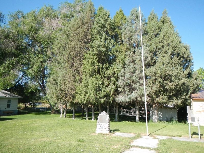
In 1879 the U.&N. Railroad Co. named their water stop, Basalt. Henry R. Whitmill settled in Cedar Point in 1884. Andrew O. Inglestrom filed on land, 1885. Others followed, built canal, homes, L.D.S. church house, cheese factory, two stores, saloon, . . . — — Map (db m231263) HM
Towering 2500 feet high, two over lapping rock domes form a 300,000 year-old butte that dominates this lava plain.
After a hot flow of molten rhyolite (acidic rock) boiled up through older lava, a second rhyolite dome pushed up a block . . . — — Map (db m103820) HM
A log structure was erected one half mile north of this site in 1864, which served as a stage station. The Ben Holliday stages use it as a stopping place as did the freighters who passed this way. Mail was unofficially handled here for more than a . . . — — Map (db m124480) HM
Molten rock, forced upward for 30 to 50 miles through fissures in the earth, has cooled into the hard lava found here.
Continued pressure from below has made great cracks in the contorted surface. This lava solidified only a few thousand . . . — — Map (db m108346) HM
This monument was erected to honor the early pioneers by whose diligent labor the canals were built, bringing life giving water from the rivers to this sagebrush plain, thus converting it into a beautiful valley, which would become the Potato . . . — — Map (db m276426) HM
Rising above this level plain of lava flows and windblown soils these high landmarks are recent additions to Idaho’s landscape.
East Butte (farthest east) flowed up and cooled quickly about 600,000 years ago, while Big Southern Butte . . . — — Map (db m103818) HM
has been designated a
Registered National
Historic Landmark
under the provisions of the historic sites act of August 21, 1935. This site possesses exceptional value in commemorating and illustrating the history of the United States . . . — — Map (db m108309) HM
First habitation in this region was built by Nathaniel J. Wyeth on Snake River 14 miles west of this monument July 15, 1834 and named for Henry Hall, senior member of Wyeth's firm.
The original stockade, 80 feet square was purchased by Hudson's . . . — — Map (db m124481) HM
This area was crossed by many trails used by the ancestors of the Shoshone and Bannock people. Some trails connected hunting and gathering grounds; others marked traditional ceremonial lands of the various Shoshone and Bannock bands. Among the . . . — — Map (db m108542) HM
(Three panels are mounted in a kiosk located near the Fort Hall Indian Reservation Museum)Panel 1:
Shoshone and Bannock Tribes
Before settlers came to this region, Shoshone and Bannock tribal members moved with . . . — — Map (db m108545) HM
The Shoshone-Bannock Tribes Dedicate This Memorial in Honor of the Men and Women Who Served Their Country in the Armed Forces of World Wars I and II
World War I Volunteers
Andrew F. Cutler • Joseph S. Cutler • Richard M. Creasey • . . . — — Map (db m124482) WM
The Fort Bridger Treaty of 1868 is among the most important documents created between the U.S. government and the Shoshone-Bannock Tribes. In addition to affirming the establishment of the Fort Hall Reservation, the Fort Bridger Treaty reserved the . . . — — Map (db m108541) HM
The south part of this area, known as Presto, was settled in 1870 by the Burrell, Just and Shoemaker families. In 1883 the Pritchett family came to Cedar Hollow. Later the Goshen, and the Christensen Monson, Hansen, Jensen, Teeples, Stoddard . . . — — Map (db m140400) HM
Moreland, Bingham County, Idaho, was carved out of flat, sagebrush-covered land inhabited by snakes and jackrabbits. It received its name from a remark made by an apostle of the Church of Jesus Christ of Latter-day Saints While visiting the area he . . . — — Map (db m140398) HM
"Teachers affect eternity: they can never tell where their influence stops."
The Alridge School was originally located on Cedar Creek off the Blackfoot River Road and was relocated in September of 1999.
The schoolhouse was donated to Bingham . . . — — Map (db m140453) HM
General Stores have been in wide use since the late 1860's. Some of the first General Stores were created in Paris, France as a means of attracting more business. The settling of the Wild West was a contributor to the growing number of General . . . — — Map (db m140455) HM
Before the close of 1885 the families of James Mitchell, A.T. Lawrence, Darius Allen, Joshua Adams, Felix, Heber, Frank and Ann Husband, Albert Christiansen and N.G. Mickelson settled here. Soon other followed. These settlers were organized into a . . . — — Map (db m140402) HM
Barns are a testament to our rural foundations. They are perhaps one of the greatest monuments of an almost forgotten way of life. These rustic buildings represent a time when people led a simpler, more provincial lifestyle.
The Barn was . . . — — Map (db m140452) HM
This village, first called South Iona, was settled by Latter-day Saints. A branch of the Church was organized Nov. 26, 1889 with Arthur M. Rawson as presiding elder. He later became bishop. On Feb. 12, 1893, the ward name was changed to Ammon, . . . — — Map (db m140511) HM
Six men came to this area from Hooper, Utah, to homestead in the early spring of 1885: John, Edward and William Priest, Smith Johnson, and Edwin and Abiah Wadsworth Jr. They each built a log house on their claim before returning to Utah for their . . . — — Map (db m231554) HM
Honoring builders of bridges and trails and pioneers who passed this way in the development of the West.
The first wagon bridge over Snake River was erected here by James M. Taylor in 1865 replacing the ferry established on the . . . — — Map (db m152316) HM
On June 20, 1863, Bill Hickman started a ferry 9 miles up Snake River for thousands of gold hunters headed for mines that now are in Montana.
Named for an eagle that had a nest on a rock there, his ferry flourished until James Madison . . . — — Map (db m70584) HM
Marking the site of the first Latter-Day Saints meeting house, built in 1885.
This was the first building erected in this community for religious purposes. The building was 16 X 28 feet costing $450.00, money for which was obtained by donation.
. . . — — Map (db m109814) HM
Early day big game hunters who occupied lava caves around here more than 12,000 years ago, had a diet that included elephants, camels and giant bison.
When a gradual change to a warmer, drier climate made local grasslands into more . . . — — Map (db m174239) HM
In 1908 when James L. Milner needed to house his Farmers and Merchants' Bank, he purchased Turner and Shane's clothing and furnishing store at Park Avenue and A Street. By 1918, Milner had transformed the store into one of Idaho's best-equipped . . . — — Map (db m124381) HM
The Idaho Falls Temple, visible across the Snake River, was the first temple constructed by The Church of Jesus Christ of Latter-day Saints in Idaho.
Construction began in 1939 and was completed in 1945.
The temple’s soaring tower draws the eye . . . — — Map (db m110540) HM
A special tribute to Joseph Allen Taylor and his son Chet, who were the first to develop the potato cellar in 1909. At this time the Russet Burbank had been introduced to the Taylors. They planted the first 20 ares just to the west. The . . . — — Map (db m140510) HM
Keefer’s Island occupies 1.85 acres and is located approximately ¼ mile south (downstream) from a cut in the Snake River known as John’s Hole.
Keefer’s Island was named for Fred. W. Keefer, a member of a prominent family in the early days of Eagle . . . — — Map (db m110484) HM
The earliest known human occupation of the Idaho Falls area reaches back about 1,200 years, according to archaeological evidence.
The bones of mammoths, ground sloths, camels, and other extinct mammals, discovered in association with Native . . . — — Map (db m110497) HM
After German Field Marshall Erwin Rommel’s North African Army surrendered on May 13, 1943, the allies had approximately 275,000 prisoners-of-war in their possession.
During 1945, 15,000 of the prisoners lived and worked in Idaho.
Rupert, Idaho . . . — — Map (db m110477) HM
On December 10, 1864 a franchise was granted to Edward M. Morgan, James M. (Matt) Taylor, and William F. Bartlett to operate a ferry one and one-half miles below Cedar Island and build a bridge over Snake River at Black Canyon. Mr. Taylor selected . . . — — Map (db m70571) HM
Idaho’s earliest toll bridge spanned Snake River at this rocky site in 1865, replacing Eagle Rock Ferry, 9 miles upstream.
James Madison Taylor (a relative of Presidents Madison and Taylor and a founder of Denver, Colorado) settled here in . . . — — Map (db m70583) HM
The idea of the hospital was conceived by Heber C. Austin with construction commencing in 1919, though the completion of the building was delayed because of a depressed economy.
On 22 October 1923, the hospital was dedicated by President Heber J. . . . — — Map (db m109826) HM
The International Order of Odd Fellow dedicated the building April, 14, 1908. Reserving second floor space below a stained glass skylight for their Lodge Room, the Trustees rented out the rest. Unfortunately, excessive noise from a tenant, the . . . — — Map (db m124380) HM
The fertile soil and abundance of water in this
valley lured pioneer settlers. With small slip
scrapers, hand plows, picks and shovels, they
cleared sagebrush, built log homes, made canals,
ditches and dams to put water on the land. One of . . . — — Map (db m239843) HM
which means "The Beautiful" was named by apostle W. Taylor in honor of a town in Palestine. It was originally known as Sand Creek and embraces a tract of country lying east of Eagle Rock (now Idaho Falls). The first settlement was made in 1883 by . . . — — Map (db m140538) HM
The Willow Creek pioneers established farms in this area in 1874, a school and irrigation canal in 1879, and early branch of the Latter-day Saints church in 1885
This portion of the East Willow Creek country became Shelton Ward on Aug. 14, . . . — — Map (db m140539) HM
In 1888 the first settlers of the Coltman Ward cleared the sage brush, dug canals and ditches, and built humble homes. At first it was a part of what was called Poverty Flat, later named Grant Ward. In 1896 Grant was divided and this, the south . . . — — Map (db m140544) HM
The shallow arc of Idaho’s Snake River Plain spans southern Idaho, gently rising from west to east. Current theories suggest that the plain marks the path of continental movement over a deep hotspot now lying beneath the Yellowstone Plateau. As the . . . — — Map (db m71602)
A Memorial To Those Whose
Lives Were Lost In Defense
Of Freedom, By Acts Of War
Or Terrorism; And A Tribute
To The Heroic Actions Of All
Patriotic Americans — — Map (db m103591) WM
Walking off trails may be destroying these spatter cones which are some of the rarest volcanic features on the face of the earth.
Photographs taken at different times demonstrate that unrestricted visitor use left these fragile volcanic cones . . . — — Map (db m80429) HM
An important page in atomic history was written here on July 17, 1955, when the lights of Arco were successfully powered from atomic energy. Chosen by the Atomic Energy Commission as an experiment in the peaceful use of atomic power, Arco, Idaho . . . — — Map (db m68916) HM
On old maps, this region was referred to as "the Cinder Buttes." Towering above the surrounding landscape by more than 700 feet (200 meters) and spreading across an area of more than three square miles (eight square kilometers) the tallest and . . . — — Map (db m140015) HM
Look for lava and ice stalactites ("lavacicles" and "icicles") on the ceiling and walls of this lava tube. They were formed by dripping hot lava and melting ice. Born of fire, this cave now retains ice year-round—a cool place to visit on a hot . . . — — Map (db m92943)
Two thousand years ago, nearby volcanoes erupted so violently that they tore themselves apart. Rivers of lava floated huge chunks of crater wall down to this spot. Time passed. Rocks crumbled. The seeds of rabbitbrush and limber pine root in the . . . — — Map (db m183502) HM
Beginning in the 1850s, armed skirmishes broke out between Shoshone Indians and emigrants traveling by wagon train to the west. Many pioneers tried new paths through Idaho that would avoid the Snake River, where they were most vulnerable to attack. . . . — — Map (db m140017) HM
The United States Submarine Force
Has lost 65 submarines and more
Than 4,027 crewmembers are still on
Final patrol since submarines became
Part of the Naval Service in 1900
It Is Well That They Should Be Remembered
1915 - USS F-4 . . . — — Map (db m103593) WM
Indian Tunnel is named for the mysterious stone circles that lie near the path to this large lava tube. Ancient stone structures are visible in many locations throughout the Monument. Archeologists believe that some of these structures may have had . . . — — Map (db m183501)
The Strangest 75 square miles on the North American continent
-Comment from an early traveler.
The landscape before you was explosively created by volcanic eruptions. Cracks in the earth’s crest allowed lava to blast, . . . — — Map (db m70597) HM
The Strangest 75 square miles on the North American continent Comment from an early traveler The landscape before you was explosively created by volcanic eruptions. Cracks in the earth's crust allowed lava to blast, plop, . . . — — Map (db m92942)
When its water is not diverted for upstream irrigation, Lost River flows past here into a sink 14 miles to the northeast.
Lava flows in the Snake River plains buried old channels of Lost River, Little Lost River, and Birch Creek. No longer able . . . — — Map (db m70448) HM
Statistics
Length: 20.5 feet
Diameter: 21 inches
Weight: 3300 pounds
Range: 5500 to 9000 yards
Propulsion: Steam Turbine
History
The Mark 14 torpedo was introduced into the navy in 1929. The warhead contained . . . — — Map (db m103596) WM
Here in the path of a lava flow you can view a variety of volcanic features, now frozen in time. The trail crosses over the most recent of several successive flows that originated from the North Crater area. As you walk the path, imagine slow moving . . . — — Map (db m70602) HM
After centuries of rest, North Crater stirred once more. The old crater wall broke open and lava poured out carrying great chunks of broken wall. Again it rested. About 2000 years ago, lava flowed out for the last time. — — Map (db m70603) HM
Since 1949, more nuclear reactors – over 50 of them – have been built on this plain than anywhere else in the world.
This 900-square-mile Idaho National Laboratory is the birthplace of the Nuclear Navy. Commercial power reactor . . . — — Map (db m70447) HM
This Oliver Three Disc Gang Plow, (ca. 1909) was found just two miles south of Argonne-West on the INEEL. Oliver disc plows, known for their ability to penetrate hard rocky soils with relative ease, were made to stand up to the hard knocks, while . . . — — Map (db m270785) HM
Big Southern Butte -- A Waypoint for Thousands of Years
“Just passing through, ma’ma”
The harsh conditions on the plain discouraged most long-term settlement, but Big Southern Butte was a clear waypoint. In the 1800s, travelers headed toward Fort . . . — — Map (db m70573) HM
A study initiated in 2008 found that a narrow but lengthy corridor passing through Craters of the Moon links pronghorn between their summer and winter ranges. Although pronghorn are considered to be the fastest land mammals in the western . . . — — Map (db m140018) HM
This silent volcano made some noise approximately 6,500 years ago when eruptions ejected cinders and pumped out lava from the crater.
Today, the shady north-facing slope of this cinder cone supports a forest of Limber pines and a few larger . . . — — Map (db m140026) HM
Class: (Sturgeon Variant) Sturgeon
Built At: Mare Island Naval Shipyard
Keel Laid: 12 September 1966
Launched: 2 April 1969
Christening: Mrs. Bernard F. Roeder
Commissioned: 4 February 1971
First Commanding Officer: Commander . . . — — Map (db m103649) HM WM
USS S-27
USS S-27 (SS-132) was one of
52 United States Submarines Lost
In World War ll
S-27 was commissioned on 22 January, 1924
under command of Lt. Herbert Jukes
S-27 was lost in the early morning hours of
19 June, 1942 When she ran . . . — — Map (db m103595) WM
From this vantage point, you gaze across 25 miles of lava to Big Southern Butte. Early pioneers, following Goodale’s Cutoff from the Oregon Trail, used this land mark to navigate around the rugged lavas of the Snake River Plain. As a traveler today, . . . — — Map (db m70595) HM
Before you lies the Great Rift, a 52-mile (84 kilometer) long system of fissures which a chain of volcanoes erupted. Crescent Butte is the oldest of these cinder cones, created during the earliest eruptions here about 15,000 years ago.
North . . . — — Map (db m140027) HM
Say the word volcano and usually the image flashes to mind of a single great symmetrical cone. But, the volcanic activity in Craters of the Moon National Monument and the Snake River Plain has taken a different form.
Parallel cracks in the . . . — — Map (db m71601)
Fur traders named this stream for John Day, a pioneer trapper who died in the valley north of here, Feb. 16, 1820
John Day had started west with John Jacob Astor’s Pacific Fur Company that discovered Snake River Valley to the south of . . . — — Map (db m103827) HM
In Memory of
Benjamin A. Pearson
Born-1848 Died-1934
Came to Idaho in 1869 with wife-Eliza Mary Curtis
Homesteaded in valley in 1884-Ranched 45 years
Ran freight & stage-Blackfoot to Challis-1896
Was first State Senator from . . . — — Map (db m140065) HM
In the early 90's the Church of Jesus Christ of Latter Day Saints organized a branch in Lost Rover Valley. The people built a Church 1.03 miles south of this in 1898. It was 38 x 54 feet, four windows on each side, double doors in front and a stage . . . — — Map (db m140067) HM
Tall sagebrush and grass, wild animals, the beautiful Tetons and surrounding mountains greeted the first pioneers of this area. Joe and Mary Weaver Baker and their eight children drove their wagon and cattle from Nebraska and arrived in May of . . . — — Map (db m140744) HM
Look around you. You are standing amid a faded dream - a dream to create a premiere ski resort out of wilderness. Much of eastern Idaho during 1938 was considered a frontier when Forest Ranger Rufus Hall searched for a location to build Idaho's . . . — — Map (db m108977) HM
Holding a unique niche in Idaho’s history, Big Falls Inn was built around 1915 by the Snake River Electric Light and Power Company. Although it may originally have been constructed as a combination office and residence for workers, it eventually . . . — — Map (db m73321) HM
High on Island Park Caldera's west rim, a 72-foot forest service lookout tower affords an excellent view of this large volcanic feature.
No other steel tower has been preserved in this part of Idaho. When it was erected in 1936, lookouts . . . — — Map (db m72955) HM
John Colter after serving with the Lewis and Clark Expedition journeyed to the Teton Yellowstone Country in 1807, and became the first mountain man to see the Teton Mountain Range. Early fur trappers gathered in the valley at the base of the Teton . . . — — Map (db m108571) HM
The Three Tetons
The giant peaks to the southeast were a famous early western landmark known to fur hunters and mountain men.
Perhaps as early as 1819, French-speaking trappers were calling them the Trois Tetons - - the three breasts. More . . . — — Map (db m103907) HM
Some 2,000,000 years ago, massive eruptions of hot rock boiled for 60 miles from this high rim on across Yellowstone Park.
An exceptionally large crater remained when that lava surface collapsed. Another smaller caldera followed north . . . — — Map (db m103937)
Harriman State Park
Started in 1902 as a large cattle ranch, Railroad Ranch soon became a summer retreat for wealthy easterners and eventually Idaho’s largest state park.
Railroad magnate and diplomat W. Averell Harriman and his brother . . . — — Map (db m103938) HM
Henry's Fork meanders through an 16,000 acre wildlife refuge that retains diverse habitats for many kinds of birds and animals.
Lodgepole pine forests and open meadows provide many opportunities to enjoy wildlife here, and fly fishing still . . . — — Map (db m108979) HM
Two panels make up this marker:
Island Park describes the northern part of Fremont County from the top of the Ashton Hill to the Montana border. Within its borders is an ancient volcanic caldera that has been inactive for the last . . . — — Map (db m109006) HM
In 1868, Gilman Sawtell started a dude ranch and Henry's Lake fishery that did much to develop this natural resort area.
Sawtell did everything from supplying swans for New York's Central Park zoo to building a network of roads for tourists . . . — — Map (db m108978) HM
Roman Catholic Missionary services began in Idaho on Sunday July 10, 1840 in Teton Valley, followed by a mass held near here at Henry's Lake, July 23.
Pierre J. DeSmet a Belgian Jesuit leader accompanied a Pend Oreille - Flathead band on . . . — — Map (db m31214) HM
When Teton Dam suddenly was washed away, June 5, 1976, a large reservoir (280 feet deep) was dumped on farms and towns below.
Houses floated away and crop land was ruined as water surged into Snake River and American Falls Reservoir, which . . . — — Map (db m108351) HM
The Egin bench area settled in approximately 1880 is watered by subirrigation, a system rare in the world. Customary surface flooding irrigation did not work in this deep sandy soil. The pioneers found that a natural substratum barrier trapped . . . — — Map (db m142174) HM
In 1810, Andrew Henry and a party of trappers from Saint Louis established a winter outpost about 6 miles west of here.
Driven from their upper Missouri beaver camp by hostile Blackfeet, they expanded their operations from United States . . . — — Map (db m108993) HM
was built in the fall of 1810 by Captain Andrew Henry and his companions of the Missouri Fur Company, about five miles below here on the left bank of this stream (Henry's Fork of Snake River), first buildings erected by Americans in the present . . . — — Map (db m108980) HM
No tank performed longer than the M60 series. First introduced in 1961, the M60 series with its advanced weapon control and mighty engine, served under the administration of nine U.S. Presidents. The brawny tank's thick armor eventually shielded the . . . — — Map (db m108989) HM
The first house of worship erected in the Upper Snake River Valley, was located approximately five and three-fourths miles west, and one and three-fourths miles south of this marker. It was completed by members of the Egin Branch of the Cache Stake . . . — — Map (db m108988) HM
On 17 January, 1920, this island was granted to St. Anthony from the Federal Government.
The statue of the "Doughboy" was ordered by the county in May 1923. When it was installed it was veiled until Memorial Day, 30 May, 1923.
O.O. Skalet, . . . — — Map (db m108991) WM
A group of pioneer men, members of The Church of Jesus Christ of Latter-day Saints, left Mendon, Cache, Utah, April 1883 and traveled to Idaho in search of new homes for their families. The company consisted of Henry Sorenson, John and Niles . . . — — Map (db m108349) HM
In 1882, Richard F. Jardine, Edmund, Brigham, and John Ellsworth with their families founded Lewisville. It was named in honor of Lewis and Clark Expedition and was one of the first settlements in the Snake River Valley. They cleared sagebrush, dug . . . — — Map (db m124483) HM
Pooles Island, first settled 1879 by members of Church of Jesus Christ of Latter-day Saints, John R. Poole, presiding elder. Cedar Butte Ward organized 1884, Robert L. Bybee, Bishop. Long Island Canal water right decreed 1880; school began 1881; . . . — — Map (db m108994) HM
March, 1879, the first of many hardy, courageous pioneers to settle here were Mr. and Mrs. O.C. Fisher and son Will, Mr. and Mrs Albert Richardson and Joseph Fisher and family. First white child born, H.J. Fisher 16 December 1879. First public . . . — — Map (db m140581) HM
Bybee-Centerville, also known as Sayer, was located between Lewisville and Rigby, the Drybed Channel of the Snake River (Great Feeder Canal) and the Burgess Canal. It was settled 1883-84 by John A. Cuthbert, Alexander Kinghorn, Dan Adams, William . . . — — Map (db m140582) HM
In 1884 a group of Utah Mormons settled and pioneered this locality. The cleared sagebrush land, dug canals and erected humble log homes. The built a log room which was used for church, school and recreation. Daniel S. Robbins, a veteran, was made . . . — — Map (db m124386) HM
Prior to the Holt Ferry, mail and supplies could be sent across the South Fork of the Snake River in a heavy wire basket on a cable. In 1894, Richard C. Heise, who had read of the healing properties of the mineral springs, came from Pocatello and . . . — — Map (db m140543) HM
131 entries matched your criteria. The first 100 are listed above. The final 31 ⊳