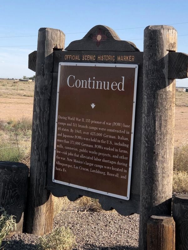
Camp Roswell was one of the first and largest base
camps built in the U.S. and was located on Orchard
Park Road. The camp operated from August 1942 to
February 1946 and interned 4,816 German POWs at
its peak. Camp construction was similar to . . . — — Map (db m235365) HM
West of this location stood the now abandoned community of Blackdom. The community was founded circa 1908 by Francis Marion Boyer and his wife Ella. Several dozen African American families homesteaded nearly 15,000 acres of land and built a . . . — — Map (db m56143) HM
Completed in 1926, the Rio Felix Bridge was one of the most important structures in New Mexico’s highway system. The bridge was placed across the river at nearly a 45-degree angle to increase stability during floods. Constructed with three 144 foot . . . — — Map (db m56141) HM
The Civilian Conservation Corps was established to provide employment for the nation's young men during the Great Depression of the 1930's. More than 50,000 were enrolled in the program in New Mexico between 1933 and 1942. CCC enrollees at the Lake . . . — — Map (db m56142) HM
During the Cold War (1946-1989), this area became home for twelve Atlas missile silo sites — America’s first operational Intercontinental Ballistic Missile system. They protected the Strategic Air Command facilities at Walker Air Force Base . . . — — Map (db m73724) HM
When 19th Century cowboys attempted to measure these lakes by tying lariats together, they found no bottom and declared the lakes “bottomless.” Today we know these sinkholes, formed by collapsed salt and gypsum deposits, are 17 to 90 . . . — — Map (db m73455) HM
Chaves County
Courthouse
has been placed on the
National Register
of Historic Places
by the United States
Department of the Interior
1985 — — Map (db m102803) HM
Dedicated to
The Men and Women of Chaves County,
New Mexico Who Served Their Country
During the Persian Gulf War
1990 — 1991
by
Roswell Cares Support Group — — Map (db m102806) WM
In Remembrance of
The Veterans of All
Wars and Military
Actions Who Made
The Supreme Sacri
Fice With Grateful
Appreciation from
The Citizens of Chavez
County
Nov. 11, 1983 — — Map (db m102807) WM
Memorial Wall Dedicated To All Citizens Of Chaves County
Who Served And Died Defending Our Freedom
( engraved on the stone wall )
World War I
Pvt. Alter, Cecil W. · Baker, Ray A. · Bozarth, Lewis Hath · Pvt. Bradley, Floyd L. · Pvt. . . . — — Map (db m102802) WM
This tablet is erected in memory of Dr. Robert Hutchings Goddard who here laid the foundations for the science of rocket propulsion. He used this tower from 1930 to 1942 for launching liquid propellant rockets, to develop a means for . . . — — Map (db m167746) HM
This famous old cattle trail, running 2000 miles from Texas to Wyoming, was blazed in 1866 by Charles Goodnight and Oliver Loving. In New Mexico, the trail followed the Pecos River north to Fort Sumner, where the government needed beef to feed the . . . — — Map (db m73457) HM
The barracks quadrangle was constructed in segments from 1909 through 1952, and completely refurbished in 1978. The quadrangle was named for railroad pioneer J. J. Hagerman and his son Herbert J. Hagerman who served as territorial governor of New . . . — — Map (db m196778) HM
Listed on the National Register of Historical Places, contractor
David Young Tomlinson began construction on this house in 1910
and completed it in 1912, the same year New Mexico became a state.
Taking cues from Frank Lloyd Wright's Prairie-style . . . — — Map (db m235388) HM
Roswell’s first building was erected near this spot. Built by James Patterson, the 15 by 15 foot trading post was a rest stop along the Goodnight Loving Cattle Trail. The trading post was later acquired by Van C. Smith who, around 1870, added onto . . . — — Map (db m102893) HM
John S. Chisum, a western icon, is generally recognized as the early West's most prominent cattleman.
In the mid-1870s, Chisum was the largest cattle producer in the nation, with as many as 80,000 longhorn steers in his herd. Beginning as a . . . — — Map (db m73451) HM
Before the construction of the elegant courthouse that stands here today, a smaller courthouse constructed in 1890 was home to Roswell’s judicial system.
In 1889, prior to construction, Captain Joseph C. Lea, Charles Eddy, and Pat Garrett (the . . . — — Map (db m73527) HM
Named for Captain Joseph Calloway Lea (1841-1904) who proposed the foundation of the Institute, and who gave the first buildings and the original site for its establishment as Goss Military Institute in 1891, on the west side of present Main . . . — — Map (db m196782) HM
One of the first female radio stars in the 1930s, Louise's career spanned from 1918-1950. Her recordings in English and Spanish sold millions of copies. Heading the Roswell-based group, Louise Massey and the Westerners, she became known . . . — — Map (db m280094) HM
In Memoriam
N.M. 200th Coast Artillery AA Regt.
8 Dec.1941 – First Into Battle W.W.II
15 Aug. 1945 – Liberated
From Death Camps
“Let Us Not Forget Their Faith In
God and Country”
Donated by V.F.W. Post 2575 . . . — — Map (db m102804) WM
In the frontier west, Pat Garrett has to be considered as one of the most famous and effective of legendary law officers. Six feet, five inches tall, he was an imposing and implacable foe of western criminals. An honest and honorable lawman, . . . — — Map (db m73452) HM
Named in honor of Colonel Daniel Cecil Pearson Born 1881 • Died 1956
D. C. Pearson served NMMI over a 50-year period starting in 1906 as Commandant of Cadets. He was also an Instructor, Dean, and in 1927 became Superintendent. The 22 years he . . . — — Map (db m130071) HM
Roswell was a watering place for the Pecos Valley cattle drives of the 1870s and 1880s. It was incorporated in 1891 and is seat of Chaves County, named for Col. J. Francisco Chaves, Civil War Soldier and delegate to the U.S. Congress from the . . . — — Map (db m73453) HM
Roswell was a watering place for the Pecos Valley cattle drives of the 1870s and 1880s. It was incorporated in 1891 and is seat of Chaves County, named for Col. J. Francisco Chaves, Civil War soldier and delegate to the U. S. Congress from the . . . — — Map (db m280093) HM
Roswell was a watering place for the Pecos Valley cattle drives of the 1870s and 1880s. It was incorporated in 1891 and is seat of Chaves County, named for Col. J. Francisco Chaves, Civil War Soldier and delegate to the U.S. Congress from the . . . — — Map (db m119935) HM
President Franklin Delano Roosevelt implemented the “New Deal,” a plan for ending the Great Depression. His economic program was was based on relief, recovery, and reform and included the introduction of the Works Progress Administration . . . — — Map (db m104410) HM
This location incorporates two of downtown Roswell's most historic buildings. East of this location is the Chaves County Courthouse, built in 1911. It is one of the best surviving examples of courthouses built in the Beaux Arts Revival "monumental . . . — — Map (db m56139) HM
Roswell’s first general store and post office stood near this spot. The building was constructed by Van C. Smith in 1870 and hosted a somewhat famous postmaster, Ash Upton, who was a political player in the Lincoln County War and the ghost writer . . . — — Map (db m102896) HM
Joseph C. Lea enrolled his son Wildy in Fort Worth University, a noted military school. Lea was so impressed with his son's education that he recruited the superintendent of the school, Colonel Robert S. Goss, to found a military institute in . . . — — Map (db m104395) HM
During World War II a prisoner of war camp was established by the War Department near Orchard Park southeast of Roswell, which housed some 4800 German prisoners of war. On January 1, 1943, the first prisoners arrived there from the “Afrikacorps”, . . . — — Map (db m72748) HM
This site is named for Victor H. Waldrop and stewardship for is shared by the New Mexico Department of Transportation and local bird enthusiasts. Wind blown-sand deposited at the base of Mescalero Ridge forms a 60 mile expanse of open dunes and . . . — — Map (db m73458) HM
Roswell Army Air Field was established in 1941 and renamed after New Mexico native Brig. Gen. Kenneth Walker in 1948. Once the Strategic Air Command’s largest base, its bomber fleet and Atlas missiles were key deterrents during the early years of . . . — — Map (db m119809) HM
Completed 1927
Named in honor of
Colonel James William Willson 1872-1922
Commandant 1898–1901
Superintendent 1901–1922
Colonel Willson came to NMMI in 1898 and was the prime mover in developing this school into a premier military . . . — — Map (db m196787) HM
He was known by many names, William Henry McCarthy, William H. Bonney, but he was best known as "Billy the Kid." Born in New York City in 1859, he would find infamy in the old west as a hired gun, outlaw and other wise stone-cold killer. His mother . . . — — Map (db m269527) HM
• Billy the Kids tombstone was stolen in 1951. Its location was a mystery for twenty-six years until 1976 when it was recovered in Granbury, Texas, by Joe Bowlin.
• The tombstone was stolen again on Feb. 8, 1981 and recovered four days later . . . — — Map (db m269530) HM
The U.S. Army established Fort Sumner in 1862 as a supply and control point for the Bosque Redondo Indian Reservation. About 10,000 Navajo were forcibly relocated from the Four-Corners Region during the tragic march known as the Long Walk. About 500 . . . — — Map (db m73718) HM
You are entering the grounds of historic Fort Sumner, headquarters of the Bosque Redondo Indian Reservation.
Over 400 Mescalero Apache and 7,000 Navajo were held here as prisoners of war. The museum tells their stories. — — Map (db m280103) HM
Why Here?
General James H. Carleton, commanding the Military Department of New Mexico, ordered the establishment of Fort Sumner in late 1862. Carleton and others mistakenly believed the Pecos River and the land surrounding Fort Sumner would . . . — — Map (db m269513) HM
A New Community
Following the disastrous failure of the U.S. Government's Bosque Redondo experiment, the land set aside as reservation returned to the public domain. The Army sold the fort buildings and other improvements to the famous . . . — — Map (db m269514) HM
Charlie Bowdre fought alongside Billy the Kid in the Lincoln County War. After losing the war, both he and the Kid retreated to Fort Sumner, NM, where Bowdre worked as a cowboy and was also suspect in Billy's outlaw endeavors. In December 1880 the . . . — — Map (db m269534) HM
A Navajo woman born in Canyon de Chelly, AZ, Deluvina was taken as a slave during an Apache raid when she was a child. Later adopted by Lucien Maxwell of Fort Sumner, she was a loyal servant of the Maxwell family.
She was present in Fort . . . — — Map (db m269544) HM
Population 1,250 – Elevation 4,028 ft.
Named for the fort built in 1862 to guard the Bosque Redondo Indian Reservation, the town of Fort Sumner grew out of settlements clustering around the Maxwell family properties. It moved to its present . . . — — Map (db m73721) HM
Population 1,250 – Elevation 4,028 ft.
Named for the fort built in 1862 to guard the Bosque Redondo Indian Reservation, the town of Fort Sumner grew out of settlements clustering around the Maxwell family properties. It moved to its . . . — — Map (db m73722) HM
Named for the fort built in 1862 to guard the Bosque Redondo Indian Reservation, the town of Fort Sumner grew out of settlements clustering around the Maxwell family properties. It moved to its present site with the construction of the Belén Cutoff . . . — — Map (db m270116) HM
Fort Sumner was established in 1862 to control the Diné (Navajo) and N'de (Mescalero Apache) who were forcibly marched from their homelands and interned at the Bosque Redondo Reservation. Conditions here caused great suffering. The N'de escaped in . . . — — Map (db m270115) HM
It is said that... While drunk one night, Grant had the misfortune of getting on the wrong side of "Billy the Kid" at Beaver Smith's saloon in Ft. Sumner, NM. After a heated discussion, Grant bet Billy $25 that he would kill a man first. Billy . . . — — Map (db m269524) HM
A native of Kaskaskia, Ill, a fur trader and trapper who by industry, good fortune and trading became sole owner in 1864 of the largest single tract of land owned by any one individual in the United States.
Maxwell founded the First National . . . — — Map (db m73719) HM
Fort Sumner was established in 1862 to guard the Navajo and Apaches on the Bosque Redondo reservation. It was discontinued as a military post in 1868 and the buildings and site sold to Lucien B. Maxwell. William "Billy the Kid" Bonney was killed . . . — — Map (db m73713) HM
Tom O'Folliard was the best friend of outlaw William Bonney (Billy the Kid). Both men were members of the Regulators during the Lincoln County War. O'Folliard was shot in the shoulder during the famous Five-Day Battle in Lincoln. After the war . . . — — Map (db m269532) HM
Welcome to the cemetery at Historic Fort Sumner. The U.S. Army established this post cemetery in 1863, shortly after opening the nearby fort and the Bosque Redondo Indian Reservation. Between 1863 and 1869, 22 soldiers and officers, along with . . . — — Map (db m269521) HM
William "Billy the Kid" Bonney Grave 1859-1881
Henry McCarty is better known by his alias, William "Billy the Kid" Bonney. His family moved to the New Mexico territory in 1873. Bonney was charged with numerous thefts and involved in nine . . . — — Map (db m270111) HM
Lake Sumner was originally named Alamogordo Lake after Alamogordo Creek. The lake and surrounding land became a state park in 1960. In 1974, the lake and state park were renamed Sumner in honor of Colonial Edmond Vose Sumner who in the mid 19th . . . — — Map (db m245417) HM
At noon on November 30, 1944, a World War II supply train hauling 165 five-hundred-pound bombs headed for the Pacific Theater derailed in Tolar. The train caught fire and the bombs exploded. The blast, which leveled nearly every building in town, . . . — — Map (db m269512) HM
Built 1962. The only Cold-War era fallout shelter/school building in the United States.
Site no. 1781
A Registered Cultural Property
State of New Mexico — — Map (db m235316) HM
Artesia, named for the area's many artesian wells, lies on the route of the Pecos Valley cattle trails used by Charles Goodnight, Oliver Loving, and John S. Chisum. The town, established in 1903, is located in what was once part of Chisum's vast . . . — — Map (db m300922) HM
Artesia, named for the area's many artesian wells, lies on the route of the Pecos Valley cattle trails used by Charles Goodnight, Oliver Loving, and John S. Chisum. The town, established in 1903, is located in what was once part of Chisum's vast . . . — — Map (db m280073) HM
In 1590-91 Gaspar Castaño de Sosa, a Portuguese by birth, took an expedition up the Pecos River in an attempt to establish a colony in New Mexico. His venture was a failure, but it led to a permanent settlement under Don Juan de Oñate in 1598. . . . — — Map (db m280126) HM
Before the term "cowboy" became popularized, most men who drove cattle for a living were called "cowhands" or "vaqueros." The Spanish word, vaquero, is derived from the term vaca, meaning cow. Today vaquero translates to cowboy in English, but the . . . — — Map (db m251253) HM
Dedicated
to the
Spirit of the Pioneer Woman
Sculptor: Robert Summers
Foundry: Eagle Bronze
First Lady of Artesia is approximately 12 feet tall and 6 feet in diameter. The artist designed Sallie Chisum from several photographs . . . — — Map (db m73436) HM
The men who drove cattle from Texas up along the Pecos River during the mid-1860s until the barbed-wire era of the early 1900s were tough, independent and courageous. Those who chose to settle down and ranch in the surrounding plains or rugged . . . — — Map (db m61443) HM
"He was born with compassion" is the way John R. Gray was described by his daughter, Terry Gray Chandler, and is remembered by those who knew him. His outward appearances portrayed him as a gruff cowboy, but he was known as a benefactor in his town, . . . — — Map (db m235349) HM
Mack Chase got his start in the oilfield in 1945 at the young age of 14. After graduating from Artesia High School, he went straight to the field full time on a pulling unit, then into two years of service in the United States Army in the early . . . — — Map (db m235351) HM
“It is my boiled-down, concentrated, solidified and undiluted opinion that the oil development in this Valley so far is only a preliminary skirmish compared with the artillery that will soon follow.” – Martin Yates, Jr., 1924
The brochures . . . — — Map (db m235362) HM
“They rode out over the country in a Model T Ford. When they came to what felt like the right spot she said, ‘Stop here,’ and that's where they drilled the well. She kept up pretty well with Dad's business. Dad had some failures and she didn't . . . — — Map (db m235363) HM
The Trail Boss monument features six brands, two on each of the Longhorns and two more on the horse. Every rancher owns a distinctive brand, with the location of the brand on the livestock being part of the brand's unique character. The brands . . . — — Map (db m254703) HM
Sallie was 19 when she arrived from Texas at her Uncle John Chisum’s Jinglebob Land and Livestock Company ranch south of Roswell. Her ranching skills rivaled those of the cowboys she joined driving cattle up her uncle’s Goodnight-Loving Trail to . . . — — Map (db m235270) HM
Seven Rivers was located south of Artesia near the confluence of seven branches of a stream that flowed into the Pecos River. Settled in the mid-1860s, the town flourished as a trading post and refuge for participants in the Lincoln County War. The . . . — — Map (db m300923) HM
[Top]
has been placed on the
National Register
of Historic Places
by the United States
Department of the Interior
1905
[Bottom]
Baskin Building
Built 1905. Example of early Artesia commercial building of . . . — — Map (db m235364) HM
At the end of the civil war a huge glut of cattle, as many as 3 million, occupied lands in Texas. Markets to the north at the developing railheads and markets in Kansas, Colorado and New Mexico afforded much higher prices than the $3 to $5 per head . . . — — Map (db m254712) HM
Gear was critical to the 19th century cowboy who spent much of his time on the trail. In addition to its functionality, a cowboy's gear also served as a source of pride and showed a sense of style. Here, the Trail Boss features gear common in this . . . — — Map (db m254707) HM
Dedicated to the men and women who take the risks and do the work to find, produce and refine New Mexico oil and gas. This monument of a 1950s drilling rig is unveiled in celebration of the 80th anniversary of the Illinois #3, the first commercial . . . — — Map (db m61445) HM
In the mid 1860s, an increasingly dangerous Comanche Indian presence threatened cattle drives heading directly north out of Texas. Because of the danger and hoping for cattle markets at US Military Forts along the eastern front of the Rocky . . . — — Map (db m254710) HM
The Illinois State #3 was the first commercial oil well drilled in Southeast New Mexico and the first on state-owned lands in New Mexico.
The oil sand, or "pay," was drilled into on April 9, 1924. At some time in late April or May, the well . . . — — Map (db m235360) HM
After meeting up in the Artesia-area oil patch on a number of occasions, Mack Chase and Johnny Gray decided to go into business together. In 1972, they formed Marbob Energy Corporation, named after their wives, Marilyn Chase and Bobbie Gray. The oil . . . — — Map (db m235352) HM
[Top]
has been placed on the
National Register
of Historic Places
by the United States
Department of the Interior
1908
[Bottom]
Sallie Chisum Robert House
Built of cast-stone, this house was erected in . . . — — Map (db m235341) HM
Van was a worker's worker and this sculpture is dedicated to all the oilfield workers who make this industry great.
Van Stratton Welch was born in 1880 in a log cabin in Allegheny County, New York, the son of a Civil War veteran and oil barge . . . — — Map (db m235359) HM
Inspired by a vintage travel postcard, artist Michael Fish created his own modern version in November 2021. The words were changed from "Greetings from" to "Welcome to Artesia" as the mural sits at the entry point into the Downtown District and . . . — — Map (db m300959) HM
These vast and magnificent caverns contain over 21 miles of explored corridors. The chambers contain countless stalactites and stalagmites unrivaled in size and beauty. The caverns are within a reef that formed in an ancient sea 240 million years . . . — — Map (db m280128)
The Civilian Conservation Corps provided employment for more than 50,000 young men in New Mexico during the great depression of the 1930's. At the National Park Service CCC Camp, they developed nearby Rattle Snake Springs into a permanent water . . . — — Map (db m280129) HM
The massive concrete flume in the distance
carries water from the Pecos River to
irrigate much of the farmland in this area.
It is a vital link in an extensive irrigation
system which made possible development
of the region's agricultural . . . — — Map (db m300581) HM
The massive concrete flume in the distance carries water from the Pecos River to irrigate much of the farmland in this area. It is a vital link in an extensive irrigation system which made possible development of the region's agricultural . . . — — Map (db m300582) HM
The massive concrete flume in the distance carries water from the Pecos River to irrigate much of the farmland in this area. It is a vital link in an extensive irrigation system which made possible development of the region's agricultural . . . — — Map (db m301295) HM
The Civilian Conservation Corps (CCC) provided employment for more than 50,000 young men in New Mexico during the Great Depression as part of President Roosevelt's New Deal Program. Three CCC companies were located where the Carlsbad Hospital now . . . — — Map (db m280131) HM
Eddy County was created in 1889. The original Eddy County courthouse was built in 1892 and is considered to be one of the most picturesque buildings of this type in the Southwest with its Spanish style architecture. It contains many unique and . . . — — Map (db m300850) HM
After leaving Fort Sumner, the Goodnight-Loving Trail forked in two directions. This branch, developed by Oliver Loving in 1866, followed the Pecos River to Las Vegas, and the Santa Fe Trail to Raton Pass. The great Texas cattle drives followed this . . . — — Map (db m300575) HM
Fellow Travelers, imagine the land and mountains before you covered by a deep inland sea. Then imagine a large reef forming over 255 million years ago. As the inland sea vanished minerals such as calcite and aragonite bonded together the sea life . . . — — Map (db m61488) HM
Guadalupe Mountains to southwest rise from Pecos River Valley, with higher southern peaks at 8,750 feet. Bold escarpment is of famous Capitan limestone, an ancient reef similar to Great Barrier Reef of Australia, and host to Carlsbad Caverns as . . . — — Map (db m280133) HM
During the terrible "la grippe" flu epidemic of
1918, Grandma fearlessly led other women in
nursing and feeding the sick in tents and shacks
along the banks of the Pecos River. She did not
lose a single patient, later opening a sanatorium
in . . . — — Map (db m300832) HM
Mother Magdalen and the Sisters of Loretto (1852 - 1968). Four Sisters of Loretto, Mother Magdalen Hayden and Sisters Roberta Brown, Rosana Dant and Catherine Mahoney, arrived in Santa Fe from Kentucky on September 26,1852. In January 1853 . . . — — Map (db m300896) HM
He laid the foundation of the National Park Service defining and establishing the policies under which its areas shall be developed and conserved unimpaired for future generations. There will never come an end to the good that he has done. — — Map (db m5979) HM
Don Antonio de Espejo, leader of the third expedition to explore New Mexico, passed near here on his return to Mexico City in 1583. After learning of the martyrdom of two Franciscan friars from an earlier expedition, he explored the Pueblo country . . . — — Map (db m300564) HM
270 entries matched your criteria. The first 100 are listed above. Next 100 ⊳