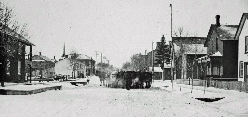
On Queen Street South (Provincial Highway 50) at King Street East (Regional Road 9), on the right when traveling north on Queen Street South.
On this site once stood the Masonic Arms Hotel. Built circa 1848 by James Johnson, an Irish innkeeper, this two-storey hotel contributed much to the social and economic life of the village of Bolton in the latter half of the nineteenth century. . . . — — Map (db m255196) HM
On Chapel Street at John Street, on the right when traveling north on Chapel Street.
In honoured memory of the over 4,000 men of the 20th Regiment Halton Rifles and the 36th Peel Regiment who served in the First Contingent (1st and 4th Bn), the Perpetuated Battalions (37th, 74th, 76th, 126th, 164th 234th) and other units of the . . . — — Map (db m287875) HM WM
On Main Street South at William Street East, on the right when traveling south on Main Street South.
[east side]
1914
1918
Ypres
Ferstubert
Mount Sorrell
Somme
To perpetuate the memory of our Glorius Dead and to
Gratefully recognize the scarifice of the men of Brampton in the Great War
1914-1918
And
1939-1945 . . . — — Map (db m288158) WM
On Sproule Drive at Ken Whillans Drive, on the right when traveling east on Sproule Drive.
For more than a century, Brampton was known as the "Flowertown of Canada". From the mid 19th century until the 1970s, hundreds of acres of land in the City were devoted to growing prize-winning orchids, hybrid roses, chrysanthemums and many other . . . — — Map (db m287693) HM
On Queen Street East at Chapel Street, on the right when traveling east on Queen Street East.
The Carnegie Library was constructed in 1906 in the Beaux
Arts style. It exhibits classic features including a rusticated basement level constructed of large stone. The main floor, which is constructed of brick, is divided near the top by a running . . . — — Map (db m287874) HM
Gage Park was the first municipal park in Brampton, established at the peak of the City Beautiful Movement that swept across North America in the early 20th century. Before the park was created, public celebrations and large gatherings were held . . . — — Map (db m288008) HM
The Gage Park bandstand was built in 1903 as a dedicated musical performance space for the Brampton Mechanics Band (now known as the Brampton Concert Band). It continues to be enjoyed by the public as an iconic feature of Gage Park.
At the turn . . . — — Map (db m288011) HM
On Church Street West 0.2 kilometers west of Main Street North, on the left when traveling west.
Historical Summary 27 Church Street West
This railway station at 27 Church Street West is federally recognized under the Heritage Railway Stations Protection Act and was registered on May 1, 2006, it is a one-and-a-half-storey . . . — — Map (db m287795) HM
On Wellington Street East at Main St S, on the left when traveling north on Wellington Street East. Reported missing.
This court house building, together with the adjacent jail and registry office, served as the judicial and administrative centre for the County of Peel for more than a century. Its prominent location on a rise of land and its stately . . . — — Map (db m287664) HM
On Main Street South at Wellington Street West, on the right when traveling south on Main Street South.
Born near Brampton, educated there and at the Toronto Normal School, Gage taught for a time and studied medicine for a year before joining, in 1874, the publishing house of Adam Miller and Co. In 1875 he became a partner and five years . . . — — Map (db m288014) HM
On McLaughlin Road North at Campbell Drive, on the left when traveling north on McLaughlin Road North.
The Blackburn family was the first modern-day Black
family to live in Brampton, moving into the city in 1958.
Estelle and Austin Blackburn purchased a home on Campbell Drive and moved to the Flowertown community.
The family was met with . . . — — Map (db m287691) HM
On Ken Whillans Drive at Sporule Drive, on the right when traveling south on Ken Whillans Drive.
The Dale Estate
The Dale Estate nurseries played an instrumental role in the development of Brampton, establishing its reputation as "The Flower Town of Canada." The business began in 1863 with its founder Edward Dale selling . . . — — Map (db m287695) HM
On Wellington Street West at Main Street South, on the right when traveling south on Wellington Street West.
The Etobicoke Creek plays an integral role in shaping Brampton's identity. its name is derived from the Ojibwe word "Wah-do-be-kaung" meaning "the place where the black alders grow". Before the first European settlers arrived, the Creek was a source . . . — — Map (db m287963) HM
On Main Street North 0.2 kilometers north of Vodden Street East, on the right when traveling north.
Chinguacousy Township, part of the Missisauga Indian tract, was surveyed in 1819. John Elliott, John Scott and William Buffy were early settlers here of a crossroads hamlet first known as Butty's Corners. In 1834 Elliott laid out a village plot and . . . — — Map (db m287692) HM
On Embleton Road 0.2 kilometers east of Mississauga Road, on the right when traveling east.
The decision to build the Huttonville church came following
a meeting held on February 16, 1885. At that meeting it
was decided to combine the congregations of the Page
and Springbrook churches. The Page Church was demolished while the . . . — — Map (db m287690) HM
On Main Street North at Market Street, on the right when traveling south on Main Street North.
Established circa 1880, the beautiful McKillop House displayed elements of the Italianate style and was a well-known landmark on Main Street. In its early days the home was owned by Dr. Burns, a preacher of Grace Methodist Church.
It was later . . . — — Map (db m287872) HM
On Chapel Street at Queen Street East, on the right when traveling west on Chapel Street.
This structure was originally constructed as a market and town hall in 1854. The three arches which were later closed each contained double doors opening into the market area. Three of the four windows on the front of the second storey were used to . . . — — Map (db m196179) HM
On Wellington Street East 0.1 kilometers east of Main Street South, on the right when traveling east.
William Perkins Bull, K.C., LL.D. 1870-1948
Financier, philanthropist and historian William Perkins Bull was born in Downsview, Ontario, in 1870. Bull attended Osgoode Hall Law School and was called to the bar in 1896. He . . . — — Map (db m288047) HM
On Old Church Road (Peel Regional Road 22) at Marilyn Street, on the right when traveling east on Old Church Road (Peel Regional Road 22).
A Community Hub
The Caledon East Community Memorial Hall stood on this site from 1923 to 1981. Prominent local builders Joseph Proctor and Samuel White oversaw construction of the brick building, which was set on three acres of land purchased . . . — — Map (db m306126) HM
On Forks of the Credit Road 1.5 kilometers east of Mississauga Road, on the left when traveling east.
The Niagara Escarpment is an important part of Ontario's natural heritage system. It hosts a myriad of flora and fauna, some of which are endangered or rare. In 1973,
Premier Davis and the Government of Ontario took the remarkable step of enacting . . . — — Map (db m305658) HM
On Outer Circle 0.4 kilometers east of Mississauga Road, on the left when traveling east.
An accomplished British artist who gained prominence in Canadían cultural circles, Charlotte Morrell was born in the County of Essex, England. She studied art in London and, while still a young woman, achieved distinction for her paintings and . . . — — Map (db m284032) HM
Merigold's Point was the name given to this part of Clarkson, situated at the foot of Southdown and Lakeshore Roads. Most of this land is now owned by Suncor Energy, but was previously used for farming fruit, vegetables and wheat. The Bradley House, . . . — — Map (db m258066) HM
The name Merigold's Point was the unofficial name for this early settlement. The area was named for Thomas Merigold, Lewis Bradley's father-in-law.
The families who settled here were Merigold, Jarvis, Bradley, Thompson, and Marlatt. Lewis' petition . . . — — Map (db m257976) HM
On Mississauga Road 0.4 kilometers north of North Sheridan Way, on the right when traveling south.
The Credit Mission, also known as the Credit Indian Village, was located on the site of what is now the Mississaugua Golf & Country Club. The Credit Mission was part of the Government's plan to settle Native peoples in one area and to allow for new . . . — — Map (db m257702) HM
On Orr Road 0.5 kilometers east of Clarkson Road South, on the right when traveling east.
Conflict came to Canada in June of 1812 when the United States of America declared war on Great Britain and its North American colonies. Civilians in Upper Canada (Ontario) felt the brunt of the war, and many able-bodied men volunteered to serve . . . — — Map (db m257961) HM WM
On Mississauga Road 0.2 kilometers north of North Sheridan Way, on the right when traveling north.
Thanks in large part to the efforts of Egerton Ryerson, Reverend Peter Jones and his brother John, and Chief Joseph Sawyer, the Methodist faith became established amongst the Mississaugas at the Credit River.
Elected as Chief in 1829, Reverend . . . — — Map (db m257673) HM
On Mississauga Road 0.4 kilometers North Sheridan Way, on the right when traveling north.
In a short period of time the Credit Mission Village grew to include a school, a Methodist chapel, a sawmill, and a meeting lodge. Thanks in large part to the leadership efforts of Reverend Peter Jones (Kahkewaquanaby, 1802-1856), his brother John . . . — — Map (db m257892) HM
On Mississauga Road 0.4 kilometers north of North Sheridan Way, on the right when traveling north.
The Mississaugas, who refer to themselves as Anishinabe, are part of the Algonkian/Algonquin culture. In 1640 Jesuits first recorded a people they referred to as the Oumisagai (Mississaugas), living near the Mississagi River on the northwestern . . . — — Map (db m257896) HM
On Flagship Drive 0.4 kilometers east of Tomken Road.
Born on a farm which included this site, Kennedy was educated locally and in Toronto, and became active in local politics. He served with distinction in the First World War, later attaining the rank of colonel in the militia. Elected in 1919 to . . . — — Map (db m242970) HM
On Clarkson Road North 0.2 kilometers north of Truscott Drive, on the right when traveling north.
Named after a city in India, Benares was home to the Harris family starting in 1837. Retired British Military Captain James Harris and his wife Elizabeth settled on the 28 acre farm estate to raise their family of eight children. Their youngest son . . . — — Map (db m257932) HM
On Clarkson Road North 0.2 kilometers north of Truscott Drive, on the right when traveling north.
Born in Newmarket, Ontario, Mazo de la Roche was a prolific writer whose works include novels, short stories, plays, and autobiography. Her novel Jalna, first in a series of sixteen, won the prestigious
Atlantic Monthly . . . — — Map (db m278046) HM
On Dundas Street East at Cawthra Road, on the right when traveling west on Dundas Street East.
Constructed of stone from the nearby Etobicoke River, this
building, also known as the Stone Chapel, is a rare surviving example of a "union" chapel from the settlement period of Upper Canada. It was erected in 1837 through the
efforts of John . . . — — Map (db m242978) HM
On Dundas Street East at Cawthra Road, on the right when traveling west on Dundas Street East.
War came to Canada in June of 1812 when the United States of America declared war on Great Britain. Local civilians, many of whom were American by birth, felt the brunt of the war. Some militia volunteers fought in battles, while others served in a . . . — — Map (db m242981) HM WM
On Mississauga Road 0.1 kilometers north of Dundas Street West, on the right when traveling north.
Born in Ireland in 1769, Magrath was educated at Trinity College, Dublin. He applied to the Society for the Propagation of the Gospel for a colonial missionary post and emigrated to Upper Canada with his family. In 1827 he was appointed to the . . . — — Map (db m257665) HM
On Lakeshore Road East at Hydro Road, on the right when traveling east on Lakeshore Road East.
In May, 1915, Curtiss Aeroplanes and Motors, Ltd. established Canada's first aerodrome and flying school on this site. The school, and the Curtiss aircraft factory on Strachan Avenue in Toronto, were managed by John A.D. McCurdy, Canada's first . . . — — Map (db m242983) HM
Many vessels that sailed out of Port Credit were lost on Lake Ontario, along with the sailors that sailed on them. Ships wrecked in the lake included the Augusta, Barque Swallow, Brothers, Coronet, Jessie Drummond, Maggie Hunter, Morning Star, . . . — — Map (db m258714) HM
On Stavebank Road South near Port Street East, on the right when traveling south.
The Credit River meanders through our landscape, much as it has done for thousands of years. Its lazy course through our modern city belies its importance to early life in what is today the city of Mississauga. To the Indigenous Mississaugas the . . . — — Map (db m258581) HM
In 1826, the government built a village for the Mississaugas on their traditional lands on what is now the upper portion of the golf club property overlooking the Credit River Valley. The village began as 20 dressed-log houses including a . . . — — Map (db m243009) HM
For generations, people have been drawn to the mouth of the Credit River, and the development of roads brought an increased need for a reliable way to cross the Credit River.
There have been many different ways of crossing over time.
After the . . . — — Map (db m258584) HM
The Credit River begins near Orangeville, 60 kilometres north of Port Credit. As it passes through the City of Mississauga it is sometimes hidden behind shopping centres and housing estates. At Port Credit it flows through a marsh before emptying . . . — — Map (db m258449) HM
Dundas Street was the first road constructed (1790s) through Toronto Township. It was laid out one mile from the lake as a defensive measure against the threat of American invasion. The purchase of lands from the Native Mississaugas opened up the . . . — — Map (db m258465) HM
Port Credit developed relatively late because of the Native claim on the river's mouth. In 1834 under order of government the Credit Harbour Company was organized. Its task was to construct a commercial harbour and build shipping piers. The majority . . . — — Map (db m258510) HM
The native Mississaugas (of the Ojibway nation) had long recognized the mouth of the Credit River as a meeting place. Up river was an important hunting and fishing ground. After 1750, British traders were guided to this area in the spring and . . . — — Map (db m258839) HM
On Stavebank Road at Park Street East, on the right when traveling north on Stavebank Road.
The Battle of Vimy Ridge,
April 9-12, 1917
The Battle of Vimy Ridge was a pivotal military engagement in the First World War. The Ridge was a strategic and heavily fortified ridge that held a commanding view. Canadian troops were ordered to . . . — — Map (db m258447) HM
On Lakeshore Road East at Stavebank Road South, on the left when traveling west on Lakeshore Road East.
Joyce May Firman became the first female letter carrier in Ontario and the first long-term female letter carrier in Canada at age 44. In 1965 and 1966 she was a 'helper at Christmastime, and by October 1967 she was on staff full-time.
Joyce . . . — — Map (db m243007) HM
On Stavebank Road at Park Street East on Stavebank Road.
Those whom this memorial
commemorates were numbered
among those who, at the call
of King and country, left
all that was dear to them,
endured hardness, faced danger,
and finally passed out of
the sight of men by the path
of duty and . . . — — Map (db m273320) WM
In an age before concrete, a constant supply of building stone was essential. Beginning in the 1840s and lasting until just after the First World War, the Lake Ontario waterfront between the Credit River and Burlington Bay was busy with sailors . . . — — Map (db m258710) HM
The steam-driven water pump on display is a duplex pump manufactured by Canada Foundries Limited of Toronto. It was installed in the factory in 1912 as a fire pump. Employees tested the pump on a regular basis until mid-1970, when it was taken out . . . — — Map (db m258782) HM
St. Lawrence Starch Company (often called "The Starch Works" by local residents) quickly became the largest employer in the community. By 1900, more than 100 men, youth and boys worked at the plant. Over time, several generations of the same family . . . — — Map (db m258821) HM
St. Lawrence Starch purchased the factory site in 1889. Archie Hutchison bought 10 acres from the Cotton Estate that was located at the eastern end of the Village of Port Credit. John Gray supervised the construction of the original factory. . . . — — Map (db m258822) HM
Incorporated in 1889, St. Lawrence Starch
Company built a corn wet milling factory at the foot of Centre Road (now Hurontario Street) in Port Credit. Cornstarch production began in April of 1890. The name St. Lawrence was chosen because it was . . . — — Map (db m258825) HM
New development came to the port in the late 1950s as a result of
the development of the St. Lawrence Seaway. The Department of Public Works built a new 120-metre pier here in 1952, and new navigation lights were installed. The pier was the . . . — — Map (db m258751) HM
On Lakeshore Road West at Front Street North, on the right when traveling west on Lakeshore Road West.
Near this site on the Credit River's eastern bank, the
government of Upper Canada built a "post-house" or inn in
1798, for the use of persons travelling between York and such settlements as Niagara and Detroit. Constructed of dressed timber, it . . . — — Map (db m242984) HM
In 1834 the Credit Harbour Company was formed to improve the harbour for shipping and navigation purposes.
The river channel also had to be deepened as silting up was an ongoing challenge. A commercial fishery began out of Port Credit in the . . . — — Map (db m258588) HM
The harbour has been a meeting place and shipping centre for generations. Historically large amounts of rough cut logs, sawn lumber, and staves were floated down the river to be rafted or loaded onto schooners to be shipped to York or elsewhere. . . . — — Map (db m258628) HM
The lighthouse is often the recognized symbol of a port, and Port Credit has had more than one. The Peel General Manufacturing Company, under the direction of Frederick Chase Capreol, was formed in 1863 with an ambitious plan for industrial . . . — — Map (db m258754) HM
The seemingly tranquil course of the Credit River belies its importance to the early development of our city. The establishment of mills, particularly saw and grist mills, along with the harnessing of water power, was often the catalyst that . . . — — Map (db m258602) HM
On Stavebank Road South at Port Street East, on the right when traveling south on Stavebank Road South.
By the 1790s, the British Crown recognized that the Mississaugas controlled a large amount of land at the western end of Lake Ontario known as the "Mississauga Tract". At the end of July of 1805 representatives of the British Crown convened a . . . — — Map (db m258575) HM
Since 1974 the Ridgetown has been a familiar sight at the
entrance to the Port Credit harbour. The Ridgetown was
built as the S.S. William E. Corey, and was launched on June
24, 1905 by the Chicago Shipbuilding Company. She served
as . . . — — Map (db m258756) HM
On Mississauga Road at Barbertown Road, on the right when traveling north on Mississauga Road.
The Barber family emigrated from Ireland to Canada in 1822. In 1837 the four brothers set up a mill complex in Georgetown. In 1844, William (1808-1887) and Robert (1819-1890) Barber purchased William Comfort's
Streetsville area saw and grist mill . . . — — Map (db m257305) HM
On Queen Street South at Main Street, on the right when traveling north on Queen Street South.
The intersection of Queen Street and Main Street has been the hub of commercial and social activity in Streetsville since the arrival of Timothy Street and the founding of the village circa 1820. Many of Streetsville's earliest businesses were . . . — — Map (db m257567) HM
On Queen Street South at Reid Drive, on the right when traveling north on Queen Street South.
Reed Mill
This flour mill was built on the Credit River southeast of the village of Streetsville, in the mid-1830s by John Beaty and by 1861 had an annual Capacity of 12,000 barrels of flour. The mill employed four pairs of milling stones, . . . — — Map (db m257580) HM
On Queen Street South, on the right when traveling north.
War came to Canada in June of 1812 when the United States of America declared war on Great Britain. Local civilians, many of whom were American by birth, felt the brunt of the war. Some militia volunteers fought in battles, while others served in . . . — — Map (db m257528) HM WM
On Queen Street South, on the right when traveling north.
In the early years of settlement in Streetsville, the community lacked a formal cemetery. Timothy Street sought to rectify this situation.
On February 24th, 1824 Timothy donated part of his land to the Presbyterian congregation for use as a . . . — — Map (db m257527) HM
On Queen Street South at Barry Avenue, on the right when traveling south on Queen Street South.
Although Streetsville's prosperity peaked before 1867, the village continued to thrive after the arrival of the Credit Valley Railway in 1879. It was too late, however, for the village to supplant Brampton as the business and political centre of . . . — — Map (db m257558) HM
On Queen Street South 0.1 kilometers south of Church Street, on the right when traveling north.
This was Peel's first secondary school.
Growing enrolment necessitated its enlargement in 1877, including the landmark tower. In 1951, it ceased being used as a school. It was the town hall from 1966 until 1974, when Streetsville was amalgamated . . . — — Map (db m257463) HM
On Queen Street South 0.1 kilometers north of Church Street, on the right when traveling north.
In 1824 Timothy Street deeded one acre
of his land to trustees of the nearby
Presbyterian Church of Scotland, one of
the earliest congregations in the area to
serve Streetsville as a Protestant burying
ground. The first established cemetery . . . — — Map (db m257467) HM
On Queen Street South 0.1 kilometers south of Water Street, on the right when traveling north.
This water wheel from Streetsville P.U.C.’s power
plant at the dam in the Credit River dates back to
1907. It provided the first supply of electricity
to the Streetsville area and today is a visible
reminder of the contribution of the Credit . . . — — Map (db m260980) HM