He was born Sept. 25, 1882 on the old Stevenot Homestead one-half mile west of this marker. Son of Emile K. and Sarah E. Stevenot and the grandson of Gabriel K. Stevenot, Calaveras County pioneer who pitched tent there in April, 1850.
Student, . . . — — Map (db m6847) HM
This building, once owned by Sam Choy, is the only building remaining from a large Chinese settlement here in early Gold Rush days. Now owned by the City of Angels Camp. — — Map (db m31889) HM
Built in the early 1850’s, year not documented, by Frank Egan, as the Central Park Hotel. Then, it included a brothel upstairs. The hotel was sold to Mrs. Mitrovich and renamed The Waverly Hotel. Blagoje “Billy” Ratkovich bought the . . . — — Map (db m40811) HM
In Tribute
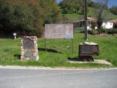
To the pioneer craftsman whose skills, ingenuity and determination established permanent communities in the wake of the gold rush, and whose progeny have continued to contribute to the region’s character and spirit, recognition is . . . — — Map (db m58925) HM
Avery one-room school was established April 4, 1886. School was in session from March to December due to winter snows that kept the highway closed.
Hazel Fischer taught here from July 1916 to March 1941. Ms Fischer took all the students to San . . . — — Map (db m53304) HM
The oldest continuously operated hotel in Calaveras County, it was built as a family home in 1851 by Joseph and Sarah Goodell of Maine. The Goodells later relocated to Stockton. In 1853 Peter and Nancy Avery, also of Maine, began operating it as a . . . — — Map (db m20626) HM
July 1875, at Funk Hill 4 miles due east Black Bart, alias Charles E. Bolton or Boles, wearing a flour sack mask and a linen duster, waving a double-barrelled shot gun held up the Wells Fargo Sonora to Milton Stage. The first successful stage . . . — — Map (db m70090) HM
Present site of one of the last family-founded and-still-operated-by-that-family phone companies in America. Founded by Jim Tower, who strung his first telephone wires in 1895 tacked along posts of barb wire fences, earning himself the colorful . . . — — Map (db m57982) HM
With the discovery of copper ore in 1860 by Thomas McCarty and William K. Reed, the town of Copperopolis sprang into existence and soon became the largest producer of copper in the western United States. The population of Copperopolis grew to exceed . . . — — Map (db m13004) HM
Located atop a prominent hill, this cemetery overlooks the community of Copperopolis and it’s surrounding area.
After crossing through the wrought iron gates and walking amongst the paths you’ll find yourself surrounded by the 4 foot natural stone . . . — — Map (db m19759) HM
Josephine Felix arrived from France in 1852, one of the first settlers in Salt Spring Valley. Soon widowed, she established a waystation at the junction of the Angels and Central Ferry Roads. She wed neighbor Alban Hettick and the couple developed a . . . — — Map (db m58929) HM
In the 1860’s Copperopolis had a population of 10,000 and was the principal mine in the west. The mine closed in 1945.
This building has housed a saloon since it was built in 1862. Twice it survived raging fires which destroyed the town.
The bar . . . — — Map (db m19770) HM
Board’s Crossing was first used as a cattle crossing in the early 1870’s. Brothers David and William Board moved here from Missouri in 1854. They settled in Salt Springs Valley and raised cattle. This shallow ford across the river was a favorite . . . — — Map (db m58791) HM
Built in 1860 by John and Rebecca Gardner, this was a stage coach stop on the Big Trees Carson Valley Road. A toll road from 1862 – 1910. The hotel served as a depot for stockmen and as a summer resort.
Noted for its ice cold . . . — — Map (db m57983) HM
Built is 1861 by Antonio and Caterina Gagliardo. Served as a Post Office and social center for the community of Douglas Flat. A hand dug well located next to the store supplied Douglas Flat with good fresh water and remains in good shape today. . . . — — Map (db m58852) HM
Beneath this spot in 1851, Joe H. Zumwalt established the first chapter of the Ancient and Honorable Order of E Clampus Vitus. On his way West, Zumwalt discovered an amusing ritual in the newspaper office at Bowling Green, Mo. Arriving in Moke Hill . . . — — Map (db m45976) HM
First American scientist awarded the Nobel Peace Prize (Physics – 1907); Dean of American Optics; Measured velocity of light, ether drift, standard meter, steller diameters. Lived here during childhood. — — Map (db m32818) HM
The brothers John Murphy (1824-1892) and Daniel Murphy (1826-1882) reportedly pitched their trading tent near this site late in 1848. — — Map (db m51558) HM
The Old Utica Powerhouse
The Utica Gold Mining Company (UGM.C) of Angels Camp was formed in the 1850’s. By the early 1880's they consolidated the Madison Gold Cliff stickles and other Angels Camp mines. This extensive holding combined with . . . — — Map (db m243895) HM
At this place, April 30th 1892, without warning, a lone bandit fired two charges of buckshot into the stage carrying the payroll for the Sheepranch Mine. Miss Johanna Rodesino, a passenger, was instantly killed. Babe Raggio, driver, was severely . . . — — Map (db m11683) HM
In this cemetery lie the remains of 600 Calaveras pioneers. All died in the once adjacent county hospital and were interred here between 1890 and the 1910’s. Mostly older men, they lacked the means to be buried in a church or town cemetery. Some . . . — — Map (db m19324) HM
The Red Barn Museum is the only remnant of The Calaveras County Hospital that remains on these grounds. The two-story hospital was built in 1870, and remained in use until Mark Twain Hospital was constructed in 1951. This building served as the . . . — — Map (db m102244) HM
The discovery of gold in 1860 on George Johnson's Sheep Ranch, by Harvey Childers led to the birth of the community. In the 1870's the town included a Catholic and Protestant Church, a post office, a two teacher school with 30 students, and the . . . — — Map (db m102263) HM
First located in 1867, the fabulous Sheep Ranch Mine produced more than 8 million dollars in gold while in operation. Aquired in 1877, by senator George Hearst, K.B. Haggin and associates. It was operated continuously by the Hearst firm until 1893, . . . — — Map (db m102288) HM
For more than 80 years, the area was known as Onion Valley due to the profusion of wild onions growing here. It was mainly used as a summer stock range. In the late 1860-70’s a sawmill was operated by C. Brown. Later a man called “Turkey” Johnson . . . — — Map (db m40974) HM
From New York in 1900 to the present day in California; from cookhouse to firehouse this bell has been a part of Vallecito’s history.
In 1906, Beach Thompson needing water for his hydraulic mining, and investors in San Francisco needing . . . — — Map (db m32727) HM
The store was built in 1851 and opened for business in 1852 by the Dinkelspiel family, who had recently emigrated from Germany. The buildings were made of rhyolite tuff blocks from the Altaville Quarry. The small adjoining building originally used . . . — — Map (db m11967) HM
The original three foot narrow gauge line was built by the San Joaquin & Sierra Nevada Railroad, extending from Brack’s Landing on the Mokelumne River, east to Valley Springs. The depot and turntable were built around the time of completion of the . . . — — Map (db m10635) HM
First called Johnsonville, Bear Valley had a population of 3,000 including Chinese, Cornish and Mexicans during 1850-60 when Col. John C Fremont's Pine Tree and Josephine mines were producing. Fremont's elegant hotel "Oso House", built with lumber . . . — — Map (db m129139) HM
General John C. Fremont, 1813-1890. A noted military man, explorer, topographer, senator & businessman, Fremont was also a miner. He settled in Mariposa County living just outside Bear Valley. He operated the Josephine, Pine Tree & Princeton mines . . . — — Map (db m5783) HM
Originally named Tower Rock, May Rock is the largest outcropping of quartz along the Mother Lode. This 82 foot high formation contains no gold ore. Most gold ore within quartz is at greater depths in the earth.
It was part of Colonel John C. . . . — — Map (db m46375) HM
Louis Trabucco was born in 1821 and emigrated from Italy in 1847. He opened his first store in Bear Valley in 1856. After becoming successful in his Mariposa mining and business ventures he returned to Italy and married 19 year old Elena . . . — — Map (db m46374) HM
In 1879, Andrew Cathey donated land to establish an elementary school. James Cliff directed the construction of the one room schoolhouse located about one mile southwest of the location where the schoolhouse now stands.
Over the years the . . . — — Map (db m46847) HM
From a vista point near the 1,156 long, 130 foot high bridge, completed in 1966, the site of Bagby lies east under, and sometimes exposed beside, the back waters of Lake McClure. Bagby's history passed through three definite development eras. From . . . — — Map (db m5957) HM
The original rock building was built by Thomas and Caroline McCarthy as a private home. Upon completion of the building, they placed a cornerstone with the date of 1852. Eventually, the property was leased to Percy Davis who converted the home into . . . — — Map (db m46327) HM
In 1849 Penon Blanco was a Mexican and Chilean gold mining camp. The foreign miners tax of 1852 caused the camp to be abandoned. In 1855 George Bell and Mary Haigh opened a store in Penon Blanco and reportedly sold supplies to Joaquin Murietta’s . . . — — Map (db m46373) HM
The Coulterville Main Street Historical District includes 25 structures, including this one story building built circa 1860. This building's stone and brick walls survived the 1879 and 1899 fires that destroyed Coulterville.
Using the walls, . . . — — Map (db m137795) HM
On September 9, 1850 California became a state and the
Coulterville Independent Order of Odd Fellows Lodge
104 was instituted a year later, on October 31, 1851.
Charter members were Samuel A. Scott, George Wilson
Coulter, James Wilson, . . . — — Map (db m241718) HM
Built originally in the late 1840’s to serve the Mexican community as a cantina and fandango hall, the succeeding Jeffery Hotel has been warmly praised in the memoirs of the 49er and travelers.
The hotel is among the oldest owned and operated by . . . — — Map (db m46339) HM
This structure was built around 1860. After a fire, it was reconstructed in 1890. At this time, the building was owned by Tom Hollow and housed a blacksmith’s shop. The upper level was added around 1900 and eventually the building became a bar and . . . — — Map (db m46365) HM
Indian Gulch was one of the earliest settlements in Mariposa County. Originally called Santa Cruz. The town adapted the new name when the post office opened as another Santa Cruz already existed. James Morton was the first postmaster. During its . . . — — Map (db m38671) HM
In honor of the sesquincentennial of the Mariposa County Courthouse and recognition of its continuous use since 1855.
In June 1857 Biddle Boggs vs. Merced Mining Company made legal mining history and the 1861 cases of Moore vs. Smaw and Fremont . . . — — Map (db m46739) HM
Discoverd by Sonoran miners in the early summer of 1849. It was located about a quarter mile above the two springs of cold water from which the town derived its name.
Aqua Fria was the first county seat from Feb. 18, 1850 to Nov. 10. 1851. . . . — — Map (db m46410) HM
In 1852 Andrew Church established a trading post where a road from the San Joaquin Valley, crossed the Agua Fria Creek. The site, known as Bridgeport, was on the Fremont Grant, about five miles south of Aqua Fria, first county seat of Mariposa . . . — — Map (db m46846) HM
The California State Geological Society started collecting mineral specimens in 1865. In 1880, the California State Mining Bureau was founded. This plaque is dedicated to the miners and founders for their foresight. Todays collection displays . . . — — Map (db m46845) HM
This property was part of Juan Alvarado's 1844 Mexican "Las Mariposas” land grant, later purchased by John C. Fremont. In 1895 John and Catherine Trabucco purchased this lot and began construction in 1896 on the site of the Arcade Saloon . . . — — Map (db m158226) HM
This site is part of the 44,000 arce [sic] Las Mariposa Land Grant purchased in 1847 by Colonel John C. Fremont for $3,000. In 1850 La Mineta, a mining camp, was established here by Sonoran miners. La Mineta was changed to Princeton in 1854 for the . . . — — Map (db m46407) HM
This 33 X 26 foot structure was built in 1858 from granite blocks quarried near Mormon Bar at a cost of 14,744.00 by J.O. Lovejoy. It originally had two stories and a gallows at the east end. In 1892 a fire gutted the building, taking the life of . . . — — Map (db m46443) HM
The first meeting of the Mariposa County Historical Society was held April 14, 1957. In 1958 the museum was established at the Historic Masonic Lodge located nearby.
In December 1969, Judge Thomas and Katherine Coakley donated the land to . . . — — Map (db m38670) HM
In 1849, a group of Mormons established a tent encampment near here while searching for land to farm. After an influx of gold miners the Mormons moved on. Next came thousands of Chinese miners, merchants and farmers. Mormon Bar became the largest . . . — — Map (db m46408) HM
This school was originally two stories and was built in Georgetown about 1878. At that time it was called the Snow Creek School. Space was limited so the school was dismantled and moved to a larger site in 1910. The land was donated by Richard . . . — — Map (db m46771) HM
Built in 1859 by John F. McNamera, destroyed by fire in 1866, rebuilt in 1867 by Herman Schlegeter, Presidents Grant & Garfield stayed here, Walter & Clarice Robinson acquired ownership in 1963. — — Map (db m46441) HM
The Mount Ophir Mine is one of the most successful and conspicuous of the Mother Lode mines in Mariposa County. It includes the Mount Ophir Mint which was the first of such mints to turn gold into coins. The Mint was built by John Moffitt, who had . . . — — Map (db m46381) HM
This monument is located in the Whitlock Mining District, which is on the eastern Mother Lode gold vein and includes the Colorado, Sherlock Creek and Whiskey Flat areas. Placer and lode mining began in 1849. 49er’s Lafayette Bunnell, Champlin . . . — — Map (db m46445) HM
First record of Montezuma was June 1850 when partners Solomon Miller and Peter K. Aurand, proprietors of the 'Montezuma Tent,' were attacked and Aurand killed by a group of Mexicans during the foreign miners tax excitement of that period. Due to the . . . — — Map (db m12991) HM
Built in 1853 by James W. Kerrick. Having come over the emigrant trail, to Keystone District with nine covered wagons. This place originally housed a restaurant, bar rooms and stables. Located on the main road from San Joaquin and Bay Region into . . . — — Map (db m53311) HM
Born December 17, 1880, in Snelling, Calif. One of the last of the stage drivers, Eddie made the haul from Chinese to the Coulterville, Groveland areas between 1898-1902 and drove the first mail stage over the "new" Shawmut Road. — — Map (db m907) HM
(On Marble Quarry Road
one mile from this site)
Deposit discovered in
1854 by John Grant.
Produced the marble used
in Pacific Coast buildings.
Still producing. — — Map (db m53302) HM
Established by Charles Maisson and a group of French goldseekers in 1851. Gold discovered in nearby Long Gulch in that year. At one time 300 miners lived here and traded at store, ruins of which are west of this monument. Regular pack trains brought . . . — — Map (db m64895) HM
This monitor used by Louis Dondero Yankee Hill Mining and Gravel 1873 produced one million dollars in gold annually. Largest monitor in Southern Mines. Hydraulic mining was prohibited by legislature in 1906.
Dedicated October 28, 1967
Re-dedicated . . . — — Map (db m53278) HM
In 1856 Prosper Rocher constructed Columbia's second brewery located one-half mile east of town on the north side of Yankee Hill Road. Rocher, a French physician, was first partners with Anton Bixel in the Columbia Brewery on Italian Bar Road. . . . — — Map (db m8590) HM
Completed in 1860 by innkeeper David Hayes in anticipation of the soon to be completed Sonora-Mono Toll Road.
By 1865 with the toll road completed, wagons, stages, and pack trains used the station as a mail, relay, and rest stop for weary . . . — — Map (db m58847) HM
Built in 1849 for Joshua D. Crippen and Co., it served as an adobe trading post and dwelling house until 1865. George Reid bought the property in 1851. Sold to Matthew Foote in 1866 who converted the building and opened the Garrote Hotel, renamed . . . — — Map (db m51559) HM
This building is the oldest liquor-serving establishment in the state of California. It began life in 1852 as “The Granite Store” built by Peter King. It operated as a general mercantile with, of course, the obligatory “plank over . . . — — Map (db m53273) HM
Founded in 1848, one mile from the first gold find in Tuolumne County, at Woods Crossing.
Arriving in 1849, Col. George F. James, a merchant popular for supplying free champagne to patrons, was elected acalde, and the town was dubbed . . . — — Map (db m33668) HM
California’s gold country was in the midst of a second gold rush when the Tuolumne County Board of Supervisors approved construction of a Jamestown Branch Jail. It was designed by Sonora architect C.W. Ayers and built by A.S. Thomas for $1060.00, . . . — — Map (db m33671) HM
This historic Gold Rush Landmark, built in 1859 by Heinrich Neilson as the Hotel Europe, housed miners and notables: offered lodging, meals and a saloon. The original building was badly damaged by fire of 1901 and 1927.
Renamed the . . . — — Map (db m33676) HM
California’s Mother Lode short line
Incorporated in 1897 by T.S. Bullock and W. Crocker. That first ran
35 miles from Oakdale to Jamestown
then north to Angels Camp and
south to Hetch-Hetchy. — — Map (db m32364) HM
The Humbug Mine was situated on the east slope of Table Mountain near Jamestown. It was the richest mine of its kind in the Mother Lode. Producing more than $4,000,000 worth of gold in its heyday. Due to the geology of the mountain, the mine . . . — — Map (db m102043) HM
Est. and in continuous operation since 1862. “The Willow Hotel” was named for the trees that were growing here long before the Gold Rush started. In its heyday The Willow hosted President McKinley, Mrs. Robert E. Lee and . . . — — Map (db m33720) HM
Original marker which went missing following the 2007 fire:
First settled in late 1800s by Thomas Kennedy and used as a rest stop by early travelers across the Sierras, Kennedy Meadows was taken over by Frank Kurzi as tent camp and pack . . . — — Map (db m58831) HM
Oldest of the Trans-Sierra Emigrant Trails to California is spectacular Sonora Pass crossed by Highway 108, second highest (9,626 feet) of all the highway crossings of the range. The Bartleson-Bidwell Party, with mules, horses and oxen, made the . . . — — Map (db m57989) HM
who succeeded to the chieftainship of the Mi-Wuk tribe at the age of 15 in 1888 and until his death continued his great interest in the welfare of California Indians A rancher, logger, rancheria chairman, weather prophet, oracle and chairman of the . . . — — Map (db m49882) HM
The shrine was built for Moccasin Creek pioneer Guiseppe Ferretti by his neighbor Joseph Cavagnaro in 1884. The roadside shrine, believed to be the only one of its kind along Hwy. 49, was reminiscent of the kind found along roadsides in Italy. . . . — — Map (db m53271) HM
Fred Leighton first entered this emigrant wilderness basin in 1895 to tend cattle with his uncle Alvah Shaw. Thanks to his vision to build check dams, first one in 1920, on the stream flows in the area. The water was reserved for fish propagation . . . — — Map (db m49886) HM
Strawberry Flat House, established about 1853 and named after the wild strawberry plants that grew at the Lair of the Golden Bear, the main stopping place on the Mono Road to accomodate [sic] the travelers over the new route. Across the . . . — — Map (db m49883) HM
Originating from Ohio & Indiana, the Clark Skidmore party of 1852 – 75 people & 13 mule wagons – was the 1st wagon train to gross the Sierra-Nevada via the Walker River-Sonora route. 35 days were spent to blaze a trail of 60 miles over . . . — — Map (db m49884) HM
Discovered 1851, by Chileans, they took out a substantial amount of free gold.
Early 1870's acquired by James Divoll, Charles Clark, and Joseph Bray, sinking a shaft 1500 ft. in 1877. Big strike came in 1879, 990 lbs. of gold was removed in one . . . — — Map (db m7565) HM
Built in 1852 by Alonzo Green and James Lane, the City Hotel was constructed of adobe, slate and brick. A family hotel, there was a saloon, billard [sic] and dining room on the first floor, with private rooms and parlors upstairs. Originally . . . — — Map (db m53328) HM
Sonora was the goal of many emigrants traveling the various overland and sea routes.
The 1852 Clark-Skidmore Party of emigrants from Elizabethtown, Ohio and Lawrenceburg, Indiana struggled to force a wagon train up the Walker River and over the . . . — — Map (db m7566) HM
The corner property was originally called Patrick’s Corner, after George Washington Patrick, an early settler of Sonora and one of its first mayors. At the outbreak of the Civil War in 1861, Patrick left Sonora to volunteer his services to the . . . — — Map (db m6968) HM
Established in July, 1854, the pioneer newspaper was published at this location continuously until 1954. First publisher was Albert N. Francisco followed by a colorful group of editors that included Prentice Milford, John and Ferdinand Van . . . — — Map (db m31909) HM
The Sonora Inn, originally the Hotel Victoria, is comprised of two buildings. The northern structure is stone and the southern is wood. G.B. Ventre and Philip Cavalero began construction on the stone building in 1895. Before its completion the . . . — — Map (db m51557) HM
In 1857, William Sugg, a freed slave, built this three-room brick-faced adobe house. The adobe blocks were made in the front yard. The walls are up to 18 inches thick. A wood frame kitchen was at the rear. As Sugg’s family eventually grew to 11 . . . — — Map (db m31861) HM
This building first used by Fred Freund, cabinet maker, upholsterer, undertaker in 1858. Prior to the 90’s, it was known as the Yosemite Hotel – later changed to the Yo–Semite House. It has been a hotel, hardware store, general store and . . . — — Map (db m31891) HM
Ben Soulsby first settled here in 1851. His son, young Ben, when age 12, discovered the first gold in the area by accident. One evening, while walking the family cow home, he saw some gold, told his father who, upon investigation, found a rich vein . . . — — Map (db m6952) HM
Starting as a Mi-Wuk village, Standard was ranchland during the gold rush era, when the murderous Jim Lyons lived here. In 1909 Xavier Fassler sold his 567-acre dairy ranch to Standard Lumber Co. By the 1920’s the town had been sold to Pickering . . . — — Map (db m78214) HM
Land homesteaded by Isaac Taylor Holland and the adjoining Campbell property was sold to Jonathan Florentine Ralph, who later divided and gave the parcels to his son's Galo, Walter, and Frank. An apple packing house, served by the Sierra Railroad . . . — — Map (db m6710) HM
Joseph Lord was a significant pioneer of the community. A naturalized Englishman, he was born about 1837 and died before 1906. The house was built around 1875 in the Italianate style. It is the oldest surviving house in the Tuolumne community. . . . — — Map (db m6816) HM
May 31, 1889 Henry J. Crocker, Wellington Gregg, Thomas Bullock and Charles Gardner formed the Westside Flume and Lumber Company, for a total cost of 361,000.00 dollars. The mill was built, and by the end of the year was in operation, and by 1900 . . . — — Map (db m7560) HM
Site of Mi-Wuk Pow-Wows and birthplace of Chief William Fuller. Homesteaded by John D. Williams family in 1865. Purchased by A.T. Wood in 1919. Twain Harte named by Kerurah Ball in 1923. — — Map (db m53339) HM
Discovered in 1853, Confidence Mine became one of California’s richest gold mines. It was developed by the pioneer stage owner and pony express man Ben Holladay. An incline shaft of 1,000’ was sunk and off that a 2,000’ horizontal shaft hit the best . . . — — Map (db m49881) HM
The idea of a wagon road through this pass connecting Tuolumne County with mining towns of Mono County was first called to attention by Andrew Fletcher in 1862. The original trail through Sonora Pass was opened for pack animals in September 1862. . . . — — Map (db m12480) HM
During the Gold Rush Days of California the organization known as E Clampus Vitas flourished throughout the gold diggings. It was sort of a parody of the solemn and mysterious fraternal orders then so popular in the states. Every member held an . . . — — Map (db m115597) HM
The establishment of Estanislao Chapter 58 occurred on June 21, 1958. The inaugural meeting took place at the historic Tulloch Flour Mill in Knights Ferry under the direction of Noble Grand Humbug W.S. 'Walt' Hargrove. There were forty-eight . . . — — Map (db m178005) HM
* Inflectional forms of words are their plurals, singulars, and possessives as well as gramatical tenses and similar variations.