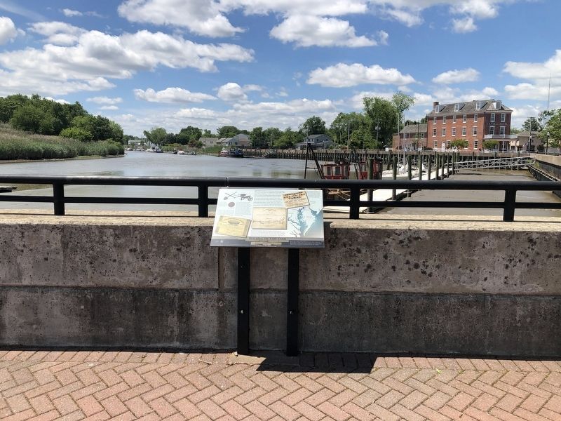
Although the idea of a waterway crossing the upper Delmarva peninsula was suggested in the 1600s, the canal did not become a reality until 1829. Over 2,600 workers, including many Irish immigrant and African-American laborers, dug the canal with . . . — — Map (db m174514) HM
The British attack on Lewes, Delaware, during the War of 1812 demonstrated the need for forts to protect the Delaware River and the ports of Wilmington and Philadelphia. The War Department recognized Pea Patch Island's strategic location and . . . — — Map (db m174520) HM
The river marshes around Delaware City provided the ideal habitat for fishes, waterfowl and muskrats. In the 1800s, local residents thought this wildlife would always be available and abundant.
The harvesting of fish and birds in excessive . . . — — Map (db m174497) HM
Just a half-mile off Delaware City's Battery Park, Pea Patch Island is home to a large colony of herons in America. While Fort Delaware occupies the southern end of the island, nine species of wading birds have settled on the marshy, forested . . . — — Map (db m189915) HM
Delaware City’s story begins in 1801 when the Newbold brothers, Barzilla, Clayton, and John, of New Jersey, acquired 1600 acres of land on the Delaware River, John Newbold built a wharf that became a center for trading and shipping grain, giving . . . — — Map (db m189478) HM
The Chesapeake and Delaware Canal offered easy passage between Philadelphia and Baltimore for both freight and passengers. By reducing the miles traveled between the two cities, the canal improved access to Pennsylvania's Susquehanna Valley and . . . — — Map (db m174515) HM
This earthbound rectangle of water before you was once the eastern gateway to the Chesapeake and Delaware Canal, one of four locks that regulated water depth along the canal to allow vessels to make the 14-mile journey between the Delaware River . . . — — Map (db m174502) HM
This quiet waterfront promenade was once part of a busy, noisy commercial district that included coal wharves, a steamboat dock, sheds and stores, and broad staging areas for local produce destined for markets in Philadelphia and Baltimore. Piers . . . — — Map (db m174518) HM
< Fort Delaware Side: >
The present day Fort, a replica of the frontier “lower fort” of the Cushetunk settlement of 1755-1785, was originally located six miles up river near Milanville, Pennsylvania. Another fort was . . . — — Map (db m23934) HM
Historic Roads of Newark, Delaware
1. Old Baltimore Pike
The Old Baltimore Pike was built before 1720 and connected Elkton, Maryland to Christiana. It followed the path of an east-west Indian trail over the south side of Iron Hill. . . . — — Map (db m214020) HM
For more than 12,000 years before the first Europeans arrived, the Lenape people and their predecessors lived in the Cheswold area. They fished, hunted deer and other animals, and gathered nuts, seeds, and other plant products for food, . . . — — Map (db m273499) HM
Preservation Amidst Development
The Anne McClements Woods Tract of the Fork Branch Nature Preserve is the largest forest stand within Dover city limits, containing 259.32 acres. The preserve is home to more than 200 acres of mature forest with . . . — — Map (db m273496) HM
This bridge is named for local heroine Michelle Newton Smith, an Emergency Medical Technician with the Delaware City Fire Co. Smith, who dedicated her life to helping others, was aiding an injured motorcyclist along U.S. 13 when she was struck by an . . . — — Map (db m263577) HM
The Delaware portion of the Pomeroy and Newark Railroad was constructed in 1871 by the Delaware and Pennsylvania Railroad Company. The line ran from Pomeroy, Pennsylvania south through Avondale along the White Clay Creek, to Newark, for a length . . . — — Map (db m238435) HM
The Diamonds Walkway recognizes Delaware Diamonds Society donors who have generously contributed to UD for five consecutive years. As a special thank you, these loyal donors are offered the opportunity to have a personalized brick on the Walkway. . . . — — Map (db m238439) HM
The Diamonds Walkway recognizes donors who make leadership level gifts to the University of Delaware for five consecutive years as members of the
Delaware Diamonds Society. Each brick in the walkway is inscribed to recognize the generosity of . . . — — Map (db m154614) HM
In 1938 the Wilmington Board of Education proudly dedicated a new vocational high school on the northwest corner of Market and 14th Streets. State and city dignitaries attended the ceremony that officially opened a school that for the next three . . . — — Map (db m131160) HM
Early in the 1890s, Civil War Union veterans claimed a small corner of Brandywine Park as a place to congregate in good weather. The familiar sight of the old soldiers sitting regularly in that area led people to call the spot "Old Soldiers' . . . — — Map (db m169002) HM
In 2020, in partnership with the Center for the Inland Bays (CIB) and DNREC, over 300' of DBG's Pepper Creek southeast edge was restored using a natural living shoreline approach to preserve and protect the eroding tidal saltmarsh. In 2023, a . . . — — Map (db m302735) HM
For more than a quarter century, Senator Venables was an admired and influential legislator, serving 26 years in the Delaware General Assembly. During his many years as the co-chair of the state's Bond Bill Committee, he was able to garner . . . — — Map (db m198862) HM
Saving an Historic Landmark
The Bethesda Methodist Episcopal Church was built in 1879 to replace an older chapel. This rural country church is an excellent example of the Greek Revival style of architecture. Although it was . . . — — Map (db m198870) HM
Once Common, Now Rare
The Bethesda Methodist Episcopal Church is a quiet reminder of the past. It may be hard to imagine now, but this was a central religious and community gathering site for 150 years. By the late 1800s, the church . . . — — Map (db m198868) HM
The University of Delaware's 2-megawatt wind turbine generates clean power and represents an important contribution to renewable energy development in the United States.
Clean Energy
Using wind power reduces our use of fossil . . . — — Map (db m113701) HM
"Besides, I want to tell you there were pretty good times and many a heart broken and rough life on the canal."
Flora Henry, Locktender
Shouts of "Gid-Up" echo along the canal. Pairs of mules strain at their . . . — — Map (db m131430) HM
Discovered by the Dutch, settled by the Swedes. Granted to William Penn by King Charles II of England, Delaware County is the site of Penn's first landing in Pennsylvania. Here the first assembly met and adopted the frame of government honored in . . . — — Map (db m14957) HM
"I remember one day, my dad grabbed both the driver and captain and threw them in the canal. My dog Buster, got one of the captains by the seat of the pants and really tore his pants off. He got his wife to steer while he went in the cabin to . . . — — Map (db m109562) HM
Philadelphia's industrial might and its location along the Delaware River earned it the title "Workshop of the World." For the earliest inhabitants, the river provided food. Industry used it later for transportation and as a convenient sewer. . . . — — Map (db m194938) HM
Philadelphia's industrial might and its location along the Delaware River earned it the title "Workshop of the World." For the earliest inhabitants, the river provided food. Industry used it later for transportation and as a convenient sewer. . . . — — Map (db m274241) HM
Philadelphia's industrial might and its location along the Delaware River earned it the title "Workshop of the World." For the earliest inhabitants, the river provided food. Industry used it later for transportation and as a convenient sewer. . . . — — Map (db m274240) HM
Philadelphia's industrial might and its location along the Delaware River earned it the title "Workshop of the World." For the earliest inhabitants, the river provided food. Industry used it later for transportation and as a convenient sewer. . . . — — Map (db m194937) HM
The Delaware River has shaped the culture and economy of Philadelphia for centuries. The area's first residents, the Lenni Lenapi, came here to fish and hunt. European immigrants arrived in the mid-1500s. They built factory towns connected to the . . . — — Map (db m194933) HM
The Delaware River has shaped the culture and economy of Philadelphia for centuries. The area's first residents, the Lenni Lenapi, came here to fish and hunt. European immigrants arrived in the mid-1500s. They built factory towns connected to the . . . — — Map (db m240200) HM
"Floyd Durham has achieved in Delaware what is considered nearly impossible in the entire field of aviation. He built a privately-owned, public use airport, complete with hard-surface runway, taxiway and ramp, instrument approach, . . . — — Map (db m273502) HM
Delaware's first "urban park without boundaries" is a partnership of the historical and cultural sites of Dover.
John Bell House:
Take a walking tour of The Green and step back in time as Historical Interpreters work on 18th . . . — — Map (db m307059) HM
The Rise of Delaware's Railroads
The 19th century saw railroad expansion all over the country. In Delaware, railroads connected New Castle County and Wilmington to points north, south and west. Yet, the need for a direct line between New . . . — — Map (db m168198) HM
Near this site, the Union army established two camps on either side of the Olentangy River during the Civil War. Both were known as Camp Delaware. The first camp, situated on the west side of the river in the summer of 1862, was where the white . . . — — Map (db m12816) HM
Born in New Jersey, Allan joined the Loyalist forces in 1777 and served with Butler's Rangers and the Indian Department during the American Revolution. The founder of Rochester, N.Y, he moved to Upper Canada in 1794 and obtained 2,000 acres of land . . . — — Map (db m274123) HM
A native of New Hampshire who had come to Niagara in 1794, Tiffany was appointed King's Printer and published the official "Upper Canada Gazette" until 1797. He was not a Loyalist and the government, concerned by his American background, forced his . . . — — Map (db m274124) HM
On June 17, 1921, the Board of Trustees of the State College for Colored Students, later known as Delaware State College, approved a resolution recommending the establishment of a high school for Negro students on its campus. This was the second . . . — — Map (db m142491) HM
Susan Yost Ph.D. and Lou Calabrese
Claude E. Phillips Herbarium, Dept. of Agriculture & Natural Resources, and Cooperative Extension, College of Agriculture & Related Sciences
The DSU Arboretum became an accredited arboretum on the Morton . . . — — Map (db m273475) HM
Delaware State College Highlights:
Accreditation — Dr. Holland restructured academic programs to create a stronger academic environment. In 1957, Delaware State College regained accreditation from the Middle States Commission on . . . — — Map (db m273447) HM
For those
who served
1941 - 1945 WWII
Delaware State University
Tuskegee
Airmen
Lt. Luna I. Mishoe, Photographic Intelligence Officer •
Lt. Maxwell Honemont, Tuskegee Trained Observation Pilot •
Airman Nathan O. Thomas, 99th . . . — — Map (db m273486) HM WM
From 1921 until 1952 this simple brick structure, named for its benefactor, Pierre S. Dupont, served as a laboratory-classroom for students enrolled in the teaching course at the State College for Colored Students (now DSU).
The educational . . . — — Map (db m142492) HM
In 1723 Nicholas Loockerman purchased 600 acres of land known as “The Range.” Following his death in 1771, the property passed to his grandson Vincent Loockerman Jr. Evidence suggests that he built the Georgian-style mansion known today as . . . — — Map (db m39053) HM
The land where DSU stands was once a large slave-holding plantation owned by Nicholas Loockerman. In 1723 Loockerman purchased 600 acres of land on the St. Jones River upon which his descendants built a saw-mill and stately Georgian-style brick . . . — — Map (db m273489) HM
Dr. Luna I. Mishoe served as the President of Delaware State University from 1960 until 1987 and as a math and physics professor from 1946 to 1948. DSU flourished under Dr. Mishoe's administration. Fourteen new buildings were constructed, 18 . . . — — Map (db m273476) HM
"I say!" murmured Horton. I've never heard tell
Of a small speck of dust that is able to yell
So you know what I think?…Why, I think there must
Be someone on top of that small speck of dust!
Some sort of creature of very . . . — — Map (db m273488) HM
You are standing in the "asteroid belt," a region between the orbits of Mars and Jupiter where countless rocks called asteroids orbit the sun. Every so often icy bodies called comets pass through this region on their way to the inner solar . . . — — Map (db m273490) HM
The William C. Jason Library is named in honor of Delaware State University's longest serving president. President Jason's tenure, from 1895 to 1923, was punctuated by expansive growth of both the student body and campus infrastructure. His . . . — — Map (db m273477) HM
By the turn of the century, Fort Delaware had become part of a coastal defense system, linking Fort Mott in New Jersey and Fort Dupont in Delaware. Batteries* Hentig and Dodd, which each housed two rapid-fire guns, were intended to furnish . . . — — Map (db m21662) HM
Ten separate granite block formed each gun embrasure. Granite could absorb the shock of enemy fire, and thus protect the troops within the fort's walls. The iron shutters on the outside of the embrasure were designed to shield the gun crews from . . . — — Map (db m174814) HM
Through his leadership Pea Patch Island was returned to the State of Delaware by the Federal Government in 1948. He was the founder and first president of the Fort Delaware Society, January 1950 and was elected chairman of the board in 1956. — — Map (db m10207) HM
Fort Delaware is located on Pea Patch Island in the Delaware River. The island is sometimes said to have gotten its name from a boat loaded with peas that ran aground on a mud shoal in the 1770s. The spilled peas sprouted, mud caught in the . . . — — Map (db m21589) HM
In the late 1890s, when the fort was being modernized, these generators were installed to provide back-up power for the lights, elevators, and the firing of the twelve-inch guns. An electrical service ran under the Delaware River to supply the . . . — — Map (db m174813) HM
In its original state, heavy iron-studded oak doors (like the one before you) stood at both ends of the sally port. Large granite blocks, quarried in Quincy, Massachusetts, line its walls. A sample of the fort’s fine brickwork can be seen on the . . . — — Map (db m21665) HM
In 1835 five trustees of the African Union Church purchased this half acre of land for $80, thereby establishing a church, now razed, and cemetery. Throughout its active years the church and cemetery served the residents of Polktown, one of the . . . — — Map (db m244708) HM
Fort DuPont’s chapel was constructed in 1941 to meet the spiritual needs of soldiers preparing to go abroad. The spire on this chapel indicates its non-denominational status.
The Army considered wooden structures “temporary.” Most of the wooden . . . — — Map (db m156151) HM
In 1847, the Reverend Andrew F. Freeman and the Reverend Thomas F. Billop were appointed as a committee to organize and solicit subscriptions for a Protestant Episcopal church in Delaware City. The parish was formally organized on May 28, 1848, . . . — — Map (db m10208) HM
This building, formerly known as Delaware City School #118C, served as a school for the African American students of Delaware City between the years of 1922 and 1961. During these years 13 teachers taught over 300 students. — — Map (db m174522) HM
Constructed in 1910 at the head of Officers Row, the Commanding Officer Quarters sits on what was once Delaware City farmland.
The building is prominently located on the north corner of the Parade Ground, a highly visible and dominating . . . — — Map (db m189100) HM
These brick were brought from England in the 17th Century and used in the construction of Lord Fairfax Mansion at Belvoir, Virginia, 1736. — — Map (db m174452) HM
In the years prior to WW II, many of the local citizens were watermen and made their living from the river. If a boat crew was in distress and needed assistance, other boat owners from town would navigate their craft to make the needed rescue. . . . — — Map (db m189888) HM
March 17, 1887 First Organized;
January 23, 1889 Delaware City Hose Co.;
July 9, 1924 Reorganized Delaware City Fire Co. No. 1;
January 29, 1926 Incorporated;
November 7, 2004 815 Fifth St. — — Map (db m140485) HM
In 1919 Delaware radically altered its state school system, opening a new era in the education of African-American youth. Progress was stimulated by the efforts of the Delaware School Auxiliary Association and its primary supporter, P.S. duPont, who . . . — — Map (db m10445) HM
In 1914, the Equal Suffrage Study Club, founded by and for African American women, encouraged the public to campaign for women's voting rights and inclusion of African American women. This club was one of Delaware's most active suffrage . . . — — Map (db m205501) HM
As operations at Fort Dupont continued to expand, so did the need for additional housing.
The solution? Utilize surplus housing from nearby Fort Mott, New Jersey, which was in caretaker status. In December 1931, the 1st Engineers rolled . . . — — Map (db m174451) HM
Located in the Delaware River, Fort Delaware was
built by the federal government on Pea Patch Island
in the mid-1800s as a coastal defense fortification to protect the ports of Wilmington and Philadelphia. During the Civil War. Union forces housed . . . — — Map (db m298223) HM
This fort was originally established in 1863 as the Ten Gun Battery opposite Fort Delaware. In 1897 construction began on concrete gun batteries armed with long-range rifles, rapid-fire rifles and mortars. The fort was renamed in honor of Rear . . . — — Map (db m140397) HM
The U.S Army’s World War II XIII Corps (Dec ’42-Sept ’45) stationed its headquarters at Ft. DuPont (May ’43-June’44) prior to transferring to Eto. XIII Corps troops reached the Elbe River, near Tangermunde, Germany, in April 1945, the closest that . . . — — Map (db m140451) WM
Fort DuPont State Park
Tucked beneath the northern foot of Reedy Point Bridge, Fort DuPont is one of the last open riverfront areas left in northern New Castle County. Once farmland, the site has been dedicated to defending the Delaware . . . — — Map (db m174456) HM
Officers Row was a home to commissioned officers and their families. The road was the originally the Henry farmhouse driveway leading from the canal (bottom left). The fountain replaced the “triangle” between Officers Row, Elm and Maple. The . . . — — Map (db m140434) WM
Delaware City was founded in 1826, in anticipation of the opening of the Chesapeake and Delaware Canal. The town was incorporated in 1851. The benefits of proximity to the canal resulted in a sustained period by prosperity and expansion of the . . . — — Map (db m94190) HM
This 18 acres of open space has been the focal point for most of the fort’s existence and has served many purposes over the years.
Geographically, the Parade Ground separated officers’ quarters from enlisted barracks and utilitarian . . . — — Map (db m140448) HM
The African American community known today as Polktown is one of the earliest remaining free black settlements in Delaware and has been continuously occupied for nearly two centuries. It extended on both sides of the historic branch canal and . . . — — Map (db m244709) HM
The African Union Church once stood on this site adjacent to the cemetery. The church was a branch of the original "Spencer Churches," founded by Wilmington's Peter Spencer in 1813. In 1835, five trustees of the church - Perry Reynolds, Noah . . . — — Map (db m244731) HM
The Post Exchange (PX) was constructed in 1906. Later known as Burton Hall, the PX was a multi-purpose facility that over the years included a gymnasium, bowling alley, barber shop, pool tables, soda fountain, exchange and library. — — Map (db m188564) HM
This is the fort’s headquarters, also known as the administration building, constructed in 1901. The first floor of the building contained offices, the second floor was used for courts martial and records storage. The fort’s first official . . . — — Map (db m140447) WM
They seem scary to many people, but a world without bats is scarier. Bats eat millions of flying pests each night, helping to control mosquitos and moths and saving farmers billions of dollars in pesticides.
White-Nose Syndrome [WNS] . . . — — Map (db m190540) HM
Made in Philadelphia 1839 for the Chesapeake and Delaware Canal Company, it was used as an air chamber for workmen to make underwater repairs on the lock gates. The canal was opened in 1829 and was operated until the sea level canal was opened at . . . — — Map (db m189476) HM
The Theatre was constructed by the U.S. Army's 1st Regiment and the Works Progress Administration in 1933 to provide entertainment for soldiers, their families, employees and civilians. Adult tickets were 20 cents and children's tickets were 10 . . . — — Map (db m174453) HM
This cemetery is the final resting place for five Civil War veterans. The United States War Department established the Bureau of Colored Troops on May 22, 1863 under General Order 143. These were free African American men who served in a segregated . . . — — Map (db m244717) HM
This monument is dedicated to those residents of Delaware City and Fort Dupont, past and present, who served in the United States Military and to honor those who gave the ultimate sacrifice. — — Map (db m215308) HM
Typical of a 19th century working class community, this burial ground likely contained a large number of wooden and fieldstone markers. Open unmarked areas indicate that was probably the case. Many of these handmade markers have disappeared over . . . — — Map (db m244729) HM
What is a Hundred?
A hundred is an old English subdivision of a county. Although the origin is somewhat shrouded in mystery [,] basically it was a tract of land large enough to provide a hundred men to serve in the king’s wars. In American . . . — — Map (db m156916) HM
Dedicated by Governor Jack A. Markell and the Military Order of the Purple Heart
Department of Delaware
July 27, 2011
The National Purple Heart Trail memorializes those heroic soldiers, sailors, airmen and marines who have had the . . . — — Map (db m186858) WM
The University of Delaware (UD) has been involved with marine research since 1950, when a group of local fishermen became alarmed by drastic decline in Delaware Bay fisheries approached the Delaware General Assembly for help. The legislators . . . — — Map (db m113700) HM
The Delaware mine was a failure, but it wasn't for lack of trying. Spurred on by the great success of the nearby Cliff and Central mines, the Northwest Company, the Pennsylvania Mining Company, the Delaware Mining Company, the Conglomerate Mining . . . — — Map (db m153983) HM
As the United States began to feel the full force of the Industrial Revolution and expand its own manufacturing and commercial base, cities like Trenton that were blessed with an advantageous location were in the forefront of transportation . . . — — Map (db m166171) HM
Listed on the State & National Registers of Historical Places 2004
John I. Blair founded Delaware Village in the 1850's as a station on the newly built Warren Railroad in a rural neighborhood first settled circa 1740. While the station was . . . — — Map (db m26115) HM
Surgeon - Brigadier General - Inventor of the 'Wig-Wag' signal system - First director of the Army Signal Corps - Founder of the U.S. Weather Bureau - U.S. Delegate to the International Meteorological Conferences of Vienna, Austria, 1873 & Rome, . . . — — Map (db m65473) HM
[facing west] In Memory of All American Veterans This memorial honors all American veterans who, although separated by generations, shared a common, undeniable goal - - to valiantly protect our country's freedoms. The memories of these American . . . — — Map (db m131877) WM
Born in Newburgh, NY, raised in Buffalo, Geneva College 1847, University of Buffalo 1851, Telegraph operator, U.S. Navy assistant surgeon, invented motion telgraphy, U.S. Army Signal Corps founder, Civil War meteorologist, U.S. Weather Bureau . . . — — Map (db m65476) HM
Menagerie to Habitat. The Buffalo Zoo, like other modern zoos, has become an educational facility that focuses on conservation and reproduction of endangered species. The Zoo has reintroduced some endangered animals to their native habitats. Today's . . . — — Map (db m75074) HM
Canisius College Founded in 1870 by the Jesuits at 434 Ellicott Street. Moved to this site in 1912. Largest private institution of higher education on the Niagara Frontier. — — Map (db m131858) HM
4760 entries matched your criteria. The first 100 are listed above. Next 100 ⊳
* Inflectional forms of words are their plurals, singulars, and possessives as well as gramatical tenses and similar variations.