64 entries match your criteria.
Historical Markers and War Memorials in Calgary, Alberta
By cmh2315fl via Flickr (CC BY-NC 2.0), May 17, 2015
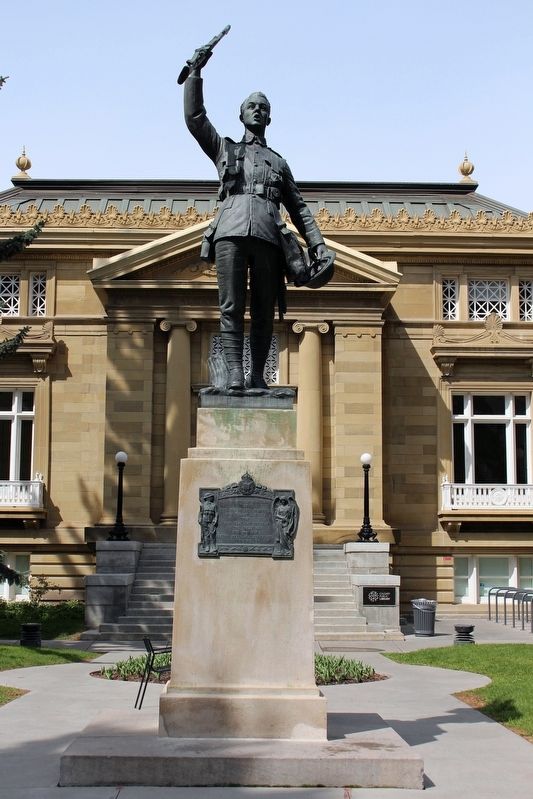
Calgary World War I Memorial
| 1 ► Alberta, Calgary Metropolitan Region, Calgary — Calgary World War I Memorial — |
| On 2 Street Southwest just south of 12 Avenue Southwest, on the right when traveling south. | |||
| 2 ► Alberta, Calgary Metropolitan Region, Calgary — Mewata Armoury / Le manege militaire Mewata — |
| On 11 Street Southwest at 8 Avenue Southwest, on the right when traveling south on 11 Street Southwest. | |||
| 3 ► Alberta, Calgary Metropolitan Region, Calgary, Beltline — Central High School — |
| On 13 Avenue Southwest just west of 9 Street Southwest, on the left when traveling west. | |||
| 4 ► Alberta, Calgary Metropolitan Region, Calgary, Beltline — Rt. Hon. Richard Bedford Bennett — 1870-1947 — |
| On 13 Avenue Southwest just west of 2 Street Southwest, on the right when traveling west. | |||
| 5 ► Alberta, Calgary Metropolitan Region, Calgary, Cliff Bungalow — Western Canada High School — |
| Near 17 Avenue Southwest at 6 Street Southwest, on the right when traveling east. | |||
| 6 ► Alberta, Calgary Metropolitan Region, Calgary, Downtown Commercial — Annie Gale — 1876-1970 — An Alberta Champion — |
| Near 7 Avenue Southwest just west of 4 Street Southwest, on the right when traveling west. | |||
| 7 ► Alberta, Calgary Metropolitan Region, Calgary, Downtown Commercial — Arthur Ryan Smith — 1919-2008 — An Alberta Champion — |
| Near 7 Avenue Southwest just west of 4 Street Southwest, on the right when traveling west. | |||
| 8 ► Alberta, Calgary Metropolitan Region, Calgary, Downtown Commercial — Calgary City Hall — |
| Near Macleod Trail Southeast just south of 7 Avenue Southeast, on the right when traveling north. | |||
| 9 ► Alberta, Calgary Metropolitan Region, Calgary, Downtown Commercial — Calgary City Hall / Hôtel de ville de Calgary — |
| On Macleod Trail Southeast just south of 7 Avenue Southeast, on the right when traveling north. | |||
| 10 ► Alberta, Calgary Metropolitan Region, Calgary, Downtown Commercial — Calgary World War Memorial — |
| On Macleod Trail Southeast just south of 7 Avenue Southeast, on the right when traveling north. | |||
| 11 ► Alberta, Calgary Metropolitan Region, Calgary, Downtown Commercial — Cathedral Church of the Redeemer — |
| On 7 Avenue Southeast at 1 Street Southeast (Macleod Trail), on the right when traveling west on 7 Avenue Southeast. | |||
| 12 ► Alberta, Calgary Metropolitan Region, Calgary, Downtown Commercial — Cathedral Church of the Redeemer — Registered Heritage Site — |
| On 7 Avenue Southeast at 1 Street Southeast (Macleod Trail), on the right when traveling west on 7 Avenue Southeast. | |||
| 13 ► Alberta, Calgary Metropolitan Region, Calgary, Downtown Commercial — Doll Block — |
| On 8 Avenue Southeast (Stephen Avenue) east of Centre Street South, on the left when traveling east. | |||
| 14 ► Alberta, Calgary Metropolitan Region, Calgary, Downtown Commercial — Grant MacEwan — 1902-2000 — An Alberta Champion — |
| Near 7 Avenue Southwest just west of 4 Street Southwest, on the right when traveling west. | |||
| 15 ► Alberta, Calgary Metropolitan Region, Calgary, Downtown Commercial — Hudson's Block — 1891-1977 — |
| On 8 Avenue Southwest (Stephen Avenue) just west of Centre Street South, on the right when traveling west. | |||
| 16 ► Alberta, Calgary Metropolitan Region, Calgary, Downtown Commercial — Imperial Bank of Canada ~ Ca. 1910 — |
| On 8 Avenue Southeast (Stephen Avenue) at Centre Street South, on the right when traveling west on 8 Avenue Southeast (Stephen Avenue). | |||
| 17 ► Alberta, Calgary Metropolitan Region, Calgary, Downtown Commercial — Lougheed Home — |
| On 8 Avenue Southwest (Stephen Avenue) east of 1 Street Southwest, on the left when traveling east. | |||
| 18 ► Alberta, Calgary Metropolitan Region, Calgary, Downtown Commercial — Maude Riley — 1882-1962 — An Alberta Champion — |
| Near 7 Avenue Southwest just west of 4 Street Southwest, on the right when traveling west. | |||
| 19 ► Alberta, Calgary Metropolitan Region, Calgary, Downtown Commercial — Molson Bank ~ 1911 — |
| On 8 Avenue Southwest (Stephen Avenue) west of Centre Street South, on the right when traveling west. | |||
| 20 ► Alberta, Calgary Metropolitan Region, Calgary, Downtown Commercial — North-West Travellers Building — |
| On 1 Street Southeast (Macleod Trail) just south of 5 Avenue Southeast, on the right when traveling south. | |||
| 21 ► Alberta, Calgary Metropolitan Region, Calgary, Downtown Commercial — Raoul Wallenberg Corner — |
| On Macleod Trail Southeast just south of 7 Avenue Southeast, on the right when traveling north. | |||
| 22 ► Alberta, Calgary Metropolitan Region, Calgary, Downtown Commercial — Sir James Alexander Lougheed — 1854-1925 — An Alberta Champion — |
| Near 7 Avenue Southwest just west of 4 Street Southwest, on the right when traveling west. | |||
| 23 ► Alberta, Calgary Metropolitan Region, Calgary, Downtown Commercial — Site of Calgary's Original Court House — |
| Near 4 Street Southwest just north of 7 Avenue Southwest, on the left when traveling north. | |||
| 24 ► Alberta, Calgary Metropolitan Region, Calgary, Downtown Commercial — Sitting Eagle — John Hunter — 1874-1970 — |
| On 6 Street Southwest at 7 Avenue Southwest, on the right when traveling north on 6 Street Southwest. | |||
| 25 ► Alberta, Calgary Metropolitan Region, Calgary, Downtown Commercial — Stephen Avenue / L'avenue Stephen — |
| On 8 Avenue Southwest (Stephen Avenue) west of Centre Street South, on the right when traveling west. | |||
| 26 ► Alberta, Calgary Metropolitan Region, Calgary, Downtown Commercial — T.C. Power & Bro. — |
| On 8 Avenue Southwest (Stephen Avenue) east of 1 Street Southwest, on the right when traveling east. | |||
| 27 ► Alberta, Calgary Metropolitan Region, Calgary, Downtown Commercial — The Builders — Stephen Avenue — |
| On 8 Avenue Southwest (Stephen Avenue) at 2 Street Southwest, on the right when traveling west on 8 Avenue Southwest (Stephen Avenue). | |||
| 28 ► Alberta, Calgary Metropolitan Region, Calgary, Downtown Commercial — The Buildings — Stephen Avenue — |
| On 8 Avenue Southwest (Stephen Avenue) at 1 Street Southwest, on the right when traveling east on 8 Avenue Southwest (Stephen Avenue). | |||
| 29 ► Alberta, Calgary Metropolitan Region, Calgary, Downtown Commercial — The Clarence Block ~ 1900 — |
| On 8 Avenue Southwest west of Centre Street South, on the right when traveling west. | |||
| 30 ► Alberta, Calgary Metropolitan Region, Calgary, Downtown Commercial — The Great White Way — Stephen Avenue — |
| On 8 Avenue Southwest (Stephen Avenue) at 3 Street Southwest, on the left when traveling east on 8 Avenue Southwest (Stephen Avenue). | |||
| 31 ► Alberta, Calgary Metropolitan Region, Calgary, Downtown Commercial — The Lancaster Building ~ 1911 — |
| On 8 Avenue Southwest just west of 2 Street Southwest, on the right when traveling west. | |||
| 32 ► Alberta, Calgary Metropolitan Region, Calgary, Downtown Commercial — The Meeting Place — Stephen Avenue — |
| On 8 Avenue Southwest (Stephen Avenue) at 1 Street Southwest, on the right when traveling west on 8 Avenue Southwest (Stephen Avenue). | |||
| 33 ► Alberta, Calgary Metropolitan Region, Calgary, Downtown Commercial — The Palace Theatre / Le Théâtre Palace — |
| On 8 Avenue Southwest west of 1st Street Southwest, on the left when traveling west. | |||
| 34 ► Alberta, Calgary Metropolitan Region, Calgary, Downtown Commercial — The T. Eaton Co. Limited — |
| On 8 Avenue Southwest west of 3 Street Southwest, on the right when traveling west. | |||
| 35 ► Alberta, Calgary Metropolitan Region, Calgary, Downtown Commercial — The View — Stephen Avenue — |
| On 8 Avenue Southwest (Stephen Avenue) at 2 Street Southwest, on the right when traveling east on 8 Avenue Southwest (Stephen Avenue). | |||
| 36 ► Alberta, Calgary Metropolitan Region, Calgary, Downtown Commercial — This Cairn is Erected to Commemorate the Following — |
| On 7 Avenue Southeast just east of 1 Street Southeast (Macleod Trail), on the right when traveling west. | |||
| 37 ► Alberta, Calgary Metropolitan Region, Calgary, Downtown Commercial — Thomson Block ~ 1893 — |
| On 8 Avenue Southeast (Stephen Avenue) east of Centre Street South, on the left when traveling east. | |||
| 38 ► Alberta, Calgary Metropolitan Region, Calgary, Downtown Commercial — W. O. Mitchell — 1914-1998 — An Alberta Champion — |
| Near 7 Avenue Southwest just west of 4 Street Southwest, on the right when traveling west. | |||
| 39 ► Alberta, Calgary Metropolitan Region, Calgary, Downtown West End — Grace Dewis and boys in front of Mewata Armouries — ca. 1916-1918 — |
| On 8 Avenue Southwest at 11 Street Southwest, on the left when traveling west on 8 Avenue Southwest. | |||
| 40 ► Alberta, Calgary Metropolitan Region, Calgary, Downtown West End — Mewata Armoury — |
| On 11 Street Southwest at 8 Avenue Southwest, on the left when traveling north on 11 Street Southwest. | |||
| 41 ► Alberta, Calgary Metropolitan Region, Calgary, Downtown West End — Remembrance Day Ceremonies inside Mewata Armouries, 1953 — |
| On 8 Avenue Southwest at 11 Street Southwest, on the left when traveling west on 8 Avenue Southwest. | |||
| 42 ► Alberta, Calgary Metropolitan Region, Calgary, Downtown West End — Soldiers Memorial — |
| On 11 Street Southwest just north of 8 Avenue Southwest, on the left when traveling north. | |||
| 43 ► Alberta, Calgary Metropolitan Region, Calgary, East Village — An Outpost on the Bow River — NWMP and I.G. Baker employees build Fort Calgary — 1875 — |
| Near 9 Avenue Southeast, 0.3 kilometers east of 6 Street Southeast, on the left when traveling east. | |||
| 44 ► Alberta, Calgary Metropolitan Region, Calgary, East Village — Building The Ideal City — From police outpost... To modern city — |
| Near 9 Avenue Southeast, 0.3 kilometers east of 6 Street Southeast, on the left when traveling east. | |||
| 45 ► Alberta, Calgary Metropolitan Region, Calgary, East Village — Calgarians Rediscover Fort Calgary — Alderman Ayer leads the way — 1875-1975 — |
| Near 9 Avenue Southeast, 0.3 kilometers east of 6 Street Southeast, on the left when traveling east. | |||
| 46 ► Alberta, Calgary Metropolitan Region, Calgary, East Village — Connections — The Modern City Reflects the Past — |
| Near 9 Avenue Southeast, 0.3 kilometers east of 6 Street Southeast, on the left when traveling east. | |||
| 47 ► Alberta, Calgary Metropolitan Region, Calgary, East Village — Early Explorers — David Thompson travelled to this area in 1800. — 1800 — |
| Near 9 Avenue Southeast, 0.3 kilometers east of 6 Street Southeast, on the right when traveling east. | |||
| 48 ► Alberta, Calgary Metropolitan Region, Calgary, East Village — Fort Calgary's Railway Era — |
| Near 9 Avenue Southeast, 0.3 kilometers east of Street Southeast, on the left when traveling east. | |||
| 49 ► Alberta, Calgary Metropolitan Region, Calgary, East Village — John Ayer — A Man with 'Fortitude' — |
| Near 9 Avenue Southeast, 0.3 kilometers east of 6 Street Southeast, on the left when traveling east. | |||
| 50 ► Alberta, Calgary Metropolitan Region, Calgary, East Village — Keeping Memory Alive: The Rock — |
| On 9 Avenue Southeast at 6 Street Southeast, on the right when traveling west on 9 Avenue Southeast. | |||
| 51 ► Alberta, Calgary Metropolitan Region, Calgary, East Village — Métis, Whiskey Traders, Missionaries and Settlers — Many find new opportunities in the west — |
| Near 9 Avenue Southeast, 0.3 kilometers east of 6 Street Southeast, on the left when traveling east. | |||
| 52 ► Alberta, Calgary Metropolitan Region, Calgary, East Village — Nitsitapi — The Real People — |
| Near 9 Avenue Southeast, 0.3 kilometers east of 6 Street Southeast, on the left when traveling east. | |||
| 53 ► Alberta, Calgary Metropolitan Region, Calgary, East Village — The City of Calgary — Calgary Becomes a City — |
| Near 9 Avenue Southeast, 0.3 kilometers east of 6 Street Southeast, on the left when traveling east. | |||
| 54 ► Alberta, Calgary Metropolitan Region, Calgary, East Village — The Frontier Community Disappears — Business and culture change the face of Calgary — |
| Near 9 Avenue Southeast, 0.3 kilometers east of 6 Street Southeast, on the left when traveling east. | |||
| 55 ► Alberta, Calgary Metropolitan Region, Calgary, East Village — The Mounties Sell Calgary Barracks — Captain Deane is last Commanding Officer on this site — 1914 — |
| Near 9 Avenue Southeast, 0.3 kilometers east of 6 Street Southeast, on the left when traveling east. | |||
| 56 ► Alberta, Calgary Metropolitan Region, Calgary, East Village — The North West Mounted Police — NWMP — |
| Near 9 Avenue Southeast, 0.3 kilometers east of 6 Street Southeast, on the left when traveling east. | |||
| 57 ► Alberta, Calgary Metropolitan Region, Calgary, East Village — The North West Mounted Police March West — Whisky Traders Flee — 1874 — |
| Near 9 Avenue Southeast, 0.3 kilometers east of 6 Street Southeast, on the left when traveling east. | |||
| 58 ► Alberta, Calgary Metropolitan Region, Calgary, East Village — The North West Territories — Dominion of Canada purchases the western plains from the Hudson's Bay Company — 1869 — |
| Near 9 Avenue Southeast, 0.3 kilometers east of 6 Street Southeast, on the left when traveling east. | |||
| 59 ► Alberta, Calgary Metropolitan Region, Calgary, East Village — The NWMP Build Calgary Barracks — Bigger and better buildings replace the old fort — 1888 — |
| Near 9 Avenue Southeast, 0.3 kilometers east of 6 Street Southeast, on the left when traveling east. | |||
| 60 ► Alberta, Calgary Metropolitan Region, Calgary, East Village — The Train Arrives in Calgary — The community becomes a transportation centre — 1883 — |
| Near 9 Avenue Southeast, 0.3 kilometers east of 6 Street Southeast, on the left when traveling east. | |||
| 61 ► Alberta, Calgary Metropolitan Region, Calgary, East Village — Wars, Depression and Oil — Oil is discovered and Calgary becomes the oil capital of Canada — 1914 — |
| Near 9 Avenue Southeast, 0.3 kilometers east of 6 Street Southeast, on the left when traveling east. | |||
| 62 ► Alberta, Calgary Metropolitan Region, Calgary, Southwest Calgary — Scollen Bridge — |
| On 25 Avenue Southwest, 0.2 kilometers east of 1 Street Southwest, on the right when traveling east. | |||
| 63 ► Alberta, Calgary Metropolitan Region, Calgary, Victoria Park — Curtis Block — |
| On Macleod Trail Southeast at 12 Avenue Southeast, on the left when traveling north on Macleod Trail Southeast. | |||
| 64 ► Alberta, Rocky View, Calgary, Northwest Calgary — The Bridge — |
| On Bow River Pathway Bridge at Bowness, 0.2 kilometers north of 52 Street Northwest, in the median. | |||