1752 entries match your criteria. Entries 101 through 200 are listed.⊲ Previous 100 — Next 100 ⊳
E Clampus Vitus Historical Markers
The Ancient and Honorable Order of E Clampus Vitus (ECV) is a fraternal organization dedicated to the preservation of the heritage of the American West, especially the history of the Mother Lode and gold mining regions of the area. More than 1,400 markers point the way to the past.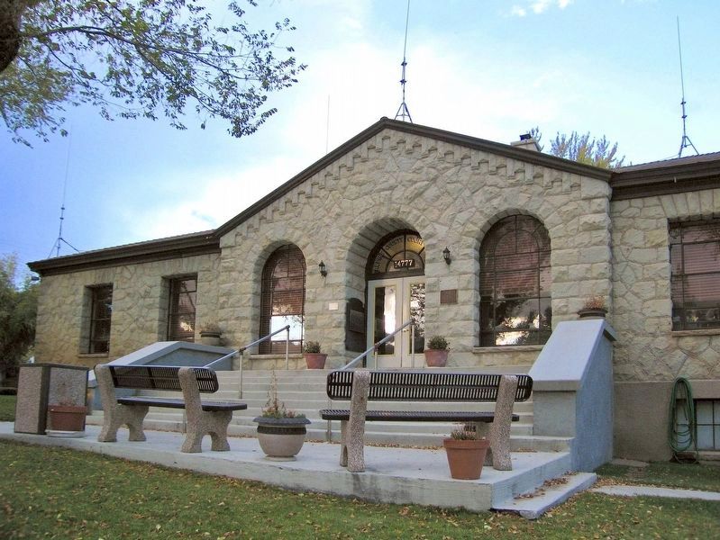
By Karen Key, October 9, 2006
Alpine County Courthouse
| 101 ► California, Alpine County, Markleeville — 240 — Jacob Markley — |
| Near Alpine State Highway (California Route 89) south of Water Street, on the left when traveling south. | |||
| 102 ► California, Alpine County, Markleeville — Markleeville General Store — |
| 103 ► California, Alpine County, Markleeville — Old Log Jail — |
| Near School Street. | |||
| 104 ► California, Alpine County, Markleeville — Old Webster School — |
| Near School Street. | |||
| 105 ► California, Alpine County, Markleeville — Silver Mountain — |
| On Ebbets Pass Scenic Highway (State Highway 4), on the right when traveling east. | |||
| 106 ► California, Alpine County, Markleeville — Snowshoe Thompson — |
| On Diamond Valley Road, 3 miles east of California Highway 89, on the right when traveling west. | |||
| 107 ► California, Alpine County, Markleeville — The Hurdy House — |
| On Main Street (Route 89) north of Montgomery Street, on the right when traveling north. | |||
| 108 ► California, Alpine County, Markleeville — The Lost Whiskey of Raymond — |
| On School Street. | |||
| 109 ► California, Amador County, Drytown — Salute to Early Amador Miners — E Clampus Vitus — |
| On State Highway 49, on the left when traveling south. | |||
| 110 ► California, Amador County, Ione — Buena Vista — |
| On Buena Vista Road at Jackson Valley Road. on Buena Vista Road. | |||
| 111 ► California, Amador County, Ione — Iron Ivan — |
| On North Church Street, on the right when traveling north. | |||
| 112 ► California, Amador County, Ione — 30 — Lancha Plana — (No. 30 California Historical Landmark) — |
| Near Camanche Road. | |||
| 113 ► California, Amador County, Ione — Old Red Brick Building Saloon — |
| On West Main Street at South Church Street, on the right when traveling west on West Main Street. | |||
| 114 ► California, Amador County, Jackson — - Jackson - — The Jumping Seat of Calaveras County — |
| Near Main Street near Court Street, on the right when traveling south. | |||
| 115 ► California, Amador County, Jackson — Kennedy Mine Headframe — |
| Near Kennedy Mine Road, on the left when traveling east. | |||
| 116 ► California, Amador County, Jackson — Martell Stage Station |
| On Golden Chain Highway (California Route 49) at Martell Road, on the left when traveling north on Golden Chain Highway. Reported missing. | |||
| 117 ► California, Amador County, Jackson — The Louisiana House — Built in 1862 — |
| On Water Street at Main Street, on the right when traveling east on Water Street. | |||
| 118 ► California, Amador County, Jackson — The Old Spring — |
| Near Water Street, on the left when traveling west. | |||
| 119 ► California, Amador County, Jackson Gate — A. Chichizola Store — |
| On Jackson Gate Road north of China Graveyard Road, on the right when traveling north. | |||
| 120 ► California, Amador County, Kit Carson — Plasse’s Trading Post — |
| Near Plasse Road near Carson Pass Scenic Byway (California Route 88). | |||
| 121 ► California, Amador County, Martell — Amador Ledger — |
| On State Highway 88 east of Wicklow Way, on the right when traveling east. | |||
| 122 ► California, Amador County, Pine Grove — 37 — Clinton — |
| On Clinton Road at Ponderosa Road / East Clinton Road, on the left when traveling south on Clinton Road. | |||
| 123 ► California, Amador County, Plymouth — 762 — D'Agostini Winery — |
| On Plymouth - Shenandoah Road, on the right when traveling north. | |||
| 124 ► California, Amador County, Sutter Creek — Bellotti Inn — |
| On Main Street (Old Highway 49) near Eureka Street, on the right when traveling south. | |||
| 125 ► California, Amador County, Sutter Creek — C. Soracco Company — |
| On Main Street (Old Highway 49), on the right when traveling north. | |||
| 126 ► California, Amador County, Sutter Creek — Leland Stanford, Sr. — 1824 – 1893 — |
| On Gopher Flat Road, on the left when traveling east on Gopher Flat Road. | |||
| 127 ► California, Amador County, Sutter Creek — Sutter Creek Jail — |
| On Gopher Flat Road near Main Street/Old Highway 49, on the left when traveling south. | |||
| 128 ► California, Amador County, Volcano — John Doble's Cabin |
| On Plug Street, 0.1 miles north of Consultation Avenue, on the right when traveling north. Reported missing. | |||
| 129 ► California, Amador County, Volcano — Moose Milk — |
| Near Main Street at St. George Street. | |||
| 130 ► California, Amador County, Volcano — Soldier Gulch — |
| On Main Street at Consolation Street, on the left when traveling north on Main Street. | |||
| 131 ► California, Amador County, Volcano — The Old Bavarian Brewery — |
| On Consolation Street just east of Main Street, on the right when traveling east. | |||
| 132 ► California, Amador County, Volcano — The Thomas Starr King Bell — |
| On Emigrant Trail at Consolation Street on Emigrant Trail. | |||
| 133 ► California, Amador County, Volcano — 29 — Volcano — |
| On Main Street at Consolation Street, on the right when traveling north on Main Street. | |||
| 134 ► California, Butte County, Durham — Samuel Neal — 1816 – 1859 — |
| Near Oroville-Chico Hwy. | |||
| 135 ► California, Butte County, Forest Ranch — Katie Thompson – Mattie Thompson – Josie Campbell — ECV Preserving California History — |
| On Humboldt Road at Butte Creek Flat (Summit) Road on Humboldt Road. | |||
| 136 ► California, Butte County, Magalia — “Magalia Depot & Butte County Railroad” |
| Near Old Skyway Road near Old Depot Road. Reported missing. | |||
| 137 ► California, Butte County, Magalia — Dogtown — |
| On Old Skyway Road near Kraus Court, on the left when traveling north. | |||
| 138 ► California, Butte County, Magalia — Lovelock — Square-Nail Town Smith — |
| On Skyway Highway near Lovelock Road. | |||
| 139 ► California, Butte County, Magalia — Magalia Community Church / The Magalia Schoolhouse Bell — |
| On Skyway Road south of Magalia Cemetery Road. | |||
| 140 ► California, Butte County, Oroville — BUT-012 — Long's Bar — |
| Near Cherokee Road. | |||
| 141 ► California, Butte County, Paradise — Nelsons Bar — |
| Near Nelson Bar Boat Ramp Road. | |||
| 142 ► California, Butte County, Paradise — Butte 011 — Old Paradise Depot — |
| On Black Olive Drive north of Pearson Road, on the right when traveling north. | |||
| 143 ► California, Butte County, Stirling City — Inskip Hotel — Elev. 4808’ — |
| On Skyway Highway, on the left when traveling north on Skyway Highway. | |||
| 144 ► California, Butte County, Stirling City — Stirling City — |
| On Skyway Highway near Retson Road. | |||
| 145 ► California, Calaveras County, Angels Camp — Archie D. Stevenot — “Mr. Mother Lode” — |
| On State Highway 49, on the left when traveling south. | |||
| 146 ► California, Calaveras County, Angels Camp — 769 — Archie Stevenot — “Mr. Mother Lode” — |
| On Route 49, 3.7 miles south of California Highway 4, on the left when traveling south. | |||
| 147 ► California, Calaveras County, Angels Camp — Chinatown — |
| On Birds Way east of South Main Street (California Highway 49), on the left when traveling east. | |||
| 148 ► California, Calaveras County, Angels Camp — Claussen’s Corner — |
| On Hardscrabble Street at South Main Street (State Highway 49), on the right when traveling east on Hardscrabble Street. | |||
| 149 ► California, Calaveras County, Angels Camp — Giovanni Lavagnino — Pioneer Craftsman — |
| On Monte Verda Street. | |||
| 150 ► California, Calaveras County, Angels Camp — James H. Carson — |
| On State Highway 49, 3.7 miles south of State Highway 4, on the left when traveling south. | |||
| 151 ► California, Calaveras County, Avery — Avery One-Room School House — |
| Near Ebbets Pass Highway (State Highway 4). | |||
| 152 ► California, Calaveras County, Avery — The Avery Hotel — |
| Near Moran Road near Avery Hotel Road. | |||
| 153 ► California, Calaveras County, Copperopolis — Black Bart at Funk Hill — Copperopolis — |
| Near Main Street, on the left when traveling south. | |||
| 154 ► California, Calaveras County, Copperopolis — Calaveras Telephone — |
| On Main Street, on the right when traveling north. | |||
| 155 ► California, Calaveras County, Copperopolis — 296 — Copperopolis — The Town of — |
| On Main Street, on the right when traveling south. | |||
| 156 ► California, Calaveras County, Copperopolis — Copperopolis Cemetery — |
| Near Reeds Turnpike. | |||
| 157 ► California, Calaveras County, Copperopolis — Madame Josephine Felix — |
| On Rock Creek Road, 4.2 miles north of California Highway 4. | |||
| 158 ► California, Calaveras County, Copperopolis — The Old Corner Saloon — |
| On Main Street near Reeds Turnpike, on the right when traveling south. | |||
| 159 ► California, Calaveras County, Dorrington — Board's Crossing — |
| On Forest Service Road 5N75. | |||
| 160 ► California, Calaveras County, Dorrington — Dorrington Hotel — |
| 161 ► California, Calaveras County, Douglas Flat — 272 — The Italian Store — |
| On Main Street, on the left when traveling east. | |||
| 162 ► California, Calaveras County, Mokelumne Hill — 663 — Calaveras County Courthouse and Leger Hotel — |
| On Main Street at Lafayette Street, on the right when traveling north on Main Street. | |||
| 163 ► California, Calaveras County, Mokelumne Hill — Mokelumne Hill — |
| On Main Street, on the right when traveling north. | |||
| 164 ► California, Calaveras County, Murphys — Albert A. Michelson — Dec. 19, 1852 – May 9, 1931 — |
| On Main Street west of Church Street, on the right when traveling west. | |||
| 165 ► California, Calaveras County, Murphys — E Clampus Vitus — ECV Wall of Comparative Ovations — |
| On Main Street at Sheep Ranch Road on Main Street. | |||
| 166 ► California, Calaveras County, Murphys — E Clampus Vitus — |
| On Main Street, on the left when traveling east. | |||
| 167 ► California, Calaveras County, Murphys — John Murphy — 1824 – 1892 — |
| Near Main Street. | |||
| 168 ► California, Calaveras County, Murphys — Maj. James D. Savage — |
| Near Main Street. | |||
| 169 ► California, Calaveras County, Murphys — Murphy Brothers — |
| On Main Street west of Big Trees Road, on the right when traveling west. | |||
| 170 ► California, Calaveras County, Murphys — Site of E.C.V. Saloon — |
| On Main Street east of Church Street. | |||
| 171 ► California, Calaveras County, Murphys — The Compere Store — |
| On Main Street east of Church Street, on the right when traveling west. | |||
| 172 ► California, Calaveras County, Murphys — William Gordon Huff — E Clampus Vitus Wall of Comparative Ovations — |
| On Main Street at Sheep Ranch Road on Main Street. | |||
| 173 ► California, Calaveras County, San Andreas — Attempted Stage Robbery — |
| On Mountain Ranch Road at Rocky Road, on the right when traveling east on Mountain Ranch Road. | |||
| 174 ► California, Calaveras County, San Andreas — Calaveras County Hospital Cemetery — |
| On Gold Hunter Road near Mountain Ranch Road, on the left when traveling north. | |||
| 175 ► California, Calaveras County, San Andreas — The Red Barn — |
| Near Government Center Road at Mountain Ranch Road, on the left when traveling east. | |||
| 176 ► California, Calaveras County, Sheep Ranch — Sheep Ranch — |
| On Main Street at El Dorado Creek, on the right when traveling west on Main Street. | |||
| 177 ► California, Calaveras County, Sheep Ranch — Sheep Ranch Mine — |
| Near Main Street. | |||
| 178 ► California, Calaveras County, Tamarack — Camp Tamarack — |
| On Ebbetts Pass Scenic Byway (State Highway 4), on the right when traveling east. | |||
| 179 ► California, Calaveras County, Vallecito — Camp Nine Bell — |
| On Main Street, 0.3 miles south of California Highway 4, on the right when traveling south. | |||
| 180 ► California, Calaveras County, Vallecito — Dinkelspiel Store — |
| Near Main Street at Church Street. | |||
| 181 ► California, Calaveras County, Valley Springs — 251 — Valley Spring — |
| On State Highway 12, on the right when traveling east. | |||
| 182 ► California, Colusa County, Arbuckle — Arbuckle — |
| On Fifth Street at Gail Avenue / Laurel Street, in the median on Fifth Street. | |||
| 183 ► California, Colusa County, Colusa — Adelade M. Ryerson House--1906 — |
| On Main Street, on the right on Main Street. | |||
| 184 ► California, Colusa County, Colusa — Old Chinatown District--Circa 1890 — |
| On Main Street east of 8th Street, on the right when traveling east. | |||
| 185 ► California, Colusa County, Colusa — U. W. Brown House - Circa 1867 — |
| On Jay Street west of 9th Street. | |||
| 186 ► California, Contra Costa County, Alamo — Stone Valley — |
| On Stone Valley Road near Danville Boulevard, on the right when traveling west. | |||
| 187 ► California, Contra Costa County, Antioch — City of Antioch War Dog Memorial — |
| On L Street near West 2nd Street, in the median. | |||
| 188 ► California, Contra Costa County, Antioch — 932 — Mount Diablo Coal Field — |
| On Somersville Road, in the median. | |||
| 189 ► California, Contra Costa County, Antioch — Riverview Union High School — |
| Near West Fourth Street near O Street. | |||
| 190 ► California, Contra Costa County, Antioch — Sidney Flat — |
| On Somersville Road, on the left when traveling south. | |||
| 191 ► California, Contra Costa County, Antioch — The Woman's Club of Antioch — |
| On G Street near West 5th Street, on the left when traveling south. | |||
| 192 ► California, Contra Costa County, Brentwood — Byer/Nail House — |
| Near Sellers Avenue near Sunset Road, on the right when traveling north. | |||
| 193 ► California, Contra Costa County, Byron — Byron — Est. 1878 — |
| On Main Street near Holway Drive, on the right when traveling north. | |||
| 194 ► California, Contra Costa County, Clayton — Clayton Cash Store — |
| On Diablo Street near Main Street, on the right when traveling south. | |||
| 195 ► California, Contra Costa County, Clayton — Joaquin Murrieta — |
| On Main Street at Morris Street, on the right when traveling west on Main Street. | |||
| 196 ► California, Contra Costa County, Clayton — Keller Ranch — |
| Near Clayton Road near Marsh Creek Road. | |||
| 197 ► California, Contra Costa County, Clayton — Old Marsh Creek Springs — |
| Near Marsh Creek Road near Aspara Drive, on the left when traveling west. | |||
| 198 ► California, Contra Costa County, Clayton — The Clayton Club — |
| On Main Street at Morris Street, on the left when traveling west on Main Street. | |||
| 199 ► California, Contra Costa County, Clayton — The Eucalyptus Grove — |
| On Main Street near Marsh Creek Road. | |||
| 200 ► California, Contra Costa County, Concord — Live Oak Cemetery — Founded 1865 — |
| On Deer Oak Place near Pebble Glen Drive, in the median. | |||
1752 entries matched your criteria. Entries 101 through 200 are listed above. ⊲ Previous 100 — Next 100 ⊳