More than 200 markers sponsored by the American Society of Civil Engineers recognizing historically significant local, national, and international civil engineering projects, structures, and sites.
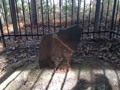
Marks 1st Southern Boundary of the United States and the Mississippi Territory created in 1798
-----900 feet East-----
Stone marked 31° North Latitude separating the U.S. & Spanish Florida.
This line of demarcation ran from the . . . — — Map (db m104073) HM
A sum of $40,000 was authorized under the Public Building Act of 1910 and construction began in 1912. Governor Walter D. Clark held the first open house January 1, 1913.
State of Alaska
Governor Walter J. Hickel
Alaska Centennial . . . — — Map (db m181739) HM
Dedicated to the
Engineering Achievements of
Percy Jones, Jr.
1888 –
Chief locating engineer who by sheer genius personally located more miles of Arizona highways than any other person. His college training in mining and geology . . . — — Map (db m37899) HM
Dedicated to the
Engineering Achievements of
Percy Jones, Jr.
1888 –
Chief locating engineer who by sheer genius personally located more miles of Arizona highways than any other person. His college training in mining and geology . . . — — Map (db m37900) HM
Constructed in 1928, the Kaibab Trail Suspension Bridge was the only crossing of the Colorado River in a distance of 754 miles from Moab, Utah to Needles, California. Built in a remove location with incredibly difficult access through rugged . . . — — Map (db m173929) HM
There are three markers on this end of the Navajo Bridge.(Marker on left:)
National Historical Civil
Engineering Landmark
American
Society of
Engineers
1852
Designated by the American Society of Civil Engineers . . . — — Map (db m94887) HM
Colorado River Storage Project
In recognition of the vision of the Colorado River Storage Project Act of 1956 and the significant contributions the act has made to the development of the Upper Colorado River Basin states, this plaque . . . — — Map (db m40350) HM
Approximately 300 B.C. Prehistoric Indians entered the Salt River Valley. They developed an extensive canal system and raised corn, beans, squash, agave and cotton.
Over 500 miles of Hohokam canal have been recorded in the Salt River . . . — — Map (db m49877) HM
A colorful administrator, he is credited with establishing the basic location of Arizona's billion-dollar Interstate Highway System. He served as State Engineer twice, from 1924 to 1928 and from 1945 to 1951.
He devoted much of his final term to . . . — — Map (db m40780) HM
Chabot Dam, originally called San Leandro Dam, was built by Anthony Chabot who started Contra Coast Water Company in 1868. When artesian wells and Temescal and Sausal Creeks failed to bring Oakland and surrounding cities enough water he decided . . . — — Map (db m71714) HM
Main marker:
California Historic Civil Engineering Landmark.
Alameda Creek Water System, 1888.
San Francisco Section A802, 1975.
Second marker:
Restoration of the Sunol Water Temple.
Started May 27, 1997. . . . — — Map (db m24499) HM
Dedicated on November 16, 1911 and affectionately known as the "Queen of Bridges", it was the longest reinforced concrete arch structure in the world at the time of its construction. The bridge was designed by John B. Leonard, Civil Engineer, . . . — — Map (db m71907) HM
The California Outstanding Civil Engineering Achievement - 1980, Interstate Highway 5, designated by the California State Council, ASCE. — — Map (db m192222) HM
In front of you is the world famous Tehachapi Loop which is about halfway upgrade to the Tehachapi Pass. This steep line averages 2.2% in gradient in its 28 miles of length. This feat of civil engineering genius was crowning achievement of civil . . . — — Map (db m134431) HM
In front of you in the hills, high above freeway Interstate 5, is a portion of the historic 1915 two-lane “Ridge Route”. The power lines follow it.
The original Ridge Route was constructed in 1914-1915 by pick, shovel and mule drawn Fresno . . . — — Map (db m152085) HM
The first high-rise in Southern California, at 452 feet, and until 1964 the tallest building in Los Angeles, originally designed only for gravity and wind loads, it has survived the earthquakes of 1933, 1971, 1987, and 1994. The engineer of . . . — — Map (db m235255) HM
This is the terminus of the Los Angeles-Owens River Aqueduct, which brings water 338 miles from the eastern slopes of the Sierra Nevada to the City of Los Angeles. Begun in 1905, the great aqueduct was completed November 5, 1913. The Mono Craters . . . — — Map (db m164815) HM
On November 5, 1913, 40,000 people gathered here to witness the dedication of the Los Angeles - Owens River Aqueduct. The terminus of a 233-mile long engineering marvel, the Cascades were the site of William Mulholland‘s famous speech: “There it is, . . . — — Map (db m165409) HM
Waddell & Harrington of Kansas City, Missouri, designed the
Colorado Street Bridge in 1912. J.D.Mercereau Construction of Los
Angeles was the contractor. Dedicated and opened to traffic on
December 13, 1913. Designated as a Historic Civil . . . — — Map (db m161949) HM
Constructed in 1913, this bridge was a part of the Pacific Electric Railway system which was designated as a Local Historic Civil Engineering Landmark by the American Society of Civil Engineers, Los Angeles section, in 1973. Although the bridge no . . . — — Map (db m140110) HM
The Golden Gate Bridge is a structure of striking form and elegance. Built in 1937, it remains an indispensable link in the Bay Area's transportation network and a historical monument of civil engineering and construction. The bridge was named for . . . — — Map (db m102433) HM
Tioga Pass at 9945 feet is the highest automobile pass in California. The road to the pass was constructed in two parts. The first part was a wagon road, 56 miles long, going from Crane Flat on the west side to a silver mine on the east slope of the . . . — — Map (db m49970) HM
History of the Air Base from 1942 to 1949
In March 1942, the Navy Bureau of Yards and Docks contracted with Holmes & Narver Consulting Engineers of Los Angeles to design and engineer an LTA base that would accommodate the design for . . . — — Map (db m190132) HM
Water from the Santa Ana River was largely responsible for the transformation of this arid valley into productive agricultural land. Irrigation companies in Orange County were in operation as early as the 1860s. The two largest were the Santa Ana . . . — — Map (db m59529) HM
Historic Civil Engineering Landmark
Sacramento Water Works
Completed in April 1854, the City of Sacramento’s water works was the first municipal, city-owned water system west of the Mississippi River. Before the municipal system was built, the . . . — — Map (db m224046) HM
In memory of
Henry Harbinson Sinclair,
1858-1914.
A testimonial to his high and useful
service as a pioneer
in the establishment
and development of the
hydro electric industry in California. — — Map (db m155025) HM
Crystal Springs Dam continues to provide the critical link in the delivery of water to the people of the San Francisco Peninsula. Centennial Observation held on this spot by joint resolution of the
San Mateo County Board of Supervisors
Tom . . . — — Map (db m18447) HM
This brick lighthouse was built to incorporate a French first order Fresnel lens. Although no longer used, the lens is still operable in the lantern room. Previously the lens had been installed at Cape Hatteras, North Carolina. It first flashed over . . . — — Map (db m2541) HM
The Cold Spring Arch Bridge, built by the California
Department of Transportation, at the time of construction was
one of the longest steel arch bridges built in the United States.
It was also one of the first major arch structures to use . . . — — Map (db m244974) HM
The original water supply for the Santa Barbara Mission is an outstanding
example of an early water system in Southern California. It was constructed
by the Native Americans under the direction of the Franciscan Padres.
Constructed in . . . — — Map (db m147954) HM
has been designated a
Registered National
Historic Landmark
under the provisions of the
Historic Sites Act of August 21, 1935
This site possesses exceptional value
in commemorating or illustrating
the history of the United . . . — — Map (db m160243) HM
Imagine this mesa top in A.D. 1150 with fields of corn, beans, and squash; supplemented with wild plants such as amaranth, tubers, and sunflowers. Children could be seen watering corn with clay water jars (ollas), and young men could be seen cutting . . . — — Map (db m71901) HM
This walking dredge, built by the Bay City (Michigan) Dredge Works, is the earliest known survivor of its type. Designed for use over swampy terrain where wheeled or tracked vehicles would bog down the machine’s weight was distributed over shoes. To . . . — — Map (db m195057) HM
Near this point, the Bellamy Road crossed the Santa Fe River. The road was named for its builder, John Bellamy, a civil engineer. Approved by Congress in 1824 and completed in 1826, it was the first Federally funded road in Florida, connecting St. . . . — — Map (db m155320) HM
Between 1859 and 1862 the U.S. Army built a military wagon road between Fort Benton Montana, and Fort Walla Walla, Washington. This National Historic Civil Engineering Landmark was the first major engineered highway in the Pacific Northwest. — — Map (db m122863) HM
[Text on the right]
The ASCE presented only ten such awards worldwide, each representing the most outstanding example of Civil engineering in a particular area of infrastructure over the past century.
Created in 1889, the District built canals . . . — — Map (db m155321) HM
An aqueduct is a bridge carrying one body of water over another. The Duck Creek Aqueduct was originally built in 1843 to convey the canal over Duck Creek 16 feet below. Flood waters in 1847 destroyed the aqueduct, which was soon replaced by the . . . — — Map (db m55560) HM
An Important Road
The National Road is a true American icon, conceived by George Washington, authorized by Thomas Jefferson, and traveled by Abraham Lincoln.
In 1806 construction of the National Road was approved by the US Congress to . . . — — Map (db m232658) HM
John A Roebling (1806-1869), pioneer civil engineer, was the designer and builder of the Covington-Cincinnati Suspension Bridge which was completed in 1866. It served as the prototype for Roebling’s design of the Brooklyn Bridge, which was complete . . . — — Map (db m55563) HM
Built 1887 as city's first waterworks. Contains original equipment in working order. Only example of its sort remaining in the United States of America, according to Smithsonian Institution. Declared a National Landmark in 1982. — — Map (db m140206) HM
This structure is a combination railroad and highway bridge. Designed by the firm of Modjeski, Masters and Chase, with foundation recommendations by Dr. Karl Terzaghi. It was the first bridge to span the Mississippi River at New Orleans. The . . . — — Map (db m125232) HM
About 18 miles below Ft. Jackson at Head of Passes, the Mississippi River branches into Southwest Pass, South Pass and Pass A Lutre before emptying into the Gulf of Mexico. As early as 1723 French colonists found navigation difficult and looked . . . — — Map (db m205283) HM
The Outstanding Civil Engineering Achievement - 1984 Hale Boggs Bridge Awarded in a National Competition by the American Society of Civil Engineers. — — Map (db m109613) HM
The Outstanding Civil Engineering Achievement - 1984 Hale Boggs Bridge Awarded in a National Competition by the American Society of Civil Engineers. — — Map (db m109557) HM
The original 23.86 mile-long structure, which now carries the Southbound traffic, was designed by the firm of Palmer & Baker. When opened in 1956, the structure was the longest bridge in the world by more than 15 miles. In building the bridge, which . . . — — Map (db m99805) HM
American
Society of
Civil
Engineers
1852
Portland Head Light
Portland Head Light was the first lighthouse completed and put into
service by the Federal Government under the Lighthouse Act of 1789
Completed 1791
Designated 2002 — — Map (db m161819) HM
Plaque 1 National Historic Civil Engineering Landmark
Bailey Island Bridge
Harpswell, Maine
Presented 1984
Plaque 2
This 1150 ft. bridge is an exceptional
engineering solution to meet unusual
conditions and is the only one of . . . — — Map (db m108111) HM
This lock, originally built of stone masonry in 1830, was a vital link in the 50 mile long waterway from Portland Harbor to Harrison at the head of Long Lake until the advent of the railroad in 1869. At one time 100 “canal boats” were . . . — — Map (db m59436) HM
One of the earliest marine signal stations in the United States, this tower is unique in its engineering design and construction and contributed to the prosperity of Portland Harbor as a vital center of maritime commerce during the "Golden Age of . . . — — Map (db m186397) HM
The Thomas Hill standpipe was designed by Ashley B. Tower of Tower and Wallace of New York and Holyoke, Mass. and built in 1897 by Major James M. Davis on land once owned by the Thomas brothers. Using a portable sawmill and blacksmith shop erected . . . — — Map (db m175789) HM
Front
Commenced, July 4th, 1833.
Finished, July 4th, 1835.
Rear
Johnathan Knight,
Chief Engineer
Caspar W. Wever,
Superintendent of Construction.
Designed by
Benjamin H. Latrobe. . . . — — Map (db m127) HM
Spanning the Little Patuxent River is the sole surviving example of the bridging system invented, 1850, by Wendel Bollman, Baltimore engineer. It was the first system, entirely of iron, used by the Baltimore and Ohio railroad and the first in . . . — — Map (db m123610) HM
"… in our midst exists one of the most imposing and wonderful structures which engineering skill could devise …"
--William T.S. Curtis, November 1, 1897, from a paper read before the Columbia Historical Society.
As late as the mid-19th . . . — — Map (db m22636) HM
Springing Over the Monocacy
Captain William McNeill of the U.S. Topographical Engineers called this aqueduct “...a work which, while it is highly ornamental, unites...in its plan and execution, ‘the true principles of economy, . . . — — Map (db m714) HM
[Center Panel]
This bridge is named in honor of Woodrow Wilson.
An early automobile enthusiast, he reportedly spent an average of two hours per day riding in his automobile to relax and “loosen his mind from the problems before him.” In . . . — — Map (db m19756) HM
Riverside Village Historic District has been placed on the National Register of Historic Places in 2017 by the United States Department of the Interior — — Map (db m230570) HM
Constructed in 1835
National Register of Historic Places
Placed by Canton Historical Commission
Dedicated July 4th 1993
National Historic Civil Engineering Landmark
Designated by the American society of Civil Engineers
Dedicated . . . — — Map (db m52387) HM
National Historic Civil Engineering Landmark.
The Granite Railway
Designated by the American Society of Civil Engineers 1976
This marker commemorates the 150th anniversary of the ground breaking for the first commercial railroad in the . . . — — Map (db m49466) HM
This stone and metal structure is Dry Dock 1, completed in 1833. As one of America’s first two granite dry docks, Dry Dock 1 made the repair of large naval ships faster, easier, and safer. Returning warships to sea duty in less time was a . . . — — Map (db m37697) HM
This simply ornamented wrought-iron bridge was built in 1886. It replaced an earlier wooden one that had begun to fall into disrepair. Designed by the King Iron Bridge and Manufacturing Company of Cleveland, Ohio, the double-intersection Pratt . . . — — Map (db m69901) HM
Designed by David B. Steinman, and representing a new level of aerodynamic stability in suspension bridges for its time, the Mackinac Bridge was the first suspension bridge to incorporate specific design features to manage the forces imposed on it . . . — — Map (db m105762) HM
The Stone Arch Bridge of the Burlington Northern Railway is acknowledged to be one of the finest stone viaducts in the world, due to its massive masonry, lofty arches, and graceful curvature.
Constructed: 1882-1883 — — Map (db m152946)
"This viaduct...is the only one of its kind that spans the Father of Waters, and is one of the largest and most noteworthy in the United States.
Firmer than the earth which supports it, it is constructed to stand the test of time."
. . . — — Map (db m27042) HM
In 1879 St. Paul railroad magnate James J. Hill opened his "Manitoba line" to the Canadian border, linking the wheat fields of the Red River Valley with the flour mills of Minneapolis. To improve railroad access at the falls he built this 2,100-foot . . . — — Map (db m21031) HM
Dedicated to
the People of the United States
May 25, 1968
Lyndon B. Johnson
President of the United States
The City of St. Louis Missouri
The United States Territorial
Expansion Memorial Committee
[The Gateway Arch was . . . — — Map (db m26866) HM
has been designated a
National
Historic Landmark
This site possesses national
significance in commemorating
the history of the
United States of America
———————
[Markers on interior . . . — — Map (db m62210) HM
[Top plaque:]
The River Des Peres Sewage and Drainage Works extends 14 miles from the city limits northwest to Delmar and Skinker to the Mississippi River south of the city.
Four miles of massive, enclosed reinforced concrete sewers . . . — — Map (db m141182) HM
James Pugh Kirkwood was born in Edinburgh, Scotland. He came to the United States in 1832 and was appointed Resident Engineer for the Western Railway of Massachusetts, and later the Long Island Railroad. He won recognition for the rapid . . . — — Map (db m140854) HM
Captain John Mullan started surveying the Mullen Road in 1853 and began construction in 1859 of the 624-mile wagon road that linked Fort Benton to the head of navigation on the Columbia. Indian wars slowed him somewhat, but Mullan opened his route . . . — — Map (db m142246) HM
One of the finest examples of how civil engineering ingenuity shaped the development of society's quality of life in the 20th century. — — Map (db m31900) HM
Following the discovery of silver and gold, the miners obtained their water from the small streams or from the springs located in the canyons such as Ophir Ravine, in Virginis City, and Bullion and Crown Point ravines above Gold Hill. Originally . . . — — Map (db m35942) HM
Beginning in the 1830's, a few arched granite highway bridges were built in southern New Hampshire under the supervision of engineers from major manufacturing centers. By the 1850's, rural stonemasons had mastered the art of building such bridges . . . — — Map (db m97139) HM
Built in 1866 at a cost of $9,000, this is the longest wooden bridge in the United States and the longest two-span covered bridge in the world. The fourth bridge at this site, the 460-foot structure was built by Bela J. Fletcher (1811-1877) of . . . — — Map (db m74586) HM
Alexander Hamilton, with great vision, prompted the incorporation of the "society for establishing usefull [sic] manufactures" in 1791 to start America's economic and industrial independence. Pierre Charles L'Enfant, engineer and planner of the . . . — — Map (db m64189) HM
Pueblo Indians irrigated and farmed the Rio Grande Valley for several hundred years before the Spaniards arrived and continued the tradition. Built between 1910-1916, Elephant Butte Dam when completed was the world's largest irrigation reservoir. It . . . — — Map (db m45125) HM
The Poughkeepsie-Highland Bridge is the oldest surviving steel cantilever bridge in the world, and when built, had the longest truss and cantilever spans. The bridge provided the first, and only, all-rail route across the Husdon River south of . . . — — Map (db m35483) HM
Image Source: Historic American Engineering Record. Jet Lowe, photographer, 1990. The Superior Elevator, as it was originally known, was built in 1915 by the Monarch Engineering Company for the Husted Milling Company. A.E. Baxter was the . . . — — Map (db m85961) HM
The Brooklyn Bridge, the largest suspension bridge in the world at the time it was built, was the first to span the East River. Designed and constructed by John A. Roebling and his son, Washington A. Roebling, the bridge spans 3,461 feet and rises . . . — — Map (db m130437) HM
Dedicated to the memory of Emily Warren Roebling 1843-1903 whose faith and courage helped her stricken husband Col. Washington A. Roebling, C.E. 1837-1926 complete the construction of this bridge from the plans of his father John A. Roebling, C.E. . . . — — Map (db m134185) HM
Second Erie Canal Aqueduct
Over Genesee River - Lower Level
completed in 1842
Outstanding example of Erie Canal Construction and engineering Built in conjunction with the first major improvement and enlargement of the canal
Nathan S. . . . — — Map (db m63995) HM
A small domed Roman-style building named the Rotunda stood on this site 1813-1870. It was the city’s first art museum and was erected to display panoramas painted by the artist, John Vanderlyn. At times the structure housed a Post Office, courts . . . — — Map (db m47325) HM
The first long mechanically ventilated underwater tunnel in the world designed for motor vehicle use
The 29.5 ft. diameter 3,500 ft. long twin tubes of this tunnel were shield driven by the pneumatic method through extremely difficult river . . . — — Map (db m237290) HM
The Queensboro Bridge was the longest cantilever span in North America (1,182 feet) from 1909 until the Quebec Bridge opened in 1917 and the longest in the United States until 1930. Many engineers, including R.S. Buck and Gustav Lindenthal, along . . . — — Map (db m168775) HM
Not like the brazen giant of Greek fame, with conquering limbs astride from land to land; here at our sea-washed, sunset gates shall stand a mighty woman with a torch, whose flame is the imprisoned lightning, and her name Mother of Exiles. From her . . . — — Map (db m149136) HM
Designed by Leffert Lefferts Buck, prolific bridge engineer of the post-Civil War period, the Williamsburg Bridge's 1,600-foot main span was the longest in the world from 1903 until 1924. With 40-foot deep stiffening trusses, it was the first . . . — — Map (db m226344) HM
From the original Erie Canal to the Barge Canal System, crossing the Niagara Escarpment posed immense challenges to canal engineers.
The first Lockport locks were designed by Nathan Roberts, who was in charge of constructing the Erie Canal from . . . — — Map (db m76954) HM
In commemoration of the 150th anniversary of the completion of the original locks which opened a connecting waterway between the Hudson River and the Great Lakes. This completion of the Erie Canal was the opening of a door to the settling of the . . . — — Map (db m65659) HM
Since 1848 many bridges have spanned the Niagara Gorge below Niagara Falls. The design and construction of these bridges was necessary for the economic development of the Niagara Falls area. The demand for safe and convenient crossings was easily . . . — — Map (db m72386) HM
The oldest extant institution in the United States
to offer formal academic instruction in
the field of civil engineering (Sept. 1813). — — Map (db m35349) HM
164 entries matched your criteria. The first 100 are listed above. The final 64 ⊳