368 entries match your criteria. Entries 101 through 200 are listed.⊲ Previous 100 — Next 100 ⊳
Oregon Trail Historical Markers
The Oregon Trail was the only practical corridor to reach the entire western United States from 1836 – 1869. Over half a million people went west during the Oregon Trail’s “glory years.”
The Santa Fe Trail forked into two routes as it headed south from Westport. Along the routes were campgrounds for trail travelers — to the northeast of the junction was Sapling Grove and the southwest was a campground called Flat Rock or . . . — — Map (db m100264) HM
Imagine seeing Santa Fe Trail wagon trains coursing through Overland Park! Around you swirls the sights and sounds of wagons creaking, oxen braying, and wagon masters shouting commands. You are standing between two historic branches of the Santa . . . — — Map (db m99307) HM
The Santa Fe, Oregon, and California trails proved to be both challenging and exhilarating for the travelers in the caravans passing through this junction along one of the Westport routes. Letters and diaries are filled with adventures and . . . — — Map (db m100260) HM
Located today at 59th Terrace and Bluejacket in the city of Shawnee, Gum Springs was the site of the Shawnee Indian church and meeting house, as well as the location of several excellent springs, all near the intersection of the Fort Leavenworth . . . — — Map (db m50693) HM
The Santa Fe Trail went through two decades of change in the Kansas City area before evolving into it's final form by about 1840. In the early years of that decade it also became the route of the Oregon Trail and California Trail.
1821 - . . . — — Map (db m50679) HM
This cut is part of the old Santa Fe Trail. Many years ago the Missouri River came near this site and thousands of early settlers were ferried here. Their wagons and teams climbed this hill and headed west toward Santa Fe and the Oregon . . . — — Map (db m66712) HM
The stone monuments to the west mark the trace of the original road leading up from the river. For many pioneers, traders, settlers and soldiers, this was the beginning of the Oregon and Santa Fe Trails leading to the Far West. The steamboat and . . . — — Map (db m66713) HM
To cross the high western mountains before the fall snow storms arrived, many emigrant wagon trains headed for the Oregon or California territories left Independence, Missouri, in mid April to early May. The downside to leaving too early often . . . — — Map (db m79152) HM
The water is of the most excellent kind. The spring is surrounded with Ash Cotton wood and Cedar trees. It is an excellent place to camp for a day or two to wash, recruit the cattle etc. I this day cut the name of the spring in the rock on . . . — — Map (db m79134) HM
Alcove Spring Park consists of more than 200 acres of native prairie and timber land maintained for the preservation of this historic camping ground on the Oregon-California trail and for the enjoyment of our visitors. The park is owned . . . — — Map (db m79116) HM
Six miles northwest is Alcove Springs, named in 1846 by appreciative travelers on the Oregon trail who carved the name on the surrounding rocks and trees. One described the Springs as "a beautiful cascade of water... altogether one of the most . . . — — Map (db m79113) HM
Stranded by heavy flood waters on the bank of the Big Blue River, 100 members of the Donner and Reed Wagon Train waited for several days anticipating that the spring runoff would begin to subside. Sarah Keyes, James Reed's mother-in-law, . . . — — Map (db m79137) HM
This city and college take their name from St. Mary's Catholic Mission founded here by the Jesuits in 1848 for the Pottawatomie Indians. These missionaries, who had lived with the tribe in eastern Kansas from 1838, accompanied the removal to this . . . — — Map (db m122966) HM
The Oregon Trail was the main street of the west from the 1830's to the completion of the first transcontinental railroad in 1869. Farmers, townsmen and restless Americans from all walks of life moved along this route seeking a better life in a . . . — — Map (db m80948) HM
Historians have estimated that between 250,000 and 300,000 emigrants used the Oregon Trail between 1840 and 1869. At least 30,000 emigrants died along the Oregon Trail, leaving an average of 15 graves for every mile of the trail. Disease, . . . — — Map (db m80946) HM
The reservoir before you taps into the famous Scott Spring. The original outlet emanates from the base of a steep rock hill to the east. The refreshing water of Scott Spring offered abundant drinking water to many travelers on the Oregon Trail and . . . — — Map (db m80945) HM
From the 1830's to the 1870's, the 2,000-mile road connecting Missouri river towns with California and Oregon was America's greatest transcontinental highway. Several routes led west from the river, converging into one trail by the time the Fort . . . — — Map (db m80927) HM
The long journey overland to Oregon took about six months. Time, distance, and hardships seasoned the emigrants. They had the ability and had earned the right to mold their own destiny in the new land. The Oregon Trail became a vital part of the . . . — — Map (db m80949) HM
Wagons for trail travel were of the simplest construction. They cost $85.00 each. They were light, strong and carried on sturdy wheels. It was recommended that wheels be made of bois-d-oro, osage of orangewood or white oak. Bolt ends should be . . . — — Map (db m80947) HM
There were many unpredictable hazards on the trail as the wagon trains moved westward. The trail itself presented the worst problems. Streams had no bridges and had to be forded. Their shifting bottoms with pockets of quicksand were dangerous. . . . — — Map (db m80959) HM
Topeka was founded in 1854 at the site of Papan's Ferry where a branch of the Oregon Trail crossed the Kansas river as early as 1842. Anti-slavery leaders framed the Topeka Constitution, 1855, in the first attempt to organize a state government. The . . . — — Map (db m20479) HM
Each spring thousands of emigrants camped in these hills and meadows waiting for new grass to support their teams along the trail. Wagons lined St. Joseph streets to the east waiting for two to three days to be ferried from this point. The settlers . . . — — Map (db m47467) HM
After the 1848 discovery of gold in California, more than 100,000 sturdy Americans passed through St. Joseph on their way west in quest of wealth, opportunity and better lives. The "Gold Rush" began and those who followed the "Star of Empire" . . . — — Map (db m47479) HM
Hiram Young came to Missouri as an enslaved African American. He earned his freedom step by step. First he purchased his wife Matilda's freedom in the early 1840s. For children to be free, they had to be born to a free mother. The Youngs welcomed . . . — — Map (db m208243) HM
Being at leisure one day, I rode over to Independence [from Westport, in May 1846]. The town was crowded. A multitude of shops had sprang up to furnish the emigrants and Santa Fe traders with necessaries for the journey; and there was an . . . — — Map (db m208146) HM
This monument honors
the pioneer spirit of
those courageous men
and women who by
their heroic trek across
the continent established
homes and civilization
in the Far Northwest — — Map (db m34753) HM
The entire country had railroad fever in the 1830s, with the dream that one day a railroad might span the continent! In Independence merchants needed to move goods between the town square and the Wayne City steamboat landing on the Missouri River - . . . — — Map (db m208135) HM
People on steamboats loaded with goods traveled upstream on the Missouri River "highway" to Independence, where the overland journey on the Santa Fe, Oregon, and California trails began. Between March and November, steamboats passed by or stopped . . . — — Map (db m208241) HM
The Santa Fe Trail began in 1821 when William Becknell took trade items west and found a ready market in Mexico. He passed through this area before the village of Independence was platted in 1827 as the county seat for newly formed Jackson County. . . . — — Map (db m208242) HM
Near this point John McCoy built a log trading post in 1833 which launched the settlement of Westport, with the town becoming the westernmost point of American civilization. From Westport, the Santa Fe, California, and Oregon Trails reached out as . . . — — Map (db m21064) HM
(Main Marker)
Originally used as an outfitting store for wagon trains, this building was completed in 1850 by Indian traders George and William Ewing and was sold in 1854 to Albert Gallatin Boone for $7,000. Boone operated the store . . . — — Map (db m20921) HM
Thousands of wagon wheels, animal hooves, and human feet once passed this way – creating the deep depression in front of you. The swale, now worn by erosion, is grassed-over evidence of three trails once connecting frontier Missouri to . . . — — Map (db m87293) HM
From the late 1830s and into the 1860s, thousands of traders, emigrants, and gold prospectors passed this way. After crossing the Big Blue River, covered wagons struggled up this hill due to the mud left behind from torrential spring downpours. Over . . . — — Map (db m199357) HM
(This marker has two panels. From the left panel:)
Key Map
Traveling across this bridge, the fourth Red Bridge near this location since 1859, you may notice art panels attached to each of the large pillars that rise at both . . . — — Map (db m210568) HM
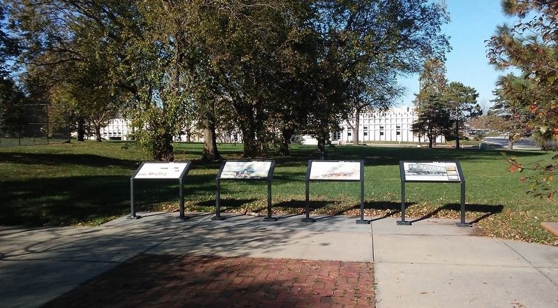
Public/private partnerships preserve three National Historic Trails in south Kansas City, highlighting 19th century exploration and migration that shaped the nation. In the heart of the historic 3-Trails Corridor, the Trailside Center at East 99th . . . — — Map (db m199522) HM
Visiting the Trails Today
The Santa Fe, Oregon and California Trails had a significant role in the history of the United States and have been designated by Congress as National Historic Trails. The National Park Service partners with site . . . — — Map (db m199379) HM
Why Did The Historic Trails Go Where They Went?
When Mexico won its independence from Spain in 1821, trade with the United States soon followed. William Becknell and five companions from the Franklin, Missouri area were the first to use . . . — — Map (db m199377) HM
New Santa Fe, also known as Little Santa Fe, was not much more than an Indian settlement when the first wagon trains passed through on the Santa Fe Trail in the early 1820's. A popular stopping place because of its grass, water and room for . . . — — Map (db m20724) HM
Susan C. Haile was born December 20, 1817, in Cape Girardeau, Missouri. She was the youngest child of Joseph and Prudence (Bledsoe) Seawell, natives of Sumner County, Tennessee. Upon the death of Joseph in 1819, Prudence Seawell returned to Sumner . . . — — Map (db m123807) HM
Pioneers traveling west on the Oregon Trail discovered this spring that Plains Indians had frequented for centuries. It provided an oasis for man and beast alike in the “Great American Desert.’
In 1867, Union Pacific railroad workers named it . . . — — Map (db m51461) HM
Ash Hollow was famous on the Oregon Trail. A branch of the trail ran northwestward from the Lower California Crossing of the South Platte River a few miles west of Brule, and descended here into the North Platte Valley. The hollow, named for a . . . — — Map (db m2503) HM
Travelers reached this point over the trail you see stretching out across the prairie to the southeast. They left the last real settlement at Westport Landing or at Independence, some 600 miles from here. Most of them took about 40 days to . . . — — Map (db m87332) HM
This ravine started as a set of wagon ruts cut through the grass and soil by heavy iron-shod wheels. It is but one example of the long interaction between man and the environment in this region. This walk to the top of the hill has . . . — — Map (db m87337) HM
The stones surrounding this marker are the remains of the homestead dwelling of Reverend Dennis B. Clary, a pioneer Methodist Minister, who received final patent for his homestead Mar 22, 1899. Mr. Clary was born September 1st 1822, in Maryland . . . — — Map (db m2501) HM
It has been estimated that at least 20,000 persons died on the overland trail, between 1842 and 1859. This averages ten graves per mile over the 2,000 mile trail. Of the hundreds who died while crossing Nebraska, only seven identifiable graves . . . — — Map (db m231177) HM
Pony Express riders and Oregon Trail emigrants used Virginia Station, once located near this site. Indians traded for whiskey at the station and harassed the emigrant trains. The whiskey was dumped in a near-by creek, thus dubbing the station . . . — — Map (db m177351) HM
The large hill to the north, which became known as “California Hill,” was climbed by thousands of covered wagon emigrants heading west between 1841 and 1860. Many were bound for Oregon. California became the destination of the majority of travelers . . . — — Map (db m51229) HM
Many emigrants to Oregon or California had to ford the South Platte River to continue their trek up the North Platte River to South Pass. The most important ford, known as the Old California Crossing, was a few miles west of present-day Ogallala. . . . — — Map (db m50790) HM
This log, two-story, cedar log structure was built in 1868 or 1869 by Mr. E.E. Ericsson. Each log is shaped and interlocked with the next with a minimal use of square nails. Mr. Ericsson was born in Varmland, Sweden on July 1st, 1835. He arrived . . . — — Map (db m191768) HM
This log cabin was constructed by the United States Army in the 1860's or 1870's at Fort McPherson. The logs were cut from the hills south of the Platte River near present-day Maxwell, Nebraska. Fort McPherson was established in 1863 by a . . . — — Map (db m191702) HM
These reproduction yokes would sit over the necks of two oxen each. Oxbows, small bent wood rods were placed under the oxen's necks and through the holes in the yokes and secured with pins. This allowed the yoke to secure itself against the oxen's . . . — — Map (db m191894) HM
This log blacksmith shop and its sister station building, which was a two-story log house, were originally located on the Upper 96 Ranch four miles east of Fort McPherson near the Sam Machette Canyon. In 1931, the log house was dismantled and taken . . . — — Map (db m191700) HM
Seal of the National Pony Express Centennial Association
Chimney Rock Station on the route of the Pony Express, was located near here between Chimney Rock and the North Platte River. This was an important Pony Express stop between . . . — — Map (db m79423) HM
On the morning of August 8, 1864, a war party of Cheyenne and Arapaho Indians attacked a Denver-bound freight wagon train killing thirteen men and taking captive Nancy Jane Morton of Sidney, Iowa, and nine-year old Daniel Marble of Council Bluffs, . . . — — Map (db m107476) WM
Commemorative of the Astorian Expedition organized June 23, 1810, by John Jacob Astor's American Fur Company This expedition discovered the Oregon Trail which spread knowledge of the Nebraska country leading to its occupancy by white people. The fur . . . — — Map (db m229275) HM
Honoring these and all the thousands who lie in nameless graves along the trail. Faith and courage such as theirs made America. May ours preserve it. — — Map (db m78704) HM
In 1909 Nebraska State Surveyor Robert Harvey surveyed the Fort Mitchell site documenting the location of the fort for the Nebraska State Historical Society. Mr. Harvey’s site sketch is partially shown to the right.
The granite Oregon Trail . . . — — Map (db m79436) HM
Text is found on both sides of this marker
Dedicated October 5, 2013
Scott’s Bluff
Original Station
Apr. 3, 1860 - Nov. 20. 1861
by
James Stretesky
Joseph L. Schroeder
Panhandle Monument
Gordy & Linda . . . — — Map (db m79437) HM
During the nineteenth century the United States underwent a dramatic westward expansion, but perhaps no single event stimulated this mass migration more than the 1848 discovery of gold at Sutter’s Mill in California. Hundreds of thousands of . . . — — Map (db m206659) HM
From Independence and Westport (Kansas City) Missouri to the Columbia River. Route of the first Oregon Colonists, the trail of trappers and traders as early as 1830. A main road to the gold fields and western military posts. The path of the Pony . . . — — Map (db m206998) HM
Massive freighting of supplies by ox and mule trains was a direct result of the establishment of Fort Kearny and other western military posts. The Mormon War and the discovery of gold in the territories of Colorado and Montana increased this . . . — — Map (db m79830) HM
In October 1861, a group of prospectors in search of the mythical Blue Bucket Mine, made camp on a creek six miles southwest of here. That evening, Henry Griffin discovered gold in the gulch which bears his name. That started a stampede which . . . — — Map (db m108152) HM
Dedicated to the memory of the intrepid pioneers who blazed the way over the Old Oregon Trail with the first covered wagons in 1843 and won an empire for the United States.
Erected by the American Legion
July 4, 1925 — — Map (db m108048) HM
Of the 2170 miles of the Oregon Trail, approximately 300 miles of ruts remain. Swales created by thousands of wagon wheels and the trampling of draft animals are deep in some areas, shallow in other places. Much of the trail has disappeared due to . . . — — Map (db m108130) HM
Early Oregon Trail emigrants crested the south flank of Flagstaff Hill and, with the Blue Mountains looming to the west, saw a solitary tree in the valley below. Called l’arbre seul (the lone tree) by French-Canadian fur trappers, this large . . . — — Map (db m108122) HM
Beginning in 1843, thousands of Oregon Trail emigrants trekked through this region toward new lives in the West. This epic journey indelibly etched the landscape with wagon ruts, such as those near by. When Henry Griffin, a prospector from . . . — — Map (db m108128) HM
Wagons and cattle of the Great Migration, led by Marcus Whitman in 1843, descended Sept. 25 into Lone Pine valley.
After nearly a month of travel over the hot dry Snake river plains from Fort Hall near Pocatello, Idaho, the cool climate and lush . . . — — Map (db m108157) HM
A moveable community for four to six months along the trail… the wagon encampment typically grouped into a circle, forming a temporary corral. Around the circle, tents and bedrolls provided the shelter for exhausted pioneers. A few guards kept an . . . — — Map (db m199177) HM
This spot was famous in early days as Express Ranch an important relay station on the Umatilla-Boise Basin stage and freight route. It was also a favorite camping place for emigrants and teamsters. — — Map (db m108121) HM
(The Farewell Bend Oregon Trail kiosk houses seven panels which deal with the trials and tribulations on this arid portion of the Oregon Trail.)
"Pathway to the "Garden of the World"
Excitement filled the air May 22, . . . — — Map (db m107276) HM
This mountain pass in named for Samuel K. Barlow who opened the first wagon route over the Cascades in 1846 to complete the Oregon Trail. The route was far from easy. Emigrant Isom Cranfill (cabinet maker, farmer, and itinerant preacher) made the . . . — — Map (db m112383) HM
Imagine feeding your hungry children and skinny ox teams whottleberries here. Helping you spouse repair your tired wagon for tomorrow's dreaded drop down Laurel Hill. Rain clouds gather around Mount Hood's peak. More storms coming. And they say the . . . — — Map (db m112373) HM
In 1924 engineers constructing the first Mt. Hood Highway discovered a gravesite here. The grave was marked with an old wooden wagon tongue buried beneath decades of overgrown brush. When they dug up the site, they found the remains of an emigrant . . . — — Map (db m113603) HM
First Road built over Cascade Range in 1845-1846 by
Samuel K. Barlow (1792-1867)
an Oregon Pioneer from Kentucky
Wamic -- Miles 32
Dalles California Highway -- Miles 38
Maupin -- Miles 48 — — Map (db m112396) HM
Village of
Government Camp
formerly a camp on the old Barlow Road, the village was named in 1849 when US Cavalry troops were forced to abandon wagons and supplies here. — — Map (db m112337) HM
Village of
Government Camp
Formerly a camp on the old Barlow Road was named in the fall of 1849 when the first United States Mounted Rifles abandoned a large number of wagons here, while a detachment was traveling from The Dalles to . . . — — Map (db m112338) HM
Samuel Kimbrough Barlow
Oregon Pioneer from Kentucky
Built the first wagon road across
Cascade Mountains
passing this spot
1845 - 1846
The building of railways . . . — — Map (db m241048) HM
Here the Pioneers Ended Their
Journey West.
Abernethy Green is the Official
End of the Oregon Trail,
As Designated by the U.S. Congress
In 1978.
Placed in Honor
of the Pioneer Achievements of
Dan Fowler
Oregon . . . — — Map (db m114198) HM
Oregon City, Western Terminus of the Oregon Trail
(about 2200 miles from Independence, MO)
Here at Abernethy Green in the fall of 1845, members of the Barlow-Palmer-Rector Wagon Train entered Oregon City as best they could. Pioneering a . . . — — Map (db m114199) HM
"We pitched our tent... remaining at this camp for about one week, feasting on watermelons and good, fresh vegetables right from the garden, which are brought in by the Clackamas County farmers in great abundance." E.W. Conyers on arrival in . . . — — Map (db m114201) HM
George Abernethy who arrived at Willamette Falls in 1840 by ship, took a land claim that stretched from the Willamette River to Holcomb Hill. The neck of land that followed Abernethy Creek acrosss Green Point became known as Abernethy Green. Oregon . . . — — Map (db m114032) HM
368 entries matched your criteria. Entries 101 through 200 are listed above. ⊲ Previous 100 — Next 100 ⊳