368 entries match your criteria. Entries 201 through 300 are listed.⊲ Previous 100 — The final 68 ⊳
Oregon Trail Historical Markers
The Oregon Trail was the only practical corridor to reach the entire western United States from 1836 – 1869. Over half a million people went west during the Oregon Trail’s “glory years.”
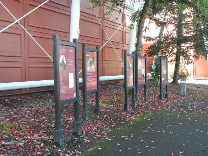
Near Washington Street near Abernethy Road, on the right when traveling north.
"A few of us (went) to the Falls of Willamut where we found many people & considerable of business." Medorem Crawford, Journal, October 3, 1842
An emigrant of 1842, Medorem Crawford worked for nearly a decade hauling freight around . . . — — Map (db m114760) HM
Near Washington Street near Abernethy Road, on the right when traveling north.
"Past on twelve miles or more, took the (w)rong road and arrived at the Willammette bottoms about dark a little below the City." -- Samuel Dexter Francis, October 14, 1852
In September and October, and early November the meadows at the . . . — — Map (db m114136) HM
Near Washington Street near Abernethy Road when traveling north.
Letters in newspapers, emigrant guide-books, and word of mouth gave counsel on overland travel. Emigrants commonly used farm wagons - simple, well-made, and utilitarian. Many were home-made or commission-built by local wagon makers. Some had custom . . . — — Map (db m114761) HM
On Mt. Hood Highway (U.S. 26), on the left when traveling west.
The pioneer road here detoured the Columbia River rapids and Mount Hood to the Willamette Valley. The road at first followed an old Indian trail. The later name was Barlow Road. Travel was difficult. Wagons were snubbed to trees by ropes on held . . . — — Map (db m112372) HM
On Mt. Hood Highway (U.S. 26) at Main Park Road, on the left when traveling west on Mt. Hood Highway.
In the shadow of the tall trees, a stream of travelers crossed ash flows, talus slopes and boggy wetlands along this last stretch of the trail. Some emigrants were forced to abandon their wagons with the death of livestock and walk, carrying their . . . — — Map (db m112341) HM
On Beech Street at Locust Street, on the right when traveling west on Beech Street.
(Seven panels dealing with the Columbia Plateau and Columbia River portions of the Oregon Trail are found at this kiosk)
Pathway to the "Garden of the World"
Excitement filled the air May 22, 1843 as nearly one thousand Americans left . . . — — Map (db m111946) HM
On Roswell Road (Oregon Route 452) at Succor Creek Highway (Oregon Route 201), on the left when traveling west on Roswell Road.
During the late 19th century thousands of Americans left farms, families and friends to trek the Oregon Trail toward new lives in the West. The trail was nearly 2,000 miles across prairies, mountains and parched deserts. Contrary to popular belief, . . . — — Map (db m106941) HM
On A Street East (U.S. 26) at Washington Street East (U.S. 26), on the left when traveling east on A Street East.
Eager to save time on the Oregon Trail, emigrants often attempted shortcuts. Between 1845 and 1854, three wagon trains left this campsite seeking a cutoff to the Willamette Valley.
The Meek Cutoff of 1845
Frontiersman Stephen . . . — — Map (db m107076) HM
On A Street West near Clark Street North, on the right when traveling west.
In 1845 Meek led 200 families away from Oregon Trail seeking a shorter route west. Gold found enroute began Blue Bucket legend. Hardships drove train back to Oregon Trail at The Dalles. — — Map (db m207961) HM
On A Street West near Clark Street North, on the right when traveling west.
Origin of name, Vale of Cashmere
The first building on the site on the present City of Vale was built on the banks of the Malheur by Jonathan Keeney in 1864. He offered accommodations to the migrants and miners on their way to the Powder River . . . — — Map (db m107057) HM
On Washington Street East (U.S. 26) at Short Street North, on the right when traveling west on Washington Street East.
(Inside this kiosk are seven panels which deal with the Malheur River and Meek's Cutoff.
"Pathway to the "Garden of the World"
Excitement filled the air May 22, 1843 as nearly one thousand Americans left Missouri . . . — — Map (db m107077) HM
On Fourmile Canyon Road, on the left when traveling north.
Fourmile Canyon witnessed the westward passage of wagons across the Columbia Plateau during the late summer and early fall. By this time on their journey, the emigrants had alternately been exposed to blazing heat, bitter cold and blustery winds. In . . . — — Map (db m111943) HM
Testing stamina and patience, the wagons were hurried to maintain constant motion across seemingly barren terrain. Facing trampled and scarce resources, the emigrants were often forced to wander miles off the established trail in search of water, . . . — — Map (db m111944) HM
On Oregon Route 74 near Cecil Lane, on the left when traveling south.
The Oregon Trail crossing of Willow Creek was an important site on the trail. There was water and forage for the pioneers and their livestock. This was often a location for a layover to rest and equipment repair before pushing on to The Dalles and a . . . — — Map (db m111942) HM
On Historic Columbia River Highway at Crown Point Highway on Historic Columbia River Highway.
On October 30, 1792 off the point in the Columbia River where the Sandy empties its waters, the boat crew from the H.M.S. Chatham (Vancouver's Voyages) were the first white men to sight the snowclad peak which Lt. Wm. R. Broughton named Mt. Hood in . . . — — Map (db m38388) HM
On Biggs-Rufus Highway (Oregon Route 206) 0.2 miles east of Moody Road (County Road 143), on the right when traveling west.
The Oregon Trail crossed the hazardous Deschutes River at this point by floating the prairie schooners and swimming the livestock. An island at the river mouth was often utilized when the water was high and the ford dangerous. Pioneer women and . . . — — Map (db m34575) HM
Near Biggs-Rufus Highway (Oregon Route 209) near Old Moody Road (County Route 143).
(Seven panels dealing with the Deschutes River Crossing portion of the Oregon Trail are found at this kiosk)
Truly Heart-Breaking!
Oregon Trail emigrants reached the Columbia River after an arduous trek across the dry and . . . — — Map (db m111990) HM
Near Forest Road 84 at milepost 228 near Evergreen Lane.
(Six panels dealing with the Deadman Pass portion of the Oregon Trail are found at this kiosk)
Wagon Ruts
More than 50,000 emigrants traveled west on the Oregon Trail between 1840 and 1850. The constant stream of wagons . . . — — Map (db m111563) HM
Near West Main Street near Water Street, on the left when traveling west.
The Wagon and Team
Wagons for trail travel were of the simplest construction, they cost $85.00 each. They were light, strong, and carried on sturdy wheels. It was recommended that wheels be made of bois-d'arc, osage orangewood or white . . . — — Map (db m111926) HM
On Rieth Road near Jane Street, on the left when traveling west.
David R. Koontz was a born in Gallia County, Ohio on September 20, 1829, and was buried here about September 10, 1852. He was the seventh child and youngest son of Martin V. Koontz, bridge builder and carpenter, and Lydia Rickabaugh. The Koontz . . . — — Map (db m111938) HM
Near West Main Street near Water Street, on the left when traveling west.
This morning after going one mile, we left the river, five mile over the ridge we crossed the river and encamped for the day in order to recruit our cattle as they were much fatigued by crossing the Blue Mountains. -- William J. . . . — — Map (db m111924) HM
Near Old Oregon Trail near Interstate 84, on the left when traveling north.
(Six panels dealing with the Emigrant Springs portion of the Oregon Trail are found beneath this kiosk)
Lost Livestock
Water is scarce in the steep, forested slopes of the Blue Mountains and is often found only at . . . — — Map (db m111537) HM
Near Old Oregon Trail near Interstate 84, on the left when traveling north.
In the first week of January, 1812, a party of trappers and traders, members of the Astor Overland Expedition, crossed the Blue Mountains in this area. Traveling afoot in bitter cold, often waist deep in snow, they were the first white men in this . . . — — Map (db m111534) HM
On Old Highway 30 near Main Street, on the right when traveling north.
In Memoriam
Erected 1925 by the
Women's Community Club
of Meacham, Oregon
In honor of those who died
Blazing the Old Oregon Trail — — Map (db m111528) HM
Dedicated to the memory of
The Intrepid Pioneers
Who came with the
First Wagon Train
In 1843 over the
Old Oregon Trail
And Saved the "Oregon County"
To the United States.
Erected by Old Oregon Trail Ass'n.
July 4, . . . — — Map (db m111533) HM
On South Main Street near Southeast Dorion Avenue, on the right when traveling north.
Aura Morse Goodwin Raley was born in Kennebec County, Maine. At age 15 she move to Wisconsin, and in 1846 she married Moses Goodwin. In 1853 the couple joined a wagon train to Oregon, where they settled north of Vancouver, Washington. In 1864 the . . . — — Map (db m111644) HM
On Pendleton Highway (Southeast Court Avenue) (U.S. 30) near Goad Road when traveling west.
This location marks a travel corridor for Plateau Tribes moving seasonally from the Columbia River to the Blue Mountains. In 1811, members of the Astor Party under the leadership of Wilson Price Hunt camped here on their way west. They traded with . . . — — Map (db m111565) HM
On Southwest Frazer Avenue near Southwest 1st Street, on the left when traveling west.
(Six panels dealing with the Pendleton area portion of the Oregon Trail are found at this kiosk)
The Long Walk to Oregon
Contrary to popular belief Oregon Trail emigrants rarely took the reins while seated in their . . . — — Map (db m111578) HM
On Westgate (Northwest Pendleton Highway) (U.S. 30) near County Route 1302, on the left when traveling west.
Weary emigrants traveling westward on the Oregon Trail favored a campsite on the near bank of the Umatilla River at this point. On leaving they climbed the same hill the highway now traverses. Then recrossed the Umatilla River at Echo 20 hot dusty . . . — — Map (db m111912) HM
On Interstate 84 at milepost 185 near Umatilla-Stanfield Highway (U.S. 395), on the right when traveling west.
(Six panels dealing with the Umatilla River Crossing portion of the Oregon Trail are found at this kiosk)
The Road Forks
Early Oregon Trail emigrants crossed the Blue Mountains and traveled north to re-provision at the . . . — — Map (db m111940) HM
Near Unnamed Road (possibly Oregon Trail Road 1843) near Old Emigrant Hill Scenic Frontage Road.
"Commenced the ascent of the Blue Mountains It is a lovely morning, and all hands seem to be delighted with the prospect, of being so near timber again, after weary months of travel, on the dry dusty sage plants, with nothing to receive the eye; . . . — — Map (db m111491) HM
Near Unnamed Road (Oregon Trail Road 1843?) near Old Emigrant Hill Scenic Frontage Road.
Native peoples crossed the Blue Mountains long before the first explores and fur trappers.
In 1834, John Kirk Townsend found the Cayuse and Nez Perce, very friendly towards us, each of the chiefs taking us by the hand with great . . . — — Map (db m111490) HM
Near Hilgard Highway (Oregon Route 244) near Interstate 84.
(Six panels dealing with the Blue Mountian portion of the Oregon Trail are found beneath this kiosk)
The Blue Mountains
Oregon Trail emigrants crossed the Rocky Mountains through South Pass in Wyoming. The ascent and . . . — — Map (db m111466) HM
Near Unnamed Road (possibly Oregon Trail Road 1843) near Old Emigrant Hill Scenic Frontage Road.
"... we traveled on for the Blue Mountains cutting our way through the fallen timber... We found it very laborious ... with our dull axes that we had not ground since we left Missouri having no grinding stone to grind them & our hands being very . . . — — Map (db m111494) HM
On Unnamed Road (possibly Oregon Trail Road 1843) near Old Emigrant Hill Scenic Frontage Road.
On August 15, 1853 Henry Allyn wrote the following about his second day in the Blue Mountains: "Elizabeth and father still quite unwell ... We noon on the mountain and take our mules down into a doleful cavern and found a little grass and water, . . . — — Map (db m111492) HM
Near Unnamed Road (possibly Oregon Trail Road 1843) near Old Emigrant Hill Scenic Frontage Road.
During the mid-1800s, thousands of American emigrants labored along this ridge. Since then, stage coach, train and automobile roads have paralleled the Oregon Trail over these mountains.
Only traces of the original road remain, yet the ideals of . . . — — Map (db m111496) HM
On Interstate 84 at milepost 71, on the right when traveling west.
(Twelve panels dealing with Oregon Trail related topics are found at this kiosk)
Pathway to the "Garden of the World"
Excitement filled the air May 22, 1843 as nearly one thousand Americans left Missouri toward new . . . — — Map (db m112193) HM
On National Park Highway/Oregon Trail (U.S. 89), on the right when traveling south.
The first covered wagons came into the Rocky Mts. in 1830, they
made their way as far west as Fort Washakie in Wyoming. Efforts
were made to find passable wagon trails through the Mountains to
the Pacific Coast, which goal was finally reached. At . . . — — Map (db m99320) HM
Before 1846 American immigrants traveling the Oregon Trail to Fort Vancouver had to make a choice at The Dalles (80 miles upriver from here). They could navigate their own handmade raft or take a Hudson's Bay Company boat down the Columbia River to . . . — — Map (db m12295) HM
Near Water Street, 0.1 miles south of Stearns Road, on the left when traveling south.
The Oregon Trail, stretching from Missouri to the Pacific, served as the most important route for settlers traveling west. As many as 1600 wagons a day rumbled over the famous route. The northwestern most extension of the Oregon Trail was the . . . — — Map (db m129173) HM
Front of Marker:
Monument Expedition
Camp One
29 Jan 1906
Left Side of Marker:
This stone is donated by
Gregory L. Meeker
Cousin to Ezra
In honor of Bobby and Helen Meeker who taught their son the love of . . . — — Map (db m39786) HM
Dedicated to the travelers on Old Oregon Trail 1832-1843 when it passed thru
Walla Walla Valley. Robert Newell and Joe Meek brought wagons to Fort Walla Walla in 1840. White, Lovejoy & Hastings led the first emigrants in 1842. Whitman, Applegate . . . — — Map (db m126012) HM
A short distance to the south, near the Walla Walla River, is Wai-i-lat-pu, "The Place of the People of the Rye Grass,” a mission founded among the Cayuse Indians of the Walla Walla Valley in 1836 by Dr. Marcus Whitman and his wife, Narcissa. . . . — — Map (db m3766) HM
On Cold Springs Road (State Highway 91) near Bedtick Road (County Route 8), on the right when traveling west.
This Monument
marks the junction
of the Oregon Trail
and road to Old Ft.
Fetterman nine
miles north of this
spot. Established
July 10, 1867. Abandoned
May 25, 1882. — — Map (db m92111) HM
Near Natural Bridge Road (County Road 13) 2.5 miles south of Spring Canyon Road (County Road 11).
The Oregon Trail crosses LaPrele Creek about one mile downstream from Natural Bridge. Before the modern road was built into the gorge, Natural Bridge was difficult to access, and it was only rarely visited by emigrants of the covered wagon era. From . . . — — Map (db m71495) HM
On Big Muddy Road near Cole Creek Road (County Route 22), on the left when traveling east.
Caleb and Nancy Magill with their six children were part of a wagon train traveling fro Brown County, Kansas, to Dallas, Oregon, in 1864. After leaving Fort Laramie their three-year-old daughter Ada was taken sick with dysentery. At Deer Creek . . . — — Map (db m92079) HM
On Tank Farm Road (County Route 27) near Business Interstate 25, on the right when traveling east.
Nineteen-year-old Alvah Unthank was one of a group of young men who left Newport, Wayne County, Indiana, for the goldfields of California in 1850. On June 23 the wagon train passed Register Cliff, south of Guernsey. There Alvah inscribed his name: . . . — — Map (db m177934) HM
On South 4th Street (Business Route 25), on the left when traveling south.
Deer Creek Station, which once stood on the site of present- day Glenrock near the confluence of Deer Creek and the North Platte River, became a familiar landmark along the Oregon-California-Mormon Trail between 1857 and 1866.
The station began . . . — — Map (db m92081) HM
On West Birch Street (U.S. 26) near Wyoming Highway 95, on the right when traveling east.
On July 26, 1842 John C. Fremont's first expedition to the far west guided by Kit Carson with Joseph Bissonette as interpreter, also L. Maxwell as hunter, camped in this rocky glen.
Names and dates of many of the 300,000 travelers of the . . . — — Map (db m92080) HM
On Interstate 25 at milepost 152 near Natural Bridge Road (County Route 13), on the right when traveling east.
Three men named Sharp,
Franklin, and Taylor, and
one unknown man were
killed by Indians July 12,
1864 where the Oregon
Trail crosses Little Box
Elder Creek 2 1/2 miles S.W.
of here. They were buried
4 miles S.W. by the grave . . . — — Map (db m92087) HM
On U.S. 287, 1.7 miles west of Happy Springs Rd, on the right when traveling west.
Ice Slough is a small stream that flows into the Sweetwater River five miles east of here. In front of this point is a slough (i.e. a marsh or shallow un-drained depression). This slough gave the name to the stream east of here. In the "Ice Slough" . . . — — Map (db m62076) HM
Near U.S. 287, 1 mile west of California Emigrant Rd, on the right when traveling west.
Originally called the Emigrant Road, the Oregon Trail was the main route of westward expansion from 1812 to 1869. An estimated 500,000 people journeyed past here in search of new lands and new lives in the West.
Because of its unique shape, . . . — — Map (db m62092) HM
Near U.S. 287, 1 mile west of California Emigrant Road, on the right when traveling west.
Split Rock was a relay station during the turbulent 18 month life of the Pony Express. The Express operated at a gallop, speeding mail across the West in only 10 days. However, because of the "talking wire," its days were numbered. The telegraph . . . — — Map (db m69603) HM
Near U.S. 287, 1 mile west of California Emigrant Road, on the right when traveling west.
Shoshone, Arapaho, Crow and Sioux Indians occupied this pleasant valley long before the Oregon Trail, which changed their cultures and life styles forever. This led to tragic warfare and the eventual loss of country they had called their own.
. . . — — Map (db m69602) HM
Near Wyoming 789 near Wyoming Highway 220, on the right when traveling west.
The Oregon Trail was American’s main street west. Building upon American Indians footpaths, emigrants bound for the Pacific Northwest used the trail. They were soon followed by Mormons fleeing persecution, gold seekers rushing to California and the . . . — — Map (db m95744) HM
On Oregon Buttes Road at Emigrant Trail, on the left when traveling south on Oregon Buttes Road.
To the south stand the Oregon Buttes, a major trail landmark. The name is significant because the Buttes were roughly the beginning of the Oregon Territory and also helped keep emigrants encouraged, even though there were still hundreds of miles of . . . — — Map (db m80499) HM
Near State Highway 28, 0.7 miles south of Lander-Pinedale Stage Road.
From where you're standing South Pass doesn't look all that remarkable. But compared to the rugged Wind River Mountains, it can easily be recognized as a type of gateway.
Nevertheless, crossing the Continental Divide into "Oregon Country" was a . . . — — Map (db m67020) HM
Near State Highway 28, 0.7 miles south of Lander-Pinedale Stage Road.
Even after the discovery of South Pass in 1824, it was years before the route was used extensively. Fur trapper/trader William Sublette brought a small caravan of wagons to South Pass in 1828. While his party did not take wagons over the pass, they . . . — — Map (db m67021) HM
South Pass was discovered in 1812 by a small band of Astorians led by Robert Stuart as they traveled east with dispatches for John Jacob Astor. It was “rediscovered” in 1824 by a party led by Jedediah Smith as they searched for a winter . . . — — Map (db m80501) HM
Near State Highway 28, 0.7 miles south of Lander-Pinedale Stage Road.
The trail over South Pass is a transportation corridor which served many purposes. In addition to being the route to Oregon and California, it was used by Mormon pioneers and by the Pony Express.
A great exodus to the Salt Lake Valley in 1847 . . . — — Map (db m67019) HM
Near State Highway 28, 0.7 miles south of Lander-Pinedale Stage Road.
The demand for beaver pelts in the early 1800s led to the exploration and eventual settlement of the American West. South Pass was part of a major thoroughfare through the Rockies and its discovery is significant to the era known as the fur trade. . . . — — Map (db m67022) HM
The Oregon Trail
In memory of those who passed this way to win and hold the West
Plaque placed by the Historical Landmark Commission of Wyoming
1950 — — Map (db m80504) HM
Near State Highway 28, 0.7 miles south of Lander-Pinedale Stage Road.
With South Pass behind them, Oregon and California-bound travelers faced the second half of their journey. The roughest travel was yet to come. From Missouri to South Pass, emigrants were able to follow rivers. But from South Pass to Oregon and . . . — — Map (db m67018) HM
On Wyoming Route 28, on the right when traveling north.
The Twin Mounds are a minor landmark along the Trail. These low hills on either side of the Trail helped keep emigrants headed in the right direction on the final climb to South Pass.
After the wagons passed between the Mounds, they fanned out . . . — — Map (db m237435) HM
On Dickinson Avenue (State Highway 28) near Lander Cut-Off Road, on the left when traveling south.
In 1858, this ancient path, which had been used by Indians, explorers and mountain men as a short cut to the Snake River country was developed by Frederick Lander in to an alternate route on the Oregon Trail. What is commonly called the Lander Trail . . . — — Map (db m80161) HM
On Emigrant Trail near Lander Pinedale Stage Road, on the left when traveling north.
For many emigrants, the first tangible evidence that the had crossed South Pass was Pacific Springs, "the fountain source of the Pacific streams," according to pioneer Joseph Goldsborough Bruff. The broad expanse of the pass from Pacific Springs . . . — — Map (db m96660) HM
On South Pass Main Street near Price Street, on the left when traveling east.
Founded 1868
A Great Gold Camp
Part of Wyoming’s historical heritage. Acquired for preservation May 18, 1966, with funds raised by Wyoming;s 75th Anniversary Commission Inc., its advisers, county committees and people of . . . — — Map (db m80162) HM
Near Wyoming 789 (U.S. 287) at Sand Draw Road (Wyoming Highway 135), on the right when traveling west.
The Sweetwater Valley is the mid-section of the 2000 mile-long Oregon Trail. West of Casper, Wyoming, branches of that trail, meld into a single transportation corridor and here, paralleling the serpentine Sweetwater River, the trail approaches the . . . — — Map (db m95776) HM
A military post on the Oregon Trail June 16, 1849-March 2, 1890. This monument is erected by the State of Wyoming and a few interested residents — — Map (db m100065) HM
Near Road 92 (County Route 50) near Gray Rocks Road, on the right when traveling west.
Mary Elizabeth Homsley was born near Lexington, Kentucky, July 20, 1824. She move with her parents, Jacob and Sarah Oden, to Truxton, Missouri, where she was married to Benjamin Franklin Homsley in 1841. In April 1852, accompanied by Mary's parents . . . — — Map (db m98361) HM
On East Merriam Street (U.S. 26) at Lawton Avernue on East Merriam Street.
Between the years 1847 and 1868, most of the approximate 80,000 Mormon Pioneers passed through Fort Laramie. This was the first stop for the vanguard company after leaving Winter Quarters, (near Omaha) Nebraska.
In June, 1847, after following a . . . — — Map (db m79776) HM
On Road 92 near Gray Rocks Road, on the right when traveling west.
"We proceeded (westward from Fort Laramie) and encamped outside the boundaries of Uncle Sam." So wrote Dr. J.S. Shepard in 1851 as he began the second leg of his journey west. "To leave Fort Laramie was to cast off all ties with civilization. It was . . . — — Map (db m98360) HM
On U.S. 85 near Industrial Park Road, on the left when traveling north.
3/4 mile east from this point
Cold Springs was a popular camping ground on the Overland Trail to California, Oregon, Utah and other points in the far west. It was a stage station along the Overland Stage Route 1854-1862 and also a Pony Express . . . — — Map (db m79702) HM
On Dempsey Road, 1 mile west of Farm Field Road, on the left when traveling west.
Many camping areas were used by the pioneers on their way west after making the Ham's Fork Crossing. This "Emigrant Springs" camping area became a favorite spot for the emigrants to spend the night. Abundant fire wood, livestock feed and good water . . . — — Map (db m179621) HM
On Farm Field Road, 2 miles east of Dempsey Road, on the right when traveling east.
Within this fence lie the graves of five or six pioneers who lost their lives while traveling to the gold fields of California and the fertile Willamette Valley of Oregon.
Alfred Corum and his brothers John, Herod, and Simeon left Cooper County, . . . — — Map (db m179620) HM
On Farm Field Road, 1 mile east of Dempsey Road, on the right when traveling east.
In April, 1852, four brothers, Wesley, Samuel, James and Steven Hill, together with their families, 62 persons in all, left Paris, Monroe County, Missouri, for California.
Their were two deaths along the Platte River and here on the Hamsfork . . . — — Map (db m179619) HM
On U.S. 189 near Bondurant Road, on the right when traveling south.
Names Hill is one of three prominent sites in Wyoming where travelers inscribed their names into stone along the emigrant trails. The other sites are Register Cliff and Independence Rock. After crossing a 40 miles stretch of waterless desert, wagon . . . — — Map (db m162509) HM