1166 entries match your criteria. The first 100 are listed. Next 100 ⊳
Lighthouses Historical Markers
Lighthouses mark dangerous coastlines, hazardous shoals, reefs, rocks, and safe entries to harbors. Once widely used, the number of operational lighthouses has declined due to the expense of maintenance and have become uneconomical since the advent of cheaper electronic navigational systems. Many remain standing due to historic preservation efforts. This Series is all about lighthouses. It includes lightships; artifacts from lighthouses; the Coast Guard's lighthouse service; replica, non-working lighthouses (such as those for tourism or novelty); lighthouse keepers' housing; and descriptions from lighthouse keeper's lives; and even markers with a photo or drawing of a lighthouse.
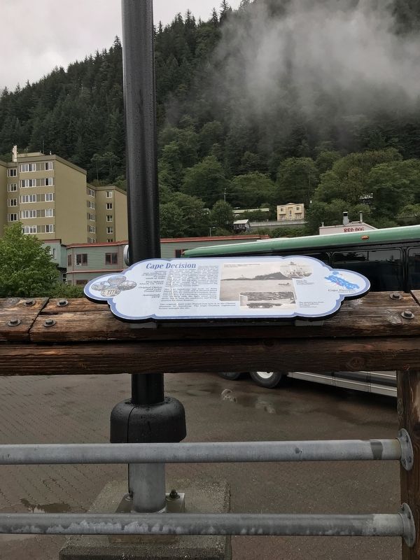
The Cape Decision lighthouse was the last one built in Alaska. Need for it grew as ship traffic and the size of the ships increased. Southeast Alaska was booming with many salmon canneries, herring salteries and whale oil reduction plants. Large . . . — — Map (db m181646) HM
Perched high on a cliff, Cape Hinchinbrook lighthouse marks the entrance to the sheltered waters of Prince William Sound. The wreck of the steamer Oregon on Hinchinbrook Island in 1906 prompted the light's installation. Foul weather during . . . — — Map (db m181634) HM
Facing the open Gulf of Alaska, Cape Saint Elias lighthouse stands on Kayak Island, where in 1741, Russian voyagers first set foot on North American soil. The Cape's bald pinnacle serves as a key landmark in daylight. The light provides guidance at . . . — — Map (db m181632) HM
Scotch Cap and Cape Sarichef lighthouses mark the north and south entrances to Unimak Pass in the Aleutian Islands. Both sites were declared to be too isolated for family life.
Scotch Cap was the first light on Alaska's outside coast and is the . . . — — Map (db m181636) HM
Cape Spencer lighthouse stands on a barren, isolated rock at the entrance to Cross Sound, where the sheltered Inside Passage meets the open Gulf of Alaska. The original lighthouse still stands. It is a single-story, reinforced concrete building . . . — — Map (db m181631) HM
Eldred Rock is the oldest original lighthouse still standing in Alaska. It is a two-story building topped by a light tower. The ground floor was built of reinforced concrete, the first time that material was used for a lighthouse facing Alaska's . . . — — Map (db m181635) HM
Southeast Five Finger was the first name given this lighthouse site due to its location on the southeastern-most island of the Five Finger Islands group. The original, wood boathouse and carpenter shop remain.
A keeper thawing frozen water pipes . . . — — Map (db m181645) HM
A square, white wooden tower housed the Guard Islands light, with a separate keeper's house nearby. When a reinforced concrete building replaced the old light tower in 1922, a second house was built so two keepers could live there with their . . . — — Map (db m181640) HM
For more than 100 years, lighthouses have guided mariners through Alaskan waters.
Lighthouses capture our imagination as lonely sentinels of the sea. They played a vital role in Alaska's development because for more than 70 years, ships . . . — — Map (db m181647) HM
Widely spaced along Alaska's Inside Passage, these three lighthouses were among the first built, and the first discontinued.
The lighthouse on Lincoln Rock, near Ketchikan, was unusually difficult to build. The small, rocky pinnacle on which it . . . — — Map (db m181637) HM
The lighthouse on Mary Island is the second one seen by ships heading up Alaska's Inside Passage. The beacon guides mariners into Revillagigedo Channel leading to Ketchikan. Like most of Alaska's lighthouses, it was built soon after the Klondike . . . — — Map (db m181642) HM
The red-roofed, white buildings at Point Retreat are a familiar sight to local boaters and passengers on cruise ships sailing between Juneau and Glacier Bay. The original, wooden light tower at Point Retreat was only 6 feet tall, but it stood 19 . . . — — Map (db m181638) HM
Sentinel Island Lighthouse guards the entrance to Favorite Channel, linking Lynn Canal to Juneau's Auke Bay. The original, wood frame structures included a keeper's house with an attached light tower and out-buildings, including a wharf and . . . — — Map (db m181644) HM
Tree Point is Alaska's most southerly of the Southeast lighthouses. It marks the first landfall for northbound ships crossing Queen Charlotte Sound, 30 miles of coastal water open to the Pacific. Mariners used Tree Point Lighthouse to guide them . . . — — Map (db m181641) HM
Creating the Cove
The transformation of the estuary from industrial harbor to recreational waterway is a major trend in Oakland’s history. The change began at this spot. The Oakland Municipal Yacht Harbor – the city’s first public marina – . . . — — Map (db m71420) HM
Constructed in 1873-74, East Brothers Light Station is the older of only two remaining light stations of San Francisco Bay that have remained substantially unchanged. The original 5th order classical (Fresnel) lens was replaced with the present . . . — — Map (db m164491) HM
The Battery Point Lighthouse is one of the first lighthouses on the California Coast.
Rugged mountains and unbridged rivers meant coastal travel was essential for the economic survival of this region.
In 1855 Congress appropriated $15,000 for . . . — — Map (db m101692) HM
The 780 prisms and fresnel lenses in this replica of the original Cape Mendocino Light House were hand ground in France, shipped around Cape Horn and originally placed in operation at Cape Mendocino in 1868. The entire mechanical gear and prisms . . . — — Map (db m189002) HM
Lit Dec. 1, 1868 to Mar. 3, 1951.
Built at 422 ft. elevation, the light swept 30 mi. to sea. The perilous waters here claimed nine ships. Mules took supplies to the site, 15 mi. north, the westernmost in the U.S.
Dedicated to the Keepers of . . . — — Map (db m51954) HM
The Mendocino presented a huge challenge to the designers of this lighthouse
The lighthouse’s assigned position was a storm-battered, 400-foot cliff prone to frequent earthquakes and landslides. The compact tower, with its lifesaving beacon, had to . . . — — Map (db m1108) HM
Lit Dec. 1, 1868, the light from its first order Fresnel lens swept 30 miles to sea. Decommissioned in 1951, the structure slowly began to inch toward the 422’ cliff. The light was dismantled in 1998 and moved to Point Delgada, Shelter Cove by . . . — — Map (db m1093) HM
A new home in Shelter Cove. Shelter Cove is not the original home of the Cape Mendocino lighthouse. The lighthouse operated at Cape Mendocino, 35 miles north of here.
The compact metal tower was installed on a cliff at the cape in 1868 . . . — — Map (db m1107) HM
The Trinidad Memorial Lighthouse is one of the most iconic landmarks on the North Coast and a beloved, historical symbol of the Trinidad community. The structure was built in 1949 as a replica of the original 1871 Trinidad Lighthouse, which . . . — — Map (db m139525) HM
Juan Rodriquez Cabrillo, exploring for Spain, discovered Alta California and named San Pedro Bay, “Bahia de los Fumos” (Bay of Smokes), October 1542. The smoke on the Bay shore came from the native Suang-Na Indian Fires. Sebastian Vizcaino named . . . — — Map (db m127129) HM
Point Fermin Light House, dedicated by Stephen M. White and Rudecinda Parlors Native Sons and Native Daughters of the Golden West, San Pedro, California, May 2, 1940. Built 1874.
Point Fermin Lighthouse, erected 1874. Honored as a . . . — — Map (db m51006) HM
The site was explored by Juan Rodriguez Cabrillo on Oct. 9, 1542, and named Pointe Vicente Bante Maria by Captain George Vancouver in 1793. Placed in service by the U.S. Lighthouse Service on May 1, 1926, it was renamed Point Vicente by the Pacific . . . — — Map (db m82001) HM
Point Reyes Light has guided and cautioned mariners along this hazardous coast for over 100 years. Built by the U.S. Lighthouse Service in 1870, it came under management of the U.S. Coast Guard in 1939. Resident personnel operated the station until . . . — — Map (db m63502) HM
Explore Battery Alexander
Battery Alexander
Built in 1901, the concrete coastal defense installation in the grove of trees behind the restroom held mortars that could fire 12-inch diameter shells in a high arcing path to penetrate the . . . — — Map (db m232187) HM
Be Safe! Stay on the trail.
Cliffs are unstable and plant life is fragile.
The Point Bonita Lighthouse has guided ships through the hazardous Golden Gate Strait into San Francisco Bay since 1855. This lighthouse has witnessed a remarkable . . . — — Map (db m232190) HM
The Point Cabrillo Light Station was built in 1908 by the US Lighthouse Service to protect the "Doghole Schooners" that plied the lumber trade between San Francisco and the Redwood Coast. These steam ships and sailing vessels were known for their . . . — — Map (db m543) HM
This site and natural landmark has been a welcome guide to safe navigation for ships along the rugged Mendocino coast since 1870, destroyed by 1906 earthquake, two years later stately tower was erected. — — Map (db m64770) HM
This rocky point, connected to the mainland by a sand spit, is a geologic formation called a tombolo. Because of its prominence, Point Sur provided an excellent location for a lighthouse and fog signal to warn ships of the hazardous coastline and . . . — — Map (db m200912) HM
Spanish explorers and later New England hide and tallow traders found the Big Sur coastline a great hazard. Heavy fogs and extreme winds caused the wreck of many vessels on this coast. The Gold Rush of 1849 dramatically increased coastal shipping. A . . . — — Map (db m68643) HM
“The Oil House”
*****************************
The structure you see before you is a fuel storage house commonly referred to as an ‘oil house’. This oil house was constructed in 1899.
In the 1880’s, before the conversion to . . . — — Map (db m63689) HM
Established Aug. 1, 1890, Ballast Point Light Station was a fine example of “railroad Gothic” and lasted until 1866, when it was replaced by a light on top of a slender steel tower, and new quarters were built for the Coast Guard personnel who . . . — — Map (db m238819) HM
No lighthouse kept vigil over the harbor four centuries ago when Cabrillo sailed into the bay. There were no channel buoys, fog horns, or local charts to guide mariners safely to anchor. Today, however, the Coast Guard and Port of San Diego . . . — — Map (db m296420) HM
Lighthouse locations were usually far from fresh water.
To compensate, many lighthouses used rain "catchment systems" like the one before you.
These giant concrete funnels diverted rainwater into underground cisterns, where it was stored for . . . — — Map (db m296432) HM
This lighthouse, built in 1854, was one of the first eight lighthouses on the Pacific Coast. It continued in use until 1891, when the new Pelican Point Lighthouse began operating. The Point Loma Lighthouse became the site of the Cabrillo National . . . — — Map (db m296421) HM
The old lighthouse you are approaching protected sailors off the San Diego Coast for 36 years, from 1855 to 1891. It was a lonely outpost on a barren headland. In January 2004, the National Park Service completed restoration of the grounds of the . . . — — Map (db m296422) HM
San Diego's first lighthouse guided ships along the coast and marked the entrance to the harbor for over 30 years. A captain reported seeing the light from as far as 39 miles (63km). For many years it was the highest coastal light in the country — . . . — — Map (db m296423) HM
Since ancient times, lighthouses have been integral to the development of maritime commerce around the globe. With each voyage, mariners staked their cargoes and, indeed, their very lives on these lights. The story of lighthouses in the United . . . — — Map (db m310924) HM
Alcatraz's original lighthouse (below) was lit in 1854, when California's gold
fields were drawing fortune-seekers from around the world. It was the first
operating lighthouse on the West Coast. Today's lighthouse, which replaced
the original one . . . — — Map (db m194652) HM
Alcatraz's executive mansion
For many years, Alcatraz's most powerful resident lived in
a Victorian cottage on Officers' Row. That changed in 1921
when this 15-room mansion was completed. Built on the
island's summit to command respect, . . . — — Map (db m191924) HM
Swift tides, treacherous rocks, dense fog, and a narrow harbor entrance have always made San Francisco’s coast and port difficult to navigate. Over 300 known vessels have failed to make the passage and sank in the cold, treacherous waters.
One . . . — — Map (db m48638) HM
Golden Gate National Recreation Area
Deep channels make San Francisco’s protected harbor accessible to immense ships. On the other hand, swift currents, high winds, rocks and fog make navigating the narrow Golden Gate treacherous. Early mariners . . . — — Map (db m211172) HM
Deep channels make San Francisco’s remarkable harbor accessible to immense ships. On the other hand, a narrow entrance, swift currents, high winds, rocks, and fog make navigating the Golden Gate treacherous. Early mariners looked for on-shore . . . — — Map (db m48641) HM
A Navigable Bay
During the Gold Rush, rock outcrops in San Francisco Bay posed hazardous obstacles for ships entering the harbor. To protect them, the government erected a lighthouse on Alcatraz, and hired lighthouse keepers to alert and guide . . . — — Map (db m228576) HM
The Warden’s house commanded the summit of the island. An impressive Mission Revival-style home, it had seventeen large rooms with sweeping views of the Golden Gate and San Francisco. Built in 1921, it was originally the residence of the military . . . — — Map (db m228667) HM
The treacherous waters of the Golden Gate have claimed dozens of ships and hundreds of lives.
Beginning in 1852, the United States Government funded the construction of a chain of 59 light-houses along the California coast. The Fort Point light . . . — — Map (db m102283) HM
With a strategic location in the center of the San Francisco Bay opposite the Golden Gate, Yerba Buena Island has been home to three branches of the U.S. Military – the Army, Navy and Coast Guard.
From 1867 to 1897 the Army used the island . . . — — Map (db m218468) HM
Built in 1890 as part of the original light station, this building combined the lighthouse (tower structure) and the residence/office of the head keeper and his family. — — Map (db m70052) HM
This first order fresnel lens was manufactured in 1850 in France by Henry LaPaute. The clock mechanism was built in 1872 and the lens you see here was installed atop the lighthouse at Piedras Blancas in 1874.
In 1949 the lens was removed . . . — — Map (db m68626) HM
Pigeon Point Lighthouse's tall, double-walled tower supports a huge four-ton lens. The first-order, or largest, Fresnel lens has 1,008 glass elements mounted in a brass framework. This lens system was perfected by Augustin Fresnel, pronounced . . . — — Map (db m155249) HM
Año Nuevo Island wasn't always an island! The first Spanish explorers to sail past this place named it Punto Año Nuevo or New Year's Point. The long jutting point has eroded since the 1600s. It is now an island separated from the mainland by a rough . . . — — Map (db m177849) HM
A Tower at Risk
Pigeon Point Lighthouse is one of one the oldest and most treasured landmarks on the California coast, a marvel of high-tech design when it was first lit in 1872. Its first-order Fresnel lens, the most powerful lens of the . . . — — Map (db m195605) HM
A Landmark Worth Saving
For nearly a century and a half, Pigeon Point Lighthouse has stood as a symbol of California's spirit and a reminder of its past - a focal point for community amidst a stunning coastal landscape. but this icon is . . . — — Map (db m195606) HM
Pre-1800s: Ohlone Indians inhabit the coast
Early 1800s: Spanish name Punta de las Balenas - Whale Point
1850s: Clipper ship Carrier Pigeon wrecks on the rocks that are thereafter called Pigeon Point
1860: Boom and . . . — — Map (db m93355) HM
This brick lighthouse was built to incorporate a French first order Fresnel lens. Although no longer used, the lens is still operable in the lantern room. Previously the lens had been installed at Cape Hatteras, North Carolina. It first flashed over . . . — — Map (db m2541) HM
The Point Arena was built in 1887. This sturdy steam schooner carried large loads of cargo yet was nimble enough to navigate the tiny "dog hole" ports of California's central coast.
On August 9, 1913, the Point Arena was loading tanbark at Pigeon . . . — — Map (db m194662) HM
As early as 1857, the need for a lighthouse at Point Hueneme to mark the eastern Santa Barbara Channel entrance was recognized. In March 1873 Congress appropriated funds for a light station and a 60-acre lighthouse reservation at Point Hueneme. . . . — — Map (db m155775) HM
How The Islands Formed -
Linked
to the movement of two great plates of
the earth's crust colliding, the norther
Channel Islands were formed by the
folding and faulting that have taken
place over the past 30 million years.
The islands . . . — — Map (db m253172) HM
The shifting sand bar at the mouth of the river made it difficult for large ships to negotiate the shallow harbor. The first Lynde Point Lighthouse built in 1803, a wooden octagonal tower 35 feet high, warned ships of the sandbar that blocked much . . . — — Map (db m182307) HM
Who Lived Here ?
James Chaugham (a Native American who was, according to his granddaughter, a member of the Narragansett Tribe) and his wife, Molly (of European descent), lived in a village located here for fifty years,
in what became Peoples . . . — — Map (db m102323) HM
About a dozen cellar holes dot the hillside of
Ragged Mountain.
Some, like the one before you, are clearly marked
with foundations made of stone quarried from
nearby bedrock, similar to the stone located directly
behind this . . . — — Map (db m112227) HM
You are now looking into the Lighthouse Village cemetery. The unmarked, upright field stones
designate the final resting places of many who lived in the community, including the founding couple,
James Chaugham, a Native American, and Molly . . . — — Map (db m102325) HM
Charcoal production was an important industry in northwestern Connecticut in the nineteenth century.
Before Pennsylvania coal became readily available, the iron forges in Litchfield County were reliant upon locally produced charcoal as . . . — — Map (db m112226) HM
The residents of the Lighthouse community were largely self-sufficient
when it came to their subsistence. Bone fragments found in their
fireplaces show that they ate deer and small wild game. Gun flints (used
in flint-lock rifles) and gun . . . — — Map (db m112198) HM
The residents of the Lighthouse community were able to supply many of their needs here on Ragged Mountain. You saw how the foundations of some of their homes were constructed with stone; the people of the Lighthouse quarried some of that stone . . . — — Map (db m112229) HM
Faulkner's Island and its historic lighthouse have played an important role in the history of Long Island Sound. The crescent-shaped island contains no less than 3 acres and lies 3 1/2 miles south of the Guilford Harbor. It is listed in the . . . — — Map (db m247047) HM
The Long Island Sound, including New Haven Harbor, is an estuary — a place where fresh and salt water meet. Estuaries provide many animals with a protected home to lay eggs and serve as a nursery for the young, a place to find food, and a . . . — — Map (db m107346) HM
The butterfly garden was planted to attract butterflies and birds to the park, and to provide these animals with a reliable source of food. Spend some time here when the flowers are in bloom and see who stops by for a visit.
Monarch Migration . . . — — Map (db m107343) HM
A Birdwatcher’s Dream
You’re standing at one of the best hawk-watching sites in New England. Every autumn birds of prey from Northern New England and Canada migrate south in a broad band across New England. Because theses birds don’t like . . . — — Map (db m269482) HM
Connecticut State Pier Complex
State Pier lies beyond the train station, just north of the Cross Sound Ferry docks. The pier was completed in 1914 with state money and is an early example of state government encouraging economic development . . . — — Map (db m216600) HM
In 1789, when the new federal government needed a national source of revenue, Congress turned to the sea. They placed a tax on imports, created the Customs Service to collect it and established federal oversight for lighthouses to ensure safer . . . — — Map (db m48329) HM
Mystic Seaport’s lighthouse is a reproduction of Nantucket Island’s Brant Point Lighthouse. Built in 1966, it is an exact replica in size and scale and uses a fourth order Fresnel lens.
Only the second lighthouse built in the English American . . . — — Map (db m68510) HM
Mystic Seaport's lighthouse is a reproduction of Nantucket Island's Brant Point Lighthouse. Built in 1966, it is an exact replica in size and scale and uses a fourth-order Fresnel lens.
Only the second lighthouse built in the . . . — — Map (db m226983) HM
Stonington
This coastline of Pequot Indian country was first mapped by Adriaen Block from Holland in 1614. The first settlers in 1649 were William and Anna Chesebrough at Wequetequock Cove. The next year Thomas Stanton built a trading post on the . . . — — Map (db m68274) HM
In 1875, Congress approved funding to build several lighthouses along this segment of the Delaware River. This site was purchased in April 1876, and by December the Port Penn Front Range Light was completed. Constructed under the direction of the . . . — — Map (db m10536) HM
The Delaware estuary is the second largest freshwater port in the United States. It hosts the country's second largest concentration of petrochemical facilities. Shipping of petrochemicals and other products has revitalized ports along the . . . — — Map (db m191845) HM
On December 29, 1858, the Lighthouse Board issued the following announcement:
“Notice to Mariners
New Light-House
at
Fenwicks Island, Delaware”
Notice is hereby given that the new tower at Fenwicks Island, Delaware, is finished, . . . — — Map (db m63345) HM
The Fenwick Island Lighthouse
Erected 1858
In operation from 1859 to 1978
as an official aid to navigation
Transferred to Delaware, 1981
Restored, 1982 – 1983, by The Friends of
the Fenwick Island Lighthouse under the
leadership of . . . — — Map (db m3027) HM
The Fenwick Island Lighthouse was listed in the National Register of Historic Places by the Department of Interior in 1979 in recognition of its significance of the rich maritime history of Delaware.
In 1852, responding to pressure to . . . — — Map (db m63347) HM
Noted painter Howard Schroeder (1910-1995) was assigned to Fort Miles in 1941. That first winter, soldiers lived in tents or a large warehouse because barracks were still under construction. Schroeder painted fellow soldiers as well as the . . . — — Map (db m272540) HM
For more than 150 years, the Cape Henlopen Lighthouse guided ships into Delaware Bay on their way to the ports of Wilmington and Philadelphia.
The Cape Henlopen Lighthouse had its beginnings in 1761. Philadelphia merchants and ship owners . . . — — Map (db m79167) HM
Located on the eastern end of the Delaware Breakwater, this brown conical structure was built in 1885. The tower is composed of four tiers of cast iron plates lined with two feet of brick. It is twenty-two feet in diameter at the base and is set . . . — — Map (db m39378) HM
A temporary light was established on the south end of the recently completed National Harbor of Refuge Breakwater on January 1, 1902. It was replaced in 1908 by a three-story frame lighthouse. A series of storms damaged the structure, resulting in . . . — — Map (db m39374) HM
Lightship LV-118
Overfalls
has been designated a
National Historic Landmark
This vessel possesses national significance in commemorating the history of the United States of America
Used from 1820 to 1983, lightships . . . — — Map (db m232749) HM
Responsible for establishing aids for the navigation of our nation’s waterways, the United States government initiated the use of manned lightships or “floating lighthouses" in 1820. These vessels addressed many needs. They could be placed in . . . — — Map (db m19312) HM
The Lightship Overfalls is one of the 179 ships that served as floating lighthouses on America's three coasts and the Great Lakes between 1820 and 1985. Lightships were used where it was not feasible to build a lighthouse, possibly because the . . . — — Map (db m38840) HM
Two of the many lighthouses that have guided mariners on Delaware Bay for nearly 250 years can be seen from Lewes beach.
The rust-colored Delaware Breakwater East End Lighthouse was built in 1885. It replaced an earlier lighthouse that was . . . — — Map (db m38524) HM
The Cape Henlopen Lighthouse stood on the Great Dune near Lewes from 1765 through 1926. The lighthouse was a widely-recognized landmark in the region and in 1924, a realtor built a replica of it at his Rehoboth Beach office. The Village Improvement . . . — — Map (db m150120) HM
Walk the Boards
The first Rehoboth Beach boardwalk was 1,000 yards long and consisted of 8-foot-wide oak planks laid on the sand. Built in 1873, it was replaced in 1884 with a new boardwalk 8 feet wide and 1.25 miles long. . . . — — Map (db m198889) HM
In 1926 a group of local World War I veterans held a meeting in Burton’s Hardware Store for the purpose of organizing an American Legion Post in Seaford. The initial effort was unsuccessful, but later that year plans were revived and Nanticoke Post . . . — — Map (db m38659) HM
The first missile launched from Cape Canaveral Air Force Station in 1950. Space exploration and missile testing still keep the station active.
The Air Force operates the historic 1868 Cape Canaveral Lighthouse. Tour the Air Force Space and . . . — — Map (db m164444) HM
When the Lighthouse was moved to this site in 1894, the Head Keeper's cottage, the First Assistant Keeper's cottage, and one storage building were also moved. Soon after another storage building and a cottage for the Second Assistant Keeper were . . . — — Map (db m217571) HM
Originally constructed in 1868 overlooking the Cape Canaveral beach. Due to shoreline erosion, the lighthouse was dismantled and moved 1 ½ miles inland in the early 1890s. In July 1894, the light was relit at the new location. — — Map (db m23522) HM
On May 21, 1838, Florida territorial delegate Charles Downing requested a lighthouse be built on Cape Canaveral. The first lighthouse completed in Jan. 1848 stood 65-feet tall, had a 55-foot tower and a 10-foot lantern room equipped with 15 lamps on . . . — — Map (db m64798) HM
Beginnings of Settlement
In the 1500s European explorers, slavers and missionaries first came to Cape Canaveral. Here they found a Native American population which had disappeared by 1730. The area remained sparsely populated until a . . . — — Map (db m217567) HM
1166 entries matched your criteria. The first 100 are listed above. Next 100 ⊳