581 entries match your criteria. The first 100 are listed. Next 100 ⊳
Delaware Public Archives Historical Markers
The Delaware Historical Marker Program began in 1931 and the Delaware Public Archives (DPA) has administered the program since 1990. The State of Delaware has erected more that 680 historical markers which represent Delawareans’ shared history.
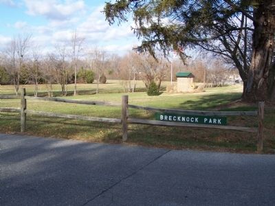
In 1680 Alexander Humphreys received a warrant from the county court for 600 acres of land which he called Brecknock. The tract is believed to have been named for a shire of Wales. A milling operation was established here in the 1740’s. For nearly . . . — — Map (db m39507) HM
Caesar Rodney-Born on October 7, 1728 on a farm east of Dover, Caesar Rodney was one of Delaware's most distinguished statesmen. Entering public life at an early age, Rodney held numerous local offices. He was a member of the Colonial State . . . — — Map (db m141257) HM
Founded 1783 on the tract “Brecknock” by Daniel Mifflin and settled largely by Quakers. Once called Piccadilly and Mifflins Cross Roads. Incorporated 1852, it was a center of anti-slavery sentiment. Several homes were by tradition stops . . . — — Map (db m168332) HM
In 1856, the trustees of Whatcoat Methodist Episcopal Church purchased this site from Thomas Mifflin. The present church was erected thereafter and dedicated on July 26, 1857. Extensive renovations of the structure were undertaken in 1865 and 1940. . . . — — Map (db m173913) HM
In 1791 Daniel Lowber granted permission for “the society of people called Methodists” to erect a “meeting house” at this location. The site was formally conveyed to church trustees in 1796. Adjoining land was obtained in . . . — — Map (db m39601) HM
By the end of the 18th century this area was home to a large number of African Americans, many of them freed slaves. Their settlement was largely due to the efforts of local Quakers. A congregation of the African Methodist Episcopal Church was . . . — — Map (db m39605) HM
Zion African Methodist Episcopal Church-The roots of this congregation can be traced to 1845, when a group of local residents met to formally organize Zion African Methodist Episcopal Church. With several churches established in the area by free . . . — — Map (db m141317) HM
The history of this community can be traced to the 1780s, when members of the Mifflin family began dividing their land into lots. Much of this land was originally a part of a tract known as Brecknock, which was granted to Alexander Humphreys in . . . — — Map (db m39511) HM
This house of worship, built in 1805, was first a Preparative Meeting under the care of Motherkiln (Murderkill) Monthly Meeting of the Religious Society of Friends (Quakers). In 1830, Camden Monthly Meeting was formed by uniting with Motherkiln and . . . — — Map (db m39513) HM
This company was organized on February 2, 1928, when a group of interested citizens met at C. H. Pearson’s Store for the purpose of electing officers. William S. Scarborough was chosen to be the President of the organization, and Willard D. Boyce . . . — — Map (db m39050) HM
Kenton Hundred-Created in 1869 by joining of western halves of Duck Creek and Little Creek Hundreds. Is bounded on north by Blackbird Hundred in New Castle County, on east by Duck Creek and Little Creek Hundreds, on south by East Dover and West . . . — — Map (db m141240) HM
Originally embraced all lands south of Leipsic Creek and north of Little Creek from Delaware River to Maryland line. In 1869 western half was detached and joined to western half of Duck Creek Hundred to form Kenton Hundred. — — Map (db m39049) HM
Originally embraced all lands south of Leipsic Creek and north of Little Creek from Delaware River to Maryland line. In 1869 western half was detached and joined to western half of Duck Creek Hundred to form Kenton Hundred. — — Map (db m39051) HM
In the early 1890s Clayton was home to an increasing population of African-Americans, many of whom were railroad workers. Byrd's African Methodist Episcopal (A.M.E.) Church was built in 1894 to accommodate this growing community who previously had . . . — — Map (db m141340) HM
A local society of Methodists was organized circa 1778. On May 16, 1781, they obtained land here on which to build a permanent house of worship. A large frame church was then constructed and named Blackiston's Chapel, to honor the family that . . . — — Map (db m40190) HM
First known as Smyrna Station, the Town of Clayton began when the railroad came to this area in the mid-1850s. In 1860, the name was changed to honor Delawarean John M. Clayton, a former United States Secretary of State and strong advocate of the . . . — — Map (db m39023) HM
Annie Jump Cannon (1863-1941), a prominent astronomer who pioneered stellar classification, observed her first stars from the roof of this house. Cannon, who was legally deaf, graduated valedictorian from Wilmington Conference Academy, now Wesley . . . — — Map (db m243726) HM
Richard Allen founded and became the first Bishop of the African Methodist Episcopal Church in 1816. Born into slavery in Philadelphia, Pennsylvania, on February 14, 1760, Allen and his family were sold to a family near Dover in 1772. While there, . . . — — Map (db m39093) HM
On November 13, 1922, 210 children and 6 teachers marched from two old school buildings located on Slaughter Street and Division Street to a new school for African-American students in Dover. Funding for the building was provided by the Delaware . . . — — Map (db m39064) HM
Statesman, Soldier and Patriot. Member of Stamp Act Congress and of First and Second Continental Congresses. Signer of Declaration of Independence. Member and Speaker of Colonial Assembly of “Three Lower Counties on Delaware.” Member of . . . — — Map (db m39067) HM
Calvary Baptist Church-On January 26, 1883, the Delaware Baptist Union was formally incorporated by the state legislature. The purpose of the organization was to spread the message of the denomination and promote the erection and maintenance of . . . — — Map (db m141273) HM
Presbyterian minister, later practiced medicine, Member of Colonial Assembly, Member of Council of Safety, 1775. Commanded First Delaware Militia Regiment. This regiment, reviewed in Dover, later joined Washington’s army and fought in Battles of . . . — — Map (db m4716) HM
On June 17, 1921, the Board of Trustees of the State College for Colored Students, later known as Delaware State College, approved a resolution recommending the establishment of a high school for Negro students on its campus. This was the second . . . — — Map (db m142491) HM
In March 1920, Governor John G. Townsend called a special session of the Delaware General Assembly to vote on the ratification of the 19th amendment. Suffrage and anti-suffrage groups descended on Dover that spring to try to sway the vote in their . . . — — Map (db m190714) HM
County seat since 1680. William Penn in 1683 ordered Town site laid out and named Dover. Plotted in 1717. Temporary capitol in 1777 and permanent capitol since 1779. Federal Constitution ratified here in 1787, making Delaware first State in Union. . . . — — Map (db m39061) HM
County seat since 1680. William Penn in 1683 ordered Town site laid out and named Dover. Plotted in 1717. Temporary capitol in 1777 and permanent capitol since 1779. Federal Constitution ratified here in 1787, making Delaware first State in Union. . . . — — Map (db m39107) HM
County seat since 1680. William Penn, in 1683, ordered townsite laid out and named Dover. Plotted in 1717. Temporary capital in 1777 and permanent capital since 1779. Federal Constitution ratified here in 1787 making Delaware First State in Union. . . . — — Map (db m51115) HM
Dover Downs began as a dual-purpose racing facility that featured a five-eights' mile dirt horse racing track built within the larger one mile race track of Dover International Speedway. Gov. David P. Buckson, Lt. Gov. John W. Rollins, and Melvin L. . . . — — Map (db m141445) HM
Dover International Speedway-The Speedway hosted its first NASCAR event, the Mason-Dixon 300, on July 6, 1969. Richard Petty won that raced by 6 laps. The highly-banked, one-mile oval track was created, financed, and built by Gov. David P. Buckson, . . . — — Map (db m141439) HM
The Light Infantry Company of Dover, a part of the 1st Battalion of Kent County, mustered in on 2 April
1776. Each militia volunteer was uniformly armed,
equipped, and wore a standard military coat of green
faced with red lapels, cuffs, and . . . — — Map (db m39576) HM
In 1680, a large tract of land called "Brothers Portion" was warranted to John and Richard Walker. In 1695, 200 acres of the parcel were purchased to create the town of Dover. When the town plot was completed in 1718, John Mifflin purchased 69 acres . . . — — Map (db m94380) HM
In 1947 the International Latex Corporation established a specialty products division and chose this site for its location. The company’s rise to prominence as a supplier of aeronautic and aerospace equipment began in 1952 when it was contracted to . . . — — Map (db m39062) HM
Born in Dagsboro, Delaware, 1796. Graduate of Yale College 1815. Member of Delaware House of Representatives 1824. Secretary of State of Delaware 1826-1828. United States Senator 1829-1836, 1845-1849 and 1853 until his death, 1856. Chief Justice of . . . — — Map (db m4748) HM
The Kent County Theatre Guild (KCTG) formed in 1953 to provide community theater in central Delaware. The volunteer organization incorporated in 1961 and initially performed theatrical productions at local high schools and Dover's Hinkle Building. . . . — — Map (db m243653) HM
In 1723 Nicholas Loockerman purchased 600 acres of land known as “The Range.” Following his death in 1771, the property passed to his grandson Vincent Loockerman Jr. Evidence suggests that he built the Georgian-style mansion known today . . . — — Map (db m39053) HM
Mount Zion African Methodist Episcopal Church-The genesis of the African Methodist Episcopal Church can be traced to Delaware in 1777, when a young slave named Richard Allen experienced a spiritual awakening at a meeting conducted by an itinerant . . . — — Map (db m141313) HM
In this churchyard lie the remains of Nicholas Ridgely, Statesman and Jurist. Born in Dover, 1762, eldest son of Dr. Charles Greenbury Ridgely and Mary Wynkoop Ridgely. Member of State Convention which ratified the Federal Constitution, December 7, . . . — — Map (db m39066) HM
The Free School Act of 1829 was passed through the efforts of Judge Willard Hall, Charles Marim, and others. Each school district received a generous subsidy for organizing & school free for children of the district.
This school was erected . . . — — Map (db m142505) HM
Rooted in the Free School Act of 1829, the Octagonal Schoolhouse, built in 1836, served as the District No. 12 school in Kent County until its closure in 1930, when it became a community center. The building's construction consisted of undressed . . . — — Map (db m244781) HM
Founded as mission by the Society for the Propagation of the Gospel in response to a petition from twenty-two inhabitants of Dover in 1703. The present church was erected in 1734. Among early missionaries here was the Rev. Charles Inglis, later . . . — — Map (db m3803) HM
Built 1790 during the pastorate of the Rev. John Miller to replace the earlier log church erected about 1715 on this plot designated as “Meeting House Square”. Presented by the Presbytery to the State of Delaware for a state museum in . . . — — Map (db m5048) HM
Dr. Charles Greenbury Ridgely: Member Colonial and State Legislative Assemblies; Delegate First State Constitutional Convention 1776.
Nicholas Ridgely (the younger): Member of Convention that ratified Federal Constitution 1787; Delegate . . . — — Map (db m238346) HM
In 1849, Caper and Leah Carlisle deeded a quarter-acre of land to Meeting House Trustees Jacob Allston, Peter Carlisle, James Collins, Perry Hawkins, and Nathaniel White. The Carlisles and the trustees were part of a free African American community . . . — — Map (db m199002) HM
In 1778, a Methodist Society was organized in Dover by Reverend Freeborn Garrettson. Desiring a permanent place of worship, members acquired a one-half acre lot at this location from Vincent Loockerman in 1782. Future Delaware Governor Richard . . . — — Map (db m39065) HM
A Presbyterian Society, present in Kent from c1694, was organized and worshipped in a log church on this site from c1708 until 1791. The Presbytery of Philadelphia recognized its congregation in 1714. The present church was built in 1791 and served . . . — — Map (db m5166) HM
From 1724 known as King George’s Tavern. On its sign was painted King George’s portrait, supplanted during the revolution, by the portrait of George Washington. For many years the old hostelry was the meeting place for political rallies and used for . . . — — Map (db m3764) HM
In 1904, the Dover Opera House opened at this location. The theater was built with funds from a public subscription, and included a stage that was used for a variety of purposes including vaudeville, photoplays, magic lantern shows, and in later . . . — — Map (db m39104) HM
This was the site of the Golden Fleece Tavern, scene of some of the most important and dramatic events in Delaware history. Built in the 1730s, the Golden Fleece was a center for community and government activities. It was a place of great . . . — — Map (db m39075) HM
Union Lodge No.7, A.F. & A. M.-The origin of organized Free masonry in Dover can be traced to the formation of Old Lodge No. 18 on August 25, 1775. During its twelve years of existence, meeting were held on the "The Green" at an inn which stood on . . . — — Map (db m141285) HM
Wesley College is a private, liberal arts college affiliated with the United Methodist Church. It was founded in 1873 as Wilmington Conference Academy, a preparatory school for boys under the patronage of the Methodist Episcopal Church. Female . . . — — Map (db m243725) HM
The origin of this congregation can be traced to the establishment of a Methodist society in Dover in 1778. Land on North Street was obtained in 1782, and a brick chapel was completed there in 1784. Bishops Francis Asbury and Richard Whatcoat, . . . — — Map (db m39100) HM
Originally part of St. Jones Hundred, renamed Dover Hundred 1823, the boundaries being Little Creek on the north and St. Jones Creek on the south, extending from Delaware River to Maryland Line. Dover Hundred was divided 1877 into two hundreds, . . . — — Map (db m243656) HM
In 1947 the General Assembly appropriated funding to build a comprehensive high school for Blacks and other persons of color residing in central Delaware. The site for the new school was selected in 1949. The state and the Delaware School Auxiliary . . . — — Map (db m243657) HM
Part of a tract of 3,000 acres granted to John Hillyard by William Penn, March 7, 1683. His great-grandson, Charles Hillyard, built this mansion and resided here with his wife, Mary, daughter of William Killen, first Chancellor of Delaware. . . . — — Map (db m42761) HM
Originally part of St. Jones Hundred renamed Dover Hundred 1823, the boundaries being Little Creek on north and St. Jones Creek on south, extending from Delaware River to Maryland line. Dover Hundred was divided 1877 into two hundreds, called East . . . — — Map (db m51114) HM
Near this site stood the boyhood home of Caesar Rodney, signer of the Declaration of Independence, Brigadier General of the State's militia (1775-1778), and President (Governor) of Delaware (1778-1781). Byfield was originally settled in the early . . . — — Map (db m75835) HM
Constructed in 1944, Hangar 1301 served as the headquarters and engineering facility for the 4146th Base Unit from 1944 to 1946. Highly secret testing and development work was done here on air-launched rocket weapons. Aircraft used in testing . . . — — Map (db m50623) HM
"The Penman of the Revolution." Member of Delaware colonial and state assemblies. Member of Continental Congress, Annapolis Convention, and Philadelphia Federal Constitutional Convention. Signer for Delaware of Articles of Confederation and Federal . . . — — Map (db m39583) HM
This part of what is now Kent County, Delaware was one of the state's earliest sites of English colonization. Beginning in the 1660's plantations were established along the St. Jones River. The Dickinson family of Talbot County, Maryland was among . . . — — Map (db m245466) HM
Like the Native Americans before them, European settlers used this rising ground or "hummock" on the shore of the Delaware Bay as a place for fishing and recreation. In 1738, Jehu Curtis received a patent for lands that he called "Kitt's Hammock." . . . — — Map (db m39578) HM
The Town of Farmington was first settled in 1851 as Flatiron. In 1855, the Delaware Railroad built a station at a crossroads in the community near the home of Governor William Tharp. When a new post office opened in 1858, the town was officially . . . — — Map (db m229504) HM
This farm, formerly known as Burberry's Berry, was home of Captain Jonathan Caldwell of Colonel Haslet's Regiment in Revolution. Tradition says Delaware soldiers received name "Blue Hen's Chickens" from Caldwell's men having with tem game chickens, . . . — — Map (db m39608) HM
In 1836 the Delaware General Assembly chartered the Delaware Railroad for the purpose of building a line from a junction with the New Castle and Frenchtown Railroad to the southern border of the state. Due to poor economic conditions, construction . . . — — Map (db m132075) HM
In the vicinity of this marker, a Flat Outline Map of the State
would be exactly balanced.
In 1989, a curious seventh grader from the Caesar Rodney School District asked where the center of Delaware was located. . . . — — Map (db m39607) HM
In 1802, Joshua Laws donated this land for the construction of a Methodist Episcopal chapel. Named in honor of Laws, the church served the local community until 1856 when a new building was constructed. Following a period of inactivity in the . . . — — Map (db m142541) HM
Organized on December 9, 1877, the Felton Methodist Protestant Church originally held services for several years in the Knights of Pythias Hall. In 1880, a parcel of land on High Street was deeded to the church trustees by Job Butterworth and his . . . — — Map (db m138267) HM
The town of Felton was laid out in 1856 when the Delaware Railroad reached this area. Located between Berrytown to the west and Johnny Cake Landing (Frederica) to the east, the town became a “whistle” stop on the new railroad line. Owing . . . — — Map (db m39606) HM
Erected on land deeded by Col.Philip Barratt, August, 1780. Here Thomas Coke, D.D., representative of John Wesley, preached November 14, 1784, administering the Sacrament of Holy Communion for first time by a Methodist America. With Francis Asbury . . . — — Map (db m39610) HM
In 1778 a Methodist Society was organized in this area by Freeborn Garrettson. Desiring a permanent place of worship, the group constructed a brick “preaching house” at his location in 1780. The site was provided by Society member . . . — — Map (db m39612) HM
The Town of Bowers, Incorporated March 9, 1907, was established as an early settlement along the Delaware Bay. Named Whitwell’s Delight in 1675, the town was renamed Bowers in 1734. Bowers is nestled between the mouths of the St. Jones and . . . — — Map (db m100344) HM
The roots of Methodism in this community can be traced
to the late 18th century, when Methodist pioneers such
as Francis Asbury traveled throughout this area spreading
the message of their faith. Over time some church members
became . . . — — Map (db m60462) HM
The origin of this congregation can be traced to the days of the American Revolution, when Methodist pioneers such as Francis Asbury and Freeborn Garrettson
traveled throughout this area organizing groups or “societies” for worship. . . . — — Map (db m60461) HM
On September 17, 1740, Thomas Clark received a Proprietary Warrant from Thomas Penn for lands “adjoining his dwellin place” which he named “Clark’s Folly.” By the 1790’s Benjamin Clark and his son Matthew had established an inn and tavern on this . . . — — Map (db m37477) HM
Delaware State Fair-In 1919 local residents held several meetings to discuss the establishment of a fair. On January 12, 1920, the Kent and Sussex County Fair Association was organized for the purposes of “promoting and encouraging agriculture . . . — — Map (db m142643) HM
For many years the National Grange and other organizations interested in the welfare of citizens residing in rural areas advocated the establishment of rural free delivery of mail. In October 1896, the Post Office Department introduced experimental . . . — — Map (db m37476) HM
Formerly known as Clark’s Corner, the roots of this community can be traced to settlement by the Clark family in the 1730’s and the subsequent establishment of an inn, tavern, store, and mill nearby. The village was little more than a country . . . — — Map (db m36916) HM
Near this site stood the home of Judge Thomas White, member of the Colonial Maryland legislature and Delaware House of Assembly, Chief Justice of the Kent County Court of Common Pleas, and delegate to the Delaware Constitutional Conventions of 1776 . . . — — Map (db m142642) HM
St. Paul AME was established as a congregation in 1830. Members met in congregants’ houses and public spaces before building a church. Construction of the church began in 1895 on New Street making St. Paul the last of eleven AME churches built in . . . — — Map (db m142641) HM
During the American Revolution many Delawareans remained loyal to the British Crown. In 1778 a group of Loyalists under the leadership of local resident Cheney Clow constructed a fort near this location. Concerned that they would march on Dover, a . . . — — Map (db m39715) HM
When Methodism first came to this area in the late 18th century, residents worshipped in local homes and journeyed to nearby towns to attend services. On November 20, 1848 William and Sarah Griffith conveyed land at this location to Trustees of the . . . — — Map (db m38620) HM
The origin of this community can be traced to the mid-18th century, when growing travel between Dover and the head of the Chester River resulted in the establishment of a Public House here to support the needs of travelers. Increasing commerce led . . . — — Map (db m39052) HM
Roby United Methodist Church-First settled in the 18th century, the town of Leipsic quickly became a center for maritime commerce. In 1831, residents of this growing community established the Leipsic Methodist Episcopal Church. Increasing political . . . — — Map (db m141316) HM
Little Creek United Methodist was established in 1820 as Gum Swamp Methodist Episcopal. By 1832 the church operated and maintained a non-segregated school. In February 1875 the congregation relocated Gum Swamp ME to its current site and on May 30, . . . — — Map (db m141374) HM
The Town of Little Creek developed in the early 1800s as a wharf on the Little River between two neighboring plantations. Originally known as Little Landing, the community began as a trading and shipping hub for salt marsh hay, agricultural products . . . — — Map (db m141378) HM
Quakers were gathering for worship in this area by 1712, when members of the Religious Society of Friends met "at the widow Needham's at Murderkill Creek." Established as Motherkiln Preparative Meeting (under the care of Duck Creek Meeting), the . . . — — Map (db m39459) HM
A native of Virginia's Eastern Shore, Mifflin came to Delaware as a young man. Born into a slaveholding Quaker family, he manumitted his own slaves in 1774-75 and later became one of America's foremost abolitionists of the 18th century. As an elder . . . — — Map (db m39456) HM
Responsible for marking the boundaries of Maryland and Pennsylvania (including the "Three Lower Counties" of Delaware), Mason and Dixon began their survey of the North-South or Tangent Line at the southwestern corner of present-day Delaware in June . . . — — Map (db m168146) HM
The site of one of the earliest Methodist Churches in America, the first structure was built in 1761 as an Episcopal Church. Built of logs, the church was referred to as the Log or Forest Chapel. According to tradition, ownership of the structure . . . — — Map (db m138266) HM
Originally part of St. Jones Hundred, renamed Dover Hundred 1823, the boundaries being Little Creek on the north and St. Jones Creek on the south, extending from Delaware River to Maryland Line. Dover Hundred was divided 1877 into two Hundreds, . . . — — Map (db m74137) HM
It is believed that parishioners of Bethel African Methodist Episcopal Church were worshiping in a private residence on North Street by 1859. The church eventually moved to a site on Church Street to accommodate the growing congregation. On March 2, . . . — — Map (db m69034) HM
Christ Church Mispillion was the second parish in Delaware established by the Society for the Propagation of the Gospel in Foreign Parts. The Rev. Thomas Crawford first held services of the Church of England in lower Kent County in 1704. The . . . — — Map (db m69033) HM
Colonel John Haslet-A native of Ulster, Ireland, John Haslet was born circa 1728 and emigrated to America about 1757. After playing an active role in the Pennsylvania militia during the French and Indian War, Haslet eventually settled in the Milford . . . — — Map (db m142542) HM
Town laid out by Joseph Oliver 1787. Village was located on tract then called “Saw-Mill Range.” Named Milford from fording place near mill-dam erected by Rev. Sydenham Thorne across Mispillion Creek, 1787. First incorporated 1807. Old town in Kent . . . — — Map (db m36909) HM
Town laid out by Joseph Oliver 1787. Village was located on tract then called “Saw-Mill Range.” Named Milford from fording place near mill-dam erected by Rev. Sydenham Thorne across Mispillion Creek, 1787. First incorporated 1807. Old town in Kent . . . — — Map (db m36950) HM
The metal observation tower at Big Stone Beach was one of five constructed in Delaware between World Wars I and II to reinforce nearby Fort Saulsbury. These towers formed an integral part of the fort’s fire control system. Built from metal and . . . — — Map (db m142612) HM
This historic building lies within a 1,750
acre Duke of York land patent called Saw Mill
Range granted to Henry Bowman in 1680. The
first known resident of this portion of the
tract was Joseph Booth, who purchased 510
acres from the Bowman . . . — — Map (db m37393) HM
The beginning of Methodism in this community
can be traced to the organization of a local
“society” in 1777. Early meetings were held
in the homes of its members. On December 3, 1787,
Joseph Oliver conveyed a lot of ground at . . . — — Map (db m36888) HM
Organized on July 18, 1781, the "Baptist Church at Mount Moriah" also called Cow Marsh Baptist Church, is the fourth Primitive Baptist congregation formally constituted in Delaware. For many years members met in area homes. In 1793, Job Meredith . . . — — Map (db m113687) HM
In 1924, the members of the David C. Harrison American Legion Post # 14 initiated the first American Legion ambulance service in the world. Its eighteen founding members were veterans of World War I who volunteered their time to transport the . . . — — Map (db m39026) HM
581 entries matched your criteria. The first 100 are listed above. Next 100 ⊳