By Barry Swackhamer, September 8, 2015
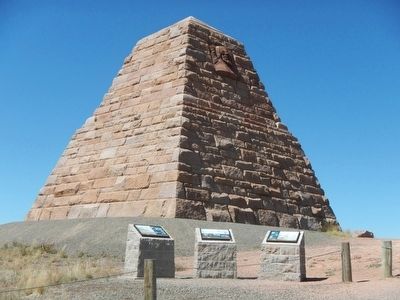
Ames Monument Marker
| On Monument Road near Hermosa Road, on the right when traveling south. |
| Near Interstate 80 at milepost 332, on the left when traveling east. |
| On Hermosa Road (County Route 222) near Monument Road (County Route 234), on the left when traveling west. |
| On Monument Road near Hermosa Road, on the right when traveling south. |
| Near Interstate 80 at milepost 332, on the left when traveling east. |
| On Interstate 80 Service Road (Local Route 80) near Warren Road, on the right when traveling west. |
| On Monument Road near Hermosa Road, on the right when traveling south. |
| On Interstate 80 at milepost 332, in the median. |
| On Interstate 80 at milepost 332, in the median. |
| On Hansen's Road at State Highway 10, on the left when traveling south on Hansen's Road. |
| On North 2nd Street near East University Avenue, on the left when traveling north. |
| On Interstate 80 at Wyoming Highway 210 on Interstate 80. |
| On Herrick Lane (State Highway 12) near Interstate 80, on the right when traveling west. |
| On Grand Avenue near 17th Street, on the right when traveling west. |
| On State Highway 230 near County Route 33, on the left when traveling west. |
| On Grand Avenue (Business Interstate 80) near 17th Street, on the right when traveling west. |
| Near West Garfield Street near Snowy Range Road (Wyoming Highway 130), on the right when traveling west. |
| Near West Garfield Street near Snowy Range Road (Wyoming Highway 130), on the left when traveling west. |
| Near West Garfield Street near Snowy Range Road (Wyoming Highway 130), on the right when traveling west. |
| On West Garfield Street near Snowy Range Road (State Highway 130), on the left when traveling west. |
| Near West Garfield Street near Snowy Range Road (Route 130), on the left. |
| Near East Ivinson Avenue near 6th Street, on the right when traveling west. |
| Near South 1st Street near East Garfield Street, on the left when traveling north. |
| On U.S. 287 at Cavalryman Ranch Road, on the right when traveling north on U.S. 287. |
| Near Interstate 80 at Wyoming Highway 210. |
| Near Interstate 80 at Happy Jack Road (Wyoming Highway 210), on the right when traveling west. |
| Near Interstate 80 at Wyoming Highway 210. |
| On S. 3rd Street (U.S. 287) north of E. Boswell Drive, on the right when traveling south. |
| Near South 1st Street at East Kearney Street, on the left when traveling north. |
| On South 1st Street at Grand Avenue, on the right when traveling north on South 1st Street. |
| On State Highway 230 near Gerhart Road, on the left when traveling west. |
| Near Interstate 80 at Wyoming Highway 210. |
| On S. Kiowa Street, 0.1 miles east of Fort Sanders Road, on the right when traveling east. |
| Near Interstate 80 at Wyoming Highway 210. |
| On Grand Avenue (Business Interstate 80) near 17th Street. |
| On South 2nd Street near East Garfield Street, on the right when traveling north. |
| On Snowy Range Road (State Highway 130) near Cactus Hill Road, on the right when traveling west. |
| Near Interstate 80 at Wyoming Highway 210. |
| On U.S. 30, on the right when traveling west. |
| On U.S. 30, on the right when traveling west. |
| On Banzhaf Lane (County Route 67) at U.S. 30, on the left when traveling north on Banzhaf Lane. |
| On U.S. 287, on the right when traveling north. |
| On Greybull Hwy (U.S. 20 / 16), on the left when traveling west. |
| On Greybull Hwy (U.S. 20 / 16), on the left when traveling west. |
| On East Main Street at South Mountain View Street, on the left when traveling east on East Main Street. |
| On Alternate U.S. 14A at milepost 35, on the right when traveling east. |
| Near South Division Street near 1st Street South, on the right when traveling north. |
| On South Division Street near Main Street (State Highway 789), on the right when traveling north. |
| On South Division Street near 1st Street South. |
| On Road 2 North near Road 3 North, on the left when traveling east. |
| On U.S. 14, on the left when traveling west. |
| On Dry Medicine Lodge Creek, 0.1 miles north of County Road 52, on the left when traveling north. |
| On Dry Medicine Lodge Creek, on the left when traveling north. |
| On Alternate Route 14A at milepost 74 near Forest Road 651, on the right when traveling east. |
| Near U.S. 14A at milepost 74 near 651, on the left when traveling east. |
| Near Forest Road 12 near U.S. 14A, on the left when traveling west. |
| On U.S. 14A at milepost 79 near 130, on the right when traveling west. |
| On East Main Street (U.S. 310) near Montana Avenue, on the right when traveling east. |
| Near Alternate U.S. 14A at milepost 59 near Crystal Creek Road, on the right when traveling south. |
| On U.S. 14A at milepost 79 near Forest Road 130, on the right when traveling west. |
| Near Forest Road 12,, 1.7 miles north of U.S. 14A. |
| Near Forest Road 12,, 1.7 miles north of U.S. 14A. |
| Near 12 near U.S. 14A. Reported permanently removed. |
| On Alternate U.S. 14A at milepost 71 near Old U.S. Highway 14A, on the left when traveling east. |
| On East Main Street (U.S. 310) near Montana Avenue, on the right when traveling east. |
| On West Main Street (U.S. 310) near Alternate U.S. 14A, on the right when traveling east. |
| On U.S. 14A at Old U.S. Highway 14A, on the left when traveling east on U.S. 14A. |
| Near Forest Road 12,, 1.7 miles north of Federal Highway 14A, on the left when traveling north. |
| Near U.S. 14, on the right when traveling west. |
| On U.S. 14, on the right when traveling west. |
| On U.S. 14, on the right. |
| Near U.S. 14, on the right when traveling west. |
| On U.S. 14, on the left when traveling east. |
| Near U.S. 14, on the right when traveling west. |
| On U.S. 14, on the right when traveling west. |
| Near U.S. 14, on the right when traveling west. |
| Near U.S. 14, on the right when traveling west. |
| On U.S. 14, 1 mile west of Forest Road 17, on the right when traveling west. |
| Near U.S. 14, on the right when traveling west. |
| Near U.S. 14, on the right when traveling west. |
| On U.S. 14, on the right when traveling west. |
| Near U.S. 14, on the left when traveling east. |
| On South Gillette Avenue at East 5th Street, on the right when traveling south on South Gillette Avenue. |
| On South Gillette Avenue just south of West 4th Street, on the right when traveling south. |
| On South Gillette Avenue at West 4th Street, on the right when traveling south on South Gillette Avenue. |
| On South Gillette Avenue at East 3rd Street, on the left when traveling south on South Gillette Avenue. |
| On U.S. 16 at milepost 70 near Werner Road, on the right when traveling east. |
| On Ranch Drive, 0.1 miles south of State Highway 387, on the left when traveling south. |
| Near State Highway 387 at Ranch Drive, on the right when traveling west. |
| Near State Highway 387 at Ranch Drive, on the right when traveling west. |
| Near State Highway 387 at Ranch Drive, on the right when traveling west. |
| Near State Highway 387 at Ranch Drive, on the right when traveling west. |
| On State Highway 387 at milepost 124 near Brown Road, on the left when traveling west. |
| Near State Highway 387 at Ranch Drive, on the right when traveling west. |
| Near State Highway 387 at Ranch Drive, on the right when traveling west. |
| Near State Highway 387 at Ranch Drive, on the right when traveling west. |
| On Elk Mountain-Arlington Road near Interstate 80 when traveling south. |
| On Rattlesnake Pass Road near Interstate 80. |
| On Elk Mountain-Arlington Road (County Route 402) near Interstate 80, on the left when traveling west. |
1364 entries matched your criteria. The first 100 are listed above.
Next 100 ⊳